Items Similar to Antique Map of Turkey in Asia (Asia Minor and Transcaucasia), 1903


Want more images or videos?
Request additional images or videos from the seller
1 of 10
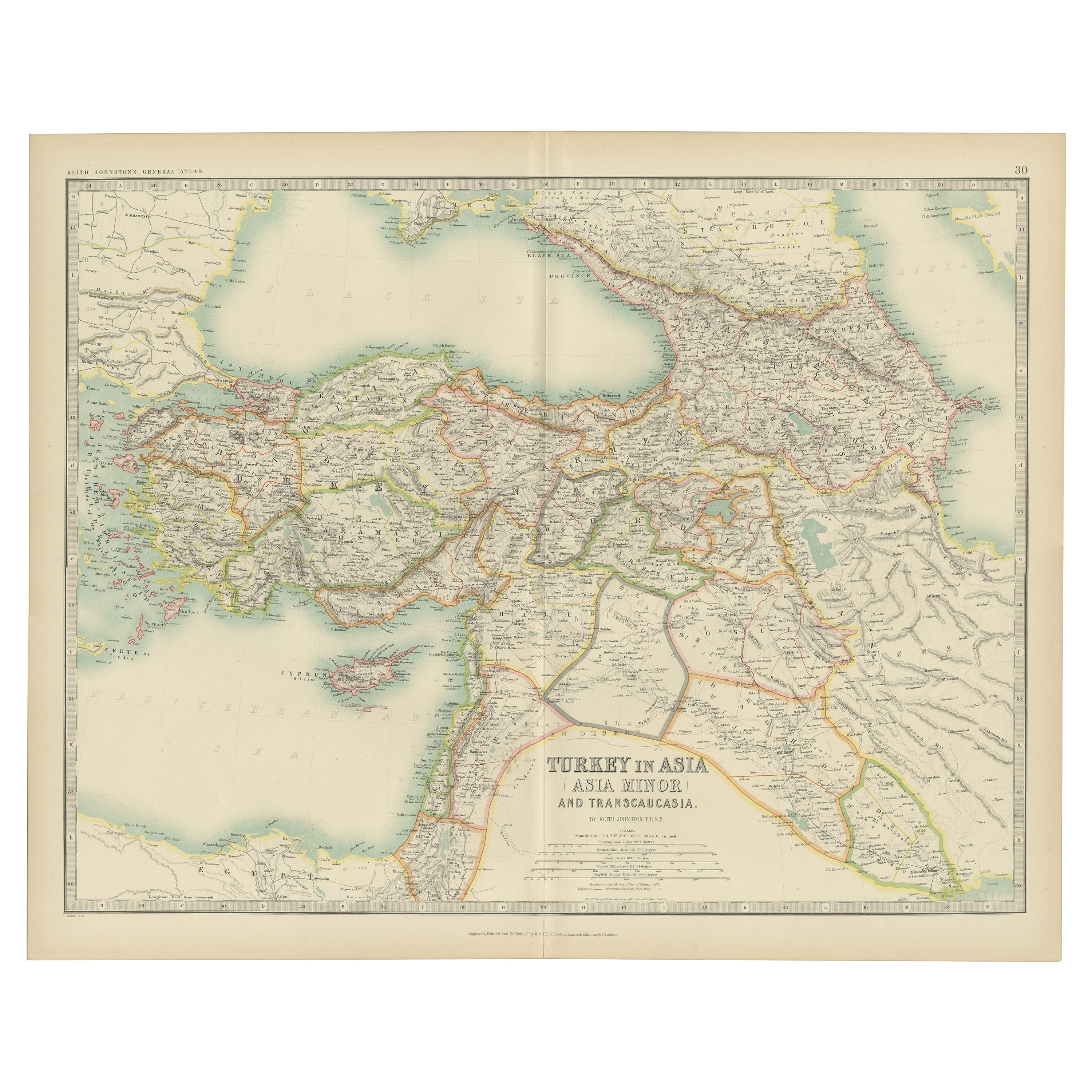
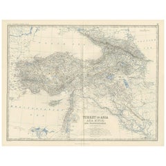
Antique Map of Turkey in Asia (Asia Minor and Transcaucasia), 1903
$347.99
£257.88
€290
CA$475.60
A$517.73
CHF 274.81
MX$6,229.36
NOK 3,482.21
SEK 3,190.69
DKK 2,209.02
About the Item
Antique Map of Turkey in Asia (Asia Minor and Transcaucasia), 1903, with Intricate Provincial Borders
This antique map, titled "Turkey in Asia (Asia Minor) and Transcaucasia," was engraved and published in 1903 by the distinguished W.
A.K. Johnston in Edinburgh and London. It offers a beautifully detailed depiction of the western regions of Asia, encompassing modern-day Turkey, the Caucasus, and parts of the Middle East, all delicately shaded in pastel colors to highlight political boundaries.
The map features major cities, rivers, mountain ranges, and key trade routes, offering a fascinating look at the region during a time of dynamic political and cultural change. It covers a vast area, from the shores of the Mediterranean and Black Seas to the Caspian Sea and the rugged mountains of the Caucasus, reflecting the complex geography and cultural diversity that have always defined this region.
Notable features include the ancient regions of Anatolia, Armenia, Georgia, and Mesopotamia, areas steeped in history and crucial to the cultural and economic exchanges of empires past. The inset detailing the Mediterranean and surrounding seas further emphasizes the maritime connections that linked these lands to Europe and beyond.
For collectors, historians, and those with a passion for Middle Eastern and Caucasian history, this map is more than a visual artifact—it is a window into a world of ancient civilizations and modern ambitions, captured with the precision and artistry of Johnston’s cartographers.
Condition report:
This map is in very good antique condition, with slight foxing and gentle edge toning typical for its age. The colors remain vibrant and the paper is stable and well-preserved. Folding line as issued.
Framing tips:
A classic dark wood frame in walnut or mahogany will complement the warm pastel tones and intricate detailing of this map. Use a cream or off-white matting to highlight the delicate linework and refined coloring, creating a sophisticated and timeless focal point in any setting.
- Dimensions:Height: 14.49 in (36.8 cm)Width: 18.51 in (47 cm)Depth: 0.01 in (0.2 mm)
- Materials and Techniques:
- Period:
- Date of Manufacture:1903
- Condition:This map is in very good antique condition, with slight foxing and gentle edge toning typical for its age. The colors remain vibrant and the paper is stable and well-preserved. Folding line as issued.
- Seller Location:Langweer, NL
- Reference Number:Seller: BG-13577-241stDibs: LU3054345262282
About the Seller
5.0
Recognized Seller
These prestigious sellers are industry leaders and represent the highest echelon for item quality and design.
Platinum Seller
Premium sellers with a 4.7+ rating and 24-hour response times
Established in 2009
1stDibs seller since 2017
2,816 sales on 1stDibs
Typical response time: 1 hour
- ShippingRetrieving quote...Shipping from: Langweer, Netherlands
- Return Policy
More From This Seller
View AllAntique Map of Turkey in Asia by Johnston
1909
Located in Langweer, NL
Antique map titled 'Turkey Asia ( Asia Minor )'. Original antique map of Turkey in Asia. This map originates from the ‘Royal Atlas of Modern Geog...
Category
Early 20th Century Maps
Materials
Paper
$239 Sale Price
20% Off
Antique Map of Turkey in Asia by A
C. Black, 1870
Located in Langweer, NL
Antique map titled 'Turkey in Asia'. Original antique map of Turkey in Asia with inset Ruins of Babylon. This map originates from ‘Black's General Atlas of The World’. Published by A...
Category
Antique Late 19th Century Maps
Materials
Paper

$167 Sale Price
20% Off
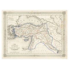
Antique Map of Turkey in Asia by A.K. Johnston, 1865
Located in Langweer, NL
Antique map titled 'Turkey in Asia (Asia Minor) and Transcaucasia'. This map originates from the ‘Royal Atlas of Modern Geography’ by Alexander Keith Johnston. Published by William B...
Category
Antique Mid-19th Century Maps
Materials
Paper
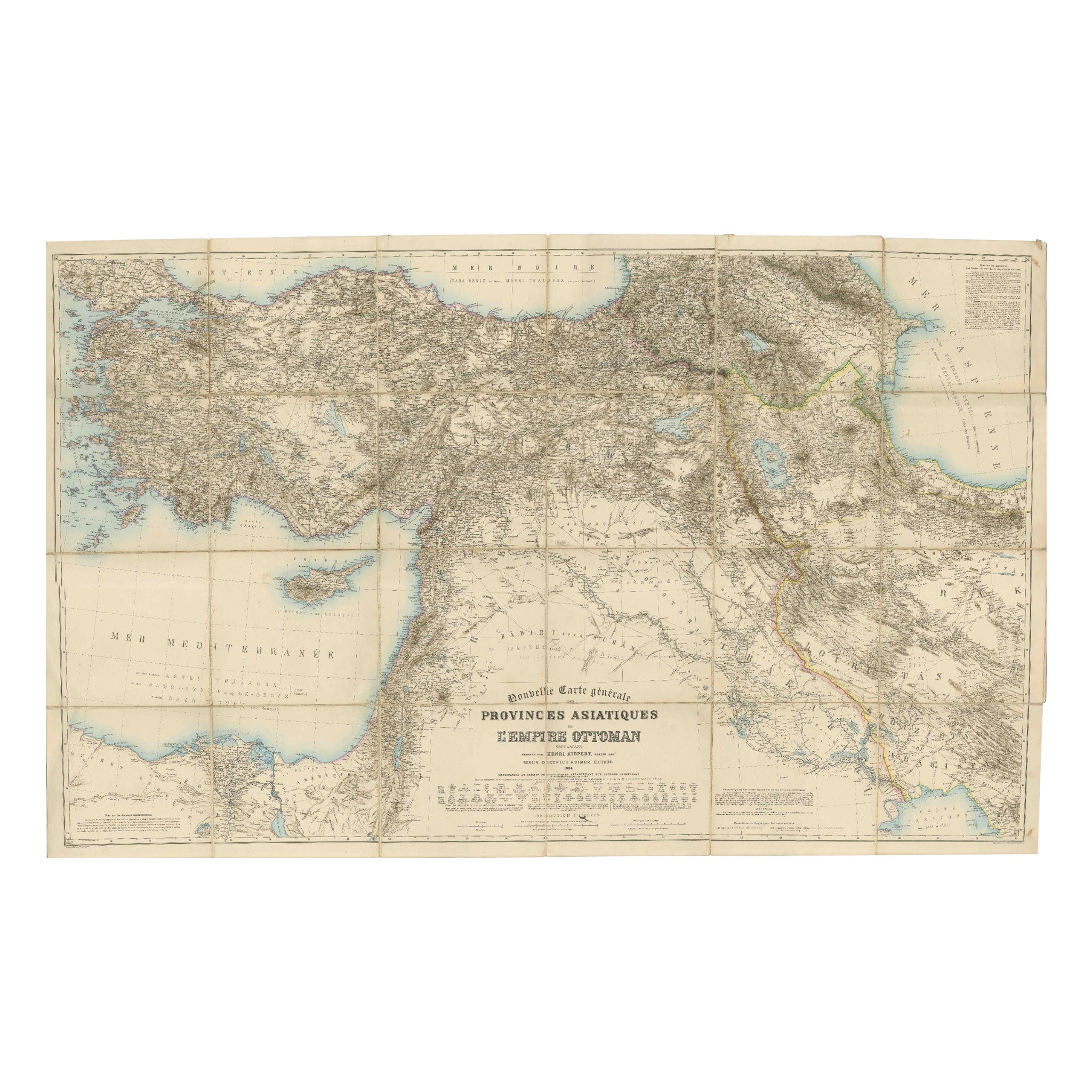
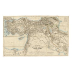
Large 1884 Kiepert Map of Asian Ottoman Provinces – Anatolia, Syria, Mesopotamia
Located in Langweer, NL
1884 Kiepert Map of Asian Ottoman Provinces – Anatolia, Syria, Mesopotamia
This remarkable mid-19th-century folding map is titled “Nouvelle Carte générale des Provinces Asiatiques d...
Category
Antique 1880s English Maps
Materials
Paper
Antique Map of Turkey in Asia, with Frame Style Border
Located in Langweer, NL
Antique map titled 'Asie Ottomane ou Turquie d'Asie'. Attractive map of Turkey in Asia. The map covers the Asian territories claimed by the Turkish Ottoman Empire c.1850 from the Bla...
Category
Antique Mid-19th Century Maps
Materials
Paper
$159 Sale Price
30% Off
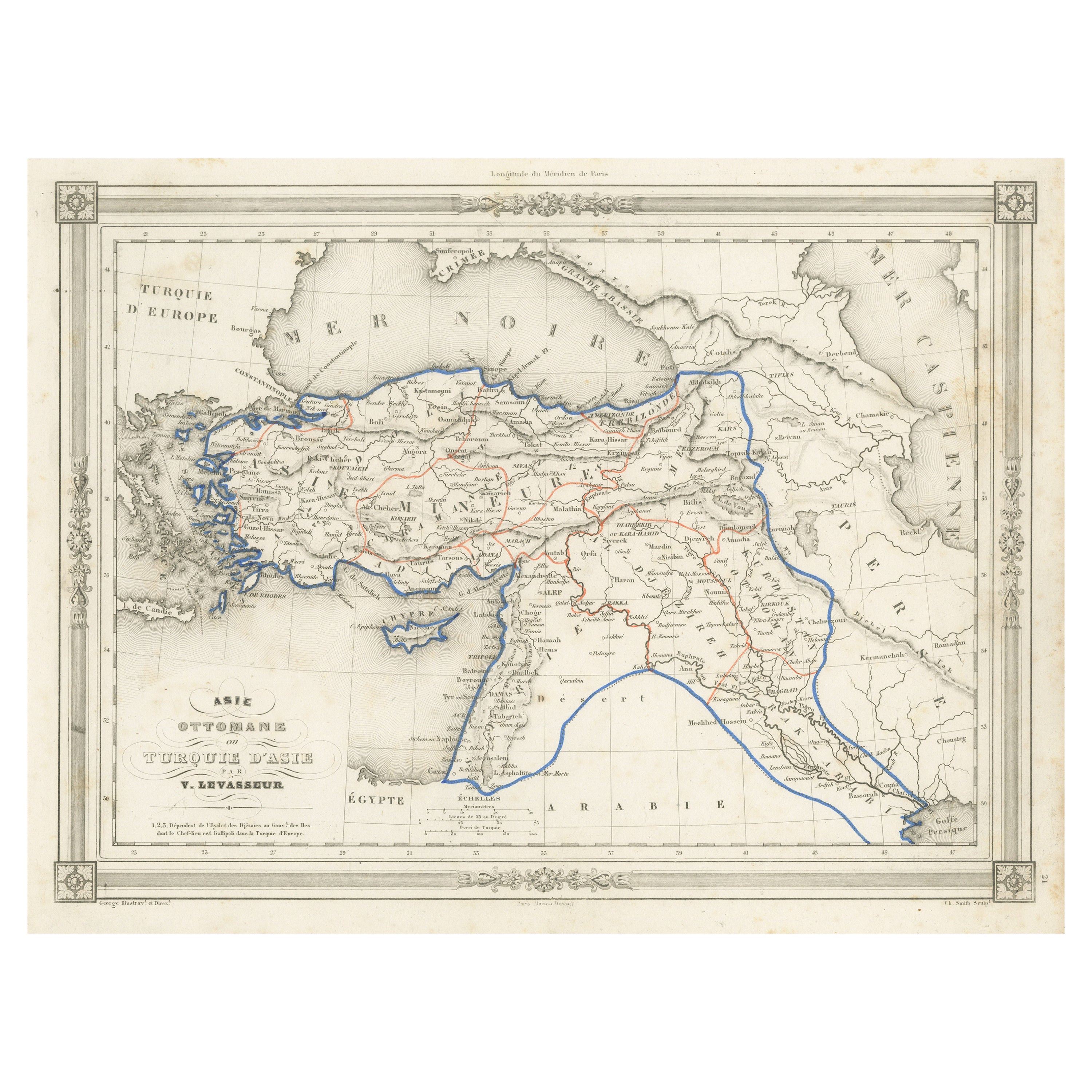
Turkey in Asia – Antique Ottoman Empire Map by John Tallis, ca. 1851
Located in Langweer, NL
Turkey in Asia – Antique Ottoman Empire Map by John Tallis, ca. 1851
This decorative 19th-century map titled "Turkey in Asia" was published by John Tallis & Company around 1851. Eng...
Category
Antique Mid-19th Century English Maps
Materials
Paper

You May Also Like
Map of Eastern Roman Empire -Vintage Offset Print - Early 20th Century
Located in Roma, IT
This map of Eastern Roman Empire is a vintage offset print realized in the early 20th Century.
The state of preservation of the artwork is aged with dif...
Category
Early 20th Century Figurative Prints
Materials
Offset

Large Original Antique Map of Cyprus. 1894
Located in St Annes, Lancashire
Superb Antique map of Cyprus
Published Edward Stanford, Charing Cross, London 1894
Original colour
Good condition
Unframed.
Free shipping
Category
Antique 1890s English Maps
Materials
Paper

Antique 1803 Italian Map of Asia Including China Indoneseia India
Located in Amsterdam, Noord Holland
Antique 1803 Italian Map of Asia Including China Indoneseia India
Very nice map of Asia. 1803.
Additional information:
Type: Map
Country of Manufacturing: Europe
Period: 19th centu...
Category
Antique 19th Century European Maps
Materials
Paper

$438 Sale Price
39% Off
Italy, Central and Southern Part. Century Atlas antique map
Located in Melbourne, Victoria
'The Century Atlas. Italy, Central and Southern Part.'
Original antique map, 1903.
Inset maps of Sicily and Naples.
Central fold as issued. Map name an...
Category
Early 20th Century Victorian More Prints
Materials
Lithograph

Original Antique Map of Ancient Greece, Achaia, Corinth, 1786
Located in St Annes, Lancashire
Great map of Ancient Greece. Showing the region of Thessaly, including Mount Olympus
Drawn by J.D. Barbie Du Bocage
Copper plate engraving by P.F Tardieu
Original hand color...
Category
Antique 1780s French Other Maps
Materials
Paper

Africa. North-East Part. Century Atlas antique vintage map
Located in Melbourne, Victoria
'The Century Atlas. Africa. North-East Part'
Original antique map, 1903.
Inset map of 'Nile Delta and Suez Canal'.
Central fold as issued. Map name and nu...
Category
Early 20th Century Victorian More Prints
Materials
Lithograph

More Ways To Browse
Asia Minor
Cream Soup
Early English Silver
Paisley Rugs and Carpets
Black And Chrome Lounge Chair
Vintage 1930 Dining Room Set
Antique Brass And Copper
Antique Cow
Antique Harvest
Antique Victorian Dining Tables
Environment Furniture
Italian Plastic Chairs
Made In Belgium
Black Crystal Glasses
French Mid Century Modern Rug
China Silk Rug
Chrome Glass Coffee Tables
Antique Italian Chairs