Items Similar to Antique map Westerkwartier Groningen by von Reilly, Vienna, 1791


Video Loading
Want more images or videos?
Request additional images or videos from the seller
1 of 11
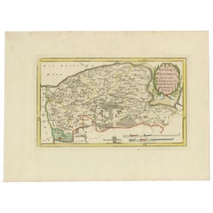
Antique map Westerkwartier Groningen by von Reilly, Vienna, 1791
$407.69
£302.47
€340
CA$559.17
A$608.67
CHF 322.87
MX$7,327.67
NOK 4,099.60
SEK 3,751.87
DKK 2,590.16
About the Item
Title: Antique map Westerkwartier Groningen by von Reilly, Vienna, 1791
Engraved map with original hand color of the Westerkwartier (western quarter) of the province of Groningen, Netherlands. German title in the cartouche reads “Das Wester Quartier.” Published in Vienna in 1791 by Franz J. J. von Reilly for his atlas “Schauplatz der fünf Theile der Welt.” The sheet shows the region between Friesland (west), Hunsingo (north), the city of Groningen (east) and Drenthe (south). Two scale bars at top give German miles (15 to a degree) and Dutch miles (19 to a degree).
Important places include Zuidhorn, Grijpskerk, Grootegast, Marum, Leek, Aduard, Niekerk, Oldekerk, Tolbert, Oldehove and the fortified city of Groningen. Roads, canals (including the Hoendiep and Reitdiep), dikes, parish symbols and moorland or cultivated areas are clearly engraved and bordered with hand-applied outline color. A small foliage cartouche anchors the lower right.
Condition:
Very good for age with light overall toning and a few scattered foxing specks in the wide margins; blank verso. Strong impression and attractive original color.
Framing tips:
Walnut or ebonized frame with a cream or light-beige mat suits the palette; a thin green inner line echoes the boundary wash and cartouche.
Technique: Engraving with original hand color
Maker: Franz J. J. von Reilly, Vienna, 1791; engraved by Ignaz Alberti
- Dimensions:Height: 11.62 in (29.5 cm)Width: 13.78 in (35 cm)Depth: 0 in (0.01 mm)
- Materials and Techniques:Paper,Engraved
- Place of Origin:
- Period:
- Date of Manufacture:1791
- Condition:Very good for age with light overall toning and a few scattered foxing specks in the wide margins; blank verso. Strong impression and attractive original color.
- Seller Location:Langweer, NL
- Reference Number:Seller: BG-002271stDibs: LU3054329304272
About the Seller
5.0
Recognized Seller
These prestigious sellers are industry leaders and represent the highest echelon for item quality and design.
Platinum Seller
Premium sellers with a 4.7+ rating and 24-hour response times
Established in 2009
1stDibs seller since 2017
2,821 sales on 1stDibs
Typical response time: 1 hour
- ShippingRetrieving quote...Shipping from: Langweer, Netherlands
- Return Policy
More From This Seller
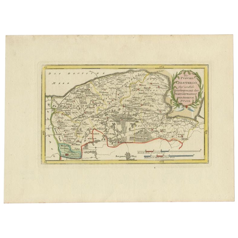
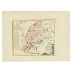
View AllAntique Map of the Region of Leeuwarden and Dokkum in The Netherlands, 1791
Located in Langweer, NL
Antique map titled 'Der Provinz Oostergo fünf nördliche Grietenyen mit der Stadt Leeuwaarden und Dokkum'. Map of the region of Leeuwarden and Dokkum, Friesland, the Netherlands. This...
Category
Antique 18th Century Maps
Materials
Paper
$151 Sale Price
20% Off
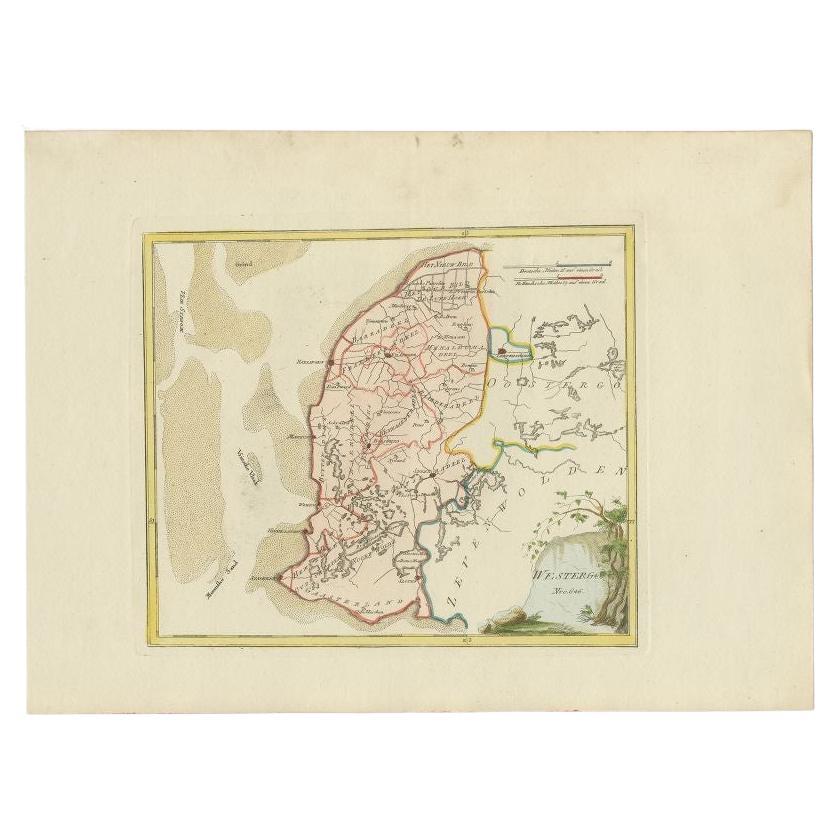
Antique Map of Westergo in Friesland, 1791
Located in Langweer, NL
Antique map titled 'Westergo'. Map of the Westergo region, Friesland, the Netherlands. This map orginates from 'Schauplatz der fünf Theile der Welt'.
Artists and Engravers: Franz...
Category
Antique 18th Century Maps
Materials
Paper
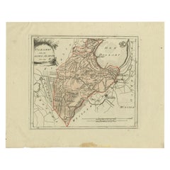
Rare 1791 von Reilly Map of Franeker and Harlingen, Friesland, Netherlands
Located in Langweer, NL
Antique Map of Franeker and Harlingen by von Reilly, 1791
Fine original map titled Der Provinz Westergo vier nördliche Grietenyen mit der Stadt Franeker und Harlingen, published in ...
Category
Antique 18th Century Austrian Maps
Materials
Paper

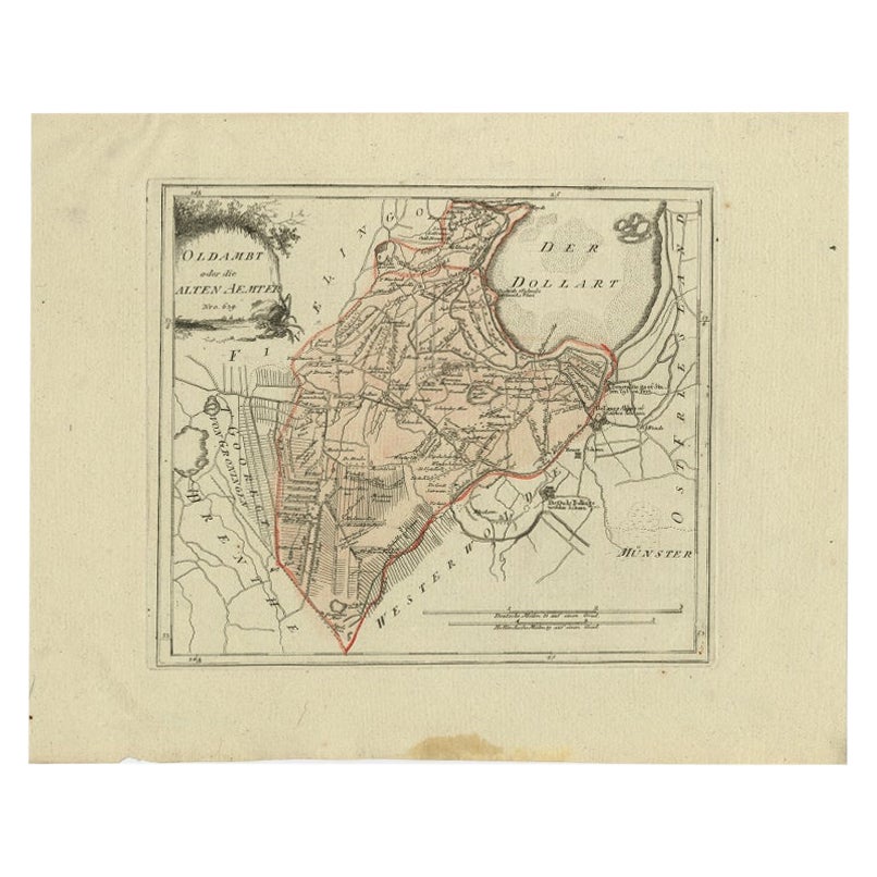
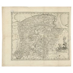
Antique Map of Part of Groningen by Von Reilly, 1792
Located in Langweer, NL
Antique map titled 'Oldambt oder die Alten Aemter'. This map depicts part of the Dutch province Groningen. This map originates from 'Schauplatz der fünf Theile der Welt' published in...
Category
Antique 18th Century Maps
Materials
Paper
$100 Sale Price
20% Off
Antique Map of Overijssel by Van Jagen, 1771
Located in Langweer, NL
Antique map titled 'L'Over-Issel'. This map depicts the Dutch province Overijssel. This map originates from 'Nouvel Atlas, très exact et fort commode pour toutes sortes de personnes,...
Category
Antique 18th Century Maps
Materials
Paper

$182 Sale Price
20% Off
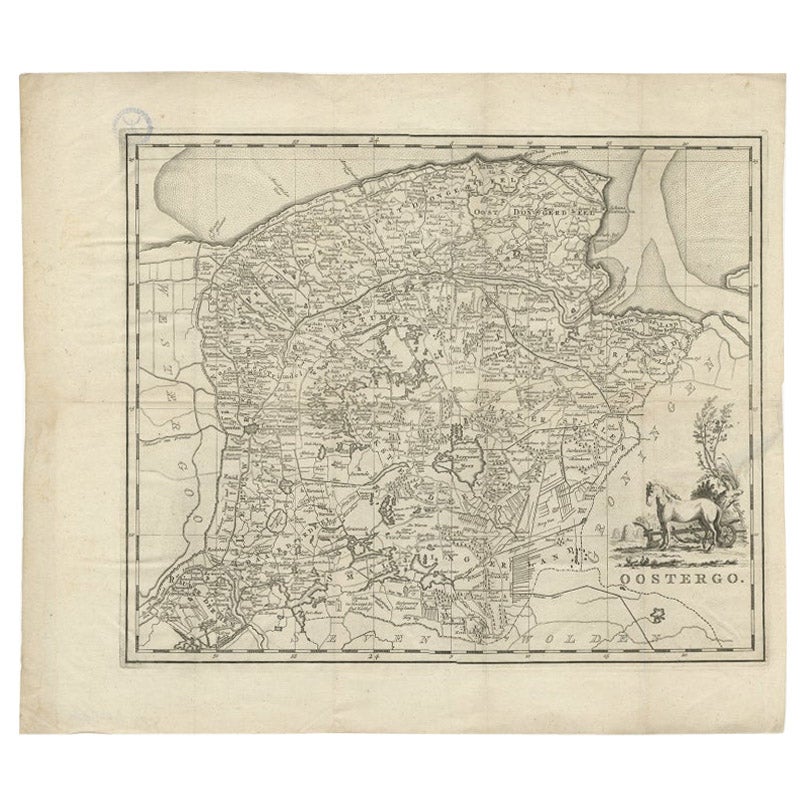
Antique Map of Oostergo, Friesland by Tirion, 1785
Located in Langweer, NL
Antique map Friesland titled 'Oostergo'. Antique map of part of Friesland depicting the 'Oostergo' region. Decorative titled cartouche with horse and plough. Originates from 'Tegenwo...
Category
Antique 18th Century Maps
Materials
Paper
You May Also Like
1752 Vaugoundy Map of Flanders : Belgium, France, and the Netherlands, Ric.a002
Located in Norton, MA
Large Vaugoundy Map of Flanders:
Belgium, France, and the Netherlands
Colored -1752
Ric.a002
Description: This is a 1752 Didier Robert de Vaugondy map of Flanders. The map de...
Category
Antique 17th Century Unknown Maps
Materials
Paper

1635 Willem Blaeu Map of Northern France"Comitatvs Bellovacvm" Ric.a08
Located in Norton, MA
1635 Willem Blaeu map of northern France, entitled.
"Comitatvs Bellovacvm Vernacule Beavvais,"
Colored
Ric.a008
“COMITATVS BELLOVACVM…” Amsterdam: W...
Category
Antique 17th Century Unknown Maps
Materials
Paper

1771 Bonne Map of Poitou, Touraine and Anjou, France, Ric.a015
Located in Norton, MA
1771 Bonne Map of Poitou,
Touraine and Anjou, France
Ric.a015
1771 Bonne map of Potiou, Touraine and Anjou entitled "Carte des Gouvernements D'Anjou et du Saumurois, de la Touraine, du Poitou,du Pays d'aunis, Saintonge?Angoumois,"
Carte des gouvernements d'Anjou et du Saumurois, de la Touraine, du Poitou, du Pays d'Aunis, Saintonge-Angoumois. Projettee et assujettie au ciel par M. Bonne, Hyd. du Roi. A Paris, Chez Lattre, rue St. Jacques a la Ville de Bord(ea)ux. Avec priv. du Roi. 1771. Arrivet inv. & sculp., Atlas moderne ou collection de cartes sur toutes...
Category
Antique 17th Century Unknown Maps
Materials
Paper

Original Antique Map or City Plan of Amsterdam, Netherlands. Circa 1835
Located in St Annes, Lancashire
Nice map of Amsterdam
Drawn and engraved by J.Dower
Published by Orr & Smith. C.1835
Unframed.
Free shipping
Category
Antique 1830s English Maps
Materials
Paper

1643 Willem&Joan Blaeu Map NW Flanders "Flandriae Teutonicae Pars Prientalior
Located in Norton, MA
1643 Willem and Joan Blaeu map of northwest Flanders, entitled
"Flandriae Teutonicae Pars Prientalior,"
Ric0012
" Authentic" - Map of the northwest Fl...
Category
Antique 17th Century Dutch Maps
Materials
Paper

Utrecht, Netherlands: A Large 17th Century Hand-colored Map by Sanson
Jaillot
By Nicholas Sanson d
Abbeville
Located in Alamo, CA
This large hand-colored map entitled "La Seigneurie d'Utrecht. Dressé sur les memoires les plus nouveaux par le Sr. Sanson" was originally created by Nicholas Sanson d'Abbeville. Thi...
Category
1690s Landscape Prints
Materials
Engraving

More Ways To Browse
Franz Joseph
Gibraltar Antique Map
Guyana Antique Map
Maps Of New Mexico
Saudi Arabia Map
16th Century Scotland
Antique Leather Map
Antique Map Of Argentina
Antique Map Of Colombia
Cornwall Map
Early Texas Furniture
Iraq Map
James Cook Map
Kentucky Antiques
Map Of Mexican California
Montreal Map
Mughal Map
Napoleon Map