Items Similar to Antique Map of Zevenwolden by Von Reilly, 1791


Want more images or videos?
Request additional images or videos from the seller
1 of 10
Antique Map of Zevenwolden by Von Reilly, 1791
$394.98
£293.48
€330
CA$541.05
A$590.25
CHF 313.06
MX$7,111.22
NOK 3,973.32
SEK 3,637.68
DKK 2,513.90
About the Item
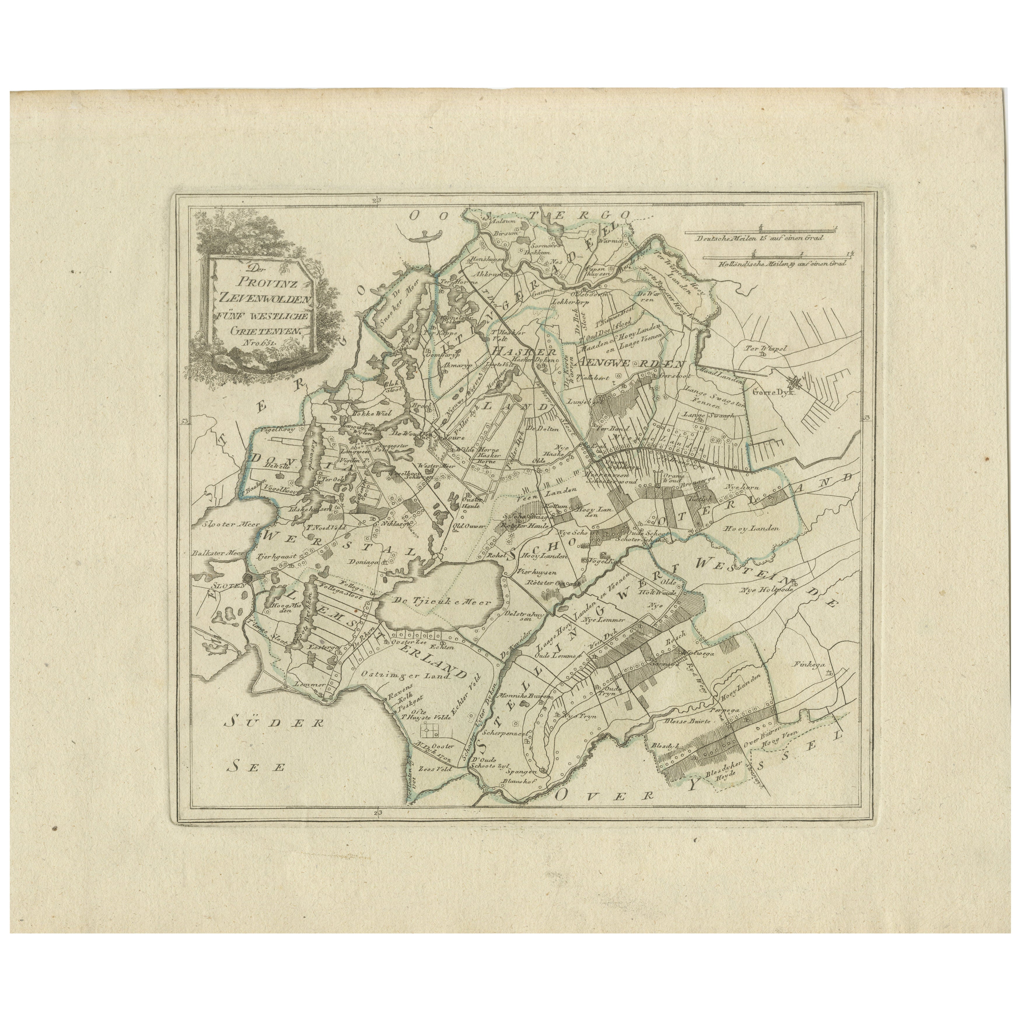
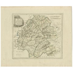
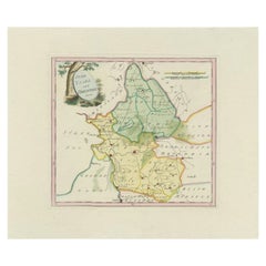
Friesland Zevenwouden eastern districts map, Reilly, Vienna, c.1791–95
Description:
Engraved map with original hand color of the Zevenwouden (Seven Forests) region in Friesland, Netherlands, titled “Der Provinz Zevenwolden vier östliche Grietenyen” (The Province of Zevenwouden, the four eastern districts). The sheet focuses on the eastern part of the region, principally Opsterland and Ooststellingwerf, with borders to Schoterland and Weststellingwerf, and shows the frontier with Drenthe. A decorative rock-and-foliage cartouche (Nro 652) appears at upper right. Dual scales are given below in German miles (15 to a degree) and Dutch miles (19 to a degree).
Important places engraved include Gorredijk (marked prominently), Beetsterzwaag, Hemrik, Terwispel, Bakkeveen, Oosterwolde, Donkerbroek, Appelscha, Elsloo, and Haule. Border features such as Friesche Palen are shown, together with the Compagnonsvaart canals and extensive moorland areas labelled Hoog Veen (high moor) and Sandige Heyde (sandy heath). The map reflects settlement, peat reclamation, and agricultural development in Friesland during the late eighteenth century.
Condition:
Good, with original outline and wash color. Light age toning and scattered marginal foxing. A faint water stain at the lower right outside the engraved border. Wide margins and a strong impression.
Framing tips:
A walnut or ebonized frame with a cream mount highlights the green wash. A double mat in cream with a soft green inner line echoes the cartouche and boundary colors.
Technique: Engraving with original hand color
Maker: Franz J. J. von Reilly, Vienna, circa 1791–1795
- Dimensions:Height: 11.42 in (29 cm)Width: 20.2 in (51.3 cm)Depth: 0.01 in (0.2 mm)
- Materials and Techniques:Paper,Engraved
- Place of Origin:
- Period:
- Date of Manufacture:1791
- Condition:Condition: Good, general age-related toning. Original/contemporary hand coloring. Blank verso. Please study image carefully.
- Seller Location:Langweer, NL
- Reference Number:Seller: PCT-7181stDibs: LU3054329258362
About the Seller
5.0
Recognized Seller
These prestigious sellers are industry leaders and represent the highest echelon for item quality and design.
Platinum Seller
Premium sellers with a 4.7+ rating and 24-hour response times
Established in 2009
1stDibs seller since 2017
2,820 sales on 1stDibs
Typical response time: 1 hour
- ShippingRetrieving quote...Shipping from: Langweer, Netherlands
- Return Policy
More From This Seller
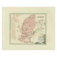
View AllAntique Map of Zevenwolden, Friesland by von Reilly, 1791
Located in Langweer, NL
Antique Map of Zevenwolden, Friesland by von Reilly, 1791
Original engraved map titled Der Provinz Zevenwolden fünf westliche Grietenyen No. 644, published in Vienna in 1791. This s...
Category
Antique 18th Century Austrian Maps
Materials
Paper
Antique Map of Friesland by Von Reilly, 1791
Located in Langweer, NL
Antique map titled 'Friesland'. Map of the province of Friesland, the Netherlands. This map orginates from 'Schauplatz der fünf Theile der Welt'. Artists and Engravers: Franz Joseph ...
Category
Antique 18th Century Austrian Maps
Materials
Paper

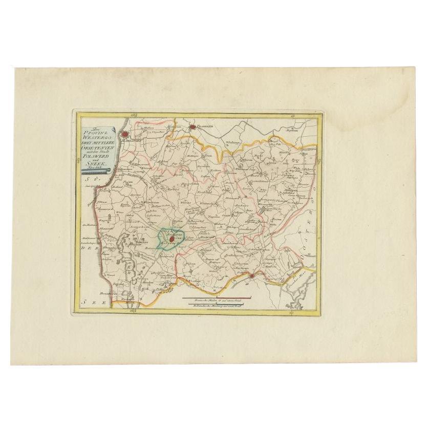
Antique Map of Southern Westergo, Friesland by von Reilly, 1791
Located in Langweer, NL
Antique Map of Southern Westergo, Friesland by von Reilly, 1791
Original engraved map titled Westergoo Norde, published in Vienna in 1791. This sheet depicts the southern and coasta...
Category
Antique 18th Century Austrian Maps
Materials
Paper
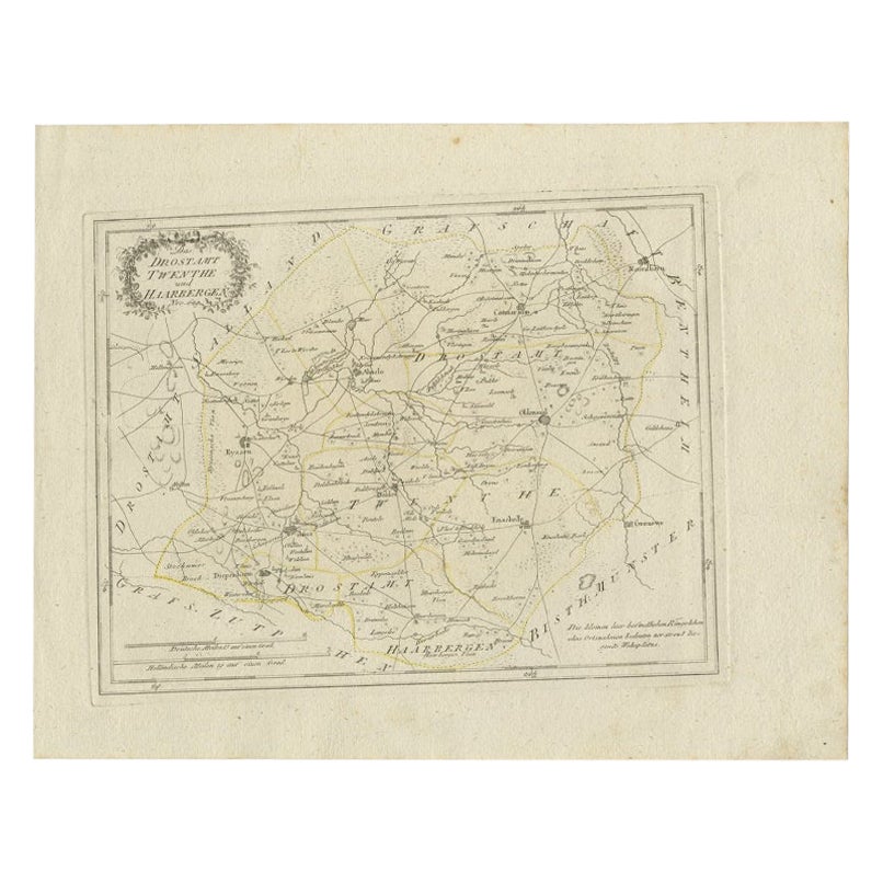
Antique Map of Part of Overijssel by Von Reilly, 1792
Located in Langweer, NL
Antique map titled 'Das Drostamt Twenthe und Haarbergen'. This map depicts part of The Netherlands (Overijssel). This map originates from 'Schauplatz der fünf Theile der Welt' publis...
Category
Antique 18th Century Maps
Materials
Paper
$119 Sale Price
20% Off
Bolsward
Sneek, Westergo (Friesland) – von Reilly antique map, 1791
Located in Langweer, NL
Title: Bolsward & Sneek, Westergo (Friesland) – von Reilly antique map, 1791
Description:
Crisp late-18th-century map of the Westergo region in Friesland focusing on the “drey mittl...
Category
Antique 18th Century Austrian Maps
Materials
Paper
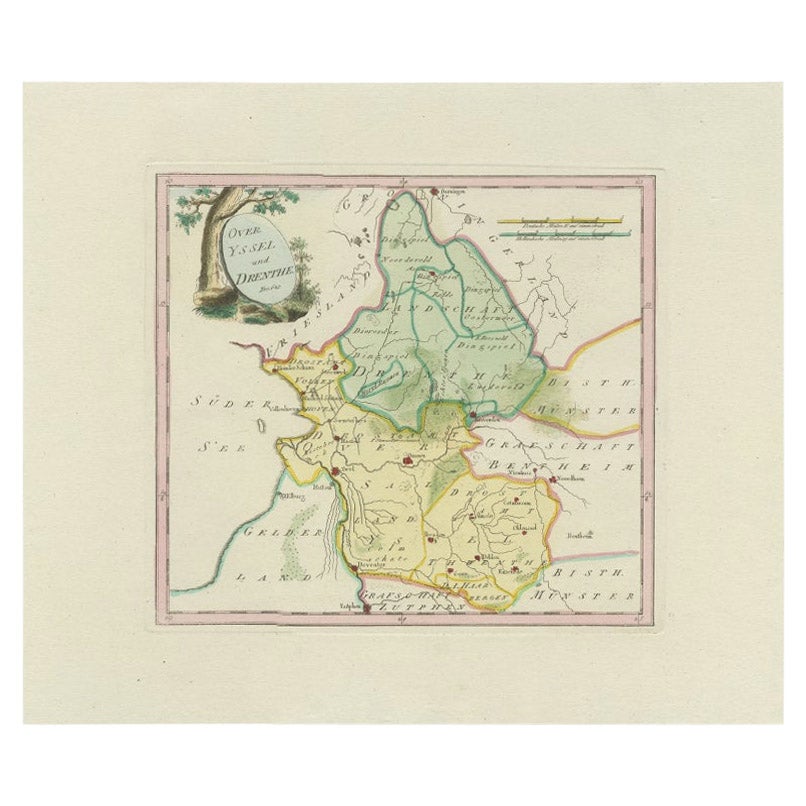
Antique Map of Overijssel and Drenthe by Von Reilly, c.1795
Located in Langweer, NL
Antique map titled 'Overyssel und Drenthe'. Decorative map of Overijssel and Drenthe, The Netherlands. This map originates from 'Schauplatz Der Funf Theile der Welt' (Wien: Reilly, 1...
Category
Antique 18th Century Maps
Materials
Paper
$148 Sale Price
20% Off
You May Also Like
1752 Vaugoundy Map of Flanders : Belgium, France, and the Netherlands, Ric.a002
Located in Norton, MA
Large Vaugoundy Map of Flanders:
Belgium, France, and the Netherlands
Colored -1752
Ric.a002
Description: This is a 1752 Didier Robert de Vaugondy map of Flanders. The map de...
Category
Antique 17th Century Unknown Maps
Materials
Paper

1839 Map of Karte Des "Russischen Reiches in Europa Und Asien" Ric.R0013
Located in Norton, MA
1839 map of Karte Des
"Russischen Reiches in Europa and Asien"
Ric.r013
Map of the European and Asian parts of Russian Empire. Karte der Russischen Reiches in Europa und Asien...
Category
Antique 19th Century Unknown Maps
Materials
Paper

1635 Willem Blaeu Map of Northern France"Comitatvs Bellovacvm" Ric.a08
Located in Norton, MA
1635 Willem Blaeu map of northern France, entitled.
"Comitatvs Bellovacvm Vernacule Beavvais,"
Colored
Ric.a008
“COMITATVS BELLOVACVM…” Amsterdam: W...
Category
Antique 17th Century Unknown Maps
Materials
Paper

1851 Map of "Independent Tartary", Ric. R018
Located in Norton, MA
1851 Map of
Independent Tartary
"Russia"
Ric.r018
A highly decorative 1851 map of Independent Tartary by John Tallis and John Rapkin. Covers the regions between the Caspian Sea and Lake Bakquash and between Russia and Afghanistan. These include the ancient Silk Route kingdoms of Khiva, Tartaria, Kokand, and Bokhara. Today this region roughly includes Kazakhstan, Uzbekistan, Turkmenistan, Kyrgyzstan, and Tajikistan. This wonderful map offers a wealth of detail for anyone with an interest in the Central Asian portion of the ancient Silk Road. Identifies various caravan routes, deserts, wells, and stopping points, including the cities of Bokhara and Samarkand. Three vignettes by W. Bragg decorate the map, these including an image of Tartars on a Journey, a horseback Bride Chase, and a tartar camp site. Surrounded by a vine motif border. Engraved by J. Rapkin for John Tallis's 1851 Illustrated Atlas .
Tartary Antique Map...
Category
Antique 19th Century Unknown Maps
Materials
Paper

Original Antique Map of Ancient Greece- Boeotia, Thebes, 1787
Located in St Annes, Lancashire
Great map of Ancient Greece. Showing the region of Boeotia, including Thebes
Drawn by J.D. Barbie Du Bocage
Copper plate engraving by P.F T...
Category
Antique 1780s French Other Maps
Materials
Paper

Original Antique Map of Hungary, Arrowsmith, 1820
Located in St Annes, Lancashire
Great map of Hungary
Drawn under the direction of Arrowsmith.
Copper-plate engraving.
Published by Longman, Hurst, Rees, Orme and Brown, 1820
Unframed.
Category
Antique 1820s English Maps
Materials
Paper
