Items Similar to Antique Maps of North-West and South Africa, 1903, Colonial Borders and Terrain
Want more images or videos?
Request additional images or videos from the seller
1 of 11
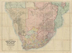
Antique Maps of North-West and South Africa, 1903, Colonial Borders and Terrain
$384.29
£284.62
€320
CA$525.69
A$572.11
CHF 303.27
MX$6,882.89
NOK 3,846.48
SEK 3,519.26
DKK 2,438.46
About the Item
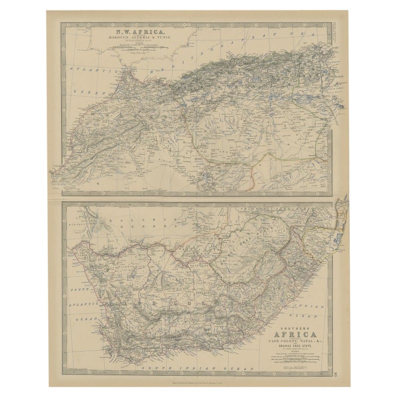
Title: Antique Maps of North-West and South Africa, 1903, Colonial Borders and Terrain
Description:
This double-plate antique map, featuring "N.W. Africa: Morocco, Algeria
Tunis" and "South Africa," was engraved and published in 1903 by W.
A.K. Johnston in Edinburgh and London. It presents a comprehensive view of the political and natural landscapes of Africa during a pivotal era of European colonial expansion.
The top half focuses on North-West Africa, highlighting the rugged terrain and significant urban centers of Morocco, Algeria, and Tunisia. The hand-coloring emphasizes the territorial divisions and mountain ranges, from the Atlas Mountains to the fertile coastal plains along the Mediterranean.
The bottom half of the map showcases South Africa, with clear depictions of the colonial territories of the Cape Colony, Natal, Transvaal, and the Orange Free State, as well as neighboring Bechuanaland (modern Botswana). Rivers, trade routes, and mineral resources are all meticulously noted, making this map a valuable historical record of the region’s natural and economic features during the early 20th century.
Collectors, historians, and those with a fascination for the geopolitical dynamics of Africa will find these maps to be both aesthetically appealing and historically rich—an exceptional resource for understanding Africa's colonial past and its long-standing geographical complexity.
Condition report:
This double map is in very good antique condition, with only minor foxing and edge toning consistent with its age. The colors remain vivid and the paper is stable and well-preserved.
Framing tips:
A classic wooden frame in walnut or cherry, paired with an off-white matting, will beautifully highlight the soft pastel colors and intricate details of the maps. Displayed together, they create an impressive and sophisticated focal point, perfect for a study, office, or library.
- Dimensions:Height: 18.51 in (47 cm)Width: 14.49 in (36.8 cm)Depth: 0.01 in (0.2 mm)
- Materials and Techniques:
- Period:
- Date of Manufacture:1903
- Condition:This map is in very good antique condition, with minor foxing and gentle toning along the edges, typical for its age. The colors remain vibrant and the paper is stable and well-preserved. Folding line as issued.
- Seller Location:Langweer, NL
- Reference Number:Seller: BG-13577-371stDibs: LU3054345272012
About the Seller
5.0
Recognized Seller
These prestigious sellers are industry leaders and represent the highest echelon for item quality and design.
Platinum Seller
Premium sellers with a 4.7+ rating and 24-hour response times
Established in 2009
1stDibs seller since 2017
2,816 sales on 1stDibs
Typical response time: 1 hour
- ShippingRetrieving quote...Shipping from: Langweer, Netherlands
- Return Policy
More From This Seller
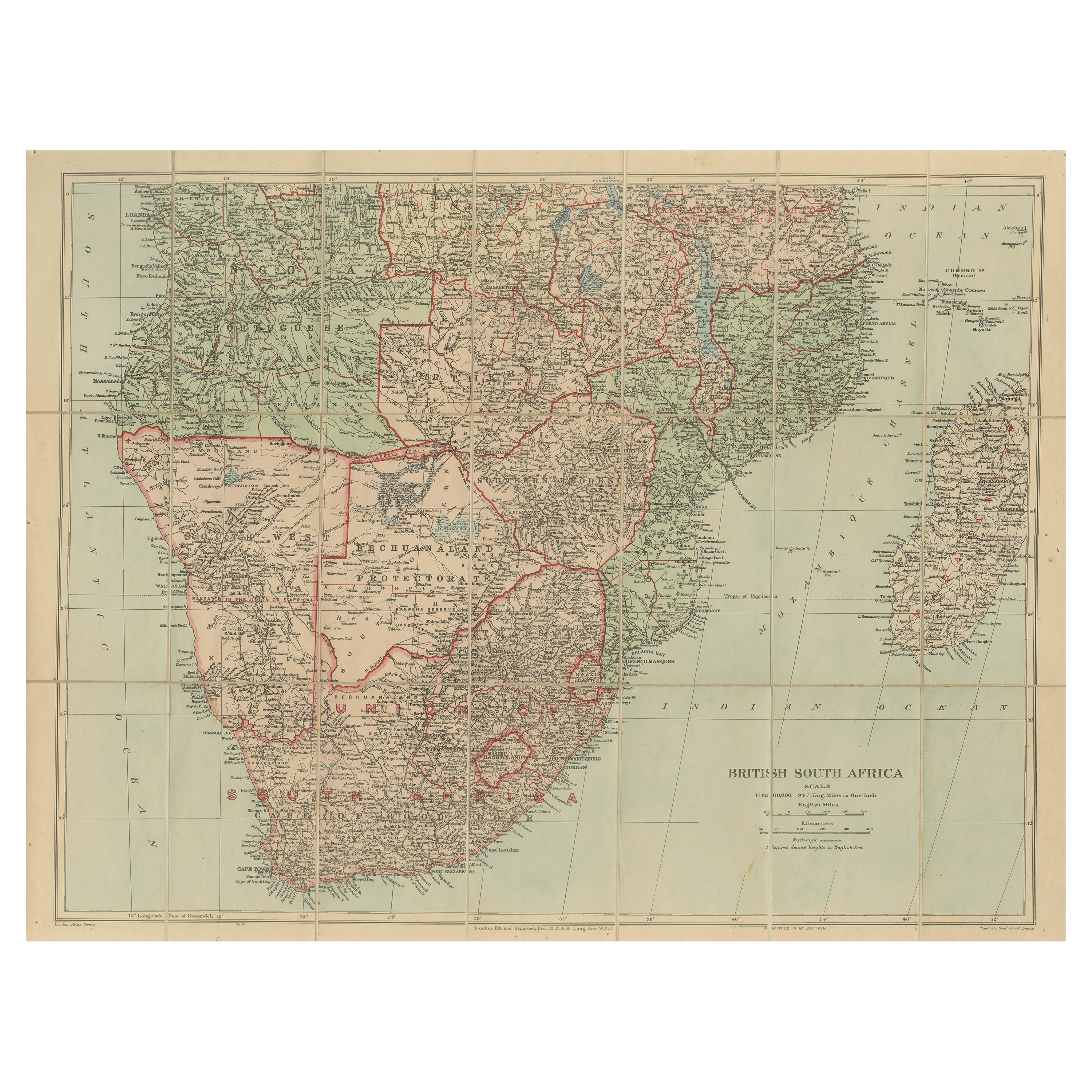
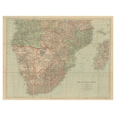
View AllAntique Map of British South Africa – Colonial Territories
Railways, c.1920s
Located in Langweer, NL
Antique Map of British South Africa – Colonial Territories & Railways, c.1920s
This large and detailed folding map depicts British South Afric...
Category
Early 20th Century English Maps
Materials
Paper
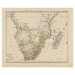
Southern Africa
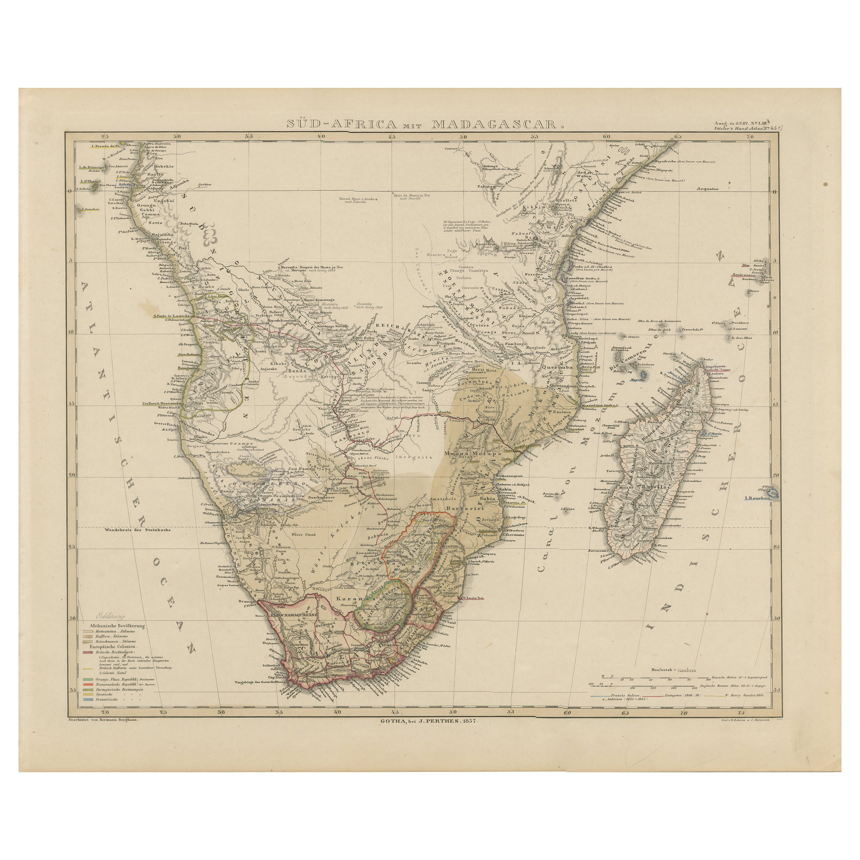
Madagascar Antique Map – Beautiful 1857 Edition
Located in Langweer, NL
Southern Africa and Madagascar Map 1857
This detailed antique print shows “Süd-Africa mit Madagascar” meaning “Southern Africa with Madagascar,” published in 1857 by Justus Perthes ...
Category
Antique Mid-19th Century German Maps
Materials
Paper
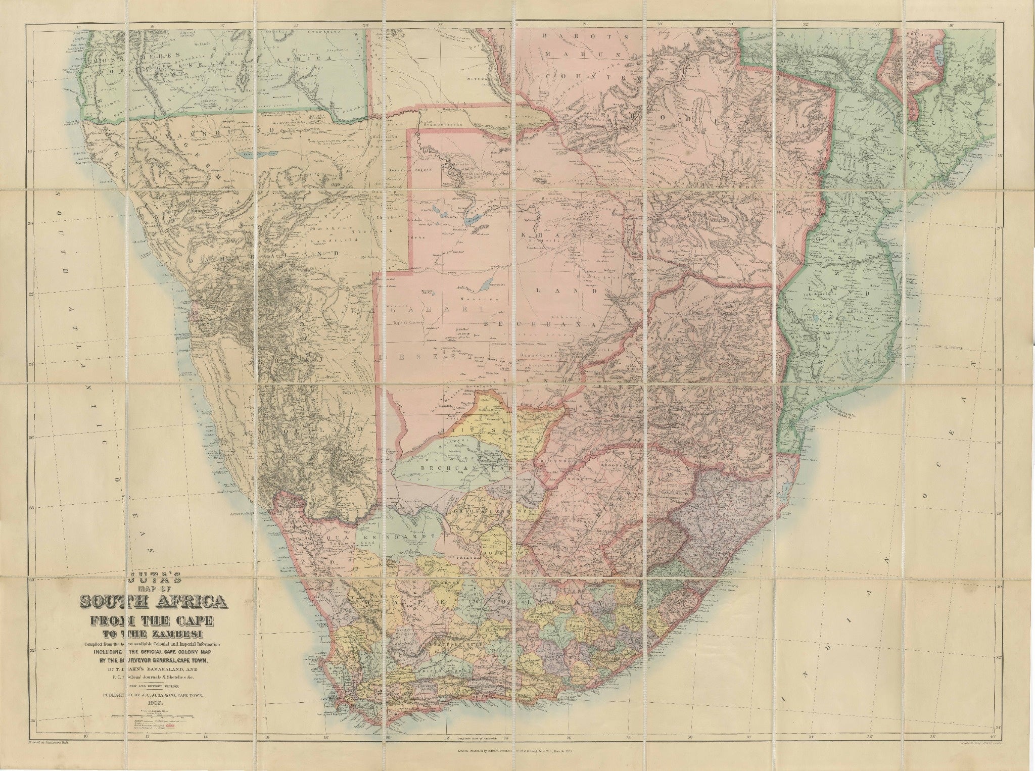
South Africa c.1890 Antique Folding Map – Cape Colony to Zambesi River
Located in Langweer, NL
South Africa Folding Map c.1890 – Juta Antique Linen-Mounted Map
This impressive antique folding map, “Juta’s Map of South Africa from the Cape to the Zambesi,” was published in Cap...
Category
Antique Late 19th Century South African Maps
Materials
Paper
Antique Map of North and South Africa by Johnston, 1882
Located in Langweer, NL
Two antique maps on one sheet titled 'N.W. Africa, Marocco, Algeria & Tunis' and 'Southern Africa, comprising Cape Colony, Natal & c'.
This map originates from 'The Royal Atlas of ...
Category
Antique 19th Century Maps
Materials
Paper
Antique Map of North-Western and South Africa by A.K. Johnston, 1865
Located in Langweer, NL
Two maps on one sheet titled 'North-Western Africa' and 'Southern Africa'. Depicting Morocco, Algeria, Tunis, Cape Colony, Natal and more. This map originates from the ‘Royal Atlas o...
Category
Antique Mid-19th Century British Maps
Materials
Paper

Antique Map of Southern Africa by Levasseur, 1875
Located in Langweer, NL
Antique map titled 'Afrique Méridionale'. Large map of Southern Africa. This map originates from 'Atlas de Géographie Moderne Physique et Politique' b...
Category
Antique Late 19th Century French Maps
Materials
Paper

You May Also Like
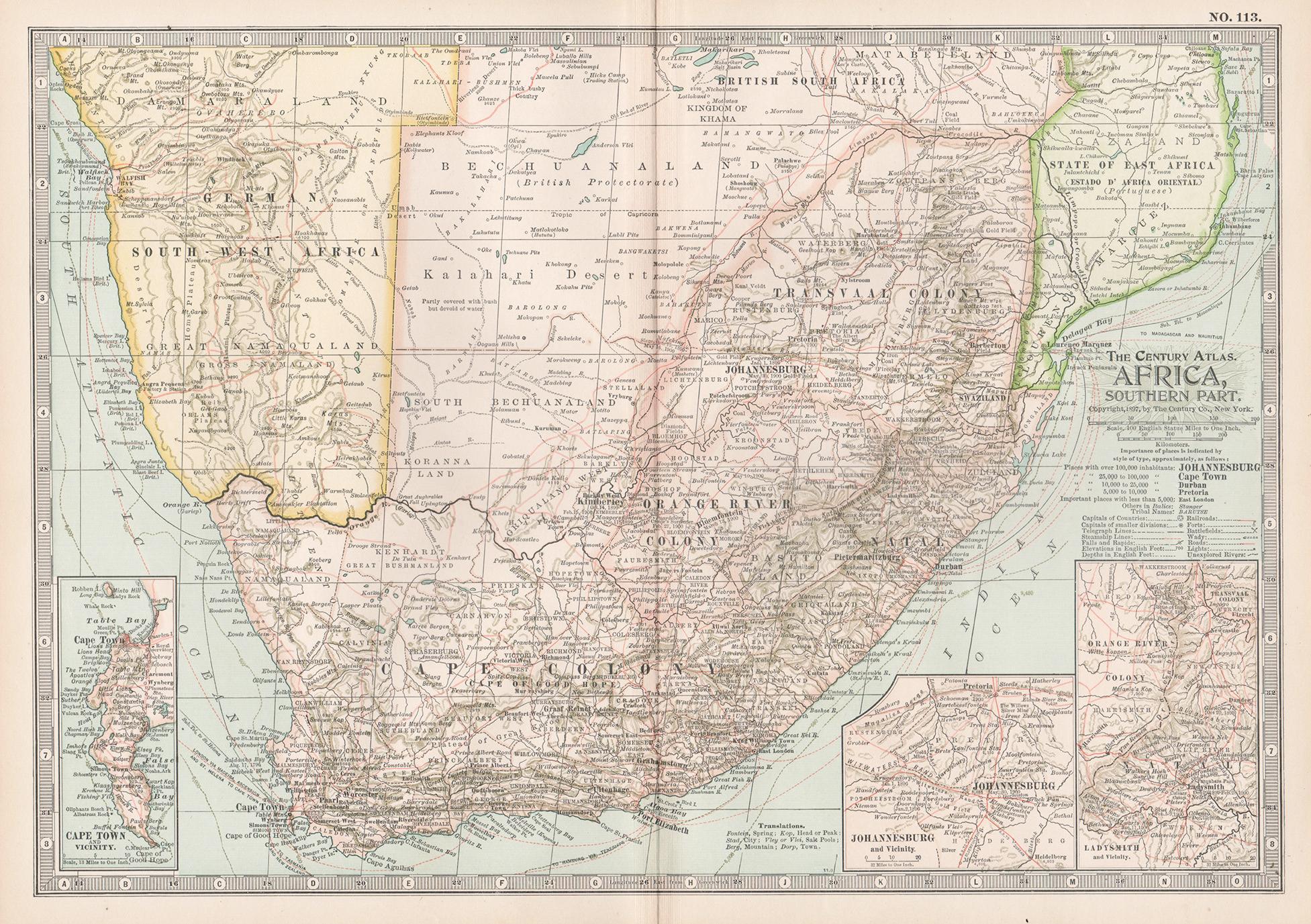
Africa. Southern Part. Century Atlas antique vintage map
Located in Melbourne, Victoria
'The Century Atlas. Africa. Southern Part'
Original antique map, 1903.
Inset maps of 'Cape Town', 'Johannesburg' and 'Ladysmith'.
Central fold as issued. Map name and number printe...
Category
Early 20th Century Victorian More Prints
Materials
Lithograph

Large Original Vintage Map of South Africa, circa 1920
Located in St Annes, Lancashire
Great map of South Africa
Original color.
Good condition / repair to a minor edge tear middle bottom
Published by Alexander Gross
Unframed.
...
Category
Vintage 1920s English Edwardian Maps
Materials
Paper

Africa. North-East Part. Century Atlas antique vintage map
Located in Melbourne, Victoria
'The Century Atlas. Africa. North-East Part'
Original antique map, 1903.
Inset map of 'Nile Delta and Suez Canal'.
Central fold as issued. Map name and nu...
Category
Early 20th Century Victorian More Prints
Materials
Lithograph

Original Antique Map of Africa by Dower, circa 1835
Located in St Annes, Lancashire
Nice map of Africa
Drawn and engraved by J.Dower
Published by Orr & Smith. C.1835
Unframed.
Free shipping
Category
Antique 1830s English Maps
Materials
Paper

Africa. Central. Century Atlas antique vintage map
Located in Melbourne, Victoria
'The Century Atlas. Africa. Central'
Inset map of 'Madagascar'.
Original antique map, 1903.
Central fold as issued. Map name and number printed on the reverse corners.
Sheet 29.5cm...
Category
Early 20th Century Victorian More Prints
Materials
Lithograph

Africa. North-West Part. Century Atlas antique vintage map
Located in Melbourne, Victoria
'The Century Atlas. Africa. Southern Part'
Original antique map, 1903.
Central fold as issued. Map name and number printed on the reverse corners.
Sheet 40cm by 29.5cm.
Category
Early 20th Century Victorian More Prints
Materials
Lithograph

More Ways To Browse
Cream Soup
Early English Silver
Paisley Rugs and Carpets
Black And Chrome Lounge Chair
Vintage 1930 Dining Room Set
Antique Brass And Copper
Antique Cow
Antique Harvest
Antique Victorian Dining Tables
Environment Furniture
Italian Plastic Chairs
Made In Belgium
Black Crystal Glasses
French Mid Century Modern Rug
China Silk Rug
Chrome Glass Coffee Tables
Antique Italian Chairs
Antique Walnut Bar