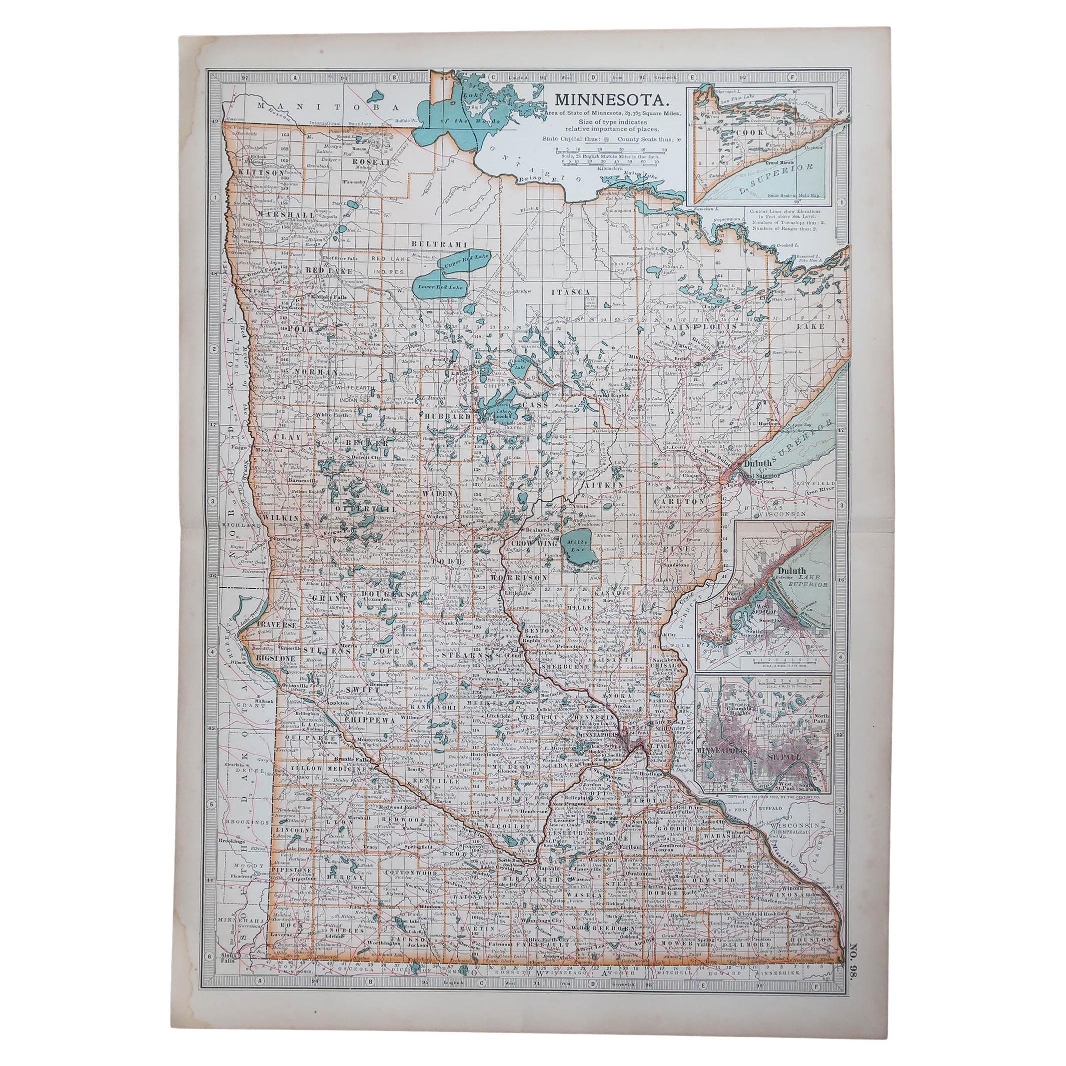
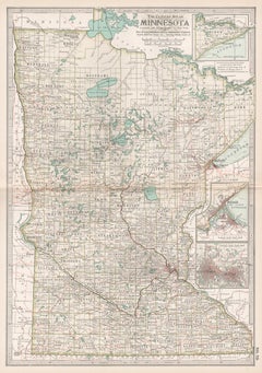
Items Similar to Antique Minnesota Map Wall Art by Rand McNally, Color Lithograph, 1888
Want more images or videos?
Request additional images or videos from the seller
1 of 13
Antique Minnesota Map Wall Art by Rand McNally, Color Lithograph, 1888
$403.50
£300.99
€340
CA$561.62
A$602.52
CHF 323.18
MX$7,254.21
NOK 4,074.03
SEK 3,714.95
DKK 2,591.06
About the Item
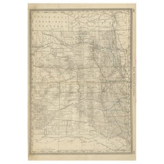
Title: Antique Minnesota Map Wall Art – Railroads, Lakes
Cities, Rand McNally
Description:
This original antique atlas map depicts the state of Minnesota in rich geographic detail, showing lakes, rivers, railroads, towns, and county boundaries across the state. The composition balances dense information with a refined, orderly layout, giving the map strong decorative appeal despite its technical precision.
Published by Rand, McNally
Co. in the late 19th century, the map captures Minnesota at a key moment of development, when railroad networks were expanding rapidly and shaping settlement patterns. The intricate web of rail lines converging on major cities creates a visually engaging structure that reads almost like a graphic design when viewed from a distance.
Major features such as Lake Superior, the Mississippi River, Red Lake, and Mille Lacs Lake are clearly rendered, alongside important cities and towns including Minneapolis, St. Paul, Duluth, Rochester, Mankato, St. Cloud, Brainerd, and Winona. Northern regions show extensive lakes and forested areas, while the southern portion reveals a denser network of towns and transportation routes.
Printed on original period atlas paper, the sheet retains the authentic surface texture and gentle patina expected of a genuine antique map. Its tall vertical format works particularly well as wall art, lending itself to studies, offices, libraries, or regional and travel-themed interiors.
Condition report: Light age toning consistent with age. Minor edge wear and small handling marks from original atlas binding. Folding line as issued. Overall clean and well preserved.
Framing tips: Especially effective in walnut, light oak, or black frames with an ivory or warm off-white mat. Museum glass recommended.
Technique: Color lithograph
Maker: Rand, McNally
Co., United States, late 19th century
Keywords:
antique minnesota map, minnesota wall art, rand mcnally map, minneapolis st paul map, duluth minnesota map, lake superior map, mississippi river map, railroad map minnesota, antique atlas map, historical minnesota map, midwest wall decor
- Dimensions:Height: 20.67 in (52.5 cm)Width: 14.18 in (36 cm)Depth: 0.01 in (0.2 mm)
- Materials and Techniques:
- Place of Origin:
- Period:
- Date of Manufacture:circa 1888
- Condition:Light age toning consistent with age. Minor edge wear and small handling marks from original atlas binding. Overall clean and well preserved. Folding line as issued.
- Seller Location:Langweer, NL
- Reference Number:Seller: BG-12794-731stDibs: LU3054348231352
About the Seller
5.0
Recognized Seller
These prestigious sellers are industry leaders and represent the highest echelon for item quality and design.
Platinum Seller
Premium sellers with a 4.7+ rating and 24-hour response times
Established in 2009
1stDibs seller since 2017
2,830 sales on 1stDibs
Typical response time: 1 hour
- ShippingRetrieving quote...Shipping from: Langweer, Netherlands
- Return Policy
More From This Seller
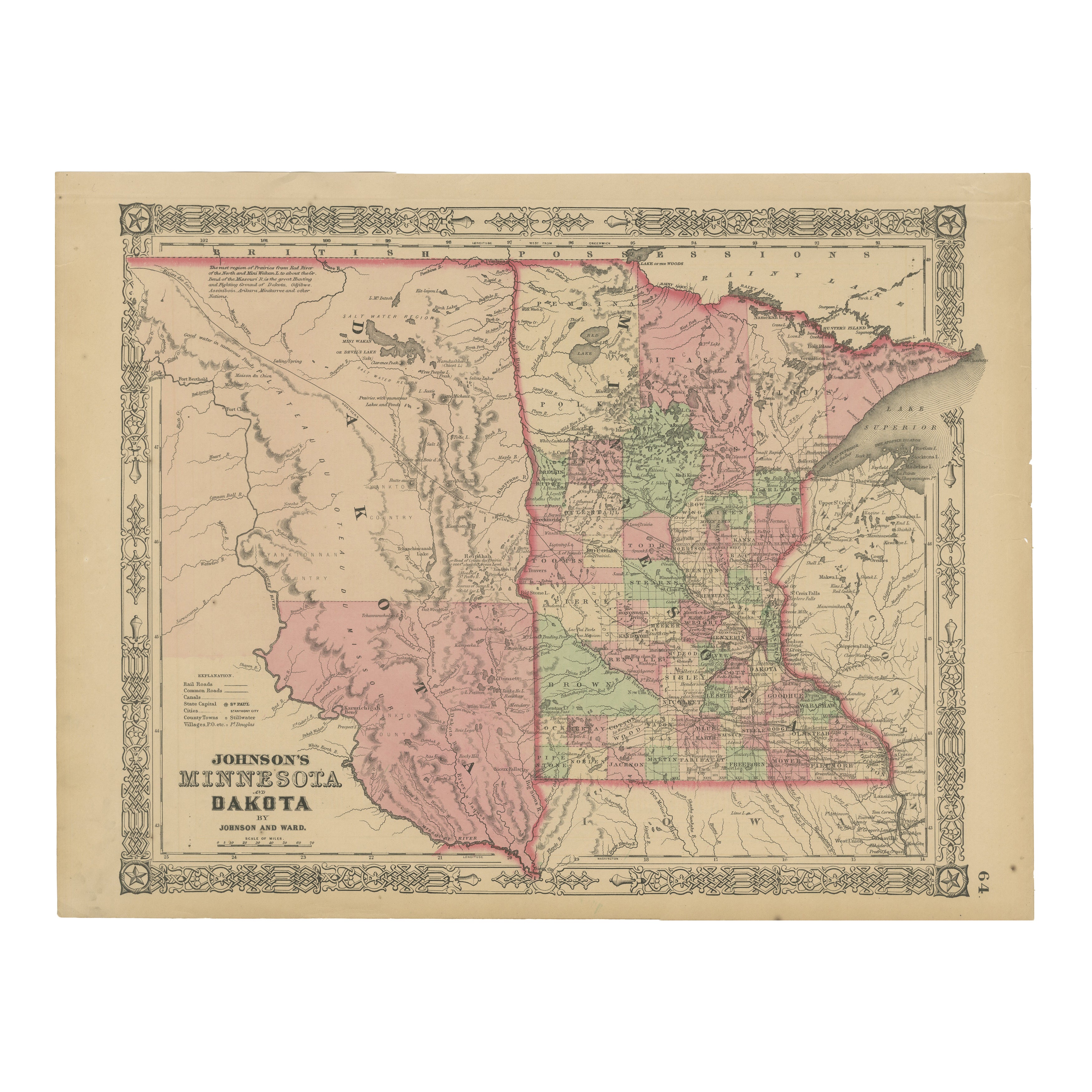
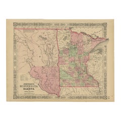
View AllMinnesota and Dakota Map – Johnson, Hand-Colored, USA c.1864
Located in Langweer, NL
Johnson’s Minnesota and Dakota Map, USA c.1864 – Hand-Colored Territorial Map
Description:
This is a finely engraved and hand-colored map titled Johnson’s Minnesota and Dakota, pub...
Category
Antique Mid-19th Century American Maps
Materials
Paper
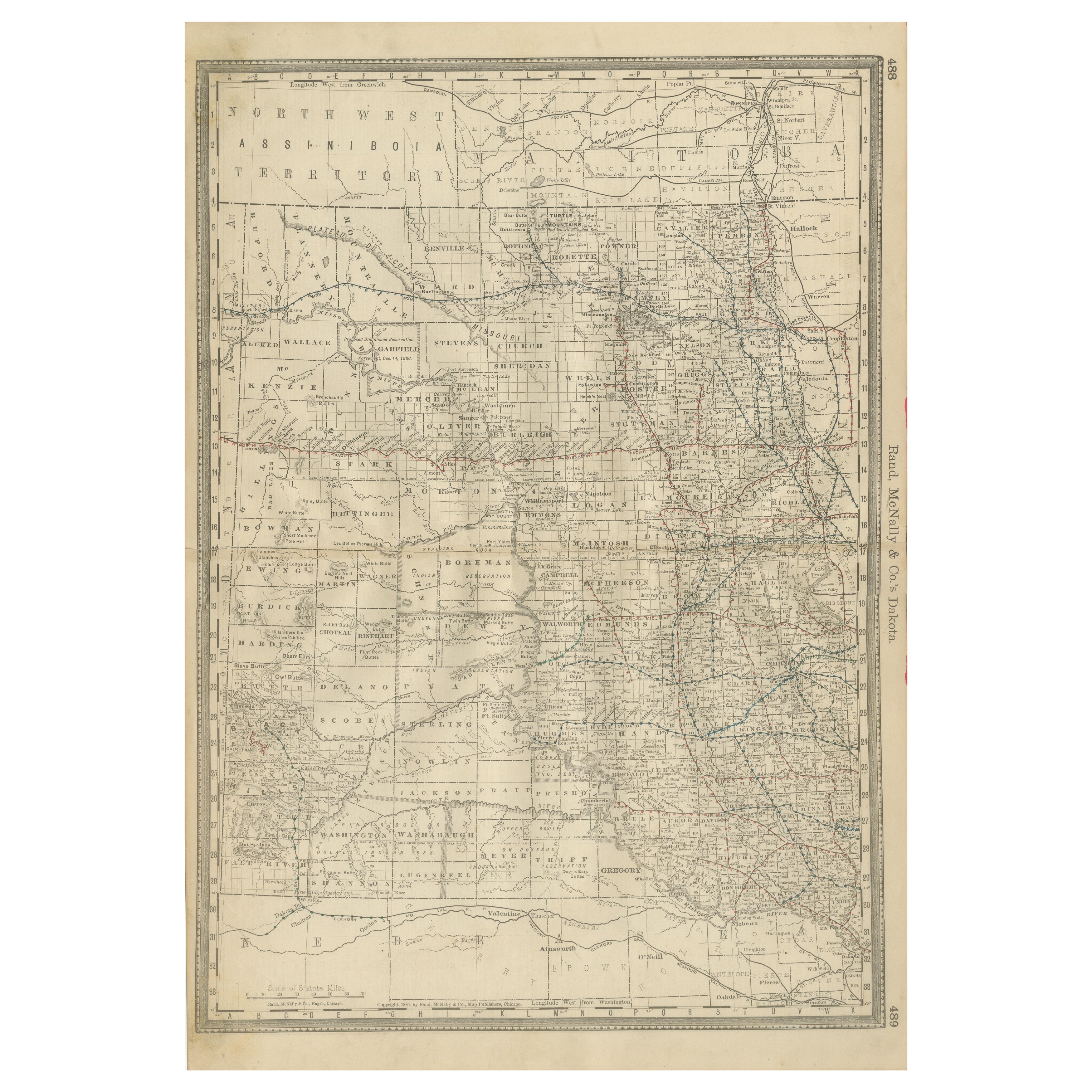
Dakota Territory Railroad Map 1888 – Rand McNally Antique Lithograph
Located in Langweer, NL
Antique Map of Dakota Territory – Rand McNally Railroad Map, 1888
This detailed 1888 map of Dakota by Rand, McNally & Co. captures the region in the final year before its division i...
Category
Antique Late 19th Century American Maps
Materials
Paper
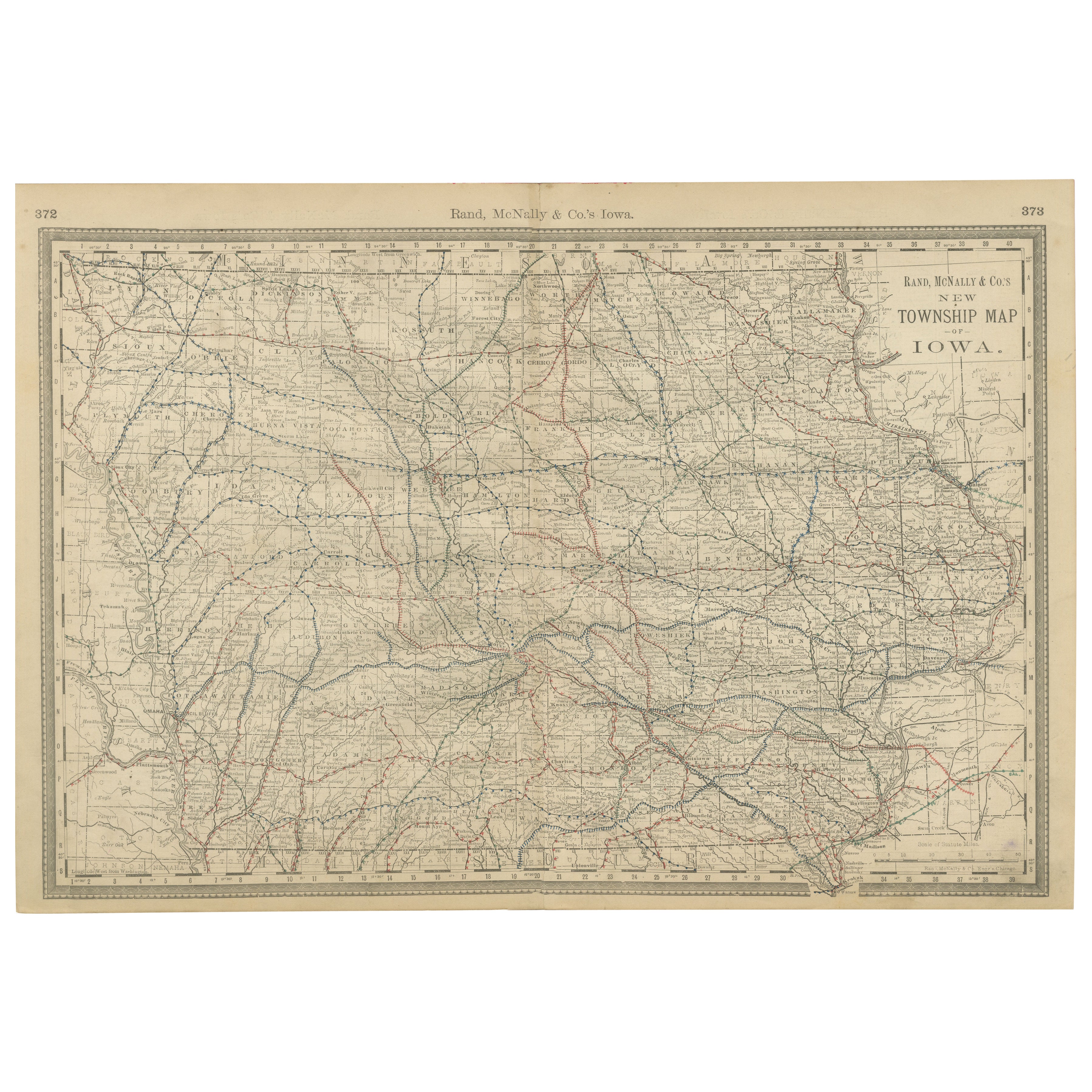
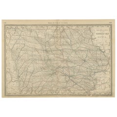
Antique Map of Iowa – The Hawkeye State with Railroads
Townships, 1888
Located in Langweer, NL
Antique Map of Iowa – Railroads, Counties & Townships, 1888
This antique engraved map of Iowa, published in 1888 by Rand, McNally & Co. in Chicago for their Improved Indexed Busines...
Category
Antique Late 19th Century American Maps
Materials
Paper
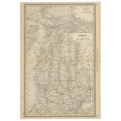
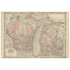
Antique Map of Michigan – The Wolverine State with Railroads
Counties, 1888
Located in Langweer, NL
Antique Map of Michigan – The Wolverine State with Railroads & Counties, 1888
This antique engraved map of Michigan, published in 1888 by Rand...
Category
Antique Late 19th Century American Maps
Materials
Paper
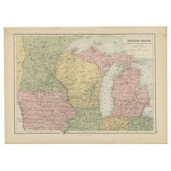
Antique Map of Western States, Michigan, Wisconsin, Iowa by A
C. Black, 1870
Located in Langweer, NL
Antique map titled 'Western States, Michigan, Wisconsin, Minnesota, Iowa with portions of Illinois & Indiana'. Original antique map of Western States, Michigan, Wisconsin, Minnesota,...
Category
Antique Late 19th Century Maps
Materials
Paper
Rare 1864 Civil War Era Map of Michigan and Wisconsin with Great Lakes Detail
Located in Langweer, NL
Title: Rare 1864 Civil War Era Map of Michigan and Wisconsin with Great Lakes Detail
Description: This beautifully crafted antique map, titled "Johnson's Michigan and Wisconsin," wa...
Category
Antique 1860s Maps
Materials
Paper
You May Also Like
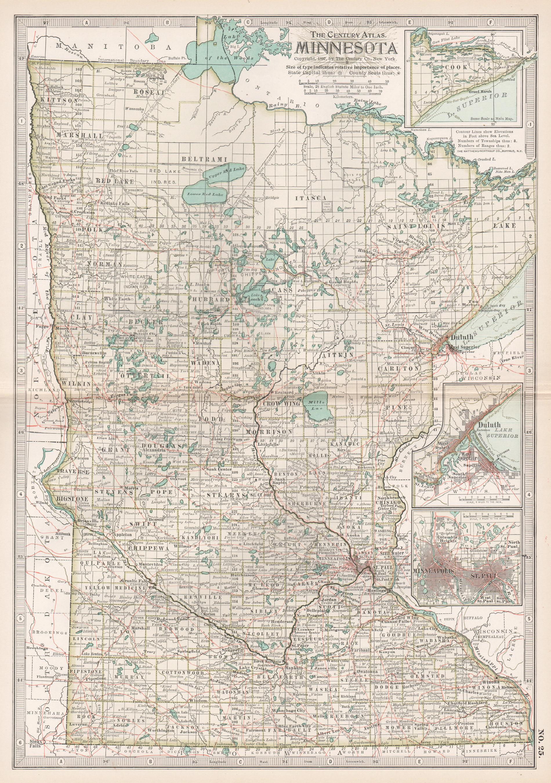
Minnesota. USA. Century Atlas state antique vintage map
Located in Melbourne, Victoria
'The Century Atlas. Minnesota.'
Original antique map, 1903.
Central fold as issued. Map name and number printed on the reverse corners.
Sheet 40cm by 29.5cm.
Category
Early 20th Century Victorian More Prints
Materials
Lithograph
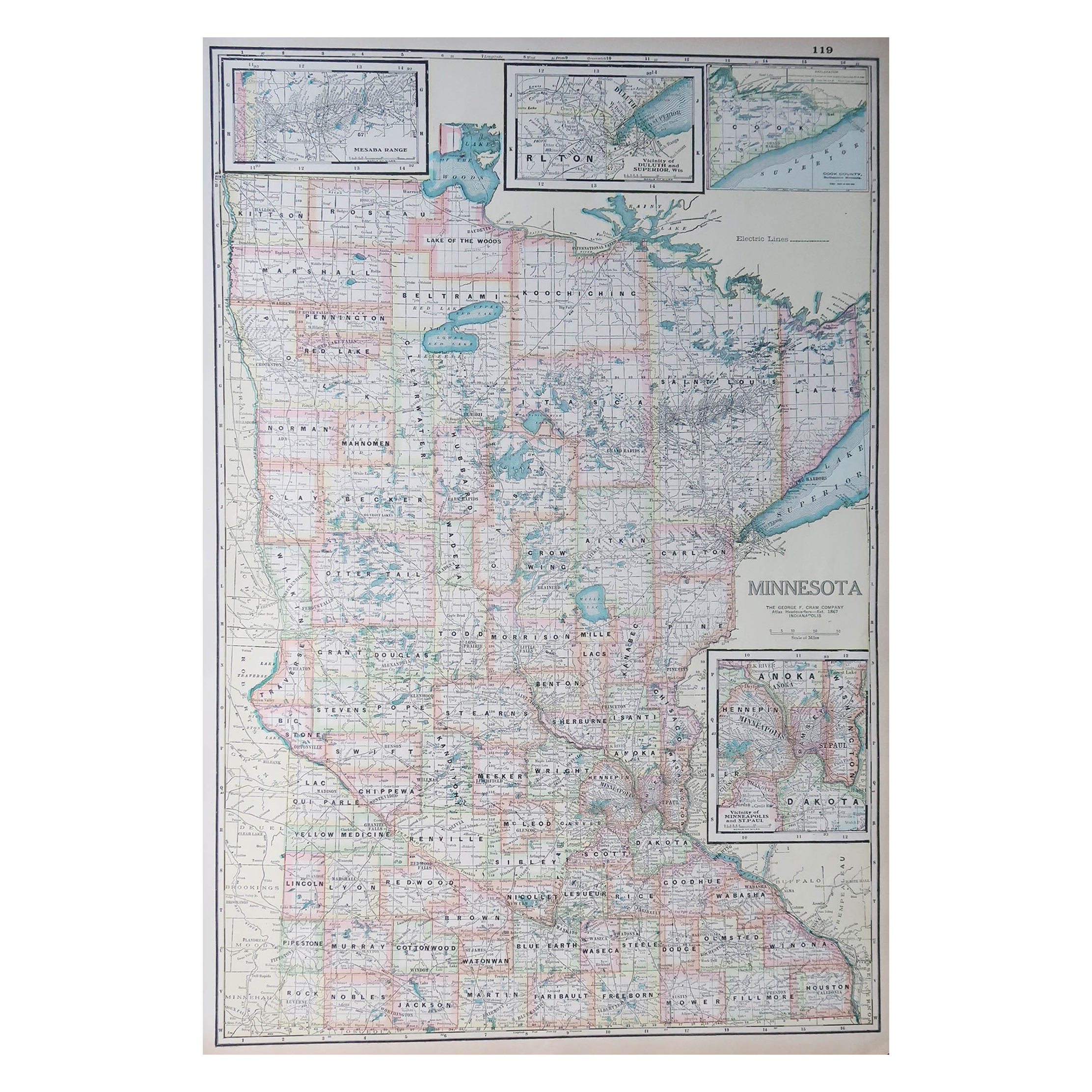
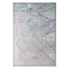
Large Original Antique Map of Minnesota, USA, C.1900
Located in St Annes, Lancashire
Fabulous map of Minnesota
Original color
Engraved and printed by the George F. Cram Company, Indianapolis.
Published, C.1900
Unframed
Repair to a small tear bottom left corner
...
Category
Antique 1890s American Maps
Materials
Paper
Original Antique Map of the American State of Minnesota, 1903
Located in St Annes, Lancashire
Antique map of Minnesota
Published By A & C Black. 1903
Original colour
Good condition
Unframed.
Free shipping
Category
Antique Early 1900s English Maps
Materials
Paper

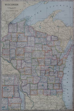
Large Original Antique Map of Wisconsin, USA, circa 1900
Located in St Annes, Lancashire
Fabulous map of Wisconsin
Original color
Engraved and printed by the George F. Cram Company, Indianapolis.
Published, circa 1900
Unframed
Category
Antique 1890s American Maps
Materials
Paper
Original Antique Map of South Dakota by Rand McNally, circa 1900
By Rand McNally
Co.
Located in St Annes, Lancashire
Fabulous monochrome map with red outline color
Original color
By Rand, McNally & Co.
Published, circa 1900
Unframed
Minor edge tears.
Category
Antique Early 1900s American Edwardian Maps
Materials
Paper

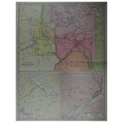
Large Original Antique City Plan of Minneapolis and St Paul, USA, circa 1900
By Rand McNally
Co.
Located in St Annes, Lancashire
Fabulous colorful map of Minneapolis and St Paul, Minnesota.
Original color
By Rand, McNally & Co.
Published, circa 1900
Unframed
Minor edge tears
Free shipping.
Category
Antique Early 1900s American Maps
Materials
Paper