Items Similar to Antique Plan of Batavia, Capital of the Dutch East Indies, by Van Der Aa, 1725


Want more images or videos?
Request additional images or videos from the seller
1 of 6
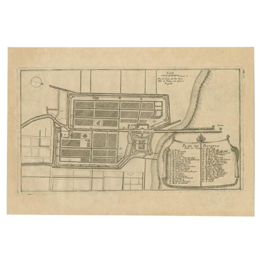
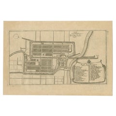
Antique Plan of Batavia, Capital of the Dutch East Indies, by Van Der Aa, 1725
$683.98
£506.87
€570
CA$934.79
A$1,017.60
CHF 540.14
MX$12,243.92
NOK 6,844.34
SEK 6,271.35
DKK 4,341.86
About the Item
Antique map titled 'Plan de Batavia'. (Plan of Batavia.) This plate shows a plan of the city of Batavia / Jakarta in Indonesia. With extensive legend, compass rose and scale. This plate originates from the very scarse: 'La galerie agreable du monde'. Tome premier des Indes Orientales.', published by P. van der Aa, Leyden, c. 1725. This famous work was published in 66 parts and is the biggest print / map book ever published. Van der Aa incorporated plates by other publishers such as Blaeu, Visscher, de Wit, meurs, Halma, Mortier, Allard in this work and often added broad decorative borders. Probably the costliest and complete universal geographic work ever produced. It is said that only 100 copies were printed. Ref: Koeman Aa9; Phillips 2780 note.
Artists and Engravers: Pieter van der Aa (Leiden 1659-1733) was a Dutch publisher best known for preparing maps and atlases. The Galerie Agreable contains plates and maps by the best Dutch engravers: Luiken, Goeree, Mulder, Stoopendaal, ao.
Condition: Good. General age related toning and occasional light staining from handling. Paper edge uncut and thus irregular. Original middle fold as issued. Please study image carefully.
Date: 1725
Overall size: 49 x 38 cm.
Image size: 27.5 x 21.5 cm.
We sell original antique maps to collectors, historians, educators and interior decorators all over the world. Our collection includes a wide range of authentic antique maps from the 16th to the 20th centuries. Buying and collecting antique maps is a tradition that goes back hundreds of years. Antique maps have proved a richly rewarding investment over the past decade, thanks to a growing appreciation of their unique historical appeal. Today the decorative qualities of antique maps are widely recognized by interior designers who appreciate their beauty and design flexibility. Depending on the individual map, presentation, and context, a rare or antique map can be modern, traditional, abstract, figurative, serious or whimsical. We offer a wide range of authentic antique maps for any budget.
- Creator:Pieter Van Der Aa (Artist)
- Dimensions:Height: 14.97 in (38 cm)Width: 19.3 in (49 cm)Depth: 0 in (0.01 mm)
- Materials and Techniques:
- Period:
- Date of Manufacture:1725
- Condition:Condition: Good. General age related toning and occasional light staining from handling. Paper edge uncut and thus irregular. Original middle fold as issued. Please study image carefully.
- Seller Location:Langweer, NL
- Reference Number:Seller: PCT-21275 1stDibs: LU3054329261502
Pieter Van Der Aa
Pieter van der Aa began his career at Leiden in 1683 as a Latin trade publisher, publishing classical texts about medicine and science. He was a Dutch publisher of maps and atlases active in the late 17th and early 18th centuries. During his long and impressive career, Van der Aa produced thousands of maps, including a vast 28 volume atlas containing no less than 3,000 maps.
About the Seller
5.0
Recognized Seller
These prestigious sellers are industry leaders and represent the highest echelon for item quality and design.
Platinum Seller
Premium sellers with a 4.7+ rating and 24-hour response times
Established in 2009
1stDibs seller since 2017
2,819 sales on 1stDibs
Typical response time: 1 hour
- ShippingRetrieving quote...Shipping from: Langweer, Netherlands
- Return Policy
More From This Seller
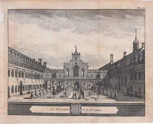
View AllAntique Plan of Batavia in the Dutch East Indies or Indonesia, circa 1695
Located in Langweer, NL
Antique print titled 'Plan de Batavia'. Plan of Batavia, Jakarta, Indonesia. Oriented with north to the lower right by a simple compass rose. French title and key cartouche in drape form.
Artists and Engravers: Nicolas de Fer...
Category
Antique 17th Century Maps
Materials
Paper
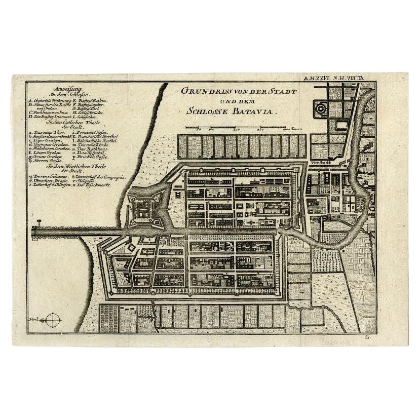
Antique Plan of Batavia and the Castle in the Dutch East Indies, 1763
Located in Langweer, NL
Antique map titled 'Grundriss von der Stadt und dem Schlosse Batavia.' Plan of the city and the castle of Batavia in the Dutch East Indies / Indonesia. From 'Algemeine Welthistorie (...
Category
Antique 18th Century Maps
Materials
Paper

Antique Map of Batavia
Jakarta, Indonesia
, the Dutch East-Indies, 1782
Located in Langweer, NL
Antique map titled 'Batavia zo als het was in den Jaare 1731.' (Batavia as it was in the year 1731.) Map of the city of Batavia (Jakarta) in Indonesia. With legend and scale. This pr...
Category
Antique 18th Century Maps
Materials
Paper

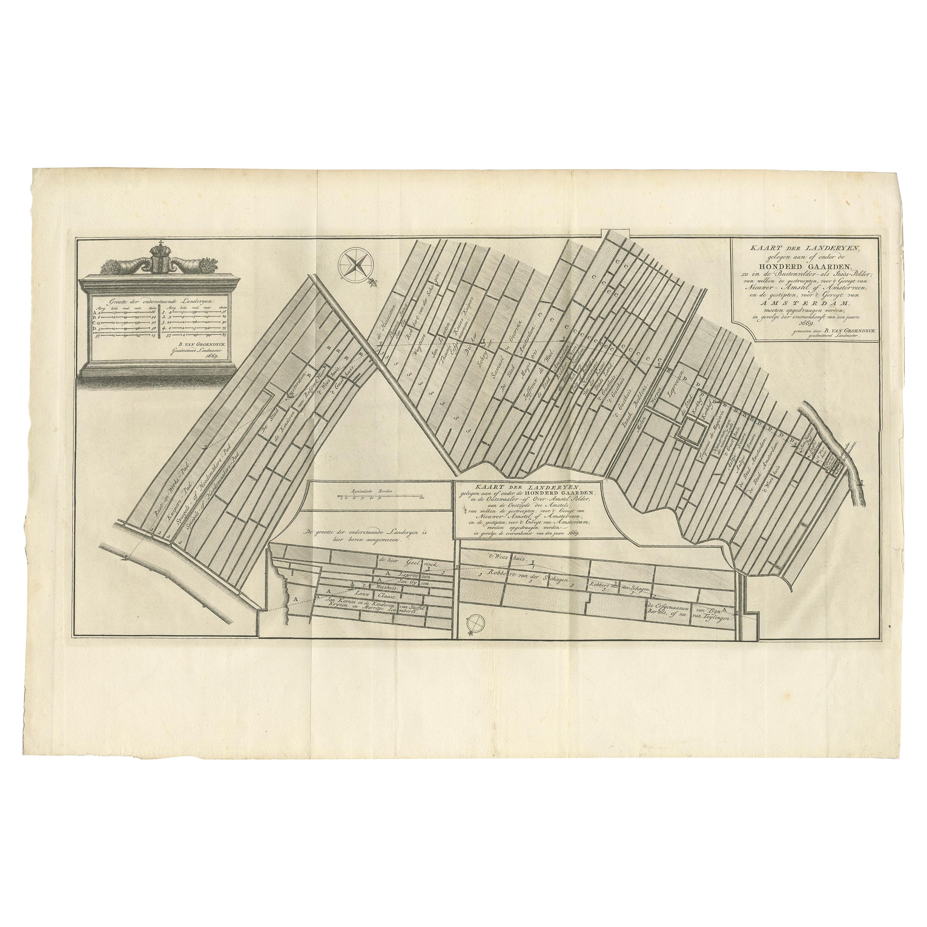
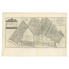
Antique Map Showing Estates of 1669 in Amsterdam, Published in c.1767
Located in Langweer, NL
Antique map titled 'Kaart der landeryen, gelegen aan of onder de honderd gaarden, zo in de Buitenvelder- als Stads-polder; van welken de gestreepten, voor 't geregt van Nieuwer-Amste...
Category
Antique 18th Century Maps
Materials
Paper
Antique Map of the City of Batavia by Van der Aa, circa 1730
Located in Langweer, NL
Antique map titled 'Plan de la Ville et du Chateau de Batavia en l'Isle de Iava - Ware affbeeldinge wegens het Casteel ende Stadt Batavia gelegen op groot Eylant Java'. Detailed plan...
Category
Antique Mid-18th Century Dutch Maps
Materials
Paper

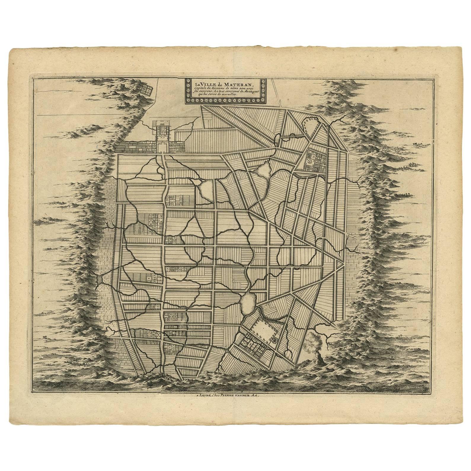
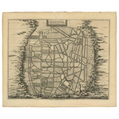
Antique Map of the City of Materan
Indonesia
by P. van der Aa, circa 1725
By Pieter Van Der Aa
Located in Langweer, NL
Antique map titled 'La Ville de Materan, capitale de Roiaume de meme nom, avec ses environs. Le tout environne de Montagnes qui lui serve de murailles.' The city of Materan, capital ...
Category
Antique Early 18th Century Maps
Materials
Paper
$379 Sale Price
20% Off
You May Also Like
1748 Map of Richmond Upon Thames by John Roque
Located in Gloucestershire, GB
A 1748 map of Richmond-Upon-Thames by famed surveyor and cartographer, John Roque. Placed in a simple black and gilt frame. The map is in fair condition but there are small sections ...
Category
Antique Mid-18th Century English Maps
Materials
Wood, Paper

1627 Hendrik Hondius Map Entitled "Vltoniae Orientalis Pars, " Ric.a009
Located in Norton, MA
1627 Hendrik Hondius map entitled
"Vltoniae orientalis pars,"
Ric.a009
Title:
Vltoniae orientalis : pars
Title (alt.) :
Ultoniae orientalis pars
Creator:
Mercator, Gerh...
Category
Antique 17th Century Dutch Maps
Materials
Paper

1620 Map of Artois Entitled "Artesia Comitatvs Artois, " by Bleau, Ric.a012
Located in Norton, MA
1640 map of Artois entitled
"Artesia Comitatvs Artois,"
by Bleau
Colored
A-012.
Detailed map of the northern province of Artois, France on the border with Belgium. Feature...
Category
Antique 17th Century Dutch Maps
Materials
Paper

1635 Willem Blaeu Map of Northern France"Comitatvs Bellovacvm" Ric.a08
Located in Norton, MA
1635 Willem Blaeu map of northern France, entitled.
"Comitatvs Bellovacvm Vernacule Beavvais,"
Colored
Ric.a008
“COMITATVS BELLOVACVM…” Amsterdam: W...
Category
Antique 17th Century Unknown Maps
Materials
Paper

1657 Janssonius Map of Vermandois and Cappelle, Ric. A-004
Located in Norton, MA
1657 Janssonius map of
Vermandois and Cappelle
Ric.a004
Description: Antique map of France titled 'Descriptio Veromanduorum - Gouvernement de la Cappelle'. Two detailed maps o...
Category
Antique 17th Century Unknown Maps
Materials
Paper

1752 Vaugoundy Map of Flanders : Belgium, France, and the Netherlands, Ric.a002
Located in Norton, MA
Large Vaugoundy Map of Flanders:
Belgium, France, and the Netherlands
Colored -1752
Ric.a002
Description: This is a 1752 Didier Robert de Vaugondy map of Flanders. The map de...
Category
Antique 17th Century Unknown Maps
Materials
Paper

More Ways To Browse
Dutch East Indies
Antique Scale Plate
Antique Maps Of Long Island
Calcutta Map
Gibraltar Antique Map
Guyana Antique Map
Maps Of New Mexico
Saudi Arabia Map
16th Century Scotland
Antique Leather Map
Antique Map Of Argentina
Antique Map Of Colombia
Cornwall Map
Early Texas Furniture
Iraq Map
James Cook Map
Kentucky Antiques
Map Of Mexican California