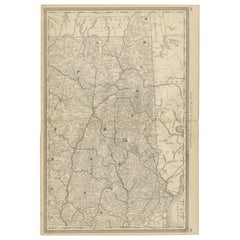
Items Similar to Antique Rhode Island Map Wall Art – Providence
Newport, Rand McNally, ca.1888
Want more images or videos?
Request additional images or videos from the seller
1 of 9
Antique Rhode Island Map Wall Art – Providence
Newport, Rand McNally, ca.1888
$272.91
£203.74
€230
CA$379.15
A$407.83
CHF 217.96
MX$4,807.18
NOK 2,747.93
SEK 2,512.13
DKK 1,752.86
About the Item
Title: Antique Rhode Island Map Wall Art – Providence
Newport, Rand McNally
Description:
This original antique atlas map depicts the state of Rhode Island in remarkable late-19th-century detail, presenting the smallest U.S. state with a density of information that feels both graphic and elegant. Towns, rivers, coastal inlets, and an intricate railroad network are clearly shown, reflecting Rhode Island’s industrial and maritime importance during this period.
The map highlights key locations including Providence, Newport, Pawtucket, Woonsocket, Warwick, Bristol, and Westerly, with Narragansett Bay forming the dramatic heart of the composition. Rail lines are picked out in red and blue, creating a lively visual rhythm across the otherwise restrained engraved base. An inset map of the City of Providence adds urban detail and visual interest, making this sheet especially appealing to collectors and interior designers alike.
Published by Rand, McNally
Co., this map combines cartographic clarity with strong decorative appeal. Its balanced proportions and subtle color accents make it well suited for both traditional and contemporary interiors, whether styled as a single statement piece or as part of a New England map wall.
Printed on original period atlas paper, the sheet shows the gentle patina and texture expected of a genuine antique map, adding warmth and authenticity impossible to replicate in modern reproductions.
Condition report: Light age toning overall. Minor edge wear and small handling marks consistent with original atlas binding. No major tears or losses; a clean and attractive example.
Framing tips: Frame in natural oak, walnut, or matte black with an off-white or light grey mat. Museum glass recommended to preserve detail and color.
Technique: Color lithograph
Maker: Rand, McNally
Co., United States, late 19th century
Keywords:
antique rhode island map, rhode island wall art, providence map, newport map, narragansett bay map, rand mcnally map, railroad map rhode island, new england map decor, antique atlas map, coastal wall art
- Dimensions:Height: 14.18 in (36 cm)Width: 10.63 in (27 cm)Depth: 0.01 in (0.2 mm)
- Materials and Techniques:
- Place of Origin:
- Period:
- Date of Manufacture:circa 1888
- Condition:Light age toning overall. Minor edge wear and small handling marks consistent with original atlas binding. No major tears or losses; a clean and attractive example.
- Seller Location:Langweer, NL
- Reference Number:Seller: BG-12794-761stDibs: LU3054348232042
About the Seller
5.0
Recognized Seller
These prestigious sellers are industry leaders and represent the highest echelon for item quality and design.
Platinum Seller
Premium sellers with a 4.7+ rating and 24-hour response times
Established in 2009
1stDibs seller since 2017
2,836 sales on 1stDibs
Typical response time: 1 hour
- ShippingRetrieving quote...Shipping from: Langweer, Netherlands
- Return Policy
More From This Seller
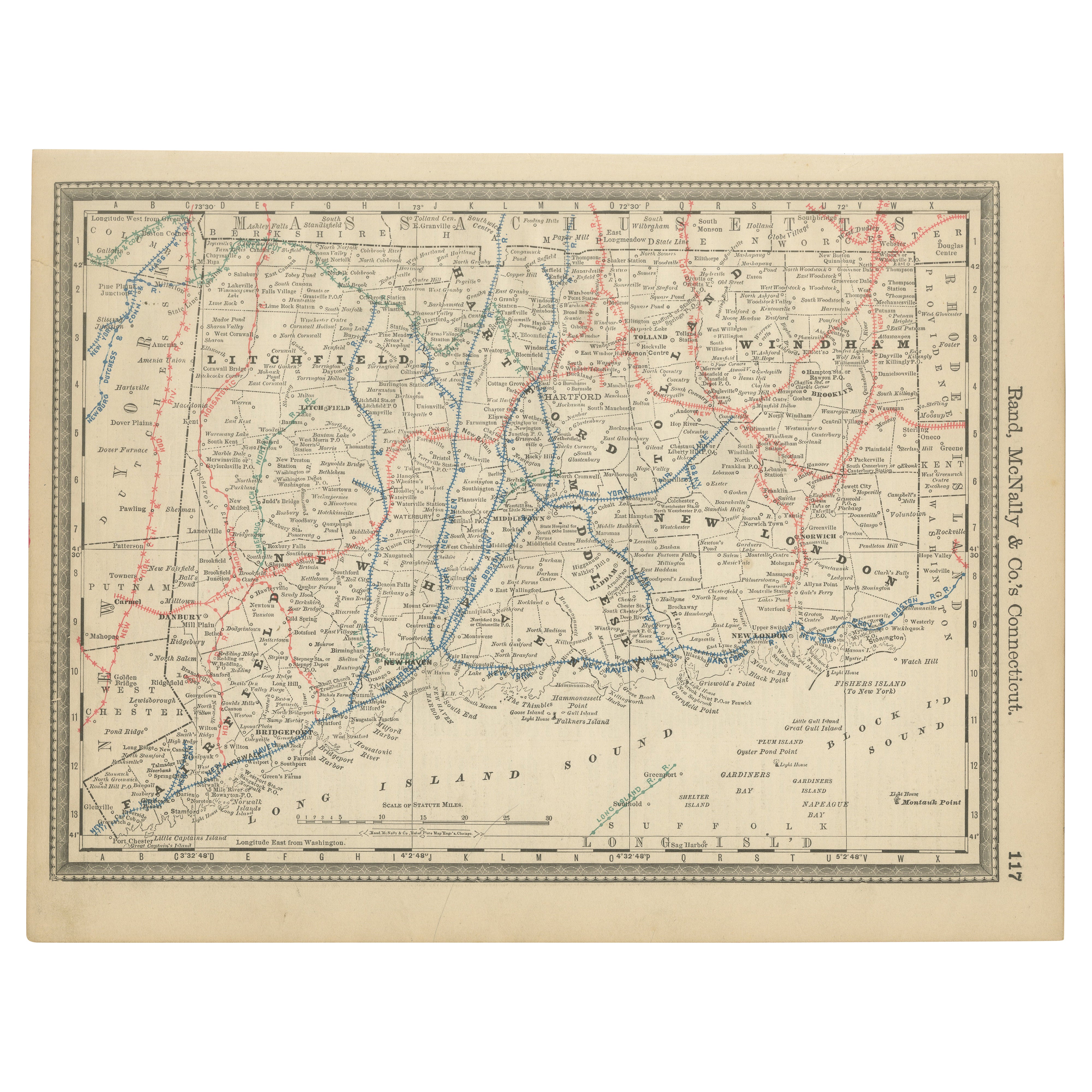
View Allntique Connecticut Map Wall Art – Railroads, Towns
Long Island Sound, ca.1888
Located in Langweer, NL
Antique Connecticut Map Wall Art – Railroads, Towns
Long Island Sound, Rand McNally
Description:
This original antique atlas map depicts the state of Connecticut in detailed a...
Category
Antique Late 19th Century American Maps
Materials
Paper
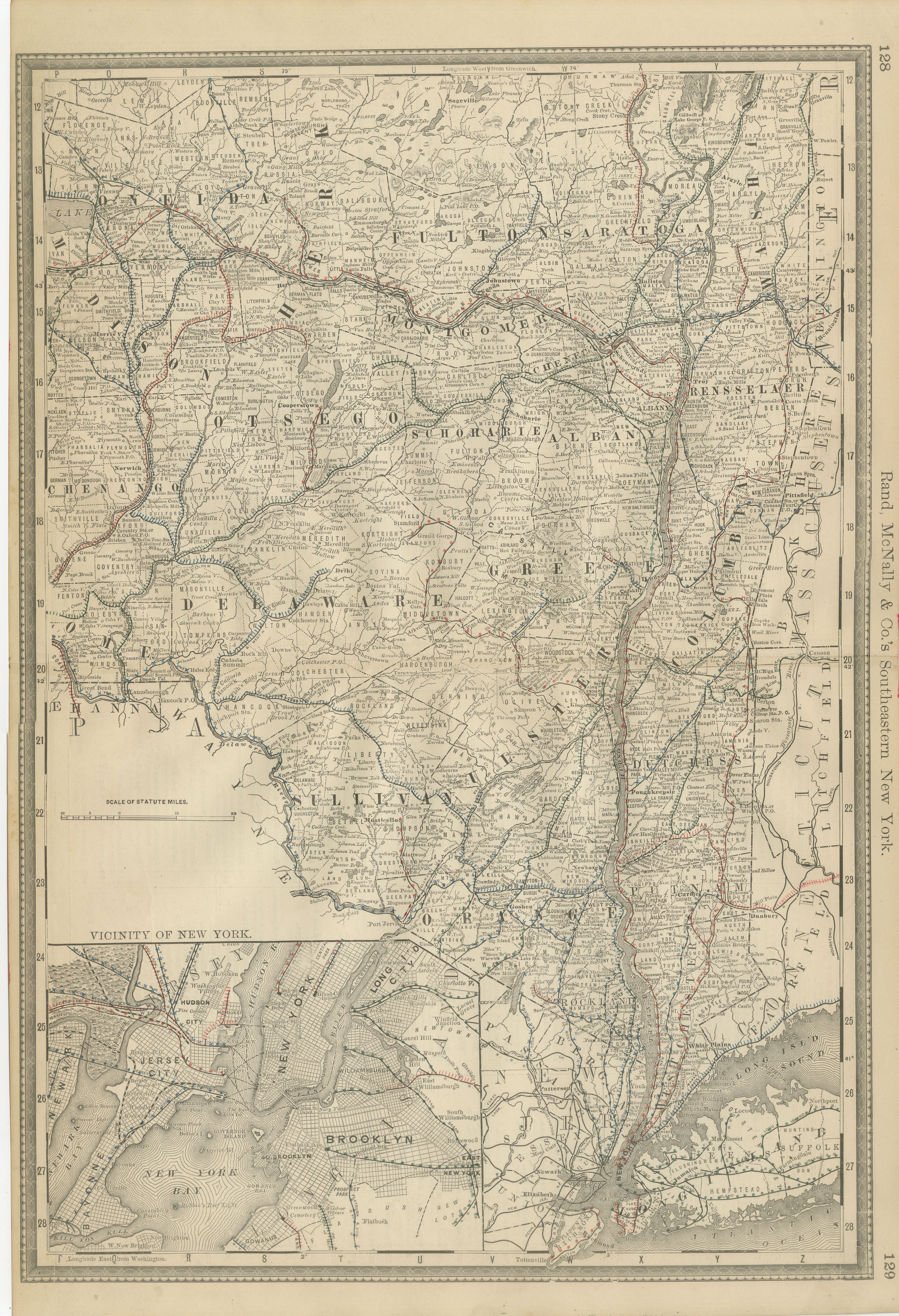
Antique Map of Southeastern New York by Rand McNally, Lithograph, 1888
Located in Langweer, NL
Antique Map of Southeastern New York – Rand McNally, circa 1888
This antique map of southeastern New York was published by Rand, McNally
Co. around 1888. It offers a detailed ...
Category
Antique Late 19th Century American Maps
Materials
Paper
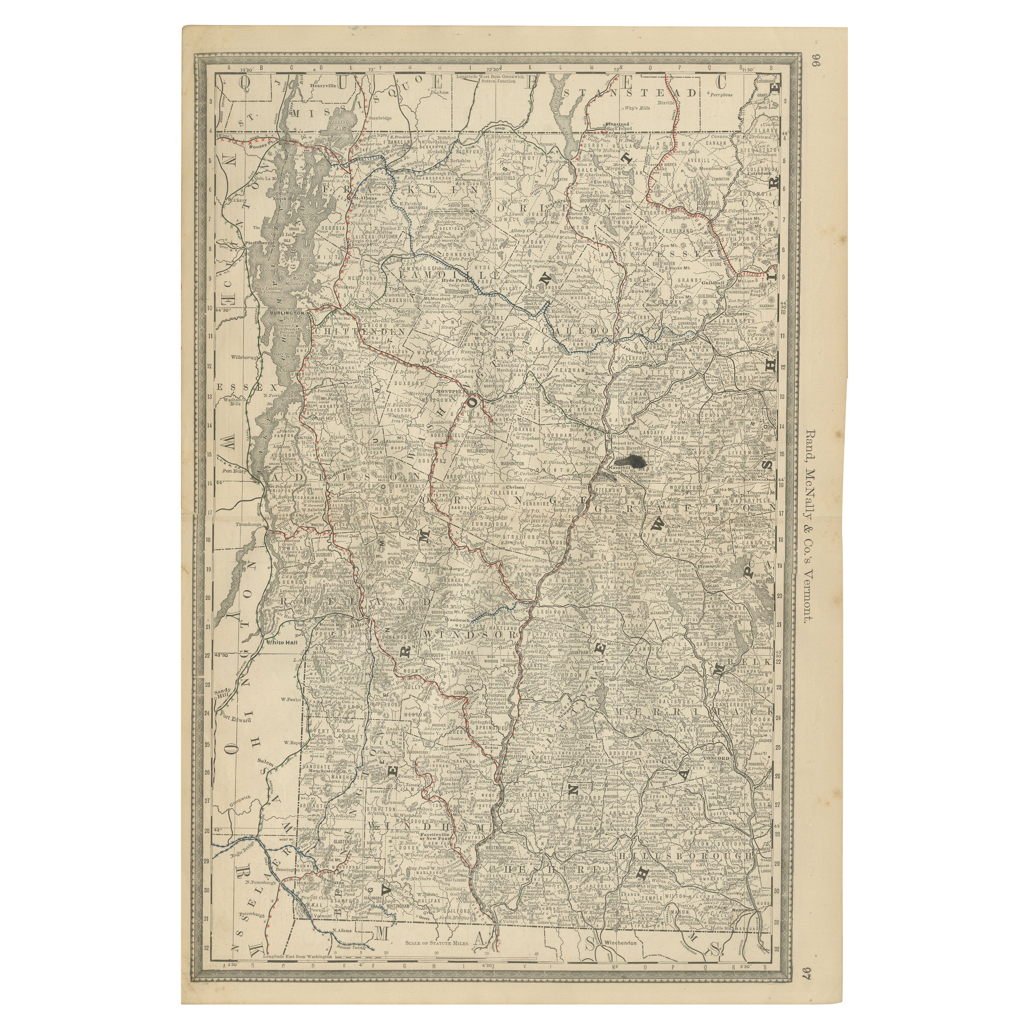
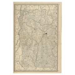
Antique Vermont Map Wall Art – Railroads, Mountains
Towns, Rand McNally, 1888
Located in Langweer, NL
Title: Antique Vermont Map Wall Art – Railroads, Mountains
Towns, Rand McNally
Description:
This original antique atlas map presents the state of Vermont in fine late-19th-cen...
Category
Antique Late 19th Century American Maps
Materials
Paper
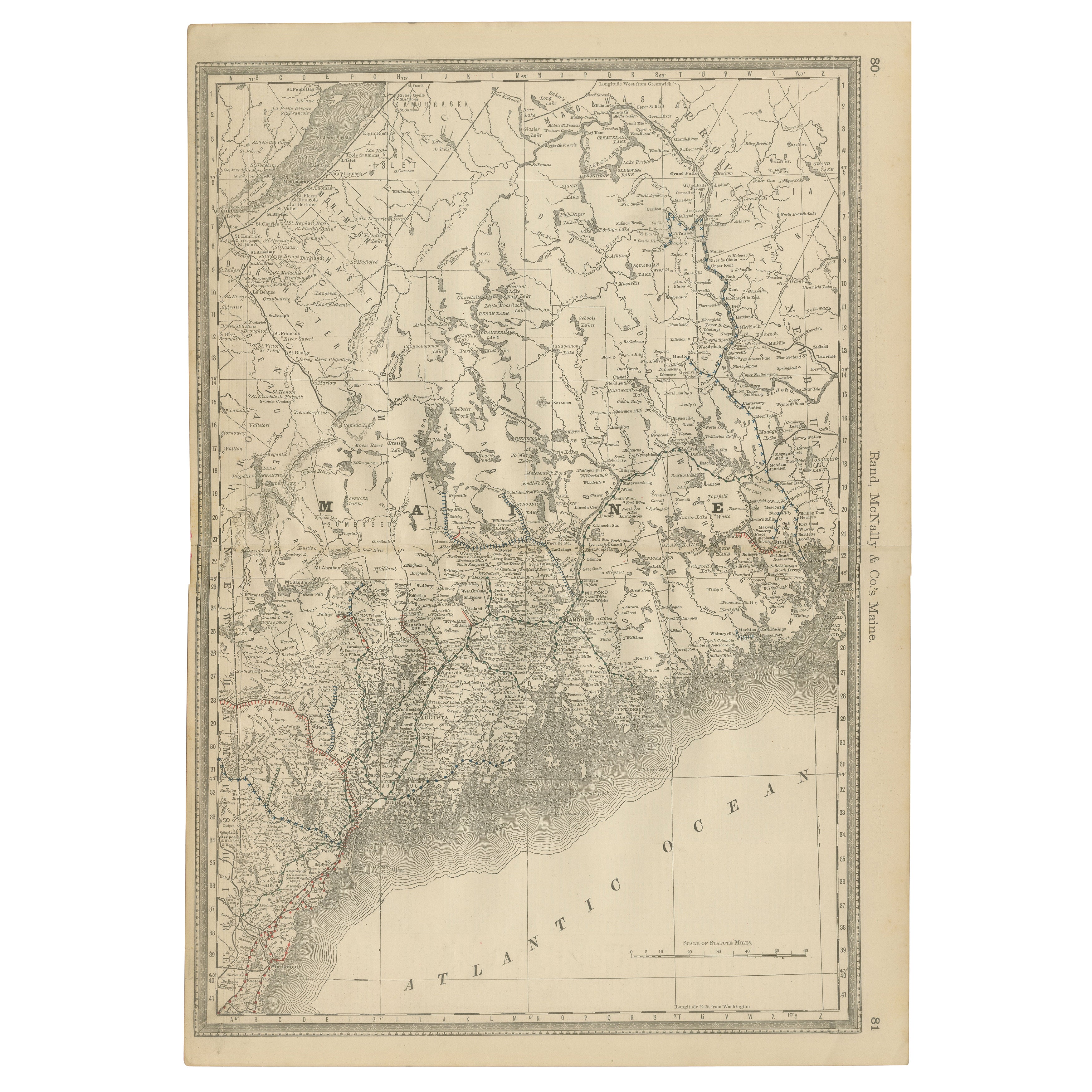
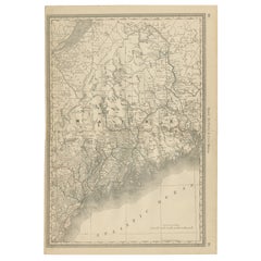
Maine Antique Railroad Map c.1888 – Pine Tree State Counties
Settlements
Located in Langweer, NL
Antique Map of Maine – Rand McNally, circa 1888
This antique map of Maine was published by Rand, McNally & Co. around 1888. It depicts the Pine Tree State in great detail, showing i...
Category
Antique Late 19th Century American Maps
Materials
Paper
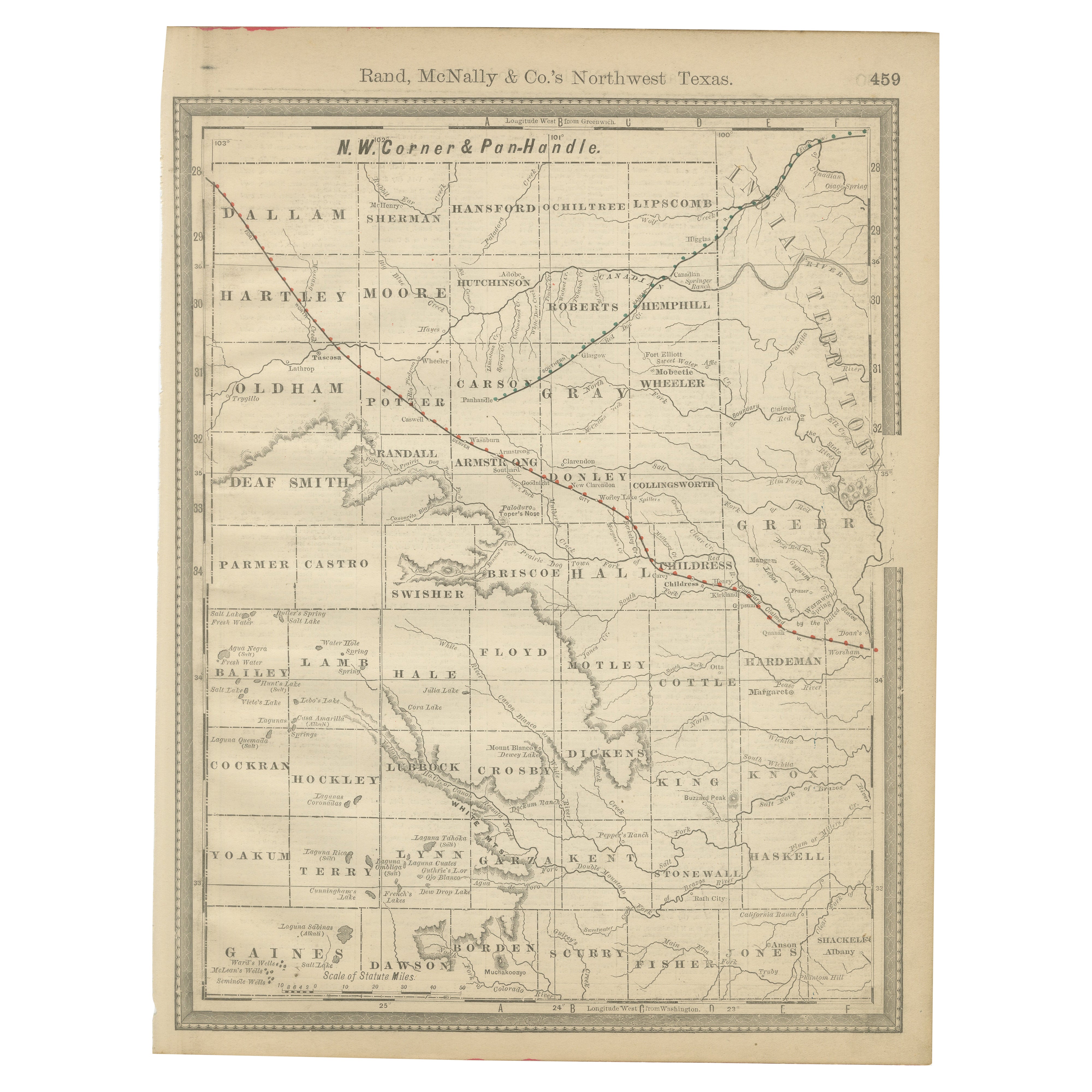
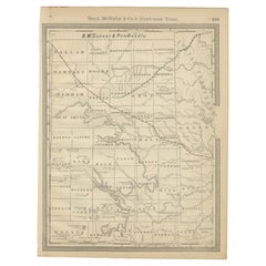
Antique Northwest Texas Map – Panhandle Railroads
Counties, Rand McNally, 1888
Located in Langweer, NL
Title: Antique Northwest Texas Map – Panhandle Railroads
Counties, Rand McNally
Description:
This original antique atlas map depicts Northwest Texas and the Panhandle, showing...
Category
Antique Late 19th Century American Maps
Materials
Paper
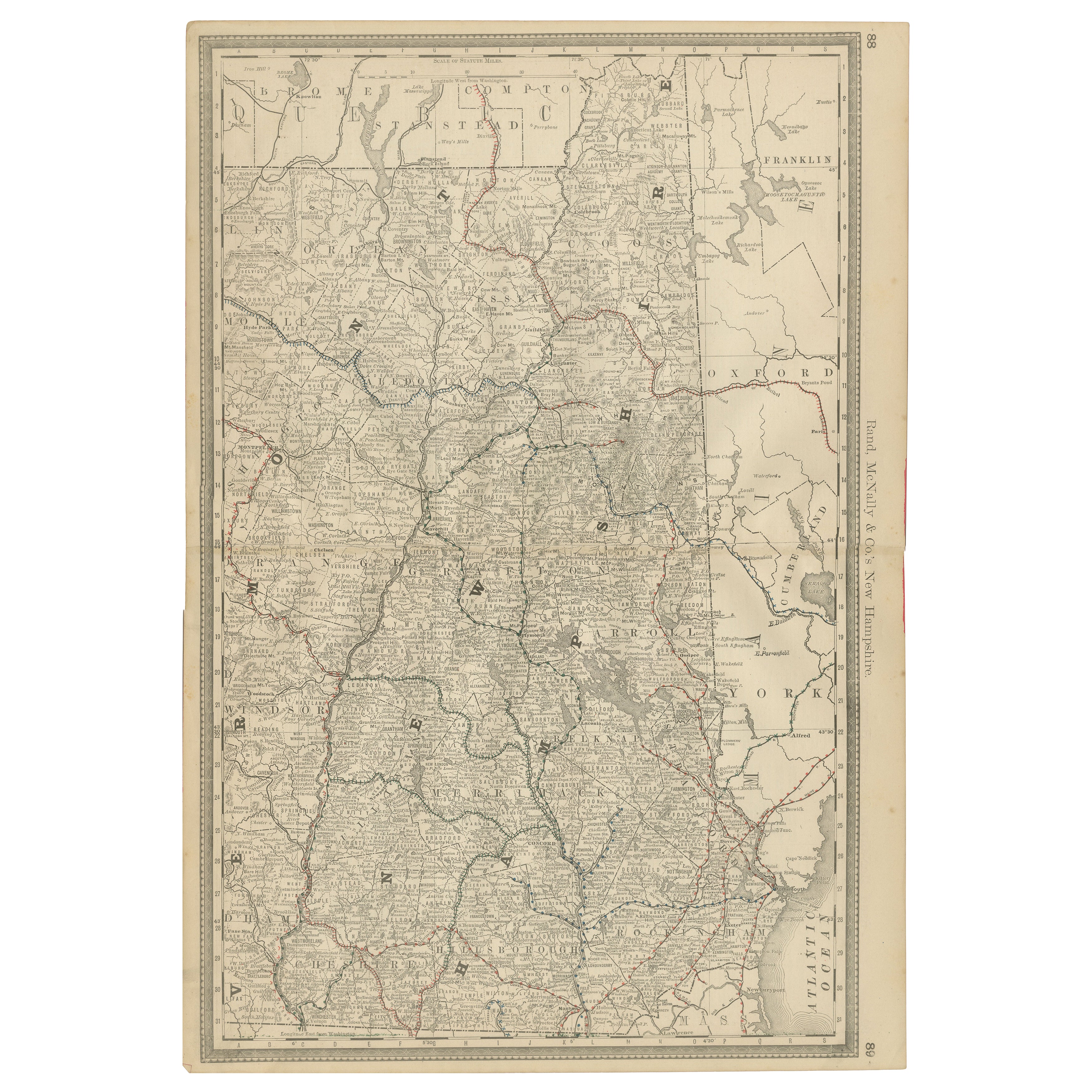
New Hampshire Antique Railroad Map c.1888 – Granite State Counties
Cities
Located in Langweer, NL
Antique Map of New Hampshire – Rand McNally, circa 1888
This antique map of New Hampshire was published by Rand, McNally & Co. around 1888. It provides a detailed late 19th-century ...
Category
Antique Late 19th Century American Maps
Materials
Paper
You May Also Like
1854 Map of Massachusetts, Connecticut and Rhode Island, Antique Wall Map
Located in Colorado Springs, CO
This striking wall map was published in 1854 by Ensign, Bridgman & Fanning and has both full original hand-coloring and original hardware. This impression is both informative and highly decorative.
The states are divided into counties, outlined in red, green, and black, and subdivided into towns. Roads, canals, and railroad lines are prominently depicted, although they are not all labeled. The mapmakers also marked lighthouses, banks, churches, and prominent buildings, with a key at right. The map is an informative and comprehensive overview of the infrastructural development of New England prior to the Civil War. Physical geographies depicted include elevation, conveyed with hachure marks, rivers and lakes. The impression features an inset map of Boston...
Category
Antique 19th Century American Maps
Materials
Paper

1891 Map of Norfolk County Massachusetts
Located in Norwell, MA
1891 map of Norfolk county Massachusetts including the towns of Wrentham, Franklin, Medfield, Sherborn, Norwood etc., measures: 23 x 31.
Category
Antique 19th Century Maps

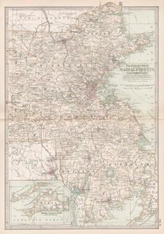
Massachusetts, Eastern Part. USA. Century Atlas state antique vintage map
Located in Melbourne, Victoria
'The Century Atlas. Massachusetts, Eastern Part'
Original antique map, 1903.
Central fold as issued. Map name and number printed on the reverse corners.
Sheet 40cm by 29.5cm.
Category
Early 20th Century Victorian More Prints
Materials
Lithograph
Africa. North-East Part. Century Atlas antique vintage map
Located in Melbourne, Victoria
'The Century Atlas. Africa. North-East Part'
Original antique map, 1903.
Inset map of 'Nile Delta and Suez Canal'.
Central fold as issued. Map name and nu...
Category
Early 20th Century Victorian More Prints
Materials
Lithograph

Large Original Antique Map of Massachusetts, USA, circa 1900
Located in St Annes, Lancashire
Fabulous map of Massachusetts
In 2 sheets. They can be joined but I have not done it
Original color
Engraved and printed by the George F. Cram ...
Category
Antique 1890s American Maps
Materials
Paper

Africa. North-West Part. Century Atlas antique vintage map
Located in Melbourne, Victoria
'The Century Atlas. Africa. Southern Part'
Original antique map, 1903.
Central fold as issued. Map name and number printed on the reverse corners.
Sheet 40cm by 29.5cm.
Category
Early 20th Century Victorian More Prints
Materials
Lithograph
