Items Similar to Antique Stafford County Map, English, Atlas Engraving, 17th Century, Cartography


Want more images or videos?
Request additional images or videos from the seller
1 of 13
Antique Stafford County Map, English, Atlas Engraving, 17th Century, Cartography
$1,326.67
£971
€1,140.44
CA$1,843.14
A$1,982.56
CHF 1,059.54
MX$23,368.74
NOK 13,358.29
SEK 12,212.01
DKK 8,521.03
About the Item
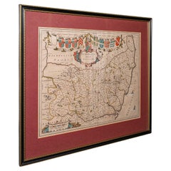
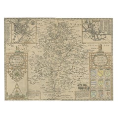
This is an antique Stafford County Map. An English, framed atlas engraving of Staffordshire, dating to the 17th century and later, circa 1676.
Superb cartography reproduction of Staffordshire - perfect for display
Displaying a desirable aged patina and in good original order
Fascinating cartography, appealingly set within a later glazed frame
Originally compiled by John Speed (1552 - 1629) in the early 17th century
Hand coloured palette accentuates the map with crests and borders
Engraved here by R. White for The Theatre of the Empire of Great Britaine, a prominent 17th century publication
Town plans for Stafford and Lichfield provide great period detail
Atlas text to the reverse, visible under close inspection of the map
Dressed to the rear with hanging wire for ease of mounting
This is a quality antique Stafford County Map, with fine cartographic interest and a quality engraving of Speed’s work. Delivered ready to display.
Dimensions:
Max Width: 57.5cm (22.75'')
Max Depth: 2.5cm (1'')
Max Height: 44.5cm (17.5'')
Map Width: 51cm (20'')
Map Height: 38.5cm (15.25'')
- Dimensions:Height: 17.52 in (44.5 cm)Width: 22.64 in (57.5 cm)Depth: 0.99 in (2.5 cm)
- Style:Charles II (Of the Period)
- Materials and Techniques:
- Place of Origin:
- Period:Late 17th Century
- Date of Manufacture:Circa 1680
- Condition:Wear consistent with age and use. Presented in good, original antique condition.
- Seller Location:Hele, Devon, GB
- Reference Number:Seller: 256851stDibs: LU2645348232392
About the Seller
5.0
Platinum Seller
Premium sellers with a 4.7+ rating and 24-hour response times
Established in 2005
1stDibs seller since 2017
1,091 sales on 1stDibs
Typical response time: <1 hour
- ShippingRetrieving quote...Shipping from: Hele, Devon, United Kingdom
- Return Policy
More From This Seller
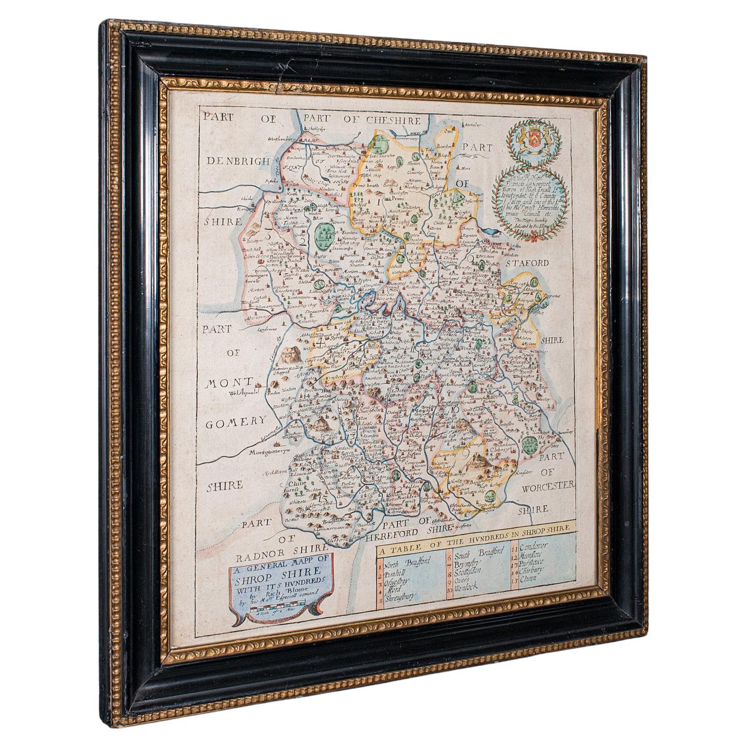
View AllAntique County Map, Shropshire, English, Atlas Engraving, Richard Blome, C.1673
Located in Hele, Devon, GB
This is an antique county map of Shropshire. An English, framed atlas engraving by Richard Blome, dating to the 17th century and later.
A treat for the collector or county native, ...
Category
Antique 17th Century British Restauration Maps
Materials
Glass, Wood, Paper

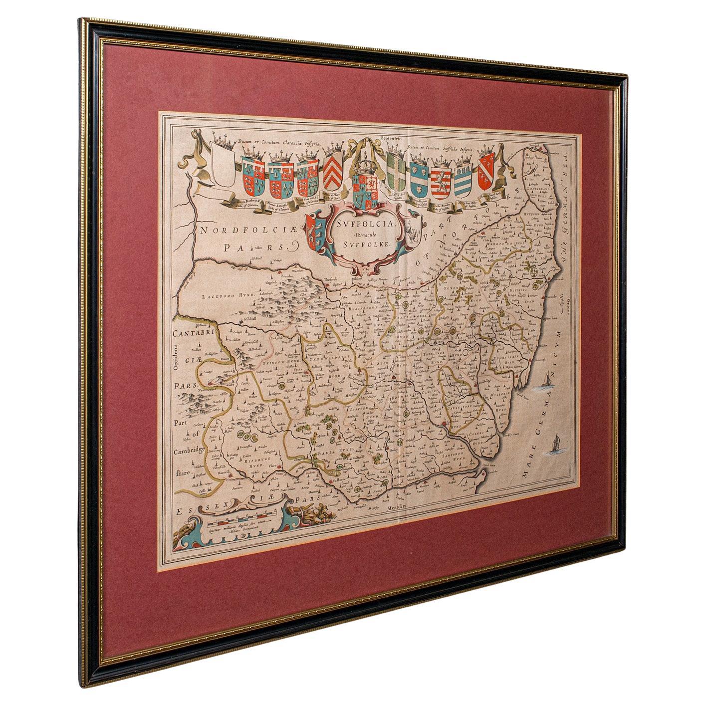
Antique Suffolk County Map, Dutch, Atlas Novus, Joan Blaeu, Cartography, C.1645
Located in Hele, Devon, GB
This is an antique county map of Suffolk. A Dutch, framed atlas engraving by Joan Blaeu, dating to the 17th century and later.
A treat for the collector or county native, with this ...
Category
Antique 1640s Dutch Charles II Maps
Materials
Glass, Paper
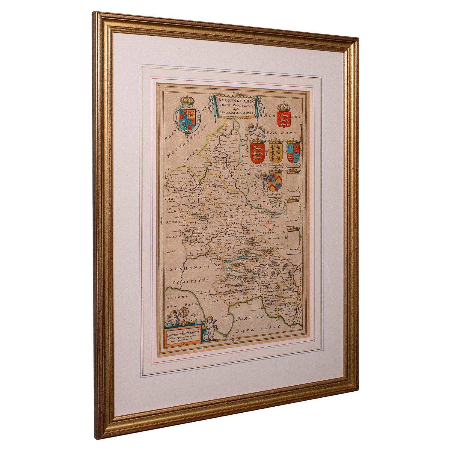
Antique Buckinghamshire Map, English, Framed 17th Century County Cartography
Located in Hele, Devon, GB
This is an antique county map of Buckinghamshire. An English, framed atlas engraving reproduction by Dutchman Joan Blaeu, dating to the 17th century and later.
A treat for the colle...
Category
Early 20th Century British Victorian Maps
Materials
Glass, Paper
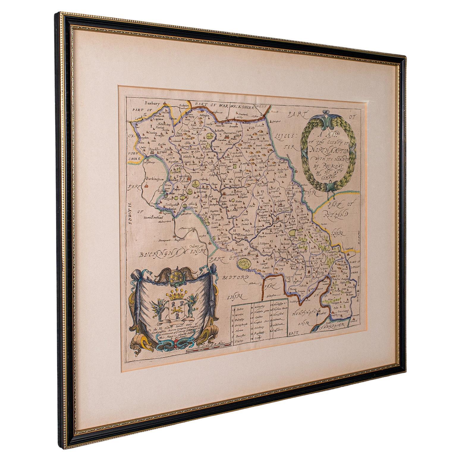
Antique County Map, Northamptonshire, English, Framed Cartography, Richard Blome
Located in Hele, Devon, GB
This is an antique county map of Northamptonshire. An English, framed atlas engraving by Richard Blome, dating to the 17th century and later.
Fascinating cartography, oriented 90 d...
Category
Antique Late 17th Century British Charles II Maps
Materials
Glass, Wood, Paper
Antique County Map of Cheshire, Dutch, Framed, Cartography, Janssonius, C.1660
Located in Hele, Devon, GB
This is an antique county map of Cheshire. A Dutch, framed atlas engraving by Johannes Janssonius, dating to the 17th century and later.
A treat for the collector or county native,...
Category
Antique Mid-17th Century Dutch Charles II Maps
Materials
Glass, Wood, Paper

Antique Lithography Map, Bedfordshire, English, Framed Engraving, Cartography
Located in Hele, Devon, GB
This is an antique lithography map of Bedfordshire. An English, framed atlas engraving of cartographic interest, dating to the mid 19th century and...
Category
Antique Mid-19th Century British Victorian Maps
Materials
Wood

You May Also Like
Antique Map of Essex by Overton, circa 1710
Located in Langweer, NL
Antique map titled 'Essex, devided into Hundreds, with the most antient and fayre Towne Colchester (..)'. Map of Essex, England. Includes an inset town pl...
Category
Antique Early 18th Century Maps
Materials
Paper

$901 Sale Price
20% Off
Framed 17th Century Map of Cumberland, England by John Speed, 1610
By John Speed
Located in Middleburg, VA
A fascinating and richly detailed antique map of Cumberland County in northwest England, drawn and published by the celebrated English cartographer John Spe...
Category
Antique Early 17th Century English British Colonial Maps
Materials
Copper, Gold Leaf

Antique Map of Leicester and Rutland by Tinney
Sayer,
circa 1756
Located in Langweer, NL
Antique map titled 'An Accurate Map of the Counties of Leicester and Rutland (..)'. Large map of Leicester and Rutland with dedications to the Most Noble John Duke of Rutland, and to...
Category
Antique Mid-18th Century Maps
Materials
Paper

$759 Sale Price
20% Off
Antique Map of Kent with Inset Plans of Rochester
Canterbury, England, 1676
Located in Langweer, NL
Antique map titled 'Kent with her Cities and Earles described and observed'.
Map of Kent, England. Includes inset town plans of Rochester and Canterbury....
Category
Antique 17th Century Maps
Materials
Paper
Antique Map of Warwickshire by Speed, c.1614
Located in Langweer, NL
Antique map titled 'The Counti of Warwick (..)'. Map of Warwickshire, England. Includes inset town plans of Warwick and Coventry. This map originates from 'Theatre of Great Britaine'...
Category
Antique 17th Century Maps
Materials
Paper
$446 Sale Price
20% Off
Antique Map of Northamptonshire by Speed, 1676
Located in Langweer, NL
Antique map titled 'Norhamtonshire'. Map of Norhamptonshire, England. Includes inset town plans of Peterborough and Northampton. This map originates from 'Theatre of Great Britaine' ...
Category
Antique 17th Century Maps
Materials
Paper

$522 Sale Price
20% Off