Items Similar to Antique Street Map of the City of Edo
Modern Tokyo
in Japan

Want more images or videos?
Request additional images or videos from the seller
1 of 6
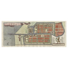
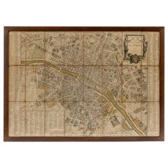
Antique Street Map of the City of Edo
Modern Tokyo
in Japan
$277.52
$346.9020% Off
£206.07
£257.5920% Off
€232
€29020% Off
CA$381.30
CA$476.6220% Off
A$414.70
A$518.3820% Off
CHF 219.78
CHF 274.7220% Off
MX$4,969
MX$6,211.2420% Off
NOK 2,793.25
NOK 3,491.5620% Off
SEK 2,559
SEK 3,198.7520% Off
DKK 1,768.79
DKK 2,210.9920% Off
About the Item
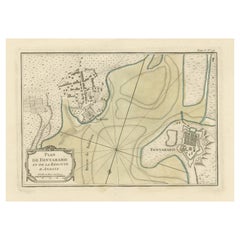
Antique map titled 'Plan de Jedo - Platte Grond van Jedo'. A detailed street map of the city of Edo (modern Tokyo) in Japan, originally engraved by Bellin and Schley and reissued for Dutch editions of Prévost's monumental 'l'Histoire Géneral des Voyages. The map shows the city as it would have been during the Tokugawa Shogunate, also known as the Edo period. The map centres on the sprawling Edo Castle, here referrred to as the 'Palais de l'Empereur' and shown improbably with a French-style garden in parterre. The only other features of the city to be labelled are two of the early stages of the famous Tokaido road between Tokyo and Kyoto, these being the Nihonbashi Bridge and post town of Shinagawa. The rest of the city is mainly shown as a network of streets, though a number of pagodas, temples, and fortifications are also shown. Published circa 1750.
- Dimensions:Height: 10.52 in (26.7 cm)Width: 10.63 in (27 cm)Depth: 0.02 in (0.5 mm)
- Materials and Techniques:
- Period:
- Date of Manufacture:c.1750
- Condition:General age-related toning, original folding lines. Shows some wear, sl. affecting image. Bottom margin trimmed, narrow margins. Blank verso. Please study image carefully.
- Seller Location:Langweer, NL
- Reference Number:Seller: BG-13370-31stDibs: LU3054333906292
About the Seller
5.0
Recognized Seller
These prestigious sellers are industry leaders and represent the highest echelon for item quality and design.
Platinum Seller
Premium sellers with a 4.7+ rating and 24-hour response times
Established in 2009
1stDibs seller since 2017
2,823 sales on 1stDibs
Typical response time: 1 hour
- ShippingRetrieving quote...Shipping from: Langweer, Netherlands
- Return Policy
More From This Seller
View AllAntique Map of Batavia, Nowadays Jakarta, the Capital of Indonesia, 1782
Located in Langweer, NL
Antique map Batavia titled 'Batavia zo als het was in den Jaare 1731'. Old map of the city of Batavia (Jakarta) in Indonesia. Originates from 'Batavia, de Hoofdstad van Neerlands O. ...
Category
Antique 18th Century Maps
Materials
Paper
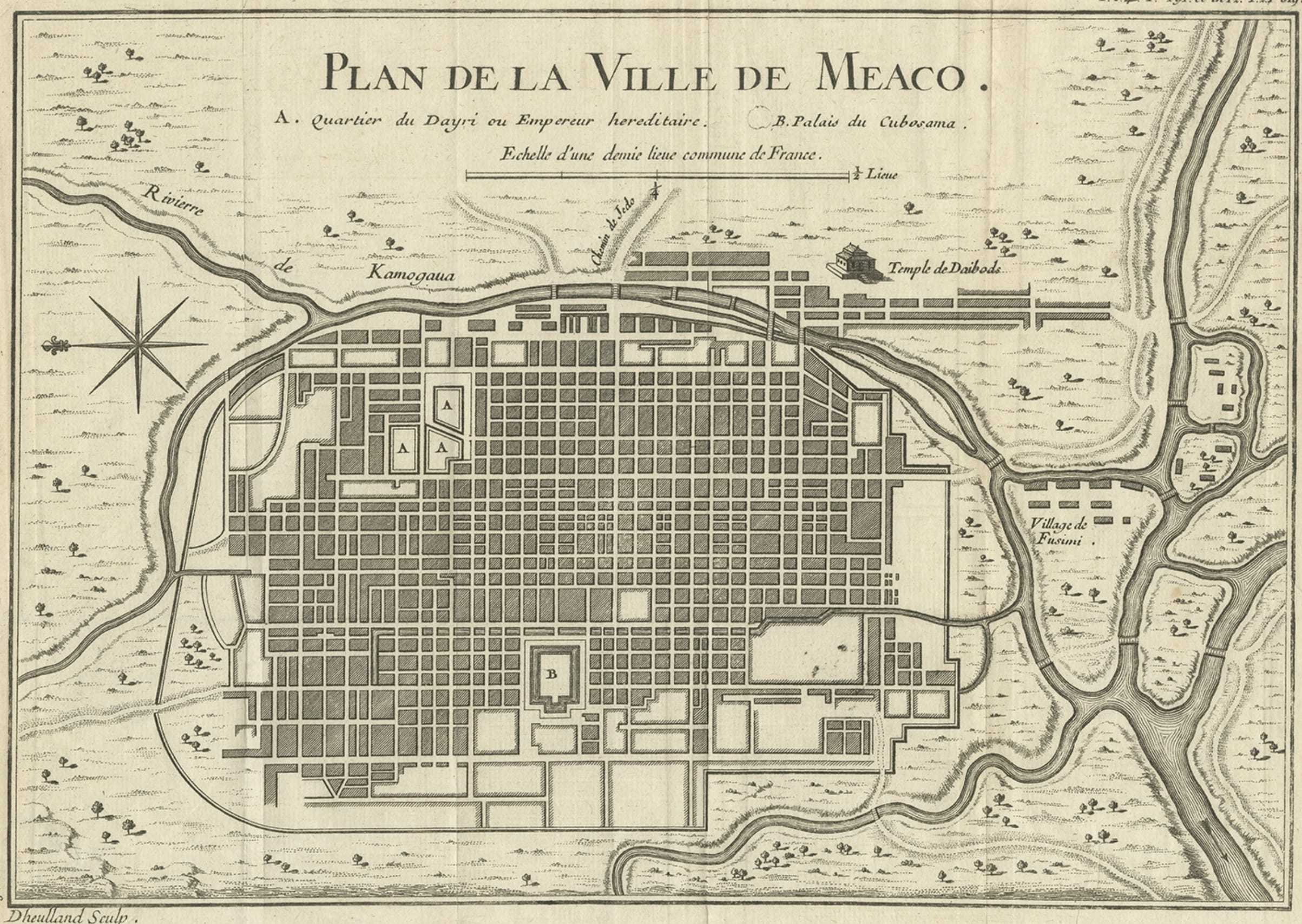
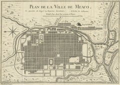
Antique Map of Kyoto located in The Kansai Region on the Island of Honshu, c1740
Located in Langweer, NL
Antique map titled 'Plan de la Ville de Meaco'.
Detailed plan of Kyoto, located in the Kansai region on the island of Honshu, Japan. This map most likely originates from an edition of 'Histoire et description generale du Japon' by P.F.X. de Charlevoix.
Artists and Engravers: Jacques-Nicolas Bellin (1703-1772) was among the most important mapmakers of the eighteenth century. In 1721, at age 18, he was appointed hydrographer (chief cartographer) to the French Navy. In August 1741, he became the first Ingénieur de la Marine of the Depot des cartes...
Category
Antique 18th Century Maps
Materials
Paper
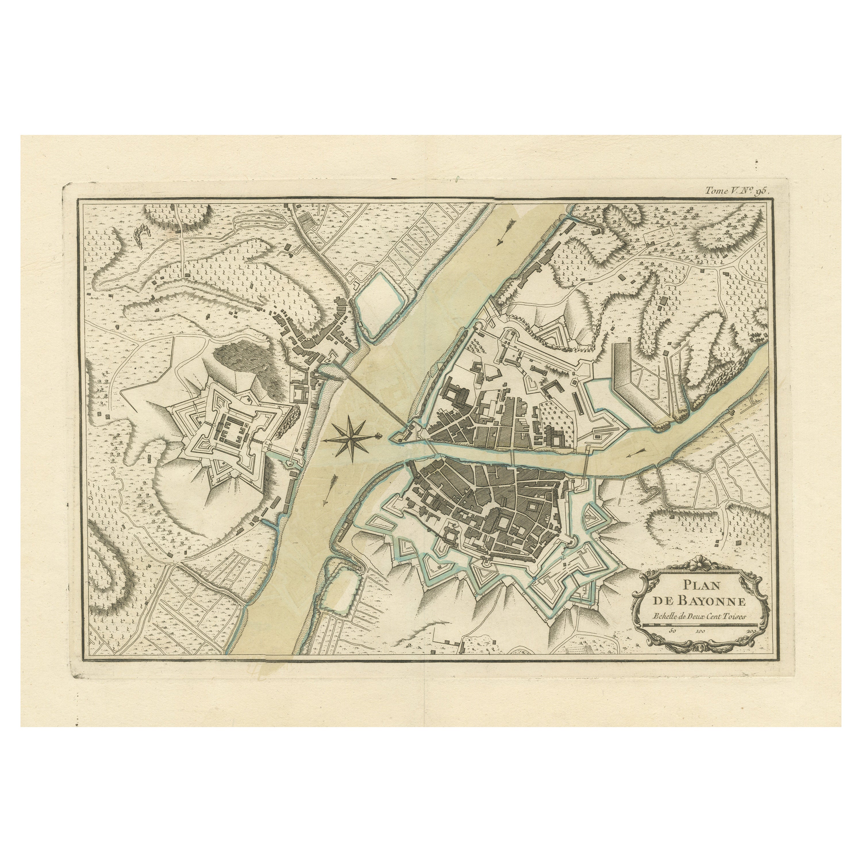
Antique Plan of the City of Bayonne, France
Located in Langweer, NL
Antique map titled 'Plan de Bayonne'. Original old plan of the city of Bayonne, France. This map originates from 'Le Petit Atlas Maritime (..)' by J.N. Bellin. Published 1764.
Be...
Category
Antique Mid-18th Century Maps
Materials
Paper
$325 Sale Price
20% Off
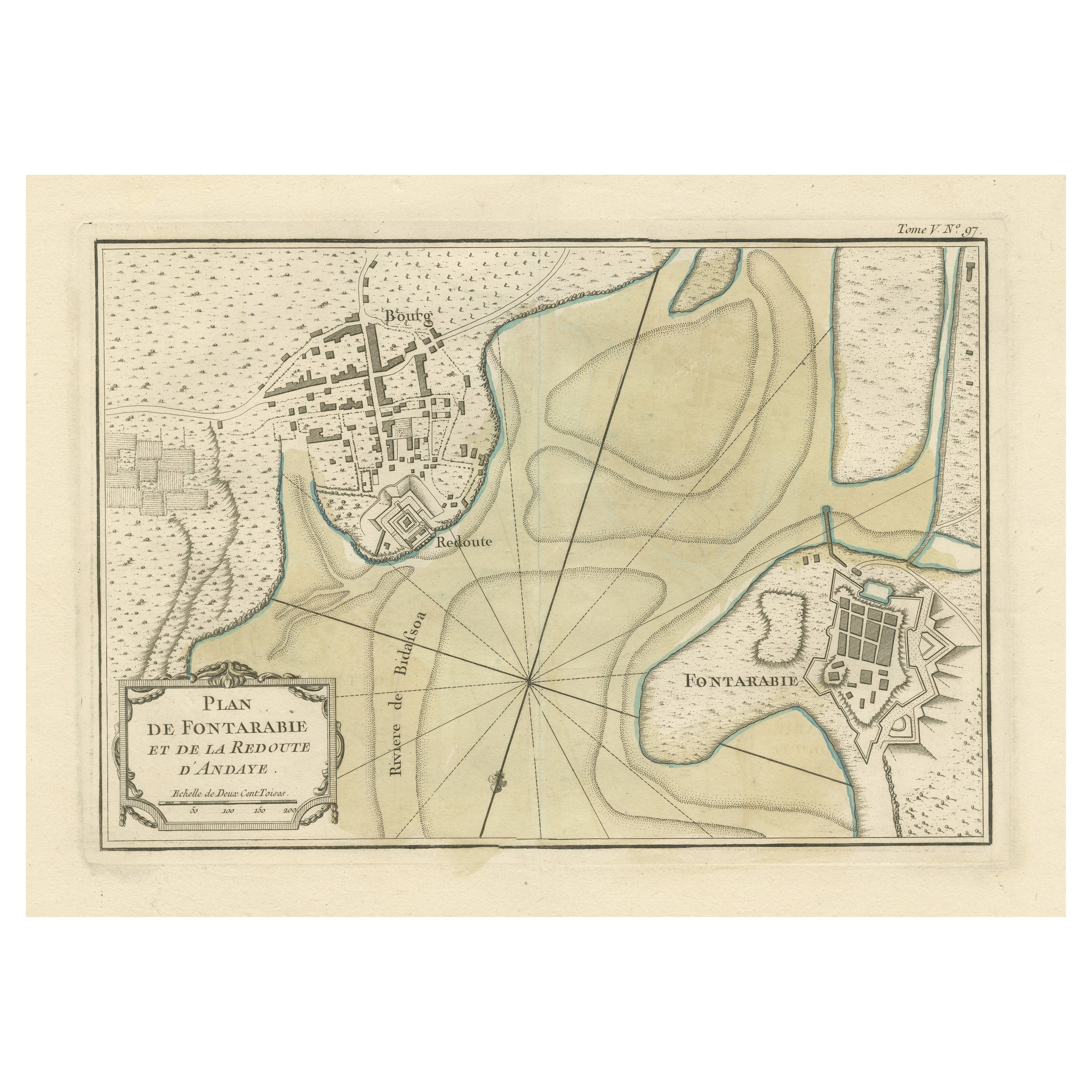
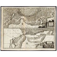
Antique Map of Hondarribia Near the Bidasoa River, France
Spain
Located in Langweer, NL
Antique map titled 'Plan de Fontarabie et de la redoute d'Andaye'. Original old map of Hondarribia near the Bidasoa river, a river in the Basque Country of northern Spain and souther...
Category
Antique Mid-18th Century Maps
Materials
Paper
$325 Sale Price
20% Off
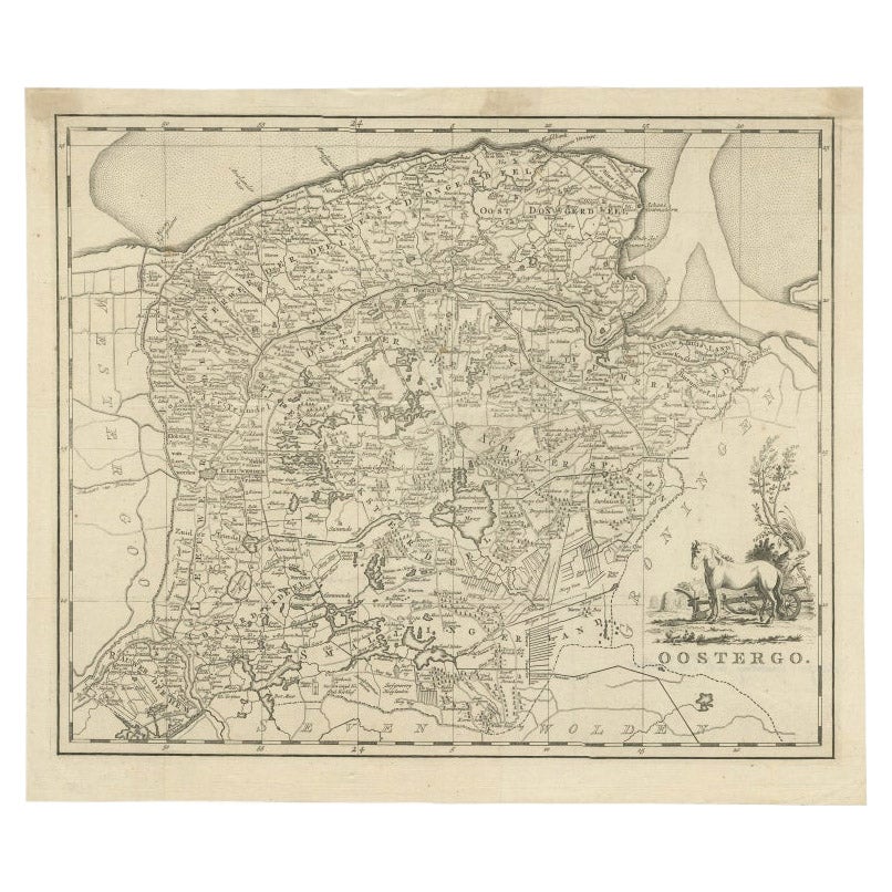
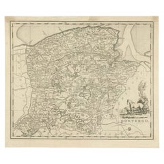
Antique Map of Oostergo by Tirion, 1744
Located in Langweer, NL
Antique map titled 'Oostergo'. Original antique map of Oostergo, part of the province of Friesland, the Netherlands. Published 1744. Artists and Engravers: Isaak Tirion (1705 in Utre...
Category
Antique 18th Century Maps
Materials
Paper
$180 Sale Price
20% Off
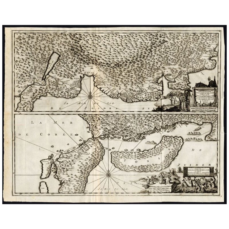
Antique Map of the Region of Osaka and Hirado Island in Japan, 1725
By Pieter Van Der Aa
Located in Langweer, NL
Antique map titled 'Description exacte et fidele des villes, bourgs et villages qui les Ambassadeurs de Hollande ont rencontrez dans leur voyage par terre de la ville Osacca jusqu'a ...
Category
Antique 18th Century Maps
Materials
Paper
You May Also Like
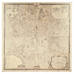
"Plan de Paris" - Antique Recreation of a Map of Paris
Located in New York, NY
Printed in the Early 20th Century, this antique "Plan de Paris" is a recreation of an earlier map from 1710, originally commissioned by Louis XIV. It was an intricately rendered view...
Category
Early 20th Century French Louis XIV Maps
Materials
Linen, Wood, Paper
Original Antique Map or City Plan of Madrid, Spain. Circa 1835
Located in St Annes, Lancashire
Nice map of Madrid
Drawn and engraved by J.Dower
Published by Orr & Smith. C.1835
Unframed.
Free shipping
Category
Antique 1830s English Maps
Materials
Paper

Original Antique Map or City Plan of Rome, Italy. Circa 1835
Located in St Annes, Lancashire
Nice map of Rome
Drawn and engraved by J.Dower
Published by Orr & Smith. C.1835
Unframed.
Free shipping
Category
Antique 1830s English Maps
Materials
Paper

Original Antique Map or City Plan of Geneva, Switzerland. Circa 1835
Located in St Annes, Lancashire
Nice map of Geneva
Drawn and engraved by J.Dower
Published by Orr & Smith. C.1835
Unframed.
Free shipping
Category
Antique 1830s English Maps
Materials
Paper

18th Century Map of Paris
Located in Washington, DC
18th century map of Paris.
Category
Antique Late 18th Century French Prints
Materials
Glass, Wood, Paper
1840 "New Map of the City of New York With Part of Brooklyn
Williamsburg"
Located in Colorado Springs, CO
Presented is a hand-colored, engraved folding map titled "New Map of the City of New York With Part of Brooklyn & Williamsburg" by J. Calvin Smith. The map was issued bound in the bo...
Category
Antique 1840s American Maps
Materials
Paper

More Ways To Browse
Japan Antiques Collectables
Georgetown Map
Hemisphere Antiques
J Matthews
Japanese Kite
Maltese Falcon
Map Tuscany
St Eustatius
Sumba Map
Used Furniture Denver Co
Used Furniture Leominster
Vintage Long Island Map
Vintage World Map Desk
Vintage World Map Mirror
Antique Furniture Toledo Ohio
Antique Maps Washington Dc
Blaeu World Map
Cape Cod Map