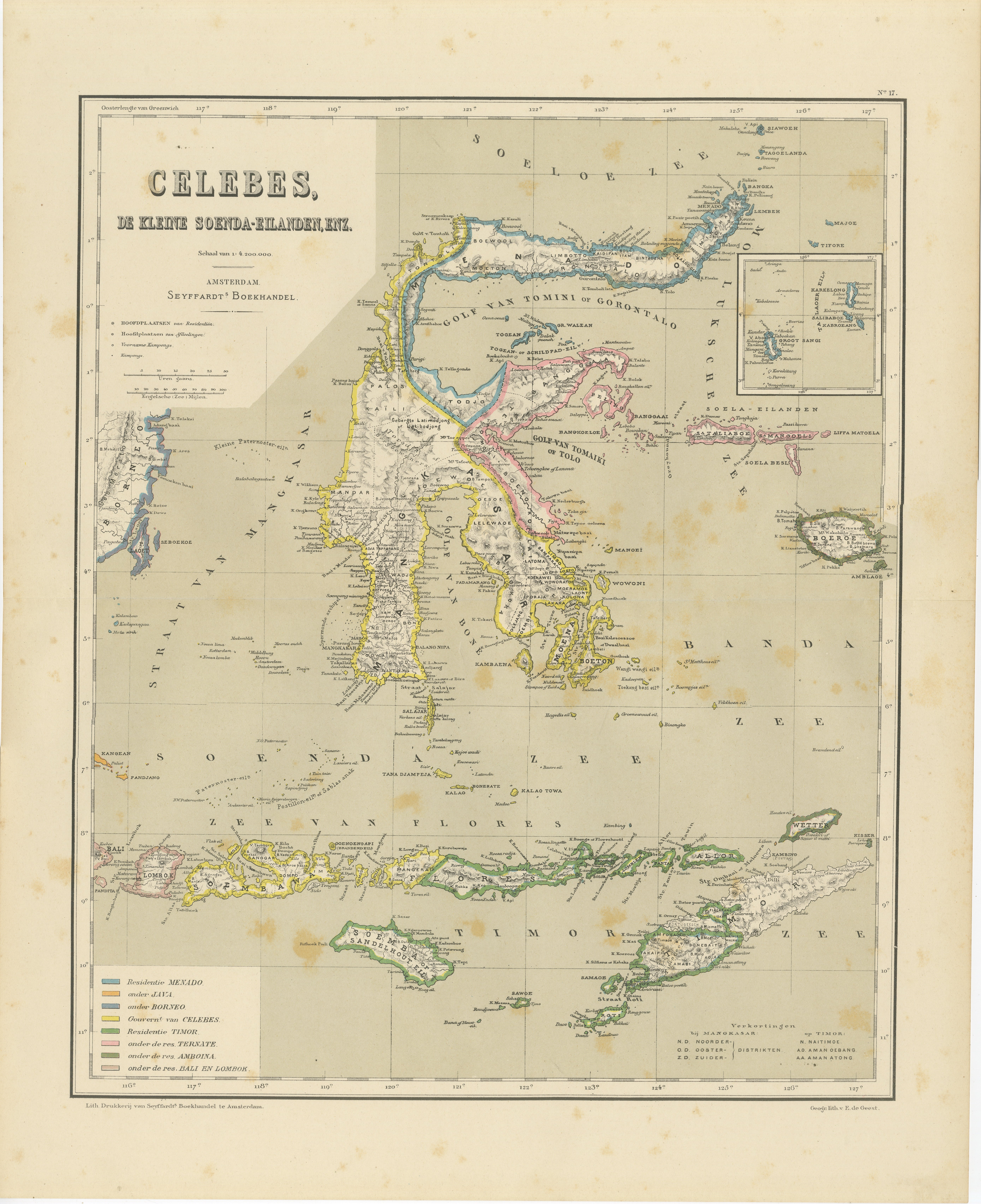
Items Similar to Antique Two-Sheet Map of Celebes Sulawesi - Dornseiffen, Dutch East Indies, 1884
Want more images or videos?
Request additional images or videos from the seller
1 of 12
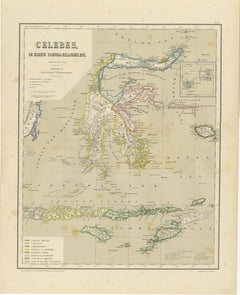
Antique Two-Sheet Map of Celebes Sulawesi - Dornseiffen, Dutch East Indies, 1884
$527.05per set
£394.11per set
€440per set
CA$726.14per set
A$791.96per set
CHF 419.53per set
MX$9,494.46per set
NOK 5,342.90per set
SEK 4,885.68per set
DKK 3,352.98per set
About the Item
Antique Two-Sheet Map of Celebes Sulawesi by Dornseiffen, Published in 1884 - Dutch East Indies
This striking two-sheet antique map set depicts the island of Celebes (modern Sulawesi) in exceptional geographic and administrative detail, issued from the authoritative Dutch colonial surveys of the late 19th century. Titled across the sheets as part of the official mapping of the region, this work was designed by J. Dornseiffen and published in Amsterdam by Seyffardt’s Boekhandel in 1884. Together, the two sheets form a complete and highly accurate cartographic representation of Northern and Central Celebes, including the Gulf of Tomini, Gorontalo, Tolo Bay, and surrounding coastal regions.
The upper sheet focuses on the northern coastline and the Sulawesi Sea (Soeloe Zee or Zee van Celebes), while the lower sheet continues southward through Central Sulawesi, including Palu, Parigi, Donggala, and the deeply indented eastern peninsulas. The coastline is rendered with extraordinary precision, mountain chains are shown in shaded relief, and rivers, settlements, anchorages, and administrative borders are all clearly defined. Original hand coloring highlights colonial divisions and coastal outlines, adding both visual clarity and decorative elegance.
By the time this map was issued, Dutch colonial rule had shifted from VOC trading dominance to fully structured territorial governance. Dornseiffen’s work reflects this modern imperial phase, where scientific surveying, inland penetration, and fixed administrative borders became standard. Celebes played a key strategic role between Java, the Moluccas, and New Guinea, and this map visually documents that geopolitical importance during the height of Dutch East Indies administration.
Visually, the paired sheets create an impressive horizontal wall presentation. The fine engraving, restrained pastel coloring, and balanced coastal composition give the map strong decorative impact while retaining full documentary authority. Displayed together, the set works beautifully in both classic and contemporary interiors, including libraries, studies, boardrooms, and curated gallery environments.
Two-sheet colonial maps of Celebes in such complete and well-preserved form are increasingly scarce on the market. This set is especially attractive for collectors of Dutch East Indies cartography, Indonesian history, colonial mapping, and 19th-century scientific surveys. It also pairs exceptionally well with Dornseiffen’s matching maps of the Moluccas, New Guinea, and the Lesser Sunda Islands for a cohesive multi-map wall installation of the archipelago.
Condition report: Good antique condition. General age toning consistent with 19th-century paper. Scattered foxing visible, mainly in the margins. Clear plate impressions visible on both sheets. Full margins preserved. No major tears or losses observed.
Framing tips: These sheets are ideally framed as a matched horizontal diptych with wide off-white or warm ivory mats and identical dark walnut, black lacquer, or antique gilt frames. Museum glass is recommended for UV protection and maximum visual clarity. Display works beautifully above a sofa, desk, or long credenza.
Technique: Hand-colored lithographs
Maker: J. Dornseiffen, Amsterdam, 1884 (published by Seyffardt’s Boekhandel)
- Dimensions:Height: 15.36 in (39 cm)Width: 19.1 in (48.5 cm)Depth: 0.01 in (0.2 mm)
- Sold As:Set of 2
- Materials and Techniques:
- Place of Origin:
- Period:
- Date of Manufacture:1884
- Condition:Good antique condition. General age toning consistent with 19th-century paper. Scattered foxing visible, mainly in the margins. Clear plate impressions visible on both sheets. Full margins preserved. No major tears or losses observed.
- Seller Location:Langweer, NL
- Reference Number:Seller: BG-14172-10A, -10B1stDibs: LU3054347872822
About the Seller
5.0
Recognized Seller
These prestigious sellers are industry leaders and represent the highest echelon for item quality and design.
Platinum Seller
Premium sellers with a 4.7+ rating and 24-hour response times
Established in 2009
1stDibs seller since 2017
2,788 sales on 1stDibs
Typical response time: <1 hour
- ShippingRetrieving quote...Shipping from: Langweer, Netherlands
- Return Policy
More From This Seller
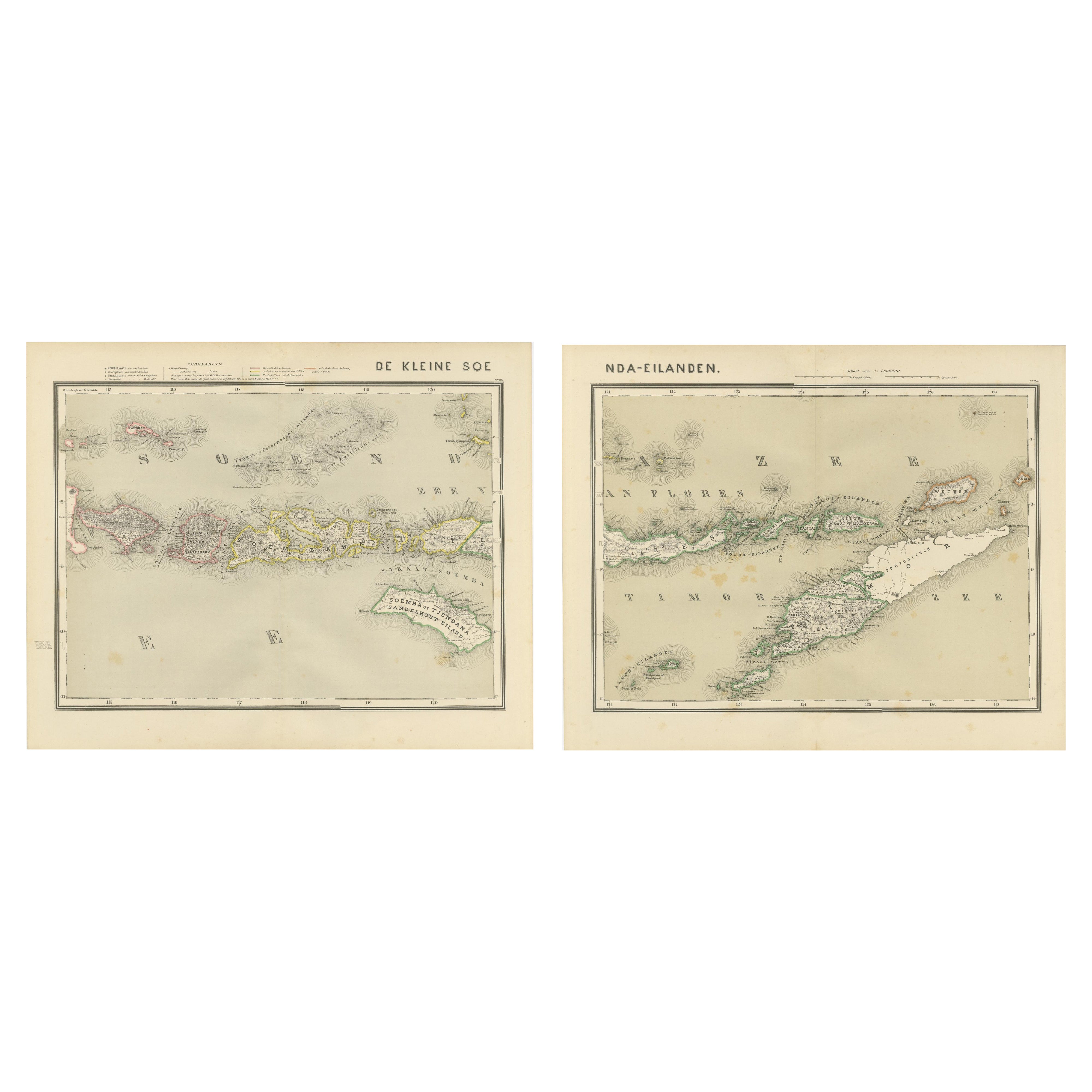
View AllAntique Two-Sheet Map of the Lesser Sunda Islands, Dutch East Indies - 1884
Located in Langweer, NL
Antique Two-Sheet Map of the Lesser Sunda Islands by Dornseiffen, Dutch East Indies, 1884
This impressive two-sheet antique map set depicts the Lesser Sunda Islands (De Kleine Soen...
Category
Antique 1880s Dutch Maps
Materials
Paper
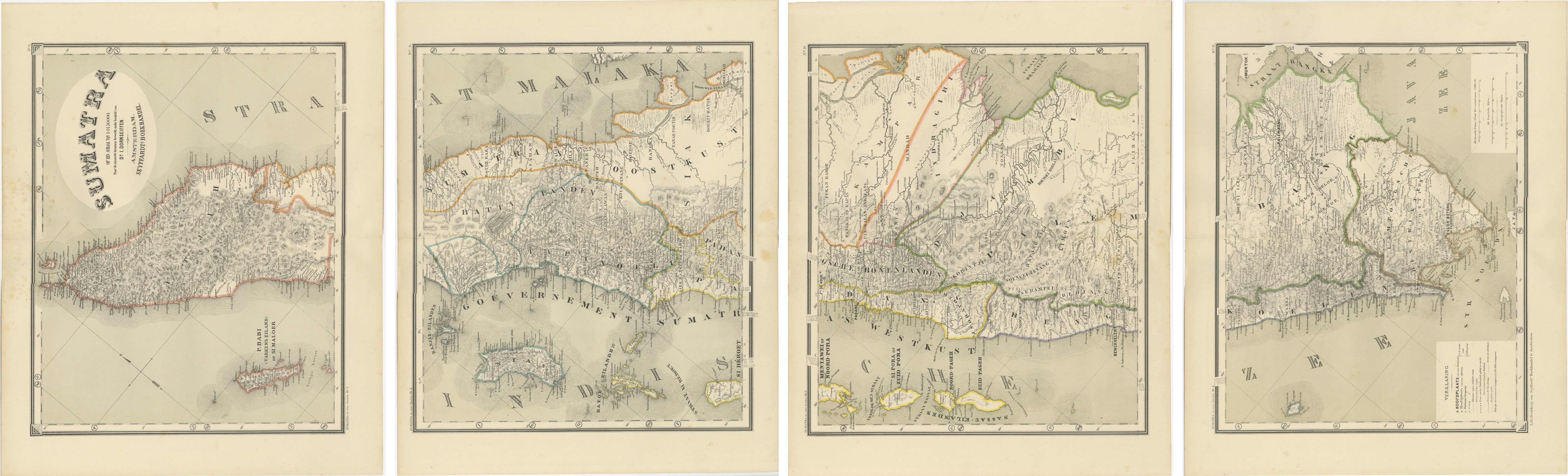
An Impressive Four-Sheet Map Set of Sumatra from the Dutch East Indies, 1884
Located in Langweer, NL
Four Matching Antique Maps Revealing the Full Coastline of Sumatra
This impressive four-sheet map set presents a complete late 19th century cartographic survey of the island of Suma...
Category
Antique 1880s Dutch Maps
Materials
Paper
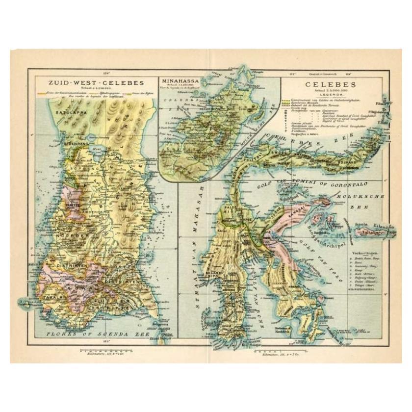
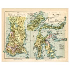
Antique Colonial Map of Celebes Sulawesi
Lesser Sunda Islands, 1884
Located in Langweer, NL
Antique Colonial Map of Celebes Sulawesi & Lesser Sunda Islands 19th C
This beautiful and highly detailed antique map depicts the island of Celebes (modern-day Sulawesi) together wi...
Category
Antique 1880s Dutch Maps
Materials
Paper
Antique Map of Sulawesi by Winkler Prins, c.1900
Located in Langweer, NL
Antique map titled 'Celebes.' (Sulawesi .) This map shows the Indonesian island of Sulawesi, one of the Sunda islands. With inset maps of South-west Sulawesi and Semenanjung Minahassa. Legend and scale. This map originates from 'De Grote Winkler Prins...
Category
20th Century Maps
Materials
Paper
$69 Sale Price
20% Off
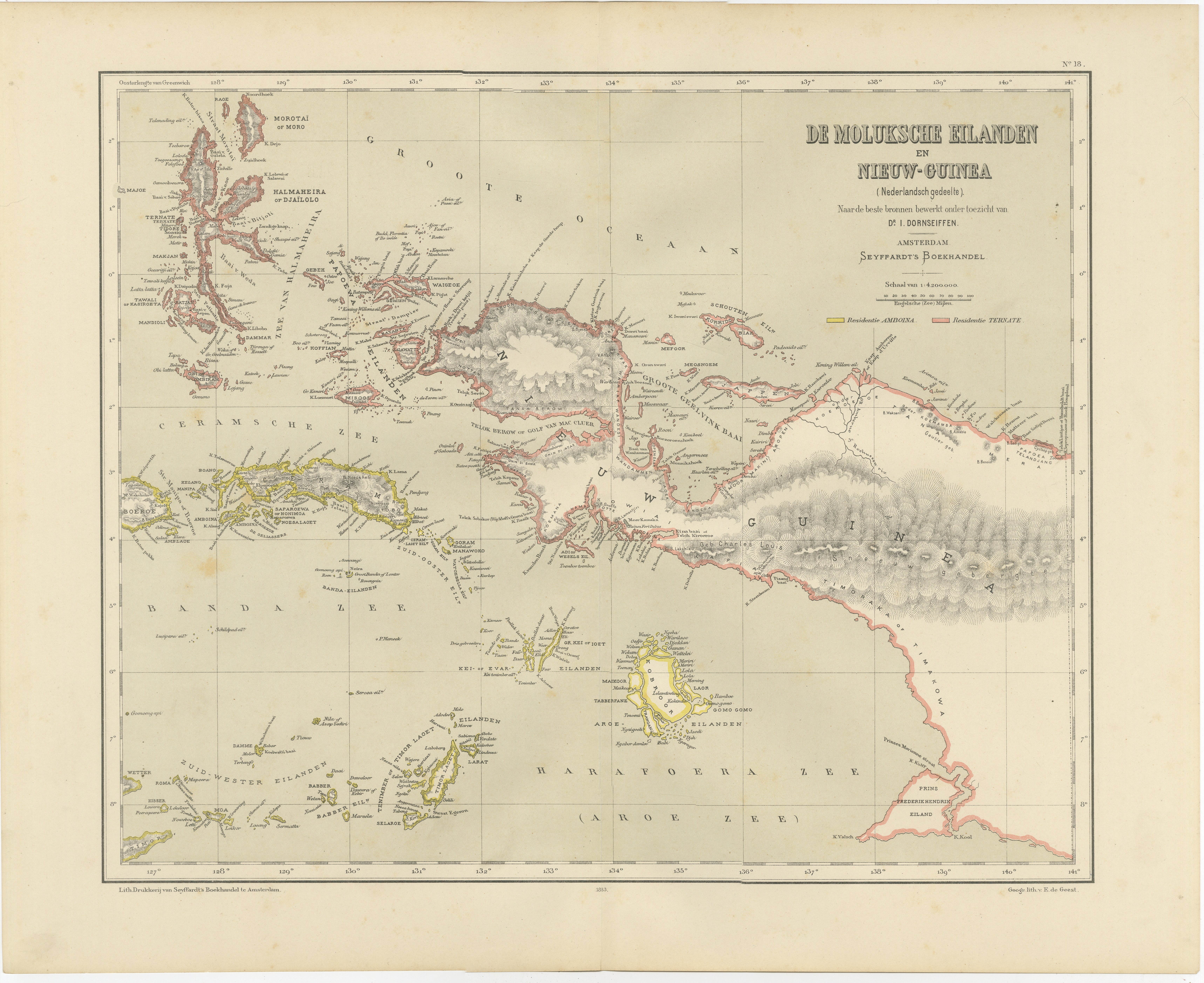
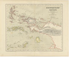
Antique Colonial Dutch Map of the Moluccas
New Guinea by Dornseiffen, 1884
Located in Langweer, NL
Antique Dutch Map of the Moluccas & New Guinea by Dornseiffen 1884 Indonesia
This decorative antique map depicts the Moluccan Islands (Spice Islands) and the western portion of New ...
Category
Antique 1880s Dutch Maps
Materials
Paper
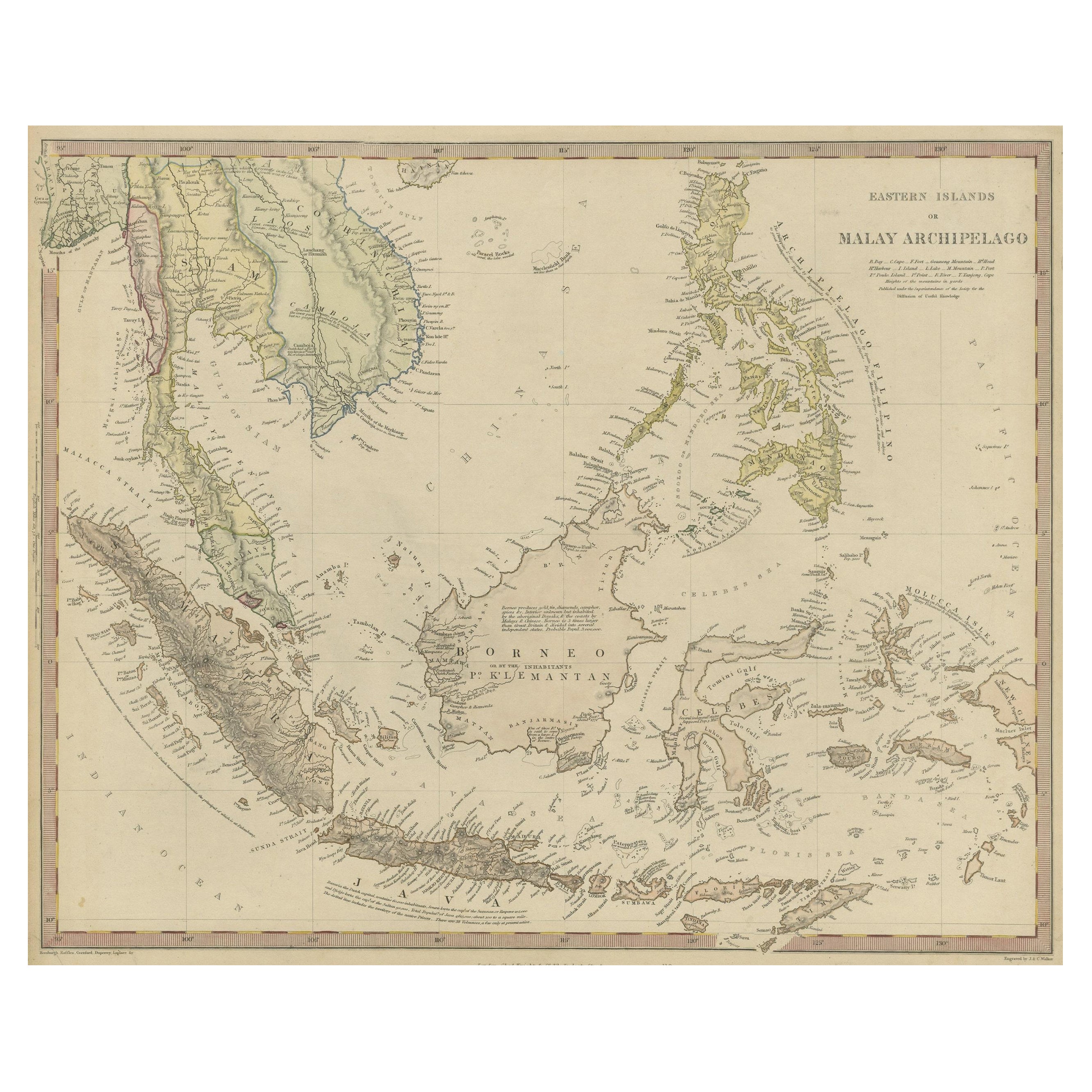
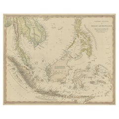
Original Antique Map of the Dutch East Indies, Nowadays Indonesia, ca.1840
Located in Langweer, NL
Original antique map of the East Indies including Borneo, Celebes, Java, Sumatra and surrounding islands. Published circa 1840.
Artists and Engravers: Engraved by J. & C. Walker....
Category
Antique 1840s Maps
Materials
Paper
You May Also Like
Large Original Antique Map of Java and Borneo, Fullarton, C.1870
Located in St Annes, Lancashire
Great map of Java and Borneo
Wonderful figurative borders
From the celebrated Royal Illustrated Atlas
Lithograph. Original color.
Published by Fullarton, Edinburgh. C.1870
Unfr...
Category
Antique 1870s Scottish Maps
Materials
Paper

Original Antique Map of South East Asia by Thomas Clerk, 1817
Located in St Annes, Lancashire
Great map of South East Asia
Copper-plate engraving
Drawn and engraved by Thomas Clerk, Edinburgh.
Published by Mackenzie And Dent, 1817
Unframed.
Category
Antique 1810s English Maps
Materials
Paper

Original Antique Map of The Philippines. C.1900
Located in St Annes, Lancashire
Fabulous map of The Philippines
Original color.
Engraved and printed by the George F. Cram Company, Indianapolis.
Published, C.1900.
Unframed.
Free shipping.
Category
Antique 1890s American Maps
Materials
Paper

Large Original Vintage Map of S.E Asia, with a Vignette of Singapore
Located in St Annes, Lancashire
Great map of South East Asia
Original color. Good condition
Published by Alexander Gross
Unframed.
Category
Vintage 1920s English Maps
Materials
Paper

Antique 1803 Italian Map of Asia Including China Indoneseia India
Located in Amsterdam, Noord Holland
Antique 1803 Italian Map of Asia Including China Indoneseia India
Very nice map of Asia. 1803.
Additional information:
Type: Map
Country of Manufacturing: Europe
Period: 19th centu...
Category
Antique 19th Century European Maps
Materials
Paper

$438 Sale Price
39% Off
Large Original Antique Map of The Greek Islands. 1894
Located in St Annes, Lancashire
Superb Antique map of The Greek Islands
Published Edward Stanford, Charing Cross, London 1894
Original colour
Good condition
Unframed.
Free shipping
Category
Antique 1890s English Maps
Materials
Paper
