Items Similar to Attractive Detailed Map of the Empire of the Great Mogul, Incl India, 1731

Want more images or videos?
Request additional images or videos from the seller
1 of 5
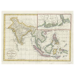
Attractive Detailed Map of the Empire of the Great Mogul, Incl India, 1731
$904.48
$1,130.6120% Off
£669.31
£836.6320% Off
€752
€94020% Off
CA$1,237.69
CA$1,547.1120% Off
A$1,348.35
A$1,685.4420% Off
CHF 712.07
CHF 890.0920% Off
MX$16,186.59
MX$20,233.2320% Off
NOK 9,072.56
NOK 11,340.7020% Off
SEK 8,291.98
SEK 10,364.9820% Off
DKK 5,729.70
DKK 7,162.1220% Off
About the Item
Antique map titled 'Nieuwe Kaart van t Keyzer Ryk Grooten Mogol.'
Attractive detailed map of the Empire of the Great Mogul, which included India, Sri Lanka, Pakistan and Bangladesh, decorated with a simple compass rose. Source unknown, to be determined.
Artists and Engravers: Made by 'Isaak Tirion' after an anonymous artist. Isaak Tirion, a Dutch publisher in Amsterdam, was born 1705. He produced serveral Atlases and Dutch town plans. The maps mainly based on those of Guillaume de l'Isle. He died in 1765.
- Dimensions:Height: 13.12 in (33.3 cm)Width: 16.15 in (41 cm)Depth: 0 in (0.02 mm)
- Materials and Techniques:
- Period:1730-1739
- Date of Manufacture:1731
- Condition:Wear consistent with age and use. Condition: Good, given age. Edges with a few tiny tears. Some discolouration top margin left, hardly touching image. Original folds as issued. General age-related toning and/or occasional minor defects from handling. Please study image carefully.
- Seller Location:Langweer, NL
- Reference Number:Seller: PCT-59208 1stDibs: LU3054326960862
About the Seller
5.0
Recognized Seller
These prestigious sellers are industry leaders and represent the highest echelon for item quality and design.
Platinum Seller
Premium sellers with a 4.7+ rating and 24-hour response times
Established in 2009
1stDibs seller since 2017
2,811 sales on 1stDibs
Typical response time: 1 hour
- ShippingRetrieving quote...Shipping from: Langweer, Netherlands
- Return Policy
More From This Seller
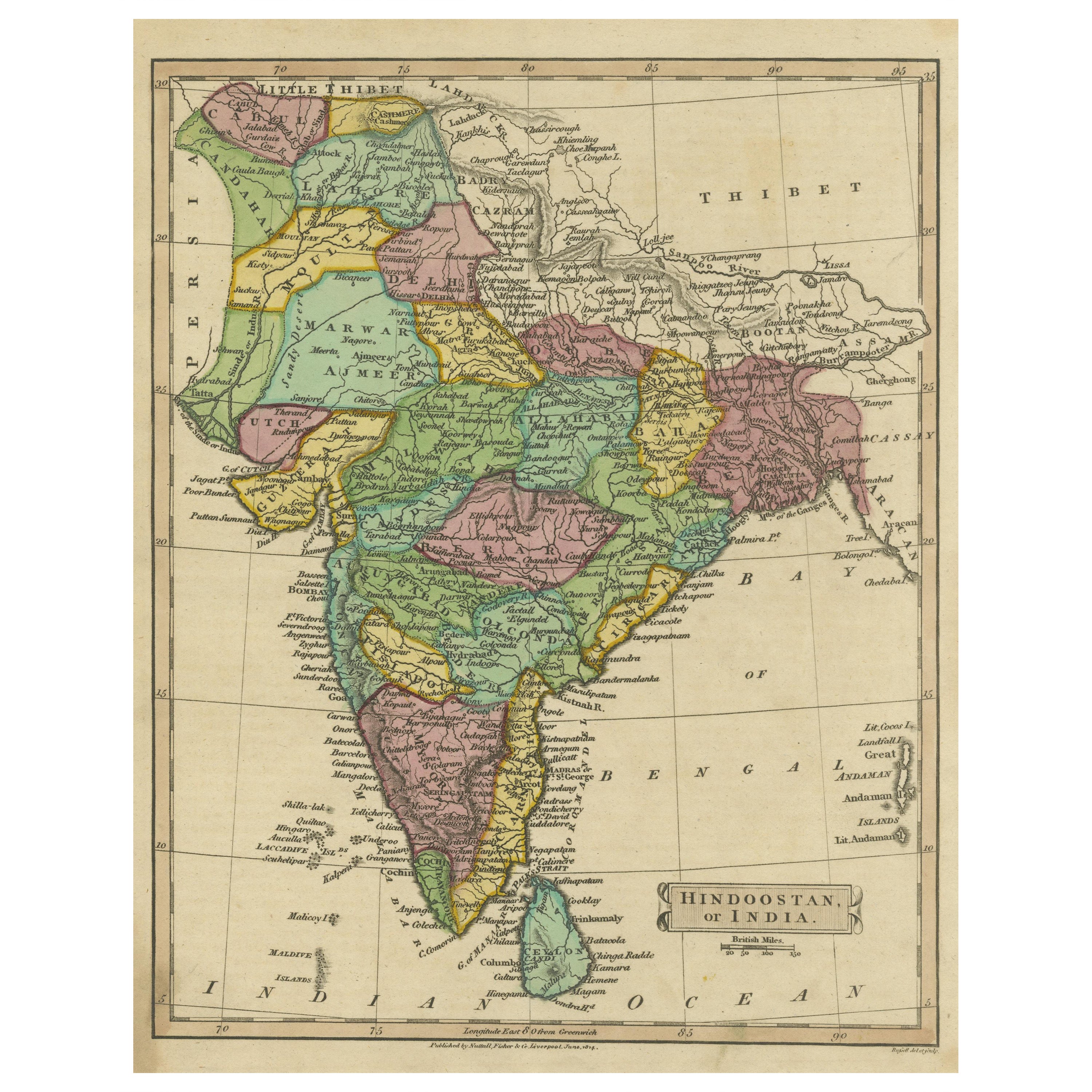
View AllAntique Map of Hindustan, or India
Located in Langweer, NL
Antique map titled 'Hindoostan, or India'. Original antique map of India (Hindustan) and Sri Lanka (Ceylon). Engraved by Russell. Published by Nuttall, Fisher & Co, 1814.
Category
Antique Early 19th Century Maps
Materials
Paper

$278 Sale Price
20% Off
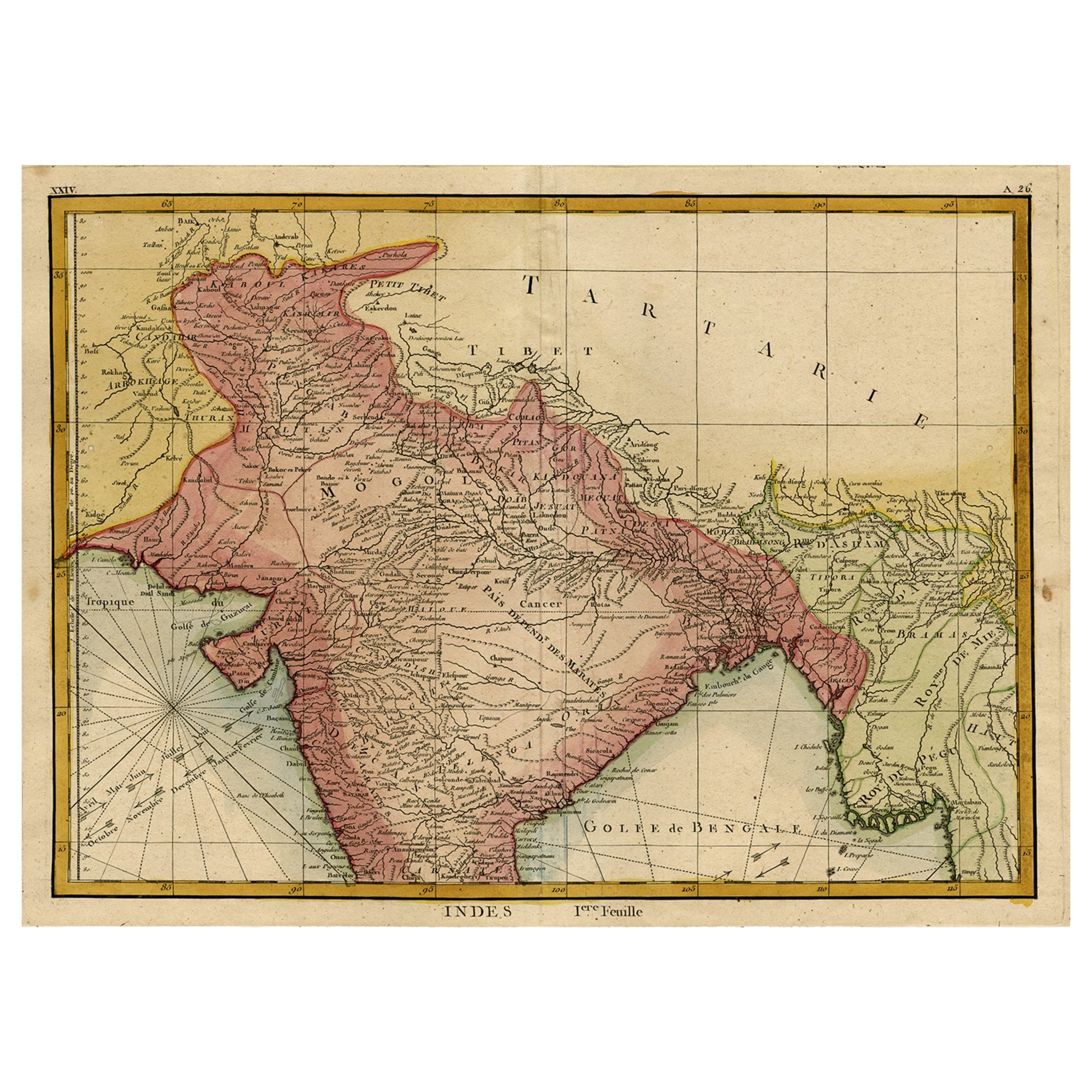
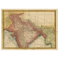
Original and Colourful Map of Northern India with Surrounding Regions, 1783
Located in Langweer, NL
Antique map titled 'Indes'. A map of Northern India with surrounding regions. From Lattre's 'Atlas moderne ou collection de cartes sur toutes les parties du globe terrestre...
Category
Antique 1780s Maps
Materials
Paper
$548 Sale Price
20% Off
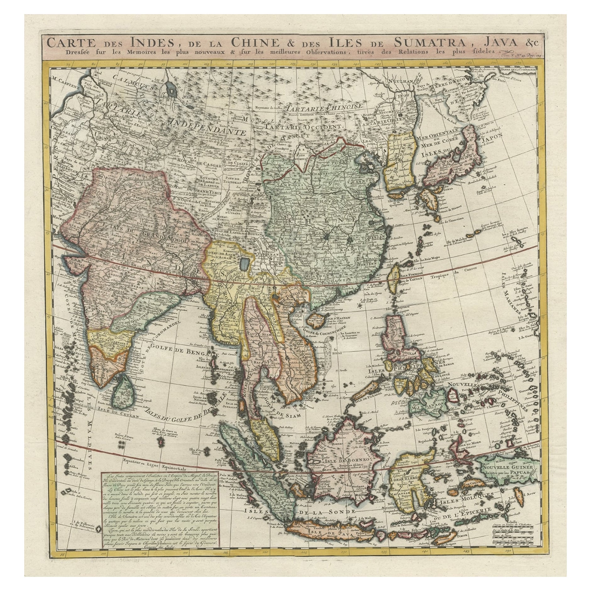
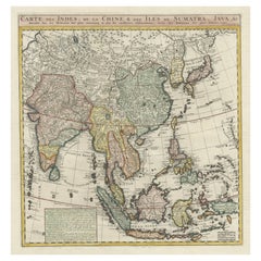
Detailed Original Antique Map of India, Southeast Asia and the Far East, 1719
Located in Langweer, NL
Antique map titled 'Carte des Indes, de la Chine & des Iles de Sumatra, Java & c'.
Detailed map of India, Southeast Asia and the Far East, extending from Gujerat to the supposed "T...
Category
Antique 1710s Maps
Materials
Paper
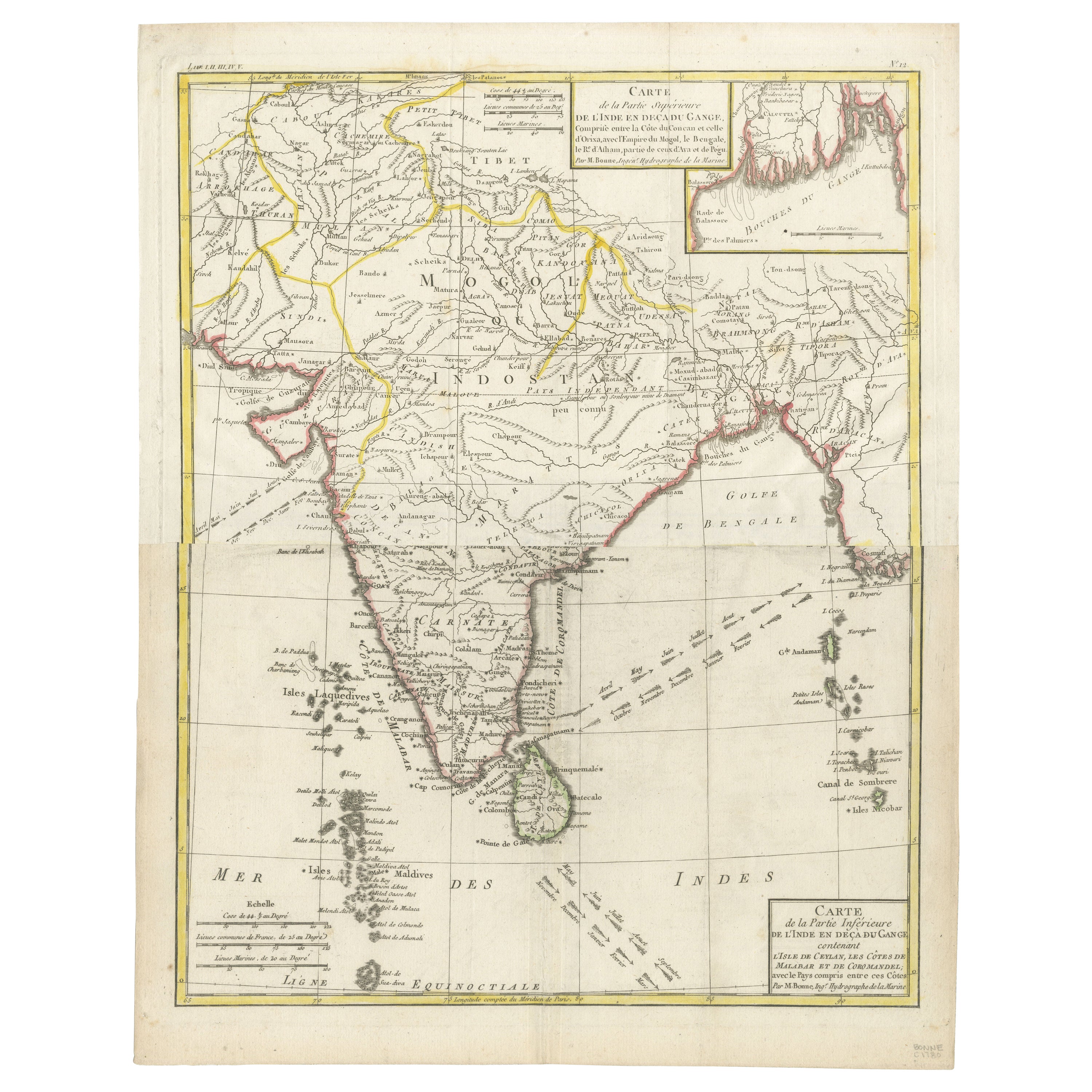
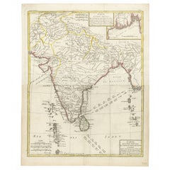
Map of India and Ceylon with Inset of Calcutta and the Ganges, by Bonne, 1780
Located in Langweer, NL
The map on offer is an antique copperplate engraving of India and Ceylon (Sri Lanka), created by Rigobert Bonne (1727-1794), a prominent French cartographer. Here is a breakdown of t...
Category
Antique 1780s Maps
Materials
Paper
$327 Sale Price
20% Off
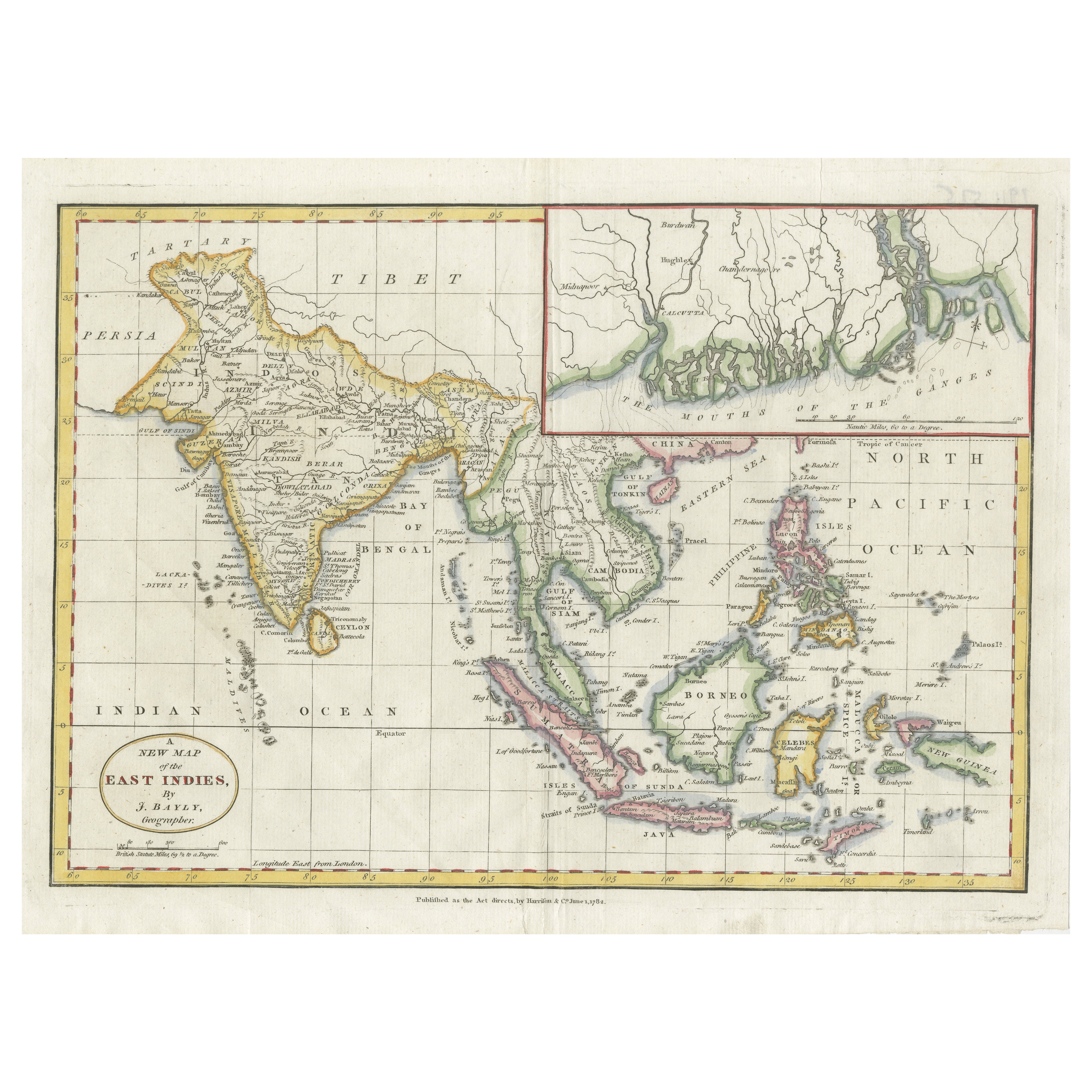
1782 Map of the East Indies – India, Siam, Philippines, Java, Borneo, Ganges
Located in Langweer, NL
1782 Bayly Map of the East Indies – India, Siam, Philippines, Java, Borneo, Ganges
This finely engraved and vibrantly hand-colored map titled 'A New Map of the East Indies' was dr...
Category
Antique 1780s Maps
Materials
Paper
Antique Map of India as Described It Was before the 5th Century, 1744
Located in Langweer, NL
Antique map titled 'India, as described by all Authors before the fifth Century'. Detailed map of part of India, including Hyrcania, Parthia, Carmania, Gedorossii, Drangiana, Aria, M...
Category
Antique 18th Century Maps
Materials
Paper

You May Also Like
Original Antique Map of India by Dower, circa 1835
Located in St Annes, Lancashire
Nice map of India
Drawn and engraved by J.Dower
Published by Orr & Smith. C.1835
Unframed.
Free shipping
Category
Antique 1830s English Maps
Materials
Paper

Antique 1803 Italian Map of Asia Including China Indoneseia India
Located in Amsterdam, Noord Holland
Antique 1803 Italian Map of Asia Including China Indoneseia India
Very nice map of Asia. 1803.
Additional information:
Type: Map
Country of Manufacturing: Europe
Period: 19th centu...
Category
Antique 19th Century European Maps
Materials
Paper

$438 Sale Price
39% Off
Antique French Map of Asia Including China Indoneseia India, 1783
Located in Amsterdam, Noord Holland
Very nice map of Asia. 1783 Dedie au Roy.
Additional information:
Country of Manufacturing: Europe
Period: 18th century Qing (1661 - 1912)
Condition: Overall Condition B (Good Used)...
Category
Antique 18th Century European Maps
Materials
Paper

$486 Sale Price
40% Off
Large Original Vintage Map of India, circa 1920
Located in St Annes, Lancashire
Great map of India
Original color.
Good condition / repair to some minor damage just above Sri Lanka. Shown in the last image.
Published by Alexander Gross
Unframed.
Category
Vintage 1920s English Maps
Materials
Paper

Map of the East Indies: An Original 18th Century Hand-colored Map by E. Bowen
Located in Alamo, CA
This is an original 18th century hand-colored map entitled "An Accurate Map of the East Indies Exhibiting the Course of the European Trade both on the Continent and Islands" by Emanu...
Category
Mid-18th Century Old Masters Landscape Prints
Materials
Engraving

$1,020 Sale Price
20% Off
Antique Map of Eastern Hemisphere from the collection of Thierry Despont
Located in New York, NY
Designed by Enrico Bonetti (E. Bonatti) and published by Francesco Vallardi Editore. Based on an earlier map by Evangelista Azzi (Ev. Azzi). Labeled as such at bottom edge of map.
T...
Category
Antique Late 19th Century Italian Maps
Materials
Canvas, Wood

More Ways To Browse
Antique Florida Map
Antique Map Chile
Antique Map Of Georgia
Antique Mississippi Furniture
Burgundy Map
John Speed Antique Maps
Malabar Map
Malaysia Map
Map Of Syria
Taiwan Map
Antique Chicago Maps
Dutch Bible
New Jersey 19th Century
Thailand Map
Antique Coal Mining
Antique Dutch Bible
Antique Louisiana Map
Antique Maps Of Sicily