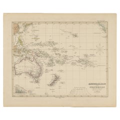
Items Similar to Australia and Polynesia with New Zealand – Noothoven van Goor, 1876 Map

Want more images or videos?
Request additional images or videos from the seller
1 of 11
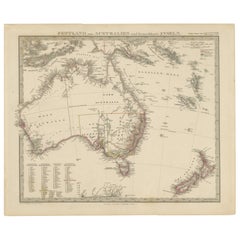
Australia and Polynesia with New Zealand – Noothoven van Goor, 1876 Map
$526.52
£393.26
€440
CA$725.38
A$790.54
CHF 418.62
MX$9,495.19
NOK 5,299.87
SEK 4,872.71
DKK 3,352.04
About the Item
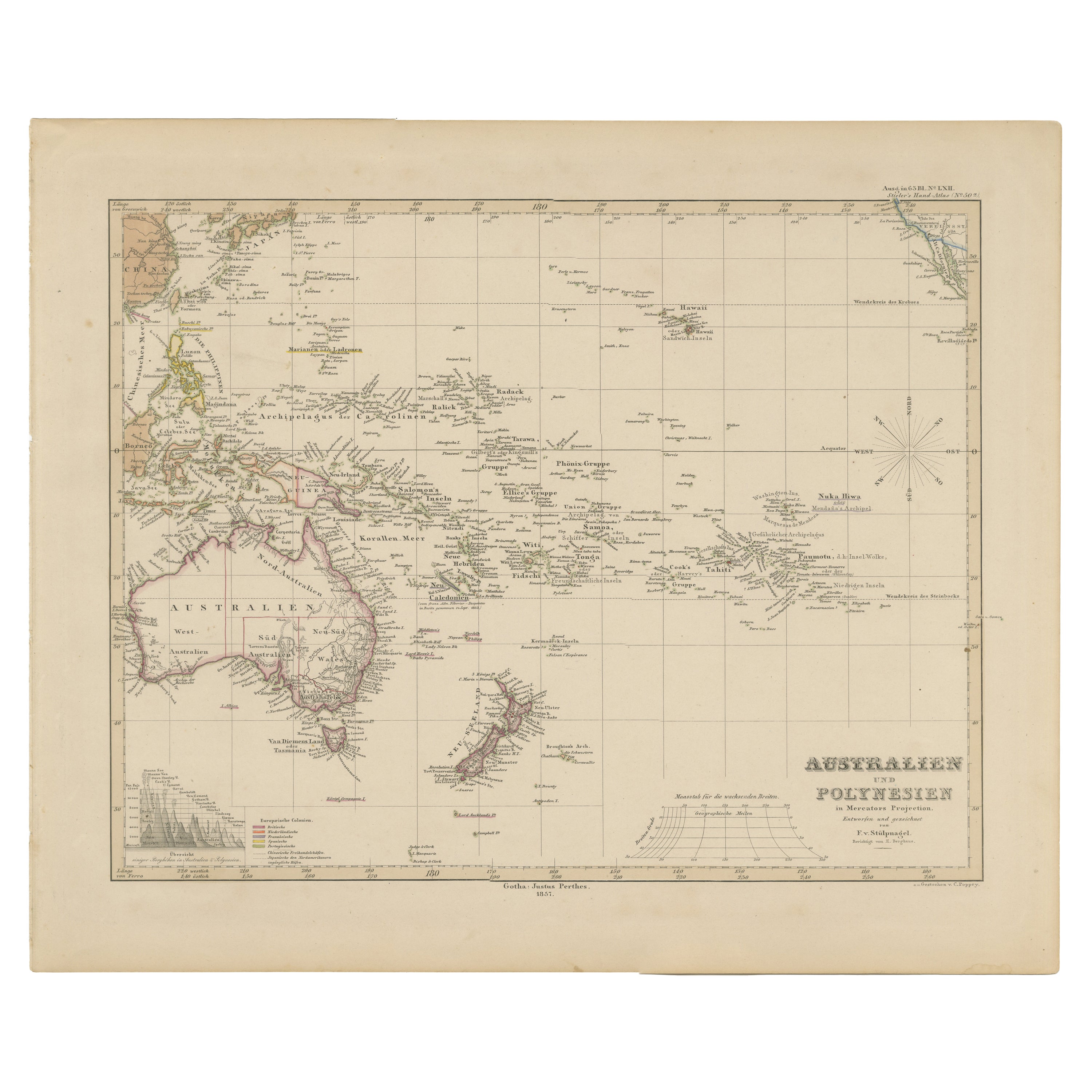
Australia and Polynesia with New Zealand – Noothoven van Goor, 1876 Map
This finely engraved 19th-century map, titled “Australië en Polynesie,” was published in Leiden by D. Noothoven van Goor for the *Nieuwe Hand-Atlas der Aarde* (circa 1876). It presents a remarkably detailed view of Australia, New Zealand, and the vast island world of Polynesia at a moment when European exploration, colonial administration, and scientific mapping were rapidly transforming the region. The map is beautifully hand-coloured with subtle boundary tints and offers a rare historical snapshot of Oceania before many modern political borders were fully defined.
Australia is shown with clear divisions between Western Australia, South Australia, Queensland, New South Wales, Victoria, and Tasmania. Major coastal centres such as Sydney, Melbourne, Adelaide, Brisbane, Perth, and Hobart are marked, while the interior still contains large uncharted or sparsely surveyed territories labelled with early expedition routes, indigenous regions, and wide desert tracts. The map reflects an era shortly after pioneering inland journeys by Stuart, Burke
Wills, and Giles expanded European knowledge of the continent’s interior.
To the east, New Zealand is depicted with an impressive level of detail. Both Te Ika-a-Māui (North Island) and Te Waipounamu (South Island) show provincial boundaries, mountain ranges, ports, lakes, and early settlement names. Christchurch, Wellington, Auckland, and Dunedin all appear, along with the Southern Alps and numerous bays and inlets. The separate inset of New Zealand in the lower right corner provides an even clearer view of its geography.
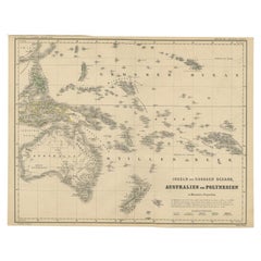
Across the Pacific, the map identifies countless island groups with precision characteristic of 19th-century Dutch cartography. Fiji, Tonga, Samoa, Tahiti, the Marquesas, the Society Islands, the Sandwich (Hawaiian) Islands, the Gilbert and Marshall Islands, and the Caroline and Mariana archipelagos are all carefully placed. Many islands are accompanied by historical or navigational notes, reflecting the maritime importance of the Pacific during the high age of exploration and trade. A set of inset maps highlights specific islands, including Tahiti and its surrounding waters, the Gambier Islands, and several areas of Hawaii, showing their coastlines and anchorages in greater detail.
This map is an elegant combination of scientific accuracy and contemporary artistic engraving, making it an appealing piece for collectors of Australian history, Pacific exploration, cartography, or maritime heritage. Its large format and extensive geographic coverage provide a strong visual impact when framed.
Condition report:
Good condition with light age toning and scattered foxing, mainly in margins. Original center fold as issued. Engraving crisp and hand-colouring well preserved. No significant tears or repairs.
Framing tips:
A soft ivory mat enhances the delicate hand-colouring, while a teak, walnut, or dark oak frame harmonises beautifully with the map’s warm tones. For a more modern display, a simple black frame with generous white matting creates a clean gallery effect suitable for large wall spaces.
Keyword block:
Australia, Polynesia, New Zealand, Oceania, Pacific Islands, Fiji, Samoa, Tonga, Tahiti, Hawaii, Marquesas, Society Islands, Western Australia, Queensland, New South Wales, Victoria, Tasmania, Sydney, Melbourne, Auckland, Wellington, 19th century map, Noothoven van Goor, Nieuwe Hand-Atlas, exploration, colonial cartography, Oceania history.
- Dimensions:Height: 17.33 in (44 cm)Width: 21.66 in (55 cm)Depth: 0.01 in (0.2 mm)
- Materials and Techniques:
- Place of Origin:
- Period:
- Date of Manufacture:1876
- Condition:Good condition with light age toning and scattered foxing, mainly in margins. Original center fold as issued. Engraving crisp and hand-colouring well preserved. No significant tears or repairs.
- Seller Location:Langweer, NL
- Reference Number:Seller: BG-12788-301stDibs: LU3054347571282
About the Seller
5.0
Recognized Seller
These prestigious sellers are industry leaders and represent the highest echelon for item quality and design.
Platinum Seller
Premium sellers with a 4.7+ rating and 24-hour response times
Established in 2009
1stDibs seller since 2017
2,788 sales on 1stDibs
Typical response time: <1 hour
- ShippingRetrieving quote...Shipping from: Langweer, Netherlands
- Return Policy
More From This Seller
View AllAntique Map of Australia, New Zealand
Polynesia – Stülpnagel, 1857
Located in Langweer, NL
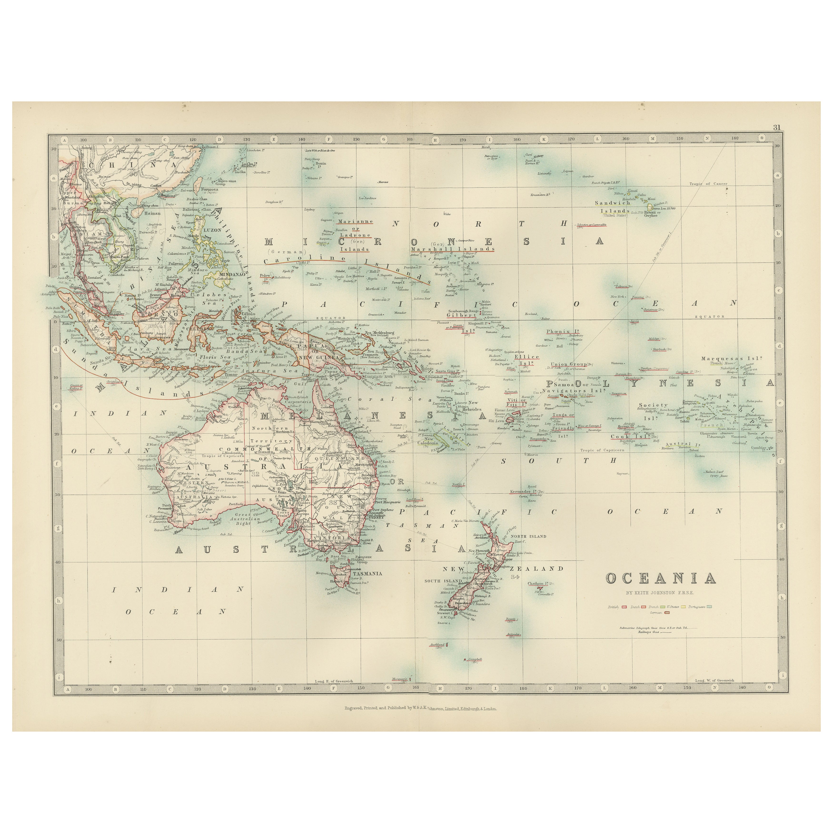
Antique Map of Australia, New Zealand & Polynesia – Stülpnagel, 1857
Description:
This finely engraved and delicately hand-colored map titled "Australien und Polynesien in Mercator'...
Category
Antique Mid-19th Century German Maps
Materials
Paper
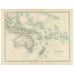
Antique Map of Oceania, 1903, Featuring the Pacific Islands and Australasia
Located in Langweer, NL
Title: Antique Map of Oceania, 1903, Featuring the Pacific Islands and Australasian Region
Description:
This antique map, titled "Oceania," was engraved and published in 1903 by W. ...
Category
Early 20th Century Maps
Materials
Paper
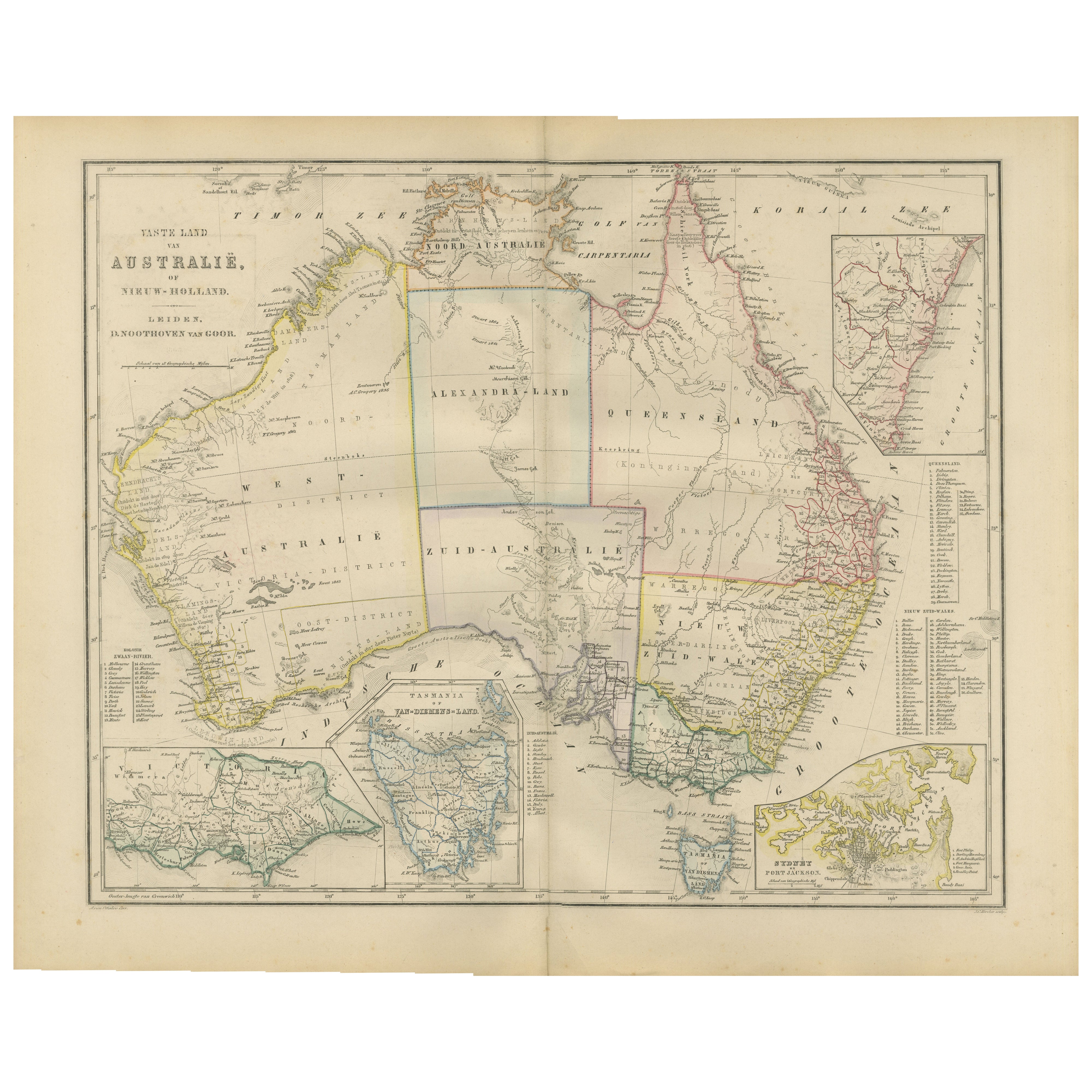
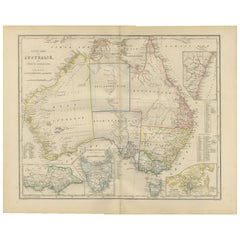
Australia or New Holland Map with Inset Regions by Noothoven van Goor, 1876
Located in Langweer, NL
Australia or New Holland Map with Inset Regions by Noothoven van Goor, 1876
This detailed 19th-century map, titled “Vaste Land van Australië, of Nieuw-Holland,” was published in Lei...
Category
Antique 1870s Dutch Maps
Materials
Paper
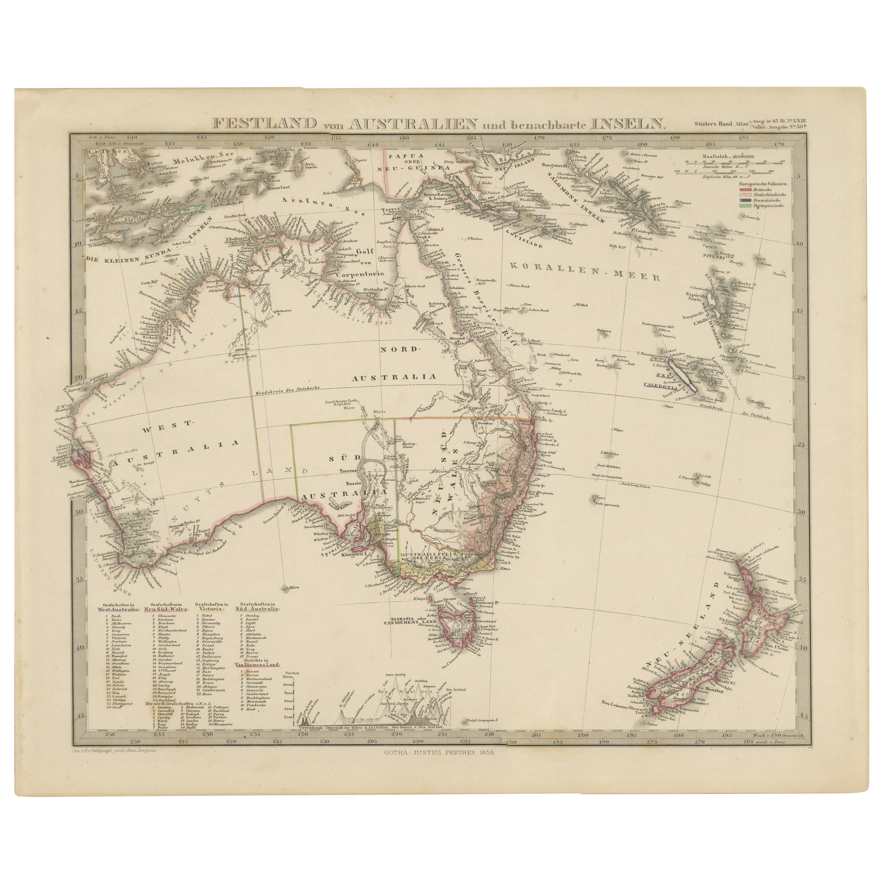
Australia, New Zealand, and Neighbouring Islands Map 1858
Located in Langweer, NL
Australia and Neighbouring Islands Map 1858
This attractive antique print shows “Festland von Australien und benachbarte Inseln” meaning “Mainland Australia and neighbouring islands...
Category
Antique Mid-19th Century German Maps
Materials
Paper
Antique Map of Australia and Polynesia, inset of Tasmania c.1860
Located in Langweer, NL
German antique map titled 'Australien und Polynesien'. Old map of Australia (New Holland) and Polynesia. With an inset map of Southern Australia including Tasmania (Van Diemen's Land...
Category
Antique 19th Century Maps
Materials
Paper

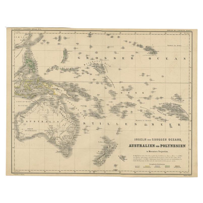
German Antique Map of Australia and Polynesia, c.1870
Located in Langweer, NL
Antique map titled 'Inseln des Grossen Oceans, Australien und Polynesien'. Old map of Australia and Polynesia. This map originates from 'H. Kiepert's Kleiner Atlas der Neueren Geogra...
Category
Antique 19th Century Maps
Materials
Paper
You May Also Like
Original Antique Map of Australia by Dower, circa 1835
Located in St Annes, Lancashire
Nice map of Australia
Drawn and engraved by J.Dower
Published by Orr & Smith. C.1835
Unframed.
Free shipping
Category
Antique 1830s English Maps
Materials
Paper

Large Original Antique Map of Australia by Sidney Hall, 1847
Located in St Annes, Lancashire
Great map of Australia
Drawn and engraved by Sidney Hall
Steel engraving
Original colour outline
Published by A & C Black. 1847
Unframed
Free shipping.
Category
Antique 1840s Scottish Maps
Materials
Paper

Australia, Tallis antique map, 1851
Located in Melbourne, Victoria
'Australia'
With decorative border surrounds and vignettes including a view of Sydney, Kangaroos, Natives of Australia Felix, Australian Parrots and Cockatoos and Natives of the Tri...
Category
19th Century Naturalistic Landscape Prints
Materials
Engraving

Ancient Map of Oceania - Original Etching - 19th century
Located in Roma, IT
This Map of Oceania is an etching realized in the 19th century.
The state of preservation of the artwork is good. At the top of the paper, the inscription “Longitudine del Meridiano...
Category
19th Century More Prints
Materials
Etching

Large Original Antique Map of The Pacific Ocean, Fullarton, C.1870
Located in St Annes, Lancashire
Great map of The Pacific Ocean
From the celebrated Royal Illustrated Atlas
Lithograph by Swanston. Original color.
Published by Fullarton,...
Category
Antique 1870s Scottish Maps
Materials
Paper

Original Antique Map of The World by Dower, circa 1835
Located in St Annes, Lancashire
Nice map of the World
Drawn and engraved by J.Dower
Published by Orr & Smith. C.1835
Unframed.
Free shipping
Category
Antique 1830s English Maps
Materials
Paper
