Items Similar to Austria–Hungary Map with Vienna Inset – Nieuwe Hand-Atlas, Leiden 1876

Want more images or videos?
Request additional images or videos from the seller
1 of 10
Austria–Hungary Map with Vienna Inset – Nieuwe Hand-Atlas, Leiden 1876
$405.45
£300.22
€340
CA$560.02
A$599.78
CHF 322.44
MX$7,284.73
NOK 4,074.18
SEK 3,730.22
DKK 2,591.23
About the Item
Austria–Hungary Map with Vienna Inset – Nieuwe Hand-Atlas, Leiden 1876
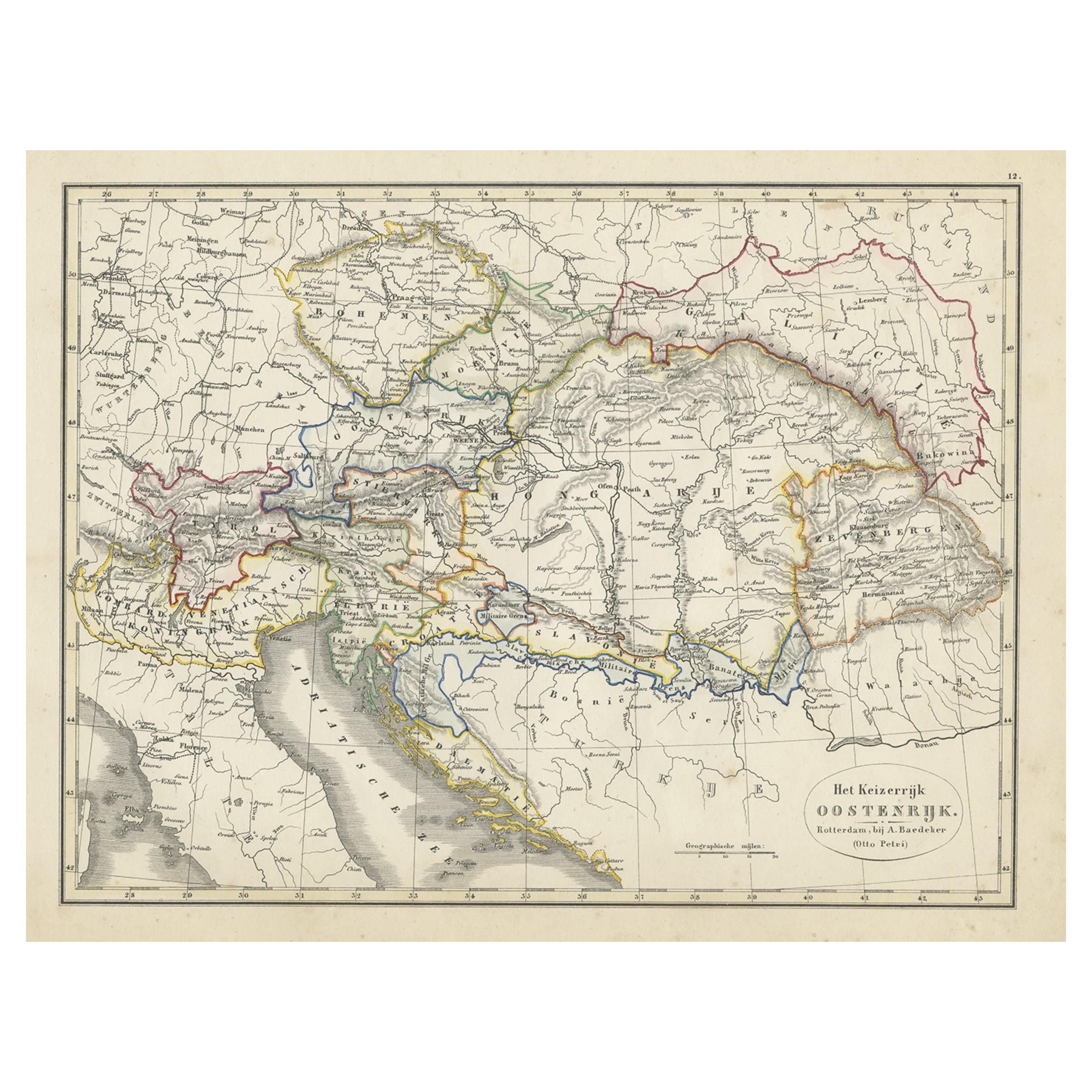
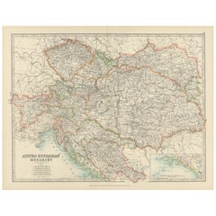
This richly detailed 19th-century map titled “Oostenrijk” depicts the territories of the Austro-Hungarian Empire shortly after its transformation into the Dual Monarchy in 1867. Published in 1876 in the Nieuwe Hand-Atlas der Aarde in haren Tegenwoordigen Toestand by M. Frijlink, fully revised by A. van Otterloo and printed by D. Noothoven van Goor in Leiden, the map presents one of Europe’s most complex historical regions with clarity and sophistication.
The map encompasses the full expanse of the empire as it existed in the late 19th century, including Austria, Bohemia, Moravia, Galicia, Bukovina, Hungary, Transylvania, Croatia-Slavonia, Dalmatia, Styria, Carinthia, Carniola, Tyrol, and the Adriatic coastline. Borders between these crown lands are marked in soft hand-colored lines, while dense networks of towns, roads, rivers, and mountain ranges fill the interior with remarkable precision. Major rivers such as the Danube, Drava, Save, Vistula and Tisza are clearly engraved, providing essential orientation across this vast territory.
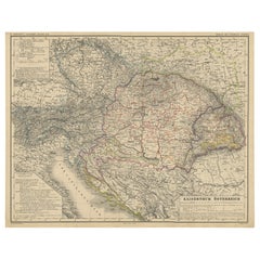
Prominent cities — Vienna, Prague, Budapest, Graz, Trieste, Lemberg (Lviv), Zagreb, Innsbruck, Brünn (Brno), Salzburg, and Pressburg (Bratislava) — are sharply labeled. The lower right corner features a highly detailed city plan of Vienna (Wenen), illustrating the Ringstrasse, the old fortifications, and the imperial center during its monumental rebuilding phase. Additional insets depict Prague (Praag) and the Adriatic region around Trieste, showing strategic coastal towns and transport routes that linked the empire to Mediterranean trade.
This map captures the Austro-Hungarian Empire at its political height, when it governed a mosaic of languages, cultures, and historic provinces. The fine engraving, precise typography, and balanced composition reflect the high standards of Dutch educational cartography during the late 19th century. Frijlink’s atlas was a widely used reference in Dutch schools, valued for its accuracy and its elegant, methodical approach to geography.
---
Condition Report: Good condition with consistent light toning and minor foxing along the margins. Original center fold as issued. The printed image is sharp, the paper remains sound, and the hand-coloring is soft and even. No tears, losses, or repairs.
Framing Tips:
This map displays beautifully with a warm ivory or pale cream mat and a slim walnut or black wooden frame. The detailed Vienna inset benefits from a slightly wider mat margin, which allows the viewer to appreciate the fine engraving. Ideal for libraries, offices, historical interiors, and collectors of Central European cartography.
Austria, Oostenrijk, Austro-Hungarian Empire, Austria-Hungary, Habsburg Empire, Vienna, Wenen, Budapest, Prague, Praag, Trieste, Graz, Linz, Salzburg, Innsbruck, Brünn, Brno, Pressburg, Bratislava, Lemberg, Lviv, Zagreb, Ljubljana, Triest, Dalmatia, Croatia, Slavonia, Bosnia border, Tyrol, Tirol, Carinthia, Kärnten, Carniola, Krain, Styria, Steiermark, Moravia, Galicia, Bukovina, Hungary, Hongarije, Transylvania, Siebenbürgen, Banat, Vojvodina, Adriatic Sea, Danube River, Drava, Save, Tisza, Vistula, Ringstrasse, Vienna inset, Prague inset, Trieste inset, 19th century Austria-Hungary map, 1876 map.
- Dimensions:Height: 17.33 in (44 cm)Width: 21.66 in (55 cm)Depth: 0.01 in (0.2 mm)
- Materials and Techniques:
- Place of Origin:
- Period:
- Date of Manufacture:1876
- Condition:Condition Report: Good condition with consistent light toning and minor foxing along the margins. Original center fold as issued. The printed image is sharp, the paper remains sound, and the hand-coloring is soft and even. No tears, losses, or repair.
- Seller Location:Langweer, NL
- Reference Number:Seller: BG-12788-181stDibs: LU3054347559082
About the Seller
5.0
Recognized Seller
These prestigious sellers are industry leaders and represent the highest echelon for item quality and design.
Platinum Seller
Premium sellers with a 4.7+ rating and 24-hour response times
Established in 2009
1stDibs seller since 2017
2,826 sales on 1stDibs
Typical response time: 1 hour
- ShippingRetrieving quote...Shipping from: Langweer, Netherlands
- Return Policy
More From This Seller
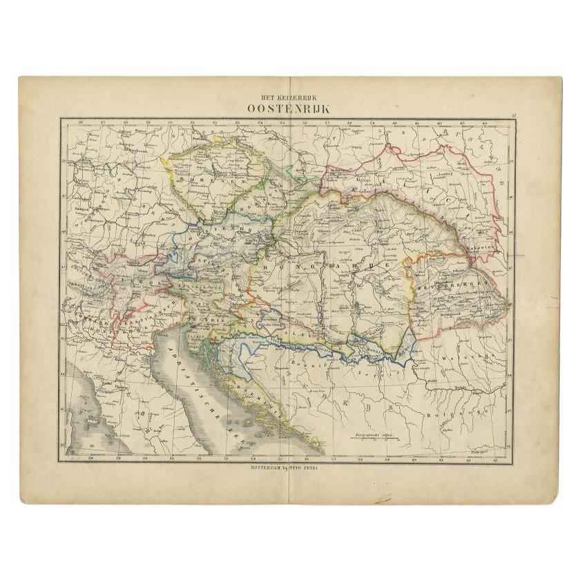
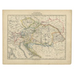
View AllOriginal Antique Map of Austria from an Old Dutch School Atlas, 1852
Located in Langweer, NL
Antique map titled 'Het Keizerrijk Oostenrijk'.
Map of the Austrian Empire. This map originates from 'School-Atlas van alle deelen der Aarde' by Otto Petri...
Category
Antique 1850s Maps
Materials
Paper
$181 Sale Price
20% Off
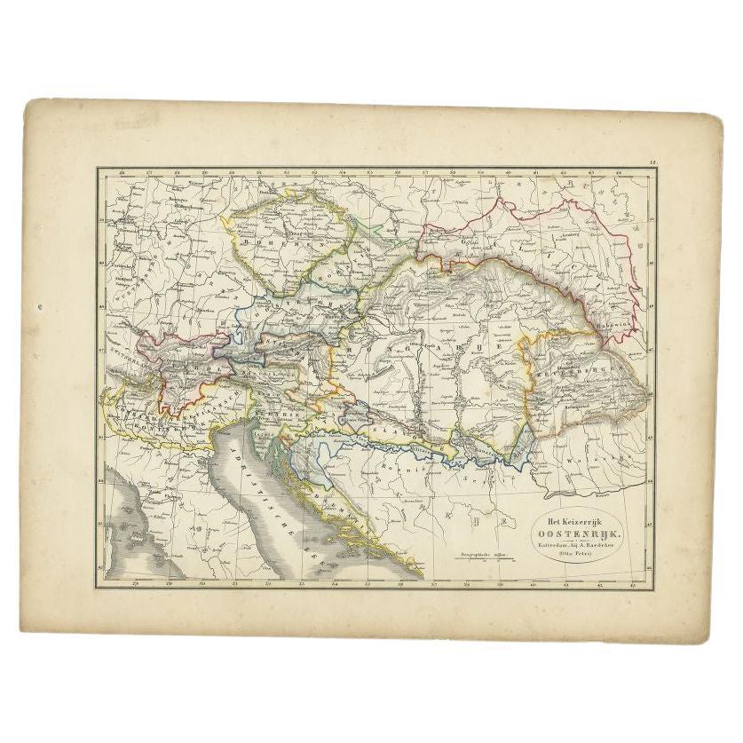
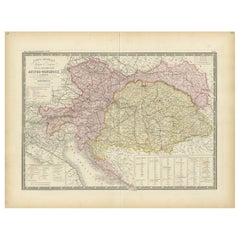
Antique Map of the Austrian Empire by Petri, c.1873
Located in Langweer, NL
Antique map titled 'Het Keizerrijk Oostenrijk'. Old map depicting the Austrian Empire. This map originates from 'School-Atlas van alle Deelen der Aarde'. Artists and Engravers: Publi...
Category
Antique 19th Century Maps
Materials
Paper
$88 Sale Price
20% Off
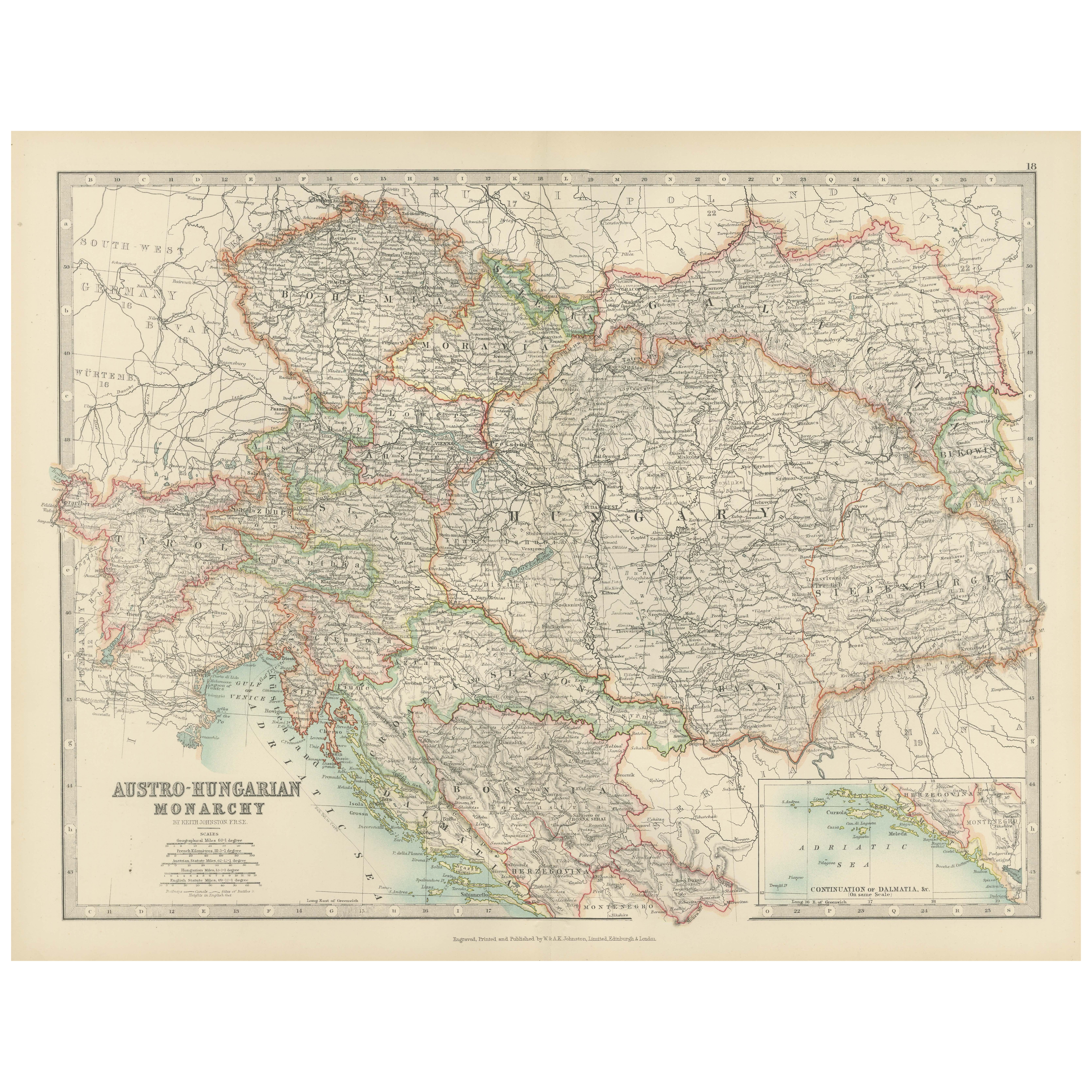
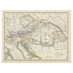
Antique Map of Austria-Hungary by Levasseur,
1875
Located in Langweer, NL
Antique map titled 'Carte générale de la Monarchie Austro-Hongroise (..)'. Large map of Austria-Hungary. This map originates from 'Atlas de Géographie M...
Category
Antique Late 19th Century Maps
Materials
Paper
$310 Sale Price
35% Off
Antique Map of the Austrian Empire by Petri, 1852
Located in Langweer, NL
Antique map titled 'Het Keizerrijk Oostenrijk'. Map of the Austrian Empire. This map originates from 'School-Atlas van alle deelen der Aarde' by Otto Petri....
Category
Antique 19th Century Maps
Materials
Paper

$114 Sale Price
20% Off
Antique Map of the Austro-Hungarian Monarchy, 1903, with Colorful Borderlines
Located in Langweer, NL
Title: Antique Map of the Austro-Hungarian Monarchy, 1903, with Colorful Provincial Borders
Description:
This antique map, titled "Austro-Hungarian Monarchy," was engraved and publi...
Category
Early 20th Century Maps
Materials
Paper
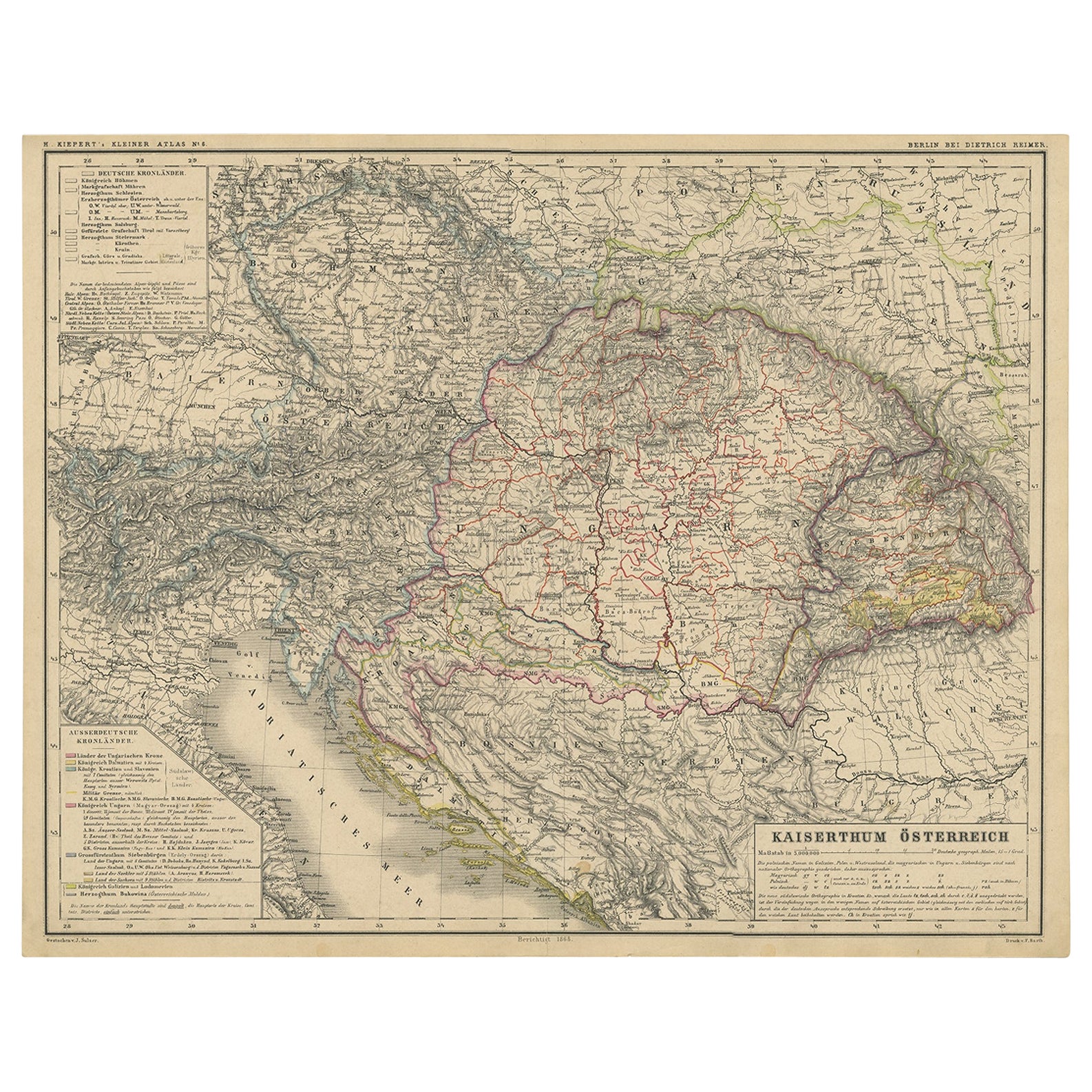
Old German Map of the Austrian Empire, ca.1870
Located in Langweer, NL
Antique map titled 'Kaiserthum Österreich'.
Old map of the Austrian Empire. This map originates from 'H. Kiepert's Kleiner Atlas der Neueren Geographie für Schule und Haus'.
Arti...
Category
Antique 1870s German Maps
Materials
Paper
$276 Sale Price
20% Off
You May Also Like
Austria-Hungary, Western Part. Century Atlas antique vintage map
Located in Melbourne, Victoria
'The Century Atlas. Austria-Hungary, Western Part'
Original antique map, 1903.
Central fold as issued. Map name and number printed on the reverse corners.
Sheet 40cm by 29.5cm.
Category
Early 20th Century Victorian More Prints
Materials
Lithograph

1849 Map of "Europaische Russland",
Meyer Map of European Russia
, Ric. R017
Located in Norton, MA
1849 Map of
"Europaische Russland"
( Meyer Map of European Russia)
Ric.r017
A lovely map of European Russia dating to 1849 by Joseph Meyer. It covers the European portions of...
Category
Antique 19th Century Unknown Maps
Materials
Paper

Russia in Europe with Poland and Finland. Century Atlas antique vintage map
Located in Melbourne, Victoria
'The Century Atlas. Russia in Europe with Poland and Finland'
Original antique map, 1903.
Central fold as issued. Map name and number printed on the reverse corners.
Sheet 40cm by ...
Category
Early 20th Century Victorian More Prints
Materials
Lithograph

German Empire, Southwestern Part. Century Atlas antique vintage map
Located in Melbourne, Victoria
'The Century Atlas. German Empire, Southwestern Part'
Original antique map, 1903.
Central fold as issued. Map name and number printed on the reverse co...
Category
Early 20th Century Victorian More Prints
Materials
Lithograph

1853 Map of "Russia in Europe Including Poland" Ric.r016
Located in Norton, MA
Description
Russia in Europe incl. Poland by J Wyld c.1853
Hand coloured steel engraving
Dimension: Paper: 25 cm W x 33 cm H ; Sight: 22 cm W x 28 cm H
Condition: Good ...
Category
Antique 19th Century Unknown Maps
Materials
Paper

German Empire, Northern Part. Century Atlas antique vintage map
Located in Melbourne, Victoria
'The Century Atlas. German Empire, Northern Part.'
Original antique map, 1903.
Central fold as issued. Map name and number printed on the reverse corne...
Category
Early 20th Century Victorian More Prints
Materials
Lithograph
