Items Similar to Authentic Antique Map of the Caribbean, Gulf Coast and Central America, 1787


Want more images or videos?
Request additional images or videos from the seller
1 of 10
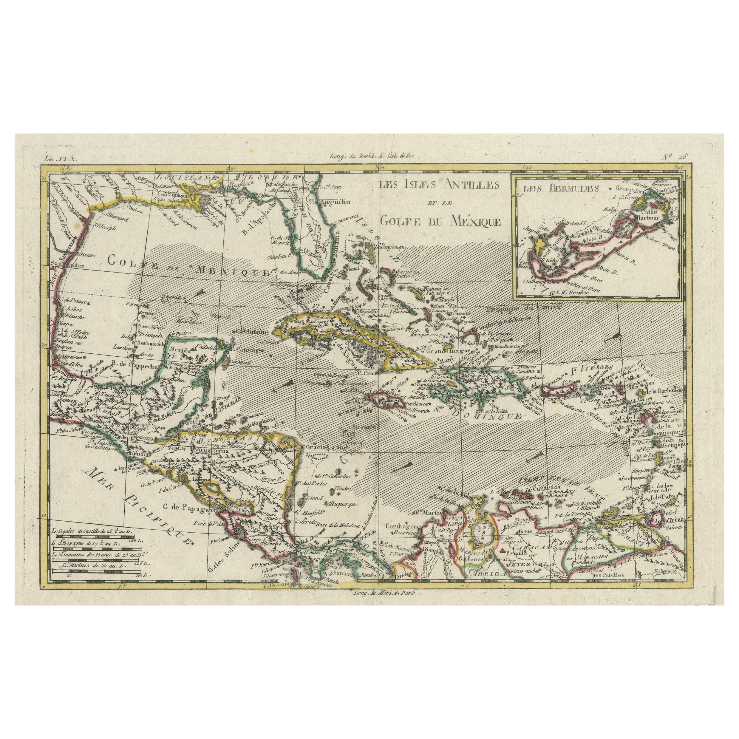
Authentic Antique Map of the Caribbean, Gulf Coast and Central America, 1787
$296.79
$370.9920% Off
£222.18
£277.7320% Off
€248
€31020% Off
CA$408.57
CA$510.7120% Off
A$446.65
A$558.3120% Off
CHF 236.30
CHF 295.3720% Off
MX$5,344.84
MX$6,681.0520% Off
NOK 3,006.53
NOK 3,758.1620% Off
SEK 2,752.17
SEK 3,440.2220% Off
DKK 1,889.45
DKK 2,361.8220% Off
About the Item
Antique map titled 'Les Isles Antilles et le Golfe du Méxique'. Original old map of the Caribbean, Gulf Coast and Central America. With inset map of Bermuda. Originates from 'Histoire Philosopgique et Politique des Establissements et du Commerce des Europeens (..)' by R. Bonne. Published 1787.
Rigobert Bonne (1727-1794) was an influential French cartographer of the late-eighteenth century. Born in the Lorraine region of France, Bonne came to Paris to study and practice cartography. He was a skilled cartographer and hydrographer and succeeded Jacques Nicolas Bellin as Royal Hydrographer at the Depot de la Marine in 1773. He published many charts for the Depot, including some of those for the Atlas Maritime of 1762. In addition to his work at the Depot, he is best known for his work on the maps of the Atlas Encyclopedique (1788) which he did with Nicholas Desmarest.
There are several aspects that make this antique map particularly special:
1. **Historical Significance**: The map originates from "Histoire Philosopgique et Politique des Establissements et du Commerce des Europeens" by R. Bonne, published in 1787. This means it is over two centuries old, providing a valuable glimpse into the geographical knowledge and understanding of the Caribbean, Gulf Coast, and Central America during the late 18th century.
2. **Cartographic Detail**: Rigobert Bonne was a skilled French cartographer known for his accuracy and attention to detail. His maps are renowned for their precision and clarity, making them not only aesthetically pleasing but also valuable historical documents.
3. **Scope and Coverage**: The map covers a wide geographic area, including the Caribbean islands, the Gulf Coast of North America, and parts of Central America. Such comprehensive coverage would have been particularly valuable to navigators, explorers, and traders of the time.
4. **Inset Map of Bermuda**: The inclusion of an inset map of Bermuda adds to the map's appeal and utility, providing additional detail for a specific region of interest.
5. **Association with R. Bonne**: Rigobert Bonne's contributions to cartography, including his role as Royal Hydrographer, and his collaborations with other notable cartographers like Nicolas Desmarest, add to the map's significance and collectability.
6. **Artistic and Aesthetic Value**: Beyond its practical utility, antique maps are often appreciated for their artistic qualities, including elaborate decorative elements, ornate cartouches, and vibrant coloration.
Overall, the combination of historical context, cartographic excellence, and the map's association with a renowned cartographer like R. Bonne contributes to its special status among collectors, historians, and enthusiasts of antique maps and cartography.
- Dimensions:Height: 10.52 in (26.7 cm)Width: 16.38 in (41.6 cm)Depth: 0.02 in (0.5 mm)
- Materials and Techniques:
- Period:
- Date of Manufacture:1787
- Condition:Age-related toning. Original folding line. Blank verso. Please study image carefully.
- Seller Location:Langweer, NL
- Reference Number:Seller: BG-13528-81stDibs: LU3054338411892
About the Seller
5.0
Recognized Seller
These prestigious sellers are industry leaders and represent the highest echelon for item quality and design.
Platinum Seller
Premium sellers with a 4.7+ rating and 24-hour response times
Established in 2009
1stDibs seller since 2017
2,792 sales on 1stDibs
Typical response time: <1 hour
- ShippingRetrieving quote...Shipping from: Langweer, Netherlands
- Return Policy
More From This Seller
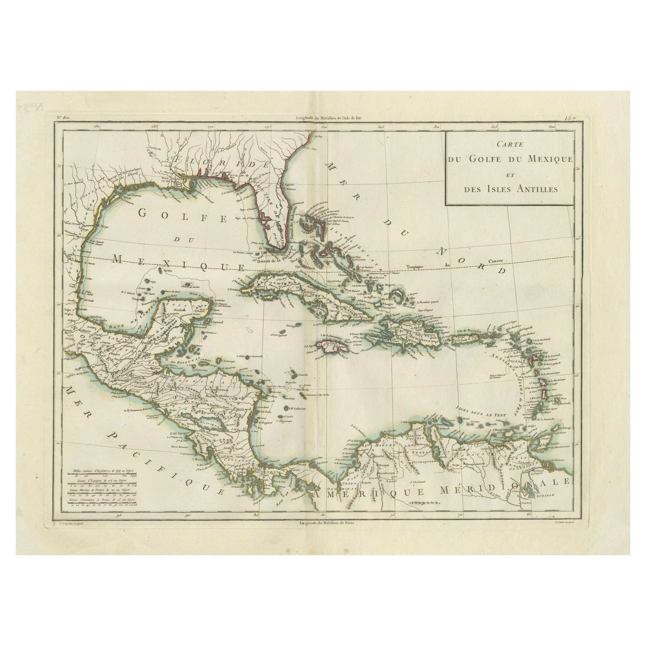
View AllAntique Map of the Gulf of Mexico and Caribbean Islands by Tardieu, 1802
Located in Langweer, NL
This is an original antique map titled "Carte du Golfe du Mexique et des Isles Antilles," depicting the Gulf of Mexico and the Caribbean islands. Created by Pierre Antoine Tardieu, t...
Category
Antique Early 1800s Maps
Materials
Paper
$536 Sale Price
20% Off
Engraving of a Map of Florida, the Gulf Coast, Caribbean
Central America, 1728
Located in Langweer, NL
This exceptional antique map, titled "Nouvelle Carte Marine de Toute les Cotes de l´Amerique" and alternatively known as "Nieuwe groote en seer Curieuse Paskaart van Geheel-WestIndie...
Category
Antique Mid-18th Century Dutch Maps
Materials
Paper

$12,565 Sale Price
30% Off
Free Shipping
Original Engraving of the West Indies, Gulf of Mexico, Antilles, Caribbean, 1780
Located in Langweer, NL
Rigobert Bonne and G. Raynal's 1780 map of the West Indies, Gulf of Mexico, Antilles, and the Caribbean stands as a remarkable cartographic piece, offering a detailed and expansive v...
Category
Antique Late 18th Century French Maps
Materials
Paper
$373 Sale Price
20% Off
Antique Map of South American, The West Indies
Most of Africa, Ca.1775
Located in Langweer, NL
Antique map titled 'Carte pour Servir a l' Histoire Philosophique et Politique des Etablissemens et du Commerce des Europeens dans les deux Indes'.
This map is roughly centered o...
Category
Antique 1770s Maps
Materials
Paper

$727 Sale Price
20% Off
Antique Map of the Antilles in the Caribbean,
1875
Located in Langweer, NL
Antique map titled 'Carte des Iles Antilles'. Large map of the Antilles. This map originates from 'Atlas de Géographie Moderne Physique et Politique' by A. Levasseur. Published, 1875.
Category
Antique Late 19th Century French Maps
Materials
Paper

$329 Sale Price
44% Off
Antique Map of South America by J. Cook, 1775
Located in Langweer, NL
Antique map titled 'Kaart van het Zuidlyk Eind van Amerika'. Map of the sourthern part of South America, focusing on Cook's tracks around the Cape Horn and T...
Category
Antique Mid-18th Century Maps
Materials
Paper

You May Also Like
Original Antique Map of Central America / Florida, Arrowsmith, 1820
Located in St Annes, Lancashire
Great map of Central America.
Drawn under the direction of Arrowsmith.
Copper-plate engraving.
Published by Longman, Hurst, Rees, Orme and Brown, 1820
Unframed.
Category
Antique 1820s English Maps
Materials
Paper

Map Of The Island Of Cuba - Guillaume Thomas Raynal (1711-1796)
Located in Porto, PT
This historical map of the Island of Cuba was produced in the late 18th century and is taken from an edition of “Atlas de toutes les parties connues du globe terrestre” by the French...
Category
Antique 18th Century Prints
Materials
Glass, Paper

Original Antique Map of South America. C.1780
Located in St Annes, Lancashire
Great map of South America
Copper-plate engraving
Published C.1780
Two small worm holes to left side of map
Unframed.
Category
Antique Early 1800s English Georgian Maps
Materials
Paper

Early 19th Century Hand Colored Map of the United States and Caribbean Islands
Located in Hamilton, Ontario
Hand coloured early 19th century map by Giraldon of France titled "Etats Unis et Grandes Antilles" (United States and Greater Antilles).
Category
Antique Early 19th Century French Maps
Materials
Paper

$595 Sale Price
40% Off
The Americas - Vintage Map - 18th century
Located in Roma, IT
The Americas is a very beautiful vintage map realized in the 18th century by an Italian cartographer.
Very good conditions, on the right side the inscript...
Category
18th Century Figurative Prints
Materials
Paper, Etching

1705 Golfe de Mexico and Florida Framed Map
Located in Stamford, CT
Framed map of Mexico & Florida circa 1705, Paris. Small map with Mexico and the Gulf Coast. Inset text indicating Panama, Acapulco, Mexico City and the Mississippi. Extends North to ...
Category
Antique Early 1700s French Spanish Colonial Maps
Materials
Glass, Wood, Paper

More Ways To Browse
18th Century American Antiques
Antique Plate Germany
Side Table Made In Denmark
England Antique Plates
19th Century Round Dining Table
Antique Thrones
Carved Chinese Tables
Italian Ceramic 1960s
Mid Century Modern Danish Teak Dining Tables
Rosenthal Century
Long Rug Runners
Pair Arm Chairs
Sterling Silver Dinner Sets
United Chair Company
British Antiques
Italian Beech Chairs
Shirvan Rugs
Spain Marble