Items Similar to Barbados Island at the Height of the Plantation Economy, Circa 1759
Want more images or videos?
Request additional images or videos from the seller
1 of 6
Barbados Island at the Height of the Plantation Economy, Circa 1759
$422.72
$528.3920% Off
£313.08
£391.3620% Off
€352
€44020% Off
CA$578.25
CA$722.8220% Off
A$629.32
A$786.6520% Off
CHF 333.60
CHF 41720% Off
MX$7,571.18
MX$9,463.9720% Off
NOK 4,231.13
NOK 5,288.9120% Off
SEK 3,871.19
SEK 4,838.9920% Off
DKK 2,682.30
DKK 3,352.8820% Off
About the Item
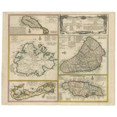
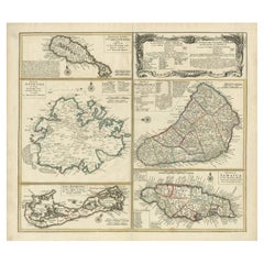
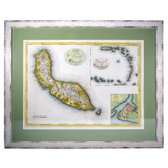
Carte de l'Isle de la Barbade by Jacques-Nicolas Bellin (1703–1772), Circa 1759
This rare antique map of Barbados, titled Carte de l'Isle de la Barbade, was created by the esteemed French cartographer Jacques-Nicolas Bellin around 1759. The map is a highly collectible piece from the 18th century, showcasing Barbados during the height of its plantation economy, when sugar production dominated the island.
Measuring 9.75 x 7.75 inches (24.765 x 19.685 cm), it provides detailed representations of Barbados' parishes, towns, roads, and coastline. Bellin’s maps are renowned for their precision and elegance, making this a valuable acquisition for collectors of antique maps and those interested in colonial history.
This map was published for the Histoire générale des voyages, a monumental work on exploration. Bellin, as Hydrographer to the King of France, is known for his nautical charts and colonial maps that capture the world during a transformative era in global trade and colonization.
This map of Barbados is especially relevant for collectors of Caribbean maps, plantation economy artifacts, and those interested in the history of slavery and British colonialism.
Similar editions of this Jacques-Nicolas Bellin map are found in prestigious collections such as the University of Michigan and the University of Florida, highlighting its scarcity and value. Don’t miss this opportunity to own a piece of 18th-century cartographic history.
The island is shown during a period when it was a major hub for sugar production, relying on enslaved laborers brought from Africa, and influenced by Dutch plantation managers. Longitude is measured in degrees from Paris, following the French cartographic standards of the time.
This map provides a fascinating snapshot of Barbados' role in the global economy of the 18th century and is a rare collectible, with similar editions held in the University of Michigan and University of Florida collections.
Condition: Very Good to Excellent, beautifully hand-colored, with slight edge wear typical of maps from this era.
- Dimensions:Height: 9.73 in (24.7 cm)Width: 7.25 in (18.4 cm)Depth: 0 in (0.02 mm)
- Materials and Techniques:Paper,Engraved
- Period:1750-1759
- Date of Manufacture:circa 1759
- Condition:Condition: Very Good to Excellent, beautifully hand-colored, with slight edge wear typical of maps from this era.
- Seller Location:Langweer, NL
- Reference Number:Seller: BG-13618-371stDibs: LU3054341466802
About the Seller
5.0
Recognized Seller
These prestigious sellers are industry leaders and represent the highest echelon for item quality and design.
Platinum Seller
Premium sellers with a 4.7+ rating and 24-hour response times
Established in 2009
1stDibs seller since 2017
2,816 sales on 1stDibs
Typical response time: 1 hour
- ShippingRetrieving quote...Shipping from: Langweer, Netherlands
- Return Policy
More From This Seller
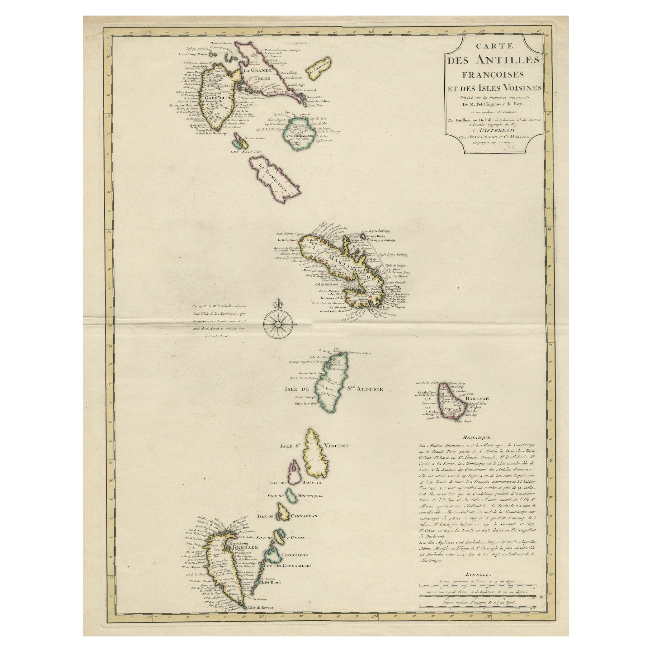
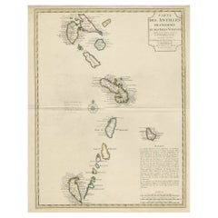
View AllDetailed Antique Map of the Windward Islands in the Caribbean
By Covens
Mortier
Located in Langweer, NL
Antique map titled 'Carte des Antilles Francoises et des Isles Voisines'. Original antique map of the French Antilles, covering an area stretching from Guadeloupe in the north to Gre...
Category
Antique Early 18th Century Maps
Materials
Paper
$903 Sale Price
20% Off
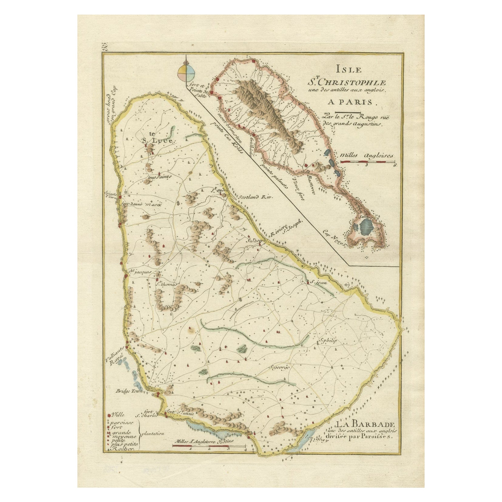
Barados and St Christopher or St Kitts and Nevis Islands in the Caribbean, 1748
Located in Langweer, NL
This original map, a copperplate engraving by Le Rouge, presents two significant areas in the Caribbean. Titled "Isle St. Christophle une des Antilles aux anglois" and "La Barbade. d...
Category
Antique Mid-18th Century Maps
Materials
Paper
$345 Sale Price
20% Off
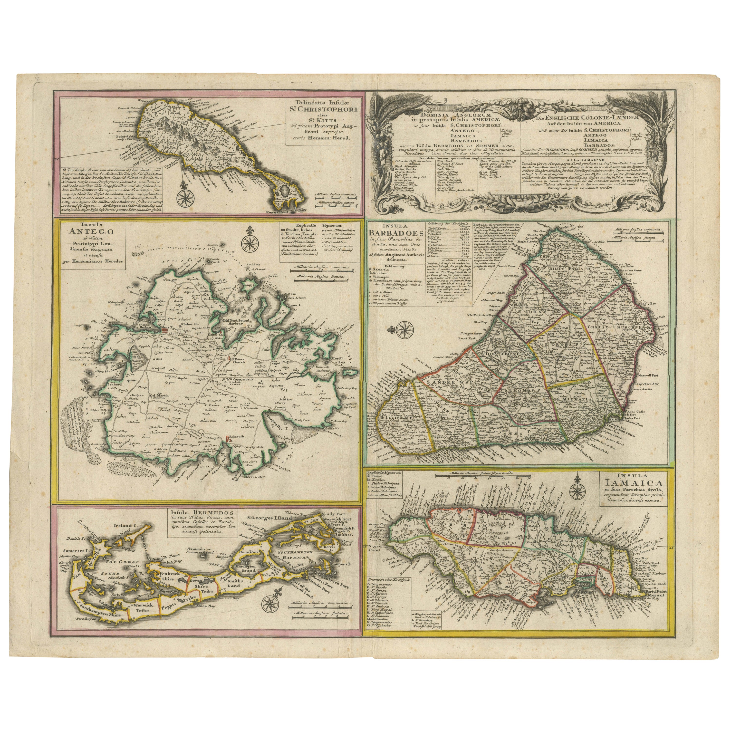
Old 18th Century Composite Map of Key Caribbean Islands with Descriptive Texts
Located in Langweer, NL
Antique map titled 'Dominia Anglorum in praecipuis Insulis Americae ut sunt Insula S. Christophori, Antegoa, Iamaica, Barbados nec non Insulae Bermudes vel Sommers dictae. Die Englis...
Category
Antique 1740s Maps
Materials
Paper
$749 Sale Price
20% Off
Free Shipping
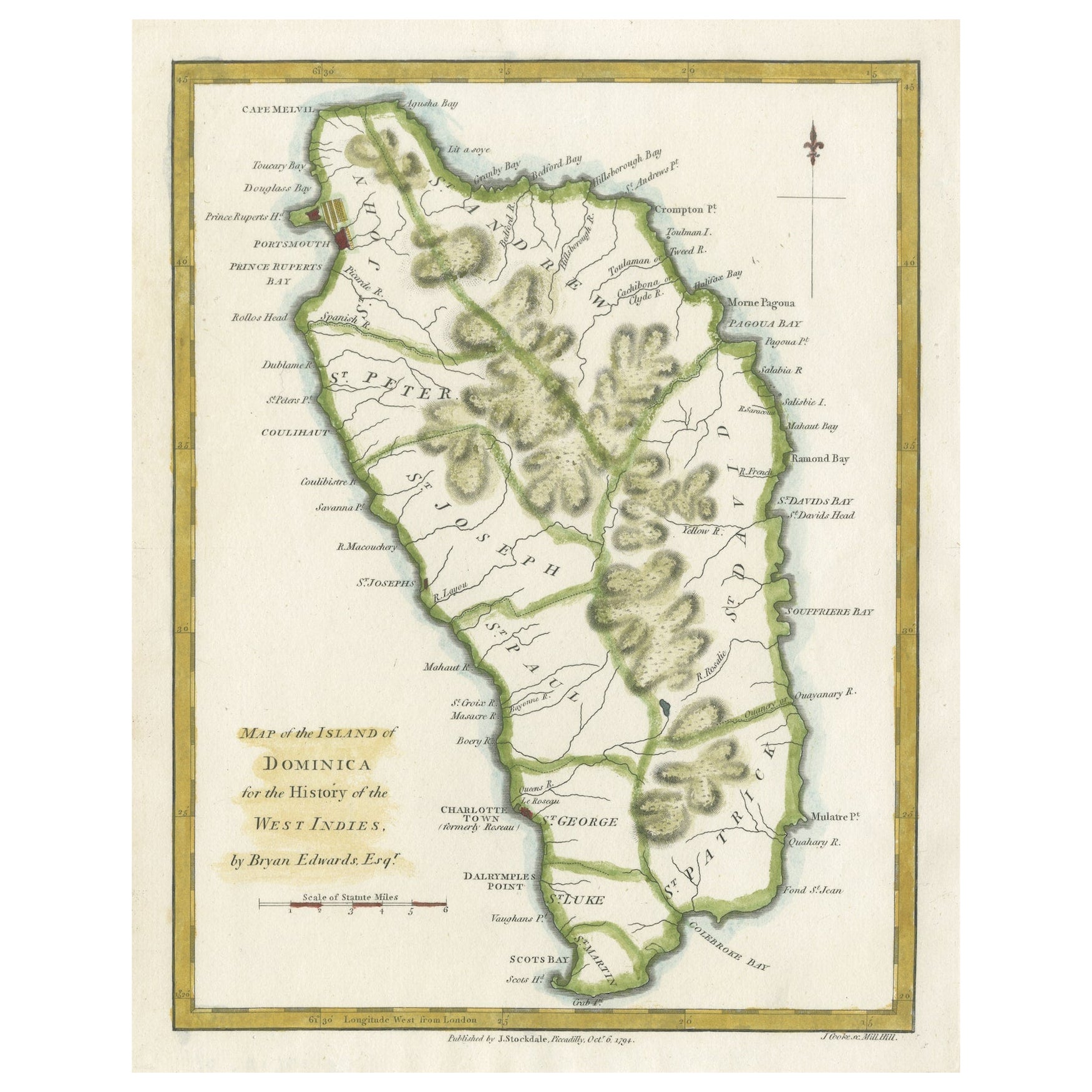
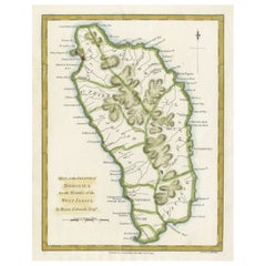
Original Antique Map of the Island of Dominica in the West Indies, 1794
Located in Langweer, NL
MAP OF THE ISLAND OF DOMINICA for the History of the West Indies, by Bryan Edwards. Esq.
Dominica, an island renowned for its lucrative exports of sugar, cocoa, and coffee, operated...
Category
Antique 1790s Maps
Materials
Paper
$230 Sale Price
20% Off
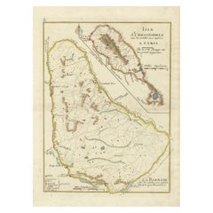
Antique Map of the Caribbean Island of St Kitts, ca.1750
Located in Langweer, NL
Description: Antique map titled 'Carte de l'Isle St. Christophe pour Servir a l'Histoire Genle. des Voyages.'
Detailed map of the Island of St. Kitts, showing the Parishes, towns, ...
Category
Antique 1750s Maps
Materials
Paper
Original Old Map of St Kitts, Antigua, Bermuda, Barbados, and Jamaica, ca.1745
Located in Langweer, NL
Antique map titled 'Dominia Anglorum in praecipuis Insulis Americae ut sunt Insula S. Christophori, Antegoa, Iamaica, Barbados nec non Insulae Bermudes vel Sommers dictae. Die Englis...
Category
Antique 1740s Maps
Materials
Paper
You May Also Like
St. Christophe
St. Kitts
Island: An 18th Century Hand-colored Map by Bellin
By Jacques-Nicolas Bellin
Located in Alamo, CA
Jacques Bellin's copper-plate map of the Caribbean island of Saint Kitts entitled "Carte De De l'Isle St. Christophe Pour servir á l'Histoire Genle. des V...
Category
Antique Mid-18th Century French Maps
Materials
Paper

$460 Sale Price
20% Off
Curaçao map - C. van Baarsel en zoon
Located in UTRECHT, UT
“Kaart van het eiland Curaçao.”, “Algemeene kaart der Caraïbische eilanden”, “Plan van het fort Amsterdam op Curaçao” from the atlas “Atlas der overzeesche bezittingen van Zijne Maje...
Category
Antique 1810s Dutch Other Maps
Materials
Paper
Captain Cook
s Exploration of Tahiti 18th C. Hand-Colored Map by Bellin
By Jacques-Nicolas Bellin
Located in Alamo, CA
This beautiful 18th century hand-colored copper plate engraved map is entitled "Carte de l'Isle de Taiti, par le Lieutenant J. Cook" was created by Jacques Nicolas Bellin and publish...
Category
Antique Mid-18th Century French Maps
Materials
Paper

$620 Sale Price
20% Off
Map Colonies Francaises Martinique, 1845
Located in BUNGAY, SUFFOLK
Colonies Francaises, Martinique, Amerique DU SUD
Geographie et Statistique par V.Levasseur. Ing'r Geographe.
Illustre par Raymond Bonheur, peintre.
Grave par Laguihermie, Rue St...
Category
Antique 19th Century French Maps
Materials
Paper

Map Of The Island Of Cuba - Guillaume Thomas Raynal (1711-1796)
Located in Porto, PT
This historical map of the Island of Cuba was produced in the late 18th century and is taken from an edition of “Atlas de toutes les parties connues du globe terrestre” by the French...
Category
Antique 18th Century Prints
Materials
Glass, Paper

West Coast of Africa, Guinea
Sierra Leone: An 18th Century Map by Bellin
By Jacques-Nicolas Bellin
Located in Alamo, CA
Jacques Bellin's copper-plate map entitled "Partie de la Coste de Guinee Dupuis la Riviere de Sierra Leona Jusquau Cap das Palmas", depicting the coast of Guinea and Sierra Leone in ...
Category
Antique Mid-18th Century French Maps
Materials
Paper

$460 Sale Price
20% Off
More Ways To Browse
Plantation Furniture
18th Century Engravings
Antique Carved Wood Chair
Black Scandinavian Modern Dining Chairs
Dutch Mid Century Modern Table
Gold Modern Coffee Table
Iconic Modern Furniture
Midcentury Modern Gray Glass Vase
Round Glass Coffee Tables
Vintage Cave
18th Century Wood Side Tables
Antique Hand Carved Dining Room Sets
Mid Century Modern Pitcher
Vintage Italian Leather Dining Chair
Vintage Movie Posters
Blue Green Wool And Silk Rug
Brown Sheepskin Chair
Vintage Brass Bar Carts