1 of 2
Bellin
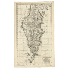
s Rare Map of Australia, 1753
Price:$2,800
About the Item
- Dimensions:Height: 8.08 in (20.5 cm)Width: 10.83 in (27.5 cm)Depth: 1.19 in (3 cm)
- Place of Origin:
- Period:
- Date of Manufacture:1753
- Condition:
- Seller Location:Malvern, AU
- Reference Number:Seller: CDS7501stDibs: LU126122238372
Authenticity Guarantee
In the unlikely event there’s an issue with an item’s authenticity, contact us within 1 year for a full refund. DetailsMoney-Back Guarantee
If your item is not as described, is damaged in transit, or does not arrive, contact us within 7 days for a full refund. Details24-Hour Cancellation
You have a 24-hour grace period in which to reconsider your purchase, with no questions asked.Vetted Professional Sellers
Our world-class sellers must adhere to strict standards for service and quality, maintaining the integrity of our listings.Price-Match Guarantee
If you find that a seller listed the same item for a lower price elsewhere, we’ll match it.Trusted Global Delivery
Our best-in-class carrier network provides specialized shipping options worldwide, including custom delivery.You May Also Like
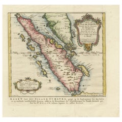
Rare 1770 Bellin Map of Sumatra with Stunning Decorative Cartouches
Located in Langweer, NL
Title: 1750 Bellin Map of Sumatra with Decorative Cartouches
This exquisite 18th-century map of Sumatra, drawn by Jacques-Nicolas Bellin around 1750, is a testament to the artistr...
Category
Antique 1770s Maps
Materials
Paper
$657
H 13.08 in W 13.59 in D 0.01 in
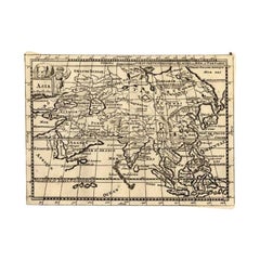
Rare Antique Map of Asia with Cartouche Depicting an Elephant, 1753
Located in Langweer, NL
Antique map titled 'Asia.' Original antique map of Asia. With a small cartouche depicting an elephant. Map by Daniel de la Feuille. This very rare old antique copperplate engraved pr...
Category
Antique 18th Century Maps
Materials
Paper
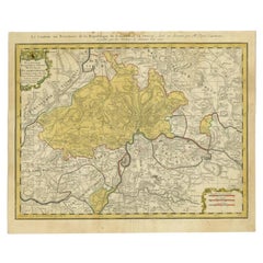
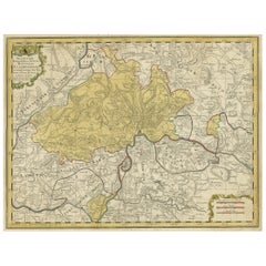
Antique Map of Switzerland by Homann, 1753
Located in Langweer, NL
Antique map Switzerland titled 'Territorium Reipublicae liberae Helveticae Scaphusiensis (..)'. Regional map of Switzerland. Artists and Engrav...
Category
Antique 18th Century Maps
Materials
Paper
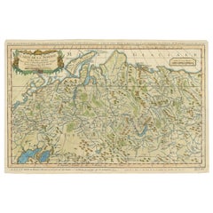
Antique Map of Siberia by Bellin, 1754
Located in Langweer, NL
Antique map titled 'Carte de la Siberie'. Detailed map of Siberia, extending from the White Sea and the Caspian Sea in the west to Irkuckoi Province, Jakutky on the Lena River and regions just to the east. Centered on the Jenisi River. Originates from Prévost's 'Histoire Générale des Voyages'. Artists and Engravers: Jacques-Nicolas Bellin (1703-1772) was among the most important mapmakers of the eighteenth century. In 1721, at age 18, he was appointed hydrographer (chief cartographer) to the French Navy. In August 1741, he became the first Ingénieur de la Marine of the Depot des cartes...
Category
Antique 18th Century Maps
Materials
Paper
Antique Map of Sumatra by Bellin, 1764
Located in Langweer, NL
Antique map Sumatra titled 'Carte de l'Isle de Sumatra'. Old map of Sumatra, Malaysia and the Straits of Malacca, including Singapore. This map originates ...
Category
Antique 18th Century Maps
Materials
Paper

Antique Map of Kamchatka by Bellin,
1757
By Jacques-Nicolas Bellin
Located in Langweer, NL
Antique map titled 'Carte du Kamtchatka'. Antique map of the Kamchatka Peninsula. The map includes the island of Ouiakous Atch ou Anfinogen, Schoumctchou, and Sirinki ou Dilkon. Orig...
Category
Antique Mid-18th Century Maps
Materials
Paper
Antique Map of Japan by J.N. Bellin, 1752
Located in Langweer, NL
Bellin's wonderfully detailed map of Japan from the atlas of Prevost d'Exiles' influential collection of travel narratives, Histoire Generale des Voyages. Considered the best general...
Category
Antique Mid-18th Century Maps
Materials
Paper

Antique Map of Eastern Siberia by Bellin
1768
Located in Langweer, NL
Antique map titled 'Suite de la Carte de la Siberie et le Pays de Kamtchatka'. Original antique map of the eastern portion of Siberia, centered on eastern Russia and the Mer d'Ochozk (Sea of Okhotsk) showing the Kamchatka Peninsula and I. de Beringe and I. Sagalin. The map shows the tracks of Russian ships...
Category
Antique Mid-18th Century Maps
Materials
Paper

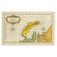
Antique Map of Novaya Zemlya by Bellin, 1758
Located in Langweer, NL
Antique map titled 'Partie de la Mer Glaciale Contenant la Nouvelle Zemle et le Pais des Samoiedes'. This map features Novaya Zemlya, the island off northern Russia in the Barents Se...
Category
Antique 18th Century Maps
Materials
Paper
Original Hand-Colored Antique Regional Map of Switzerland, 1753
Located in Langweer, NL
Antique map Switzerland titled 'Territorium Reipublicae liberae Helveticae Scaphusiensis (..)'. Regional map of Switzerland.
Artists and En...
Category
Antique 1750s Maps
Materials
Paper
$564 Sale Price
20% Off
H 19.3 in W 23.43 in D 0 in