Items Similar to China, Korea
Japan – Antique East Asia Map, Bonne c1780


Want more images or videos?
Request additional images or videos from the seller
1 of 10
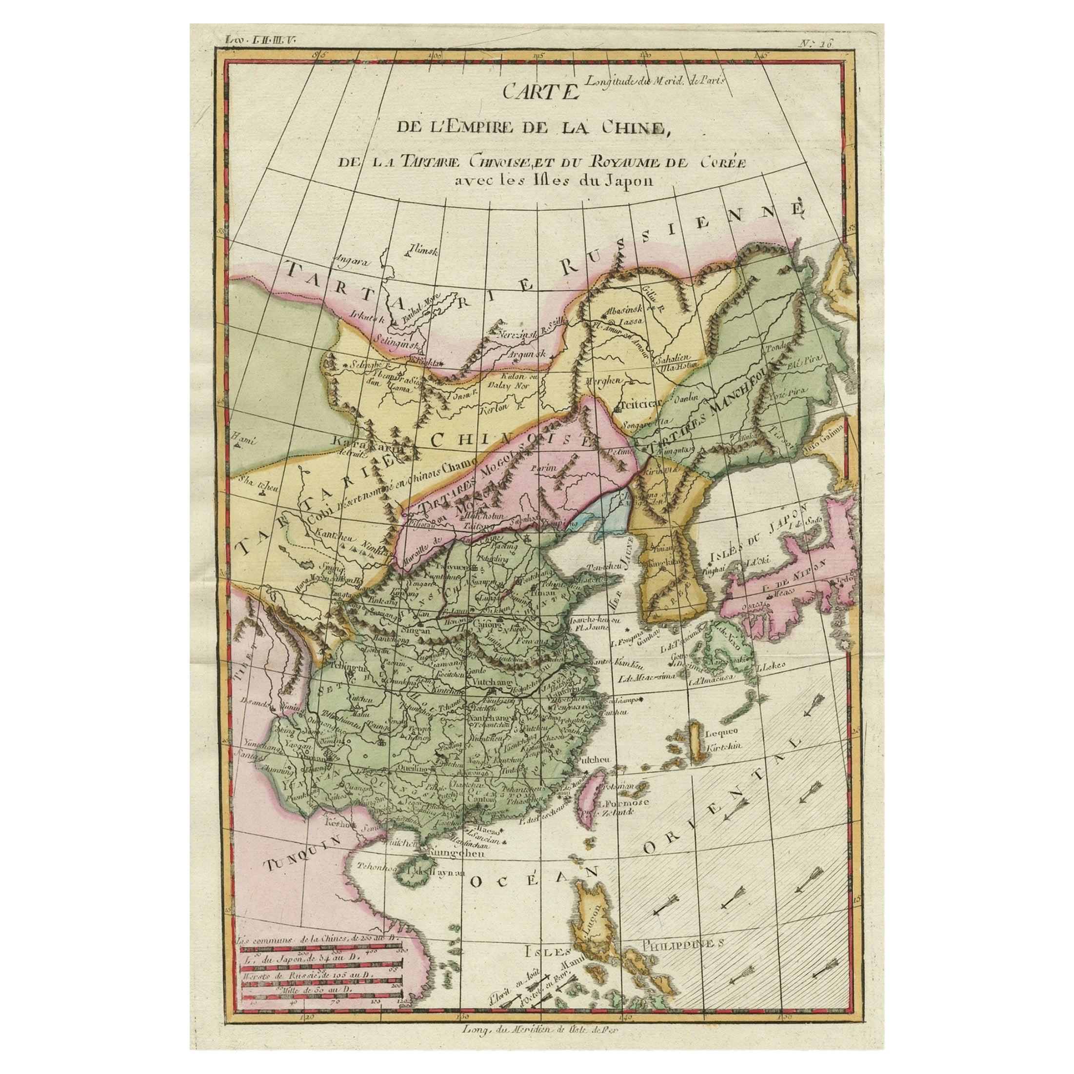
China, Korea
Japan – Antique East Asia Map, Bonne c1780
$403.43
£301.18
€340
CA$560.49
A$602.88
CHF 322.20
MX$7,106.26
NOK 4,062.16
SEK 3,713.58
DKK 2,591.18
About the Item
China, Korea
Japan – Antique East Asia Map, Bonne c1780
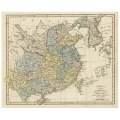
Description: This map presents China, Korea, and Japan, including Tartary and surrounding seas. Rivers, mountain ranges, and provincial divisions are carefully delineated, reflecting European geographic knowledge of East Asia in the late 18th century. Rigobert Bonne’s engraving is dense yet readable, offering insight into political and cultural boundaries as understood at the time. A fine example of Enlightenment-era Asian cartography.
Condition: Good condition with light toning, original fold, minor edge wear.
Framing tips: A slim black frame with a pale mat emphasizes the vertical composition.
Keywords: China map, Japan map, Korea map, East Asia cartography, antique Asian map, Rigobert Bonne, 18th century geography
Technique: Copper engraving
Maker: Rigobert Bonne, France, circa 1780
- Dimensions:Height: 16.15 in (41 cm)Width: 10.24 in (26 cm)Depth: 0.01 in (0.2 mm)
- Materials and Techniques:Paper,Engraved
- Place of Origin:
- Period:
- Date of Manufacture:Circa 1780
- Condition:Good condition with light toning, original fold, minor edge wear. The map is offered unframed, preserving the sheet in its original, untouched state.
- Seller Location:Langweer, NL
- Reference Number:Seller: BG-14105-161stDibs: LU3054348264402
About the Seller
5.0
Recognized Seller
These prestigious sellers are industry leaders and represent the highest echelon for item quality and design.
Platinum Seller
Premium sellers with a 4.7+ rating and 24-hour response times
Established in 2009
1stDibs seller since 2017
2,836 sales on 1stDibs
Typical response time: 1 hour
- ShippingRetrieving quote...Shipping from: Langweer, Netherlands
- Return Policy
More From This Seller
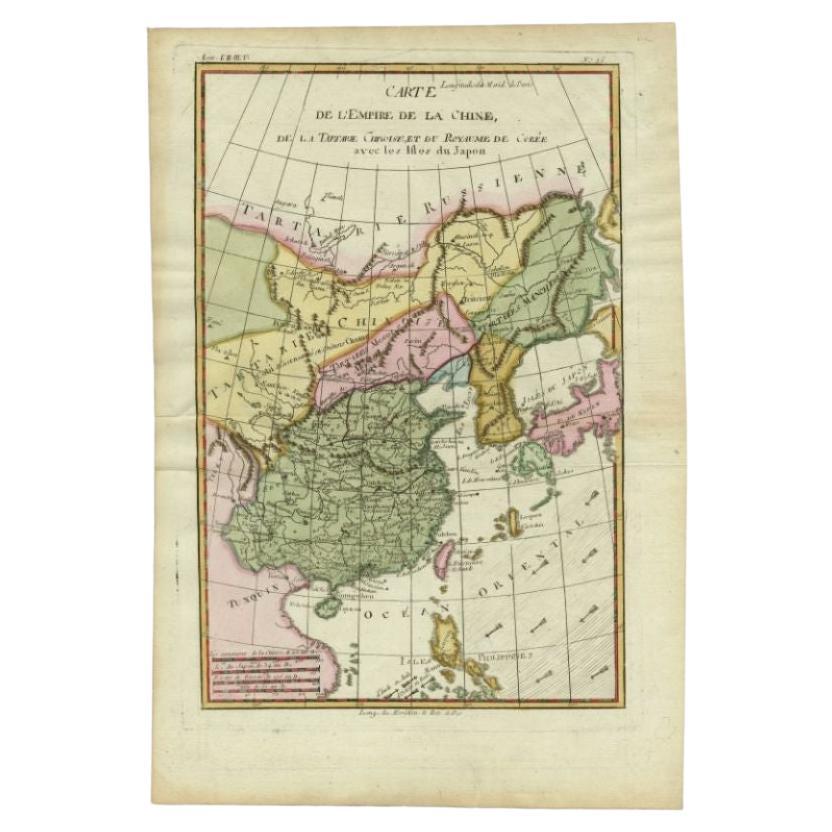
View AllAntique Map of China, Korea, Japan and the Northern Philippines, circa 1780
Located in Langweer, NL
Antique map titled 'Carte de l'Empire de la Chine de la Tartarie Chinoise, et du Royaume de Corée'. Interesting and detailed map of China, Korea, Japan and the Northern Philippines. ...
Category
Antique Late 18th Century European Maps
Materials
Paper

Decorative Map of the Empire of China, Korea, Japan, Taiwan, Lucon, Macau, 1780
Located in Langweer, NL
Antique map titled 'Carte de L'Empire de la Chine.'
Decorative map of the Empire of China, depicting China, Corea ( Korea ), Japan, Tonquin and the Philippine island Lucon. Source unknown, to be determined.
Artists and Engravers: Rigobert Bonne (1727-1795 ) was one of the most important cartographers of the late 18th century. In 1773 he succeeded Jacques Bellin as Royal Cartographer to France in the office of the Hydrographer at the Depôt de la Marine. Working in his official capacity Bonne compiled some of the most detailed and accurate maps of the period. Bonne's work represents an important step in the evolution of the cartographic ideology away from the decorative work of the 17th and early 18th century towards a more detail oriented and practical aesthetic. With regard to the rendering of terrain Bonne maps...
Category
Antique 1780s Maps
Materials
Paper
$617 Sale Price
20% Off
Antique Map of the Empire of China by Bonne, c.1780
By Rigobert Bonne
Located in Langweer, NL
Antique map titled 'Carte de L'Empire de la Chine.' Decorative map of the Empire of China, depicting China, Corea ( Korea ), Japan, Tonquin and the Philippine island Lucon. Source un...
Category
Antique 18th Century Maps
Materials
Paper

Antique Map of North and East Asia, 1751
Located in Langweer, NL
Map 2: 'Carte des parties nord et est de L'Asie'. (Map of the Northern parts and East Asia.) Five maps on one sheet, showing California, Alaska and Siberia, Korea and Japan. South to...
Category
Antique 18th Century French Maps
Materials
Paper

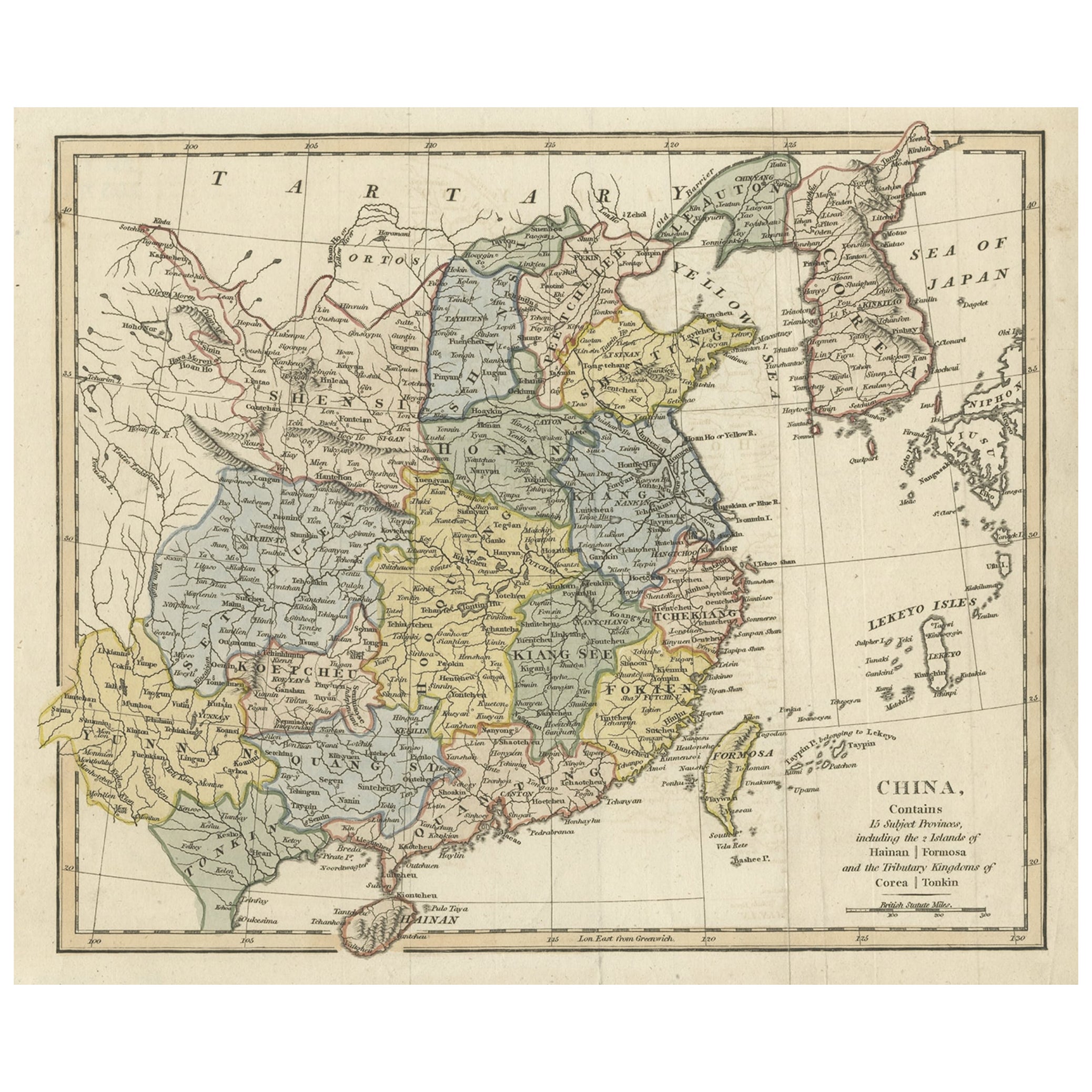
Original Old China Map, From Korea and the Sea of Japan to Teypin Island, 1803
Located in Langweer, NL
Antique map titled 'China, Contains 15 Subject Provinces Including the 2 Islands of Hainan, Formosa and the Tributary Kingdoms of Corea, Tonkin'.
Old map depicting China, extendi...
Category
Antique Early 1800s Maps
Materials
Paper
$522 Sale Price
20% Off
Antique Map of Asia by Guthrie, 1787
Located in Langweer, NL
Antique map titled 'Asia from the best Authorities'. Old map of the Asian continent. This map originates from 'A New Geographical, Historical and Commercial Grammar; and Present State of the several Kingdoms of the World' 10th ed. by W. Guthrie.
Artists and Engravers: Published by Ch.Dilly; GGJ...
Category
Antique 18th Century Maps
Materials
Paper

You May Also Like
Super Rare Antique French Map of Chine and the Chinese Empire, 1780
Located in Amsterdam, Noord Holland
Super Rare Antique French Map of Chine and the Chinese Empire, 1780
Very nice map of Asia. 1780 Made by Bonne.
Additional information:
Type: Map
...
Category
Antique 18th Century European Maps
Materials
Paper

$438 Sale Price
49% Off
Original Antique Map of China, Arrowsmith, 1820
Located in St Annes, Lancashire
Great map of China
Drawn under the direction of Arrowsmith
Copper-plate engraving
Published by Longman, Hurst, Rees, Orme and Brown, 1820
Unfr...
Category
Antique 1820s English Maps
Materials
Paper

Antique 1803 Italian Map of Asia Including China Indoneseia India
Located in Amsterdam, Noord Holland
Antique 1803 Italian Map of Asia Including China Indoneseia India
Very nice map of Asia. 1803.
Additional information:
Type: Map
Country of Manufacturing: Europe
Period: 19th centu...
Category
Antique 19th Century European Maps
Materials
Paper

$438 Sale Price
39% Off
Antique French Map of Asia Including China Indoneseia India, 1783
Located in Amsterdam, Noord Holland
Very nice map of Asia. 1783 Dedie au Roy.
Additional information:
Country of Manufacturing: Europe
Period: 18th century Qing (1661 - 1912)
Condition: Overall Condition B (Good Used)...
Category
Antique 18th Century European Maps
Materials
Paper

$486 Sale Price
40% Off
Original Antique Map of The Eastern Hemisphere by Dower, circa 1835
Located in St Annes, Lancashire
Nice map of the Eastern Hemisphere
Drawn and engraved by J.Dower
Published by Orr & Smith. C.1835
Unframed.
Free shipping
Category
Antique 1830s English Maps
Materials
Paper

China: An Original 18th Century Hand-colored Map by E. Bowen
Located in Alamo, CA
This is an original 18th century hand-colored map entitled "A New & Accurate Map of China, Drawn from Surveys made by the Jesuit Missionaries, by order of the Emperor. The whole bein...
Category
Mid-18th Century Old Masters Landscape Prints
Materials
Engraving
