Items Similar to Decorative Antique Celestial Map – Zodiac, Stars
Hemel Globe, 1720

Want more images or videos?
Request additional images or videos from the seller
1 of 10
Decorative Antique Celestial Map – Zodiac, Stars
Hemel Globe, 1720
$703.04
£523.66
€590
CA$968.14
A$1,053.80
CHF 558.37
MX$12,673.54
NOK 7,099.55
SEK 6,505.95
DKK 4,495.41
About the Item
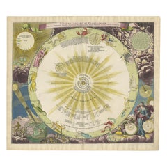
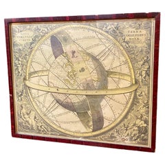
Antique Celestial Map – Hemel Globe, Zodiac
Constellations by Halma, 1720
This striking double-hemisphere celestial chart, titled Hemel Globe. Coeli enarrant gloriam Dei (The Heavens Declare the Glory of God), was published in Amsterdam by François Halma around 1720. It presents the night sky as a richly decorated star atlas, combining scientific observation with artistic embellishment.
The chart depicts the constellations of the northern and southern skies, illustrated with mythological figures, zodiac signs, and animals. Prominent constellations such as Orion, Ursa Major, Scorpius, Leo, Cancer, and Sagittarius appear in vivid detail, while surrounding allegorical vignettes of putti, clouds, and birds frame the composition. A decorative cartouche crowns the map with its Dutch title, and a Latin banner at the bottom recalls the biblical phrase from Psalm 19, “The heavens declare the glory of God.”
Halma’s celestial charts are celebrated for their artistry as well as their scientific interest, reflecting the 18th-century fascination with astronomy and the grandeur of the cosmos. The use of hand-coloring enhances the mythical and symbolic imagery, making the sheet as decorative as it is instructive.
Condition report: Good condition, with original hand-coloring, but note that the sheet laid is down on board mount. Some expected toning and signs of age.
Framing tips: Consider a broad ivory mat with a gilt or dark wood frame to emphasize the celestial imagery.
Technique: Hand-colored engraving
Maker: François Halma, Amsterdam, 1720
- Dimensions:Height: 7.09 in (18 cm)Width: 12.6 in (32 cm)Depth: 0.12 in (3 mm)
- Materials and Techniques:Paper,Engraved
- Place of Origin:
- Period:
- Date of Manufacture:circa 1720
- Condition:Condition report: Good condition, with original hand-coloring. Sheet laid down on board mount. Some expected toning and signs of age.
- Seller Location:Langweer, NL
- Reference Number:Seller: BG-140901stDibs: LU3054346568392
About the Seller
5.0
Recognized Seller
These prestigious sellers are industry leaders and represent the highest echelon for item quality and design.
Platinum Seller
Premium sellers with a 4.7+ rating and 24-hour response times
Established in 2009
1stDibs seller since 2017
2,824 sales on 1stDibs
Typical response time: 1 hour
- ShippingRetrieving quote...Shipping from: Langweer, Netherlands
- Return Policy
More From This Seller
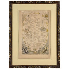
View AllSet of Two Hand-Colored Celestial Maps - Early 18th Century
Located in Langweer, NL
Set of two maps:
Number 1:
1711 Star Chart of the Southern Sky - "Mappa Stellarum Australium quae in Altitudine Poli Borei Graduum"
This beautiful star chart, engraved by Arnold van Westerhout in 1711, shows the stars visible in the southern sky, centered on the south equatorial pole. The chart includes numerous constellations, such as Argo Navis, Centaur, Lupus, Apus (bird of paradise), Apis (bee), Indus (Native Indian), and Pavo (peacock). The map is hand-colored, bringing life to these celestial figures and adding artistic charm.
The chart also provides details about the 'magnitude of the stars', represented in a table on the left side of the map, allowing viewers to understand the relative brightness of various stars. The artwork is finely detailed, with each constellation illustrated in a unique and imaginative style, typical of the celestial maps from this period.
The chart serves both as a scientific and decorative piece, illustrating the fascination of 18th-century astronomers with the stars of the Southern Hemisphere, which were less known to European audiences at the time.
"Mappa Stellarum Australium quae in altitudine poli Borei graduum 30 nunquam supra Horizontem ascendunt, ex recentibus observationibus confecta. Harum Stellarum Ascensiones Rectae ac Declinationes constructae sunt ad Annum Christi completum 1687."
Translation:
"Map of the Southern Stars which, at an altitude of 30 degrees north of the pole, never rise above the horizon, based on recent observations. The right ascensions and declinations of these stars have been constructed for the year of Christ 1687."
"Tab. V. to A. 1711, M. Sept. pag. 386."
"In this map's projection, the eye is positioned at the center of the world, turned towards the Antarctic pole; thus the stars of the southern regions appear as they do when seen from those areas."
Condition Report:
- Paper Quality: The paper has minor light soiling typical of its age. The original watermarks are still visible.
- Edges and Margins: The margins have been trimmed or chipped and professionally extended to accommodate framing. Some minor image loss at the edges and the neatline at the bottom has been replaced in facsimile.
- Print Quality: A dark and clear impression remains, with vibrant hand-coloring enhancing the constellations.
Summary Condition: Overall in very good condition with minor professional restoration, vibrant hand-coloring, and intact paper quality. The extended margins and restored neatline have been done to a high standard, making the piece suitable for framing and display.
Number 2:
Antique Celestial Map...
Category
Antique Early 18th Century Maps
Materials
Paper

1711 Star Chart of Southern Sky with Mythical Constellations and Exotic Animals
Located in Langweer, NL
1711 Star Chart of the Southern Sky - "Mappa Stellarum Australium quae in Altitudine Poli Borei Graduum"
This beautiful star chart, engraved by Arnold van Westerhout in 1711, shows ...
Category
Antique 1710s Belgian Maps
Materials
Paper
$1,611 Sale Price
20% Off
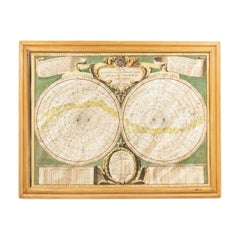
1730 Southern Hemisphere Celestial Chart with Zodiac Signs and Decorative Putti
Located in Langweer, NL
Title: 1730 Southern Hemisphere Celestial Chart with Zodiac Signs and Decorative Putti
Description: This stunning 1730 celestial map, "Hemisphaerium Coeli Australe," showcases the S...
Category
Antique 1730s Prints
Materials
Paper
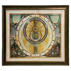
Baroque Solar System
Zodiac Map – Homann Doppelmayr, Hand Colored c.1742
Located in Langweer, NL
Baroque Solar System & Zodiac Map – Homann Doppelmayr, Hand Colored c.1742
This impressive celestial engraving depicts the Copernican heliocentric solar system and is titled “System...
Category
Antique Mid-18th Century German Maps
Materials
Paper
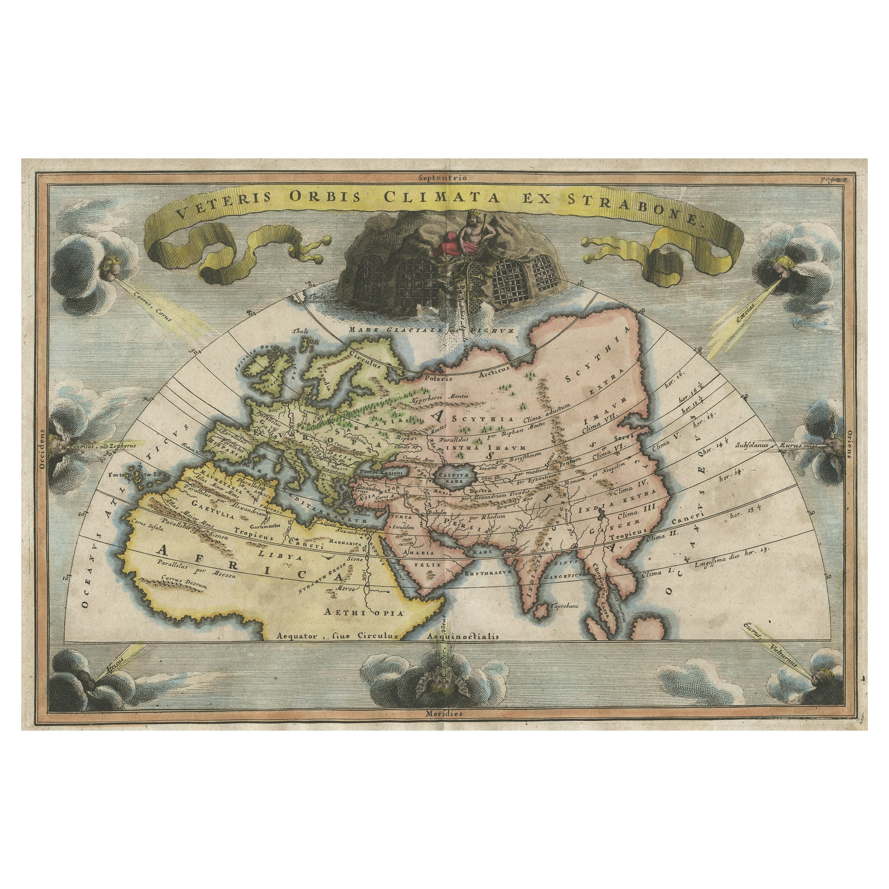
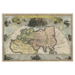
Veteris Orbis Climata – Ancient World Map after Strabo by Cellarius, 1731
Located in Langweer, NL
Veteris Orbis Climata – Ancient World Map after Strabo by Cellarius, 1731
This fascinating hand-colored antique map, titled Veteris Orbis Climata ex...
Category
Antique 1730s Maps
Materials
Paper
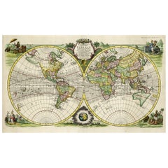
Rare Original Double Hemisphere World Map with Allegorical Figures, 1785
Located in Langweer, NL
Antique map titled 'Nieuwe en Naukeurige Kaart der Gantsche bekende Werreld.'
A double hemisphere world map. Four allegorical figures in the c...
Category
Antique 1780s Maps
Materials
Paper
$2,812 Sale Price
20% Off
You May Also Like
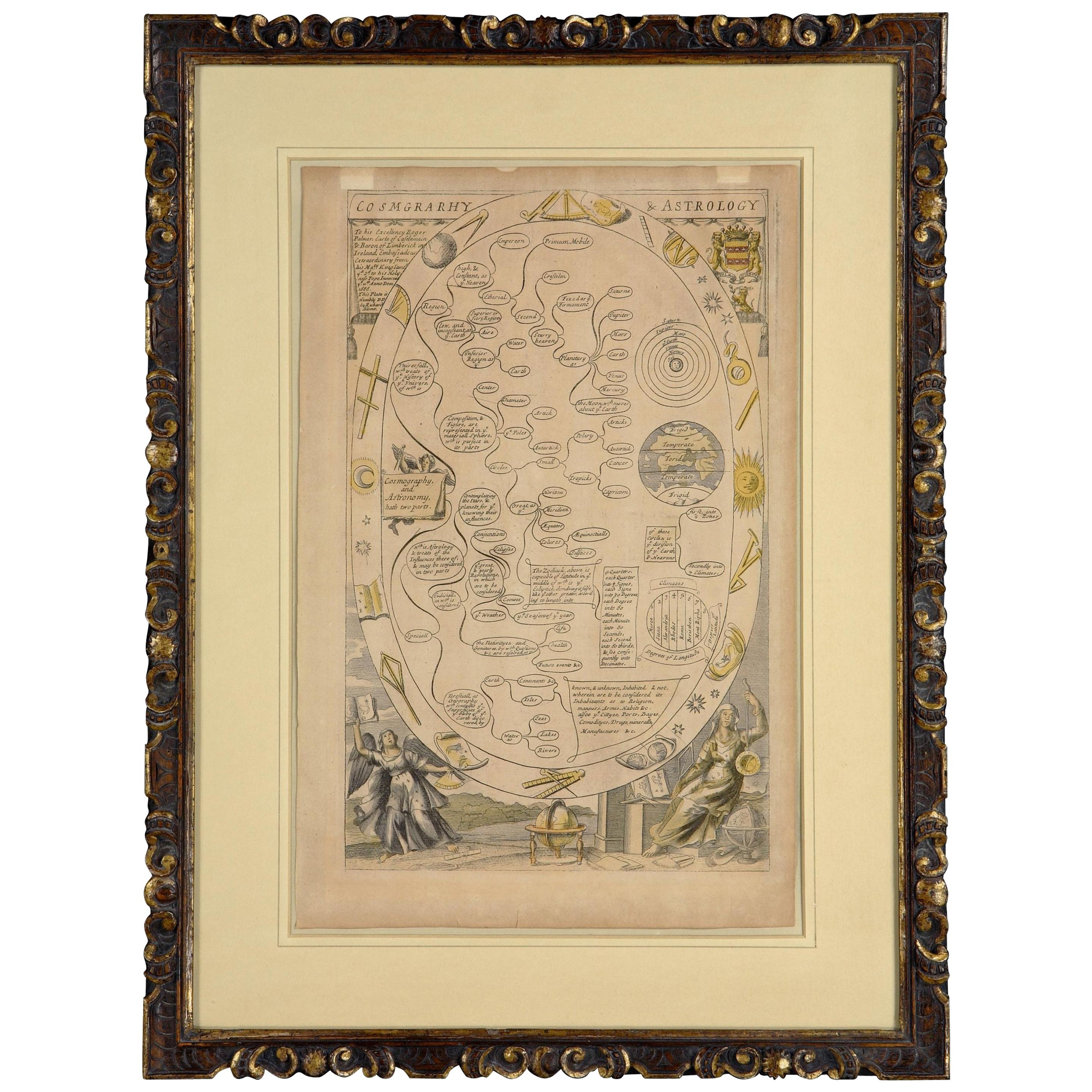
Cosmgraphy and Astrology, 1686 by Richard Blome from the First Edition
By Richard Blome
Located in BUNGAY, SUFFOLK
Cosmography & Astrology
Large oval engraved plate with inscriptions outlining the various parts of cosmography and astronomy; below, two emblematic figures with scientific instruments either side. Lettered with title, dedication, and various inscriptions. To his Excellency Roger Palmer, Earle of Castelmain and Baron of Limerick in Ireland, Embassador Extraordinary from his majesty King James II to his Holyness Pope Innocent 11th anno dom 1686. This plate is humbly DD by Richard Blome. On paper and retaining its original coloring.
Sheet width 26 ½ cm., 10 ½ in., height 41 ½ cm., 16 ½ in.,
In a part-gilded Sansovino frame...
Category
Antique 1680s English Charles II Decorative Art
Materials
Paper
Italian Renaissance Style Framed Print Of A Celestial Map "Tychonic Planisphere"
Located in Queens, NY
Italian Renaissance style framed print of a celestial map depicting the beliefs of the Earth is stationary at the center of the planetary system with the Sun and Moon revolving the E...
Category
20th Century Italian Renaissance Paintings
Materials
Brass
Italian Renaissance Celestial Map
Located in Queens, NY
Italian Renaissance style framed print of celestial map depicting stars and heavens (dated 1700 and inscribed Marco Bembo)
Category
Antique Early 18th Century Italian Renaissance Maps
Italian Renaissance Style Framed Print of Andreas Cellarius
Celestial Map, Titl
Located in Queens, NY
Italian Renaissance style framed print of a celestial map depicting how the Sun, Moon and other planets revolves around the Earth
Category
20th Century Italian Renaissance Paintings
Materials
Ceramic
Ancient engraving, map of the earth with circling zodiac
Located in Saint-Ouen, FR
Ancient engraving, map of the earth with circling zodiac "Situs Terrae Circulis Coelestibus Circumnate"
Category
Antique 18th Century European International Style Drawings
Materials
Paper
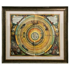
Theories of Planetary Orbits: A Framed 18th C. Celestial Map by Doppelmayr
By Johann Gabriel Doppelmayr 1
Located in Alamo, CA
This 18th century hand-colored copperplate celestial map by Johann Doppelmayr entitled "Astronomia Comparativa in qua Planetarum Primaria Phaenomena" (Co...
Category
Early 18th Century Landscape Prints
Materials
Engraving