Items Similar to Decorative Map of the Royal Württemberg District of Welzheim, Germany, ca.1880


Want more images or videos?
Request additional images or videos from the seller
1 of 6
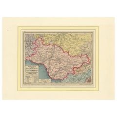
Decorative Map of the Royal Württemberg District of Welzheim, Germany, ca.1880
$336.25
£249.04
€280
CA$459.97
A$500.59
CHF 265.36
MX$6,022.53
NOK 3,365.67
SEK 3,079.35
DKK 2,133.65
About the Item
The Royal Württemberg District of Welzheim is located in Germany. Welzheim is a town in the state of Baden-Württemberg, which was historically part of the Kingdom of Württemberg. The map reflects the administrative and geographical boundaries of this region during the late 19th century, providing insights into its historical layout and surrounding areas.
Handkarte von dem Königl. Württ. Oberamt Welzheim, circa 1880, Farblitho
Description: This is a finely detailed hand-colored lithographic map of the Royal Württemberg District of Welzheim, created around 1880. The map was designed by G.W. Bauser, a teacher in Dürnau, and lithographed by L. Sautter, showcasing intricate topographic details and administrative boundaries in vibrant colors.
The map highlights various cities, towns, and natural features, including Welzheim itself, with its surrounding forests, hills, and rivers. Significant areas of interest include Schwäbisch Gmünd, Aalen, and Stuttgart's vicinity. Its precision and aesthetic qualities make it a fascinating representation of 19th-century cartography.
The condition appears excellent, with crisp outlines, bright coloration, and no visible damage. The map is mounted on a decorative mat, enhancing its presentation and preserving its integrity.
This map is a valuable artifact for collectors of historic cartography or those interested in Württemberg's regional history.
- Dimensions:Height: 13.67 in (34.7 cm)Width: 10.2 in (25.9 cm)Depth: 0.01 in (0.2 mm)
- Materials and Techniques:
- Period:
- Date of Manufacture:circa 1880
- Condition:The condition is excellent, with crisp outlines, bright coloration, and no damage. The map is mounted on a decorative mat, enhancing its presentation and preserving its integrity.
- Seller Location:Langweer, NL
- Reference Number:Seller: BG-13836-1141stDibs: LU3054342738392
About the Seller
5.0
Recognized Seller
These prestigious sellers are industry leaders and represent the highest echelon for item quality and design.
Platinum Seller
Premium sellers with a 4.7+ rating and 24-hour response times
Established in 2009
1stDibs seller since 2017
2,816 sales on 1stDibs
Typical response time: 1 hour
- ShippingRetrieving quote...Shipping from: Langweer, Netherlands
- Return Policy
More From This Seller
View AllMap of the Kingdom of Württemberg, Oberamt Tettnang in Germany, circa 1885
Located in Langweer, NL
Administrative Map of the Kingdom of Württemberg, Oberamt Tettnang, circa 1885
This detailed antique map titled "Handkarte von dem Königl. Württ. Oberamt Tettnang" was created by G....
Category
Antique 1880s Maps
Materials
Paper
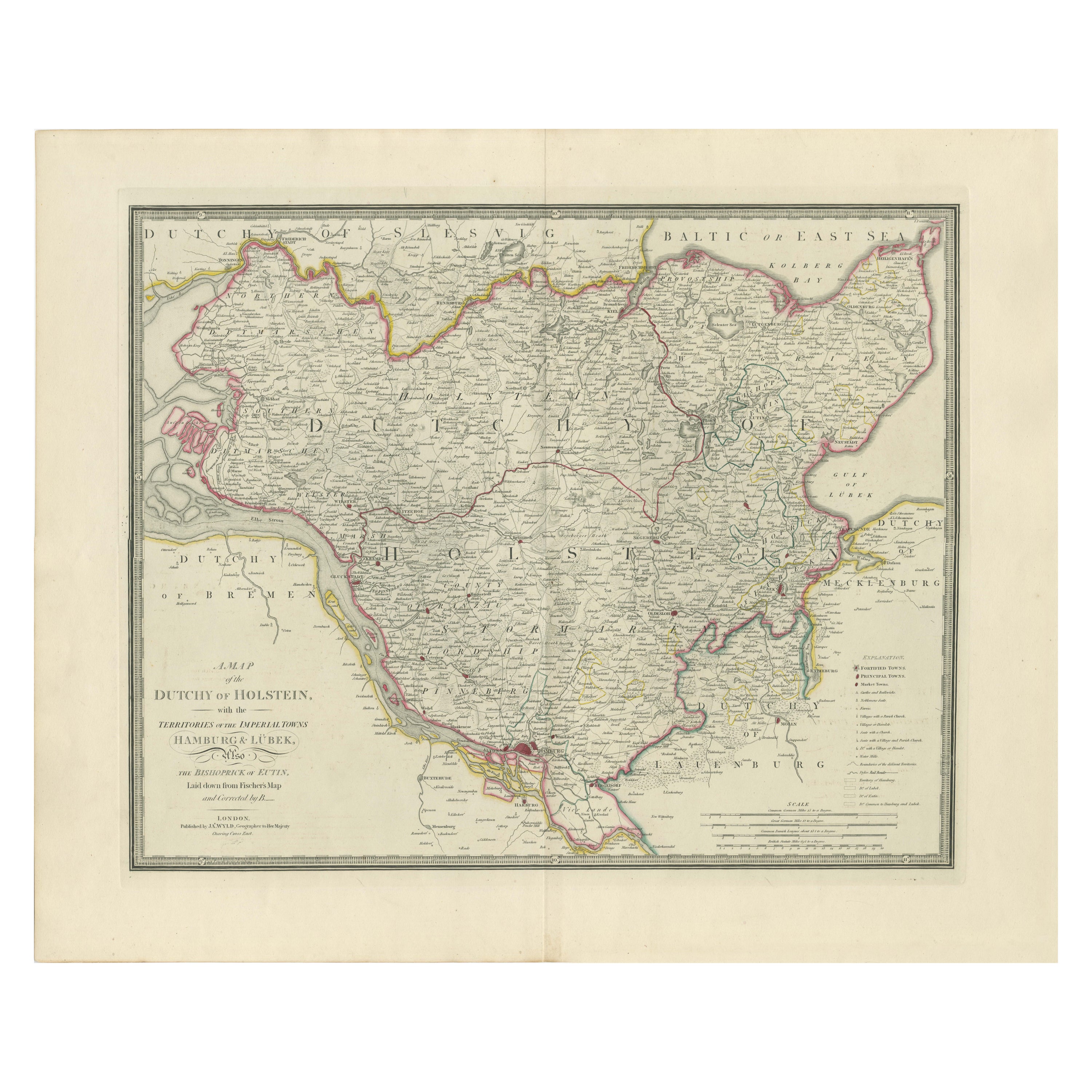
Map of the Dutchy of Holstein and the Territories of Hamburg
Lübek, 1875
Located in Langweer, NL
Title: Map of the Dutchy of Holstein and the Territories of Hamburg & Lübek by James Wyld, ca. 1875
Description: This is an antique map titled "A Map of the Dutchy of Holstein, with...
Category
Antique 1870s Maps
Materials
Paper

$903 Sale Price
20% Off
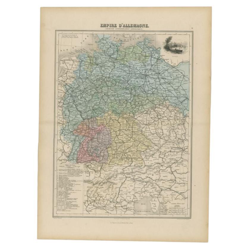
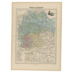
Antique Map of the German Empire by Migeon, 1880
Located in Langweer, NL
Antique map titled 'Empire d'Allemagne'. Old map of Germany. With decorative vignette of Mainz. This map originates from 'Géographie Universelle Atlas-Migeon' by J. Migeon.
Artist...
Category
Antique 19th Century Maps
Materials
Paper
Antique Map of Franconia, a region of Germany,
1811
By John Cary
Located in Langweer, NL
Antique map titled 'A New Map of the Circle of Franconia'. Detailed map of Franconia in Northwestern Germany. Covers from Upper Saxony south to Swabia, west to the Lower Rhine and we...
Category
Antique Early 19th Century Maps
Materials
Paper

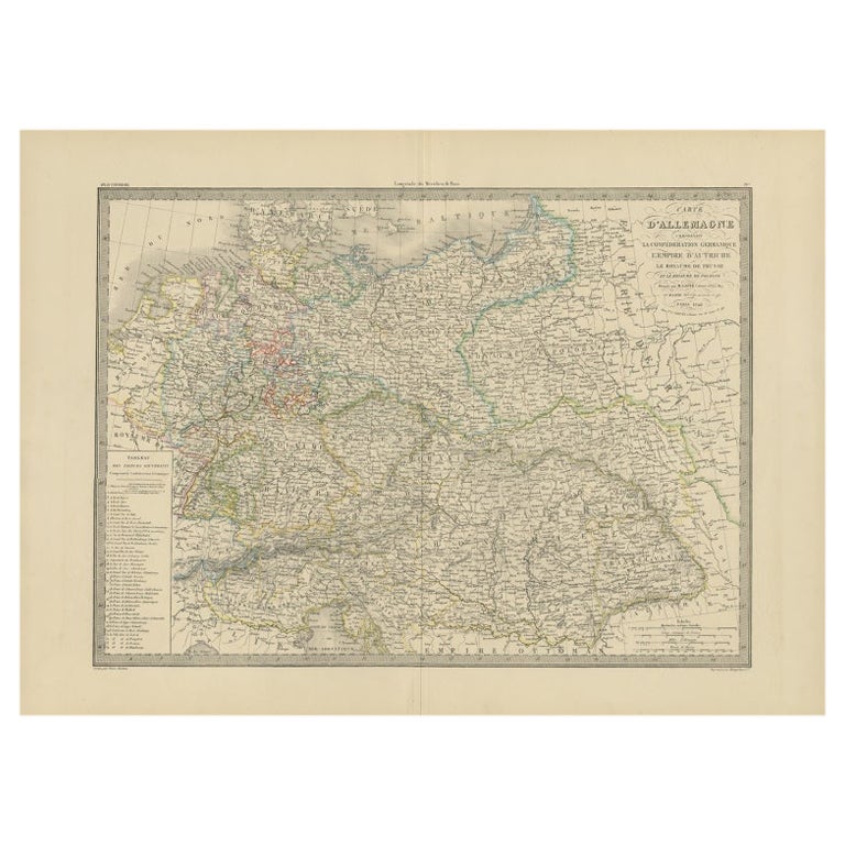
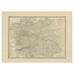
Antique Map of Germany by Pierre M. Lapie, Engraved, 1842, France
Located in Langweer, NL
Antique map titled 'Carte d'Allemagne (..)'. Map of Germany. This map originates from 'Atlas universel de géographie ancienne et moderne (..)' by Pierre M. Lapie and Alexandre E. Lap...
Category
Antique 19th Century French Maps
Materials
Paper
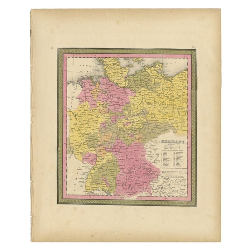
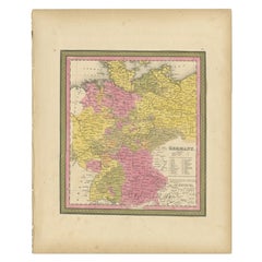
Antique Map of Germany from an American 19th Century Atlas, 1846
Located in Langweer, NL
Antique map titled 'Germany'. Old map of Germany. This map originates from 'A New Universal Atlas Containing Maps of the various Empires, Kingdoms, States and Republics Of The World ...
Category
Antique 19th Century Maps
Materials
Paper
You May Also Like
Original Antique English County Map, Nottinghamshire, J
C Walker, 1851
Located in St Annes, Lancashire
Great map of Nottinghamshire
Original colour
By J & C Walker
Published by Longman, Rees, Orme, Brown & Co. 1851
Unframed.
Category
Antique 1850s English Other Maps
Materials
Paper

1839 Map of Karte Des "Russischen Reiches in Europa Und Asien" Ric.R0013
Located in Norton, MA
1839 map of Karte Des
"Russischen Reiches in Europa and Asien"
Ric.r013
Map of the European and Asian parts of Russian Empire. Karte der Russischen Reiches in Europa und Asien...
Category
Antique 19th Century Unknown Maps
Materials
Paper

1853 Map of "Russia in Europe Including Poland" Ric.r016
Located in Norton, MA
Description
Russia in Europe incl. Poland by J Wyld c.1853
Hand coloured steel engraving
Dimension: Paper: 25 cm W x 33 cm H ; Sight: 22 cm W x 28 cm H
Condition: Good ...
Category
Antique 19th Century Unknown Maps
Materials
Paper

Original Antique English County Map, Buckinghamshire, J
C Walker, 1851
Located in St Annes, Lancashire
Great map of Buckinghamshire
Original colour
By J & C Walker
Published by Longman, Rees, Orme, Brown & Co. 1851
Unframed.
Category
Antique 1850s English Other Maps
Materials
Paper

Original Antique English County Map, Warwickshire, J
C Walker, 1851
Located in St Annes, Lancashire
Great map of Warwickshire
Original colour
By J & C Walker
Published by Longman, Rees, Orme, Brown & Co. 1851
Unframed.
Category
Antique 1850s English Other Maps
Materials
Paper

Original Antique English County Map, Derbyshire, J
C Walker, 1851
Located in St Annes, Lancashire
Great map of Derbyshire
Original colour
By J & C Walker
Published by Longman, Rees, Orme, Brown & Co. 1851
Unframed.
Category
Antique 1850s English Other Maps
Materials
Paper

More Ways To Browse
German Wurttemberg
Royal German
Blue Green Wool And Silk Rug
Brown Sheepskin Chair
Vintage Brass Bar Carts
Antique Botanical Prints
Green Persian Rug
50 X 50 Coffee Table
Milo Baughman 1970
Spanish Baroque Furniture
Stone China
Couch Console
Vintage Burn
Chinese Stone
Sterling Silver Flatware Service For 12
Antique Dining Tables With Leaves
Decorative Wall Panels
Frank Lloyd Wright For Cassina