Items Similar to Detailed 18th-Century Map of Paris and Its Surrounding Regions by Johann Homann


Want more images or videos?
Request additional images or videos from the seller
1 of 9
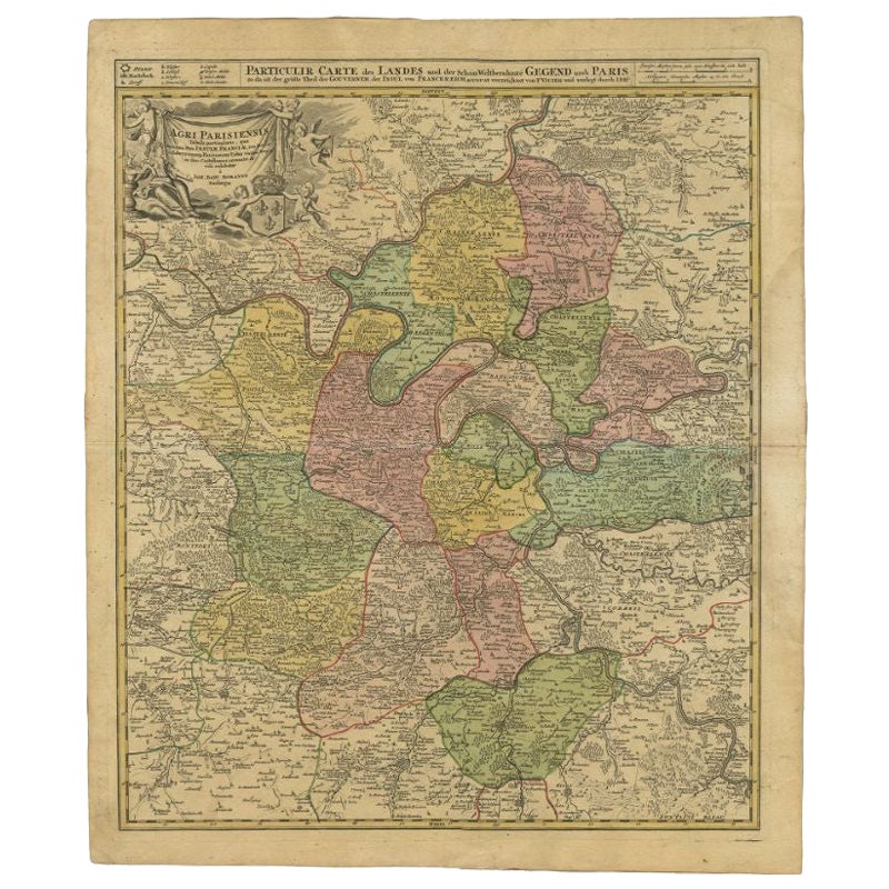
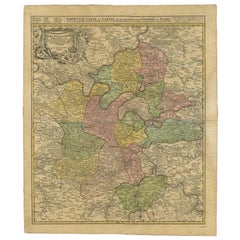
Detailed 18th-Century Map of Paris and Its Surrounding Regions by Johann Homann
$406.89
£304.60
€340
CA$560.14
A$612.34
CHF 323.95
MX$7,327.61
NOK 4,121.85
SEK 3,773.14
DKK 2,590.38
About the Item
This map, titled “Agri Parisiensis Tabula particularis,” was created and published by the German cartographer Johann Baptist Homann (1664–1724), or his workshop, in Nuremberg. Homann served as Imperial Geographer to the Holy Roman Emperor, and his firm was among the most prominent European map publishers of the early 18th century. This particular map focuses on the region around Paris, illustrating the territorial divisions and major localities of the Île-de-France and surrounding areas.
Dating likely falls in the early 18th century, around 1710–1720. The style—characterized by finely engraved details, hand-colored borders outlining various jurisdictions, and a decorative cartouche—matches Homann’s known production methods. After Homann’s death in 1724, his heirs continued the business, reissuing and revising many of his maps, so later 18th-century versions under the “Homann Heirs” imprint are also possible.
This map is interesting for several reasons. First, it provides a detailed glimpse into the historical geography of the Île-de-France region around Paris during the early 18th century, a time when territorial divisions and local borders were often quite different from those of today. Its finely engraved details and hand-colored outlines highlight the various administrative boundaries, roads, and settlements, allowing viewers to see how the landscape, infrastructure, and political divisions shaped the area’s identity. Additionally, the cartouche and other decorative elements reflect the artistic and cultural aesthetics of the period, offering insight into contemporary mapmaking techniques and stylistic preferences. In sum, it is both a valuable historical record and an attractive example of the craftsmanship and artistry that defined European cartography in the early 1700s.
- Dimensions:Height: 24.02 in (61 cm)Width: 20.48 in (52 cm)Depth: 0.01 in (0.2 mm)
- Materials and Techniques:Paper,Engraved
- Period:1720-1729
- Date of Manufacture:circa 1720
- Condition:The condition likely reflects its age, with gentle toning, slight foxing, mild edge wear and wrinkles. A few wormholes outside platemark. However, details remain legible, and the coloring and engraving are likely still relatively clear.
- Seller Location:Langweer, NL
- Reference Number:Seller: BG-13659-51stDibs: LU3054342814122
About the Seller
5.0
Recognized Seller
These prestigious sellers are industry leaders and represent the highest echelon for item quality and design.
Platinum Seller
Premium sellers with a 4.7+ rating and 24-hour response times
Established in 2009
1stDibs seller since 2017
2,793 sales on 1stDibs
Typical response time: <1 hour
- ShippingRetrieving quote...Shipping from: Langweer, Netherlands
- Return Policy
More From This Seller
View AllAntique Map of the Region of Paris by Homann Heirs, c.1720
By Homann Heirs
Located in Langweer, NL
Antique map titled 'Agri Parisiensis Tabula particularis, qua maxima Pars Insulae Franciae (..).' Incredibly detailed map showing everything from tiny villages to forests, farmland, ...
Category
Antique 18th Century Maps
Materials
Paper
Antique Map of the Lorraine
North-East France
by J. B. Homann, circa 1720
Located in Langweer, NL
Antique map of Lorraine in north-east France by J. B. Homann. Covering the area around Metz, Nancy and Sarrebruck with Luxembourg in the North and Mulhouse in Southeast. With a decor...
Category
Antique Early 18th Century Maps
Materials
Paper

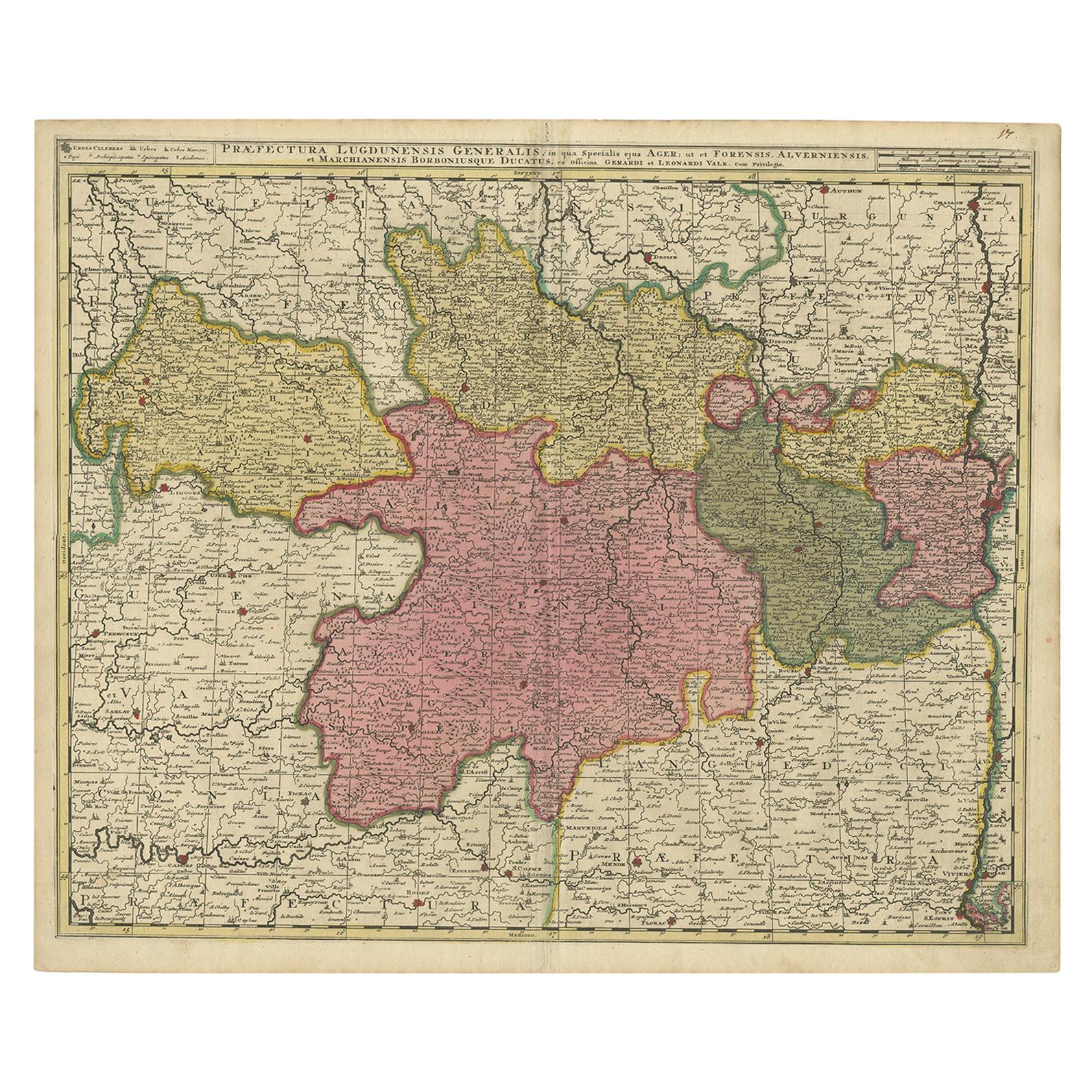
Antique Map of the Auvergne-Rhône-Alpes region of France by Valk, circa 1730
Located in Langweer, NL
Antique map titled 'Praefectura Lugdunensis Generalis'. Detailed map of the Auvergne-Rhône-Alpes region in the southeast of France. To the east the Rhône from Chalon-sur-Saône, Mâcon...
Category
Antique Mid-18th Century Maps
Materials
Paper
Antique Map of ancient France by Zannoni, 1765
Located in Langweer, NL
Antique map France titled 'Galliae Veteris (..)'. Beautiful old map of France. This map originates from 'Atlas Historique de la France Ancienne et Moderne' ...
Category
Antique 18th Century Maps
Materials
Paper

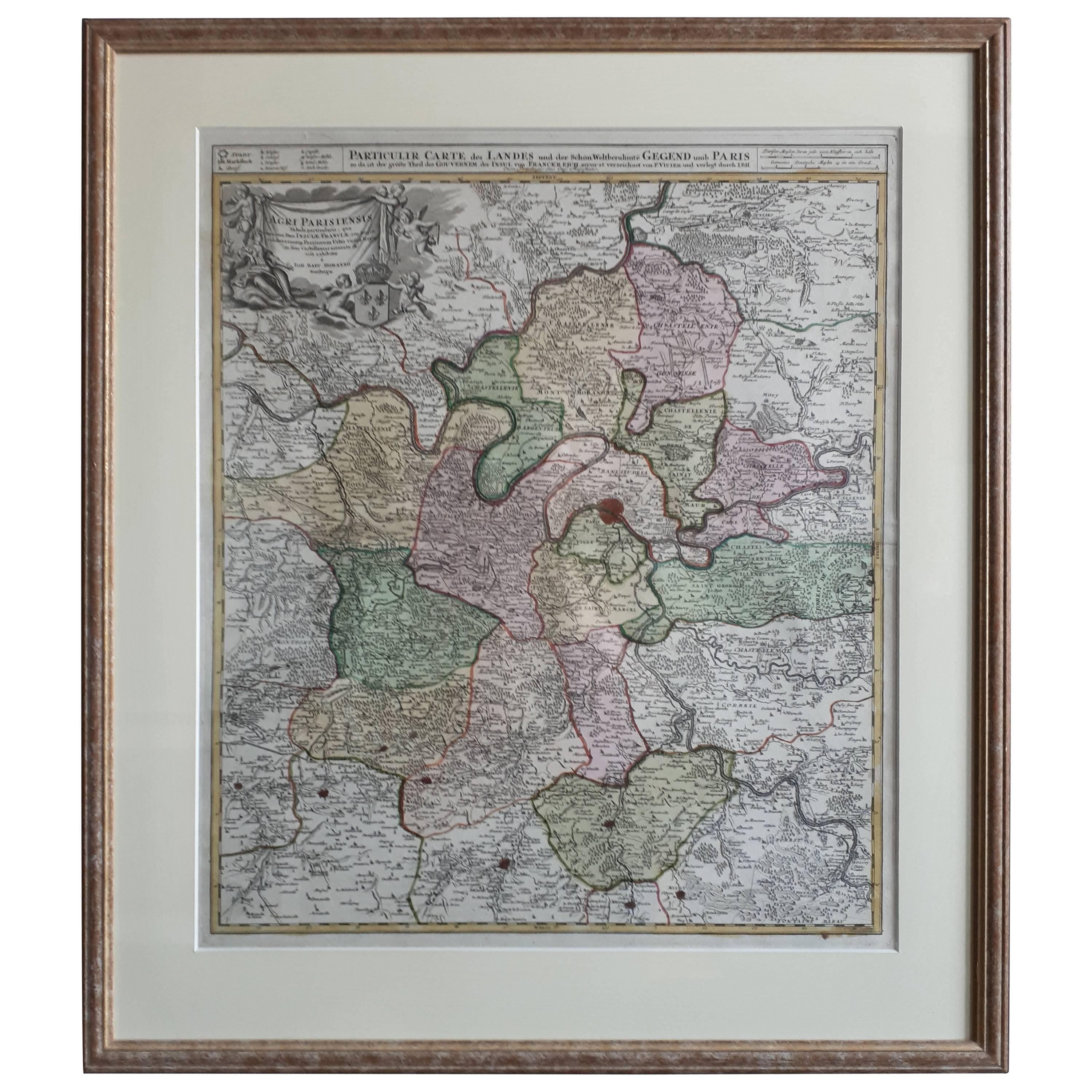
Antique Map in Frame of the Region of Paris ‘France’ by H. Heirs, circa 1720
Located in Langweer, NL
Antique map titled 'Agri Parisiensis Tabula particularis, qua maxima Pars Insulae Franciae (..)'. Incredibly detailed map showing everything from tiny villages to forests, farmland, ...
Category
Antique Early 18th Century German Maps
Materials
Paper

$1,053 Sale Price
20% Off
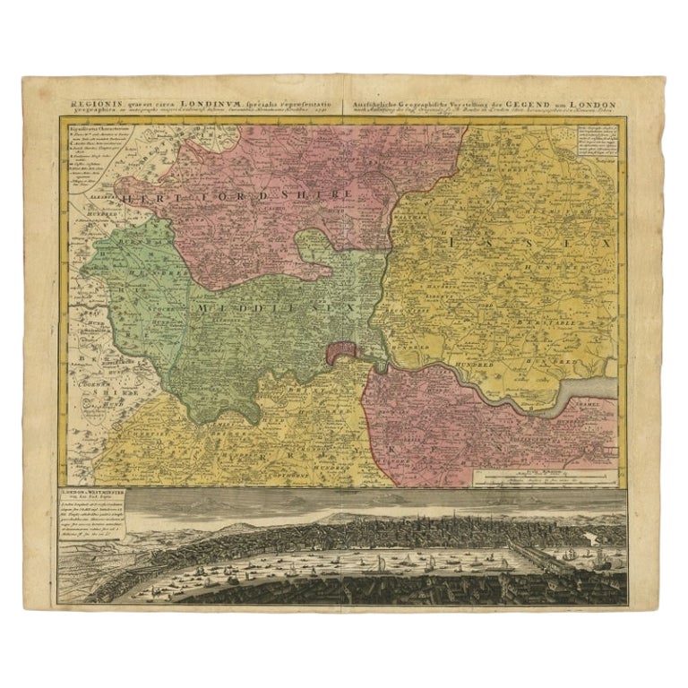
Antique Map of London Showing the Area from Essex to Surrey, England, 1741
Located in Langweer, NL
Antique map titled 'Regionis quae est circa Londinum specialis repraesentatio (..)'
Very detailed map showing the area from Essex to Surrey and shows a lovely view of London with a high level of detail, stretching from Old London Bridge...
Category
Antique 18th Century Maps
Materials
Paper

You May Also Like
1771 Bonne Map of Poitou, Touraine and Anjou, France, Ric.a015
Located in Norton, MA
1771 Bonne Map of Poitou,
Touraine and Anjou, France
Ric.a015
1771 Bonne map of Potiou, Touraine and Anjou entitled "Carte des Gouvernements D'Anjou et du Saumurois, de la Touraine, du Poitou,du Pays d'aunis, Saintonge?Angoumois,"
Carte des gouvernements d'Anjou et du Saumurois, de la Touraine, du Poitou, du Pays d'Aunis, Saintonge-Angoumois. Projettee et assujettie au ciel par M. Bonne, Hyd. du Roi. A Paris, Chez Lattre, rue St. Jacques a la Ville de Bord(ea)ux. Avec priv. du Roi. 1771. Arrivet inv. & sculp., Atlas moderne ou collection de cartes sur toutes...
Category
Antique 17th Century Unknown Maps
Materials
Paper

"Plan de Paris" - Antique Recreation of a Map of Paris
Located in New York, NY
Printed in the Early 20th Century, this antique "Plan de Paris" is a recreation of an earlier map from 1710, originally commissioned by Louis XIV. It was an intricately rendered view...
Category
Early 20th Century French Louis XIV Maps
Materials
Linen, Wood, Paper
1640 Joan Bleau Map Entitled"Diocecese de rheims et le pais de rethel, " Eic.a011
Located in Norton, MA
1640 Joan Bleau map entitled
"Diocecese de rheims et le pais de rethel,"
Ric.a011
OAN BLAEU
Diocecese de Rheims, et le pais de Rethel.
Handcolored engraving, c.1640.
...
Category
Antique 17th Century Dutch Maps
Materials
Paper

1752 Vaugoundy Map of Flanders : Belgium, France, and the Netherlands, Ric.a002
Located in Norton, MA
Large Vaugoundy Map of Flanders:
Belgium, France, and the Netherlands
Colored -1752
Ric.a002
Description: This is a 1752 Didier Robert de Vaugondy map of Flanders. The map de...
Category
Antique 17th Century Unknown Maps
Materials
Paper

18th Century Map of Paris
Located in Washington, DC
18th century map of Paris.
Category
Antique Late 18th Century French Prints
Materials
Glass, Wood, Paper
Original Large Antique Map of Paris, France by John Dower, 1861
Located in St Annes, Lancashire
Fabulous monochrome map of Paris.
Vignettes of St Germain En Laye, Saint Cloud, Versailles and Fontainbleau.
Unframed.
Drawn by J.Dower.
Lithography by Weller. 4 sheets joined to...
Category
Antique 1860s English Victorian Maps
Materials
Paper

More Ways To Browse
Blue Green Wool And Silk Rug
Brown Sheepskin Chair
Vintage Brass Bar Carts
Antique Botanical Prints
Green Persian Rug
50 X 50 Coffee Table
Milo Baughman 1970
Spanish Baroque Furniture
Stone China
Couch Console
Vintage Burn
Chinese Stone
Sterling Silver Flatware Service For 12
Antique Dining Tables With Leaves
Decorative Wall Panels
Frank Lloyd Wright For Cassina
Natural Curved
Spanish Wool Rug