Items Similar to Detailed Plan of the City of Zutphen, The Netherlands – Hendrik de Leth, c.1740


Want more images or videos?
Request additional images or videos from the seller
1 of 6
Detailed Plan of the City of Zutphen, The Netherlands – Hendrik de Leth, c.1740
$576.91
£427.34
€480
CA$789.20
A$860.18
CHF 454.77
MX$10,354.97
NOK 5,772.18
SEK 5,291.91
DKK 3,657.33
About the Item
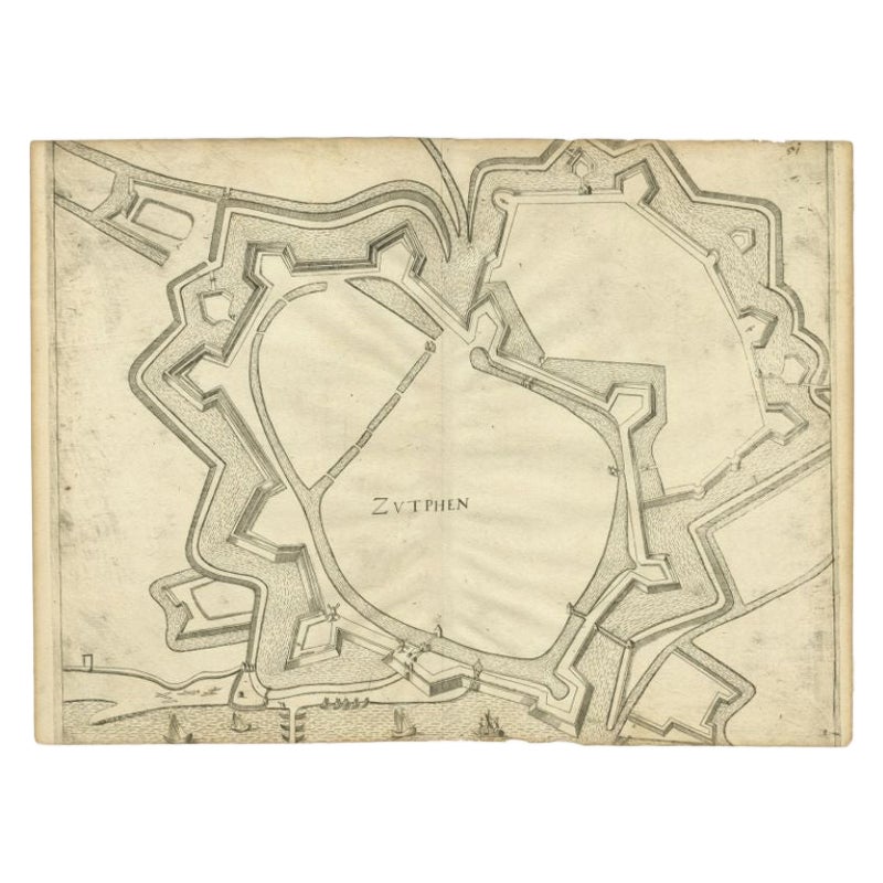
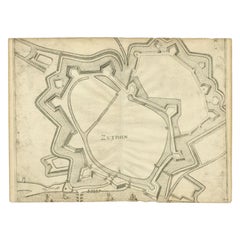
Title: Detailed Plan of the City of Zutphen – Hendrik de Leth, ca. 1740
This hand-colored engraving, created by Hendrik de Leth and published around 1740, presents a detailed and precise plan of the fortified city of Zutphen in the Netherlands. The map showcases the city’s intricate star-shaped fortifications, a hallmark of 17th and 18th-century military architecture. The canals, bastions, and strategic defenses surrounding Zutphen reflect its importance as a fortified town along the IJssel River.
The plan includes a numbered legend that identifies key locations and landmarks within the city, such as gates, buildings, and public spaces, providing a valuable historical record of Zutphen's urban and defensive layout during the early 18th century.
This map is presented in excellent condition, with vibrant hand-coloring that enhances the details of the fortifications, waterways, and urban structures. It is elegantly mounted on a cream matting board with a dark inner border, ensuring both protection and a refined display.
Hendrik de Leth was a renowned Dutch cartographer and engraver, known for his meticulous city plans and landscapes. His works are celebrated for their accuracy and artistic quality, making this map a fascinating example of his craftsmanship.
This piece is not only an important historical artifact for those interested in Dutch history and cartography but also a striking decorative addition for collectors of antique maps and city plans.
- Dimensions:Height: 13.78 in (35 cm)Width: 14.97 in (38 cm)Depth: 0.12 in (3 mm)
- Materials and Techniques:Paper,Engraved
- Period:1740-1749
- Date of Manufacture:circa 1740
- Condition:The map is in excellent condition, with vibrant hand-coloring, no visible tears or discoloration, and elegantly mounted on a cream matting board for display.
- Seller Location:Langweer, NL
- Reference Number:Seller: BG-028571stDibs: LU3054342827742
About the Seller
5.0
Recognized Seller
These prestigious sellers are industry leaders and represent the highest echelon for item quality and design.
Platinum Seller
Premium sellers with a 4.7+ rating and 24-hour response times
Established in 2009
1stDibs seller since 2017
2,811 sales on 1stDibs
Typical response time: 1 hour
- ShippingRetrieving quote...Shipping from: Langweer, Netherlands
- Return Policy
More From This Seller
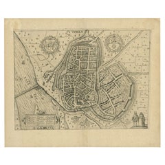
View AllAntique Map of the City of Zutphen, c.1650
Located in Langweer, NL
Antique map titled 'Zutphen'. Uncommon original antique map of the city of Zutphen, the Netherlands. Source unknown, to be determined.
Artists and Engravers: Anonymous.
Conditi...
Category
Antique 17th Century Maps
Materials
Paper
Antique Map of the City of Zutphen by Guicciardini, 1612
Located in Langweer, NL
Antique map Zutphen titled 'Zutphen'. This map depicts the city of Zutphen, Gelderland, The Netherlands. Originates from 'Beschryvinghe van alle de Neder-landen anderssins ghenoemt N...
Category
Antique 17th Century Maps
Materials
Paper

Antique Map of the City of Zutphen by Guicciardini, 1613
Located in Langweer, NL
Antique map Zutphen titled 'Zutphen'. This map depicts the city of Zutphen, Gelderland, The Netherlands. Originates from 'Discrittione di tutti i Paesi Bassi'.
Artists and Engrav...
Category
Antique 17th Century Maps
Materials
Paper
Antique Map of Leeuwarden, Capital of Friesland, the Netherlands, by Blaeu, 1649
Located in Langweer, NL
Antique map titled 'Leoverdia.'
Bird's-eye view plan of Leeuwarden, Friesland, the Netherlands. With key to locations and coats of arms. Text in Dutch on verso.
This plan origina...
Category
Antique 17th Century Maps
Materials
Paper

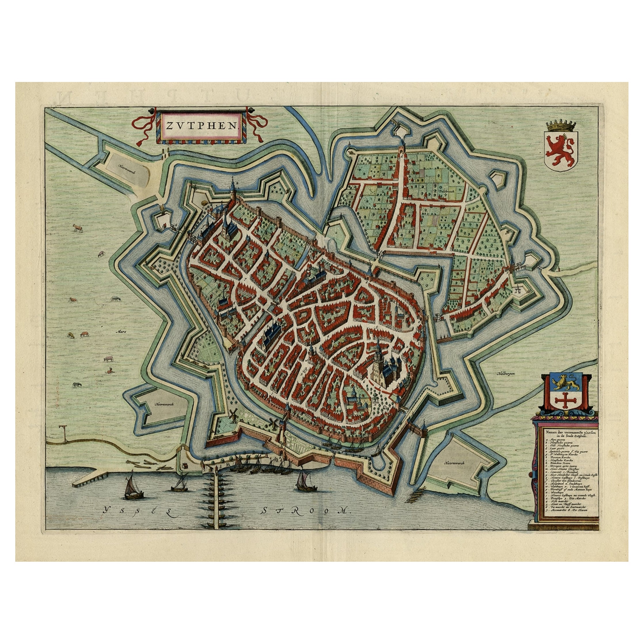
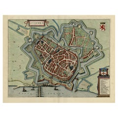
Original Map with Bird
s-Eye View of Zutphen in the Netherlands by Blaeu, 1649
Located in Langweer, NL
Antique print, titled: 'Zutphen.' - Bird's-eye view plan of Zutphen in The Netherlands, with key to locations and coats of arms. Text in Dutch on verso. This plan originates from the famous city Atlas: 'Toneel der Steeden' published by Joan Blaeu...
Category
Antique 1640s Maps
Materials
Paper
$1,201 Sale Price
20% Off
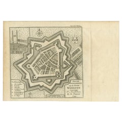
Antique Map of the City of Woerden by Tirion, c.1750
Located in Langweer, NL
Antique map titled 'Nieuwe Grondtekening van de Stad Woerden'. Plan of the city of Woerden, the Netherlands. Published circa 1750.
Artists and Engravers: Published by I. Tirion. ...
Category
Antique 18th Century Maps
Materials
Paper
You May Also Like
18th Century Map Engraving - Newport, a Strong Sea-Port Town in Flanders
Located in Corsham, GB
A map of Nieuwpoort, anglicised to 'Newport', in northern Belgium. There is a panorama in the upper quarter depicting major landmarks. Below is a plan of the town, including its strong defences and ships at the port in the lower register. Inscribed with the title in plate to the lower edge, 'Newport a Strong Sea-Port Town...
Category
18th Century More Prints
Materials
Engraving

$269 Sale Price
20% Off
Map of Groningen - Etching by George Braun - Late 16th Century
Located in Roma, IT
This map of Groninga is an original etching realized by George Braun and Franz Hogenberg, and part of the series "Civitates Orbis Terrarum".
The state of preservation of the artwork...
Category
16th Century Figurative Prints
Materials
Etching

18th Century Map Engraving - Mechlin, or Malines
Located in Corsham, GB
A map of Mechelen, known as Malines in French and Mechlin in English, a city and municipality in the province of Antwerp in the Flemish Region of Belgium. A birds-eye view plan of th...
Category
18th Century More Prints
Materials
Engraving

$269 Sale Price
20% Off
Utrecht, Netherlands: A Large 17th Century Hand-colored Map by Sanson
Jaillot
By Nicholas Sanson d
Abbeville
Located in Alamo, CA
This large hand-colored map entitled "La Seigneurie d'Utrecht. Dressé sur les memoires les plus nouveaux par le Sr. Sanson" was originally created by Nicholas Sanson d'Abbeville. Thi...
Category
1690s Landscape Prints
Materials
Engraving

Map of Kampen, Netherlands - by G. Braun and F. Hogenberg - Late 16th Century
By Franz Hogenberg
Located in Roma, IT
This map of Kampen (the ancient Campensis) is an original etching realized by George Braun and Franz Hogenberg as part of the famous Series "Civitates Orbis Terrarum".
The “Civita...
Category
16th Century Figurative Prints
Materials
Etching

Utrecht, Antique Map from "Civitates Orbis Terrarum"
By Franz Hogenberg
Located in Roma, IT
Braun G., Hogenberg F., Traiectum or Utrecht, from the collection Civitates Orbis Terrarum, Cologne, T. Graminaeus, 1572-1617.
Very fine B/W aquatint showing a view of Utrecht, with...
Category
16th Century Landscape Prints
Materials
Etching

More Ways To Browse
Blue Green Wool And Silk Rug
Brown Sheepskin Chair
Vintage Brass Bar Carts
Antique Botanical Prints
Green Persian Rug
50 X 50 Coffee Table
Milo Baughman 1970
Spanish Baroque Furniture
Stone China
Couch Console
Vintage Burn
Chinese Stone
Sterling Silver Flatware Service For 12
Antique Dining Tables With Leaves
Decorative Wall Panels
Frank Lloyd Wright For Cassina
Natural Curved
Spanish Wool Rug