Items Similar to Double Hemisphere World Map from the Nieuwe Hand-Atlas, Leiden 1876


Want more images or videos?
Request additional images or videos from the seller
1 of 13
Double Hemisphere World Map from the Nieuwe Hand-Atlas, Leiden 1876
$355.97
£265.75
€300
CA$494.55
A$531.95
CHF 284.29
MX$6,270.23
NOK 3,584.26
SEK 3,276.69
DKK 2,286.34
About the Item
Title: Double Hemisphere World Map from the Nieuwe Hand-Atlas, Leiden 1876
Description:
This 19th-century double-hemisphere world map, titled “Wereldkaart volgens gewone projectie van Flamsteed,” was published in 1876 in the *Nieuwe Hand-Atlas der Aarde in haren Tegenwoordigen Toestand* by M. Frijlink, revised by A. van Otterloo and printed by D. Noothoven van Goor in Leiden. The map presents the world in elegant twin hemispheres, with fine hand-coloring and precise Dutch engraving characteristic of the late 19th century.
The left hemisphere shows the Americas, while the right illustrates Europe, Africa, Asia, and Australia. Each region is outlined in soft pastel hues to mark national borders and colonial possessions. Clear annotations indicate ocean currents, trade winds, and lines of latitude and longitude, while delicate hachuring defines mountains and continental forms. Smaller inset maps appear around the edges, showing alternative projections, polar regions, and a comparative profile of world elevations and sea depths.
This map was designed as an educational tool in Frijlink’s atlas, which became a widely used reference for schools and institutions throughout the Netherlands. Its accuracy and aesthetic balance reflect the precision of Dutch cartography in the late 19th century, bridging classical and scientific approaches to mapmaking. The combination of beauty and clarity makes it both a decorative and historical object of interest.
Condition report:
Good condition with soft age toning and light foxing around the margins. Central fold as issued. Colors remain clean and fresh, and the impression is strong with no tears or repairs.
Framing tips:
This piece looks elegant when mounted with a soft cream or ivory mat and framed in dark walnut or black wood. Its harmonious composition and pastel tones make it ideal for display in a study, hallway, or office.
Technique: Lithograph with original hand-coloring
Maker: M. Frijlink
A. van Otterloo, Leiden, 1876
- Dimensions:Height: 17.33 in (44 cm)Width: 21.66 in (55 cm)Depth: 0.01 in (0.2 mm)
- Materials and Techniques:
- Place of Origin:
- Period:
- Date of Manufacture:1876
- Condition:Good condition with soft age toning and light foxing around the margins. Central fold as issued. Colors remain clean and fresh, and the impression is strong with no tears or repairs.
- Seller Location:Langweer, NL
- Reference Number:Seller: BG-12788-21stDibs: LU3054347449722
About the Seller
5.0
Recognized Seller
These prestigious sellers are industry leaders and represent the highest echelon for item quality and design.
Platinum Seller
Premium sellers with a 4.7+ rating and 24-hour response times
Established in 2009
1stDibs seller since 2017
2,836 sales on 1stDibs
Typical response time: 1 hour
- ShippingRetrieving quote...Shipping from: Langweer, Netherlands
- Return Policy
More From This Seller
View AllAntique Map of The World in Hemispheres by W. G. Blackie, 1859
Located in Langweer, NL
Antique map titled 'The World in Hemispheres with other projections'. Original antique map of The World. This map originates from ‘The Imperial Atlas of Modern Geography’. Published ...
Category
Antique Mid-19th Century Maps
Materials
Paper

$290 Sale Price
30% Off
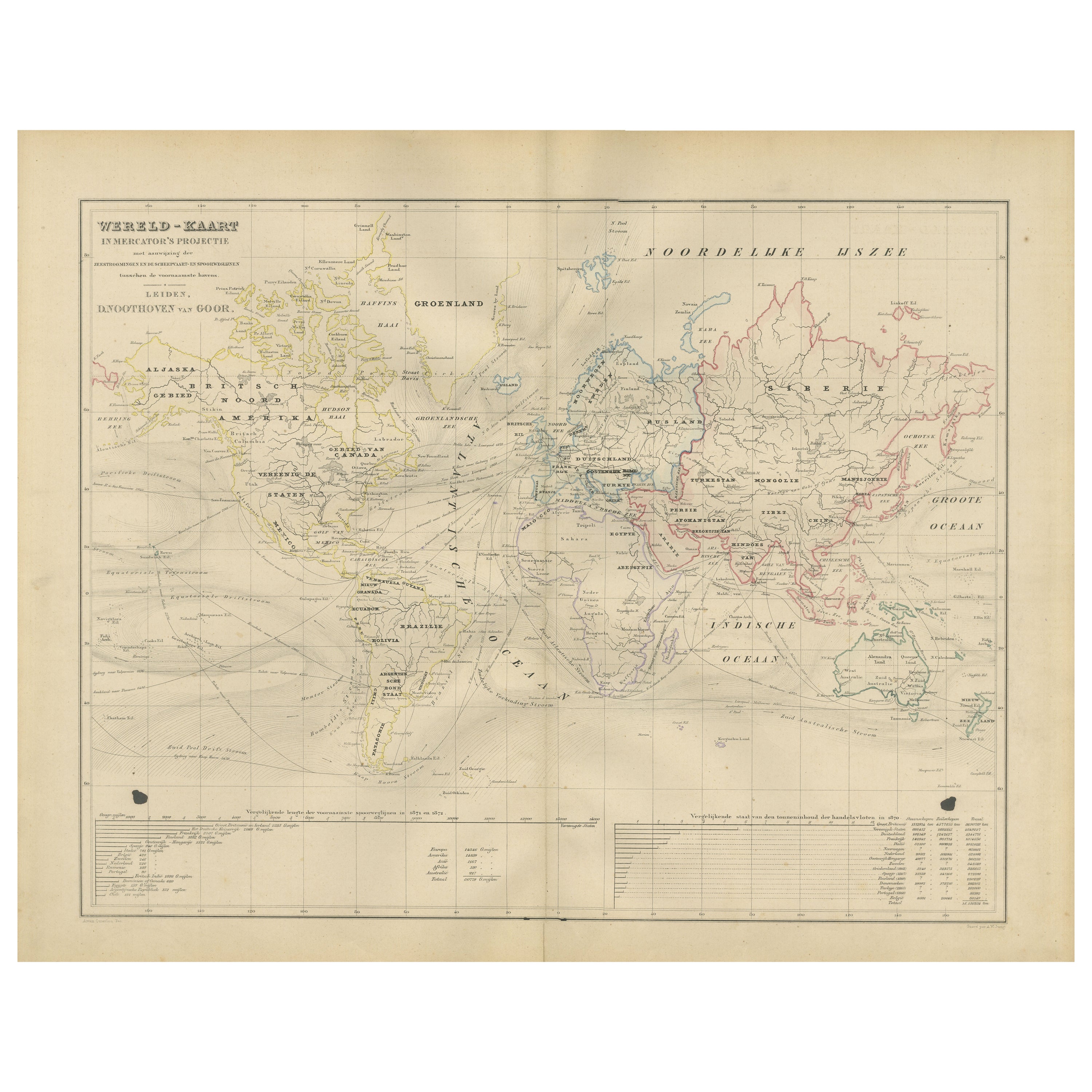
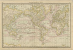
World Map in Mercator’s Projection – Nieuwe Hand-Atlas, Leiden 1876
Located in Langweer, NL
World Map in Mercator’s Projection – Nieuwe Hand-Atlas, Leiden 1876
This 19th-century Dutch world map, titled “Wereld-Kaart in Mercator’s Projectie,” was published in 1876 in the Ni...
Category
Antique 1870s Dutch Maps
Materials
Paper
Western
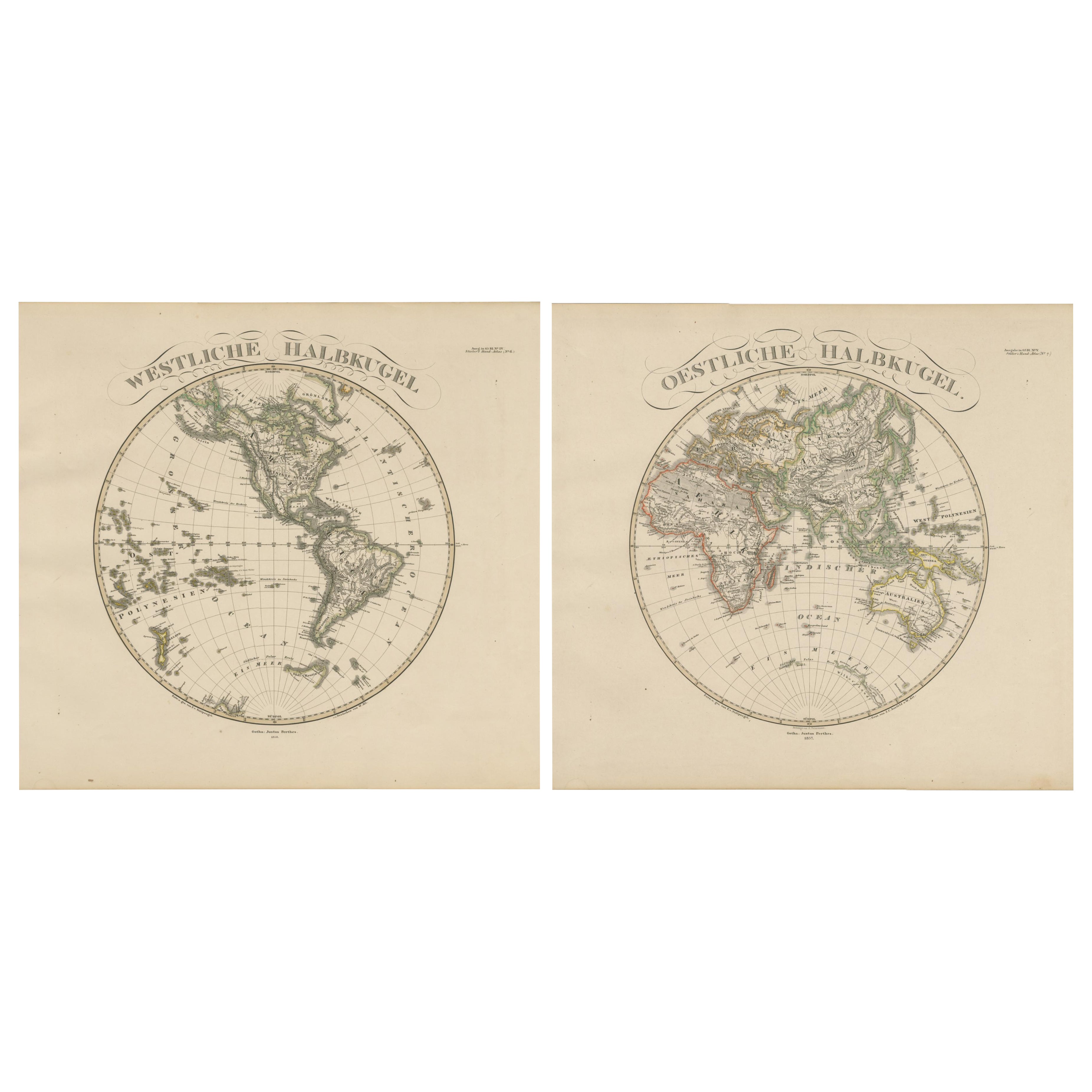
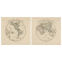
Eastern Hemisphere Maps – World Double Hemisphere Engravings 1857
Located in Langweer, NL
Western & Eastern Hemisphere Maps – World Double Hemisphere Engravings 1857
These beautiful antique prints show two complementary hemispheric maps titled “Westliche Halbkugel” (West...
Category
Antique Mid-19th Century German Maps
Materials
Paper
Antique Map of The World in Hemispheres on Various Projections, 1882
Located in Langweer, NL
This stunning 1882 'Antique Map of The World in Hemispheres' showcases an exquisite blend of cartographic precision and artistic elegance. Crafted under the watchful eye of W.G. Blac...
Category
Antique 1880s Maps
Materials
Paper

$265 Sale Price
20% Off
Antique Map of the World in Hemispheres by Johnson,
1872
Located in Langweer, NL
Antique map titled 'Johnson's Globular World. Original world map depicting the Eastern Hemisphere and the Western Hemisphere. This map originates fr...
Category
Antique Late 19th Century Maps
Materials
Paper

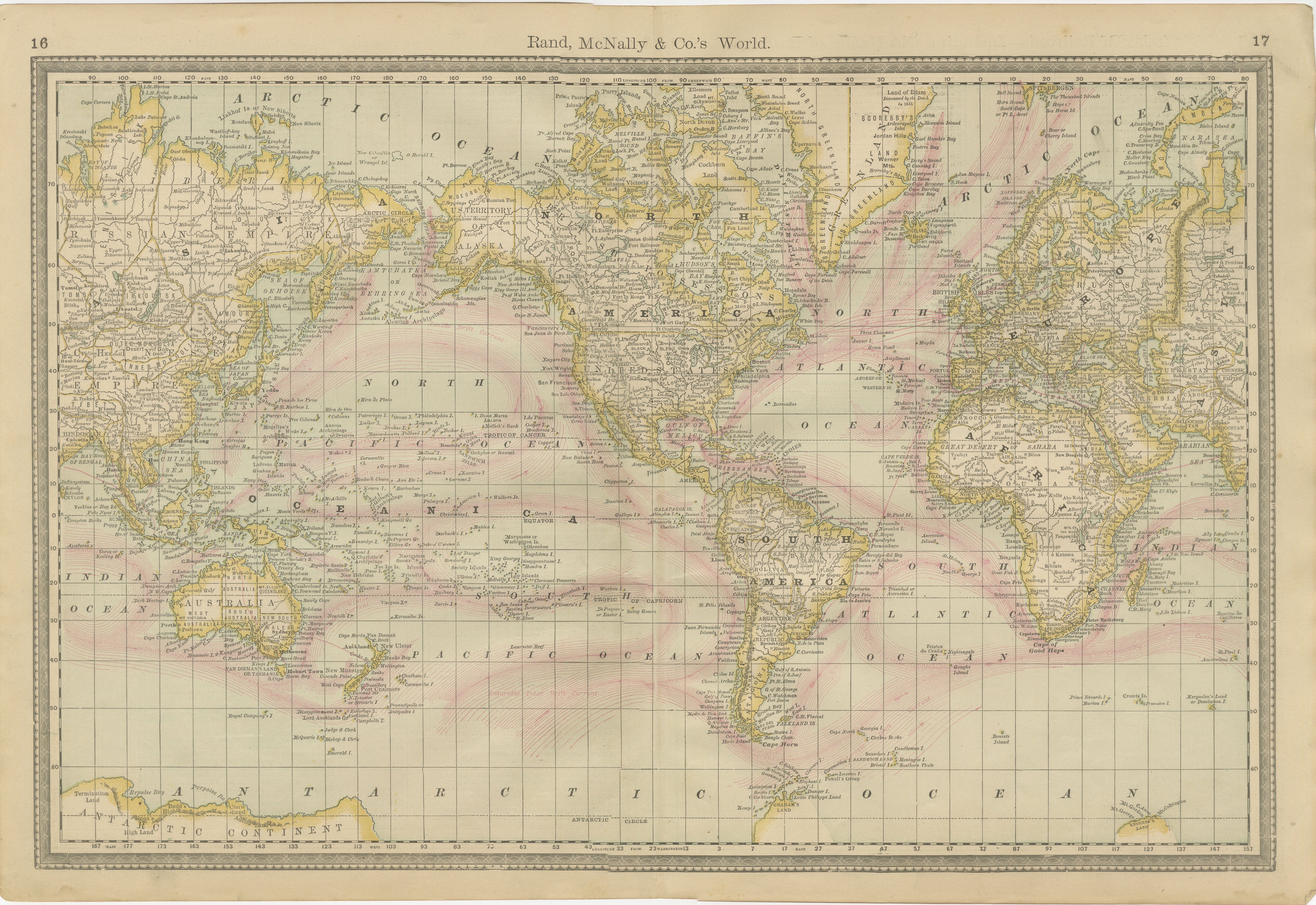
World Antique Map c.1888 – Rand McNally, Continents
Territories
Located in Langweer, NL
Antique Map of Mexico – Rand McNally, circa 1888
This antique map titled “Rand, McNally & Co.’s Mexico” was published around 1888 and depicts Mexico in the late 19th century, a peri...
Category
Antique Late 19th Century American Maps
Materials
Paper
You May Also Like
Original Antique Map of The World by Dower, circa 1835
Located in St Annes, Lancashire
Nice map of the World
Drawn and engraved by J.Dower
Published by Orr & Smith. C.1835
Unframed.
Free shipping
Category
Antique 1830s English Maps
Materials
Paper

1864 Original illustrated planisphere - World Map - Geography
Located in PARIS, FR
Immerse yourself in the epic journey of the past with the Illustrated Historical Planisphere of 1864 by Charpentier! 🗺️ This cartographic treasure transports you through the intrica...
Category
1860s Prints and Multiples
Materials
Linen, Paper, Lithograph

Original Antique Map of The Eastern Hemisphere by Dower, circa 1835
Located in St Annes, Lancashire
Nice map of the Eastern Hemisphere
Drawn and engraved by J.Dower
Published by Orr & Smith. C.1835
Unframed.
Free shipping
Category
Antique 1830s English Maps
Materials
Paper

Original Antique Map of The Western Hemisphere by Dower, circa 1835
Located in St Annes, Lancashire
Nice map of the Western Hemisphere
Drawn and engraved by J.Dower
Published by Orr & Smith. C.1835
Unframed.
Free shipping
Category
Antique 1830s English Maps
Materials
Paper

Antique Map of Eastern Hemisphere from the collection of Thierry Despont
Located in New York, NY
Designed by Enrico Bonetti (E. Bonatti) and published by Francesco Vallardi Editore. Based on an earlier map by Evangelista Azzi (Ev. Azzi). Labeled as such at bottom edge of map.
T...
Category
Antique Late 19th Century Italian Maps
Materials
Canvas, Wood

Original Antique Map of The World by Thomas Clerk, 1817
Located in St Annes, Lancashire
Great map of The Eastern and Western Hemispheres
On 2 sheets
Copper-plate engraving
Drawn and engraved by Thomas Clerk, Edinburgh.
Published by Mackenzie And Dent, 1817
...
Category
Antique 1810s English Maps
Materials
Paper
