Items Similar to Douro: The River of Tradition and Wine in Portugal, 1903

Want more images or videos?
Request additional images or videos from the seller
1 of 9
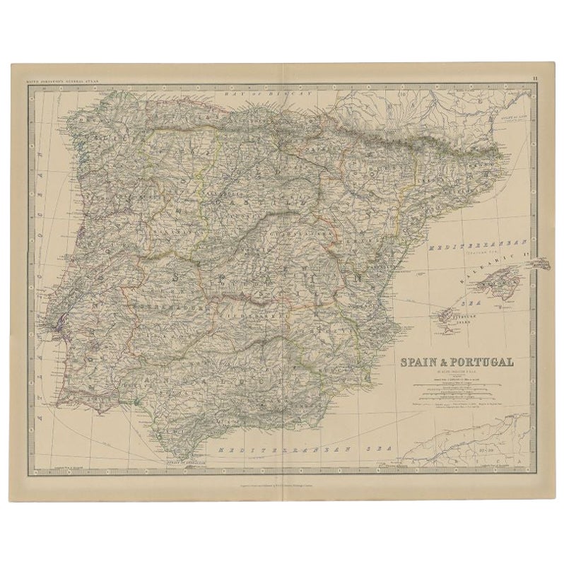
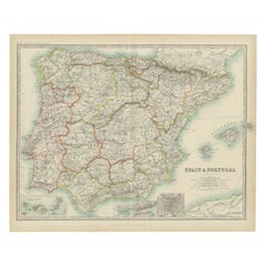
Douro: The River of Tradition and Wine in Portugal, 1903
$277.74
$347.1820% Off
£207.71
£259.6320% Off
€232
€29020% Off
CA$382.72
CA$478.4020% Off
A$417.54
A$521.9220% Off
CHF 221.08
CHF 276.3520% Off
MX$5,003.26
MX$6,254.0820% Off
NOK 2,815.61
NOK 3,519.5120% Off
SEK 2,574.66
SEK 3,218.3320% Off
DKK 1,766.96
DKK 2,208.6920% Off
About the Item
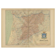
The uploaded image is a historical map of the Beira Baixa region in Portugal. The map details the topography, including mountain ranges and river systems, as well as the transportation networks with roads and railways. Beira Baixa is known for its historical towns, natural beauty, and significant cultural heritage.
Beira Baixa is special for several reasons:
1. **Natural Landscapes**: The region is characterized by its diverse landscapes, from the Serra da Estrela mountain range to the Tagus river basin.
2. **Historical Towns**: Beira Baixa hosts several historical towns and villages, with castles, Roman ruins, and archaeological sites.
3. **Geopark Naturtejo**: This UNESCO Global Geopark highlights the geological diversity and natural beauty of the region, including the Ichnological Park of Penha Garcia with its ancient fossil trails.
4. **Cultural Festivals**: The region has rich folk traditions, with various festivals and fairs throughout the year that celebrate local culture, history, and cuisine.
5. **Handicrafts**: Beira Baixa is known for its traditional handicrafts, especially lace and embroidery, which have been passed down through generations.
- Dimensions:Height: 20.08 in (51 cm)Width: 14.77 in (37.5 cm)Depth: 0 in (0.02 mm)
- Materials and Techniques:
- Place of Origin:Spain
- Period:1900-1909
- Date of Manufacture:1903
- Condition:Good condition. Central vertical folding lines as issued. Aged paper with typically warm, yellowish-brown hue, especially around the edges and folding lines, adding to its patina. Check the images carefully.
- Seller Location:Langweer, NL
- Reference Number:Seller: BG-13642-621stDibs: LU3054338034932
About the Seller
5.0
Recognized Seller
These prestigious sellers are industry leaders and represent the highest echelon for item quality and design.
Platinum Seller
Premium sellers with a 4.7+ rating and 24-hour response times
Established in 2009
1stDibs seller since 2017
2,792 sales on 1stDibs
Typical response time: <1 hour
- ShippingRetrieving quote...Shipping from: Langweer, Netherlands
- Return Policy
More From This Seller
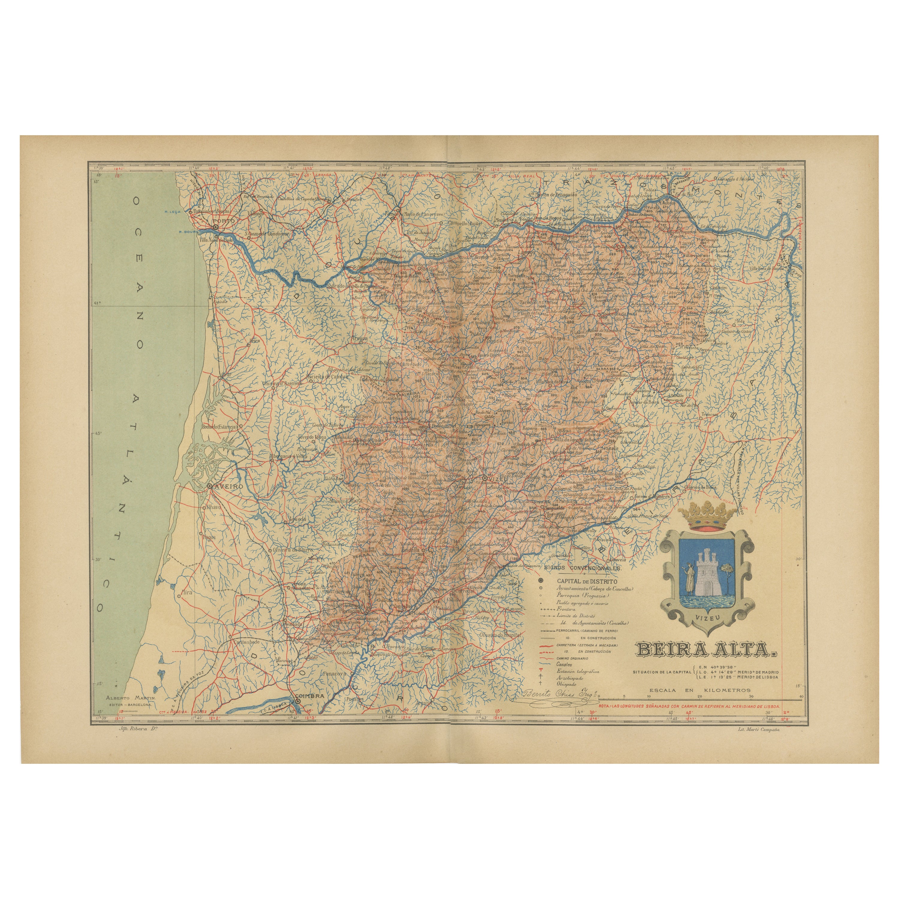
View AllBeira Alta: A Cartographic Journey Through Portugal
s Heartland in 1903
Located in Langweer, NL
The uploaded image is a historical map of the Beira Alta region in Portugal. The map is detailed, showing the topography, hydrography, and transportation networks of the region, incl...
Category
Antique Early 1900s Spanish Maps
Materials
Paper
$277 Sale Price
20% Off
Free Shipping
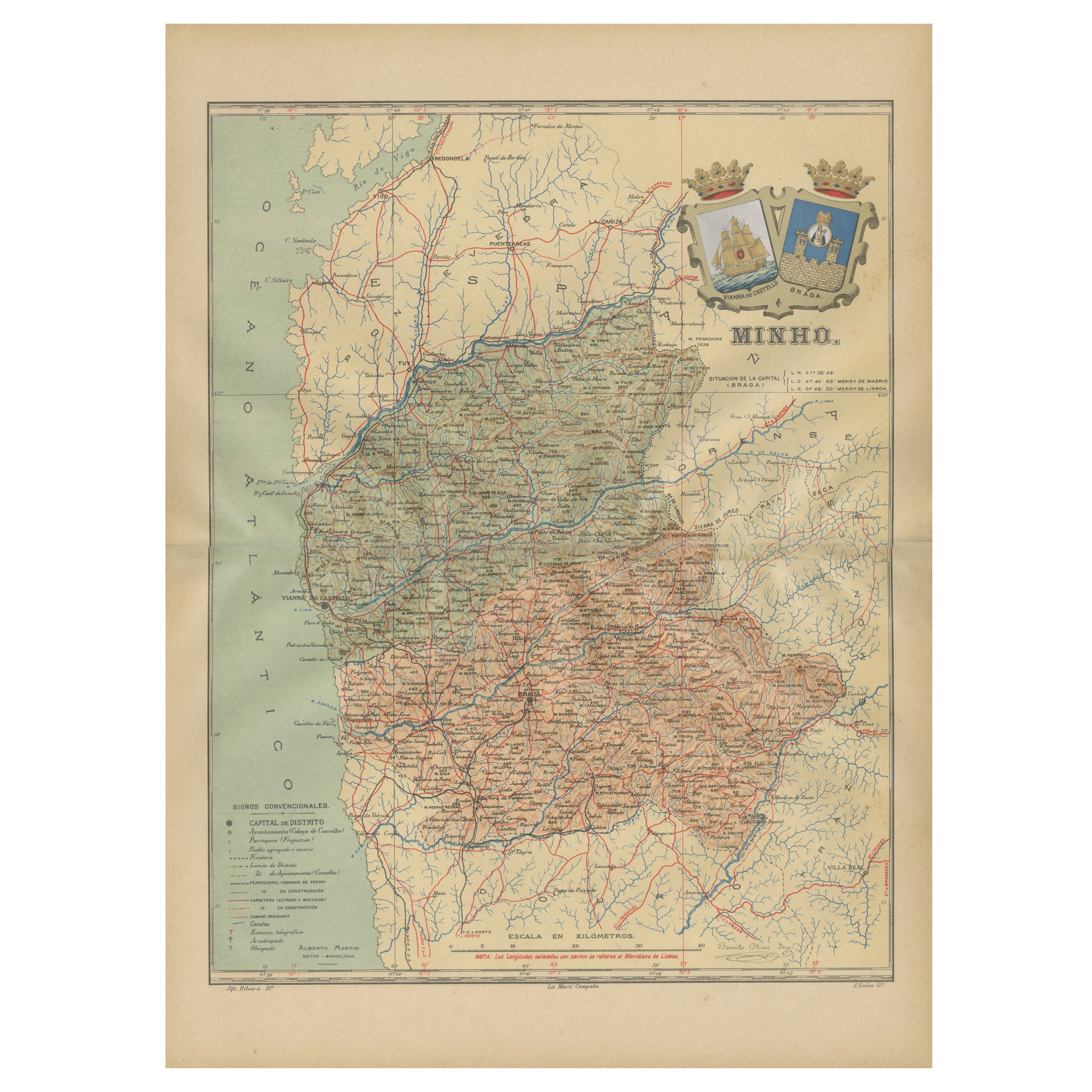
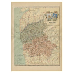
Minho: A Legacy of Lush Landscapes and Living Traditions in Portugal, 1903
Located in Langweer, NL
Ths authentic print is a historical map of the Minho region in the northwestern part of Portugal. The map includes detailed geographical features, such as rivers, mountain ranges, an...
Category
Antique Early 1900s Spanish Maps
Materials
Paper
$325 Sale Price
20% Off
Free Shipping
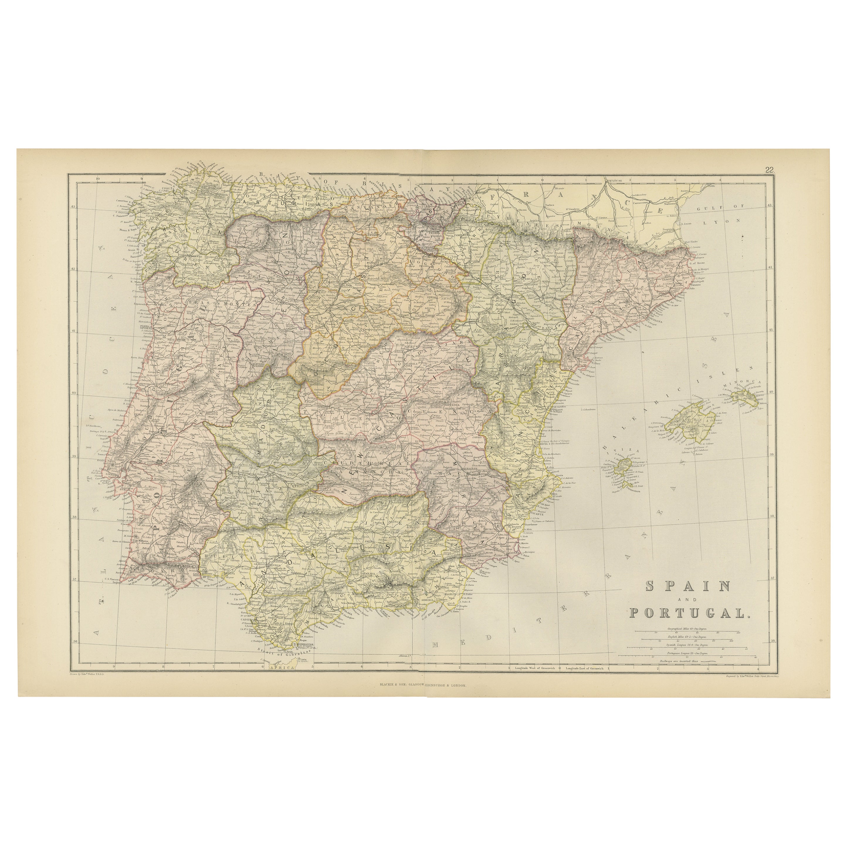
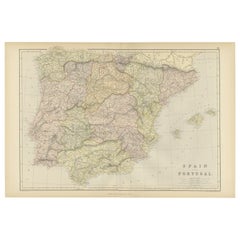
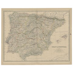
Original Antique Map of Spain and Portugal, 1882
Located in Langweer, NL
Embark on a historical voyage with an original Antique Map of Spain and Portugal from the esteemed 'Comprehensive Atlas and Geography of the World,' meticulously crafted in 1882. Thi...
Category
Antique 1880s Maps
Materials
Paper
$162 Sale Price
20% Off
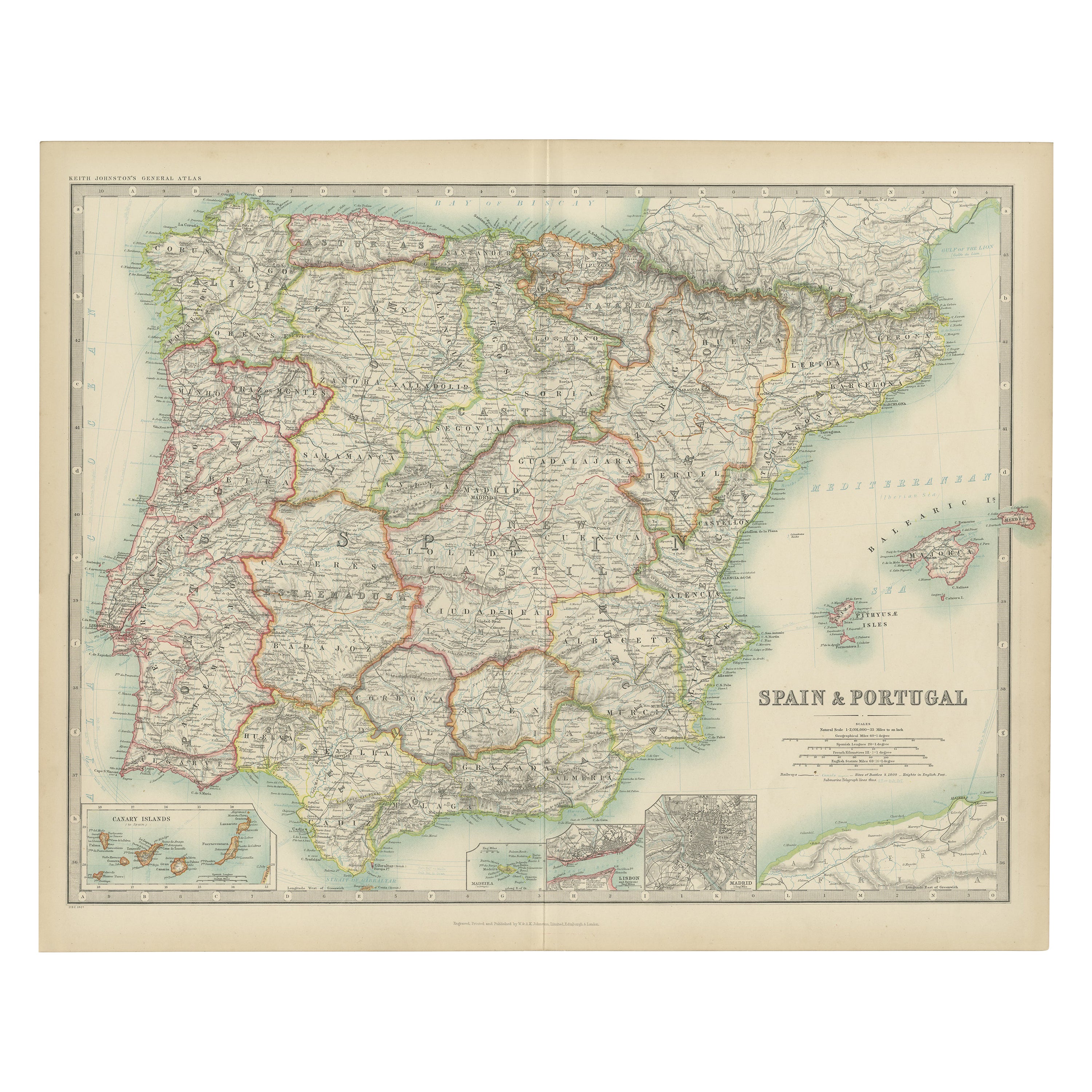
Antique Map of Spain and Portugal by Johnston,
1909
Located in Langweer, NL
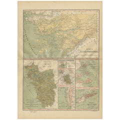
Antique map titled 'Spain and Portugal'. Original antique map of Spain and Portugal. With inset maps of the Canary Islands, Madeira, Lisbon and Ma...
Category
Early 20th Century Maps
Materials
Paper
$239 Sale Price
20% Off
Empire
s Tapestry: Mapping Portugal
s Global Legacy in 1903
Located in Langweer, NL
This map is an original antique map that showcases Portuguese possessions around the turn of the 20th century, with a focus on Guinea-Bissau (referred to on the map as "Guiné Portugu...
Category
Antique Early 1900s Maps
Materials
Paper
Antique Map of Spain and Portugal, 1882
Located in Langweer, NL
"Antique map titled 'Spain & Portugal'.
Old map of Spain and Portugal. This map originates from 'The Royal Atlas of Modern Geography, Exhibiting, in a S...
Category
Antique 19th Century Maps
Materials
Paper
You May Also Like
Large Original Vintage Map of Spain, circa 1920
Located in St Annes, Lancashire
Great map of Spain
Original color.
Good condition
Published by Alexander Gross
Unframed.
Category
Vintage 1920s English Maps
Materials
Paper

Ancient National Atlas of France with Marengo
Located in Alessandria, Piemonte
Ancient National Atlas of France with the department of Marengo: a rare French etching dated 1806.
ST/178.
Category
Antique Early 19th Century French Other Prints
Materials
Paper

Map of Spain and Portugal - Original Etching - Late 19th Century
Located in Roma, IT
This Map of Spain and Portugal is an etching realized by an anonymous artist.
The state of preservation of the artwork is good with some small diffused stains.
Sheet dimension: 28...
Category
Late 19th Century Modern Figurative Prints
Materials
Etching

1762 Berri, Nivernois Bourbonois, Lyonois, Bourgogine, Bresse, et, Franche - Com
Located in Norton, MA
1762 Vaugondy map, entitled
"Berrl Nivernois Bourbonois Lyonois, Bourgone, Bresse, Et Franche-Comte,"
Ric.b003
About this Item
A fine Copperplate Engraving with original han...
Category
Antique 18th Century Unknown Maps
Materials
Paper
Map Huntingdonshire R Scott Archibald Fullarton
Co Glasgow
Located in BUNGAY, SUFFOLK
Folding Map of Huntingdonshire by R Scott with distances from London and reference to the hundreds.
Published by Archibald Fullarton & Co Glasgow. Measure: 40...
Category
Antique 19th Century English Victorian Maps
Materials
Paper

Portugal: A Large 17th Century Hand-colored Map by Sanson and Jaillot
By Nicholas Sanson d
Abbeville
Located in Alamo, CA
This large hand-colored map entitled "Le Royaume de Portugal et des Algarves Divisee en see Archeveches, Eveches et Territoires Par le Sr Sanson" was originally created by Nicholas S...
Category
1690s Landscape Prints
Materials
Engraving

More Ways To Browse
Wine Map
Antique Plate Germany
Side Table Made In Denmark
England Antique Plates
19th Century Round Dining Table
Antique Thrones
Carved Chinese Tables
Italian Ceramic 1960s
Mid Century Modern Danish Teak Dining Tables
Rosenthal Century
Long Rug Runners
Pair Arm Chairs
Sterling Silver Dinner Sets
United Chair Company
British Antiques
Italian Beech Chairs
Shirvan Rugs
Spain Marble