Items Similar to Early 19th Century Hand Colored Map of the United States and Caribbean Islands

Want more images or videos?
Request additional images or videos from the seller
1 of 6
Early 19th Century Hand Colored Map of the United States and Caribbean Islands
$595
$99540% Off
£451.71
£755.3840% Off
€520.75
€870.8440% Off
CA$841.71
CA$1,407.5640% Off
A$906.18
A$1,515.3740% Off
CHF 485.28
CHF 811.5140% Off
MX$10,919.11
MX$18,259.6940% Off
NOK 6,122.83
NOK 10,239.0240% Off
SEK 5,603.38
SEK 9,370.3640% Off
DKK 3,891.26
DKK 6,507.2340% Off
About the Item
Hand coloured early 19th century map by Giraldon of France titled "Etats Unis et Grandes Antilles" (United States and Greater Antilles).
- Creator:Giraldon (Maker)
- Dimensions:Height: 13.5 in (34.29 cm)Width: 10 in (25.4 cm)Depth: 0.975 in (2.48 cm)
- Materials and Techniques:
- Place of Origin:
- Period:
- Date of Manufacture:circa 1810
- Condition:Wear consistent with age and use. Foxing to paper.
- Seller Location:Hamilton, CA
- Reference Number:1stDibs: LU1355214145611
About the Seller
5.0
Platinum Seller
Premium sellers with a 4.7+ rating and 24-hour response times
Established in 2010
1stDibs seller since 2015
1,366 sales on 1stDibs
Typical response time: 5 hours
- ShippingRetrieving quote...Shipping from: Hamilton, Canada
- Return Policy
More From This Seller
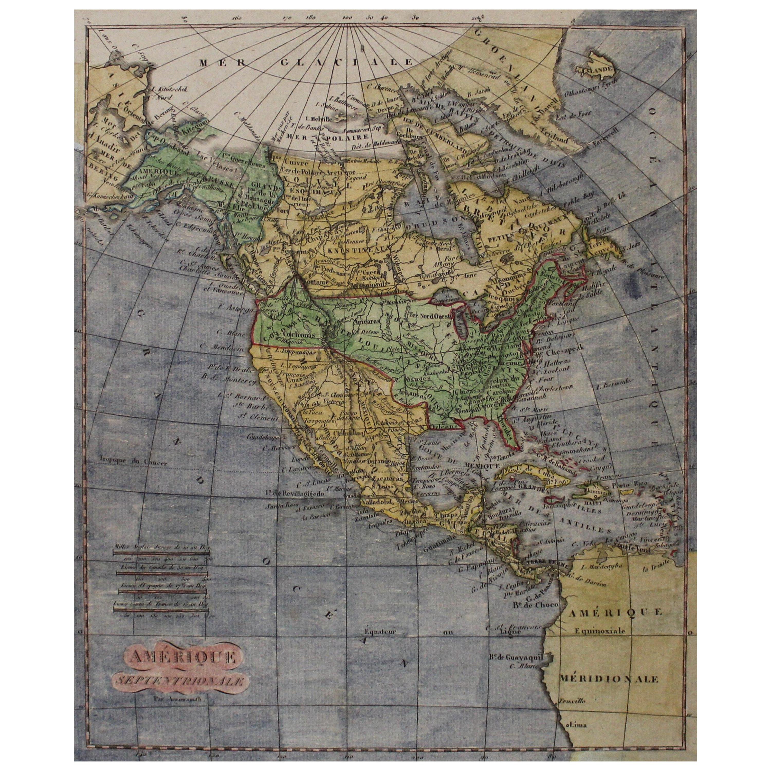
View AllEarly 19th Century Hand Coloured Map of North America by Aaron Arrowsmith
By Aaron Arrowsmith
Located in Hamilton, Ontario
Hand coloured map in French by English cartographer Aaron Arrowsmith (1750–1823) titled "Amerique Septentionale" (North America).
Map size: 9.5" x 8"
Mat size: 20.5" x 14.25".
Category
Antique Early 19th Century English Maps
Materials
Paper

$795 Sale Price
36% Off
Map of the Kingdom of Sardinia and Part of the Kingdom of Genoa, Rome
By Giovanni Maria Cassini
Located in Hamilton, Ontario
18th century map by Italian engraver Giovanni Maria Cassini (Italy 1745-1824). Map of Part of the Kingdom of Sardinia and Part of the Kingdom of Genoa: Rome. This is a hand colored a...
Category
Antique 18th Century Italian Maps
Materials
Paper

$795 Sale Price
36% Off
17th Century Nicolas Visscher Map of Southeastern Europe
Located in Hamilton, Ontario
A beautiful, highly detailed map of southeastern Europe by Nicolas Visscher. Includes regions of Northern Italy (showing the cities Bologna, Padua, and Venice), Bohemia, Austria (sho...
Category
Antique 17th Century Dutch Maps
Materials
Paper

$1,350 Sale Price
38% Off
18th Century Map of the Southern Balkans by Giovanni Maria Cassini
By Giovanni Maria Cassini
Located in Hamilton, Ontario
18th century map by Italian engraver Giovanni Maria Cassini (Italy 1745-1824).
Map of the Southern Balkans: Rome. Hand colored and copper engraved print done in the year 1788. It in...
Category
Antique 18th Century Italian Maps
Materials
Paper

$795 Sale Price
36% Off
Antique 1798 James Colnett A Voyage to the South Atlantic
Round Cape Hope Book
Located in Hamilton, Ontario
This antique book titled "A Voyage to the South Atlantic and Round Cape Horn into the Pacific Ocean", and authored by W. Bennett, on the work of James Colnet...
Category
Antique Late 18th Century English Georgian Books
Materials
Leather, Paper
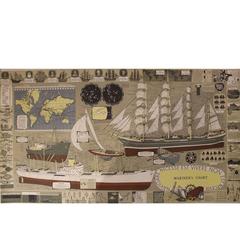
Mariner
s Chart Poster
Located in Hamilton, Ontario
Mariner's chart poster (nautical).
Category
20th Century Posters
$1,795 Sale Price
20% Off
You May Also Like
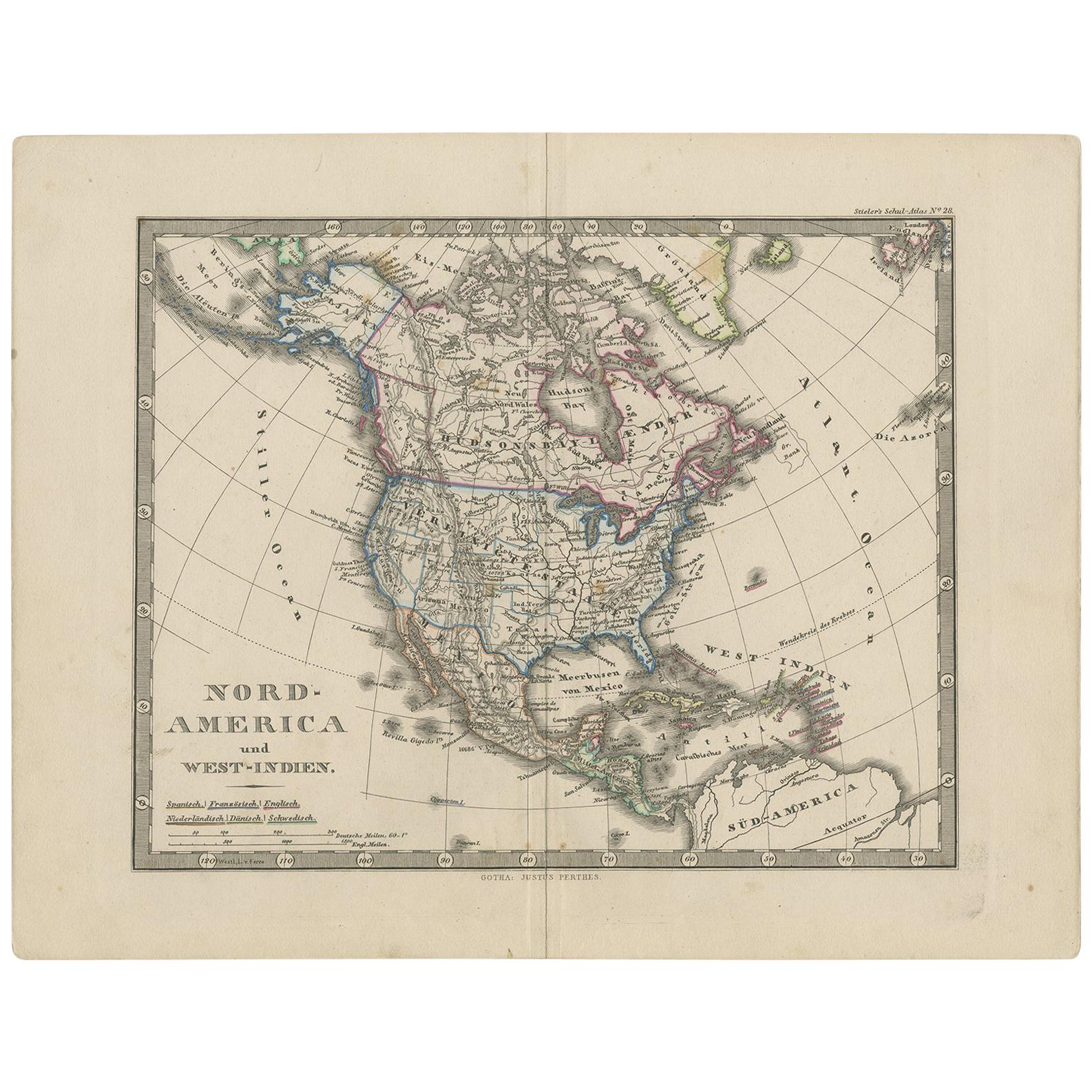
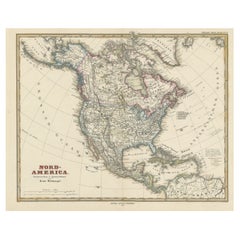
Antique Map of North America and the West Indies by Stieler, circa 1865
Located in Langweer, NL
Antique map titled 'Nord-America und West-Indien'. Old map of North America and the West Indies. This map originates from Stieler's 'Schul-Atlas'.
Category
Antique Mid-19th Century Maps
Materials
Paper
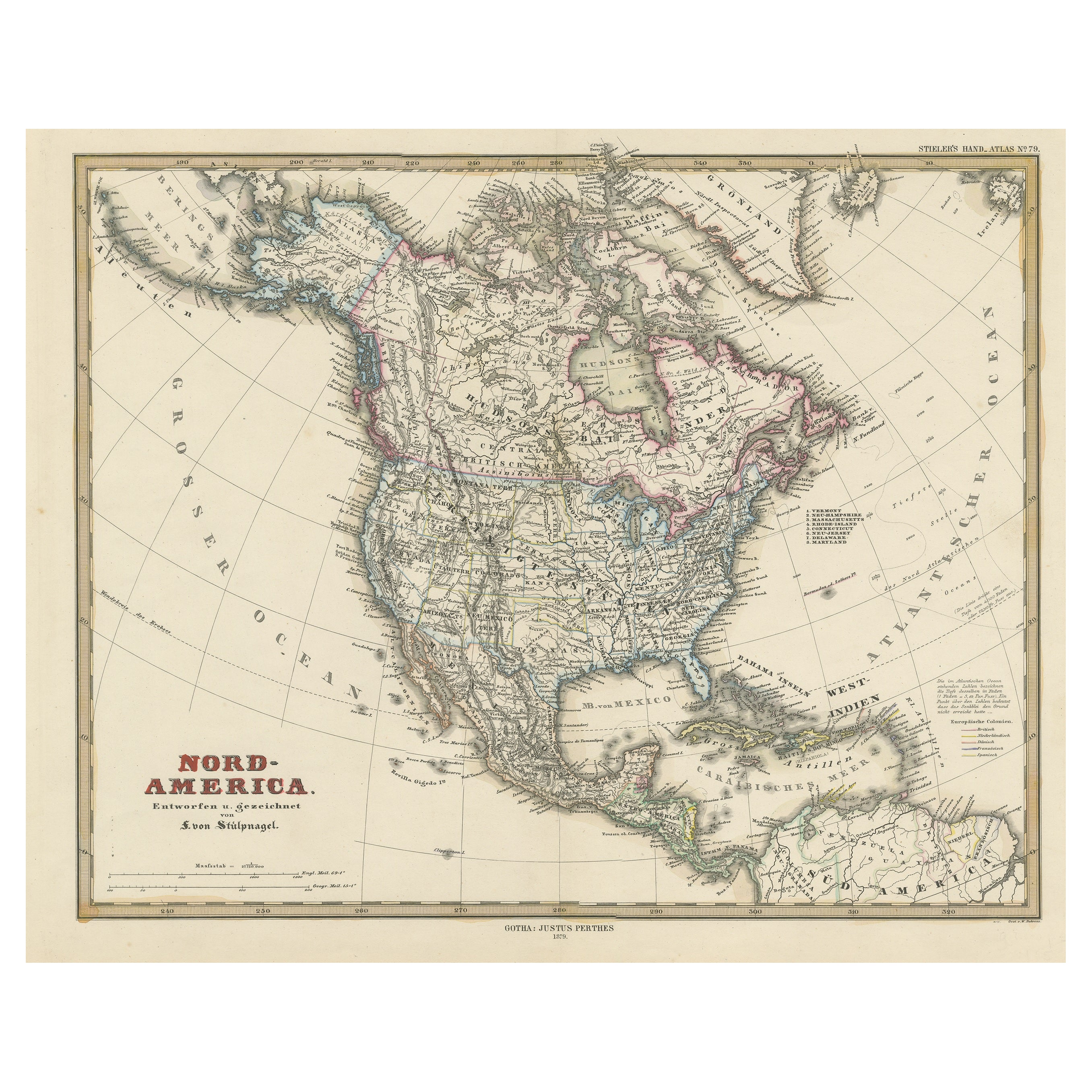
Antique Map with Hand Coloring of North America and the West Indies
Located in Langweer, NL
Original antique map titled 'Nord-America'. Old map of North America and the West Indies.
This map originates from Stielers Handatlas, published circa 1879. Stielers Handatlas (a...
Category
Antique Late 19th Century Maps
Materials
Paper
$552 Sale Price
25% Off
Free Shipping
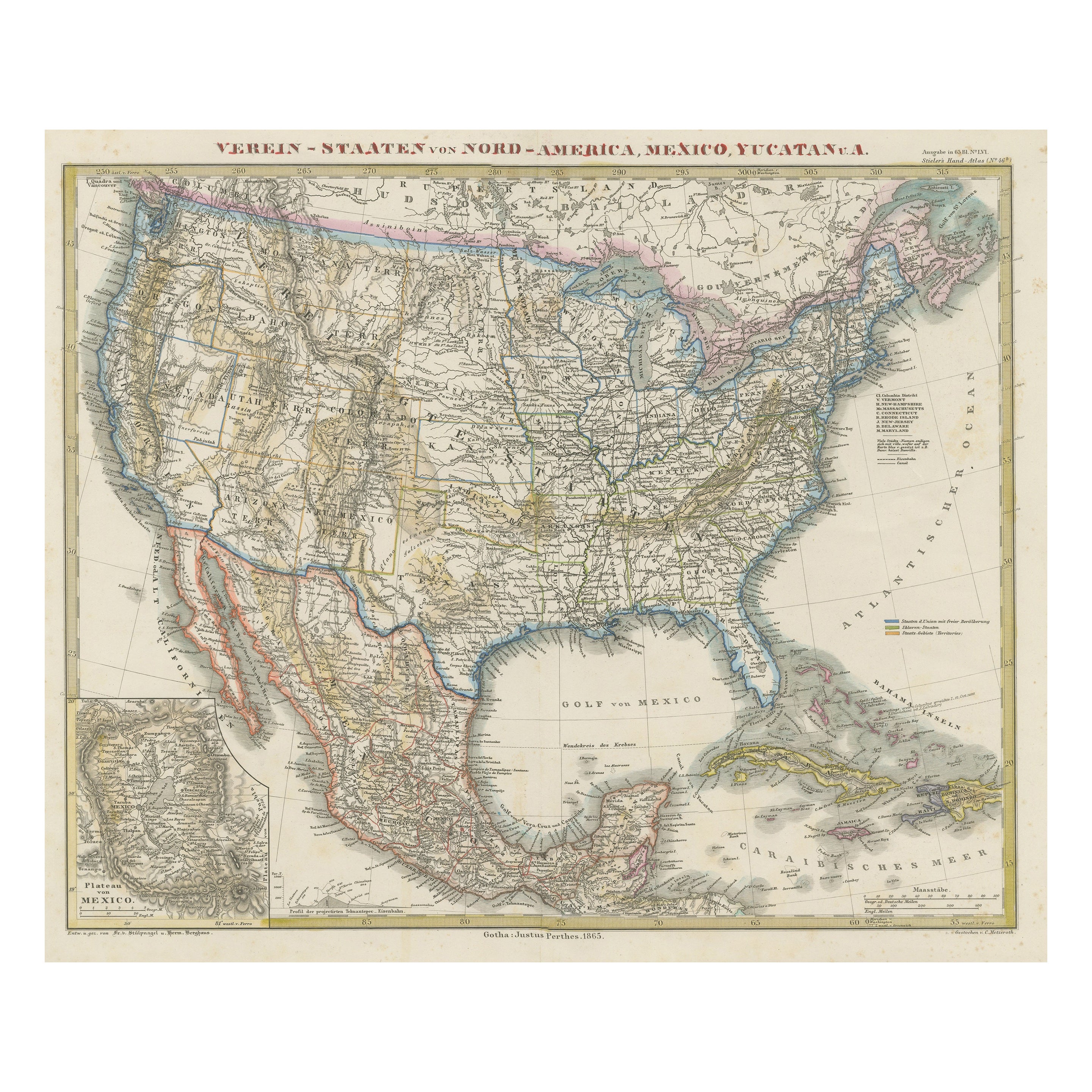
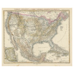
Antique Map of the United States of America, also showing the Caribbean
Located in Langweer, NL
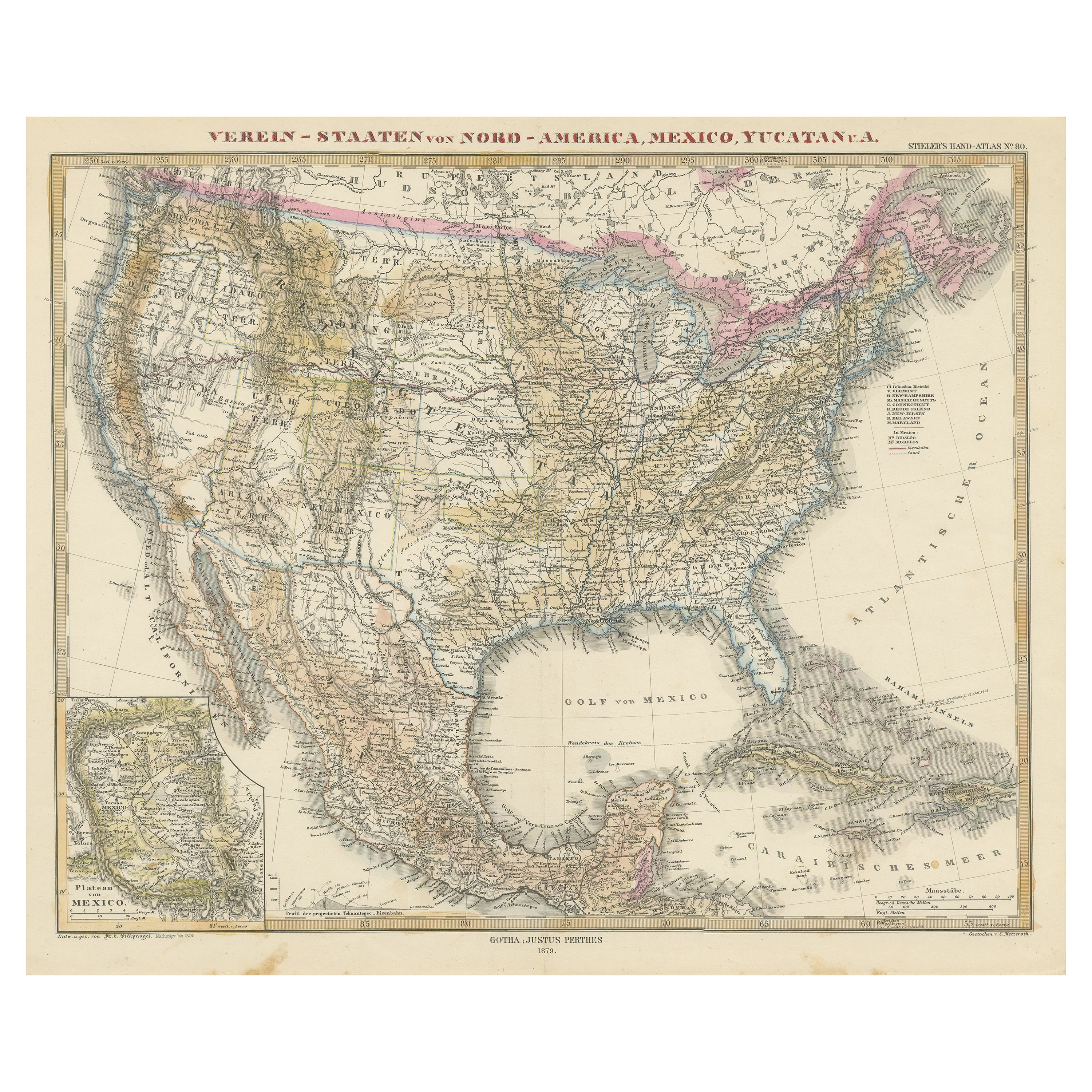
Antique map titled 'Verein-Staaten von Nord-America, Mexico, Yucatan u.a.'. Very detailed map of the United States of America showing the ...
Category
Antique Mid-19th Century Maps
Materials
Paper

$779 Sale Price
20% Off
Antique Map with Hand Coloring of the United States and the Caribbean
Located in Langweer, NL
Antique map titled 'Verein-Staaten von Nord-America, Mexico, Yucatan u.a.'. Very detailed map of the United States of America showing the Caribbean. With an inset map of the surround...
Category
Antique Late 19th Century Maps
Materials
Paper
$532 Sale Price
20% Off
Authentic Antique Map of the Caribbean, Gulf Coast and Central America, 1787
Located in Langweer, NL
Antique map titled 'Les Isles Antilles et le Golfe du Méxique'. Original old map of the Caribbean, Gulf Coast and Central America. With inset map of Bermuda...
Category
Antique Late 18th Century Maps
Materials
Paper

$294 Sale Price
20% Off
Free Shipping
Original Antique Map of United States, Grattan and Gilbert, 1843
Located in St Annes, Lancashire
Great map of United States
Drawn and engraved by Archer
Published by Grattan and Gilbert. 1843
Original colour
Unframed.
Category
Antique 1840s English Maps
Materials
Paper

More Ways To Browse
Caribbean Antique Furniture
Caribbean Map
Antique Maps Caribbean Islands
Antique English Maps
Indonesia Map
Ancient Maps
Antique Mining
Antique Atlas Furniture
Antique Maps Indonesia
Map Of India
China Map
Victorian Furniture 1920
Antique Maps Amsterdam
Antique Maps Of Russia
19th Century Map Of Africa
Map Of Britain
Antique Oregon
Bali Wood