Items Similar to Egypt
Abyssinia – Original Nile Valley and Horn of Africa Maps, c.1817


Want more images or videos?
Request additional images or videos from the seller
1 of 9
Egypt
Abyssinia – Original Nile Valley and Horn of Africa Maps, c.1817
$657.07
£491.06
€550
CA$906.46
A$992.86
CHF 522.74
MX$11,849.42
NOK 6,661.85
SEK 6,089.93
DKK 4,192.18
About the Item
Egypt
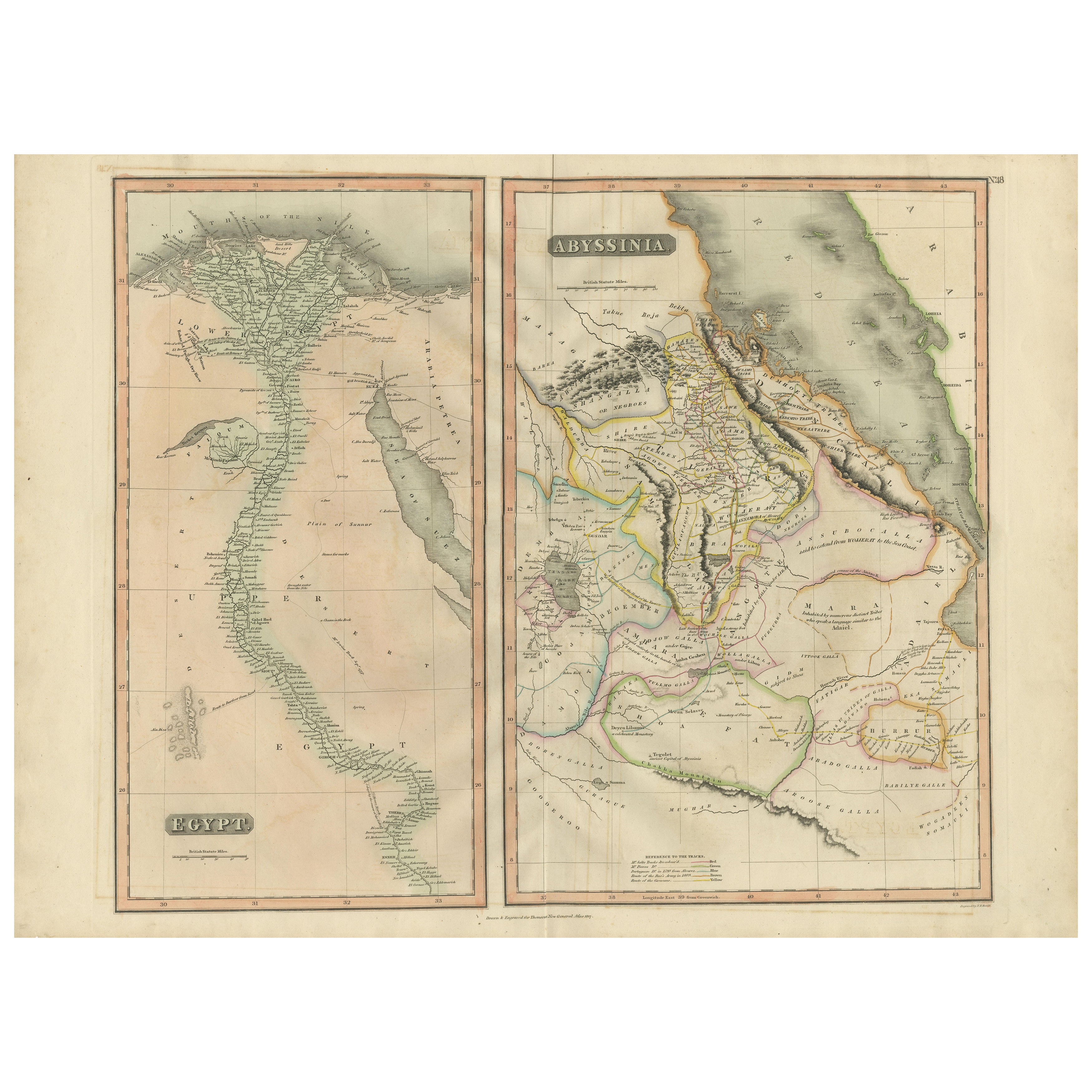
Abyssinia – Nile Valley and Horn of Africa Maps, c.1817–1820
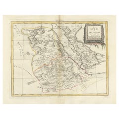
This refined early 19th-century map composition presents two related geographic views of Northeast Africa: Egypt with the full course of the Nile River, and Abyssinia (Ethiopia) with the Horn of Africa and Red Sea coast. Issued as companion maps circa 1817–1820, the sheets offer a clear and elegant overview of one of the most historically and geographically significant regions of Africa.
The Egypt map focuses on the Nile Valley from the Mediterranean Delta southward into Upper Egypt, emphasizing the river’s role as the organizing axis of settlement, agriculture, and civilization. Cities, river branches, desert regions, and historic sites are carefully engraved, creating a calm vertical composition that highlights the Nile’s uninterrupted flow through the landscape.
The Abyssinia map complements this view by presenting Ethiopia and the Horn of Africa, including the Red Sea coastline, inland mountain ranges, river systems, and regional boundaries. Political divisions are delicately outlined in contemporary hand color, distinguishing provinces and neighboring territories while maintaining visual clarity. Together, the two maps provide a balanced perspective on the Nile’s sources, surrounding highlands, and the broader Northeast African context.
The engraving style is clean and legible, characteristic of early 19th-century British atlas cartography, combining scientific precision with restrained elegance. Subtle hand coloring enhances coastlines and borders without overpowering the geography. When viewed together, the tall vertical Egypt map and the more compact Abyssinia map create a visually pleasing contrast that works exceptionally well for interior display.
This paired presentation appeals to collectors of African cartography, Nile history, and Ethiopian history, while also offering strong decorative value for both classic and contemporary interiors. Displayed side by side, the maps form a coherent and visually harmonious statement piece.
Condition report
Good condition overall. Central vertical folds as issued. Light age toning and some mild discoloration, more noticeable on the Egypt sheet. Minor scattered spots and light handling marks. Original outline hand color. Plate marks visible. Margins intact.
Framing tips
These maps work beautifully framed as a pair. Use matching off-white or light sand-colored mats to unify the presentation while allowing each map to breathe. Medium to dark wood frames or softly ebonized frames enhance the engraved detail and create a refined, gallery-ready appearance suitable for residential or hospitality interiors.
Technique: Copper engraving with contemporary outline hand color
Maker: British school (Thomson), c.1817
- Dimensions:Height: 21.26 in (54 cm)Width: 28.15 in (71.5 cm)Depth: 0.01 in (0.2 mm)
- Materials and Techniques:Paper,Engraved
- Place of Origin:
- Period:
- Date of Manufacture:circa 1817
- Condition:Good condition overall. Vertical fold as issued. Light age toning and some mild discoloration, more noticeable on the Egypt sheet. Minor scattered spots and light handling marks. Original outline hand color. Plate marks visible. Margins intact.
- Seller Location:Langweer, NL
- Reference Number:Seller: BG-14128-121stDibs: LU3054348017432
About the Seller
5.0
Recognized Seller
These prestigious sellers are industry leaders and represent the highest echelon for item quality and design.
Platinum Seller
Premium sellers with a 4.7+ rating and 24-hour response times
Established in 2009
1stDibs seller since 2017
2,806 sales on 1stDibs
Typical response time: 1 hour
- ShippingRetrieving quote...Shipping from: Langweer, Netherlands
- Return Policy
More From This Seller
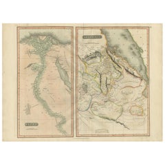
View AllEgypt and Abyssinia – Nile Valley
Horn of Africa Maps, c.1817–1820
Located in Langweer, NL
Egypt and Abyssinia – Nile Valley & Horn of Africa Maps, c.1817–1820
This refined early 19th-century paired map presents Egypt and Abyssinia (Ethiopia) as two complementary geograph...
Category
Antique 1810s British Maps
Materials
Paper
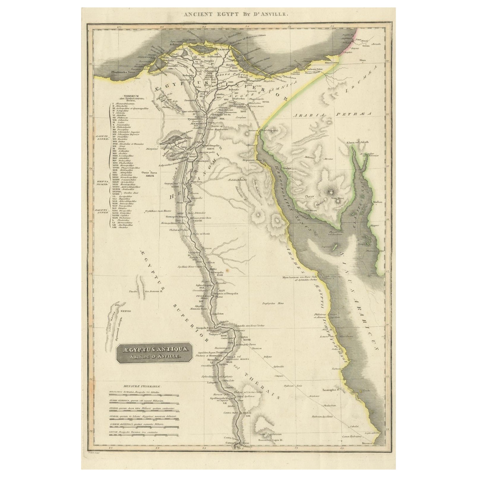
Ancient Egypt – Nile Valley Map by d’Anville, Classical Antiquity, c.1765
Located in Langweer, NL
Ancient Egypt – Nile Valley Map by d’Anville, Classical Antiquity, c.1765
This finely engraved map depicts Ancient Egypt as understood through classical sources, extending along the...
Category
Antique 1760s French Maps
Materials
Paper
Antique Map of Egypt with Detailed Inset of the Nile Delta, ca. 1799
Located in Langweer, NL
Antique Map of Egypt with Detailed Inset of the Nile Delta, ca. 1799
This finely engraved antique map titled Carte Physique et Politique de l’Égypte presents a detailed and scientif...
Category
Antique Early 1800s French Maps
Materials
Paper

Egypt
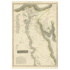
Arabia Petraea – Large Nile Map, British Cartography, c.1815
Located in Langweer, NL
Egypt & Arabia Petraea – Large Nile Map, British Cartography, c.1815
This impressive early 19th-century map depicts Egypt and Arabia Petraea with exceptional detail, extending from ...
Category
Antique 1810s British Maps
Materials
Paper

Large Antique Map of the Lower Nile Valley Including Egypt and Nubia, 1842
Located in Langweer, NL
Antique map titled 'Carte de l'Égypte, de la Nubie, de l'Abissinie'. Map of Egypt, covering the lower Nile valley including Egypt and Nubia. This map o...
Category
Antique 19th Century Maps
Materials
Paper

Nubia and Abyssinia – Venetian Map of Northeast Africa, Zatta, 1784
Located in Langweer, NL
Nubia and Abyssinia – Venetian Map of Northeast Africa, Zatta, 1784
This detailed late-18th-century map depicts Nubia and Abyssinia, covering large parts of present-day Sudan, Ethio...
Category
Antique 1780s Italian Maps
Materials
Paper
You May Also Like
Africa. North-East Part. Century Atlas antique vintage map
Located in Melbourne, Victoria
'The Century Atlas. Africa. North-East Part'
Original antique map, 1903.
Inset map of 'Nile Delta and Suez Canal'.
Central fold as issued. Map name and nu...
Category
Early 20th Century Victorian More Prints
Materials
Lithograph

Original Antique Map of Africa by Dower, circa 1835
Located in St Annes, Lancashire
Nice map of Africa
Drawn and engraved by J.Dower
Published by Orr & Smith. C.1835
Unframed.
Free shipping
Category
Antique 1830s English Maps
Materials
Paper

Africa. North-West Part. Century Atlas antique vintage map
Located in Melbourne, Victoria
'The Century Atlas. Africa. Southern Part'
Original antique map, 1903.
Central fold as issued. Map name and number printed on the reverse corners.
Sheet 40cm by 29.5cm.
Category
Early 20th Century Victorian More Prints
Materials
Lithograph

Map of Nubia and Abissinia - Original Etching by Antonio Zatta - 1784
Located in Roma, IT
This Map of Nubia and Abissinia is an etching realized by Antonio Zatta in Venice in 1784.
The state of preservation of the artwork is good expect for the worn paper with some littl...
Category
1770s Landscape Prints
Materials
Etching

Antique 1803 Italian Map of Asia Including China Indoneseia India
Located in Amsterdam, Noord Holland
Antique 1803 Italian Map of Asia Including China Indoneseia India
Very nice map of Asia. 1803.
Additional information:
Type: Map
Country of Manufacturing: Europe
Period: 19th centu...
Category
Antique 19th Century European Maps
Materials
Paper

$438 Sale Price
39% Off
Map of the Holy Land "Carte de la Syrie et de l
Egypte" by Pierre M. Lapie
By Pierre M. Lapie
Located in Alamo, CA
An early 19th century map of ancient Syria and Egypt entitled "Carte de la Syrie et de l'Egypte anciennes/dressée par M. Lapie, Colonel d'Etat Major, et...
Category
Antique Early 19th Century French Maps
Materials
Paper
