Items Similar to England and London Government Map with Allegorical Vignettes, ca. 1720


Want more images or videos?
Request additional images or videos from the seller
1 of 10
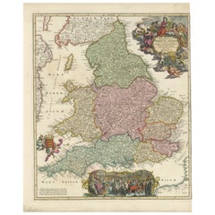
England and London Government Map with Allegorical Vignettes, ca. 1720
$696.58
£515.98
€580
CA$953.09
A$1,037.04
CHF 549.10
MX$12,476.29
NOK 6,972.34
SEK 6,379.20
DKK 4,420.07
About the Item
England and London Government Map with Allegorical Vignettes, ca. 1720
Description:
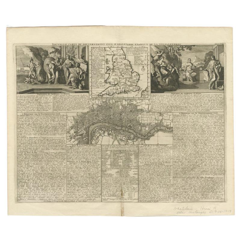
This highly decorative and information-rich copperplate engraving, titled "Nouvelle carte du Gouvernement civil D'Angleterre et de celuy de la ville de Londres," was published around 1720 by Henri Abraham Chatelain in Amsterdam. This striking composition offers a fascinating snapshot of both the geographical and political organization of England and the city of London during the early 18th century.
The top portion of the sheet contains a finely engraved map of England and Wales, complete with major cities, rivers, and territorial boundaries, and is accompanied by a key to the regions of governance. Below it lies an attractively detailed map of the city of London, focused on the River Thames and its surrounding boroughs, rendered with precise street layouts and districts.
What sets this piece apart is the inclusion of two large allegorical vignettes flanking the upper corners. On the left, an imaginative classical scene shows Britannia with personifications of justice and virtue, while the right vignette evokes enlightenment and lawmaking, aligning the image of governance with ideals of order and wisdom. These vivid hand-colored scenes imbue the map with grandeur and symbolic depth, blending cartographic detail with narrative illustration.
The French text that fills the bottom and side margins offers comprehensive commentary on English civil administration, the role of sheriffs, magistrates, and judges, and the unique municipal structure of London. This makes the print both a map and a political document, appealing to collectors of cartography, legal history, and Anglo-French Enlightenment thought.
Condition summary:
Overall very good condition with a strong impression and original hand-coloring. Minor signs of age include light toning, faint folds, middle fold as issued, and a few spots at the outer margin, not affecting the image or text. Edges are clean and the paper is stable.
Framing suggestion:
Due to its symmetrical structure and narrative richness, this piece would benefit from a broad archival mat with a black or dark wood neoclassical frame. Ideally displayed in a study or library, it will appeal to lovers of antique cartography, British history, and decorative Enlightenment-era prints.
- Dimensions:Height: 16.15 in (41 cm)Width: 20.67 in (52.5 cm)Depth: 0.01 in (0.2 mm)
- Materials and Techniques:Paper,Engraved
- Place of Origin:
- Period:
- Date of Manufacture:circa 1720
- Condition:Overall very good condition with a strong impression and original hand-coloring. Minor signs of age include light toning, faint folds, middle fold as issued, and a few spots at the outer margin, not affecting the image or text. Edges are clean.
- Seller Location:Langweer, NL
- Reference Number:Seller: BG-13757-61stDibs: LU3054345460152
About the Seller
5.0
Recognized Seller
These prestigious sellers are industry leaders and represent the highest echelon for item quality and design.
Platinum Seller
Premium sellers with a 4.7+ rating and 24-hour response times
Established in 2009
1stDibs seller since 2017
2,816 sales on 1stDibs
Typical response time: 1 hour
- ShippingRetrieving quote...Shipping from: Langweer, Netherlands
- Return Policy
More From This Seller
View AllAntique Map of England and London with Two Large Allegorical Views, c.1720
Located in Langweer, NL
Antique map titled 'Nouvelle Carte du gouvernement civil d'Angleterre (..)'. Old plan of London, with map of England and two large allegorical views. This map originates from Chatela...
Category
Antique 18th Century Maps
Materials
Paper

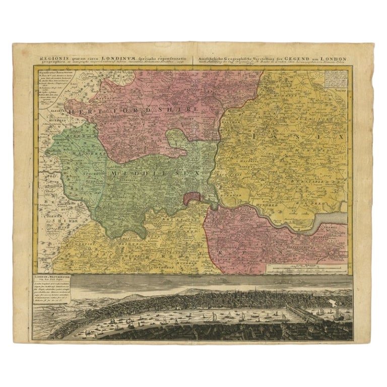
Antique Map of London Showing the Area from Essex to Surrey, England, 1741
Located in Langweer, NL
Antique map titled 'Regionis quae est circa Londinum specialis repraesentatio (..)'
Very detailed map showing the area from Essex to Surrey and shows a lovely view of London with a high level of detail, stretching from Old London Bridge...
Category
Antique 18th Century Maps
Materials
Paper

Antique Map of the British Isles and Part of Europe by Chatelain, c.1720
Located in Langweer, NL
Antique map titled 'Carte pour l'Intelligence de l'Histoire d'Angleterre (..)'. Decorative map showing the British Isles and the various regions conquered in Europe. Includese two elaborate family trees for the House of York...
Category
Antique 18th Century Maps
Materials
Paper
Antique Map of London by Tirion
1754
Located in Langweer, NL
Antique map titled 'Kaart van Londen enz. en van het naby gelegen land ruim een Uur gaans rondsom dezelve Stad; getrokken uit de groote gemeeten Kaart van Hr. John Rocque'. In the se...
Category
Antique Mid-18th Century Maps
Materials
Paper

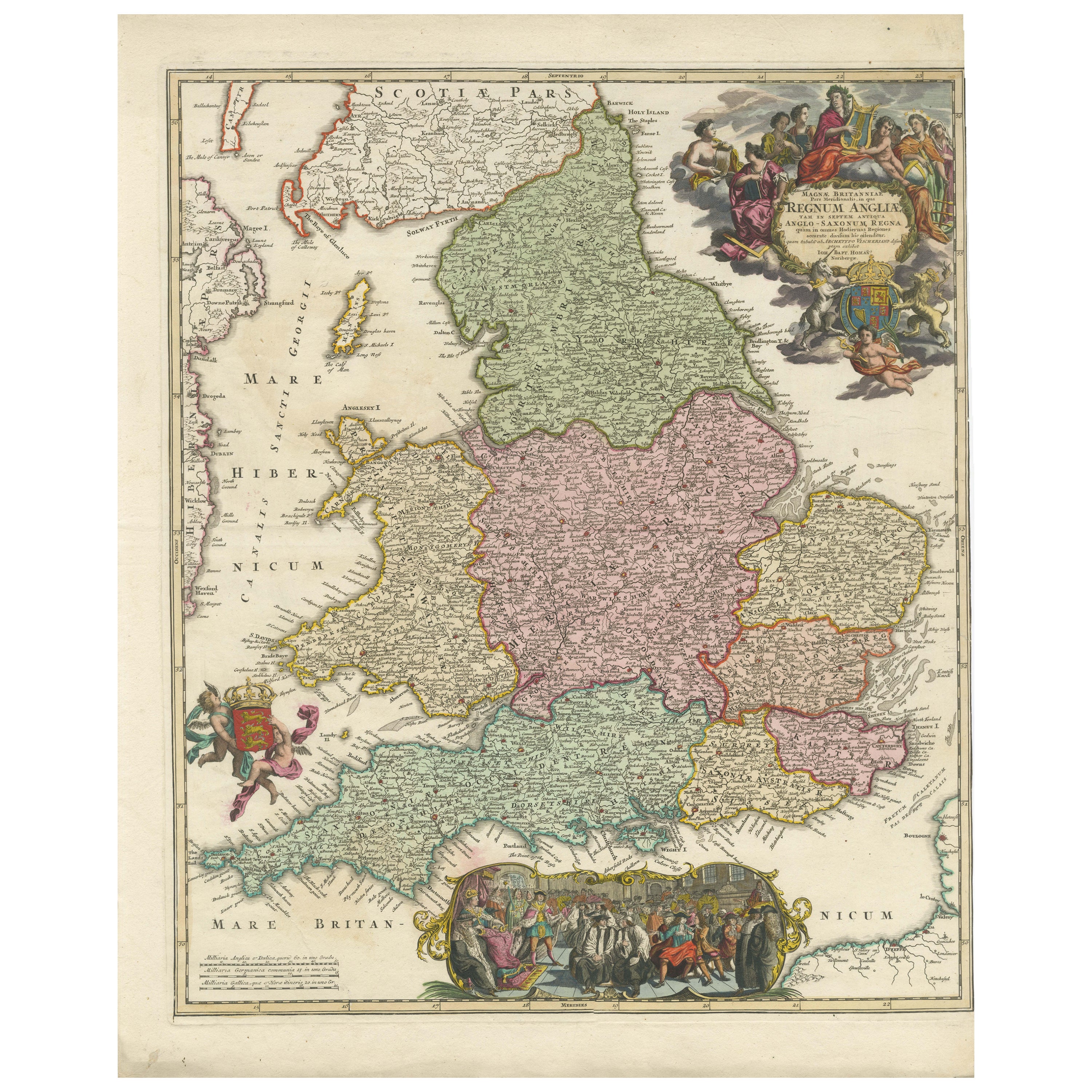
Rare 1690 Map of England by Nicolaes Visscher II – Heptarchy Depicted
Located in Langweer, NL
Map of England 1690 by Nicolaes Visscher II – Heptarchy and Counties Shown
Antique 1690 map of England by Nicolaes Visscher II, showing the Anglo-Saxon Heptarchy and detailed county...
Category
Antique Late 17th Century Dutch Maps
Materials
Paper
$1,633 Sale Price
20% Off
Antique Map of England and Ireland by Lattre, 1789
Located in Langweer, NL
Antique map titled 'Les Royaumes d'Angleterre d'Ecosse et d'Irlande'. Original antique map of England and Ireland. Originates from 'Petit Atlas ...
Category
Antique 18th Century Maps
Materials
Paper

You May Also Like
Antique Road Map, London to Hythe, Kent, English, Cartography, John Ogilby, 1675
Located in Hele, Devon, GB
This is an antique Road Map from London to Hythe, Kent. An English, cartographic atlas excerpt by John Ogilby, dating to the late 17th century with later frame, circa 1675
A superb ...
Category
Antique 17th Century British Queen Anne Maps
Materials
Glass, Paper
Great Britain, N. France: A Large 17th C. Hand-colored Map by Sanson and Jaillot
By Nicholas Sanson d
Abbeville
Located in Alamo, CA
This large hand-colored 17th century copperplate engraved map entitled "Le Royaume D Angleterre, distingué en ses Provinces. Par le Sr. Sanson. Geographe du Roy. Presenté A Monseigne...
Category
1690s Landscape Prints
Materials
Engraving

Map of Oxfordshire by Joan Blaeu with college crests
By Joan (Johannes) Blaeu
Located in London, GB
To see our other original maps, scroll down to "More from this Seller" and below it click on "See all from this Seller" - or send us a message if you cannot find the poster you want....
Category
1660s Landscape Prints
Materials
Engraving
Antique Map - Gallia - Etching by Johannes Janssonius - 1650s
By Johannes Janssonius
Located in Roma, IT
Antique Map - Gallia is an antique map realized in 1650 by Johannes Janssonius (1588-1664).
The Map is Hand-colored etching, with coeval watercoloring.
Good conditions with slight ...
Category
1650s Modern Figurative Prints
Materials
Etching

Antique Map of London by Thomas Moule and William Schmollinger
Located in Rochester, NY
Decorative engraved map of London by William Schmollinger for Moule's English County maps. Hand colored. Circa 1830's.
Category
Antique Early 19th Century English Prints
Materials
Paper
17th Century Hand Colored Map of the Liege Region in Belgium by Visscher
By Nicolaes Visscher II
Located in Alamo, CA
An original 17th century map entitled "Leodiensis Episcopatus in omnes Subjacentes Provincias distincté divisusVisscher, Leodiensis Episcopatus" by Nicolaes Visscher II, published in Amsterdam in 1688. The map is centered on Liege, Belgium, includes the area between Antwerp, Turnhout, Roermond, Cologne, Trier and Dinant.
This attractive map is presented in a cream-colored mat measuring 30" wide x 27.5" high. There is a central fold, as issued. There is minimal spotting in the upper margin and a tiny spot in the right lower margin, which are under the mat. The map is otherwise in excellent condition.
The Visscher family were one of the great cartographic families of the 17th century. Begun by Claes Jansz Visscher...
Category
Antique Late 17th Century Dutch Maps
Materials
Paper

$940 Sale Price
20% Off
More Ways To Browse
London Antique And Collectable London
Used Government Furniture
French Antique Furniture London
Paisley Rugs and Carpets
Black And Chrome Lounge Chair
Vintage 1930 Dining Room Set
Antique Victorian Dining Tables
Environment Furniture
Italian Plastic Chairs
Made In Belgium
Black Crystal Glasses
French Mid Century Modern Rug
China Silk Rug
Chrome Glass Coffee Tables
Antique Italian Chairs
Antique Walnut Bar
Beni Ourain Rugs
French Iron And Glass Table