Items Similar to European Russia Map with Saint Petersburg Inset – Nieuwe Hand-Atlas, 1876


Want more images or videos?
Request additional images or videos from the seller
1 of 9
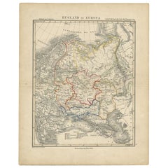
European Russia Map with Saint Petersburg Inset – Nieuwe Hand-Atlas, 1876
$443.98
£329.02
€370
CA$606.80
A$660.55
CHF 350.62
MX$7,947.81
NOK 4,442.82
SEK 4,070.88
DKK 2,818.40
About the Item
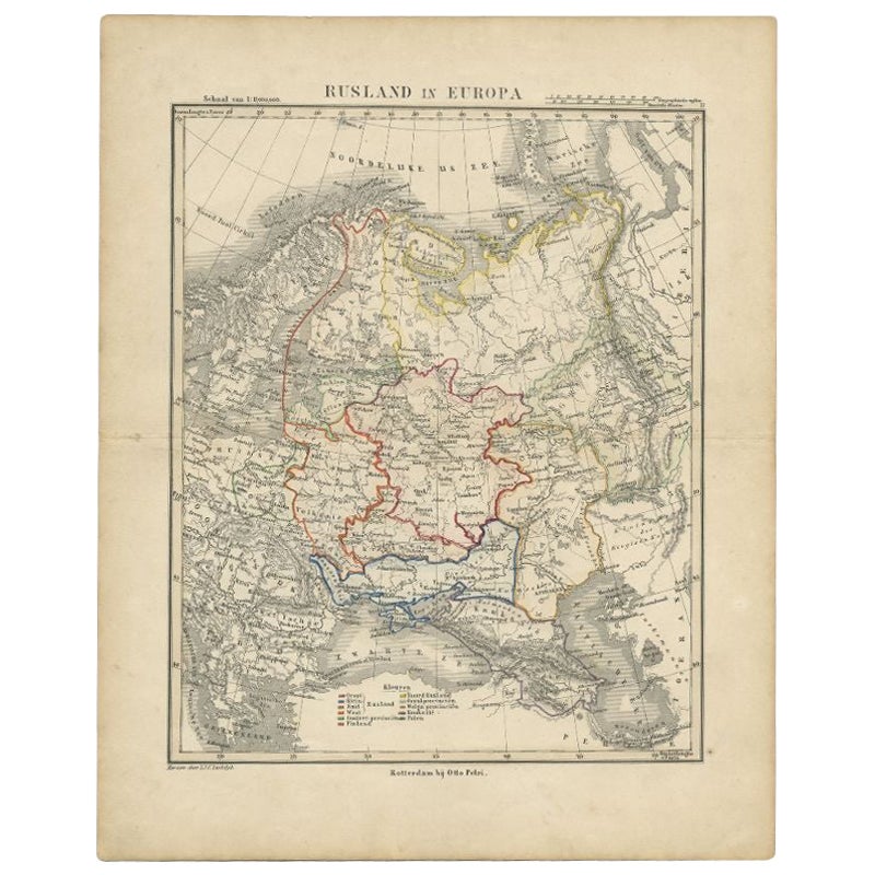
European Russia Map with Saint Petersburg Inset – Nieuwe Hand-Atlas, 1876
This finely engraved 19th-century map titled “Rusland in Europa” presents the western portion of the Russian Empire as it appeared in the late 19th century, shortly before the sweeping political changes of the early 20th century. Published in 1876 in the Nieuwe Hand-Atlas der Aarde in haren Tegenwoordigen Toestand by M. Frijlink, revised by A. van Otterloo and issued by D. Noothoven van Goor in Leiden, the map offers a detailed geographic portrait of one of the most expansive and influential empires of its time.
The map covers all of European Russia, extending from the Baltic Sea and Finland in the north to the Black Sea and the Caucasus in the south, and from Poland and Galicia in the west to the Ural regions marking the border with Asia. Major cities including Saint Petersburg, Moscow, Kiev, Odessa, Riga, Vilna, Kazan, Astrakhan, Tiflis (Tbilisi), and Sevastopol are clearly labeled, along with hundreds of provincial towns, rivers, and administrative boundaries.
Hand-colored outlines indicate the borders of historic regions such as Courland, Livonia, Lithuania, Belarus, Ukraine, Crimea, the Don Cossack territories, the Caucasus provinces, and the governments of Novgorod, Smolensk, Tambov, Saratov, and others. The dense network of rivers—including the Dnieper, Volga, Don, Neva, and Dniester—is precisely rendered, illustrating the importance of waterways to Russian trade, military movement, and communication.
Inset maps deepen the context: one details Saint Petersburg with its canals, fortifications, and early railway lines; another inset highlights the Baltic provinces; and a southern inset depicts the Black Sea region, including Crimea and the approaches to the Caucasus.
This map reflects the Russian Empire during a period of rapid modernization and territorial consolidation. The meticulous engraving and subtle hand-coloring demonstrate the precision typical of Dutch educational cartography in the 19th century, while the balanced layout preserves clarity despite the vastness of the subject. Frijlink’s atlas was widely used in Dutch schools, and this map remains an excellent example of the era’s combination of academic rigor and aesthetic refinement.
Condition Report: Good condition overall with light toning and minor foxing in the outer margins. Original center fold as issued. The printed image is sharp, with clean lines and soft, well-preserved hand-coloring. No tears, holes, or significant defects.
Framing Tips: A light ivory or warm cream mat complements the subtle hand-coloring, while a slim black, walnut, or dark oak frame enhances the historical feel. The map’s intricate detail benefits from a slightly wider mat border, allowing space for the inset maps to be appreciated. Ideal for libraries, offices, and interiors focused on history, geopolitics, or early cartography.
Keywords:
Russia, Rusland, European Russia, Russian Empire, Saint Petersburg, Moscow, Kiev, Odessa, Riga, Vilna, Vilnius, Minsk, Kazan, Astrakhan, Tiflis, Tbilisi, Sevastopol, Crimea, Black Sea, Baltic Sea, Finland, Poland, Lithuania, Livonia, Courland, Belarus, Ukraine, Caucasus, Georgia, Armenia, Chechnya, Dagestan, Kuban, Don Cossacks, Volga River, Don River, Dnieper River, Dniester River, Neva River, Ural Mountains, Caucasus Mountains, Saint Petersburg inset, Crimea inset, Baltic inset, 19th century Russia map, 1876 Russia map, Tsarist Russia, Imperial Russia.
- Dimensions:Height: 21.66 in (55 cm)Width: 17.33 in (44 cm)Depth: 0.01 in (0.2 mm)
- Materials and Techniques:
- Place of Origin:
- Period:
- Date of Manufacture:1876
- Condition:Good condition overall with light toning and minor foxing in the outer margins. Original center fold as issued. The printed image is sharp, with clean lines and soft, well-preserved hand-coloring. No tears, holes, or significant defects.
- Seller Location:Langweer, NL
- Reference Number:Seller: BG-12788-191stDibs: LU3054347559232
About the Seller
5.0
Recognized Seller
These prestigious sellers are industry leaders and represent the highest echelon for item quality and design.
Platinum Seller
Premium sellers with a 4.7+ rating and 24-hour response times
Established in 2009
1stDibs seller since 2017
2,819 sales on 1stDibs
Typical response time: 1 hour
- ShippingRetrieving quote...Shipping from: Langweer, Netherlands
- Return Policy
More From This Seller
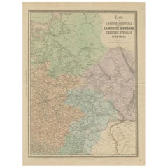
View AllAntique Map of Russia in Europe by Petri, c.1873
Located in Langweer, NL
Antique map titled 'Rusland in Europa'. Old map depicting Russia in Europe. This map originates from 'School-Atlas van alle Deelen der Aarde'. Artists and Engravers: Published by O. ...
Category
Antique 19th Century Maps
Materials
Paper
$93 Sale Price
20% Off
Antique Map of Russia in Europe by Levasseur,
1875
Located in Langweer, NL
Antique map titled 'Carte générale de la Russie d'Europe (..)'. Large map of Russia in Europe. This map originates from 'Atlas de Géographie Moderne Physique et Politique' by A. Leva...
Category
Antique Late 19th Century Maps
Materials
Paper

$335 Sale Price
20% Off
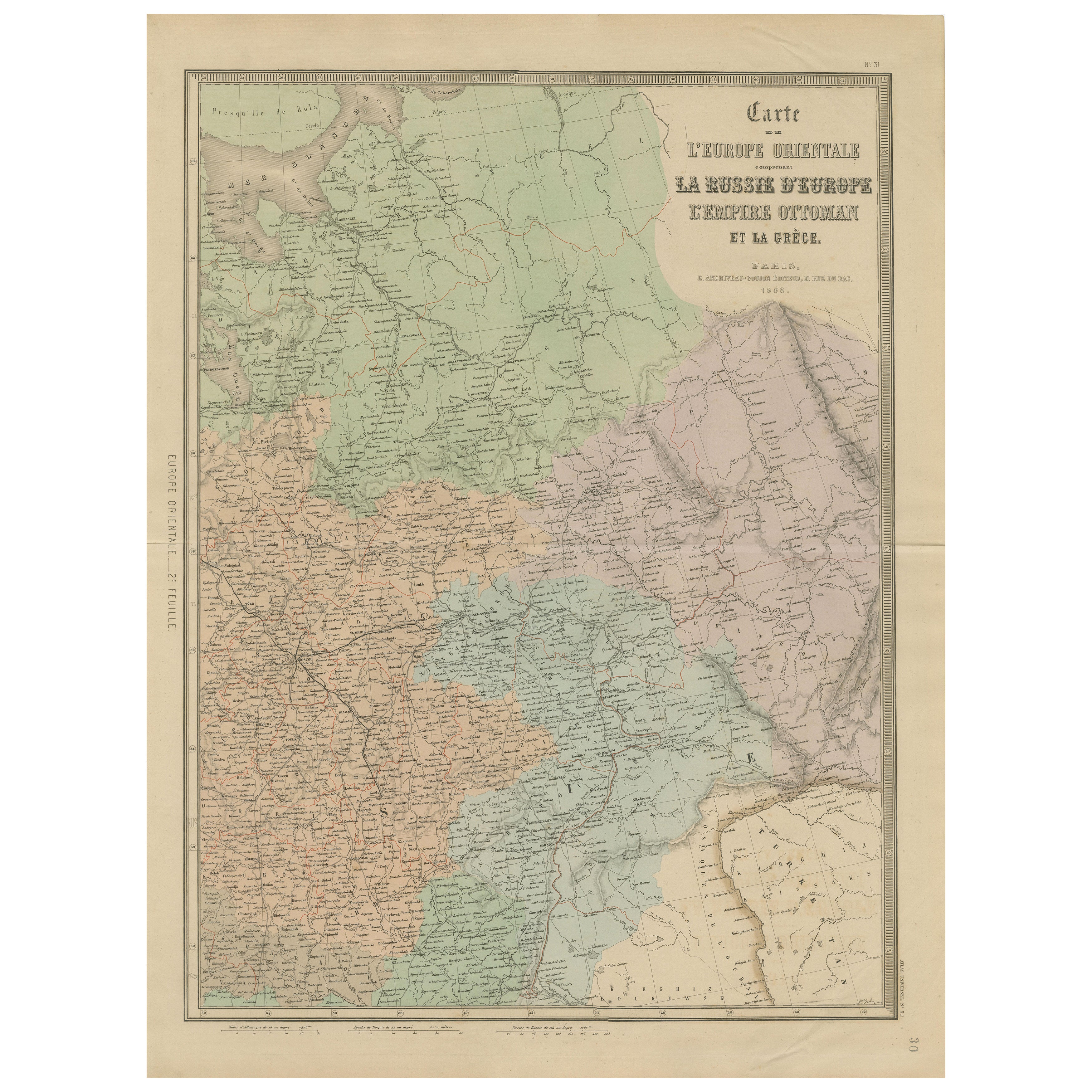
Antique Map of Eastern Europe – Russia, Ottoman Empire
Greece, 1868
Located in Langweer, NL
Antique Map of Eastern Europe – Russia, Ottoman Empire and Greece by Andriveau-Goujon, 1868
This detailed antique map titled “Carte de l’Europe Orientale, la Russie d’Europe, l’Empi...
Category
Antique Mid-19th Century French Maps
Materials
Paper
Antique Map of Russia
in Europe
by W.
A.K. Johnston, circa 1850
By W.
A.K. Johnston
Located in Langweer, NL
Antique Map: Russia in Europe by W. & A.K. Johnston, Circa 1850
This highly detailed antique map, titled *Russia in Europe,* was created by the esteemed Scottish cartographers W. ...
Category
Antique Mid-19th Century Maps
Materials
Paper

$230 Sale Price
34% Off
Antique 1842 Map of Russia in Europe by Pierre M. Lapie
Located in Langweer, NL
Antique map titled 'Carte de la Russie d'Europe'. Map of Russia in Europe. This map originates from 'Atlas universel de géographie ancienne et moderne (....
Category
Antique 19th Century French Maps
Materials
Paper

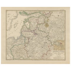
1858 Map of the Baltic States
Inner Russia to Moscow – Justus Perthes
Located in Langweer, NL
1858 Map of the Baltic States & Inner Russia to Moscow – Justus Perthes
Description:
Antique map titled "Ostsee-Länder und das Innere Russland bis Moskau," published by Justus Perth...
Category
Antique Mid-19th Century German Maps
Materials
Paper
You May Also Like
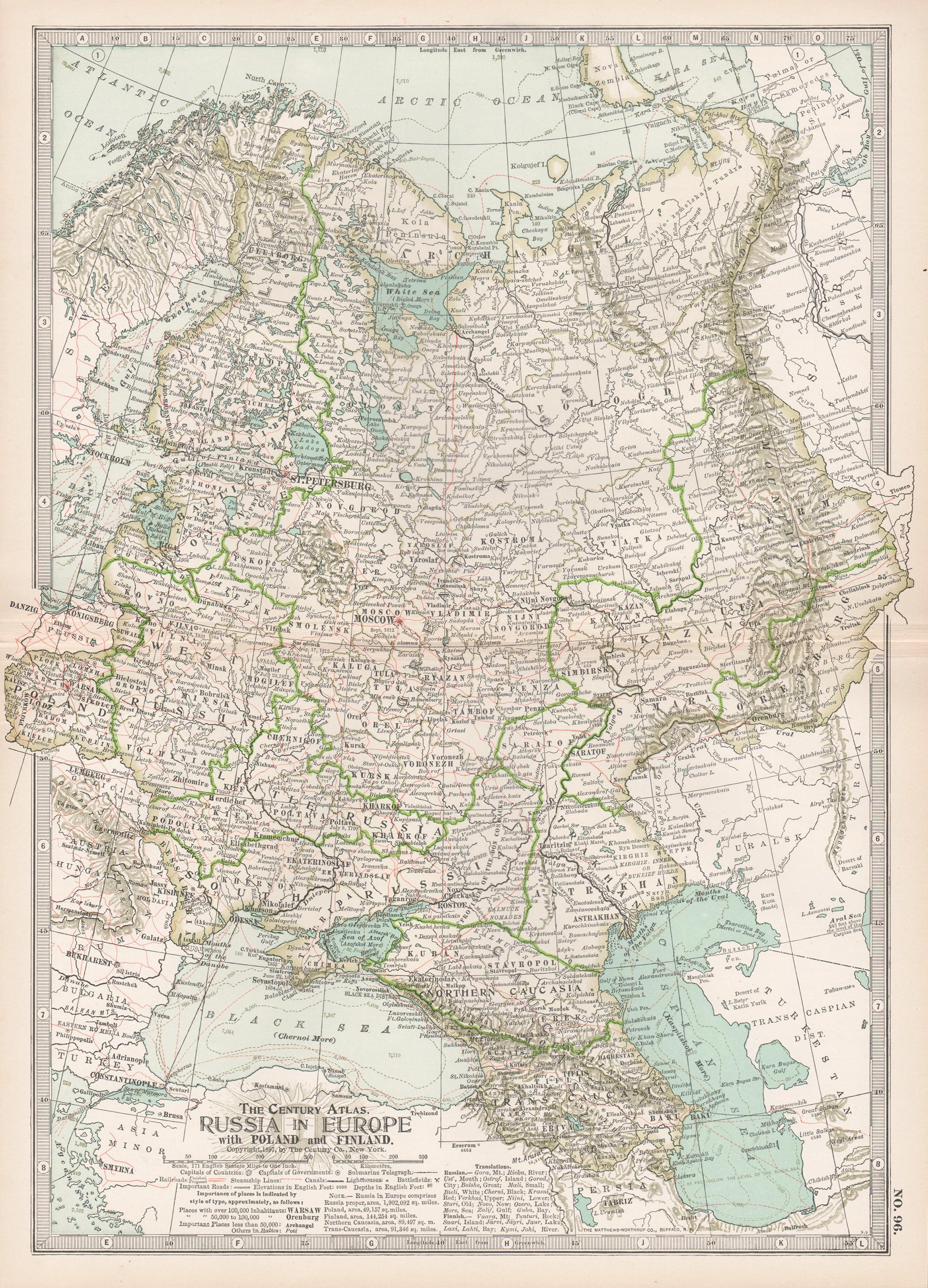
Russia in Europe with Poland and Finland. Century Atlas antique vintage map
Located in Melbourne, Victoria
'The Century Atlas. Russia in Europe with Poland and Finland'
Original antique map, 1903.
Central fold as issued. Map name and number printed on the reverse corners.
Sheet 40cm by ...
Category
Early 20th Century Victorian More Prints
Materials
Lithograph

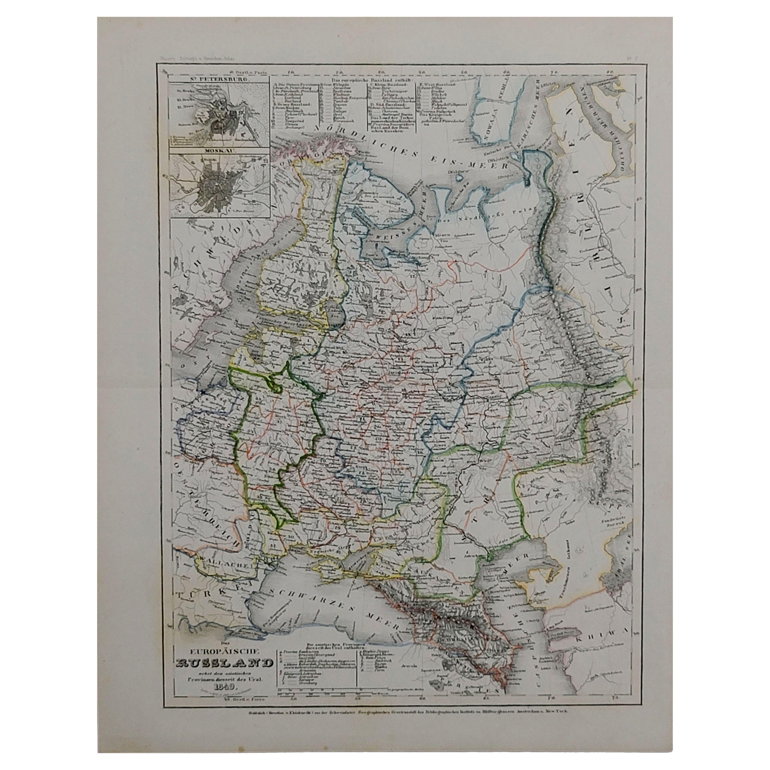
1849 Map of "Europaische Russland",
Meyer Map of European Russia
, Ric. R017
Located in Norton, MA
1849 Map of
"Europaische Russland"
( Meyer Map of European Russia)
Ric.r017
A lovely map of European Russia dating to 1849 by Joseph Meyer. It covers the European portions of...
Category
Antique 19th Century Unknown Maps
Materials
Paper

Russia, Western and Southern Part. Century Atlas antique vintage map
Located in Melbourne, Victoria
'The Century Atlas. Russia, Western and Southern Part'
Original antique map, 1903.
Inset map tilted 'St Petersburg and Environs'.
Central fold as issued. Map name and number printe...
Category
Early 20th Century Victorian More Prints
Materials
Lithograph

1853 Map of "Russia in Europe Including Poland" Ric.r016
Located in Norton, MA
Description
Russia in Europe incl. Poland by J Wyld c.1853
Hand coloured steel engraving
Dimension: Paper: 25 cm W x 33 cm H ; Sight: 22 cm W x 28 cm H
Condition: Good ...
Category
Antique 19th Century Unknown Maps
Materials
Paper

1832 Large Map "Russian
Poland" Ric. R0012
Located in Norton, MA
Large map 1832
"Russian & Poland"
Ric.r0012
Russia & Poland, by J. Arrowsmith. London, pubd. 15 Feby. 1832 by J. Arrowsmith, 35 Essex Street, Strand., ...
Category
Antique 19th Century Unknown Maps
Materials
Paper

1790 Thomas Stackhouse Map, Entitled "Russia in Europe, " , Ric.a004
Located in Norton, MA
1790 Thomas Stackhouse map, entitled
"Russia in Europe"
Ric.a004
Stackhouse, Thomas
Russia in Europe [map]
London: T. Stackhouse, 1783. Map. Matted hand-colored copper engraving. Image size: 14.5 x 15.25 inches. Mat size: 22.75 x 23.75 inches. A beautiful example of this map of Eastern Europe...
Category
Antique 17th Century Unknown Maps
Materials
Paper
