Items Similar to Framed Map of Texas Circa 1886


Want more images or videos?
Request additional images or videos from the seller
1 of 6
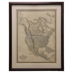
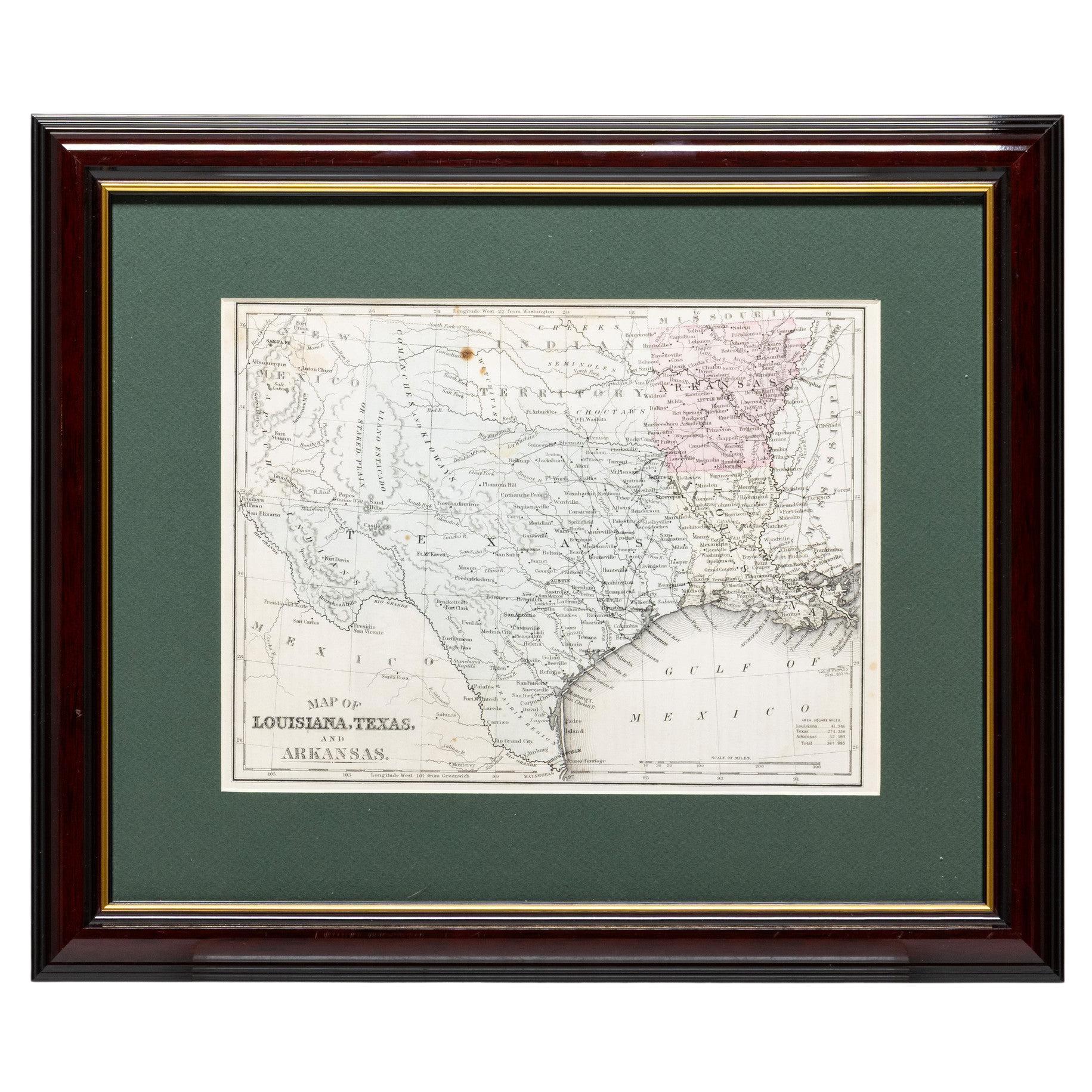
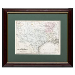
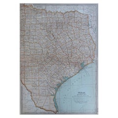
Framed Map of Texas Circa 1886
$1,725
£1,306.53
€1,500.50
CA$2,417.29
A$2,628.08
CHF 1,393.41
MX$31,504.02
NOK 17,709.54
SEK 16,224.35
DKK 11,214.35
About the Item
Framed circa 1886 map of Texas including Louisiana, Texas and Arkansas, with Indian territory. Well detailed. Great for display in any home. Encased in cherry and gold frame with dark green mating. Size: 10 1/2" x 8". frame 17" x 14 1/2"
Family Owned
Operated
Cisco’s Gallery deals in the rare, exceptional, and one-of-a-kind pieces that define the history of America and the Old West. Our pieces range from American Indian to Cowboy Western and include original items of everyday life, commerce, art, and warfare that tamed America’s frontier. Our 14,000 square foot gallery opened in 1996 in beautiful Coeur d’Alene, Idaho.
Personal Service
Cisco’s operates on old fashioned values – honesty and integrity, and all of our items are backed by our money back guarantee. We appreciate the opportunity to earn your business. Whether you desire assistance with a jewelry purchase, choosing a gift, identification, or even selling – we hope to be your trusted source.
- Dimensions:Height: 12 in (30.48 cm)Width: 17 in (43.18 cm)Depth: 2 in (5.08 cm)
- Materials and Techniques:
- Place of Origin:
- Period:
- Date of Manufacture:1886
- Condition:Wear consistent with age and use.
- Seller Location:Coeur d Alene, ID
- Reference Number:Seller: AK07161stDibs: LU4019346288812
About the Seller
5.0
Vetted Professional Seller
Every seller passes strict standards for authenticity and reliability
Established in 1996
1stDibs seller since 2018
262 sales on 1stDibs
Typical response time: 4 hours
- ShippingRetrieving quote...Shipping from: Coeur d Alene, ID
- Return Policy
More From This Seller
View AllFramed Map of Texas Circa 1880
Located in Coeur d
Alene, ID
Framed circa 1880 map of Texas with Louisiana and Arkansas. Well detailed. Great for display in any home. Encased in cherry and gold frame with dark green mating. Size: 11" x 9", fra...
Category
Antique Late 19th Century American Maps
Materials
Paper
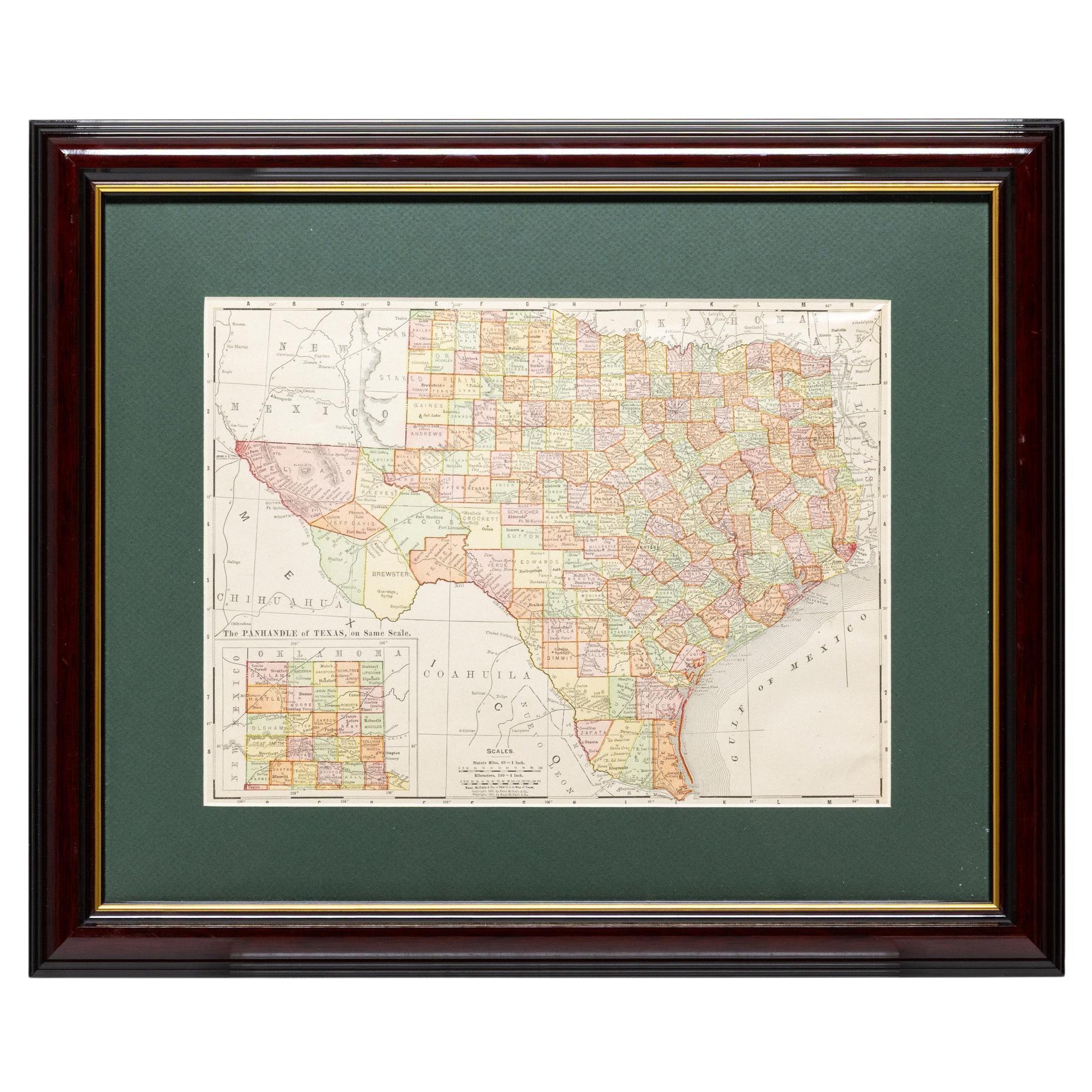
Framed Map of Texas Circa 1908
Located in Coeur d
Alene, ID
Framed circa 1908 map of Texas. Each county separated and colored with panhandle of Texas on same scale in left corner. Well detailed. Would display nicely in any home. Encased in ch...
Category
Early 20th Century American Maps
Materials
Paper
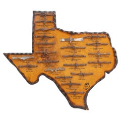
Texas Shaped Barbed Wire Display
Located in Coeur d
Alene, ID
Texas shaped barbed wire display. Wood cutout of Texas with 22 different varieties of barbed wire, each labeled with name and patent year. Exterior framed with scalloped wood edge. M...
Category
Late 20th Century American Shadow Boxes
Materials
Wire
Texas Shaped Barbed Wire Display
Located in Coeur d
Alene, ID
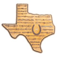
Texas shaped barbed wire display. Wood cutout of Texas with 25 different varieties of barbed wire, each hand-labeled with name and patent year. Center having old horseshoe and steer ...
Category
Late 20th Century American Shadow Boxes
Materials
Metal
Texas Shaped Barbed Wire Display
Located in Coeur d
Alene, ID
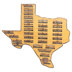
Texas shaped barbed wire display. Wood cutout of Texas with 31 different varieties of barbed wire, each labeled with name and patent year. Exterior framed with scalloped wood edge. C...
Category
Late 20th Century American Shadow Boxes
Materials
Wire
Iowa Statehood Flag
Located in Coeur d
Alene, ID
29 Star American (Iowa) parade flag with double medallion pattern. Circa 1847-1848. Flag 5 3/4" x 9" printed on gauze. The 29 star flag became the official US flag in 1847 with the a...
Category
Antique Mid-19th Century American Historical Memorabilia
Materials
Fabric
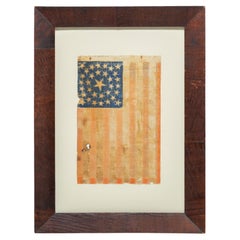
$6,325
You May Also Like
Framed 1839 Hand Colored Map of the United States
Located in Stamford, CT
Framed hand colored map of the United States of America from 1839. Newly framed in a giltwood frame.
Category
Antique 1830s American American Classical Maps
Materials
Giltwood, Paper, Glass

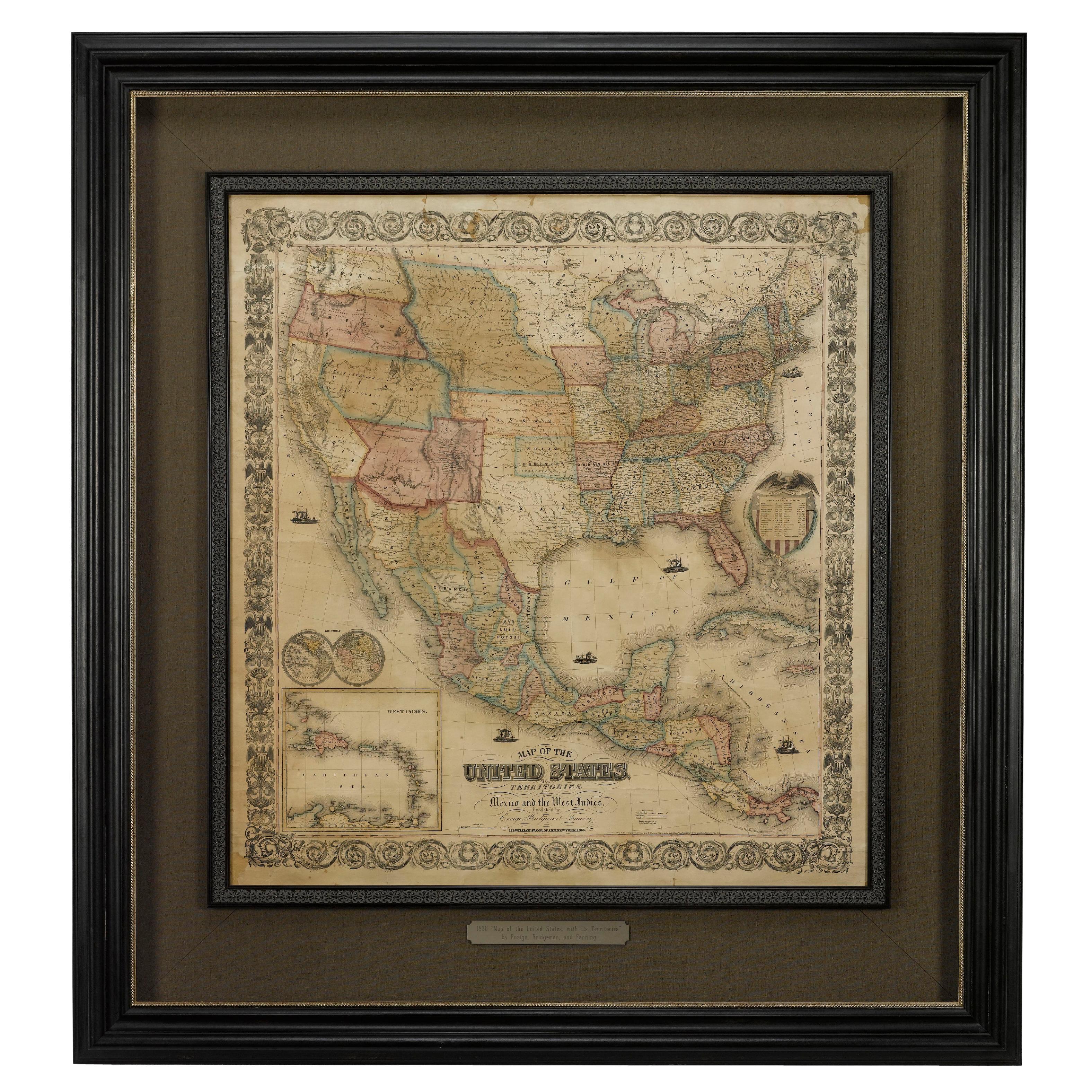
1856 "Map of the United States" by Ensign, Bridgeman, and Fanning
Located in Colorado Springs, CO
Presented is a scarce American wall map of the United States and Mexico issued by Ensign, Bridgman, and Fanning in 1856. As the title suggests, the map covers all of the United State...
Category
Antique 1850s American Victorian Maps
Materials
Paper

1830 Mexico and United States Framed Map
Located in Stamford, CT
Map of North America published circa 1830. Map shows United States into Canada. Mexico extending into the upper California territory. Texas appears in name but prior to the period of...
Category
Antique 1830s American American Classical Maps
Materials
Glass, Wood, Paper

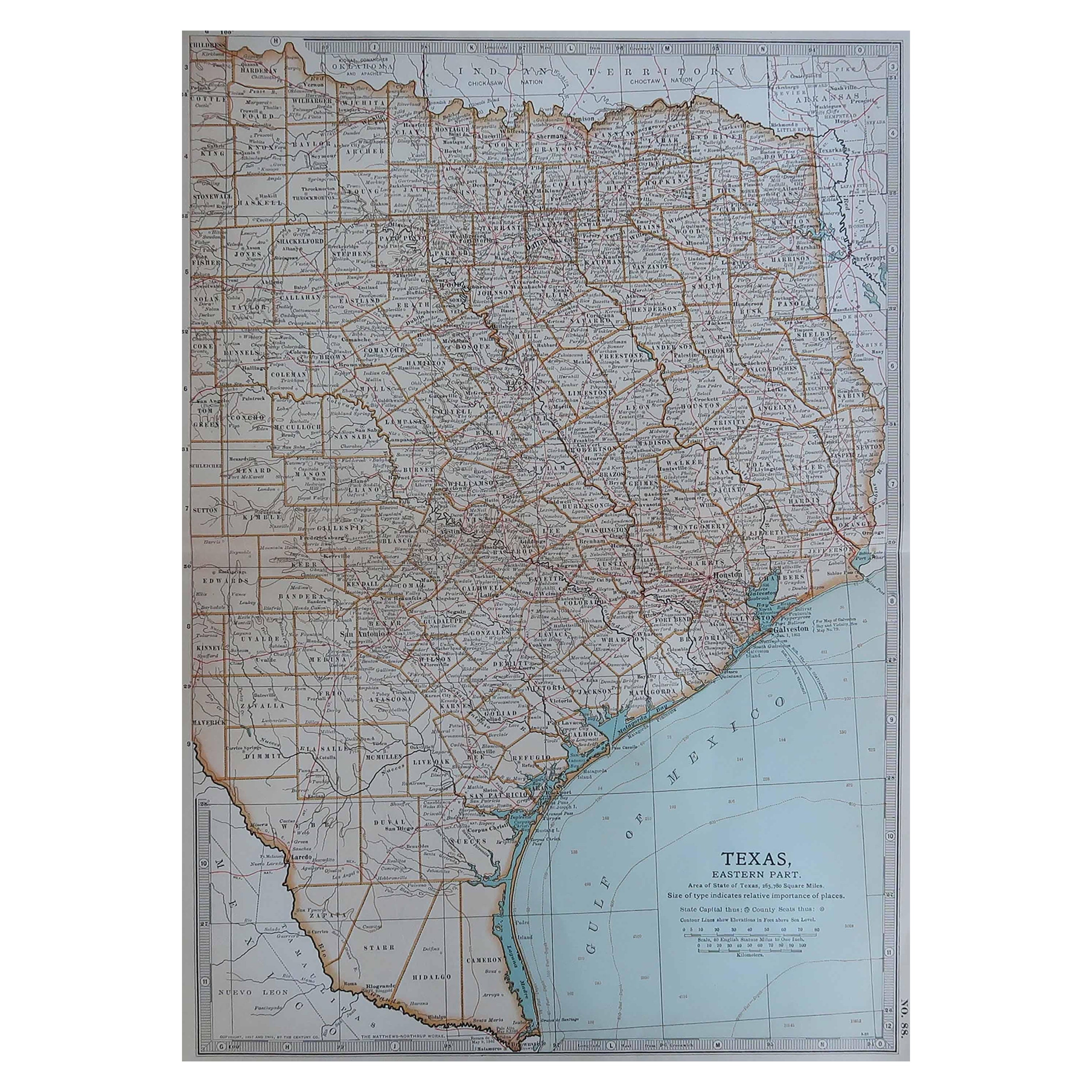
Original Antique Map of the American State of Texas ( Eastern Part ), 1903
Located in St Annes, Lancashire
Antique map of Texas ( Eastern part )
Published By A & C Black. 1903
Original colour
Good condition
Unframed.
Free shipping
Category
Antique Early 1900s English Maps
Materials
Paper
1866 "Johnson
s United States" Map, Published by Johnson and Ward
Located in Colorado Springs, CO
Presented is a detailed map of the United States by A. J. Johnson. Spanning the whole of the continental United States, as well as adjacent parts of Canada and Mexico, the map reflec...
Category
Antique 1860s American Victorian Maps
Materials
Paper

Framed 1838 North America
Recent Discoveries Map
Located in Stamford, CT
1838 map of North America & recent discoveries. Engraved color map by J. Wyld, London, England. This map shows Texas as a Republic without its panhandle.
Framed in brown carved wood...
Category
Antique 1830s American American Classical Maps
Materials
Glass, Wood, Paper