Items Similar to French Guiana and Cayenne: Mid-19th Century Map from France Pittoresque Series
Want more images or videos?
Request additional images or videos from the seller
1 of 8
French Guiana and Cayenne: Mid-19th Century Map from France Pittoresque Series
$113.91
$142.3920% Off
£85.04
£106.3020% Off
€96
€12020% Off
CA$158.25
CA$197.8220% Off
A$170.23
A$212.7820% Off
CHF 90.97
CHF 113.7220% Off
MX$2,006.47
MX$2,508.0920% Off
NOK 1,146.96
NOK 1,433.7020% Off
SEK 1,048.54
SEK 1,310.6820% Off
DKK 731.63
DKK 914.5320% Off
About the Item
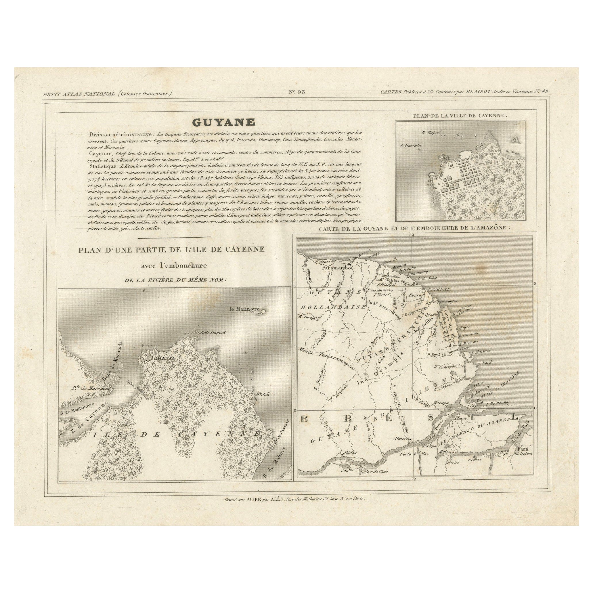
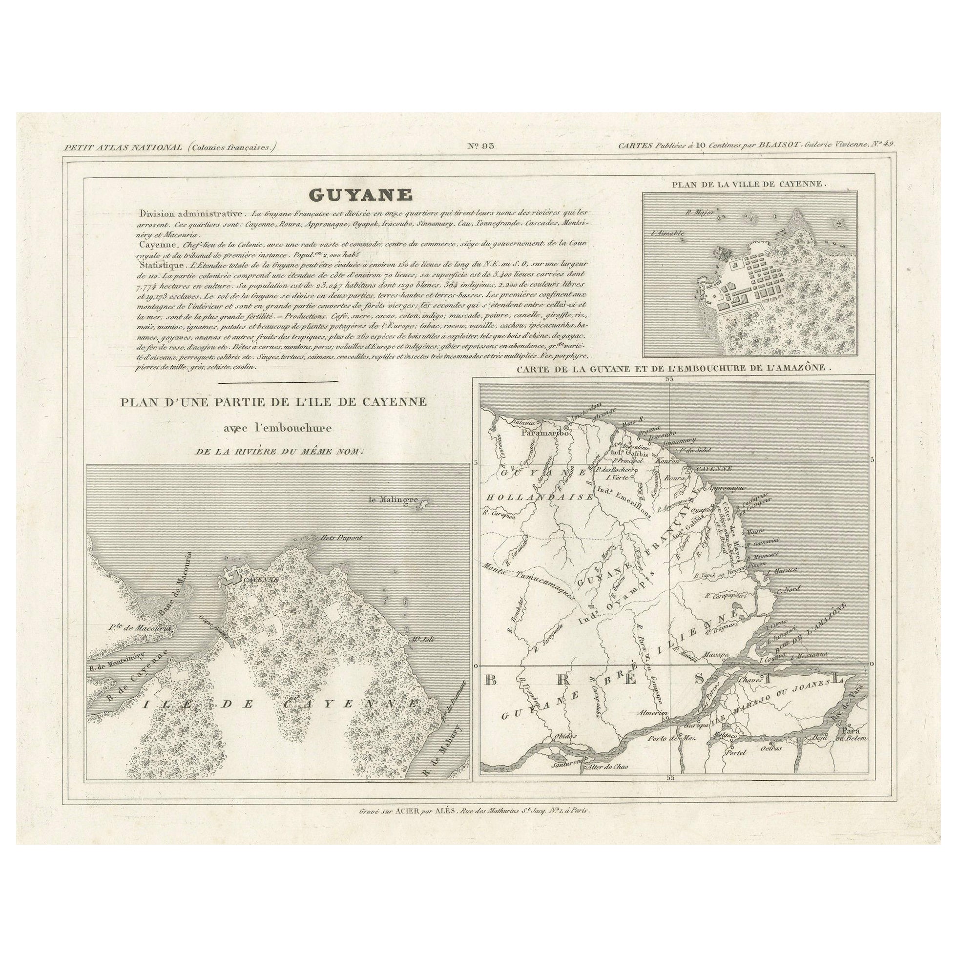
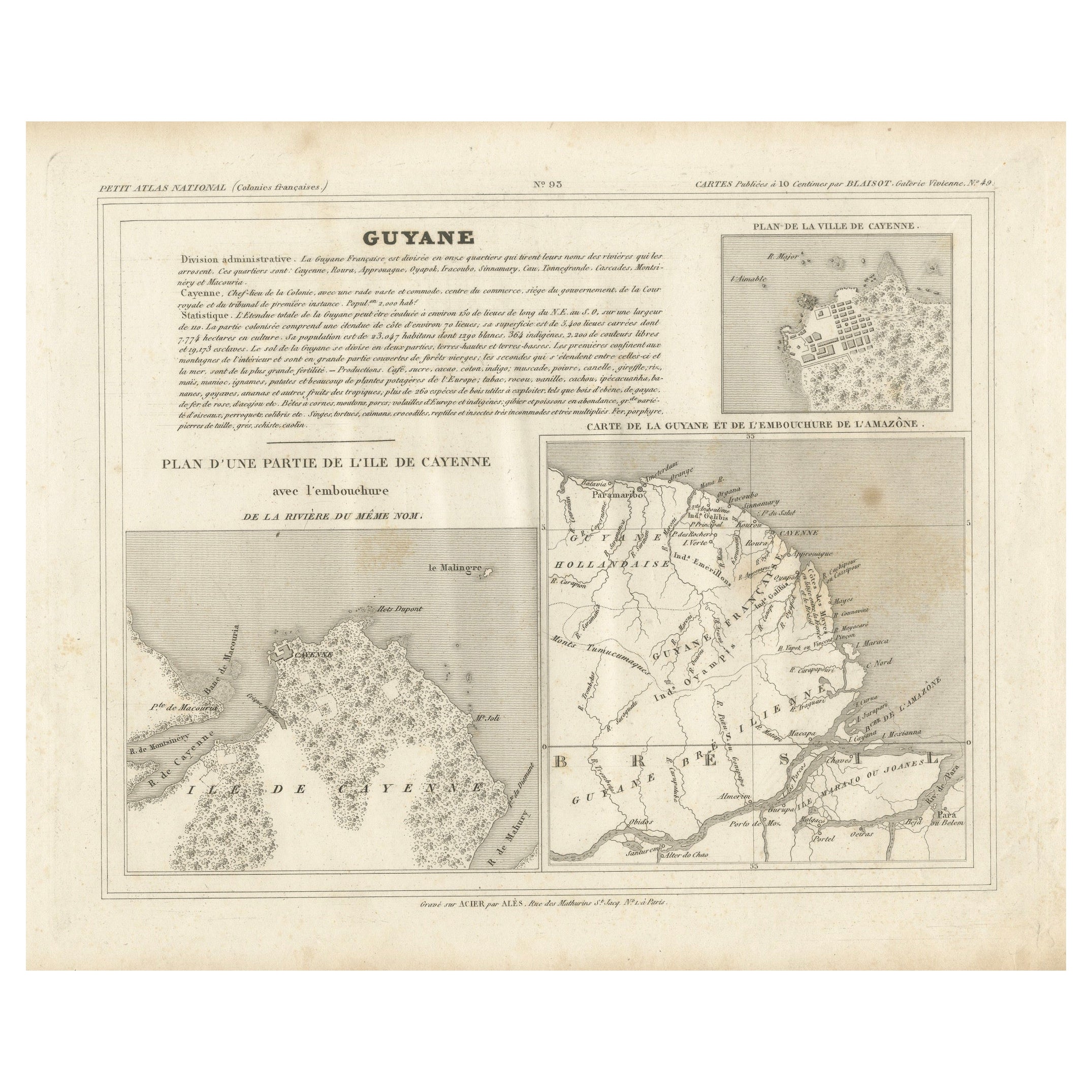
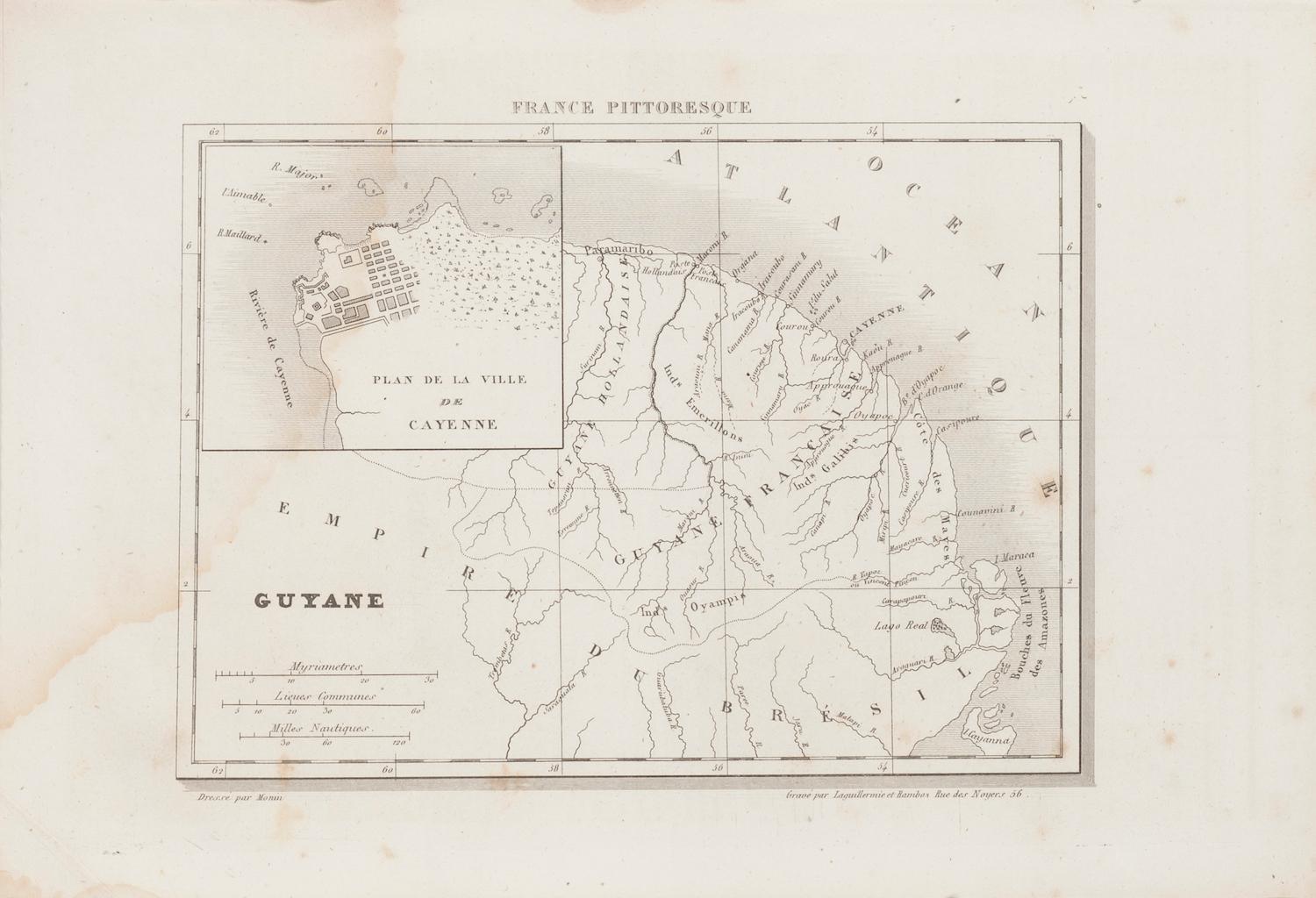
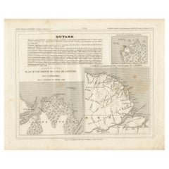
This map titled "Guyane" is part of the France Pittoresque series and provides a detailed view of French Guiana along with a plan of the city of Cayenne.
Features:
- The map showcases the broader region of French Guiana, indicating key rivers, settlements, and the coastline along the Atlantic Ocean.
- To the left, there's an inset labeled "Plan de la Ville de Cayenne", which shows the street layout, squares, and main buildings of the capital city, Cayenne. This inset provides a more detailed view of the urban area, highlighting its geometric grid layout near the coast.
- The larger map outlines geographical features such as rivers (e.g., Oyapock and Maroni), forests, and territories in the surrounding area, including the neighboring Brazilian Empire.
- Major rivers, such as Oyapock (marking the boundary with Brazil), and the **Maroni** are indicated, alongside smaller rivers flowing toward the coast.
- A scale at the bottom left provides measurements in Myriamètres, Common Leagues, and Nautical Miles.
Historical Context:
- French Guiana was an important French colony in South America, and maps like this served both administrative and educational purposes. The city of **Cayenne** was a hub for colonial administration and trade.
- This map likely dates from the mid-19th century, during the period of French colonial expansion in South America. It provides a snapshot of the region’s geography and urban planning at that time.
Artistic and Cartographic Details:
- The map is finely engraved with clear lines marking both the urban and natural landscapes.
- It was drawn by Monin and engraved by Jacqueline and Barrière in Paris, with the address at **Rue des Noyers 56**.
The map titled "Guyane" from the **France Pittoresque** series, based on its style, cartographic details, and the publisher's information, likely dates from the mid-19th century, around 1835 to 1850.
This time frame corresponds with a period when French cartography was actively producing detailed maps of its overseas territories, and French Guiana was becoming more important as a colony, especially after the establishment of the penal colony in 1852. The urban plan of Cayenne and the territorial details suggest that it predates some of the later developments in the region.
Thus, a likely date for this map would be around 1840–1850.
- Dimensions:Height: 6.7 in (17 cm)Width: 11.03 in (28 cm)Depth: 0 in (0.02 mm)
- Materials and Techniques:
- Period:
- Date of Manufacture:circa 1850
- Condition:Condition: good, given age. General age-related toning and/or occasional minor defects from handling. Please study scan carefully.
- Seller Location:Langweer, NL
- Reference Number:Seller: BG-13093-211stDibs: LU3054341482132
About the Seller
5.0
Recognized Seller
These prestigious sellers are industry leaders and represent the highest echelon for item quality and design.
Platinum Seller
Premium sellers with a 4.7+ rating and 24-hour response times
Established in 2009
1stDibs seller since 2017
2,836 sales on 1stDibs
Typical response time: 1 hour
- ShippingRetrieving quote...Shipping from: Langweer, Netherlands
- Return Policy
More From This Seller
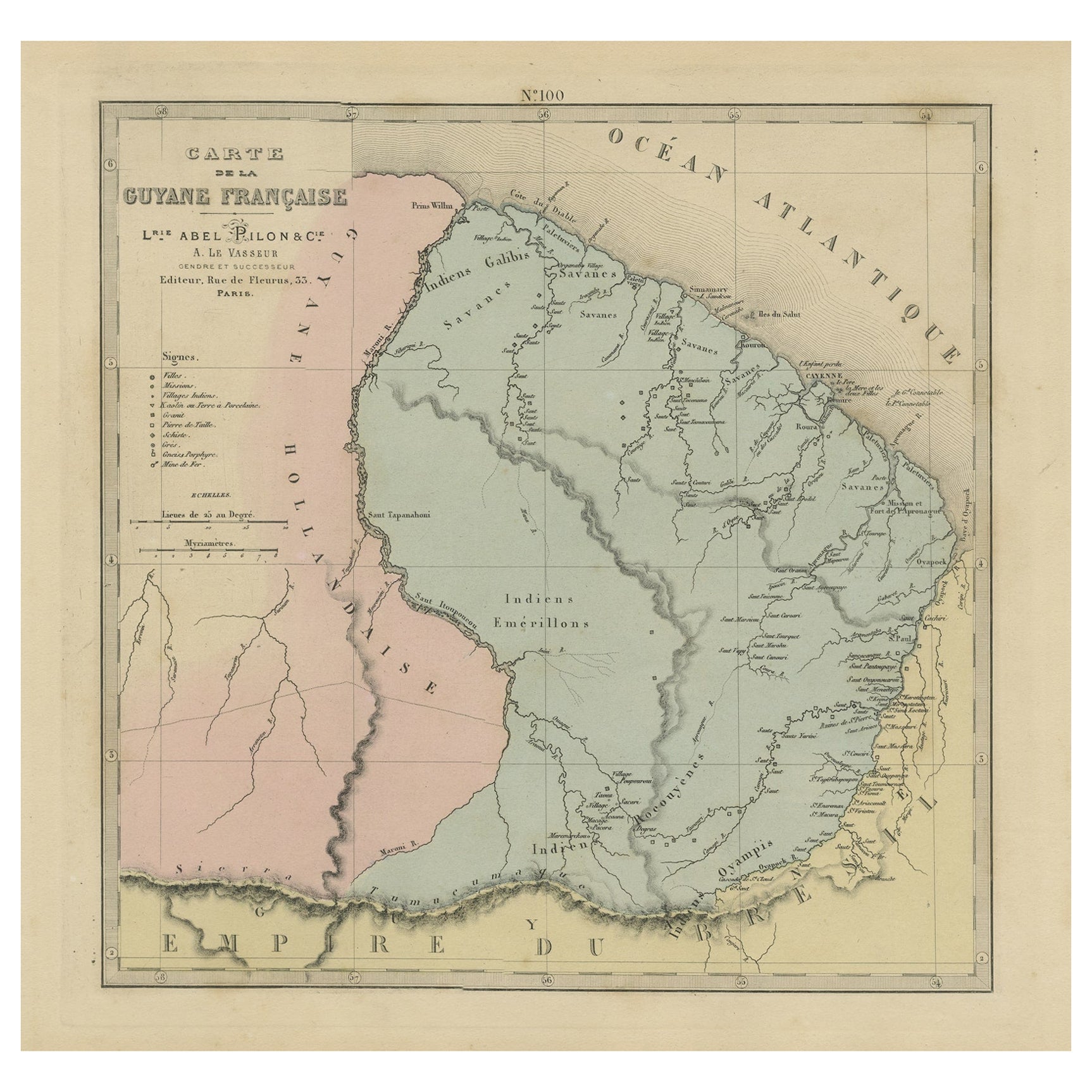
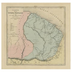
View AllAntique Map of French Guiana and Cayenne – Circa 1835
Located in Langweer, NL
Antique Map of French Guiana and Cayenne – Circa 1835
This rare 19th-century map of French Guiana, published around 1835, provides a detailed overview of the region, including the...
Category
Antique 1830s Maps
Materials
Paper
Map of French Guiana, Suriname and Cayenne: Plan from Petit Atlas National, 1820
Located in Langweer, NL
This map, titled "Guyane" (French Guiana), is part of the Petit Atlas National series, focusing on French colonies. Here are the key elements of the map and its context:
Features:
-...
Category
Antique 1820s Maps
Materials
Paper

$151 Sale Price
20% Off
Map of French Guiana: 19th Century Atlas National Depiction of Guyane Française
Located in Langweer, NL
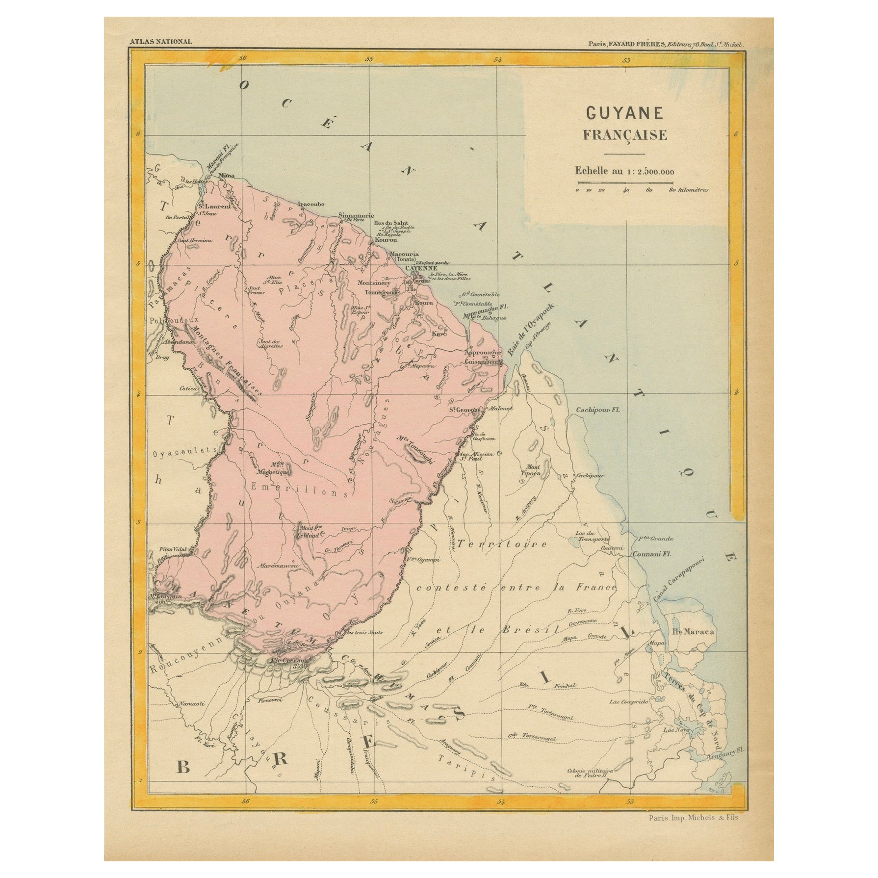
The map is titled "Guyane Française" (French Guiana) and is part of the Atlas National series. Here are the key details:
Features:
- The map focuses on French Guiana, a French overs...
Category
Antique 1890s Maps
Materials
Paper
$113 Sale Price
20% Off
Map of Guyane (French Guiana) with Cayenne, circa 1826
Located in Langweer, NL
Map of Guyane (French Guiana) with Cayenne, circa 1826
This is an antique French map titled “Guyane” from *Petit Atlas National (Colonies françaises)* published by Blaisot around 18...
Category
Antique Early 19th Century French Maps
Materials
Paper
Antique Engraved Map with Original Hand Colour of French Guiana, 1876
Located in Langweer, NL
The 1876 map of French Guiana from the "Grand Atlas Départemental de la France de L'Algérie et des colonies" by H. Fisquet, published by A. Le Vasseur in Paris, is a significant piec...
Category
Antique Late 19th Century Maps
Materials
Paper
$265 Sale Price
20% Off
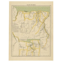
Suriname – Antique Dutch Colonial Map with Districts and Paramaribo Inset, 1905
Located in Langweer, NL
SURINAME – Dutch Colonial Map with Districts and Paramaribo Inset, 1905
Description:
This original early 20th-century map depicts Suriname, the former Dutch colony on the northern c...
Category
Early 20th Century Dutch Maps
Materials
Paper
You May Also Like
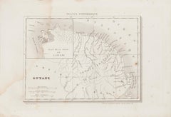
Ancient Map of Guyane - Original Etching - 19th Century
Located in Roma, IT
Map of Guyane is an original etching realized by an anonymous engraver of the 19th Century.
Belongs to the Series of "France Pittoresque" at the top center.
The state of preservati...
Category
19th Century Modern Figurative Prints
Materials
Etching
West Coast of Africa, Guinea
Sierra Leone: An 18th Century Map by Bellin
By Jacques-Nicolas Bellin
Located in Alamo, CA
Jacques Bellin's copper-plate map entitled "Partie de la Coste de Guinee Dupuis la Riviere de Sierra Leona Jusquau Cap das Palmas", depicting the coast of Guinea and Sierra Leone in ...
Category
Antique Mid-18th Century French Maps
Materials
Paper

Map Colonies Francaises Martinique, 1845
Located in BUNGAY, SUFFOLK
Colonies Francaises, Martinique, Amerique DU SUD
Geographie et Statistique par V.Levasseur. Ing'r Geographe.
Illustre par Raymond Bonheur, peintre.
Grave par Laguihermie, Rue St...
Category
Antique 19th Century French Maps
Materials
Paper

Map Of Martinique - Etching - 19th Century
Located in Roma, IT
Map Of Martinique is an etching realized by an anonymous engraver of the 19th Century.
Printed within the series "France Pittoresque" at the top center.
The state of preservation o...
Category
19th Century Modern Figurative Prints
Materials
Etching

West Africa Entitled "Guinea Propria": An 18th Century Hand Colored Homann Map
By Johann Baptist Homann
Located in Alamo, CA
This is a scarce richly hand colored copper plate engraved map of Africa entitled "Guinea Propria, nec non Nigritiae vel Terrae Nigrorum Maxima Pars" by Johann Baptist Homann (1664-1...
Category
Antique Mid-18th Century German Maps
Materials
Paper

1590 Mercator Map Entitled "France Picardie Champaigne, Ric.0001
Located in Norton, MA
Description: Published in Amsterdam by Mercator/Hondius ca. 1590.
Ric.0001
Artists and Engravers: Map : 'France Picardie Champaigne cum regionibus adiacentibus'. (Map of the french provinces of Picardie and Champagne.) Copper engraved map of the french provinces of Picardie and Champagne, showing the cities of Caen, Paris, Melun, Auxerre, Verdun, etc. Copperplate engraving on verge type hand laid paper with watermark. Description: Published in Amsterdam by Mercator/Hondius ca. 1600.Artists and Engravers: Mercator was born in Rupelmonde in Flanders and studied in Louvain under Gemma Frisius, Dutch writer, astronomer and mathematician. The excellence of his work brought him the patronage of Charles V, but in spite of his favor with the Emperor he was caught up in the persecution of Lutheran protestants and charged with heresy, fortunately without serious consequences. No doubt the fear of further persecution influenced his move in 1552 to Duisburg, where he continued the production of maps, globes and instruments. Mercator's sons and grandsons, were all cartographers and made their contributions in various ways to his atlas. Rumold, in particular, was responsible for the complete edition in 1595. The map plates...
Category
Antique 16th Century Dutch Maps
Materials
Paper

More Ways To Browse
18th Century Engravings
Antique Carved Wood Chair
Black Scandinavian Modern Dining Chairs
Dutch Mid Century Modern Table
Gold Modern Coffee Table
Iconic Modern Furniture
Midcentury Modern Gray Glass Vase
Round Glass Coffee Tables
Vintage Cave
18th Century Wood Side Tables
Antique Hand Carved Dining Room Sets
Mid Century Modern Pitcher
Vintage Italian Leather Dining Chair
Vintage Movie Posters
Blue Green Wool And Silk Rug
Brown Sheepskin Chair
Vintage Brass Bar Carts
Antique Botanical Prints