Items Similar to Frontiers of France and Italy – Duke of Berwick Campaigns Map, 1707–1712


Want more images or videos?
Request additional images or videos from the seller
1 of 10
Frontiers of France and Italy – Duke of Berwick Campaigns Map, 1707–1712
$442.86
£329.06
€370
CA$606.63
A$661.80
CHF 351
MX$7,973.18
NOK 4,454.93
SEK 4,078.61
DKK 2,818.61
About the Item
Title: Frontiers of France and Italy – Duke of Berwick Campaigns Map, 1707–1712
Description:
This original antique map depicts the frontiers of France and Italy and was specifically produced to illustrate the military campaigns of the Marshal Duke of Berwick during the years 1707, 1708, 1711, and 1712, as clearly stated in the engraved title. The map documents events from the War of the Spanish Succession and serves as a contemporary visual record of early 18th-century European warfare.
The geographical focus is southeastern France and northwestern Italy, extending from the Mediterranean coast near Nice northward through Provence, Dauphiné, Savoy, Piedmont, and the Alpine regions toward Geneva. Towns, rivers, valleys, and mountain ranges are carefully engraved, with the Alps shown in pronounced relief to emphasize the strategic importance and difficulty of the terrain. Key routes, passes, and settlements are clearly labeled, reflecting the map’s analytical and military purpose rather than decorative intent.
A distinctive red line runs vertically through the composition. As explained in the engraved note at the bottom of the map, this line marks the “line of defence formed by the Marshal of Berwick,” extending from the River Var to the Rhône. This feature transforms the map from a purely geographic document into a historical military diagram, offering insight into defensive strategy and territorial control during the campaigns.
The map was engraved by I. Cheevers, whose name appears in the engraved text. Although little biographical information about Cheevers survives, he is understood to have been an 18th-century engraver working on a professional or journeyman level, producing plates for specific publications rather than large commercial atlases. His precise and legible engraving style suits the documentary and instructional nature of this map.
This is a compelling piece for collectors of military cartography, War of the Spanish Succession material, Franco-Italian regional maps, or early 18th-century historical prints.
Condition report:
Original folds as issued. Light overall toning consistent with age. Minor edge wear and small handling marks. The red defensive line remains clear and well defined.
Framing tips:
Float-mount with a soft ivory or light grey mat to emphasize the fine line engraving. A simple dark wood or black frame complements the map’s sober military character.
Technique: Copper engraving
Maker: Engraved by I. Cheevers
Date: circa 1712
- Dimensions:Height: 13.51 in (34.3 cm)Width: 8.55 in (21.7 cm)Depth: 0.01 in (0.2 mm)
- Materials and Techniques:Paper,Engraved
- Place of Origin:
- Period:1710-1719
- Date of Manufacture:Circa 1712
- Condition:Good condition, considering age. Original folds as issued. Light overall toning consistent with age. Minor edge wear and small handling marks. The red defensive line remains clear and well defined.
- Seller Location:Langweer, NL
- Reference Number:Seller: BG-13216-781stDibs: LU3054348119492
About the Seller
5.0
Recognized Seller
These prestigious sellers are industry leaders and represent the highest echelon for item quality and design.
Platinum Seller
Premium sellers with a 4.7+ rating and 24-hour response times
Established in 2009
1stDibs seller since 2017
2,819 sales on 1stDibs
Typical response time: 1 hour
- ShippingRetrieving quote...Shipping from: Langweer, Netherlands
- Return Policy
More From This Seller
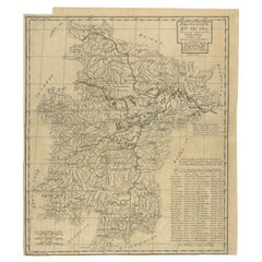
View AllAntique Map of the Lorraine Region, c.1760
Located in Langweer, NL
Untitled antique map of the Lorraine region, France. A cultural and historical region in north-eastern France, now located in the administrative region of Grand Est. Lorraine's name ...
Category
Antique 18th Century Maps
Materials
Paper

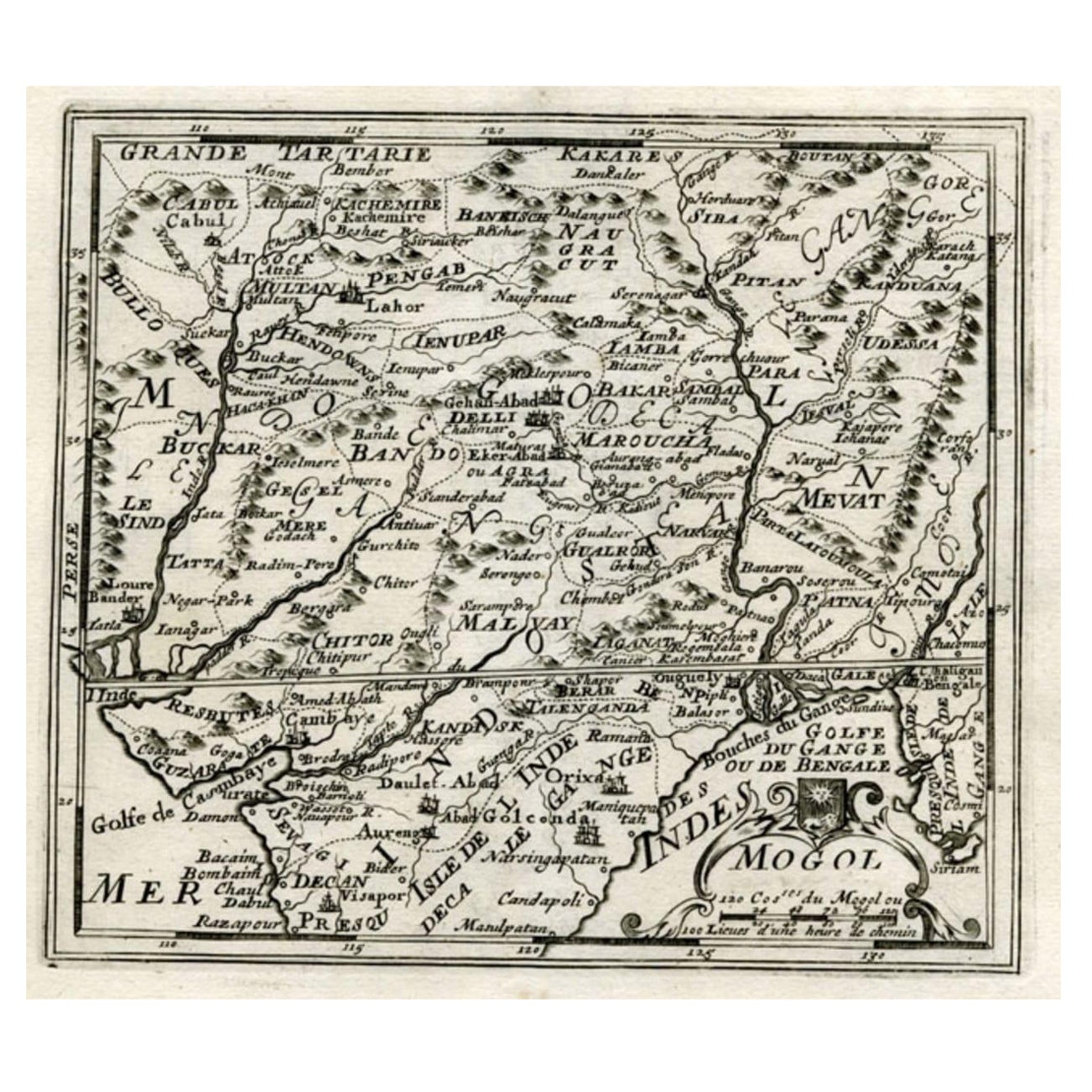
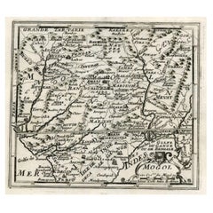
Map of Northern India and Pakistan
Mogol
, Showing Kabul, Delhi Etc., 1758
Located in Langweer, NL
Antique map titled 'Mogol'.
Map of Northern India and Pakistan ('Mogol'), showing Kabul, Delhi and surroundings. This map originates from 'Kort begrip der Oude en Nieuwe Staatkun...
Category
Antique 1750s Maps
Materials
Paper
$354 Sale Price
20% Off
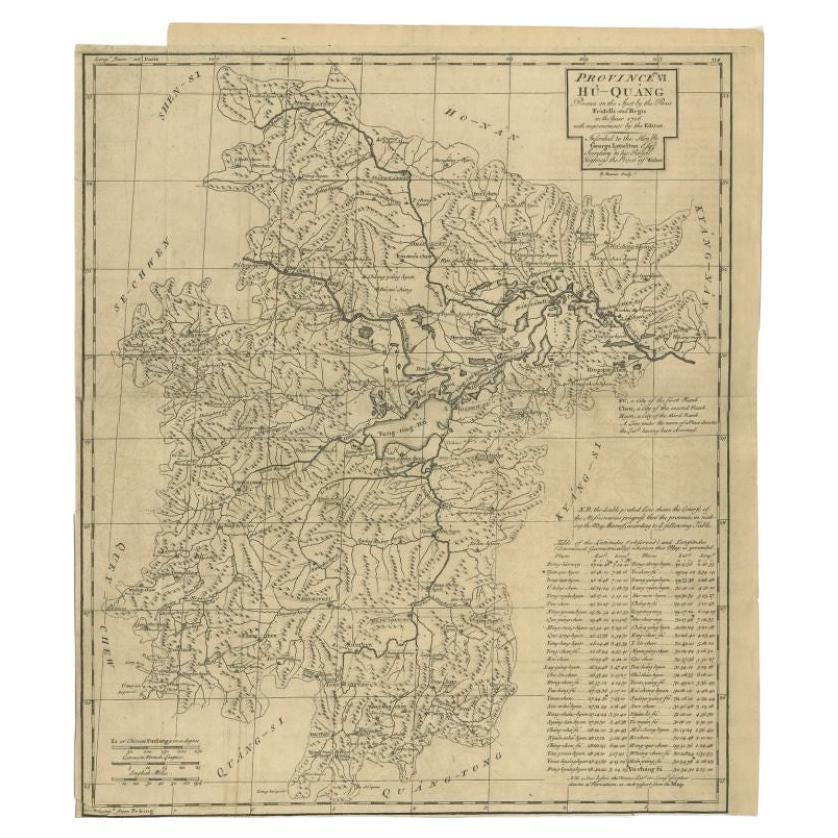
Antique Map of the Huguang Province of China by Du Halde, 1738
Located in Langweer, NL
Antique map titled 'Province VI Hu-Quang'. Old map depicting the Huguang province of China. Originates from 'A description of the Empire of China and Chinese-Tartary' by by J.B. du H...
Category
Antique 18th Century Maps
Materials
Paper
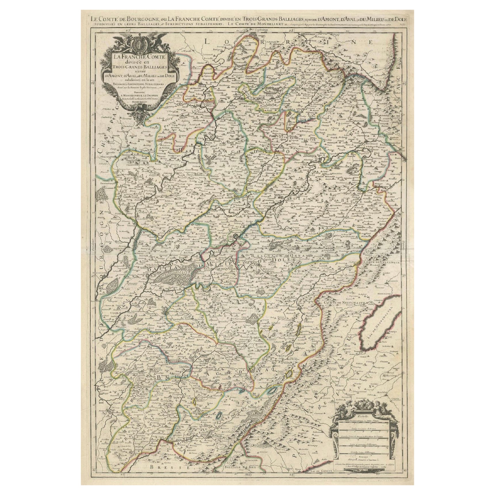
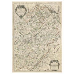
Large Antique Map of Franche-Comté – Divided into Three Historic Bailliages 1681
Located in Langweer, NL
Antique Map of Franche-Comté – “La Franche Comté divisée en Trois Grands Bailliages” by Jaillot, 1681
This richly detailed antique map, titled “La Franche Comté divisée en Trois Gra...
Category
Antique Late 17th Century French Maps
Materials
Paper
Antique Map of the Region of Picardy by Janssonius, 1657
By Johannes Janssonius
Located in Langweer, NL
Antique map of France titled 'Picardia vera et inferior'. Detailed map of the Picardy region of France. This map originates from 'Atlas Novus, Sive Theatrum Orbis Orbis Terrarum: In ...
Category
Antique Mid-17th Century Maps
Materials
Paper

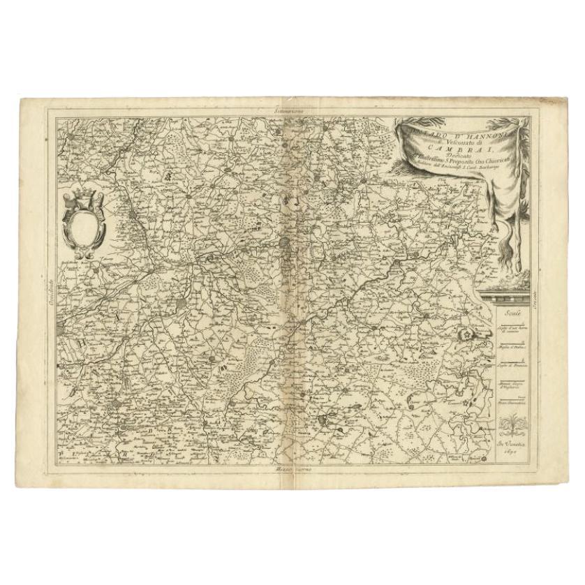
Detailed Antique Map of Western Belgium and Eastern France by Coronelli, 1690
By Vincenzo Coronelli
Located in Langweer, NL
Antique map titled 'Contado d'Hannonia (..)'. Map of western Belgium and eastern France, from south of Brussels (not shown) to Cambrai, France, generally centered around the towns of...
Category
Antique 17th Century Maps
Materials
Paper

You May Also Like
1751 Map of Spain Castilla Robert De Vaugondy 1st Edition, Ric.a001
Located in Norton, MA
Large Spain Castilla Robert De Vaugondy
1751 1st Edition
-Colored- Ric.a001
Coming from a family of cartographers, a descendant of the famous Nicolas Sanson and ordinary geographer of the king, Gilles Robert de Vaugondy makes himself known by his maps of the French provinces.
He published an Essay on the History of Geography (1755) from which he excluded the physical geography "too systematic". After a Small Atlas (1748), he draws a universal Atlas (1758), a portable Atlas (1762).
His Atlas of the revolutions of the globe remains unpublished. His warnings and prefaces, his book reviews reveal a Cartesian mind and solid knowledge.
Very early, he associates with his works his son Didier who publishes, since 1742, the methodical tables of Nicolas Sanson, two Globes, one terrestrial, the other celestial (1752).
He is credited with a map of Poland...
Category
Antique 18th Century Unknown Maps
Materials
Paper

1657 Janssonius Map of Vermandois and Cappelle, Ric. A-004
Located in Norton, MA
1657 Janssonius map of
Vermandois and Cappelle
Ric.a004
Description: Antique map of France titled 'Descriptio Veromanduorum - Gouvernement de la Cappelle'. Two detailed maps o...
Category
Antique 17th Century Unknown Maps
Materials
Paper

1762 Berri, Nivernois Bourbonois, Lyonois, Bourgogine, Bresse, et, Franche - Com
Located in Norton, MA
1762 Vaugondy map, entitled
"Berrl Nivernois Bourbonois Lyonois, Bourgone, Bresse, Et Franche-Comte,"
Ric.b003
About this Item
A fine Copperplate Engraving with original han...
Category
Antique 18th Century Unknown Maps
Materials
Paper
1714 Henri Chatelain "Nouvelle Carte Des Etatas Du Grand.Duc De Mos Moscovie Eur
Located in Norton, MA
A 1714 Henri Chatelain map, entitled
"Nouvelle Carte Des Etatas Du Grand Duc De Moscovie En Europe,"
Ricb001
Henri Abraham Chatelain (1684-1743) was a Huguenot pastor of Parisi...
Category
Antique Early 18th Century Dutch Maps
Materials
Paper

Antique French Map of Asia Including China Indoneseia India, 1783
Located in Amsterdam, Noord Holland
Very nice map of Asia. 1783 Dedie au Roy.
Additional information:
Country of Manufacturing: Europe
Period: 18th century Qing (1661 - 1912)
Condition: Overall Condition B (Good Used)...
Category
Antique 18th Century European Maps
Materials
Paper

$486 Sale Price
40% Off
Map of the Kingdom of Sardinia and Part of the Kingdom of Genoa, Rome
By Giovanni Maria Cassini
Located in Hamilton, Ontario
18th century map by Italian engraver Giovanni Maria Cassini (Italy 1745-1824). Map of Part of the Kingdom of Sardinia and Part of the Kingdom of Genoa: Rome. This is a hand colored a...
Category
Antique 18th Century Italian Maps
Materials
Paper

$795 Sale Price
36% Off