Items Similar to Gipuzkoa 1902: A Cartographic Snapshot of the Basque Coastline and Highlands

Want more images or videos?
Request additional images or videos from the seller
1 of 7
Gipuzkoa 1902: A Cartographic Snapshot of the Basque Coastline and Highlands
$344.98
$431.2220% Off
£257.97
£322.4620% Off
€288
€36020% Off
CA$475.29
CA$594.1220% Off
A$518.37
A$647.9720% Off
CHF 274.60
CHF 343.2520% Off
MX$6,214.55
MX$7,768.1920% Off
NOK 3,497.17
NOK 4,371.4620% Off
SEK 3,197.90
SEK 3,997.3820% Off
DKK 2,194.67
DKK 2,743.3420% Off
About the Item
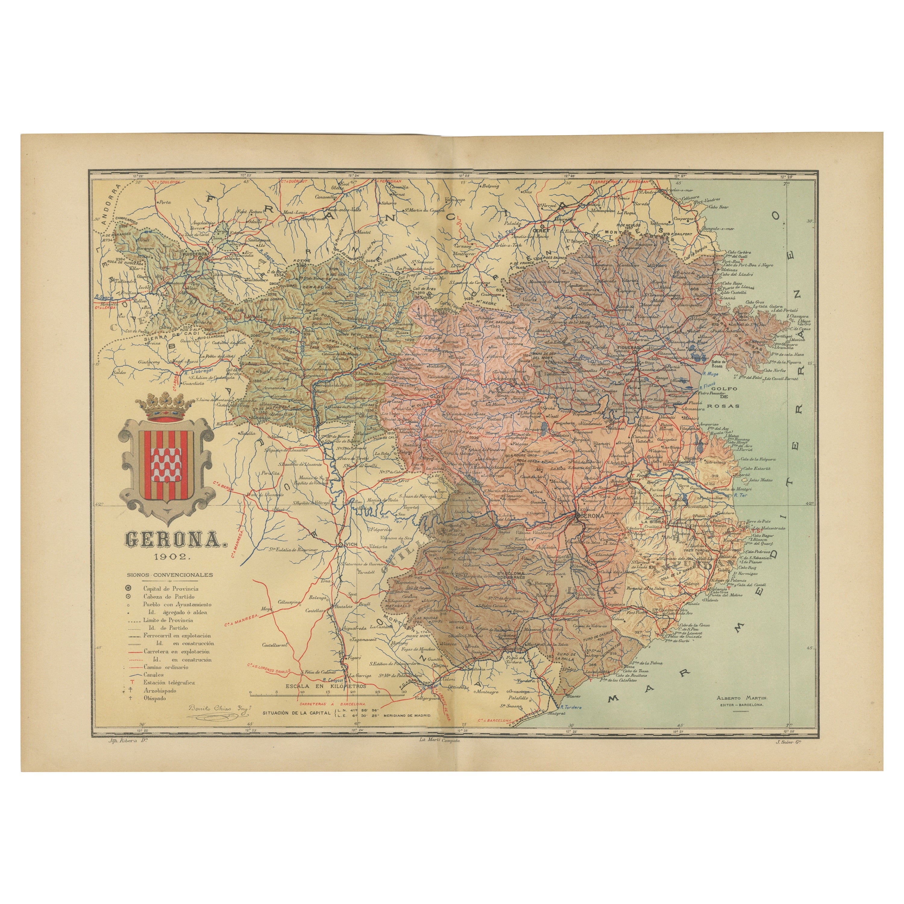
The map showcases the province of Gipuzkoa (also known as Guipúzcoa in Spanish), which is part of the autonomous community of the Basque Country in northern Spain, as of the year 1902. The map includes several notable features:
It depicts the mountainous terrain of the region, which is characteristic of the Basque Country, with detailed contour lines. There's a clear representation of the Cantabrian Sea coastline, including the rough coastal landscape for which the region is known. Blue lines likely represent the network of rivers that traverse the province, including the Urumea and Oria rivers. Red lines indicate roads and railways, outlining the transportation infrastructure critical for the region's connectivity. Various symbols are used to mark the locations of cities and towns, with the capital city, Donostia-San Sebastián, presumably indicated. Dotted lines suggest the administrative boundaries within the province. The map features a legend (Signos Convencionales) that explains the symbols used for provincial capitals, roads, railways, and other landmarks. A scale in kilometers at the bottom provides a reference for distance measurement.
The coat of arms of Gipuzkoa is prominently displayed, incorporating traditional heraldic imagery associated with the region's identity.
About the province of Gipuzkoa:
Gipuzkoa is one of the three provinces that make up the Basque Country, and it is known for its lush landscapes, coastal towns, and industrial heritage. The capital city, Donostia-San Sebastián, is famous for its beautiful bay of La Concha, vibrant cultural life, and its prestigious annual international film festival. The province has a strong industrial economy, with a history of steel manufacturing, and is also a leader in cooperative enterprises, most notably the Mondragon Corporation. The Basque culinary tradition is celebrated in Gipuzkoa, which boasts numerous high-quality restaurants, including several with Michelin stars. Traditional Basque sports, such as pelota and rural sports, are popular in the province. Gipuzkoa's unique cultural identity, language (Euskara), and traditions are a significant part of the region's allure.
- Dimensions:Height: 14.77 in (37.5 cm)Width: 20.08 in (51 cm)Depth: 0 in (0.02 mm)
- Materials and Techniques:
- Period:1900-1909
- Date of Manufacture:1902
- Condition:Good condition. Central vertical folding lines as issued. Aged paper with typically warm, yellowish-brown hue, especially around the edges. Some soiling on the borders and one small tear, not affecting the image. Check the images carefully.
- Seller Location:Langweer, NL
- Reference Number:Seller: BG-13642-191stDibs: LU3054338031942
About the Seller
5.0
Recognized Seller
These prestigious sellers are industry leaders and represent the highest echelon for item quality and design.
Platinum Seller
Premium sellers with a 4.7+ rating and 24-hour response times
Established in 2009
1stDibs seller since 2017
2,791 sales on 1stDibs
Typical response time: <1 hour
- ShippingRetrieving quote...Shipping from: Langweer, Netherlands
- Return Policy
More From This Seller
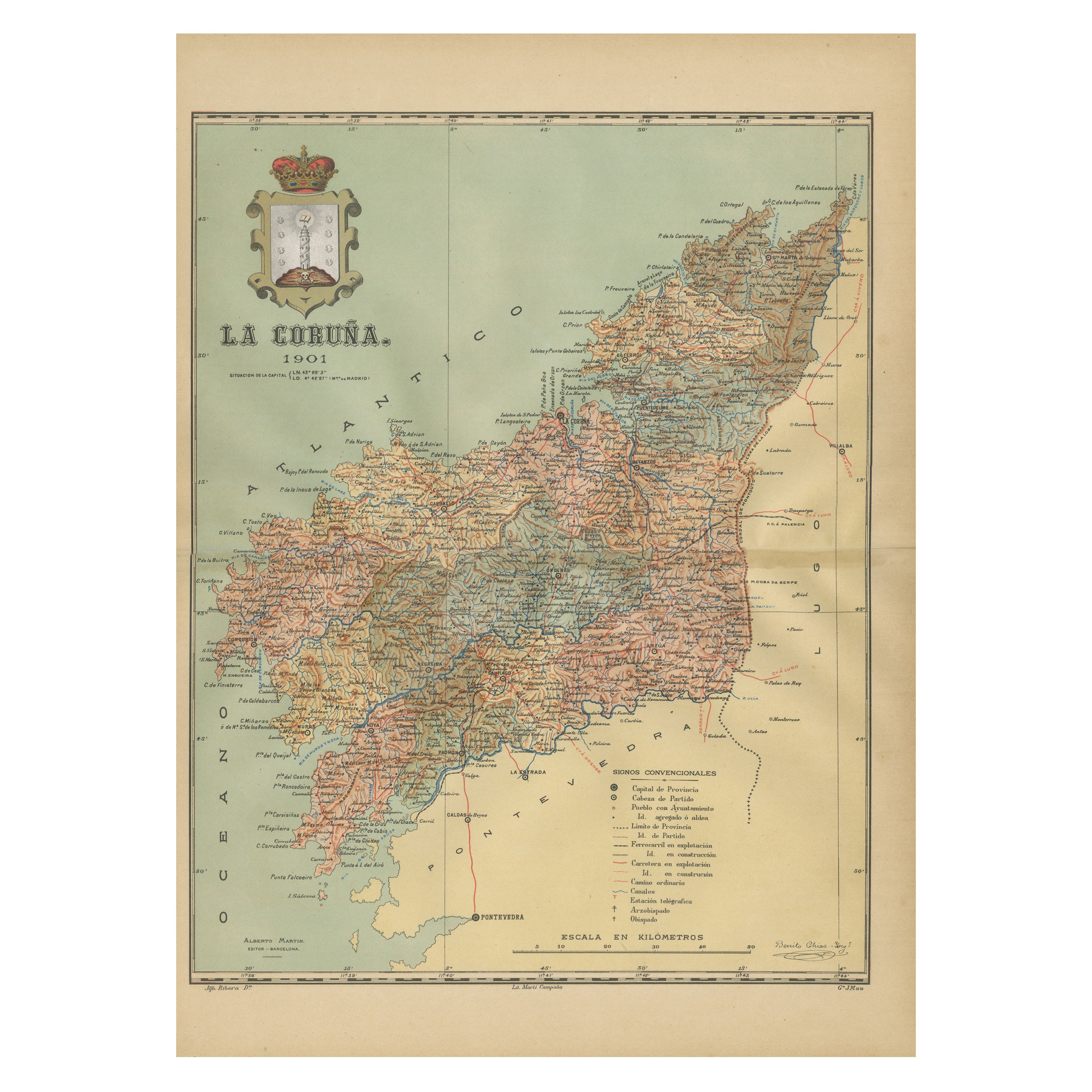
View AllLa Coruña 1901: A Cartographic View of Galicia
s Maritime Province
Located in Langweer, NL
This antique map for sale showcases the province of La Coruña (in Galician, A Coruña), located in the northwest of Spain, within the autonomous community of Galicia, as of the year 1...
Category
Antique Early 1900s Maps
Materials
Paper

$354 Sale Price
20% Off
Free Shipping
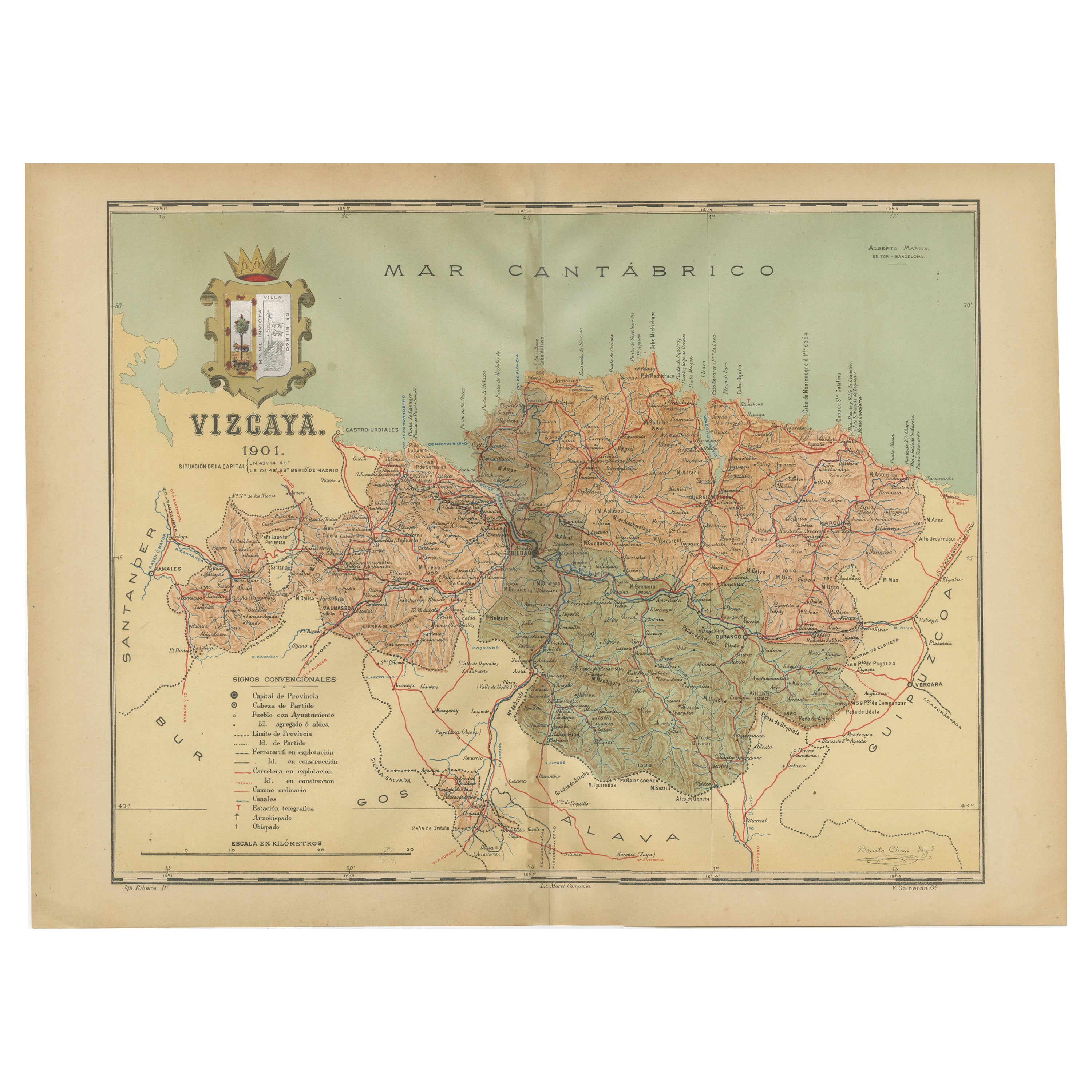
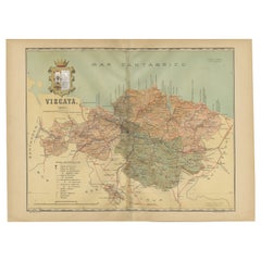
Cartographic Heritage: The 1901 Map of the Vizcaya Province in Spain
Located in Langweer, NL
This is a historical map of the province of Vizcaya (Biscay) in Spain, dated 1901. The title on the map is "VIZCAYA. 1901." It shows the topographical details of the region with cont...
Category
Antique Early 1900s Maps
Materials
Paper
$306 Sale Price
20% Off
Free Shipping
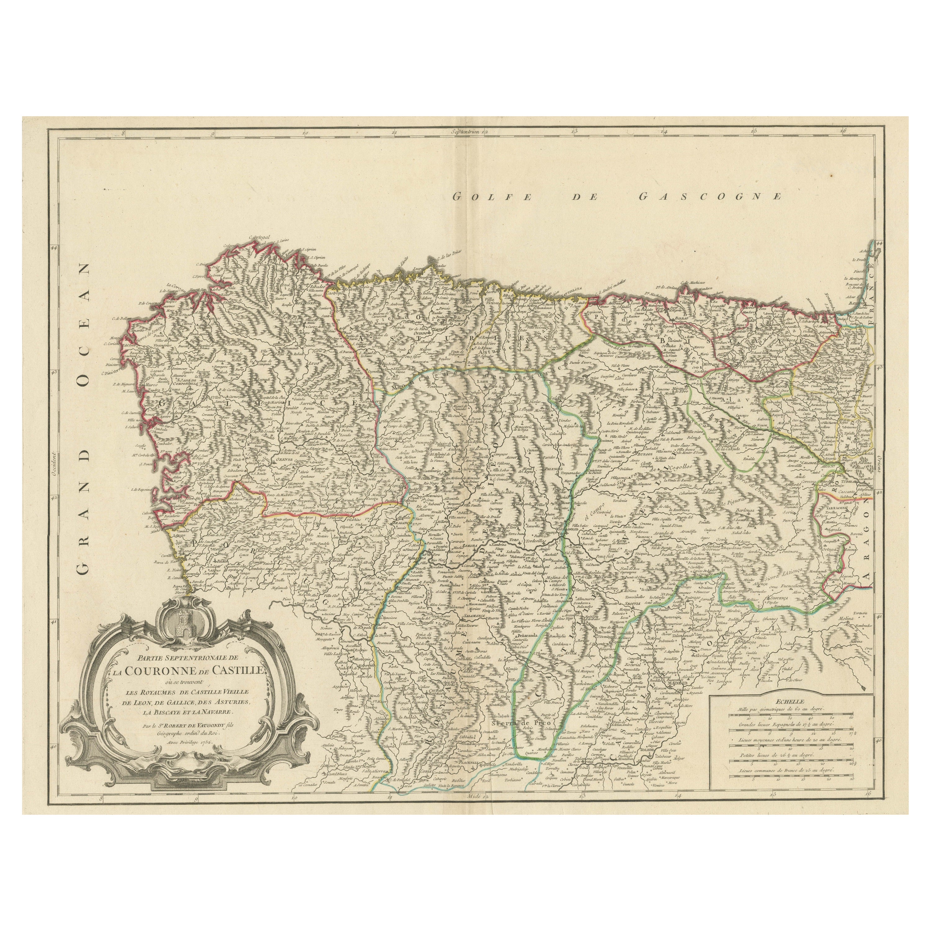
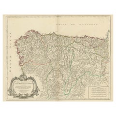
Map of Kingdoms of Castile, León, Galicia, Asturias, Biscay and Navarre in Spain
Located in Langweer, NL
Antique map titled 'Partie Septentrionale de la Couronne de Castille (..)'. Decorative and highly detailed map of Northwestern Spain, including Gallicia...
Category
Antique Mid-18th Century Maps
Materials
Paper
$632 Sale Price
20% Off
Navarra in Cartographic Detail: A 1902 Map of the Crossroads of Northern Spain
Located in Langweer, NL
The original antique map for sale shows the Spanish province of Navarra as it was in 1902. Here's a brief description and a potential title for the map:
Description:
- The map detai...
Category
Antique Early 1900s Maps
Materials
Paper

$325 Sale Price
20% Off
Free Shipping
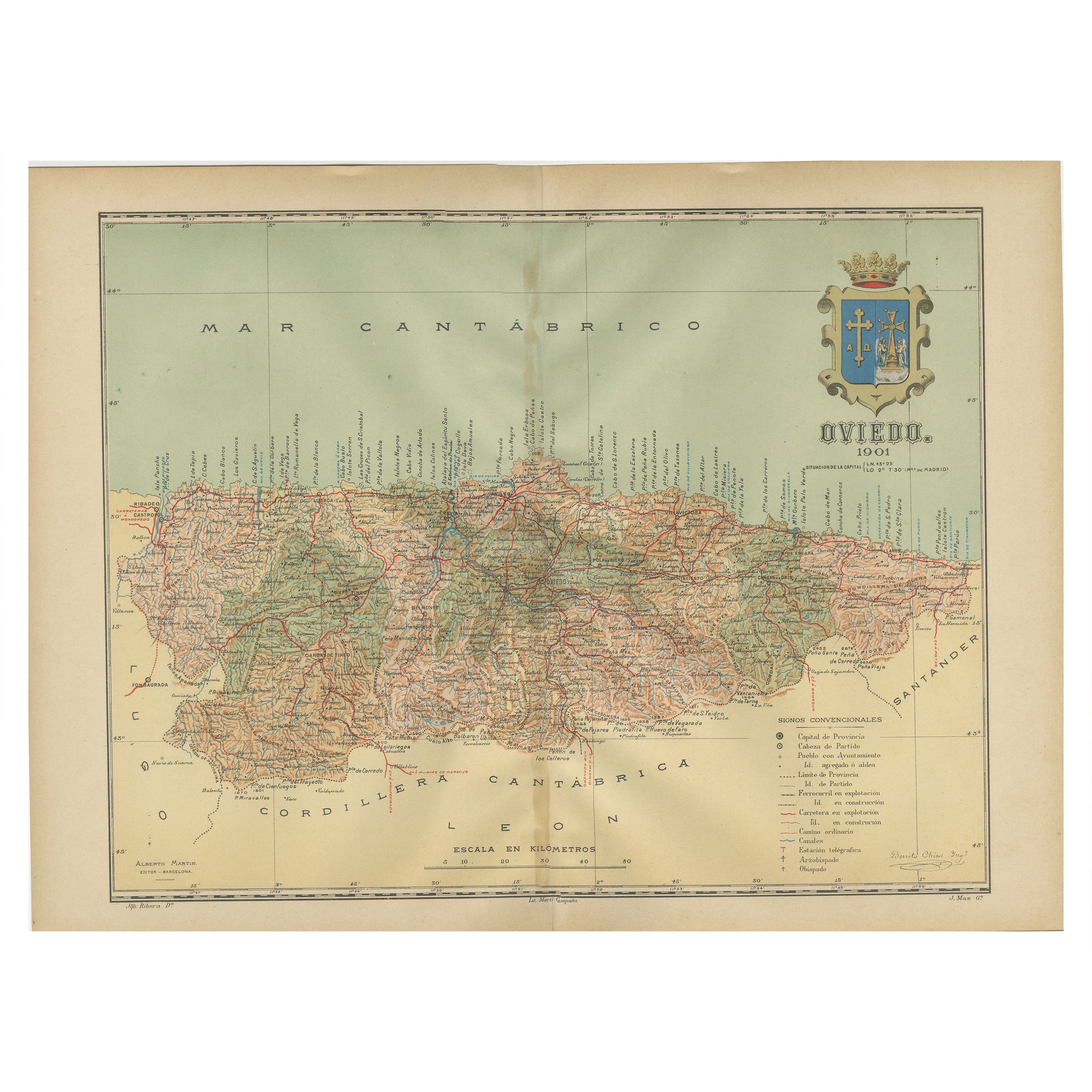
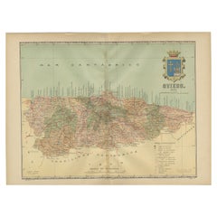
The Lay of the Land: A 1901 Topographic Map of Oviedo, Asturias
Located in Langweer, NL
The province depicted on the historical map on offer, Oviedo, corresponds to the modern-day autonomous community of Asturias in northwestern Spain. Here are some points about Asturia...
Category
Antique Early 1900s Maps
Materials
Paper
Girona 1902: Geographic and Infrastructural Map of Catalonia’s Northern Province
Located in Langweer, NL
The map provided is of the province of Girona (in Catalan, Girona), located in the northeast of Spain, within the autonomous community of Catalonia, as of the year 1902. Here are the...
Category
Antique Early 1900s Maps
Materials
Paper

$373 Sale Price
20% Off
Free Shipping
You May Also Like
Large Original Vintage Map of Spain, circa 1920
Located in St Annes, Lancashire
Great map of Spain
Original color.
Good condition
Published by Alexander Gross
Unframed.
Category
Vintage 1920s English Maps
Materials
Paper

Geographical Antique Map of Principality of Monaco
By Bruno Santini
Located in Alessandria, Piemonte
ST/609 - Interesting antique color map of Monaco Principality in French language : "Carte qui contient le Principauté de Piémont, le Monferrat et la comté de...
Category
Antique Late 18th Century Italian Other Maps
Materials
Paper

Large Original Antique Map of Madeira. 1894
Located in St Annes, Lancashire
Superb Antique map of Madeira
Published Edward Stanford, Charing Cross, London 1894
Original colour
Good condition
Unframed.
Free shipping
Category
Antique 1890s English Maps
Materials
Paper

Large Original Antique Map of The Canary Islands. 1894
Located in St Annes, Lancashire
Superb Antique map of The Canary Islands
Published Edward Stanford, Charing Cross, London 1894
Original colour
Good condition
Unframed.
Free shipping
Category
Antique 1890s English Maps
Materials
Paper

South America, Eastern Part. Century Atlas antique vintage map
Located in Melbourne, Victoria
'The Century Atlas. South America. Eastern Part'
Original antique map, 1903.
Inset map 'Rio de Janeiro and Vicinity'.
Central fold as issued. Map name and number printed on the rev...
Category
Early 20th Century Victorian More Prints
Materials
Lithograph

Map of Spain and Portugal - Original Etching - Late 19th Century
Located in Roma, IT
This Map of Spain and Portugal is an etching realized by an anonymous artist.
The state of preservation of the artwork is good with some small diffused stains.
Sheet dimension: 28...
Category
Late 19th Century Modern Figurative Prints
Materials
Etching

More Ways To Browse
Antique Basque
Basque Furniture
Antique Sultanabad Carpets
Used Beige Sofa
Antique Plate Germany
Hand Tufted Rugs
Rare China
Side Table Made In Denmark
Thonet Antique
Victorian Hall Tables
Vintage Computer
England Antique Plates
19th Century Round Dining Table
Antique Counters
Antique Thrones
Carved Chinese Tables
Italian Ceramic 1960s
Mid Century Modern Danish Teak Dining Tables