Items Similar to Globe Table Terrestrial Swedish

Want more images or videos?
Request additional images or videos from the seller
1 of 5
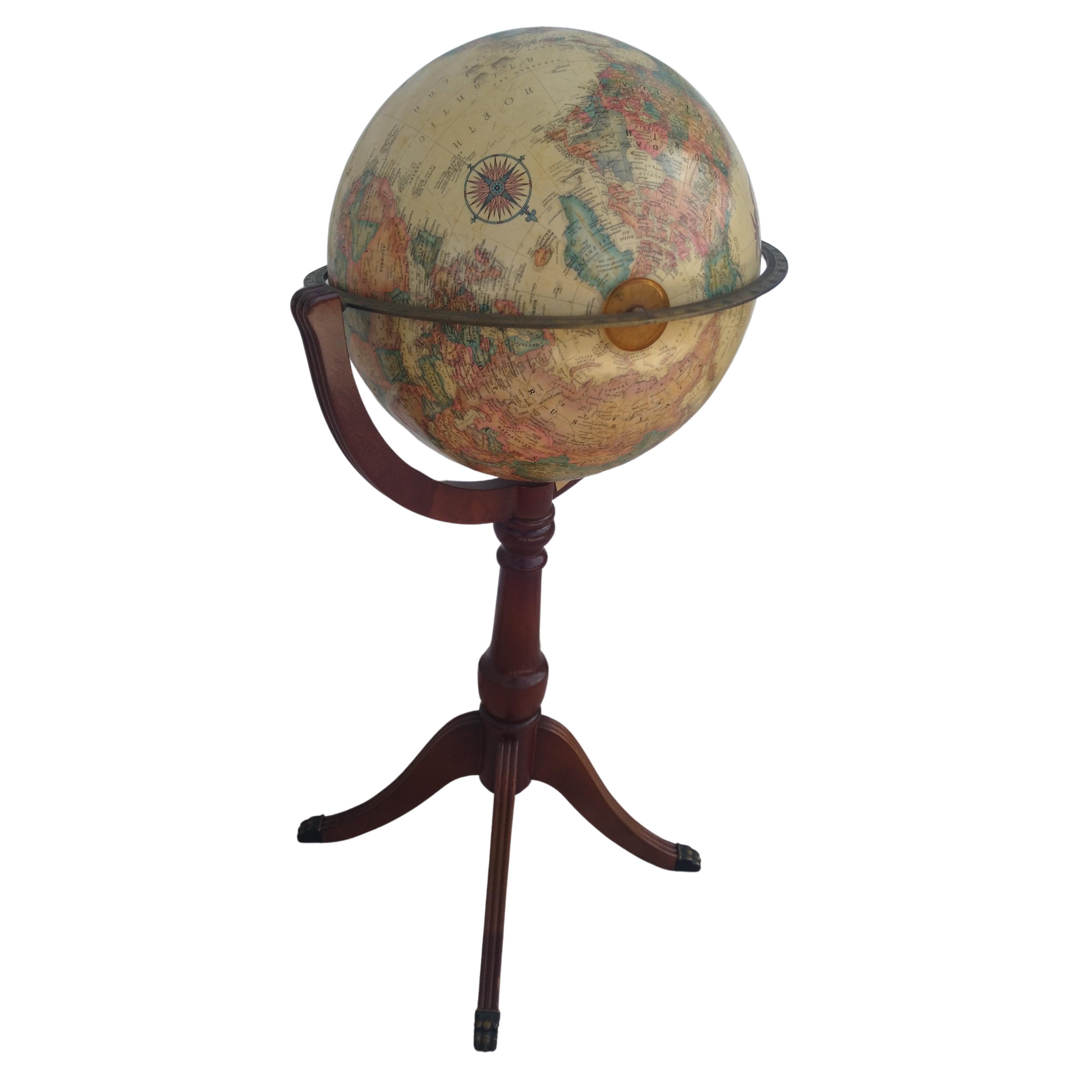
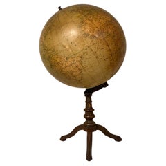
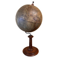
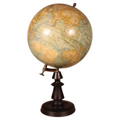
Globe Table Terrestrial Swedish
$3,446.01
£2,500
€2,922.36
CA$4,715.48
A$5,137.10
CHF 2,712.92
MX$61,669.55
NOK 34,565.71
SEK 31,591.77
DKK 21,829.66
About the Item
A Swedish 12 inch terrestrial globe, circa 1900. Measure: height 59cm
Just purchased more information to follow.
- Dimensions:Height: 23.23 in (59 cm)Diameter: 15.75 in (40 cm)
- Style:Baroque Revival (Of the Period)
- Materials and Techniques:
- Place of Origin:
- Period:
- Date of Manufacture:circa 1890
- Condition:Wear consistent with age and use.
- Seller Location:BUNGAY, GB
- Reference Number:1stDibs: LU3867322245642
About the Seller
5.0
Vetted Professional Seller
Every seller passes strict standards for authenticity and reliability
Established in 1985
1stDibs seller since 2018
103 sales on 1stDibs
Typical response time: 5 hours
- ShippingRetrieving quote...Shipping from: BUNGAY, United Kingdom
- Return Policy
More From This Seller
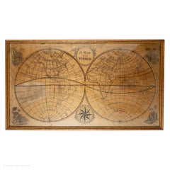
View AllMap Silk Embroidered Western Eastern Hemisphere New Old World Asia America Afri
Located in BUNGAY, SUFFOLK
A rare, late-18th century, silk, embroidered, double hemisphere, world map, blackwork, sampler, showing the tracks of captain cook’s three voyages
- Illustrating public understanding of the world in the late-18th century and the recent discoveries of the time delineating the tracks of Captain Cook’s three voyages.
- Shows the incentive for further exploration during the 19th century as no mass is indicated within the southern polar region, the interior portions of western North America, Africa, and Australia are still relatively void of detail even though California is no longer shown as an island.
- Includes beautifully worked allegories of the four continents Asia, the Americas, Africa & Europe, a cartouche being supported by two angels and a compass
- The cream, silk ground is finely embroidered with a variety of stiches in black, silk threads emulating the black ink on maps.
-“Recent international conflicts and voyages by Captain Cook and others made the study of geography exciting at the time this map was made. Elaborate embroidered maps...
Category
Antique 18th Century British Georgian Maps
Materials
Silk
Centre Table Sidetable Small 18 Century English George I Vernacular Bookmatched
Located in BUNGAY, SUFFOLK
This elegant centre or sidetable is an unusual small size.
It has a pared down form with no frieze drawer and would Stand well in a contemporary interior
The carpenter has used hi...
Category
Antique Early 18th Century British George I Side Tables
Materials
Oak
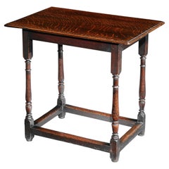
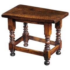
Table Low Walnut Small Spanish Baroque Ball Bobbin 24.5" long, 20" high
Located in BUNGAY, SUFFOLK
- Rare small size, perfect height for sofa's and modern armchairs
- The thick single plank walnut top and bold turnings are characteristic of Spanish furniture
- This table exudes ve...
Category
Antique 1680s Spanish Baroque Sofa Tables
Materials
Walnut
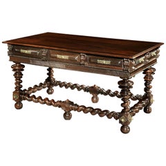
Fine Baroque Portuguese Rosewood Centre Table, Library Desk, 17th Century
Located in BUNGAY, SUFFOLK
The design and ornamentation of this centre table is characteristic of Portuguese Baroque furniture dating from the second half of the 17t...
Category
Antique Late 17th Century Portuguese Baroque Center Tables
Materials
Rosewood
Table, Tripod, Tilt-Top, Mahogany, Flame-Figured, Column, Vase, Cabriole
Located in BUNGAY, SUFFOLK
The circular 2 cm/0.75in thick, tilt-top is made from a solid piece of mahogany with beautiful flame figuring. Unusually, the tilt-top mechanism and brassware are original. The stem ...
Category
Antique 1740s British George II Dessert Tables and Tilt-top Tables
Materials
Mahogany
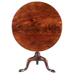
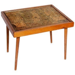
Table Low Sofa Vintage 1950s Map Isle of Man John Speed 1610 Thomas Durham 1595
Located in BUNGAY, SUFFOLK
- The juxtaposition of modern design and this ancient map create a unique small table and conversation piece
- This is the first map featuring the Isle of Man on its own.
- It is also the first map of the Island based on an actual survey, undertaken by Thomas Durham 1595 and was first published by Speed in 1605-1611 and reprinted many times over the next century. This is the second state or print from 1610.
The map is inset within a fruitwood box frame with a glass top. Supported by tapering stick legs.
The map is based on a survey (and presumably a MS map) by Thomas Durham, of whom nothing is known other that he was paid by Sir Thomas Gerrard to make a survey of the Island. This survey, almost certainly for military purposes, arose from the disputed possession of the Island during which time Elizabeth had assumed control in order to prevent the Scots or the Spanish from using the Island as a base.
Speed had used the Durham Map in his slightly earlier 4-sheet wall map showing invasions and battles of c1603/4 [ref: Shirley #261] - there are some differences from this 1605/10 map - Port Eran (rather than Earn on 1605);Knockalo point (= Contrary Hd) not on 1605;Spalbrecke shown west of Calf rather than E as on 1605/10. Thus it is possible that the Durham Map had even more detail than Speed used in his derived version.
In sea are four mythical beasts with riders: to NW of Island Unicorn with Scottish flag...
Category
Antique 1610s English Mid-Century Modern Sofa Tables
Materials
Paper
You May Also Like
Early 20th Century Desk Globe
Located in Firenze, FI
Beautiful physical and political terrestrial table globe on bronze base and plaster sphere with double rotary movement.
Designed by Prof. Guido Cora for G.B.Paravia Editori in the fi...
Category
Early 20th Century Italian Models and Miniatures
Materials
Bronze
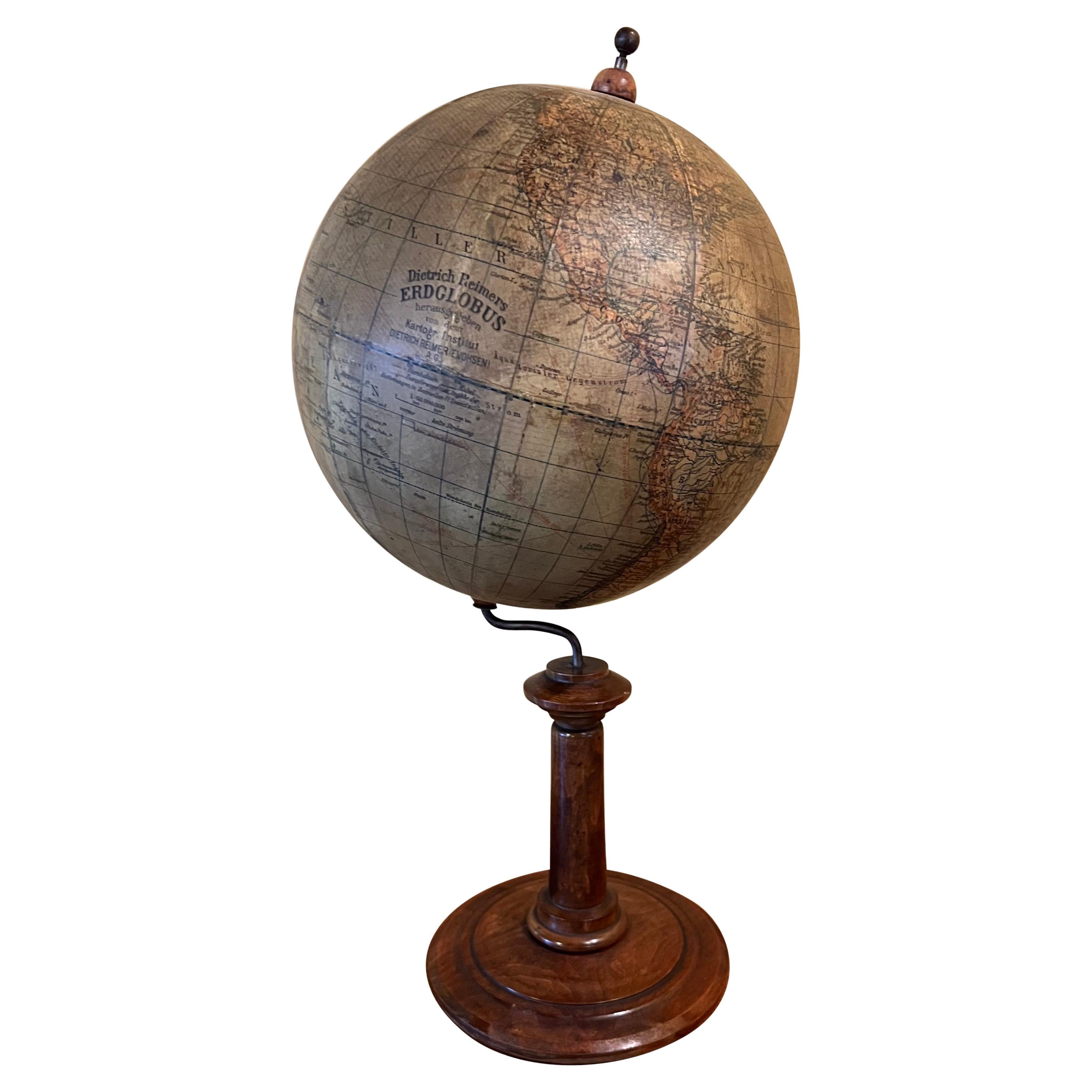
German 8" Diameter Table Globe by Mapmaker Dietrich Reimers (1818-1899)
Located in San Francisco, CA
Dietrich Reimer was a significant German globe manufacturer in the 19th to early 20th centuries. His work was renowned for its highly detailed political and physical maps showing oc...
Category
Early 20th Century German Victorian Globes
Materials
Hardwood, Paper
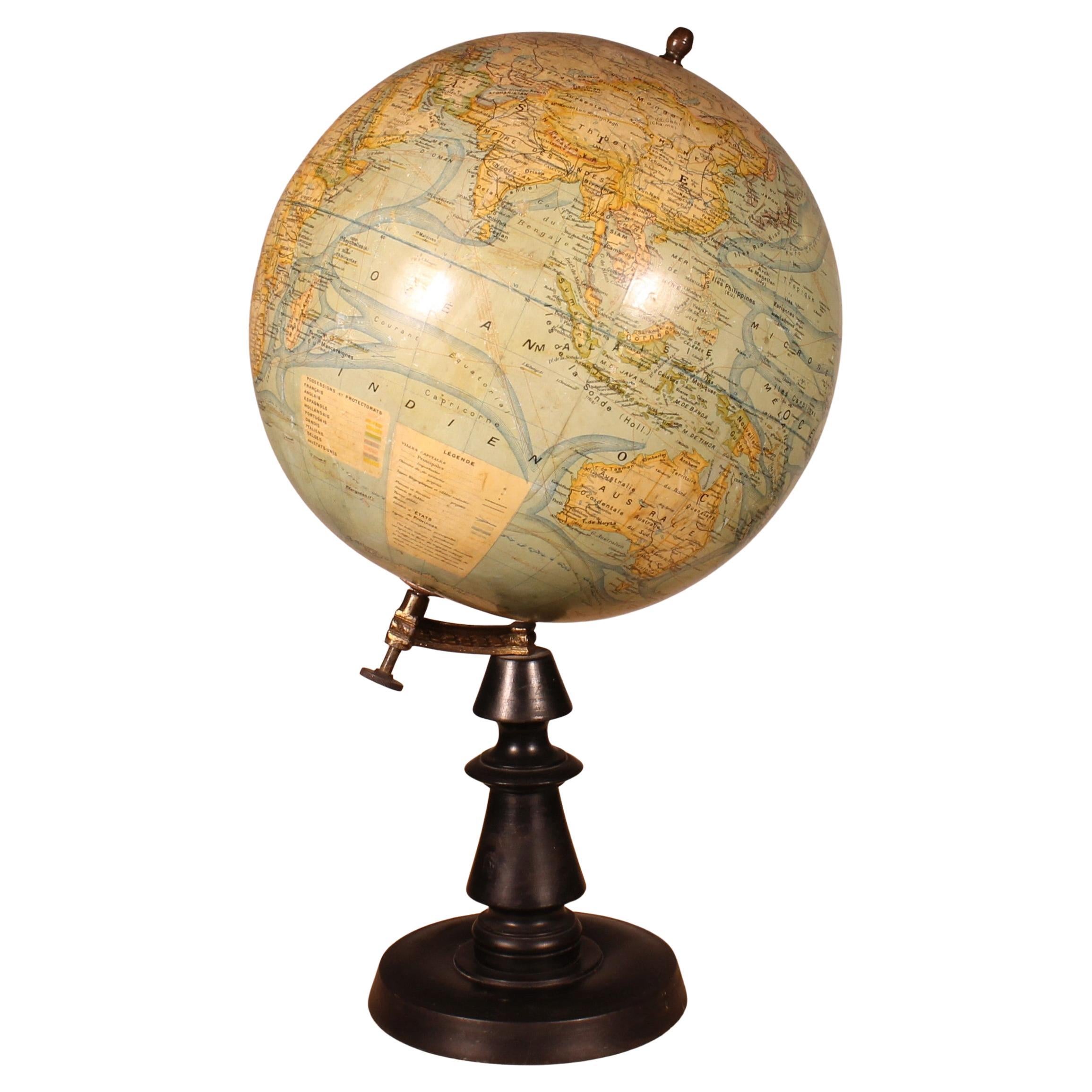
Terrestrial Globe By J. Forest Paris From The Early 20th Century
Located in Brussels, Brussels
A very beautiful early 20th-century globe, circa 1910, by J. Forest, Paris, scale 1/40,000,000.
The globe has a superb blackened wood base with a fine turning.
very beautiful globe ...
Category
Early 20th Century French Aesthetic Movement Globes
Materials
Paper
Antique World Globe On Stand French
Located in Scottsdale, AZ
Antique World Globe On Stand French. Beautiful piece purchased in France. Age appropriate wear, see detailed photos or message us with questions.
Category
Antique 19th Century French Neoclassical Nautical Objects
Materials
Wood
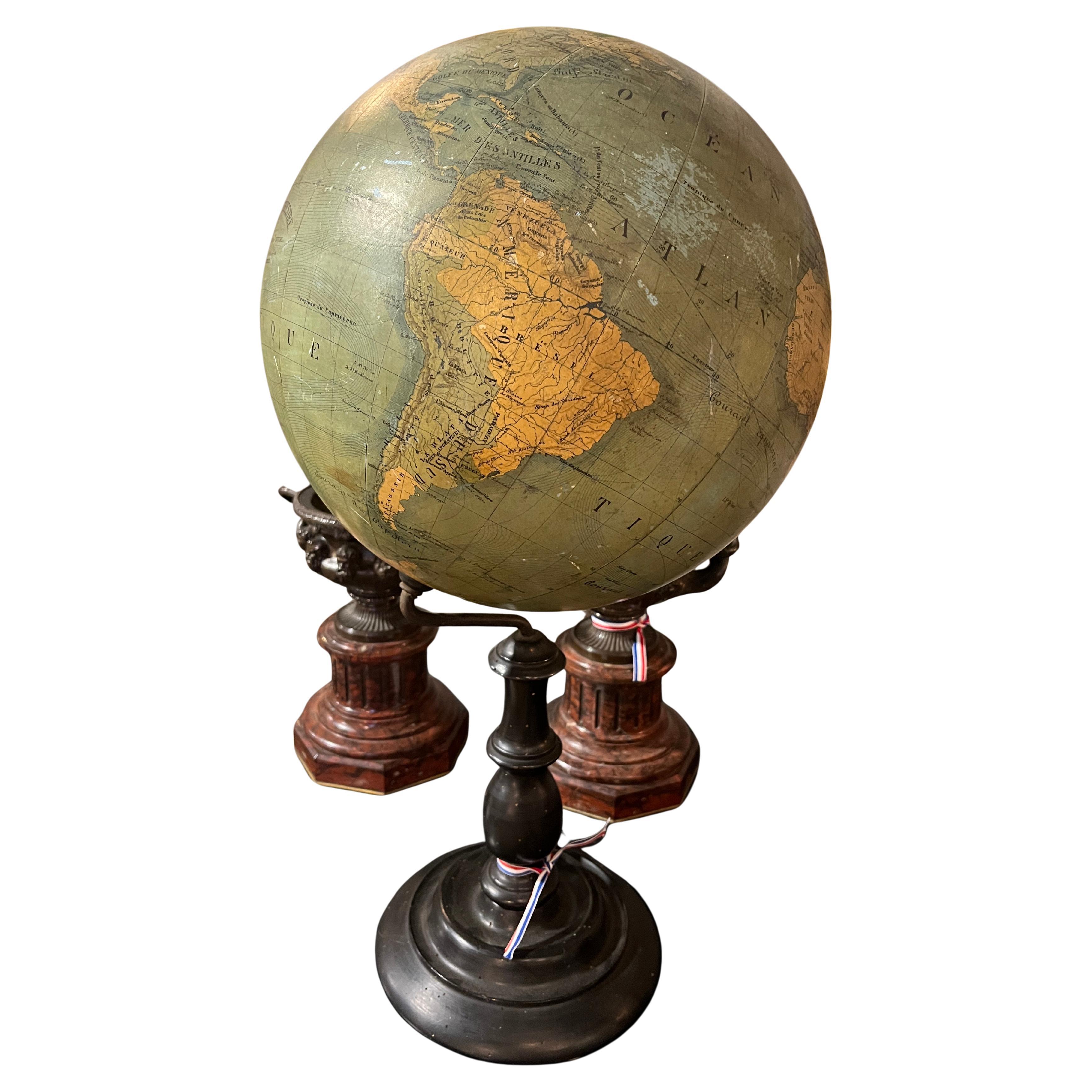
Large Terrestrial Globe
Located in London, England
Large French table top terrestrial globe. Circa 1900
H 89cm x W 51cm x D 51cm
Category
Antique Early 1900s French French Provincial Globes
Materials
Steel

$1,929
Vintage Globe on Regency Pedestal Stand
Located in Pasadena, TX
This is a nice vintage globe. It sits on a pedestal tripod base. The base is constructed in a regency style. This globe comes from the office of Roger Rolke of Shell Oil Co.
A nice ...
Category
20th Century American Maps
Materials
Wood
$632 Sale Price
20% Off
More Ways To Browse
Terrestrial Globes
West Indies Furniture
Railroad Collectibles
Antique Map Denmark
American West Furniture
Antique Railroad Collectibles
Gold Maps
World Map Of Trade Routes
J Walker
Mercator Map
Antique Map Of Switzerland
Albanian Antique
Antique Pamphlets
Antique Mediterranean Map
Antique Map Mexico
Antique Map Paris
Antique Puerto Rico
West Indies Antique Furniture