Items Similar to Greenland
the North Pole – Antique Polar Map by V.M. Coronelli, c.1692


Want more images or videos?
Request additional images or videos from the seller
1 of 10
Greenland
the North Pole – Antique Polar Map by V.M. Coronelli, c.1692
$1,657.41
£1,238.21
€1,400
CA$2,307.86
A$2,479.67
CHF 1,330.34
MX$29,213.32
About the Item
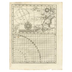
Globe gore by Vincenzo Maria Coronelli shows the North Pole with the coasts of Canada, Greenland, Scandinavia and Siberia, and is decorated with pictorial scenes of bear, seal and whale hunters. The globe gore is based on the north part of Coronelli’s large terrestrial globe for Louis XIV.
- Creator:Vincenzo Coronelli (Artist)
- Dimensions:Height: 19.3 in (49 cm)Width: 26.78 in (68 cm)Depth: 0.02 in (0.5 mm)
- Materials and Techniques:Paper,Engraved
- Place of Origin:
- Period:Late 17th Century
- Date of Manufacture:circa 1692
- Condition:Wear consistent with age and use. Minor fading. Good condition with some toning mostly in the margins. Please study images carefully.
- Seller Location:Langweer, NL
- Reference Number:Seller: BG-008741stDibs: LU305438972401
About the Seller
5.0
Recognized Seller
These prestigious sellers are industry leaders and represent the highest echelon for item quality and design.
Platinum Seller
Premium sellers with a 4.7+ rating and 24-hour response times
Established in 2009
1stDibs seller since 2017
2,836 sales on 1stDibs
Typical response time: 1 hour
- ShippingRetrieving quote...Shipping from: Langweer, Netherlands
- Return Policy
More From This Seller
View AllGreenland
the North Pole – Antique Northern Hemisphere Map by Tirion, c.1754
Located in Langweer, NL
Greenland & the North Pole – Antique Northern Hemisphere Map by Tirion, c.1754
ntique map titled 'Nieuwe Kaart van de Noord Pool na de alderlaatste ondekking int licht gebracht'. Ma...
Category
Antique Mid-18th Century Dutch Maps
Materials
Paper

$665 Sale Price
25% Off
Antique Map of the North Pole
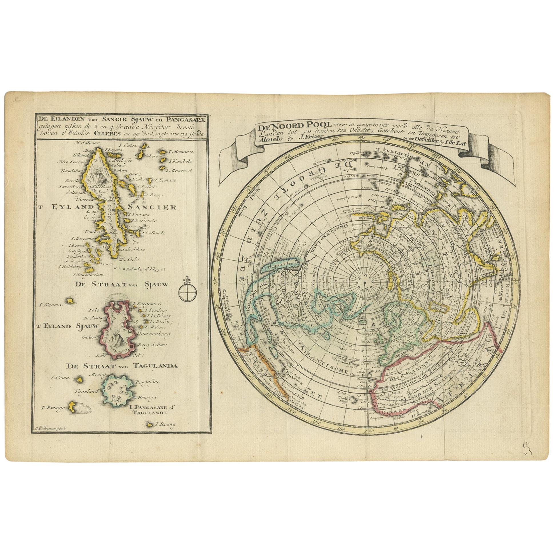
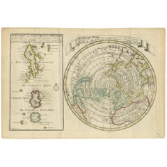
Sangihe Archipelago by Keizer
de Lat, 1788
Located in Langweer, NL
Antique map titled 'De Noord Pool waar in aangetoont werd alle de Nieuwe Landen (..) - De Eilanden van Sangir Sjauw en Pangasare (..)'. Interesting map that includes a map of the Nor...
Category
Antique Late 18th Century Maps
Materials
Paper
$473 Sale Price
20% Off
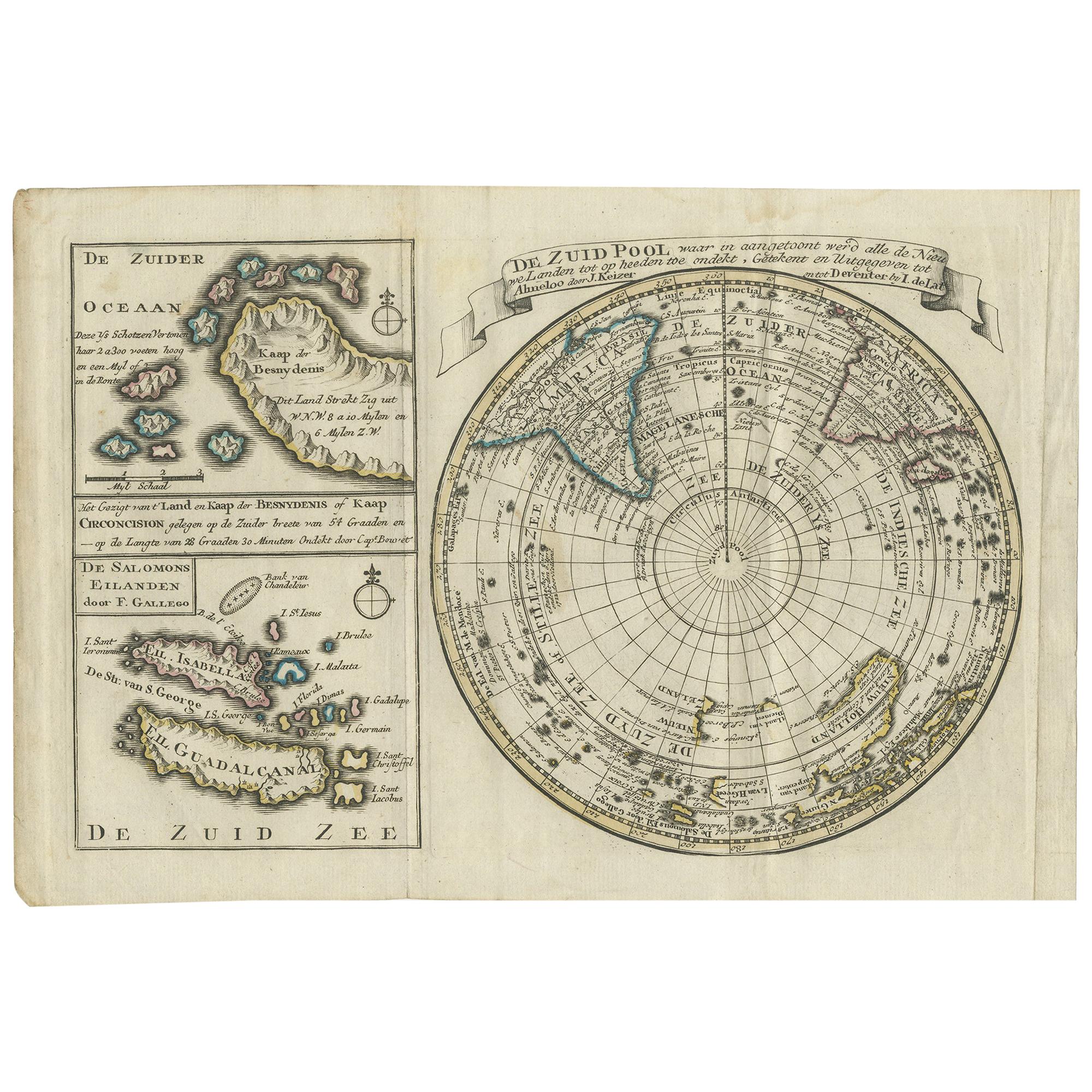
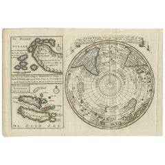
Antique Map of the South Pole by Keizer
de Lat, 1788
Located in Langweer, NL
Antique map titled 'De Zuid Pool, waar in aangetoont werd alle de Nieuwe Landen (..)'. Original antique map of the South Pole including two small inset maps...
Category
Antique Late 18th Century Maps
Materials
Paper
$473 Sale Price
20% Off
Antique Map of the World with Polar Projections by Keizer
de Lat, 1788
Located in Langweer, NL
Antique map titled 'Schuine Ronde Aard-Klooten (..)'. Interesting double hemisphere world map with polar projections. In North America, there is a...
Category
Antique Late 18th Century Maps
Materials
Paper

$443 Sale Price
25% Off
Rare Antique Map of Part of Europe and Africa by Scherer, C.1703
Located in Langweer, NL
Antique map with two figures. The upper figures showing part of Europe and Africa. Below a chart. Printed for Scherer's 'Atlas Novus' (1702-1710). Artists and Engravers: Heinrich Sch...
Category
Antique 18th Century Maps
Materials
Paper
Antique Map of the World in Hemispheres by Keizer
de Lat, 1788
Located in Langweer, NL
Antique map titled 'Schuine Ronde Aard-Bolle waar van 't Middelpunt is Amsterdam (..)'. Interesting double hemisphere world map on polar projections. In North America, there is a large Island of California. Australia and New Zealand are shown with incomplete coastlines. The map contains six smaller astronomical...
Category
Antique Late 18th Century Maps
Materials
Paper

$473 Sale Price
20% Off
You May Also Like
Original Antique Map of The World by Thomas Clerk, 1817
Located in St Annes, Lancashire
Great map of The Eastern and Western Hemispheres
On 2 sheets
Copper-plate engraving
Drawn and engraved by Thomas Clerk, Edinburgh.
Published by Mackenzie And Dent, 1817
...
Category
Antique 1810s English Maps
Materials
Paper

California, Alaska and Mexico: 18th Century Hand-Colored Map by de Vaugondy
By Didier Robert de Vaugondy
Located in Alamo, CA
This is an 18th century hand-colored map of the western portions of North America entitled "Carte de la Californie et des Pays Nord-Ouest separés de l'Asie par le détroit d'Anian, ex...
Category
Antique 1770s French Maps
Materials
Paper

Ancient Map-Poli Arctici (Map of the Poles)-Etching by Johannes Janssonius-1650s
By Johannes Janssonius
Located in Roma, IT
Poli Arctici is an ancient map realized in 1650 by Johannes Janssonius (1588-1664).
The Map is a Hand-colored etching, with coeval watercoloring.
Good conditions with slight foxing...
Category
1650s Modern Figurative Prints
Materials
Etching

Original Antique Map of South America. C.1780
Located in St Annes, Lancashire
Great map of South America
Copper-plate engraving
Published C.1780
Two small worm holes to left side of map
Unframed.
Category
Antique Early 1800s English Georgian Maps
Materials
Paper

Original Antique Map of Europe, Arrowsmith, 1820
Located in St Annes, Lancashire
Great map of Europe
Drawn under the direction of Arrowsmith.
Copper-plate engraving.
Published by Longman, Hurst, Rees, Orme and Brown, 1820
...
Category
Antique 1820s English Maps
Materials
Paper

Antique Map of Eastern Hemisphere from the collection of Thierry Despont
Located in New York, NY
Designed by Enrico Bonetti (E. Bonatti) and published by Francesco Vallardi Editore. Based on an earlier map by Evangelista Azzi (Ev. Azzi). Labeled as such at bottom edge of map.
T...
Category
Antique Late 19th Century Italian Maps
Materials
Canvas, Wood

More Ways To Browse
Terrestrial Globes
Antique Russian Rugs
For Kids
Sterling Silver Flatware Set Service For 12
Tufted Bar
Pair Of French Antique Armchairs
1970s Brass Glass Coffee Table
Charles Rennie Mackintosh For Cassina
Glass Salt
Italian Modern Silver Vases
Vintage Resin Tables
Antique English Country Furniture
Blue Kilim Vintage
Contemporary Side Tables And Stools
Decorative Wall Plate
Mid Century Modern Corner Chair
Dining Tables With Brass Inlay
Oak Mid Century Armchair