Items Similar to Hand Colored Antique Map of the Department of Tarn Et Garonne, France
Want more images or videos?
Request additional images or videos from the seller
1 of 6
Hand Colored Antique Map of the Department of Tarn Et Garonne, France
$325.63
$407.0420% Off
£243.52
£304.4020% Off
€272
€34020% Off
CA$448.70
CA$560.8820% Off
A$489.52
A$611.9120% Off
CHF 259.20
CHF 32420% Off
MX$5,865.89
MX$7,332.3720% Off
NOK 3,301.06
NOK 4,126.3220% Off
SEK 3,018.57
SEK 3,773.2120% Off
DKK 2,071.60
DKK 2,589.5020% Off
About the Item
Antique map titled 'Dépt. de Tarn et Garonne'. map of the French department of Tarn et Garonne, France. This map is centered around the city of Moissac, which is known for its fine desert grapes. This area produces a number of quality wines, such as AOC Fronton, Cotes de Brulhois, and the Vins de Pays des Côteaux et Terrasses de Montauban. Tarn et Garonne is also home to the area of Côteaux du Quercy, which has a reputation for producing supple and full-bodied wines. This region is also a historic stopping point on the Pilgrimage to Santiago de Compostella. The map is surrounded by elaborate decorative engravings designed to illustrate both the natural beauty and trade richness of the land. There is a short textual history of the regions depicted on both the left and right sides of the map.
This map originates from 'Atlas National de la France Illustree' published by V. Levasseur, circa 1852.
Victor Levasseur (1800–1870) was a French cartographer widely known for his distinctive decorative style. He produced numerous maps more admired for the artistic content of the scenes and data surrounding the map than for the detail of the map. Victor Levasseur's "Atlas National Illustré" and "Atlas Universel Illustré" are among the last great decorative atlases published.
- Creator:Victor Levasseur (Artist)
- Dimensions:Height: 14.3 in (36.3 cm)Width: 20.36 in (51.7 cm)Depth: 0.02 in (0.5 mm)
- Materials and Techniques:
- Period:
- Date of Manufacture:circa 1852
- Condition:Wear consistent with age and use. General age-related toning. Shows some wear and soiling, blank verso. Few small tears/splits in margins. Please study images carefully.
- Seller Location:Langweer, NL
- Reference Number:Seller: BG-13216-601stDibs: LU3054331412432
Victor Levasseur
Victor Jules Levasseur (1795–1862) was a French cartographer widely known for his distinctive decorative style. He produced numerous maps more admired for the artistic content of the scenes and data surrounding the map than for the detail of the map. Victor Levasseur was born in 1795 in France. Little is known about his early life and education, but he emerged as one of the most prominent French cartographers of the 19th century. Levasseur lived during a time of significant political and geographical changes in France and Europe, which greatly influenced his work as a mapmaker.
About the Seller
5.0
Recognized Seller
These prestigious sellers are industry leaders and represent the highest echelon for item quality and design.
Platinum Seller
Premium sellers with a 4.7+ rating and 24-hour response times
Established in 2009
1stDibs seller since 2017
2,791 sales on 1stDibs
Typical response time: <1 hour
- ShippingRetrieving quote...Shipping from: Langweer, Netherlands
- Return Policy
More From This Seller
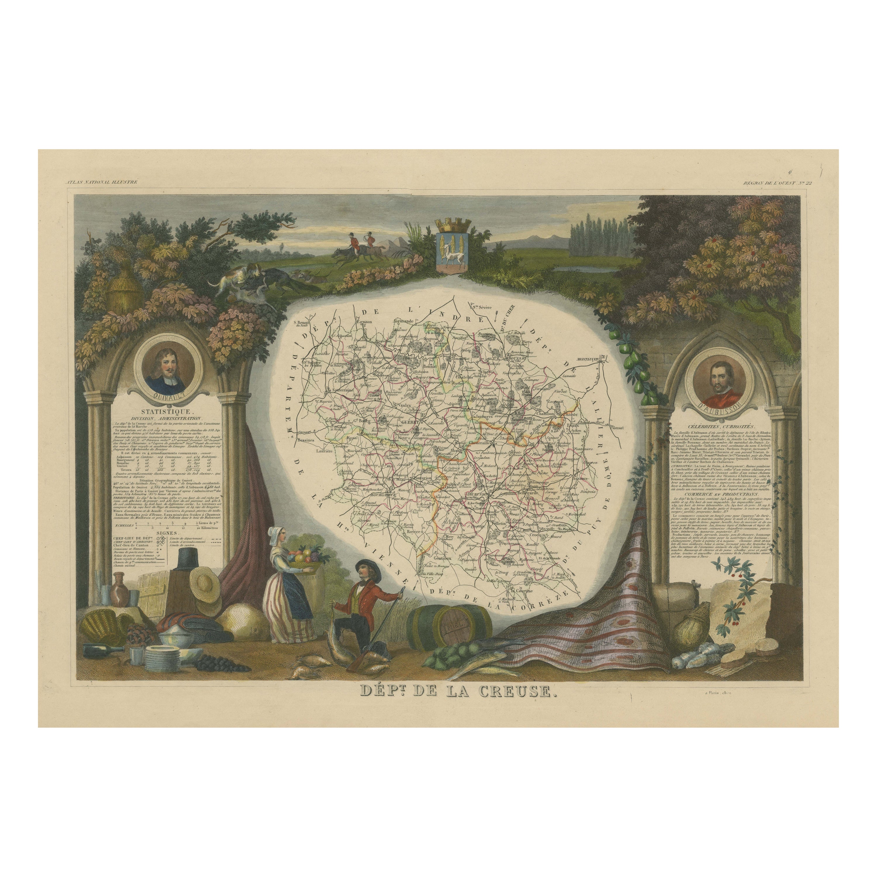
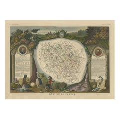
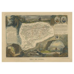
View AllHand Colored Antique Map of the Department of Creuse, France
By Victor Levasseur
Located in Langweer, NL
Antique map titled 'Dépt. de la Creuse'. Map of the French department of Creuse, France. This region is well known for its apple cider made from Limousin apples and its international...
Category
Antique Mid-19th Century Maps
Materials
Paper
$325 Sale Price
20% Off
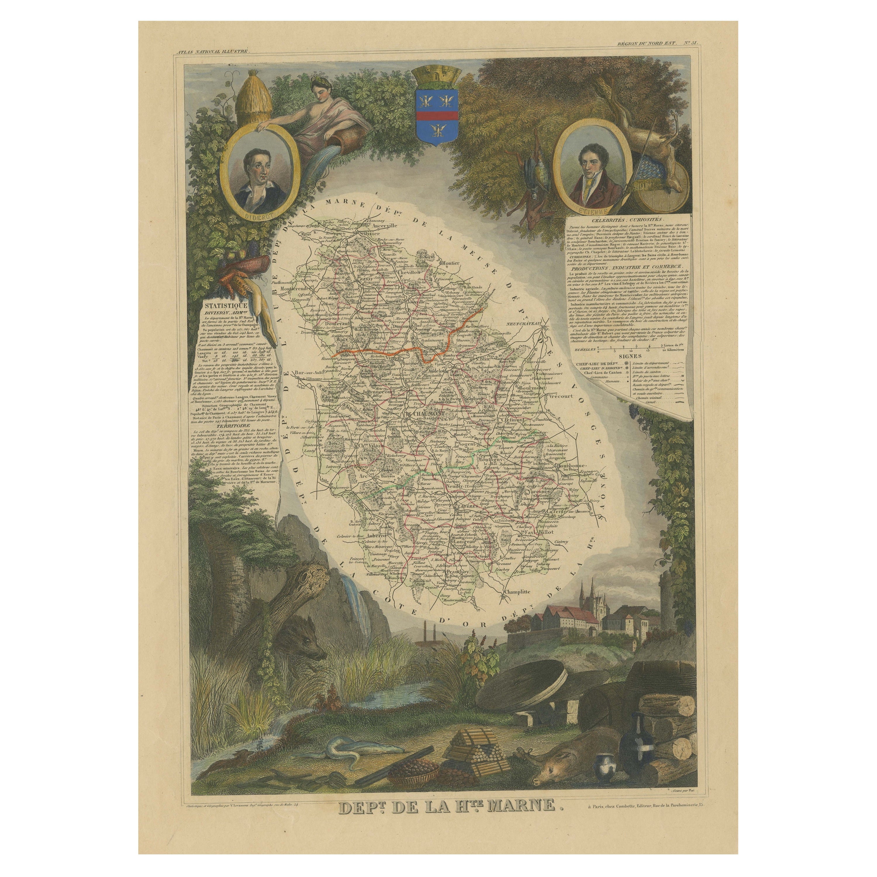
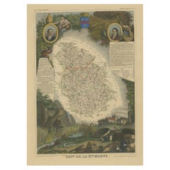
Hand Colored Antique Map of the Department of Haute Marne, France
By Victor Levasseur
Located in Langweer, NL
Antique map titled 'Dépt. de la Hte Marne'. Map of the French department of Haute Marne, France. This department is part of the Champagne region, where the world-famous sparkling win...
Category
Antique Mid-19th Century Maps
Materials
Paper
$325 Sale Price
20% Off
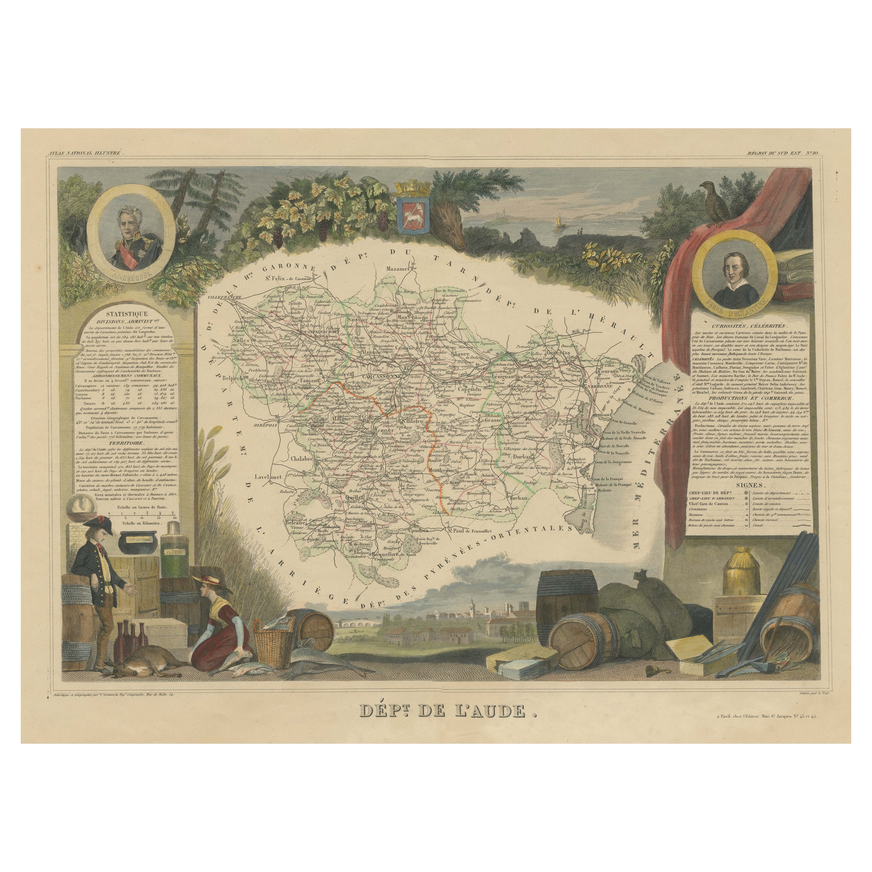
Hand Colored Antique Map of the Department of Aude, France
By Victor Levasseur
Located in Langweer, NL
Antique map titled 'Dépt. de l'Aude'. Map of the French department of Aude, France. This area of France is famous for its wide variety of vineyards and wine production. In the east a...
Category
Antique Mid-19th Century Maps
Materials
Paper

$325 Sale Price
20% Off
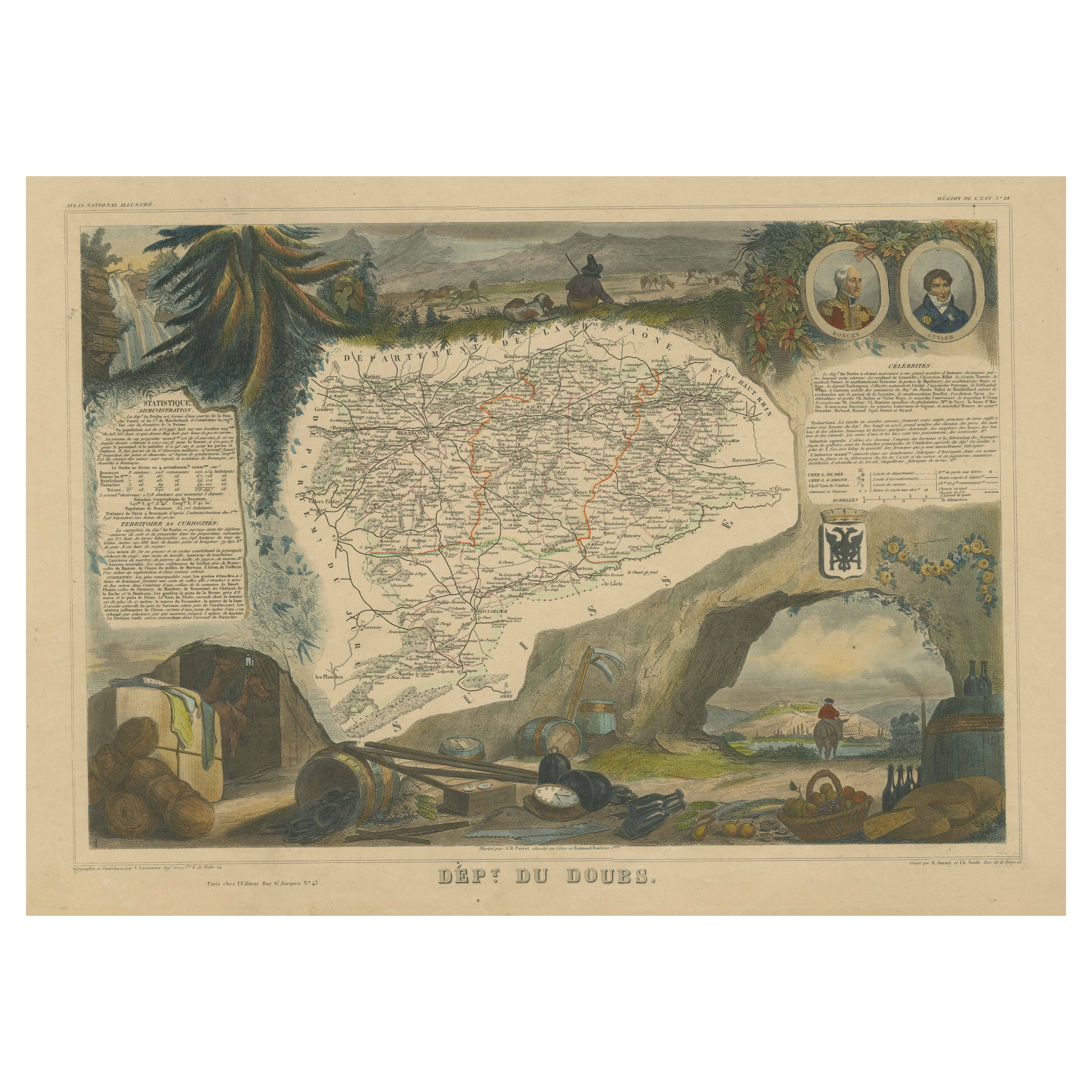
Hand Colored Antique Map of the Department of Doubs, France
By Victor Levasseur
Located in Langweer, NL
Antique map titled 'Dépt. du Doubs'. Map of the French department of Doubs, France. The whole is surrounded by elaborate decorative engravings designed to illustrate both the natural...
Category
Antique Mid-19th Century Maps
Materials
Paper
$203 Sale Price
50% Off
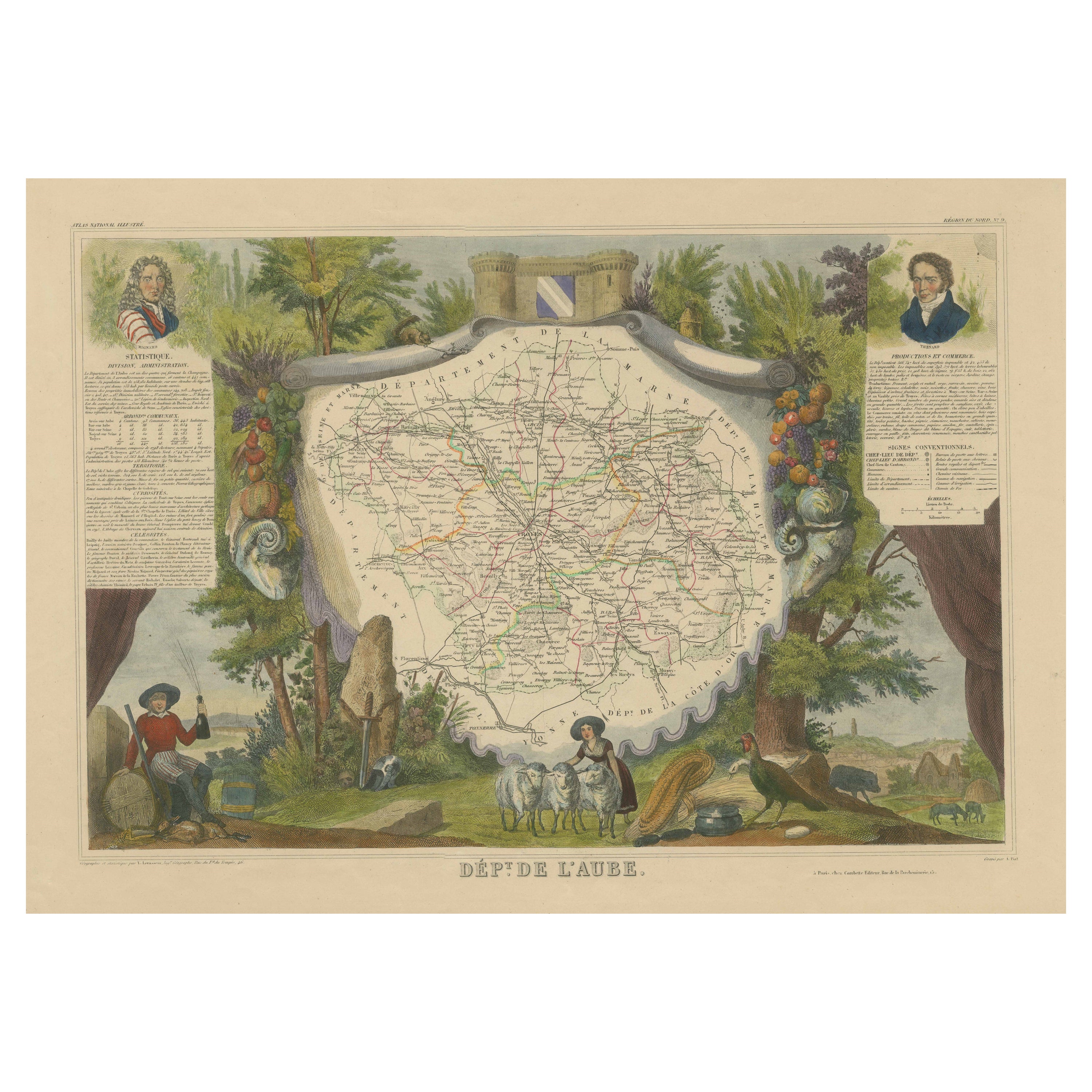
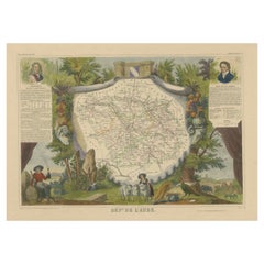
Hand Colored Antique Map of the department of Aube, France
By Victor Levasseur
Located in Langweer, NL
Antique map titled 'Dépt. de l'Aube'. Map of the French department of Aube, France. This area of France is known for its production of Chaource, a soft and salted cheese. Aube is par...
Category
Antique Mid-19th Century Maps
Materials
Paper
$325 Sale Price
20% Off
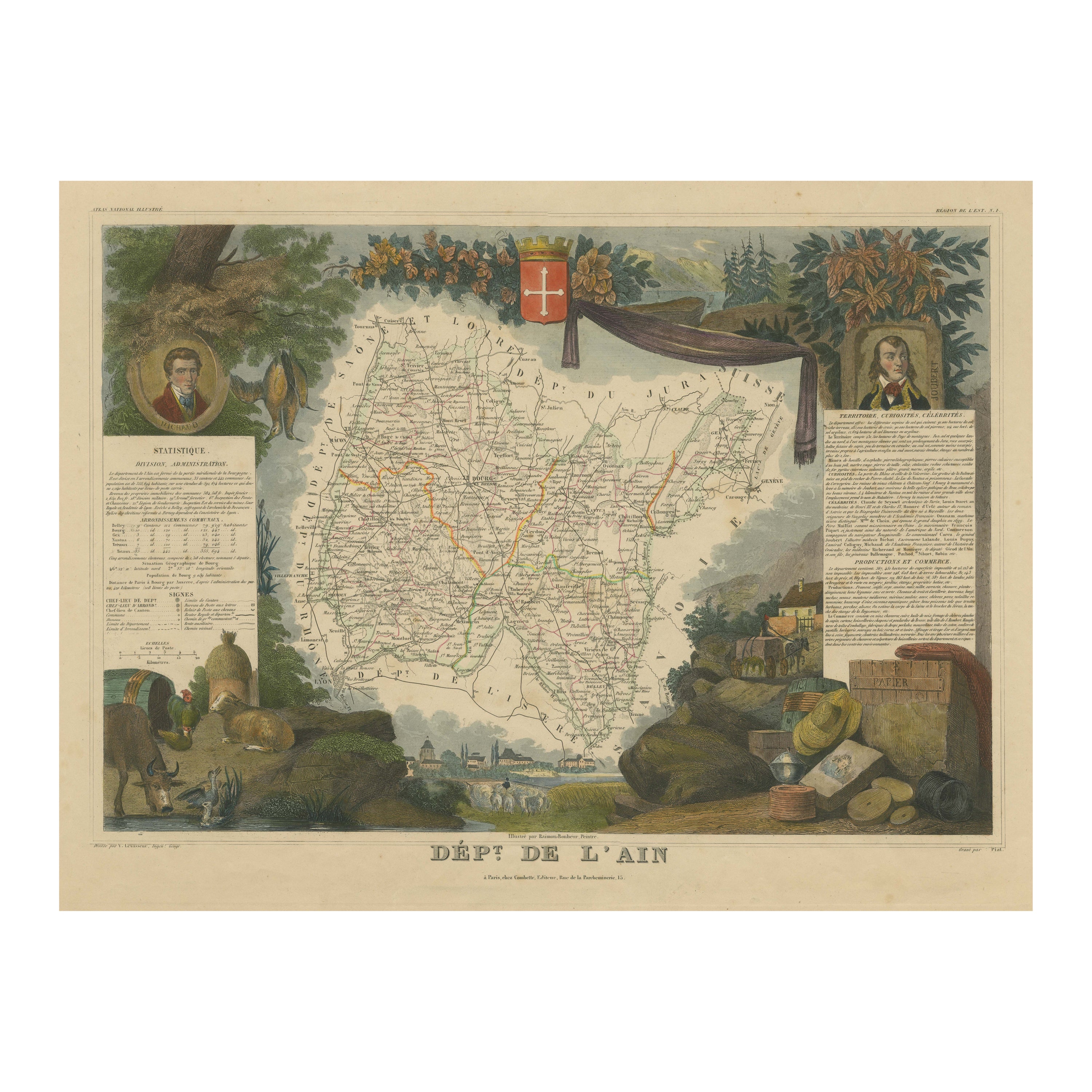
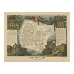
Hand Colored Antique Map of the Department of L
ain, France, 1852
By Victor Levasseur
Located in Langweer, NL
Antique map titled 'Dépt. de l'Ain'. Map of the French department of l'Ain, France. This area of France is known for its Bugey wines, which are generally aromatic and white. It is also known for its fine blue cheese...
Category
Antique Mid-19th Century French Maps
Materials
Paper
$325 Sale Price
20% Off
You May Also Like
La Gironde, France. Antique map of a French department, 1856
By Victor Levasseur
Located in Melbourne, Victoria
'La Gironde', steel engraving with original outline hand-colouring., 1856, from Levasseur's 'Atlas National Illustre'.
This coastal department is the seat of the Bordeaux wine regi...
Category
19th Century Naturalistic Landscape Prints
Materials
Engraving

Aude, France. Antique map of a French department, 1856
By Victor Levasseur
Located in Melbourne, Victoria
'Dept. de L' Aude', steel engraving with original outline hand-colouring., 1856, from Levasseur's 'Atlas National Illustre'.
This area of France is famous for its wide variety of v...
Category
19th Century Naturalistic Landscape Prints
Materials
Engraving

Jura, France. Antique map of a French department, 1856
By Victor Levasseur
Located in Melbourne, Victoria
'Dept. du Jura', steel engraving with original outline hand-colouring., 1856, from Levasseur's 'Atlas National Illustre'.
The Jura wines are very distinctive and unusual, such as V...
Category
19th Century Naturalistic Landscape Prints
Materials
Engraving

Large 19th Century Map of France
Located in Pease pottage, West Sussex
Large 19th Century Map of France.
Remarkable condition, with a pleasing age worn patina.
Recently framed.
France Circa 1874.
Category
Antique Late 19th Century French Maps
Materials
Linen, Paper

Var, France. Antique map of a French department, 1856
By Victor Levasseur
Located in Melbourne, Victoria
'Dept. du Var', steel engraving with original outline hand-colouring., 1856, from Levasseur's Atlas National Illustre.
Var covers the heart of the French Riviera or Cote d'Azur., and includes the resort cities of Cannes, Nice and San Tropez...
Category
19th Century Naturalistic Landscape Prints
Materials
Engraving

Fine French Antique 1856 Hand Watercolour Map of Dept Des Hautes Pyrenees
Located in West Sussex, Pulborough
We are delighted to offer for sale this stunning 1856 hand watercolour map of the Austrian Alps titled Dept Des Hautes Pyrenees taken from the Atlas Nat...
Category
Antique 1850s French Early Victorian Maps
Materials
Paper
