Items Similar to Hand-Colored Map of the Holy Land Divided Among the Twelve Tribes, c.1720


Want more images or videos?
Request additional images or videos from the seller
1 of 12
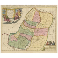
Hand-Colored Map of the Holy Land Divided Among the Twelve Tribes, c.1720
$765.48
£568.41
€640
CA$1,051.65
A$1,143.36
CHF 606.21
MX$13,705.97
NOK 7,704.62
SEK 7,058.48
DKK 4,878.85
About the Item
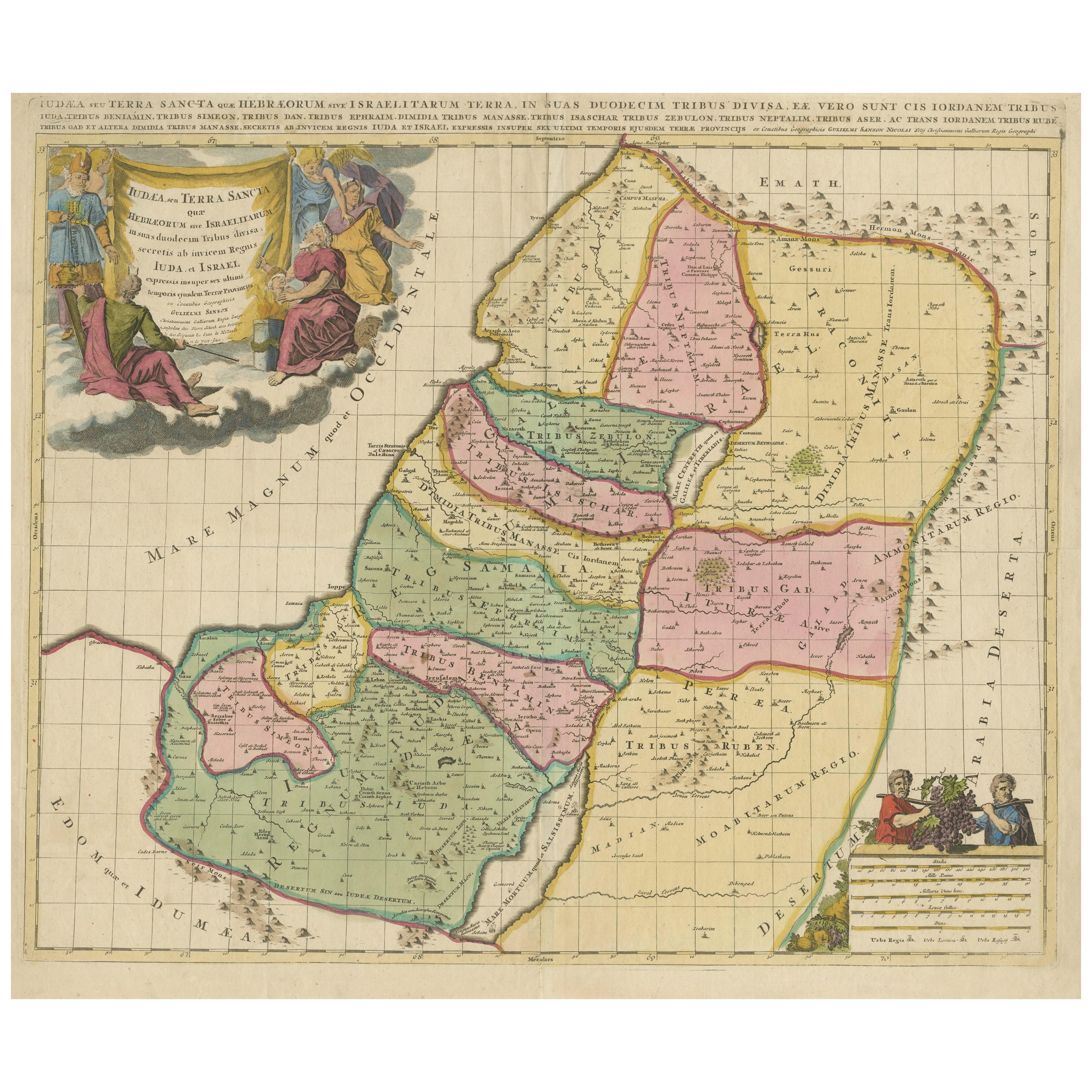
Hand-Colored Map of the Holy Land Divided Among the Twelve Tribes, c.1720
This striking antique map, titled "Iudaea seu Palaestina ob Sacratissima Redemtoris Vestigia Hodie Dicta Terra Sancta Prout olim in Deodecim Tribus Divisa Separatis ab Invicem Regnis Iuda et Israel", was created circa 1720 by Johann Baptist Homann, one of the most prominent German mapmakers of the early 18th century. The map offers a detailed and vivid depiction of the Holy Land, meticulously divided according to the twelve tribes of Israel.
Covering the region from Sidon in the north to the desert of Sirbonis in the south, the map is based on earlier cartographic work by Guillaume Sanson. It includes notable geographic elements such as the Kishon River, which is curiously depicted as linking the Mediterranean Sea with the Sea of Galilee—an imaginative interpretation typical of early biblical cartography.
Homann’s engraving is visually enriched by two highly decorative vignettes. In the upper left, a dramatic scene shows Moses on Mount Sinai receiving the Ten Commandments amidst clouds and divine lightning. In the lower right corner, an inset map traces the route of the Exodus and Forty Years in the Wilderness. This inset is framed by figures of Moses, Aaron, and two of the twelve spies carrying a large cluster of grapes—symbolizing the bounty of the Promised Land.
The map’s original color remains within the main body, delineating the tribal territories in a pastel palette of pinks, yellows, and greens. The cartouches and vignette scenes feature later hand-coloring that adds vivid contrast to the composition. The typography and Latin place names further emphasize the scholarly and theological intent behind this historical map.
Homann's works are prized for their decorative appeal and rich symbolism, making this map a compelling piece for collectors of biblical history, Judaica, or antique cartography.
Condition Report:
A strong, dark impression with original hand coloring in the main map and later enhancement in the cartouches. Minor toning and light soiling along the centerfold, with approximately a dozen small wormhole tracks scattered in the image area. Pencil graticule grid added by a previous owner. Paper generally strong and stable.
Framing Tips:
This map would benefit from an elegant gold or walnut-colored frame to enhance the 18th-century aesthetic. Use an off-white or cream archival mat to highlight the pastel hand coloring. Consider a museum-grade UV protective glass to preserve the pigments and prevent further toning.
Technique: Engraving with hand color
Maker: Johann Baptist Homann, Nuremberg, circa 1720
- Dimensions:Height: 19.3 in (49 cm)Width: 22.52 in (57.2 cm)Depth: 0.01 in (0.2 mm)
- Materials and Techniques:Paper,Engraved
- Place of Origin:
- Period:
- Date of Manufacture:circa 1720
- Condition:A strong, dark impression with original hand coloring in the main map and later enhancement in the cartouches. Minor toning and light soiling along the centerfold, with approximately a dozen small wormhole tracks scattered in the image area.
- Seller Location:Langweer, NL
- Reference Number:Seller: BG-141141stDibs: LU3054346012782
About the Seller
5.0
Recognized Seller
These prestigious sellers are industry leaders and represent the highest echelon for item quality and design.
Platinum Seller
Premium sellers with a 4.7+ rating and 24-hour response times
Established in 2009
1stDibs seller since 2017
2,821 sales on 1stDibs
Typical response time: 1 hour
- ShippingRetrieving quote...Shipping from: Langweer, Netherlands
- Return Policy
More From This Seller
View AllHoly Land Map of the Twelve Tribes of Israel – Sanson, Hand Colored, 1696
Located in Langweer, NL
Holy Land Map of the Twelve Tribes of Israel – Sanson, Hand Colored, 1696
Description:
This impressive and richly hand-colored map of the Holy Land depicts the biblical territories ...
Category
Antique Late 17th Century French Maps
Materials
Paper
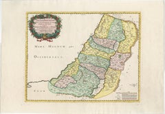
Judaea or Terra Sancta, Twelve Tribes of Israel – Sanson Map, c.1680
Located in Langweer, NL
Judaea or Terra Sancta, Twelve Tribes of Israel – Sanson Map, c.1680
This antique map depicts Judaea or the Holy Land divided among the Twelve Tribes of Israel, based on biblical ge...
Category
Antique Late 17th Century Dutch Maps
Materials
Paper
1718 Holy Land Map - Twelve Tribes, Six Provinces, Hand-Colored, Antique Map
Located in Langweer, NL
Title: Terra Sancta in XII olim Tribus nunc VI Provincias Dispertita
Cartographer: Christoph Weigel the Elder (1654–1725)
Publisher: Johann Ernst Adelbulner
Publication Locatio...
Category
Antique 1710s German Maps
Materials
Paper

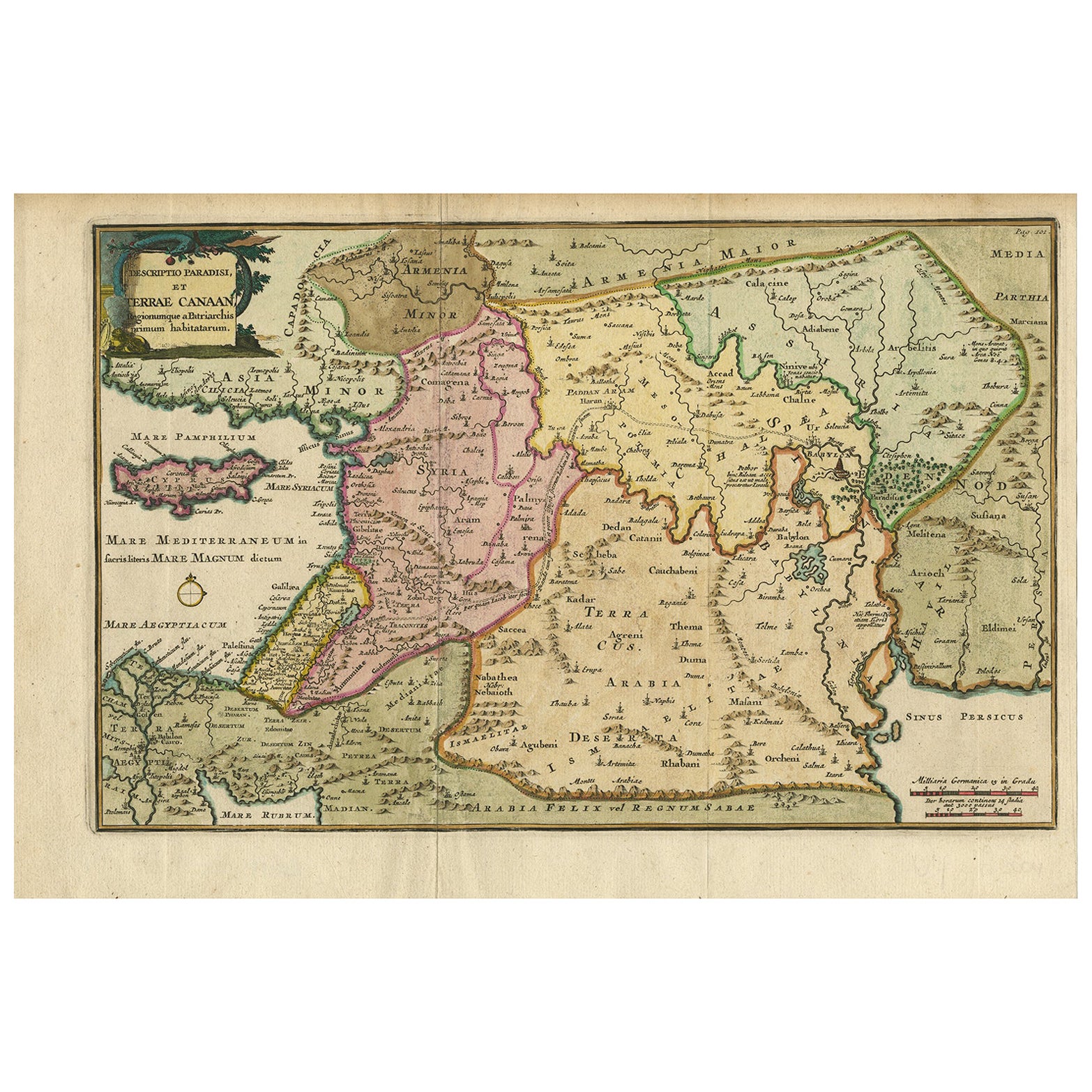
Antique Map of the Holy Land and Paradise – Terrae Canaan Map, c.1720
Located in Langweer, NL
Antique Map of the Holy Land and Paradise by François Halma, c.1720
Beautiful early 18th-century hand-colored map of the Middle East extending from the Mediterranean Sea to the Pers...
Category
Antique Early 18th Century Dutch Maps
Materials
Paper

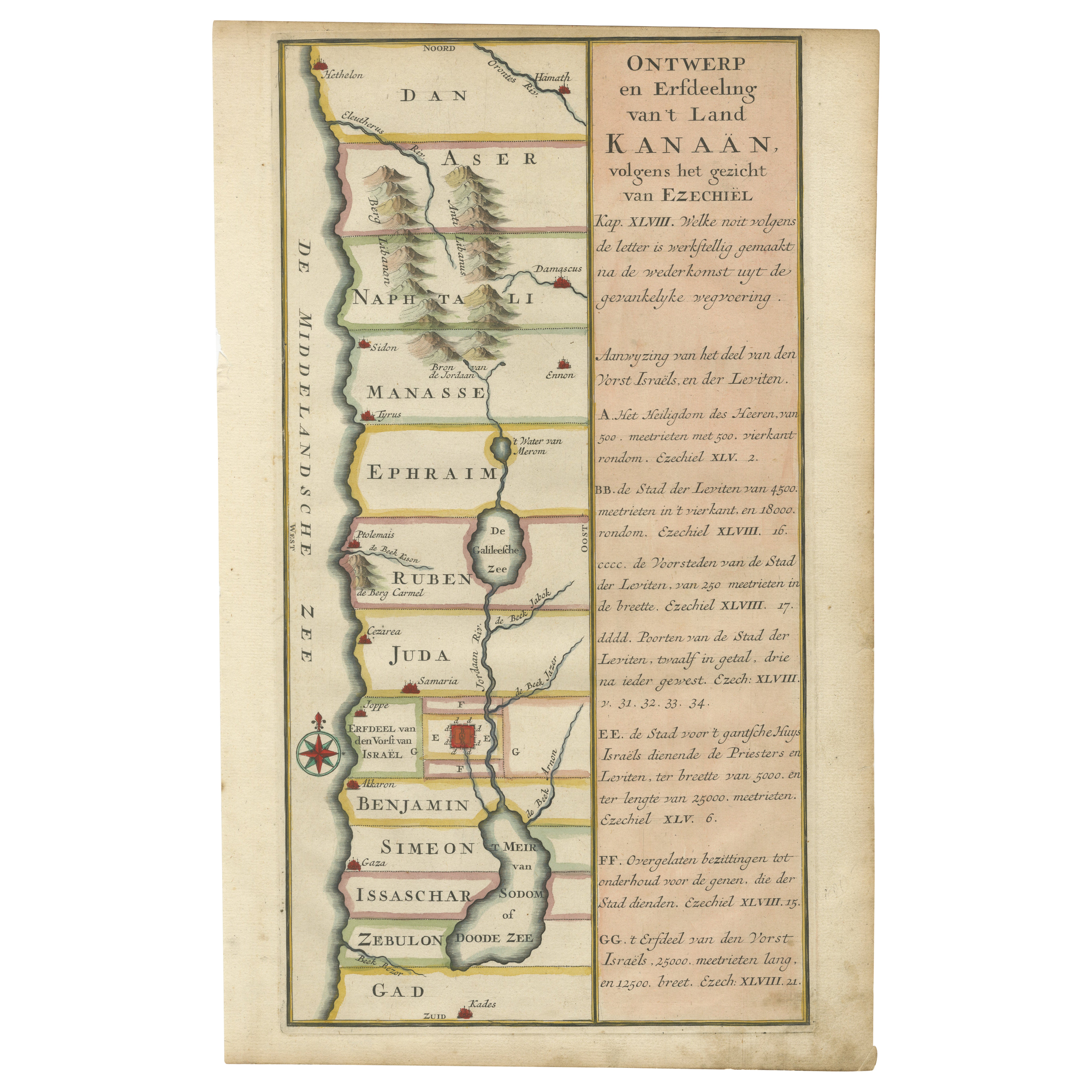
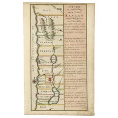
Hand-Colored Dutch Map of Ancient Israel Divided by the Twelve Tribes – c.1730
Located in Langweer, NL
Hand-Colored Dutch Map of Ancient Israel Divided by the Twelve Tribes – After Ezekiel, c.1730
This beautifully hand-colored antique map is titled "Ontwerp en Erfdeeling van’t Land K...
Category
Antique Early 18th Century Dutch Maps
Materials
Paper
Holy Land Map of the Twelve Tribes of Israel, After Sanson, Paris c.1798
Located in Langweer, NL
Holy Land, Twelve Tribes of Israel – After Nicolas Sanson, De Vaugondy / Delamarche, c.1798
Description:
Holy Land. De Vaugondy (G. R.), Carte de la Terre des Hébreux ou Israélites,...
Category
Antique Late 18th Century French Maps
Materials
Paper

You May Also Like
Southern Greece: A Large 17th Century Hand-colored Map By Sanson and Jaillot
By Nicholas Sanson d
Abbeville
Located in Alamo, CA
This large original hand-colored copperplate engraved map of southern Greece and the Pelopponese Peninsula entitled "La Moree Et Les Isles De Zante, Cefalonie, Ste. Marie, Cerigo & C...
Category
1690s Landscape Prints
Materials
Engraving

"Nova Barbariae Descriptio", a 17th Century Hand-Colored Map of North Africa
By Johannes Janssonius
Located in Alamo, CA
This original attractive 17th century hand-colored map of North Africa entitled "Nova Barbariae Descriptio" by Johannes Janssonius was published in Paris in 1635. It includes the Med...
Category
Antique Mid-17th Century Dutch Maps
Materials
Paper

$1,020 Sale Price
20% Off
18th Century Hand-Colored Homann Map of Germany, Including Frankfurt and Berlin
By Johann Baptist Homann
Located in Alamo, CA
An 18th century hand-colored map entitled "Tabula Marchionatus Brandenburgici et Ducatus Pomeraniae quae sunt Pars Septentrionalis Circuli Saxoniae Superioris" by Johann Baptist Homa...
Category
Antique Early 18th Century German Maps
Materials
Paper

$620 Sale Price
20% Off
17th Century Hand-Colored Map of a Region in West Germany by Janssonius
By Johannes Janssonius
Located in Alamo, CA
This attractive highly detailed 17th century original hand-colored map is entitled "Archiepiscopatus Maghdeburgensis et Anhaltinus Ducatus cum terris adjacentibus". It was published ...
Category
Antique Mid-17th Century Dutch Maps
Materials
Paper

$1,020 Sale Price
20% Off
West Germany: Original Hand Colored 17th Century Map by Johannes Janssonius
By Johannes Janssonius
Located in Alamo, CA
An original hand colored copperplate engraved map entitled in Latin "Archiepiscopatus Maghdeburgensis et Anhaltinus Ducatus cum terris adjacentibus", published in Amsterdam in 1640 i...
Category
Mid-17th Century Old Masters More Prints
Materials
Engraving

17th Century Hand Colored Map of the Liege Region in Belgium by Visscher
By Nicolaes Visscher II
Located in Alamo, CA
An original 17th century map entitled "Leodiensis Episcopatus in omnes Subjacentes Provincias distincté divisusVisscher, Leodiensis Episcopatus" by Nicolaes Visscher II, published in Amsterdam in 1688. The map is centered on Liege, Belgium, includes the area between Antwerp, Turnhout, Roermond, Cologne, Trier and Dinant.
This attractive map is presented in a cream-colored mat measuring 30" wide x 27.5" high. There is a central fold, as issued. There is minimal spotting in the upper margin and a tiny spot in the right lower margin, which are under the mat. The map is otherwise in excellent condition.
The Visscher family were one of the great cartographic families of the 17th century. Begun by Claes Jansz Visscher...
Category
Antique Late 17th Century Dutch Maps
Materials
Paper

$940 Sale Price
20% Off
More Ways To Browse
Sea Of Galilee
Beni Ourain Rugs
Glass Top Wood Base Coffee Tables
T Chair
Pair Of Danish Chairs
Veneer Dining Tables
1970 Italian Armchair
Furniture Uk
House Of Denmark Table And Chairs
Louis Marble Top Side Table
Antique Russian Rugs
Baker Furniture By
For Kids
Sterling Silver Flatware Set Service For 12
Tufted Bar
Pair Of French Antique Armchairs
1970s Brass Glass Coffee Table
Antique Column Base