Items Similar to Hand Colored Map of Nantucket by Austin Strong (1881 - 1952), circa 1921
Want more images or videos?
Request additional images or videos from the seller
1 of 8
Hand Colored Map of Nantucket by Austin Strong (1881 - 1952), circa 1921
$2,800
£2,121.81
€2,445.14
CA$3,959.97
A$4,258.62
CHF 2,277.09
MX$51,357.73
NOK 28,795.38
SEK 26,236.30
DKK 18,270.61
About the Item
Map of Nantucket by Austin Strong (1881 - 1952), circa 1921, an original print on paper whimsical map of Nantucket Island by Robert Louis Stevenson's step- grandson, noted stage set designer, artist and Nantucket cultural icon Austin Strong. The map illustrates the geographic locations and features on the island, in addition to Austin's own invented Nantucket Coat-of-Arms with Harpooner and Quaker flanking an inscribed shield; compass rose; anthropomorphic East Wind and West Wind; whale ship and clipper ship and frolicking sperm whales; signed and dated in the lower left; the map was hand colored in soft watercolors, either by Austin or the original purchaser of the map; mounted in its original simple pine frame.
The print is in original untouched condition, in its original frame, and is in great condition other than a faint smudge here and there on the margins. The pastel shaded coloring remains strong.
Measures in frame: 17 in H x 19-5/8 in W
One of the great Nantucket personalities of the twentieth century, Austin Strong was a stage designer, theatrical producer, author, landscape architect, Mason, clairvoyant, commodore of the Nantucket Yacht Club (1931 and 1932), founder of the Wharf Rat Club, promoter of and participant in the Nantucket Cottage Hospital “fêtes,” and a leading force in many of the chief island organizations and cultural activities from the 1920s through the 1940s. He designed this map of Nantucket in 1921, the sale of which generated substantial funds for the hospital. In addition to his more formal public art work, Strong delighted in making improvised sketches caricaturing the miscellaneous personalities he encountered on Nantucket and in his travels. Strong spent his childhood years with his step-grandfather Robert Louis Stevenson in his home, “Vailima,” on the island of Samoa, before continuing his education in Wellington,New Zealand, and Monterey, California. After several successful decades producing and writing plays and theatricals on Broadway and in London, Strong began to make Nantucket his regular summer home. In addition to their house on Quince Street, Strong and his wife, Mary, had a boathouse on Old North Wharf, filled with mementos from his childhood and exotic nautical treasures. Friends with fellow Wharf Rat Tony Sarg and a lover of all things relating to the sea, Strong would regale listeners with amusing tales drawn from his childhood in Samoa with his grandfather Robert Louis Stevenson, and his later adventures as a man of the world. Upon arrival in the spring, the Strongs were always saluted at the wharf by a blast of the Wharf Rat cannon. Described by all who knew him as a genial, high-spirited, and charming man, Strong was a “master of pantomime.” (The Nantucket Art Colony, 1920-45. An NHA Digital Exhibition. 2007).
- Dimensions:Height: 17 in (43.18 cm)Width: 19.63 in (49.87 cm)Depth: 0.63 in (1.61 cm)
- Style:Folk Art (Of the Period)
- Materials and Techniques:
- Place of Origin:
- Period:
- Date of Manufacture:Circa 1921
- Condition:Wear consistent with age and use.
- Seller Location:Nantucket, MA
- Reference Number:Seller: AD - AS-1 HE1stDibs: LU903947722272
About the Seller
5.0
Gold Seller
Premium sellers maintaining a 4.3+ rating and 24-hour response times
1stDibs seller since 2010
281 sales on 1stDibs
Typical response time: <1 hour
- ShippingRetrieving quote...Shipping from: Nantucket, MA
- Return Policy
More From This Seller
View AllTony Sarg Map of Nantucket Town, 1937
By Tony Sarg
Located in Nantucket, MA
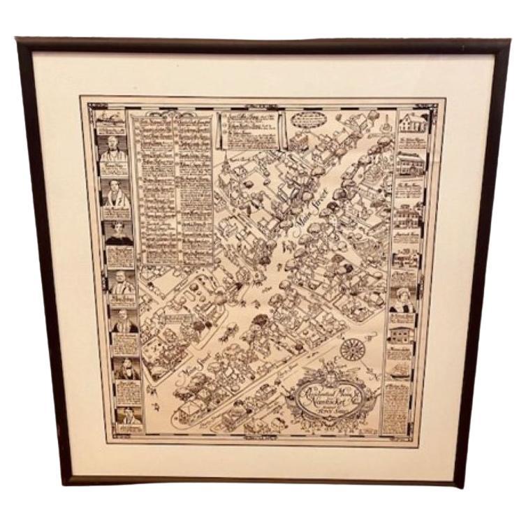
Tony Sarg Map of Residential Main Street, Nantucket, 1937, a black and white printed map of our historic downtown area, with images of each building, street names and whimsical figur...
Category
Vintage 1930s American Other Maps
Materials
Paper

Nantucket High-Ways, By-Ways and Not-Ways Decorative Map by Tony Sarg, ca 1930
By Tony Sarg
Located in Nantucket, MA
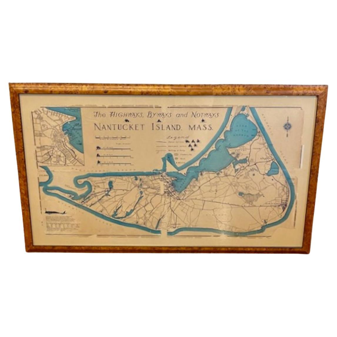
Vintage Nantucket High-Ways, By-Ways and Not-Ways Decorative Map by Tony Sarg, (Nantucket: 1880 - 1942) circa 1930, a decorative tourist map of Nantucket Island with details of roadw...
Category
Vintage 1930s American Other Maps
Materials
Paper

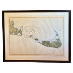
DesBarres (1776) Chart of Nantucket Island, 1966 Restrike
Located in Nantucket, MA
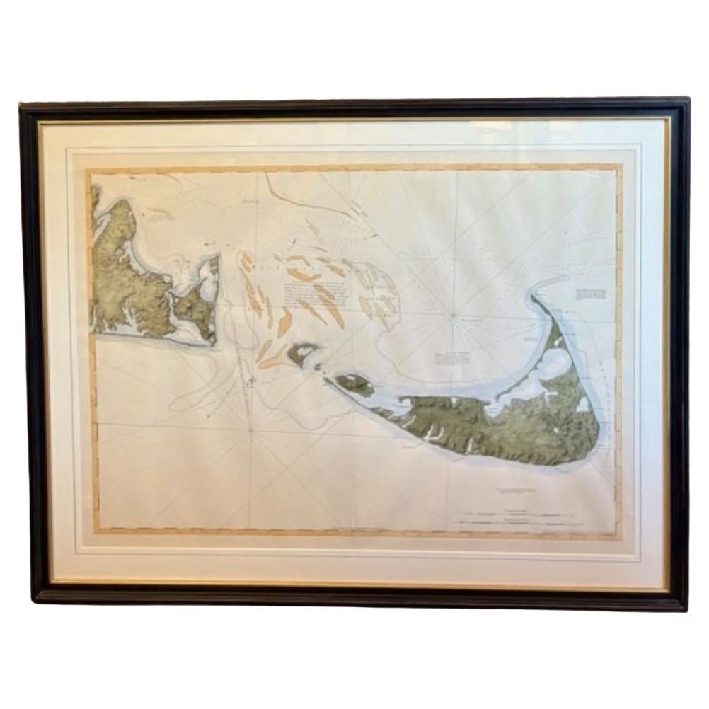
DesBarres (1776) Chart of Nantucket Island and the Eastern Half of Martha's Vineyard Restrike, published by the Massachusetts Historical Society in association with Haley
Steel...
Category
Vintage 1960s American Other Maps
Materials
Paper
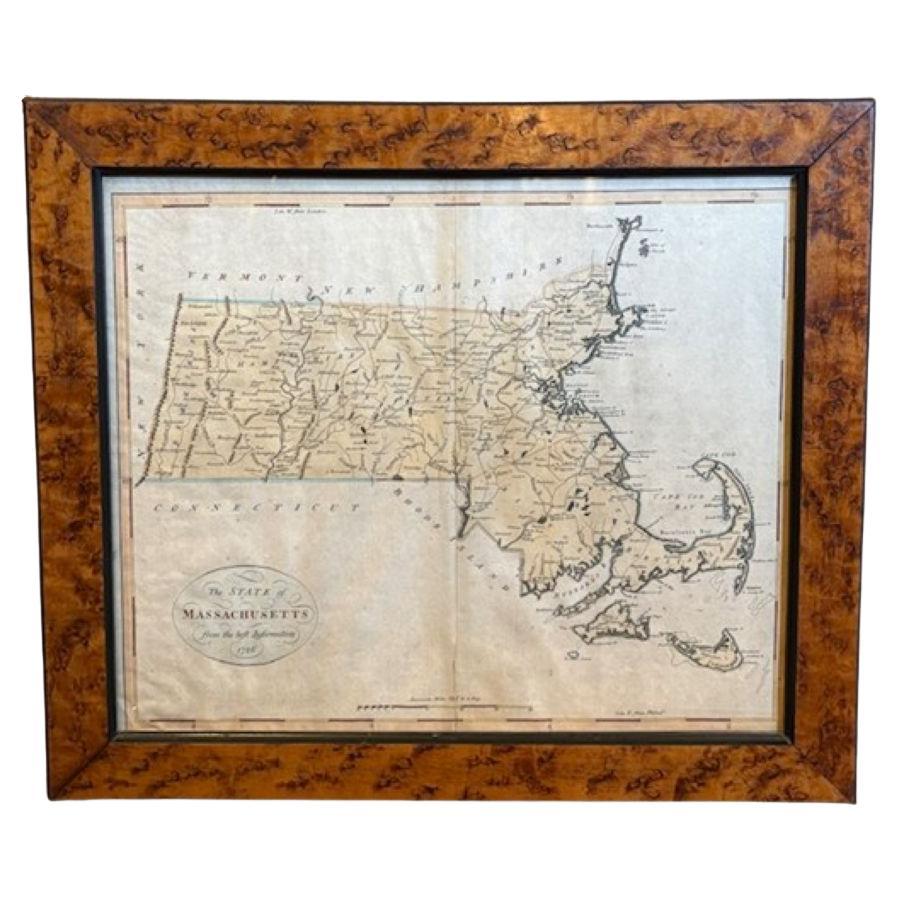
18th Century Hand Colored Map of The State of Massachusetts, 1796
Located in Nantucket, MA
18th Century Hand Colored Map of "The State of Massachusetts from the best information," 1796, by cartographer and illustrator John Reid published in his "American Atlas," a period e...
Category
Antique 1790s American American Colonial Maps
Materials
Paper

19th Century Chart of New England Coast, 1847
By U.S. Government
Located in Nantucket, MA
19th Century Chart of New England Coast: the U.S. Coast Survey Sketch A - Section 1, a triangulation chart showing the progress of the survey and details along the New England coas...
Category
Antique 1840s American Other Maps
Materials
Paper

Nantucket Old North Slip Watercolor by Doris
Richard Beer, circa 1940
By Richard Beer (American), Doris Beer
Located in Nantucket, MA
Vintage Nantucket Old North Slip watercolor by Doris & Richard Beer, circa 1940, a watercolor on paper view of Old North Slip (Wharf), signed in pencil power right. Doris and Richard Beer (1898-1967 and 1893-1959 respectively) produced a well-known series of watercolor miniatures featuring popular Nantucket scenes. Working at their Wharf Head Studio on Old North Wharf for 18 years, the couple worked together on these copyrighted creations, photo-duplicating Doris's line sketch and Doris and Richard completing the watercolor.
One of a large collection of beer watercolors...
Category
Mid-20th Century American Folk Art Paintings
Materials
Paper
You May Also Like
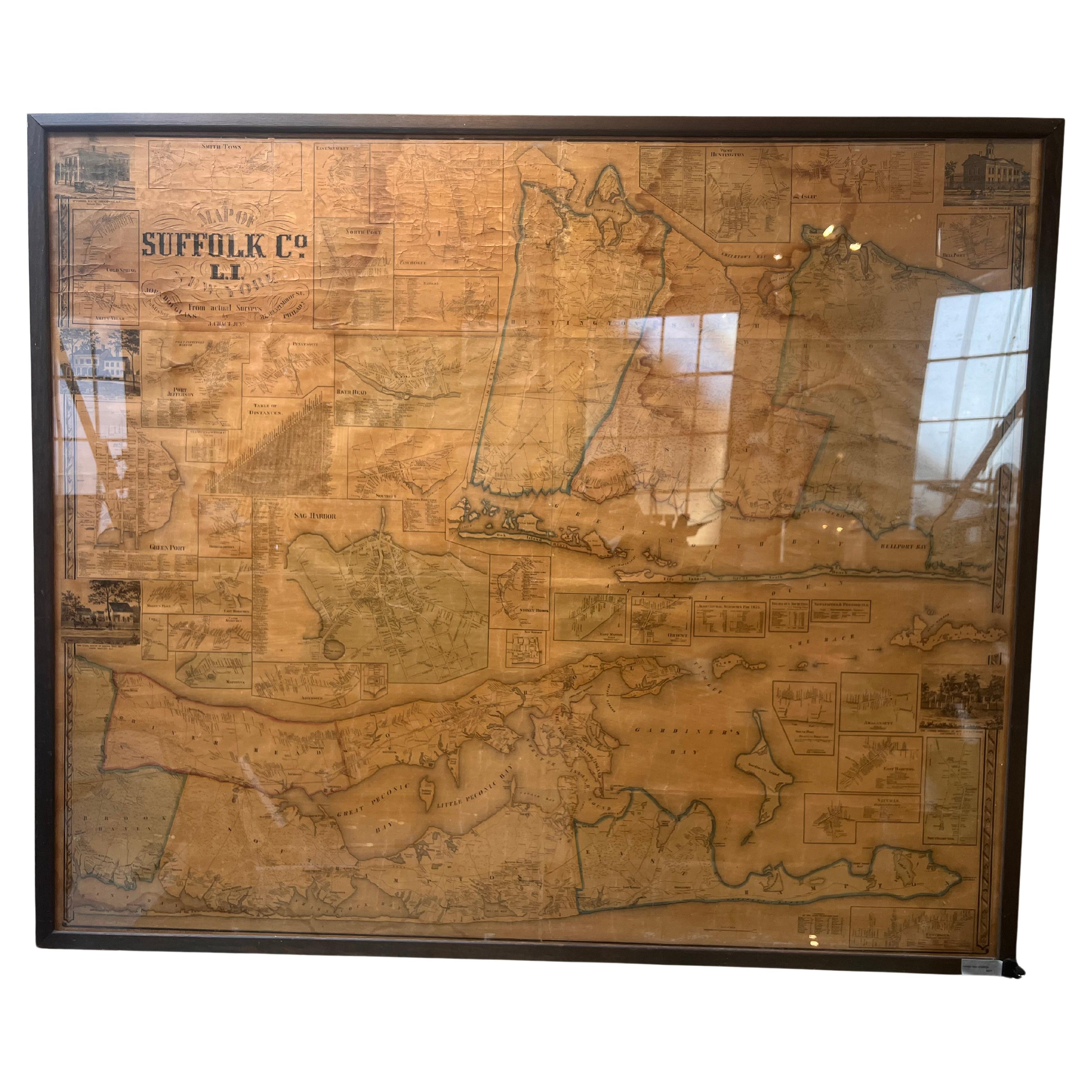
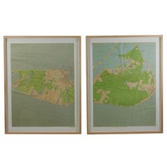
Framed Mid-19th Century Wall Map of Long Island, the Hamptons
Located in Sag Harbor, NY
A Framed museum quality find. This large wall map dates to the mid-1800s. Detailed inset maps of, Sag Harbor, East Hampton, Amagansett, Shelter Island and most villages in Long Island. It also has agriculture stats for 1855. Detailed prints of homes on Scuttle Hole in Bridgehampton as well as several other detailed prints. Lists of businesses, distance tables and railroad schedules and stops. The total amount of detailed information about Suffolk County Long Island is staggering. A unique rare New York map...
Category
Antique Mid-19th Century American Maps
Materials
Linen, Paper

$7,100 Sale Price
20% Off
Maps of Nantucket Sound and Harbor Provenance: The Susie Hilfiger Collection
Located in Bristol, CT
Map Sz: 22 1/2"H x 17"W
Frame Sz: 26 1/2"H x 20 3/4"W
*w/ age toning/ slight creasing/ waving to mounted maps*
Provenance: The Susie Hilfiger Collection
From "Point of View", the...
Category
20th Century Drawings and Watercolor Paintings
Materials
Paper
Plymouth, England: A Hand-Colored 17th Century Sea Chart by Captain Collins
By Captain Greenvile Collins
Located in Alamo, CA
This hand-colored sea chart of the area around Plymouth, England from "Great Britain's Coasting Pilot. Being a New and Exact Survey of the Sea-Coast of England", first published in 1...
Category
Antique Late 17th Century English Maps
Materials
Paper

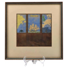
Watercolour Drawing by Kenneth Stevens MacIntire of a Nautical Map
By Kenneth Stevens MacIntire
Located in Norwich, GB
A watercolour drawing of a three-fold screen design, depicting a nautical map of the Atlantic showing America and Europe, and centred with a three-masted...
Category
20th Century American American Classical Paintings
Materials
Paper
$1,180 Sale Price
20% Off
Flanders, Holland
Norfolk: Hand-Colored 17th Century Sea Chart by Collins
By Captain Greenvile Collins
Located in Alamo, CA
This hand-colored chart of the seas about Flanders, Holland, Frisia, and Norfolk is from "Great Britain's Coasting Pilot. Being a New and Exact Survey of the Sea-Coast of England" by...
Category
Antique Late 17th Century English Maps
Materials
Paper

Dartmouth, England: A Hand-Colored 17th Century Sea Chart by Captain Collins
By Captain Greenvile Collins
Located in Alamo, CA
This hand-colored sea chart of the area around Dartmouth, England is from "Great Britain's Coasting Pilot. Being a New and Exact Survey of the Sea-Coast of England", first published ...
Category
Antique Late 17th Century English Maps
Materials
Paper
