Items Similar to Impressive Geological Map of Australia – Rare Oversized Wall Display, 1931–32

Video Loading
Want more images or videos?
Request additional images or videos from the seller
1 of 12
Impressive Geological Map of Australia – Rare Oversized Wall Display, 1931–32
$5,689.73per set
£4,254.63per set
€4,750per set
CA$7,839.02per set
A$8,549.55per set
CHF 4,528.98per set
MX$102,496.98per set
NOK 57,679.02per set
SEK 52,743.18per set
DKK 36,196.89per set
About the Item
Geological Map of the Commonwealth of Australia by Sir Edgeworth David, 1931–32
Large and highly detailed geological map of the Commonwealth of Australia, compiled under the direction of Sir Tannatt William Edgeworth David (1858–1934), one of the leading geologists of his time. Issued in 1931, this impressive map is printed in vivid colors to illustrate the geological structure of the continent. It is presented in four large sections, each linen-backed for durability, which together measure approximately 165.6 × 202.0 cm (65 × 79.5 inches). When folded, the sheets reduce to a convenient 19.6 × 13.6 cm and are housed in the original cloth slipcase (21.5 × 15.0 cm). The map is sold as a folding map and NOT in a frame!
The map is accompanied by the official explanatory notes, published in Sydney in 1932, which provide additional plates, folding illustrations, and tables clarifying the geological data. Edgeworth David was a pioneering geologist whose work was instrumental in mapping Australia’s mineral and structural resources. This map represents one of the most comprehensive geological surveys of the period, produced when Australia was seeking to develop and promote its natural resources in the interwar years.
The set is housed in the original publisher’s cloth box, showing expected age wear, while the map itself retains strong coloring with only minor foxing. The explanatory volume bears institutional stamps and signs of withdrawal but remains complete and solid. Together, the map and volume form a significant resource for the history of science, cartography, and Australia’s geological exploration.
Condition:
Unframed map in four large linen-backed sections, minor foxing, original cloth box worn and stained. Explanatory notes volume rubbed and faded, with library stamps, but complete.
Technique:
Colour-printed geological map, linen-backed; letterpress volume with plates and folding tables.
Maker:
Sir Tannatt William Edgeworth David, Sydney, 1931–1932.
- Dimensions:Height: 65.16 in (165.5 cm)Width: 79.53 in (202 cm)Depth: 0.08 in (2 mm)
- Sold As:Set of 2
- Materials and Techniques:
- Place of Origin:
- Period:
- Date of Manufacture:circa 1932
- Condition:Map in four large linen-backed sections, minor foxing, original cloth box worn and stained.
- Seller Location:Langweer, NL
- Reference Number:Seller: BG-129221stDibs: LU3054346565892
About the Seller
5.0
Recognized Seller
These prestigious sellers are industry leaders and represent the highest echelon for item quality and design.
Platinum Seller
Premium sellers with a 4.7+ rating and 24-hour response times
Established in 2009
1stDibs seller since 2017
2,788 sales on 1stDibs
Typical response time: <1 hour
- ShippingRetrieving quote...Shipping from: Langweer, Netherlands
- Return Policy
More From This Seller
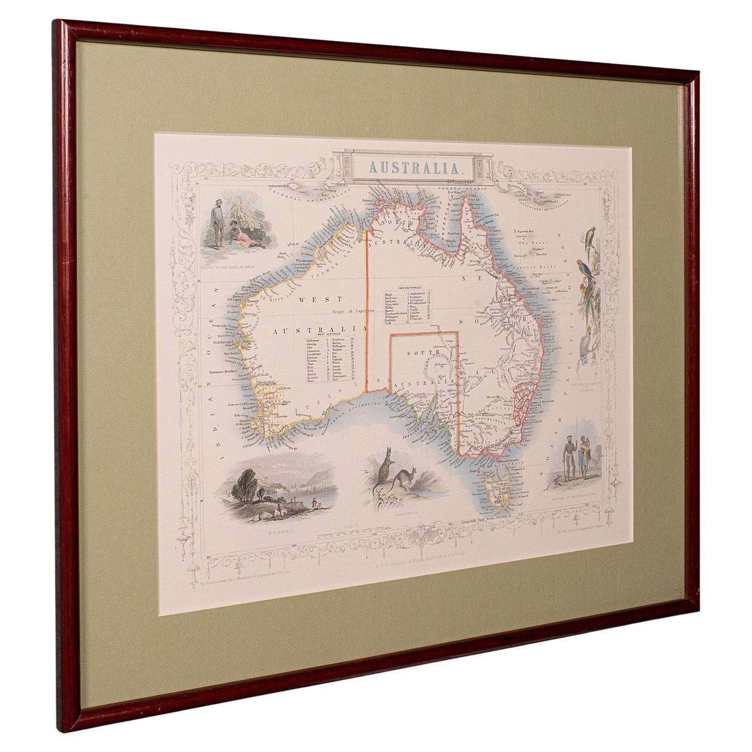
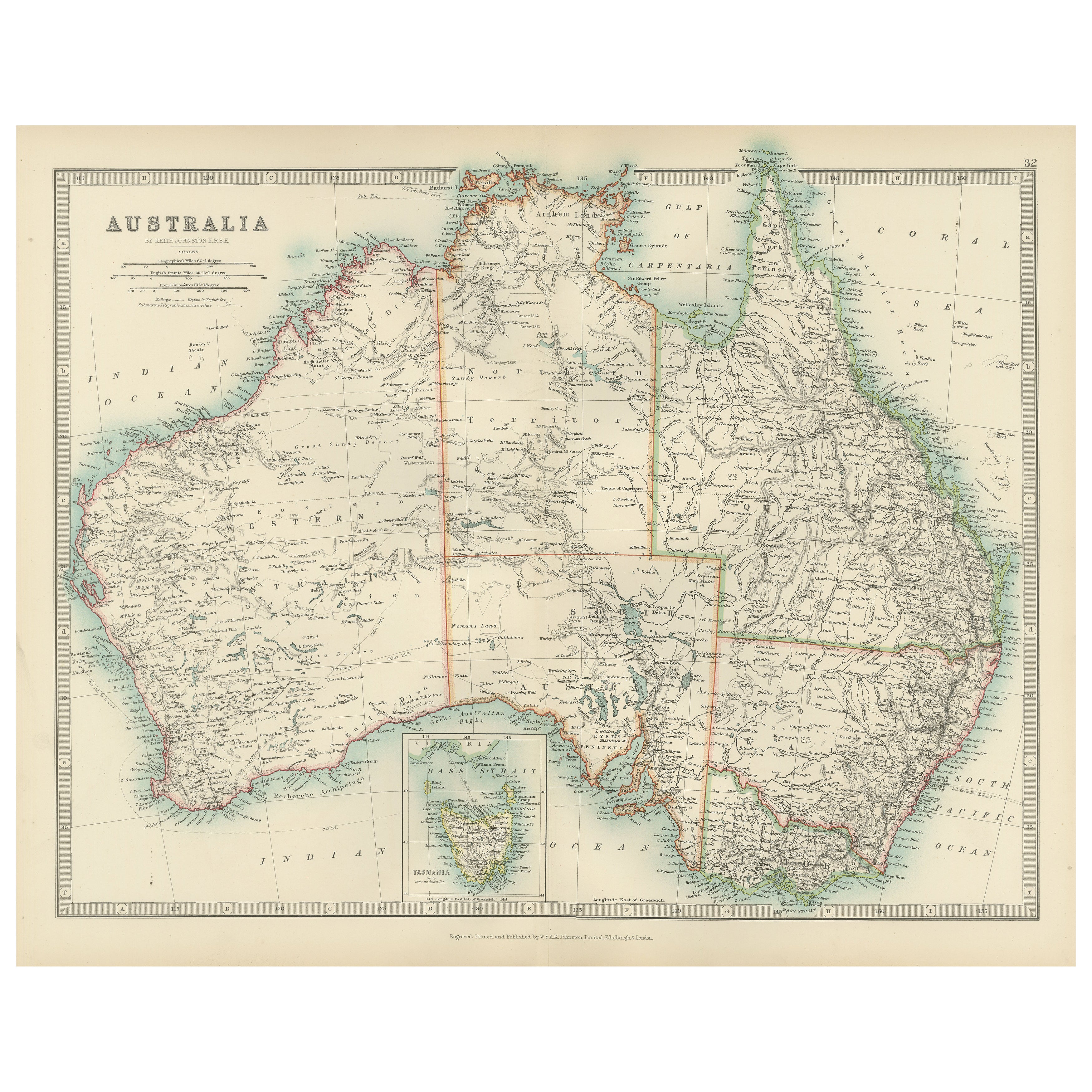
View AllAntique Map of Australia by Johnston
1909
Located in Langweer, NL
Antique map titled 'Australia'. Original antique map of Australia. With inset maps of Melbourne, Port Phillip, Adelaide, Perth, Sydney, Brisba...
Category
Early 20th Century Maps
Materials
Paper
$335 Sale Price
20% Off
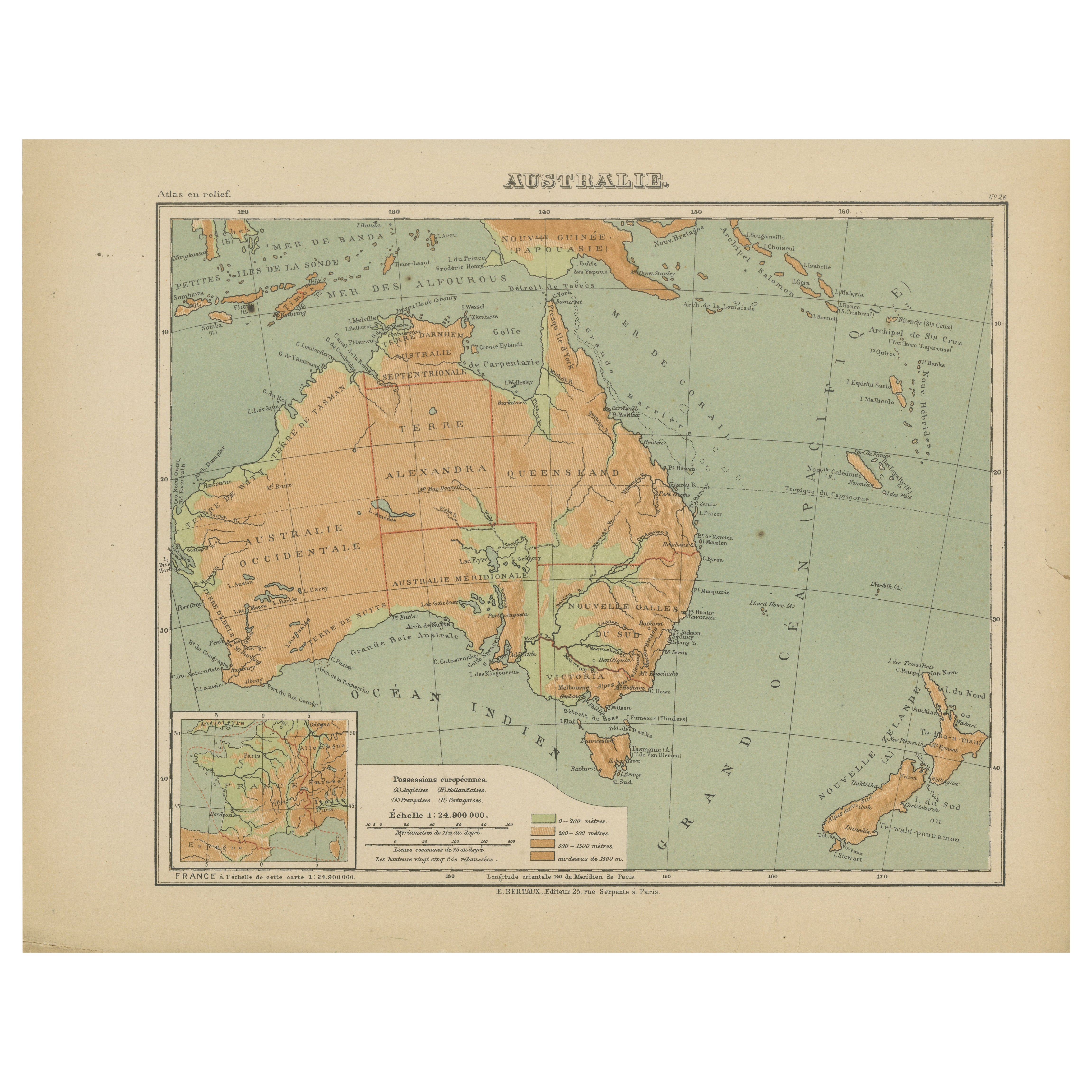
Antique Map of Australia and Oceania – Physical Relief Map by Hachette, c.1883
Located in Langweer, NL
Antique Map of Australia and Oceania – Physical Relief Map by Hachette, c.1883
Description:
This antique map titled “Australie” was published circa 1883 by Hachette in Paris as part...
Category
Antique Late 19th Century French Maps
Materials
Paper
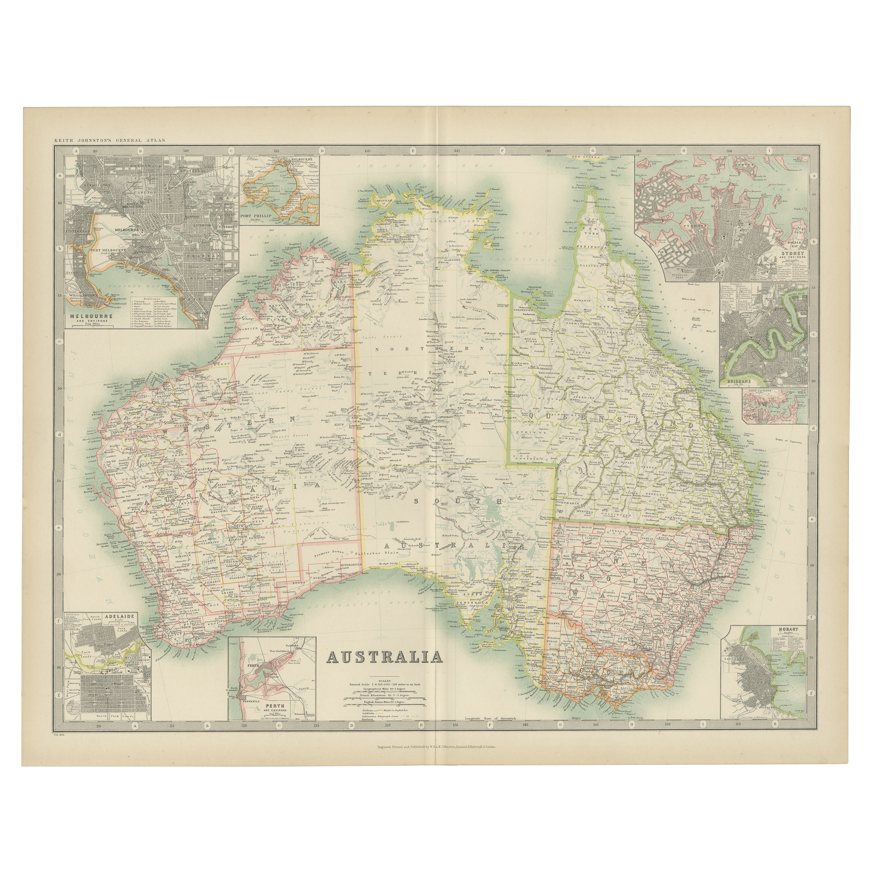
Antique Map of Australia, 1903, with Colonial Divisions and Detailed Topography
Located in Langweer, NL
Title: Antique Map of Australia, 1903, with Colonial Divisions and Detailed Topography
Description: This antique map, titled "Australia," was engraved and published in 1903 by W. & ...
Category
Early 20th Century Maps
Materials
Paper

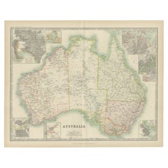
Large Detailed Map of Australia Wint Inset of Tasmania, 1937
Located in Langweer, NL
Antique map titled 'Australia'. Large folding map of Australia. With inset map of Tasmania. Printed by L.F. Johnston, Canberra.
Artists and Engravers: Compiled and drawn by Propert...
Category
20th Century Maps
Materials
Paper

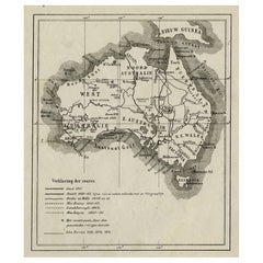
Old Map of Australia Showing The Routes of the Main Explorers, ca.1900
Located in Langweer, NL
Antique print, untitled. This map shows Australia with the routes of explorers in the continent and marking the furthest point reached.. Source unknown, to be determined.
Artists ...
Category
Antique Early 1900s Maps
Materials
Paper
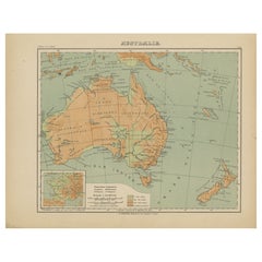
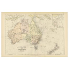
1882 Map of Australia and New Zealand with Regional and Geographical Features
Located in Langweer, NL
This 1882 map of Australia and New Zealand, published by Blackie and Son as part of the 'Comprehensive Atlas and Geography of the World,' provides a detailed and insightful look at t...
Category
Antique 1880s Maps
Materials
Paper
You May Also Like
Vintage Australia Map, Framed, Historic 19th Century Cartography Interest, 1988
Located in Hele, Devon, GB
This is a vintage Australia map. A late 20th century reproduction of John Tallis’ original 1850 steel engraving, produced to mark the 1988 Australian Bicentennial.
Fascinating repro...
Category
1990s Australian Victorian Maps
Materials
Glass, Paper

Large Original Antique Map of Australia by Sidney Hall, 1847
Located in St Annes, Lancashire
Great map of Australia
Drawn and engraved by Sidney Hall
Steel engraving
Original colour outline
Published by A & C Black. 1847
Unframed
Free shipping.
Category
Antique 1840s Scottish Maps
Materials
Paper

Antique Vintage Australia Wall Map By W
A K Johnston
By W.
A.K. Johnston
Located in Stockbridge, GB
Vintage Australia Wall Map By W & A K Johnston
A vintage school pull down wall map of Australia. The map has a wooden hanging pole at the top...
Category
Mid-20th Century British Schoolhouse Posters
Materials
Canvas, Wood
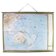
Late 20th Century Educational Geographic Map - Australasia
Located in Hook, Hampshire
Late 20th Century Educational Geographic Map – Australasia
Late 20th Century Educational Geographic Map – Australasia. Good quality roll up school educational geographic map from the...
Category
Late 20th Century Czech Posters
Materials
Cotton
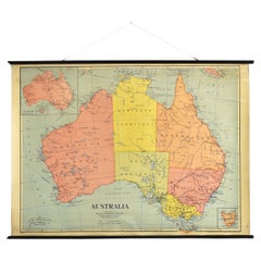
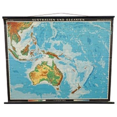
Vintage Mural Map Rollable Wall Chart Poster Australia New Zealand Indonesia
Located in Berghuelen, DE
Vintage Mural Map Rollable Wall Chart Poster Australia New Zealand Indonesia
The vintage pull-down map shows Australia and Oceania, published by Haack-Painke Justus Perthes Darmstadt. Colorful print on paper reinforced with canvas.
This wallchart is a wonderful holiday memory decoration item.
Measurements:
Width 122 cm (48.03 inch)
Height 100 cm (39.37 inch)
The measurements shown refer just to the canvas and do not include the poles.
Background information on the history of school wall charts:
The idea to upgrade every day school life by using pictures was supported in the late 18th century by Johann Bernhard Basedow. In 1774 he published a four-volume book "Elementarwerk" which combined pictures, text and information with merely hundred copperplates. Modern printing methods enabled the spread from rich private schools to rural grade schools...
Category
Vintage 1970s German Country Posters
Materials
Canvas, Wood, Paper
Original Antique Map of Australia by Dower, circa 1835
Located in St Annes, Lancashire
Nice map of Australia
Drawn and engraved by J.Dower
Published by Orr & Smith. C.1835
Unframed.
Free shipping
Category
Antique 1830s English Maps
Materials
Paper
