Items Similar to Ireland Map – Provincial and County Divisions 1851


Video Loading
Want more images or videos?
Request additional images or videos from the seller
1 of 11
Ireland Map – Provincial and County Divisions 1851
$406.95
£302.38
€340
CA$557.44
A$608.14
CHF 322.54
MX$7,326.71
NOK 4,093.72
SEK 3,747.91
DKK 2,590.08
About the Item
Ireland Map – Provincial and County Divisions 1851
This fine antique print shows Ireland titled simply “Ireland,” published in 1851 by Justus Perthes in Gotha as part of Adolf Stieler’s prestigious Hand-Atlas. The map was drawn and engraved by F. v. Stülpnagel, a noted German cartographer. It presents Ireland with detailed provincial and county boundaries highlighted in original hand colouring, and labels major towns, rivers, and mountain ranges with precision.
The map shows all four historic provinces – Connaught, Leinster, Munster, and Ulster – each outlined in different colours to distinguish their counties. Major cities such as Dublin, Cork, Limerick, Galway, and Belfast are clearly labelled, as are regional features including Lough Neagh, the Shannon River, and mountain ranges like MacGillycuddy’s Reeks.
This map is significant as it captures mid-19th-century Ireland shortly after the Great Famine period (1845–1852), a time of major social and demographic change. It provides valuable insight into Ireland’s political geography under British rule and its transport connections, including towns, canals, and ferry routes.
Technique: Copperplate engraving with original hand colouring used to delineate counties and provincial borders in subtle yet clear tones. German titles and detailed annotations are engraved with exceptional clarity typical of Stieler’s Hand-Atlas.
Condition summary: Excellent condition with strong impression, minimal toning, and no tears, repairs, or significant foxing. Colours remain vivid and the paper is firm and stable.
Framing tips: This detailed map of Ireland will display beautifully in a dark wood or black frame to emphasise its cartographic clarity, paired with a wide ivory or cream mount to soften the presentation and highlight its decorative and historical value. UV-protective glass is recommended to preserve the engraving lines and original colours for long-term display.
- Dimensions:Height: 14.77 in (37.5 cm)Width: 17.88 in (45.4 cm)Depth: 0.01 in (0.2 mm)
- Materials and Techniques:Paper,Engraved
- Place of Origin:
- Period:
- Date of Manufacture:1851
- Condition:Technique: Copperplate engraving with original hand colouring used to delineate counties and provincial borders in subtle yet clear tones. German titles and detailed annotations are engraved with exceptional clarity typical of Stieler’s Hand-Atlas.
- Seller Location:Langweer, NL
- Reference Number:Seller: BG-05552-221stDibs: LU3054345811462
About the Seller
5.0
Recognized Seller
These prestigious sellers are industry leaders and represent the highest echelon for item quality and design.
Platinum Seller
Premium sellers with a 4.7+ rating and 24-hour response times
Established in 2009
1stDibs seller since 2017
2,820 sales on 1stDibs
Typical response time: 1 hour
- ShippingRetrieving quote...Shipping from: Langweer, Netherlands
- Return Policy
More From This Seller
View AllAntique Map of Ireland, 1903, with Intricate County Boundaries
Coastal Details
Located in Langweer, NL
Title: Antique Map of Ireland, 1903, with Intricate County Boundaries and Coastal Detail
Description:
This antique map of Ireland, engraved and published in 1903 by the esteemed W. ...
Category
Early 20th Century Maps
Materials
Paper

Antique Ireland Map with County Divisions – Decorative Wall Chart, 1884
Located in Langweer, NL
Antique Map of Ireland with Counties – Black’s Atlas, 1884
Description:
This finely detailed engraved map of Ireland was published in the New and Revised Edition of Black’s General ...
Category
Antique 1880s Scottish Maps
Materials
Paper
Map of Ireland: Early 19th Century - from the 1802 Tardieu Atlas
Located in Langweer, NL
Antique Map Description
**Title:** Carte d'Irlande
**Publication Details:**
- **Atlas Title:** Nouvel Atlas Universel de Géographie Ancienne et Moderne
- **Purpose:** For the Nouve...
Category
Antique Early 1800s Maps
Materials
Paper

$421 Sale Price
20% Off
Ireland Antique Map – Royaume d’Irlande, De Vaugondy, Venice 1778
Located in Langweer, NL
Antique Map of Ireland – Royaume d’Irlande, Robert de Vaugondy, Venice 1778
Description:
This finely engraved 18th-century map depicts the Kingdom of Ireland under the title Royaume...
Category
Antique 1770s Italian Maps
Materials
Paper

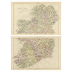
1882 Cartographic Views of Ireland
s North and South Regions
Located in Langweer, NL
Title: 1882 Maps of Ireland: Northern and Southern Regions
These two maps provide a detailed representation of Ireland as it was in 1882, divided into the northern and southern regi...
Category
Antique 1880s Maps
Materials
Paper
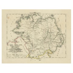
Antique 1830 Map of Ulster, Ireland with Armagh, Down, Antrim, Donegal, Tyrone
Located in Langweer, NL
Title: Antique 1830 Map of Ulster, Ireland with Armagh, Down, Antrim, Donegal, and Tyrone
Description: This 1830 German-language map, titled Britisches Reich – C. Kon: Ireland, ...
Category
Antique 1830s Maps
Materials
Paper
You May Also Like
Large Original Antique Map of Ireland. C.1900
Located in St Annes, Lancashire
Fabulous map of Ireland
Original color.
Engraved and printed by the George F. Cram Company, Indianapolis.
Published, C.1900.
Unframed.
Free shipping.
Category
Antique 1890s American Maps
Materials
Paper

Original Antique Map of Ireland- Kerry. C.1840
Located in St Annes, Lancashire
Great map of Kerry
Steel engraving
Drawn under the direction of A.Adlard
Published by How and Parsons, C.1840
Unframed.
Category
Antique 1840s English Maps
Materials
Paper

Original Antique Map of Ireland- Tipperary and Waterford. C.1840
Located in St Annes, Lancashire
Great map of Tipperary and Waterford
Steel engraving
Drawn under the direction of A.Adlard
Published by How and Parsons, C.1840
Unframed.
Category
Antique 1840s English Maps
Materials
Paper

England, Scotland
Ireland: A Hand Colored Map of Great Britain by Tirion
By Isaak Tirion
Located in Alamo, CA
This is a hand-colored double page copperplate map of Great Britain entitled "Nieuwe Kaart van de Eilanden van Groot Brittannien Behelzende de Kon...
Category
Antique Mid-18th Century Dutch Maps
Materials
Paper

$700 Sale Price
20% Off
Southeastern Ireland: A 17th Century Hand Colored Map by Mercator and Hondius
By Gerard Mercator
Located in Alamo, CA
A 17th century copperplate hand-colored map entitled "The Second Table of Ireland, Udrone" by Gerard Mercator and Jodocus Hondius, published in Amsterdam in 1635 in 'Cosmographicall ...
Category
Antique Mid-17th Century Dutch Maps
Materials
Paper

$540 Sale Price
20% Off
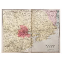
Large Original Antique Map of the Environs of Cork, Ireland, circa 1880
Located in St Annes, Lancashire
Great map of The Environs of Cork
Published circa 1880
Unframed
Free shipping.
Category
Antique 1880s Scottish Maps
Materials
Paper
More Ways To Browse
China Silk Rug
Chrome Glass Coffee Tables
Antique Italian Chairs
Beni Ourain Rugs
French Iron And Glass Table
Glass Top Wood Base Coffee Tables
T Chair
Antique Silver Basket
Antique Walkers
Ebony Wood Furniture
Opalescent Glass
Pair Of Danish Chairs
Veneer Dining Tables
1970 Italian Armchair
Furniture Uk
House Of Denmark Table And Chairs
Louis Marble Top Side Table
Antique Russian Rugs