Items Similar to Large Antique County Map of Leicestershire, England, 1805
Want more images or videos?
Request additional images or videos from the seller
1 of 6
Large Antique County Map of Leicestershire, England, 1805
$220.79
$275.9920% Off
£163.62
£204.5320% Off
€184
€23020% Off
CA$301.76
CA$377.2020% Off
A$328.49
A$410.6120% Off
CHF 174.36
CHF 217.9520% Off
MX$3,952.42
MX$4,940.5320% Off
NOK 2,209.40
NOK 2,761.7520% Off
SEK 2,024.44
SEK 2,530.5520% Off
DKK 1,401.58
DKK 1,751.9820% Off
About the Item
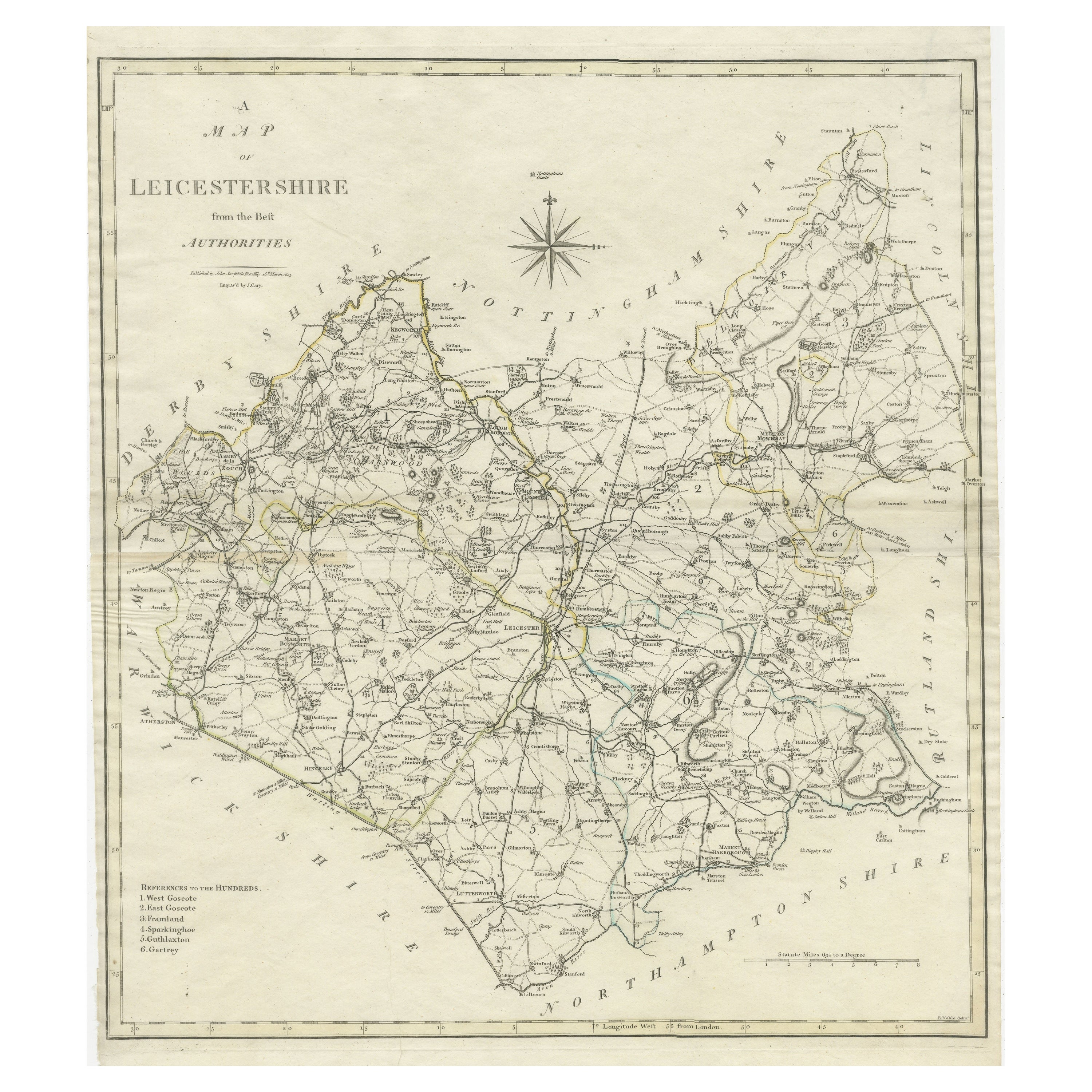
Explore Leicestershire's Past: Antique Map by John Cary
Step into the history of Leicestershire, England, with this original old county map engraved by the renowned cartographer John Cary. Titled 'A Map of Leicestershire from the best Authorities,' this intricate map showcases the region's geography, boundaries, and landmarks, capturing the essence of the area during Cary's era.
Derived from the 'New British Atlas' by John Stockdale and published in 1805, this map represents Cary's distinct cartographic style and meticulous engraving techniques. Cary, a prominent British cartographer and publisher from 1755 to 1835, revolutionized the map industry with his refined artistry and precision.
Known for his influence on mapmaking, Cary's work set high standards for clarity and detail, shaping the entire cartographic landscape. His dedication to accuracy and distinct style is evident in this Leicestershire map, making it not only a historical document but also a testament to Cary's enduring legacy in the world of cartography.
Collectors, historians, and map enthusiasts alike treasure Cary's maps for their historical significance and aesthetic appeal. This antique map serves as a timeless representation of Leicestershire's geography, offering a glimpse into the past while celebrating Cary's enduring impact on the art of mapmaking.
- Dimensions:Height: 20.36 in (51.7 cm)Width: 17.33 in (44 cm)Depth: 0.02 in (0.5 mm)
- Materials and Techniques:
- Period:
- Date of Manufacture:1805
- Condition:General age-related toning. Original folding lines. Minor wear and soiling, narrow margins. Please study image carefully.
- Seller Location:Langweer, NL
- Reference Number:Seller: BG-13394-101stDibs: LU3054334061942
About the Seller
5.0
Recognized Seller
These prestigious sellers are industry leaders and represent the highest echelon for item quality and design.
Platinum Seller
Premium sellers with a 4.7+ rating and 24-hour response times
Established in 2009
1stDibs seller since 2017
2,819 sales on 1stDibs
Typical response time: 1 hour
- ShippingRetrieving quote...Shipping from: Langweer, Netherlands
- Return Policy
More From This Seller
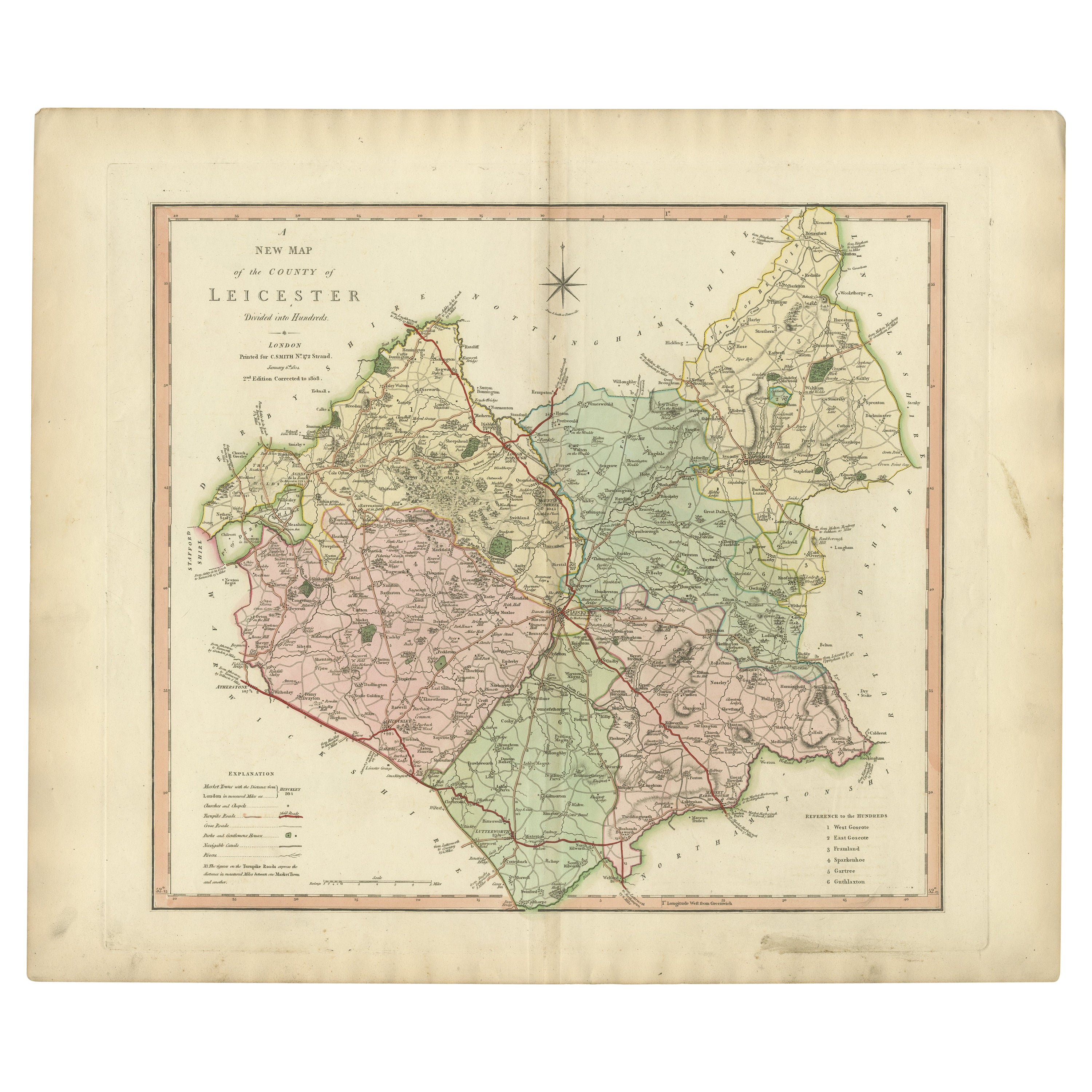
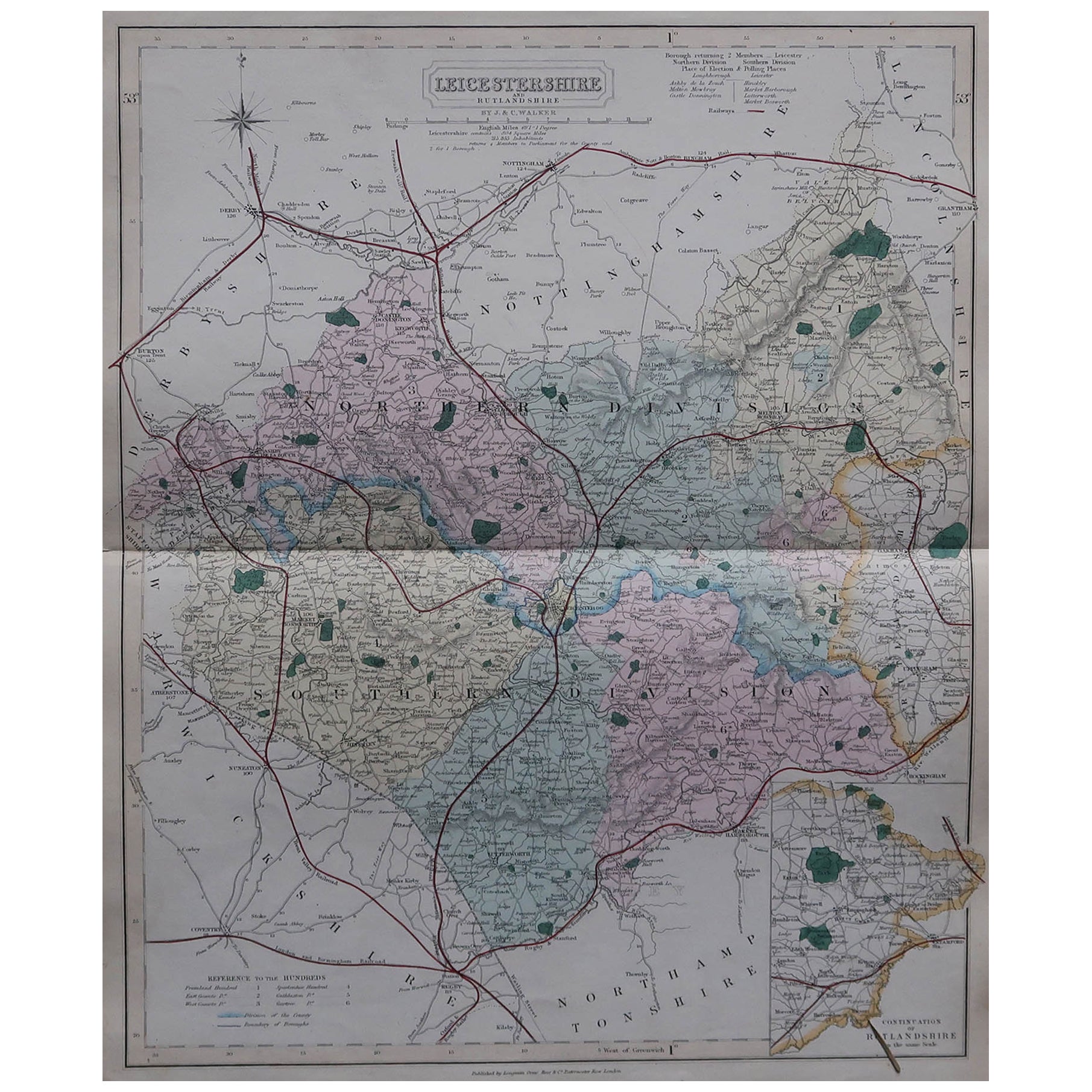
View AllLarge Antique County Map of Leicestershire, England, with Outline Coloring
Located in Langweer, NL
Antique map titled 'A Map of Leicestershire from the best Authorities'. Original old county map of Leicestershire, England. Engraved by John Cary. Originates from 'New British Atlas'...
Category
Antique Early 19th Century Maps
Materials
Paper
$163 Sale Price
20% Off
Antique County Map of Leicestershire, England, 1804
Located in Langweer, NL
Antique county map of Leicestershire first published c.1800. Villages, towns, and cities illustrated include Lutterworth, Ashby, Hinkley, and Marke...
Category
Antique Early 1800s Maps
Materials
Paper
$311 Sale Price
20% Off
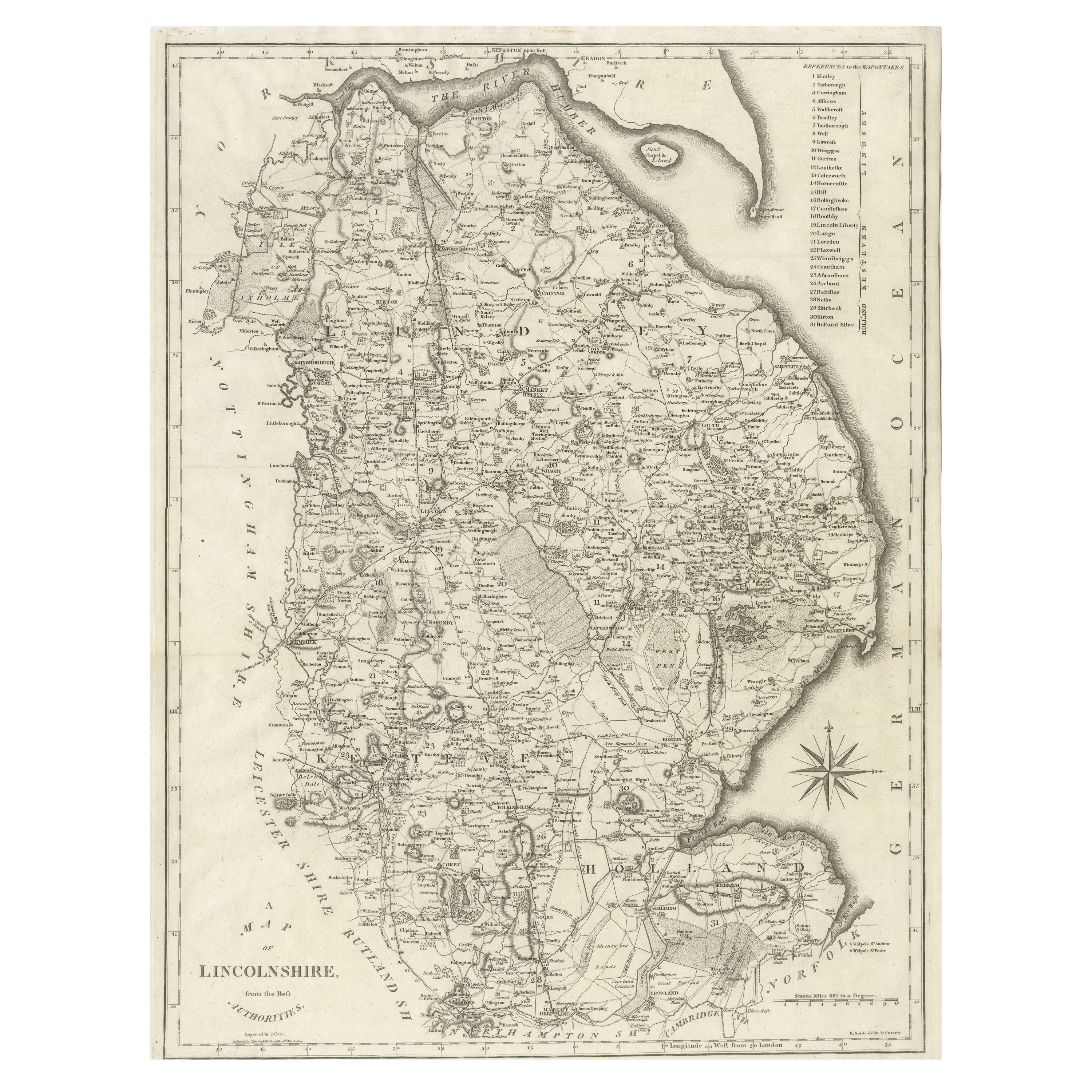
Large Antique County Map of Lincolnshire, England
Located in Langweer, NL
Antique map titled 'A Map of Lincolnshire from the best Authorities'. Original old county map of Lincolnshire, England. Engraved by John Cary. Originates from 'New British Atlas' by ...
Category
Antique Early 19th Century Maps
Materials
Paper
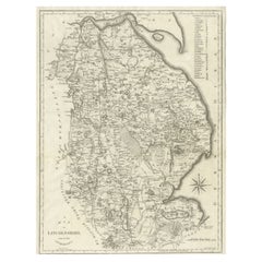
$278 Sale Price
20% Off
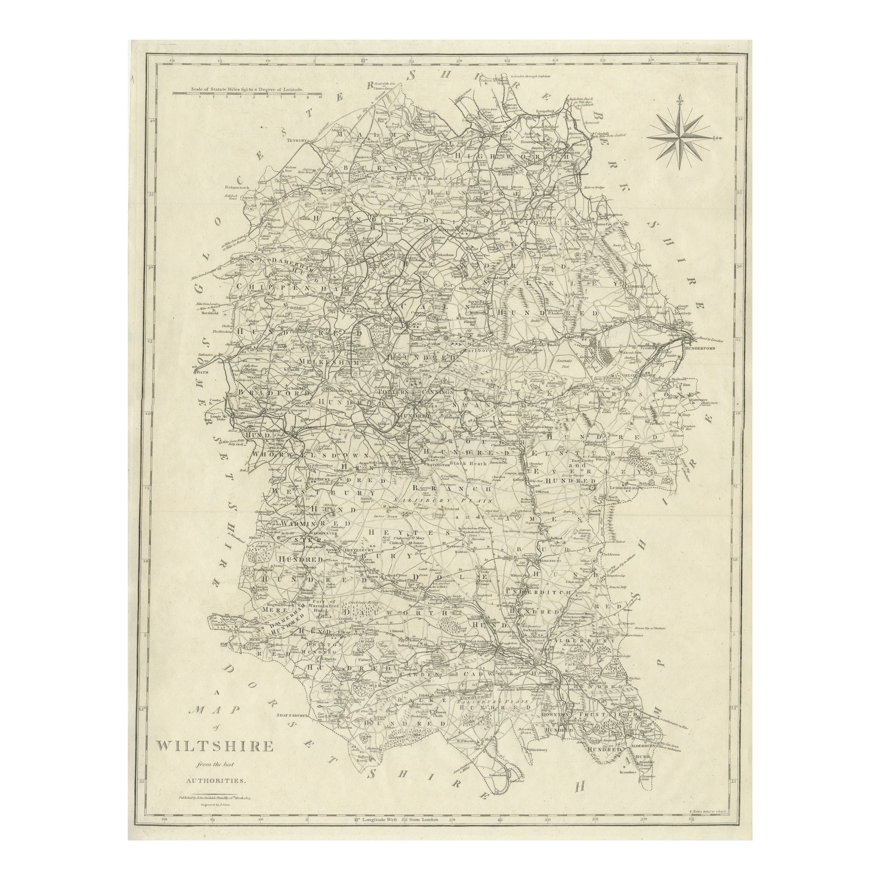
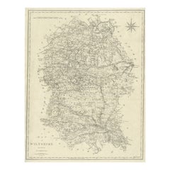
Large Antique County Map of Wiltshire, England, 1805
Located in Langweer, NL
Antique map titled 'A Map of Wiltshire from the best Authorities'. Original old county map of Wiltshire, England. Engraved by John Cary. Originates from 'New British Atlas' by John S...
Category
Antique Early 19th Century Maps
Materials
Paper
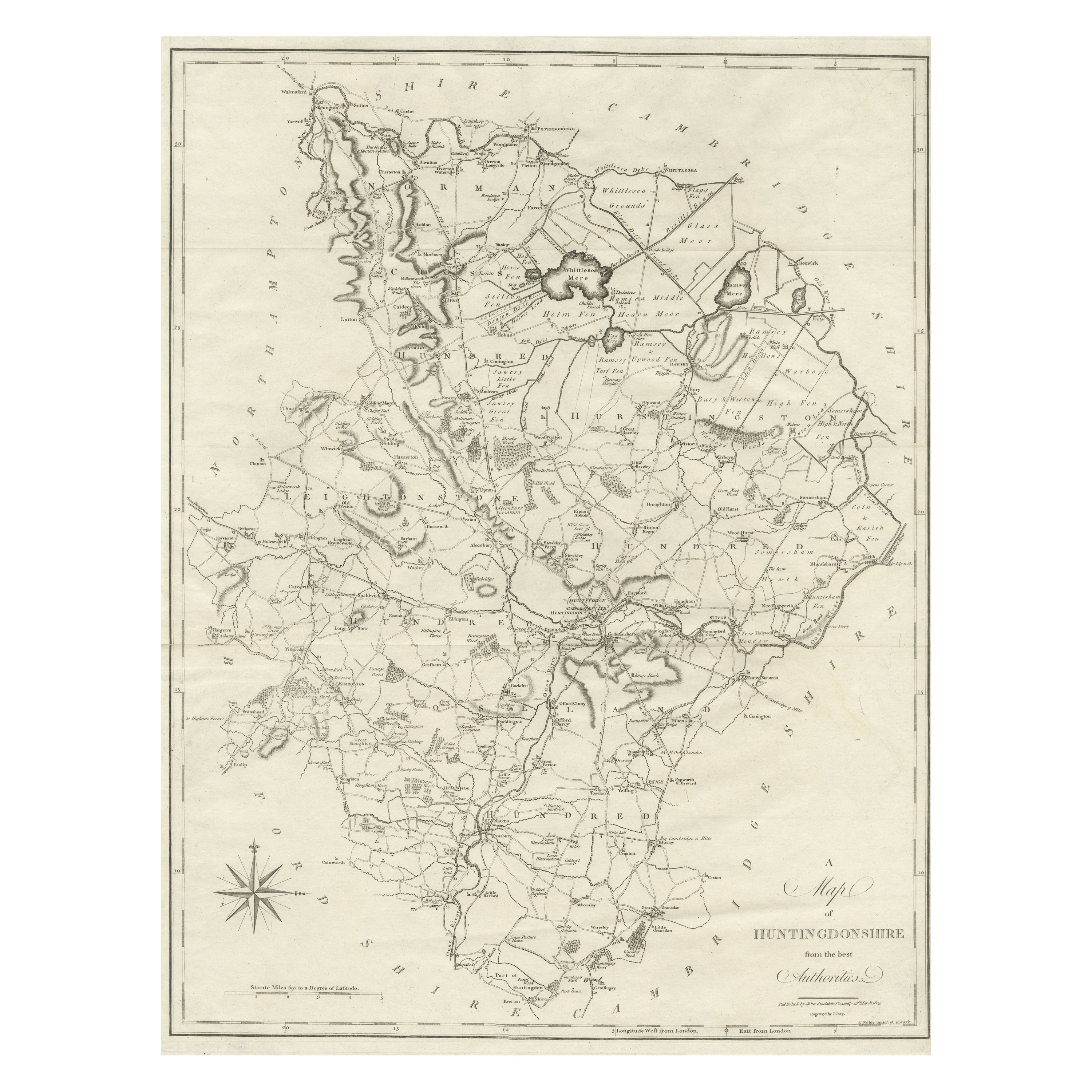
Large Antique County Map of Huntingdonshire, England
Located in Langweer, NL
Antique map titled 'A Map of Huntingdonshire from the best Authorities'. Original old county map of Huntingdonshire, England. Engraved by John Cary. Originates from 'New British Atla...
Category
Antique Early 19th Century Maps
Materials
Paper
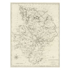
$220 Sale Price
20% Off
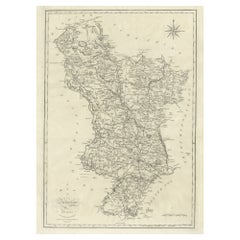
Large Antique County Map of Derbyshire, England, 1805
Located in Langweer, NL
Antique map titled 'A Map of Derbyshire from the best Authorities'. Original old county map of Derbyshire, England. Engraved by John Cary. Originates from 'New British Atlas' by John...
Category
Antique Early 19th Century British Maps
Materials
Paper
You May Also Like
Original Antique English County Map, Leicestershire, J
C Walker, 1851
Located in St Annes, Lancashire
Great map of Leicestershire
Original colour
By J & C Walker
Published by Longman, Rees, Orme, Brown & Co. 1851
Unframed.
Category
Antique 1850s English Other Maps
Materials
Paper

Original Antique English County Map, Derbyshire, J
C Walker, 1851
Located in St Annes, Lancashire
Great map of Derbyshire
Original colour
By J & C Walker
Published by Longman, Rees, Orme, Brown & Co. 1851
Unframed.
Category
Antique 1850s English Other Maps
Materials
Paper

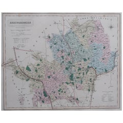
Original Antique English County Map, Hertfordshire. J
C Walker, 1851
Located in St Annes, Lancashire
Great map of Hertfordshire
Original colour
By J & C Walker
Published by Longman, Rees, Orme, Brown & Co. 1851
Unframed.
Category
Antique 1850s English Other Maps
Materials
Paper
Original Antique English County Map, Warwickshire, J
C Walker, 1851
Located in St Annes, Lancashire
Great map of Warwickshire
Original colour
By J & C Walker
Published by Longman, Rees, Orme, Brown & Co. 1851
Unframed.
Category
Antique 1850s English Other Maps
Materials
Paper

Original Antique English County Map, Cambridgeshire, J
C Walker, 1851
Located in St Annes, Lancashire
Great map of Cambridgeshire
Original colour
By J & C Walker
Published by Longman, Rees, Orme, Brown & Co. 1851
Unframed.
Category
Antique 1850s English Other Maps
Materials
Paper

Original Antique English County Map, Buckinghamshire, J
C Walker, 1851
Located in St Annes, Lancashire
Great map of Buckinghamshire
Original colour
By J & C Walker
Published by Longman, Rees, Orme, Brown & Co. 1851
Unframed.
Category
Antique 1850s English Other Maps
Materials
Paper

More Ways To Browse
Historical Documents
Georgetown Map
Hemisphere Antiques
J Matthews
Japanese Kite
Maltese Falcon
Map Tuscany
St Eustatius
Sumba Map
Used Furniture Denver Co
Used Furniture Leominster
Vintage Long Island Map
Vintage World Map Desk
Vintage World Map Mirror
Antique Furniture Toledo Ohio
Antique Maps Washington Dc
Blaeu World Map
Cape Cod Map