Items Similar to Large Decorative Map of Westchester County New York 1931 – Linen-Backed Wall Map

Want more images or videos?
Request additional images or videos from the seller
1 of 11
Large Decorative Map of Westchester County New York 1931 – Linen-Backed Wall Map
$1,095.07
£818.10
€925
CA$1,524.84
A$1,638.35
CHF 878.97
MX$19,301.66
About the Item
Large Decorative Map of Westchester County NY 1931 – Linen-Backed Wall Map
Description:
This impressive large-format decorative map of Lower Westchester County was published in 1931 by Dolph
Stewart and presents a richly detailed snapshot of suburban New York on the eve of major mid-20th-century expansion. Covering the area from Tarrytown in the north to just below the New York City boundary in the south, the map captures the dense network of towns, streets, rail lines, parks, and waterways that defined Westchester’s early commuter landscape.
Prominently shown are Yonkers, Mount Vernon, New Rochelle, Rye, Scarsdale, White Plains, Harrison, Mamaroneck, Bronxville, Pelham, and Eastchester, with parts of the Bronx—including Van Cortlandt Park and Woodlawn Cemetery—clearly delineated along the southern edge. The Hudson River defines the western boundary, with a sliver of New Jersey visible beyond, while the northeastern portion extends into Connecticut. Parks and golf courses are highlighted in green, bodies of water in blue, and transportation routes—including railroads, stations, and ferry connections—are clearly identified.
Below the main map is an extensive street and avenue index, making this not only a visually striking wall piece but also a fascinating historical reference. The cartography reflects early 20th-century planning priorities, emphasizing transportation infrastructure and residential development during a formative period for Westchester County as a desirable suburban extension of New York City.
This example has been dissected and mounted on linen, as issued, allowing the large sheet to fold neatly while also making it especially suitable for framing. With its balanced pastel palette, fine linework, and substantial scale, the map works beautifully as a statement piece in both classic and modern interiors—particularly appealing to interior designers, architects, and collectors of American cartography.
Condition:
Issued folding, dissected and mounted on linen. Minor toning along some fold lines, with light foxing and a small amount of soiling near the upper edge. Overall a well-preserved and attractive example, with strong color and excellent legibility throughout.
Framing tips:
This map presents best framed without glass glare in a large, clean-lined frame. A natural oak, walnut, or muted black frame with a narrow off-white or soft ivory mat will emphasize the scale and detail without overpowering the composition. For a more architectural look, consider float-mounting to reveal the linen backing.
Keywords:
Westchester County map, Lower Westchester, New York map, 1931 map, antique New York map, Westchester wall map, linen backed map, Yonkers map, White Plains map, Scarsdale map, New Rochelle map, Rye NY map, Mount Vernon map, Bronxville map, Pelham map, Eastchester map, Harrison NY map, Mamaroneck map, Tarrytown map, Hudson River map, Van Cortlandt Park, Woodlawn Cemetery, Bronx map, suburban New York map, vintage American map, decorative wall map, large format map, golf courses Westchester, railroads Westchester, commuter suburbs NY, historic street index map, Dolph and Stewart map, early 20th century map, New York interior wall art, cartographic wall decor, architectural office map, designer map art, classic Americana map, New York county map, Connecticut border map, New Jersey Hudson map, linen mounted antique map, framed map decor, New York history map, collectible wall map
Technique: printed color map, linen-backed
Maker: Dolph
Stewart, United States, 1931
- Dimensions:Height: 35.91 in (91.2 cm)Width: 34.1 in (86.6 cm)Depth: 0.08 in (2 mm)
- Materials and Techniques:
- Place of Origin:
- Period:
- Date of Manufacture:1931
- Condition:Issued folding, dissected and mounted on linen. Minor toning along some fold lines, with light foxing and a small amount of soiling near the upper edge. Overall a well-preserved and attractive example, with strong color.
- Seller Location:Langweer, NL
- Reference Number:Seller: BG-141951stDibs: LU3054348262382
About the Seller
5.0
Recognized Seller
These prestigious sellers are industry leaders and represent the highest echelon for item quality and design.
Platinum Seller
Premium sellers with a 4.7+ rating and 24-hour response times
Established in 2009
1stDibs seller since 2017
2,836 sales on 1stDibs
Typical response time: 1 hour
- ShippingRetrieving quote...Shipping from: Langweer, Netherlands
- Return Policy
More From This Seller
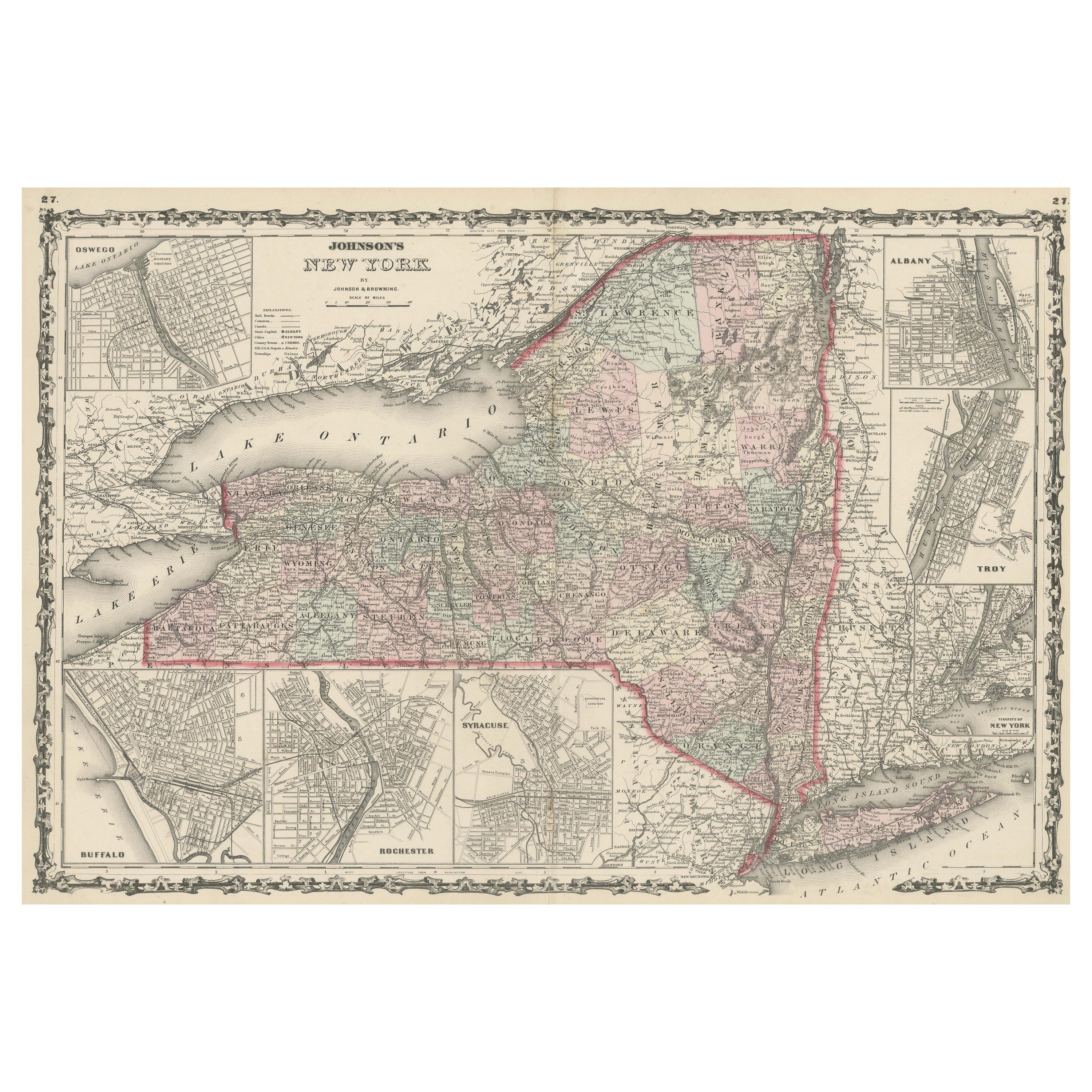
View AllLarge Antique Map of New York State with Inset Maps
Located in Langweer, NL
Antique map titled 'Johnson's New York' Large map of New York State. With insets of Albany, Oswego, Buffalo, Rochester, Syracuse, Troy and NYC. Published by Johnson and Browning, 186...
Category
Antique Mid-19th Century Maps
Materials
Paper

$465 Sale Price
20% Off
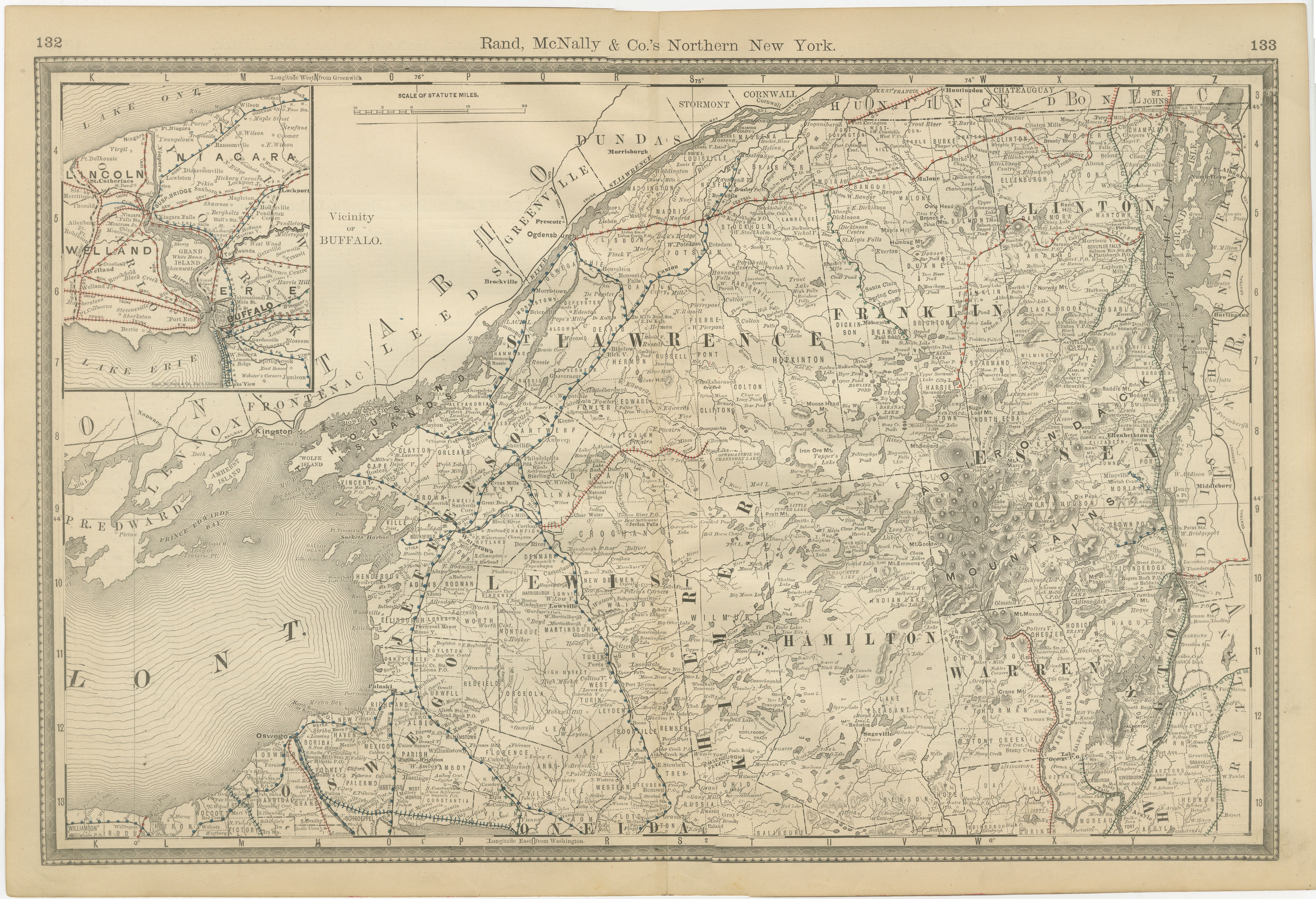
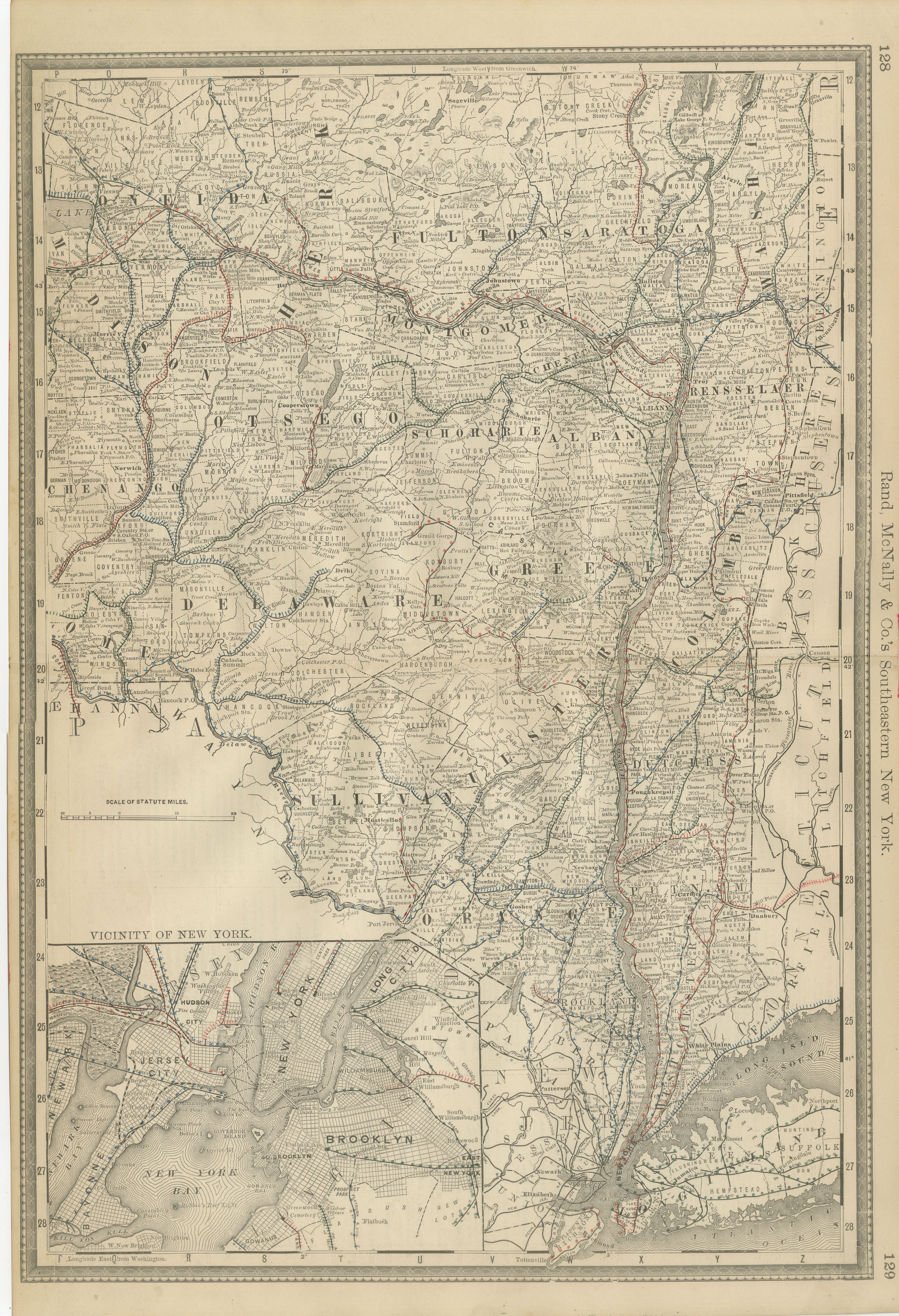
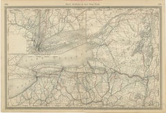
Antique Map of Northern New York – Rand McNally, circa 1888
Located in Langweer, NL
Antique Map of Northern New York – Rand McNally, circa 1888
This antique map of northern New York was published by Rand, McNally & Co. around 1888. Taken from one of their late 19th...
Category
Antique Late 19th Century American Maps
Materials
Paper
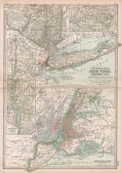
Antique Map of Southeastern New York by Rand McNally, Lithograph, 1888
Located in Langweer, NL
Antique Map of Southeastern New York – Rand McNally, circa 1888
This antique map of southeastern New York was published by Rand, McNally
Co. around 1888. It offers a detailed ...
Category
Antique Late 19th Century American Maps
Materials
Paper
1864 Johnson
s Map of New York State with City Insets
Located in Langweer, NL
Title: 1864 Johnson's Map of New York State with City Insets
Description: This 1864 map, titled "Johnson's New York," was published by Johnson and Ward and features a detailed depic...
Category
Antique 1860s Maps
Materials
Paper

$265 Sale Price
20% Off
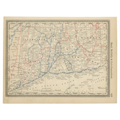
ntique Connecticut Map Wall Art – Railroads, Towns
Long Island Sound, ca.1888
Located in Langweer, NL
Antique Connecticut Map Wall Art – Railroads, Towns
Long Island Sound, Rand McNally
Description:
This original antique atlas map depicts the state of Connecticut in detailed a...
Category
Antique Late 19th Century American Maps
Materials
Paper
New York State Antique Map c.1888 – The Empire State, Railroads
Counties
Located in Langweer, NL
Antique Map of New York State – Rand McNally, circa 1888
This antique map of New York State was published by Rand, McNally & Co. around 1888. Unlike the sectional plates, this gener...
Category
Antique Late 19th Century American Maps
Materials
Paper
You May Also Like
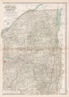
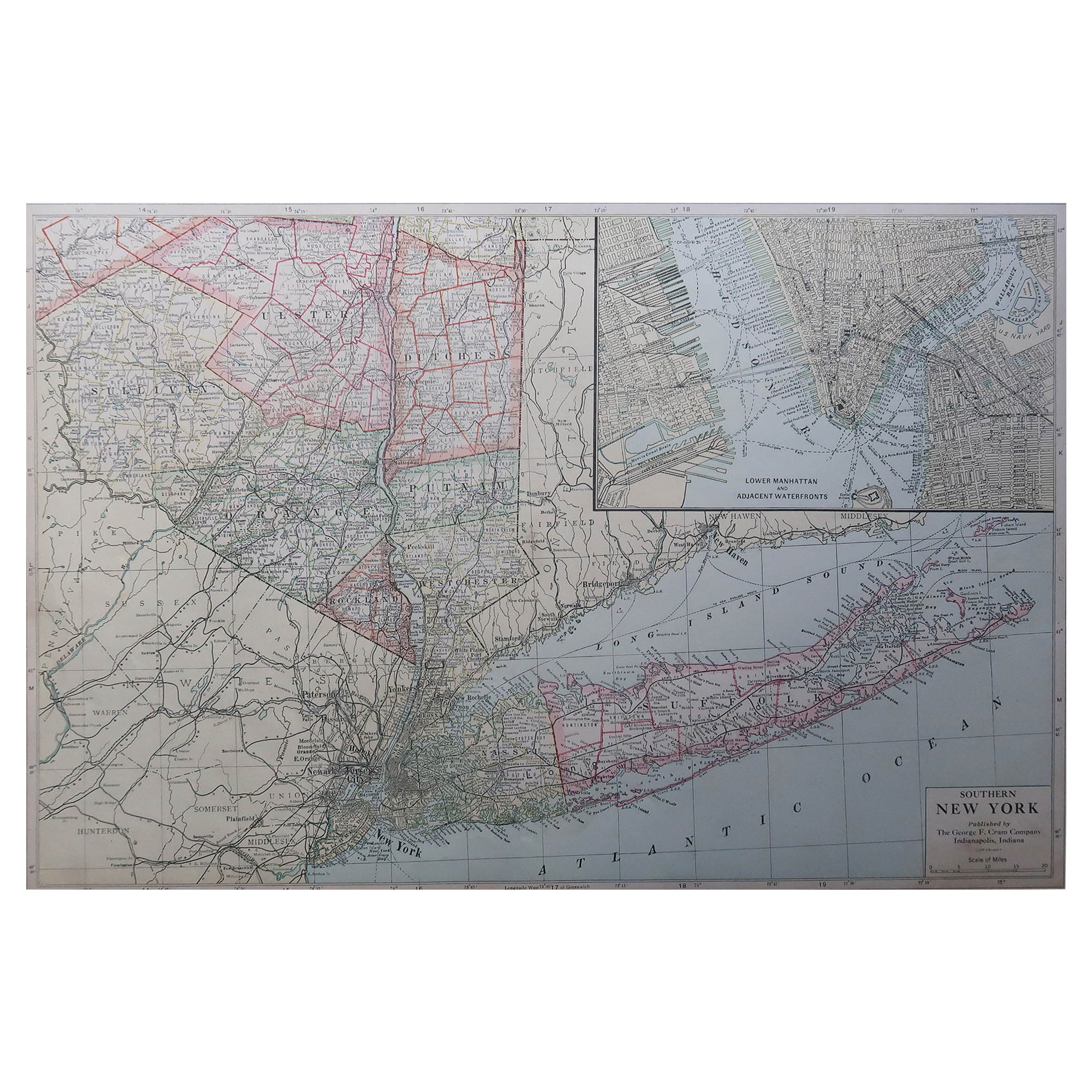
Large Original Antique Map of New York State( Southern ), USA, C.1900
Located in St Annes, Lancashire
Fabulous map of Southern New York . With a vignette of Lower Manhattan
Original color.
Engraved and printed by the George F. Cram Company, Indianapolis.
Published, C.1900.
Unfram...
Category
Antique 1890s American Maps
Materials
Paper

Original Antique Map of the American State of New York ( Southern Part ) 1903
Located in St Annes, Lancashire
Antique map of New York ( Southern Part )
Published By A & C Black. 1903
Original colour
Good condition
Unframed.
Free shipping
Category
Antique Early 1900s English Maps
Materials
Paper

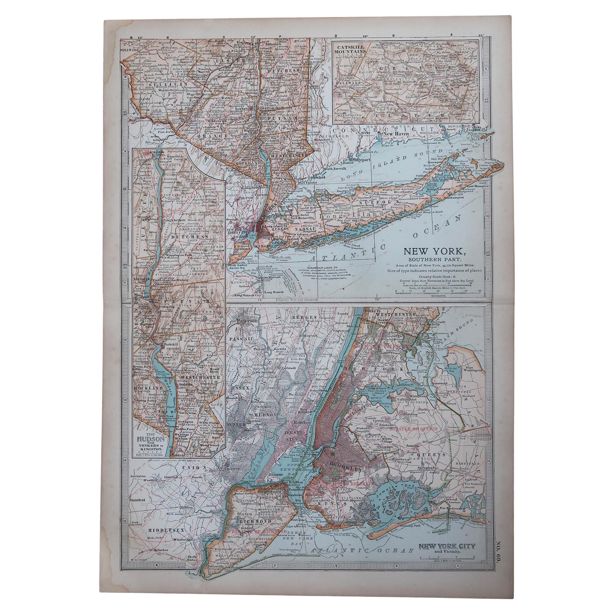
New York. Southern Part. USA. Century Atlas state antique vintage map
Located in Melbourne, Victoria
'The Century Atlas. New York. Southern Part.'
Original antique map, 1903.
Inset maps of 'New York City and Vicinity' and 'The Hudson'.
Central fold as issued. Map name and number p...
Category
Early 20th Century Victorian More Prints
Materials
Lithograph
Original Antique Map of the American State of New York ( Western Part ) 1903
Located in St Annes, Lancashire
Antique map of New York ( Western Part )
Published By A & C Black. 1903
Original colour
Good condition
Unframed.
Free shipping
Category
Antique Early 1900s English Maps
Materials
Paper

1872 Map of Hudson, Union and Essex Counties, New Jersey
Located in Savannah, GA
A hand-colored topographical map of New Jersey’s Hudson, Union and Essex Counties from the Atlas of New Jersey by F.W. Beers, published in 1872.
sight 15 by 22½ inches
frame 20 by...
Category
Antique 1870s American Prints
Materials
Glass, Wood, Paper

New York. Northern and Eastern Part. USA Century Atlas state antique vintage map
Located in Melbourne, Victoria
'The Century Atlas. New York. Northern and Eastern Part'
Original antique map, 1903.
Central fold as issued. Map name and number printed on the reverse corners.
Sheet 40cm by 29.5c...
Category
Early 20th Century Victorian More Prints
Materials
Lithograph