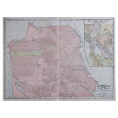
Items Similar to Large Original Antique City Plan of Baltimore, USA, 1894

Want more images or videos?
Request additional images or videos from the seller
1 of 5
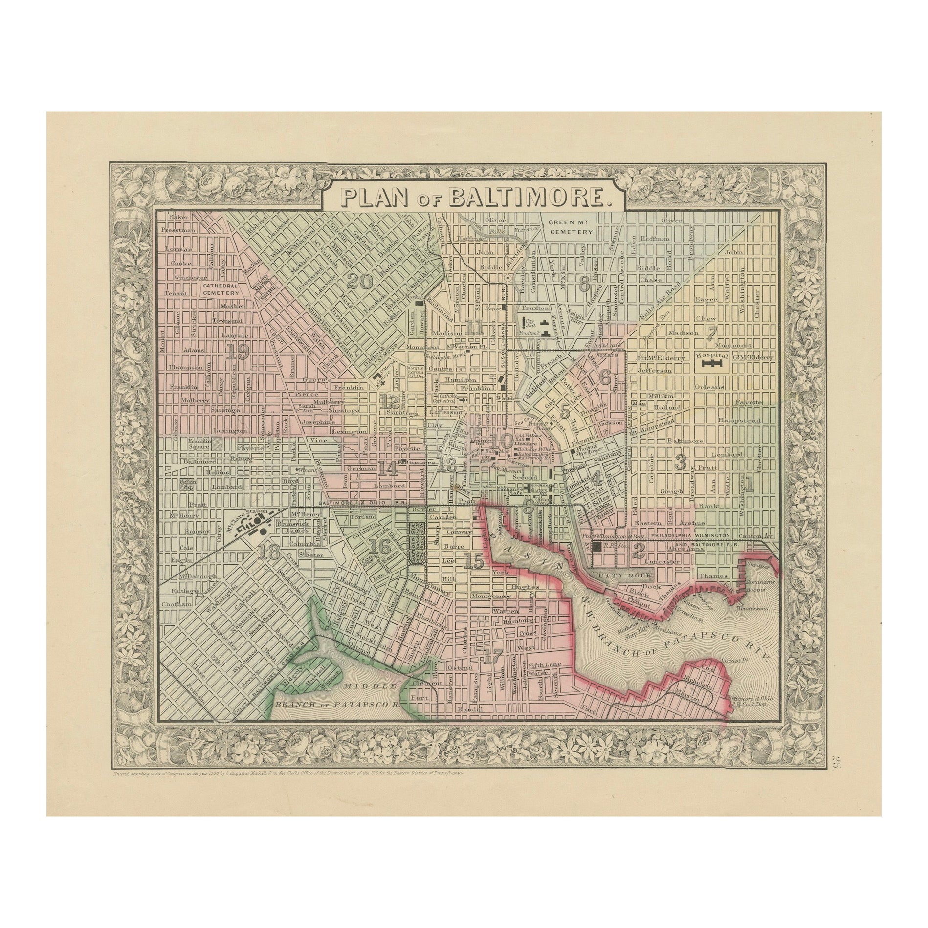
Large Original Antique City Plan of Baltimore, USA, 1894
$90
£68.53
€78.91
CA$127.54
A$137.19
CHF 73.32
MX$1,617.02
NOK 924.34
SEK 845.02
DKK 589.62
About the Item
Fabulous colorful map of Baltimore
Original color
By Rand, McNally
Co.
Published, 1894
Unframed
Free shipping.
- Creator:Rand McNally Co. (Maker)
- Dimensions:Height: 26.75 in (67.95 cm)Width: 20.5 in (52.07 cm)Depth: 0.07 in (1.78 mm)
- Materials and Techniques:Paper,Other
- Place of Origin:
- Period:
- Date of Manufacture:1894
- Condition:Wear consistent with age and use.
- Seller Location:St Annes, GB
- Reference Number:1stDibs: LU1836328810752
About the Seller
4.9
Gold Seller
Premium sellers maintaining a 4.3+ rating and 24-hour response times
1stDibs seller since 2016
3,281 sales on 1stDibs
Typical response time: 1 hour
Associations
International Confederation of Art and Antique Dealers
Associations
- ShippingRetrieving quote...Shipping from: St Annes, United Kingdom
- Return Policy
More From This Seller
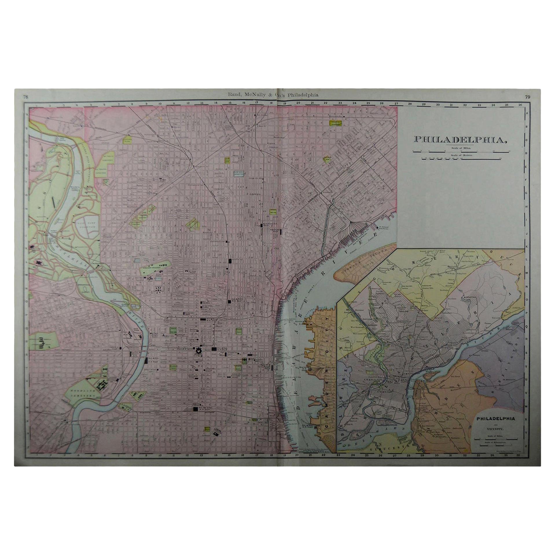
View AllLarge Original Antique City Plan of Philadelphia, USA, circa 1900
By Rand McNally
Co.
Located in St Annes, Lancashire
Fabulous colorful map of Philadelphia
Original color
By Rand, McNally & Co.
Published, circa 1900.
Unframed
Free shipping.
Category
Antique Early 1900s American Maps
Materials
Paper

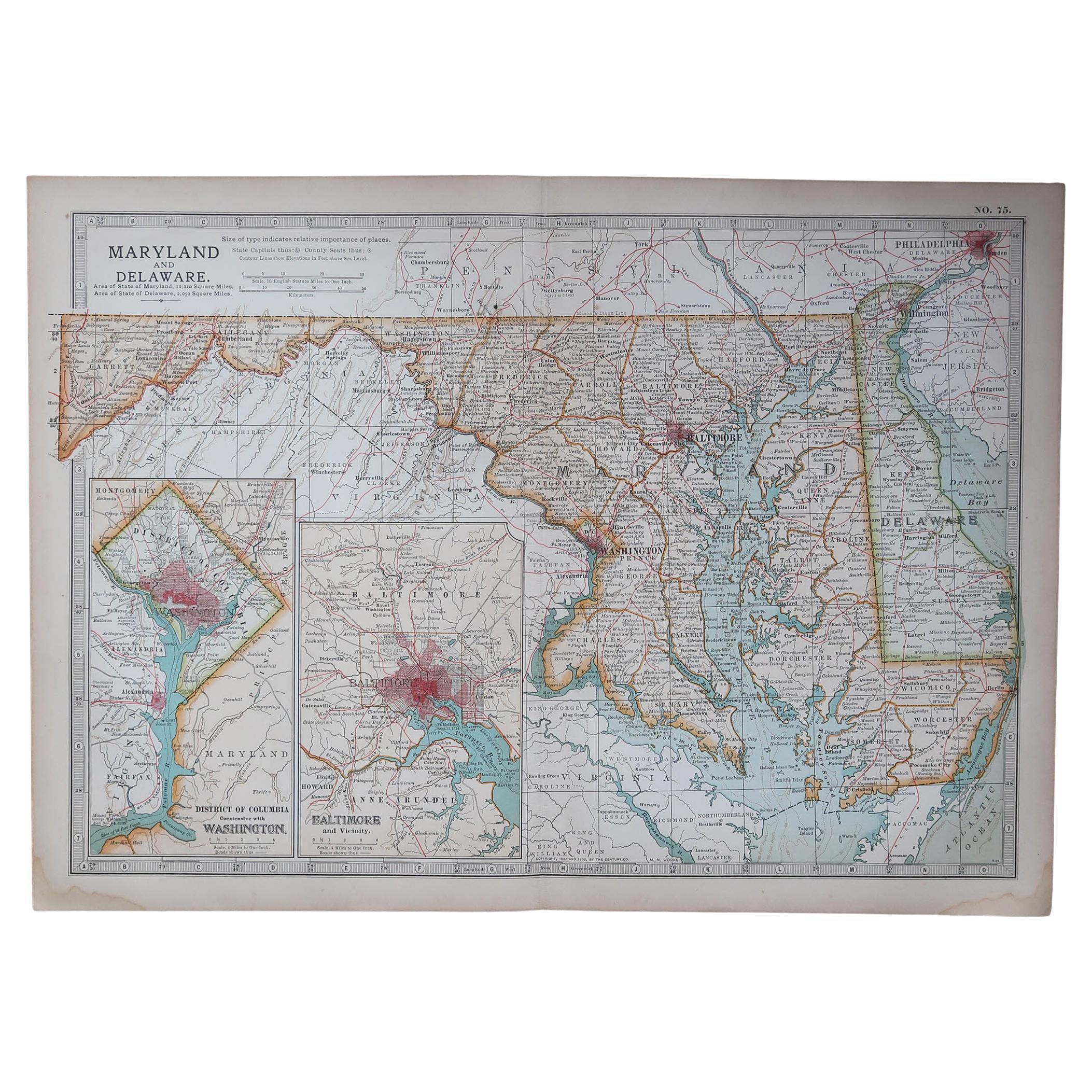
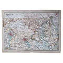
Original Antique Map of the American State of Maryland
Delaware, 1903
Located in St Annes, Lancashire
Antique map of Maryland And Delaware
Published By A & C Black. 1903
Original colour
Good condition
Unframed.
Free shipping
Category
Antique Early 1900s English Maps
Materials
Paper
Large Original Antique City Plan of Montreal, Canada, circa 1900
By Rand McNally
Co.
Located in St Annes, Lancashire
Fabulous colorful map of Montreal
Original color
By Rand, McNally & Co.
Published, circa 1900
Unframed
Minor edge tears
Free shipping.
Category
Antique Early 1900s American Maps
Materials
Paper

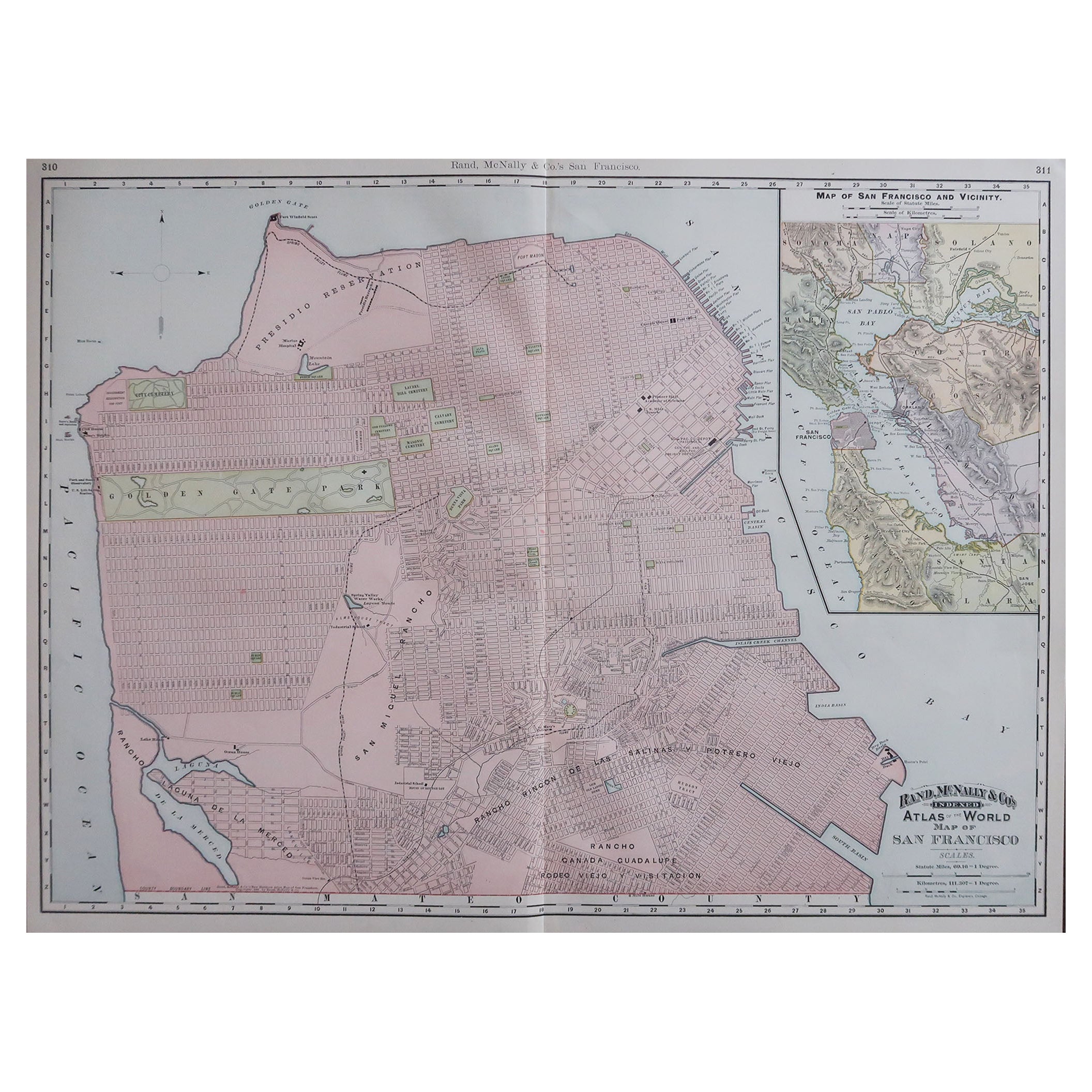
Large Original Antique City Plan of San Francisco, USA, 1894
By Rand McNally
Co.
Located in St Annes, Lancashire
Fabulous colorful map of San Francisco
Original color
By Rand, McNally & Co.
Published, 1894
Unframed
Free shipping.
Category
Antique 1890s American Maps
Materials
Paper
Original Antique City Plan of Kansas City, USA. 1894
By Rand McNally
Co.
Located in St Annes, Lancashire
Fabulous colorful map of Kansas City
Original color
By Rand, McNally & Co.
Published, 1894
Unframed
Slightly reduced bottom margin.
Free shipping.
Category
Antique 1890s American Maps
Materials
Paper

Antique Map of American Cities, Vignette of New York City, circa 1920
Located in St Annes, Lancashire
Great maps of American Cities
Unframed
Original color
By John Bartholomew and Co. Edinburgh Geographical Institute
Published, circa 1920
Category
Vintage 1920s British Maps
Materials
Paper

You May Also Like
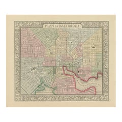
Plan of Baltimore City Map, USA c.1870 – Hand-Colored Street Plan
Located in Langweer, NL
Plan of Baltimore City Map, USA c.1870 – Hand-Colored Street Plan
This is a finely engraved and hand-colored street plan titled Plan of Baltimore, published in the United States cir...
Category
Antique Mid-19th Century American Maps
Materials
Paper
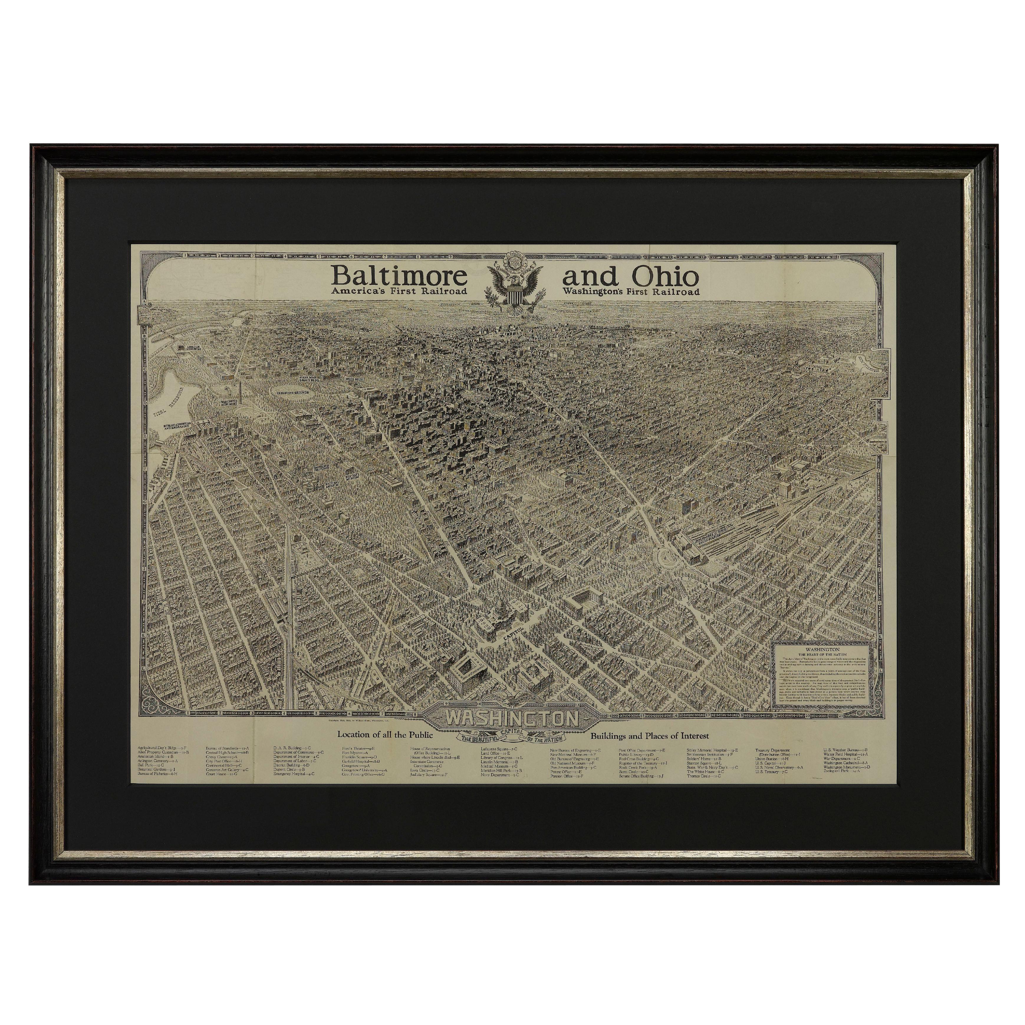
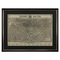
1923 "Washington, The Beautiful Capital of the Nation" Baltimore and Ohio RR Map
Located in Colorado Springs, CO
This is a fabulous 1923 bird's eye map of Washington, DC that shows the city in amazing detail. Every building is individually drawn and all major roads in the city are shown. The vi...
Category
Vintage 1920s American Art Deco Maps
Materials
Paper
Maryland, D.C.
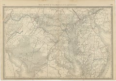
Delaware Antique Map – Old Line State Railroads, c.1888
Located in Langweer, NL
Antique Map of Maryland, Delaware & Washington D.C. – Rand McNally, circa 1888
This antique map of Maryland, Delaware, and Washington, D.C., was published by Rand, McNally & Co. aro...
Category
Antique Late 19th Century American Maps
Materials
Paper
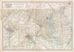
Maryland and Delaware. USA. Century Atlas state antique vintage map
Located in Melbourne, Victoria
'The Century Atlas. Maryland and Delaware.'
Original antique map, 1903.
Central fold as issued. Map name and number printed on the reverse corners.
Sheet 29.5cm by 40cm.
Category
Early 20th Century Victorian More Prints
Materials
Lithograph
1840 Map of the City of Washington Published by William M. Morrison
Located in Colorado Springs, CO
This map, printed in 1840, is a detailed representation of Washington, D.C. in the mid-19th century. The map shows block numbers, wards, and government buildings as well as details o...
Category
Antique 1840s American Federal Maps
Materials
Paper

Antique, Hand Colored Map of Washington, D.C., 19th Century
Located in Houston, TX
Antique map of Washington, D.C. carefully hand colored bringing warmth and charm to the engraving. This map features the city's distinguished layout as designed by urban planner Pie...
Category
Antique 19th Century American American Classical Decorative Art
Materials
Paint, Paper
More Ways To Browse
Baltimore Antique Furniture
Antique Maps Of Long Island
Calcutta Map
Gibraltar Antique Map
Guyana Antique Map
Maps Of New Mexico
Saudi Arabia Map
16th Century Scotland
Antique Leather Map
Antique Map Of Argentina
Antique Map Of Colombia
Cornwall Map
Early Texas Furniture
Iraq Map
James Cook Map
Kentucky Antiques
Map Of Mexican California
Montreal Map