Items Similar to Large Original Antique City Plan of Minneapolis and St Paul, USA, circa 1900

Want more images or videos?
Request additional images or videos from the seller
1 of 6
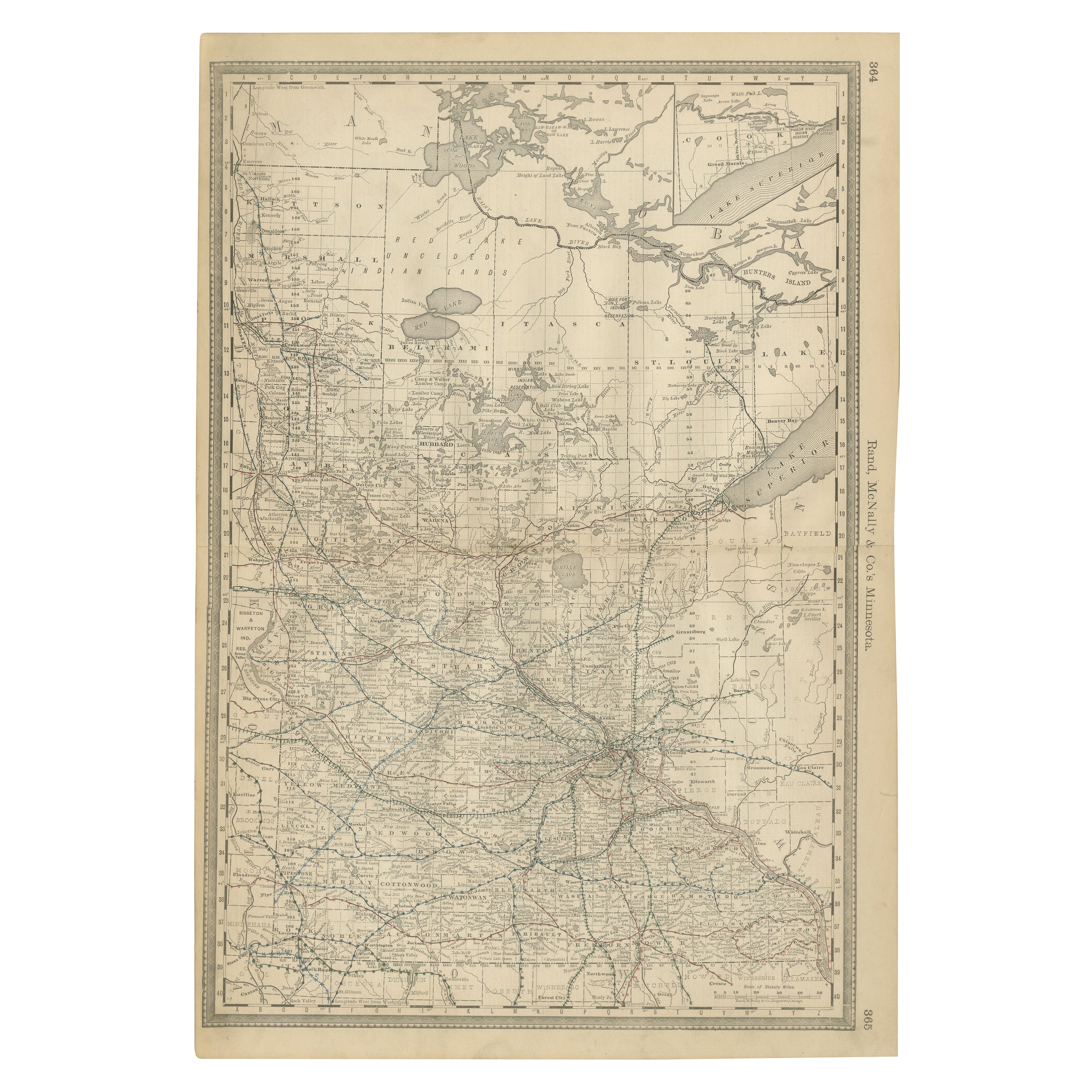
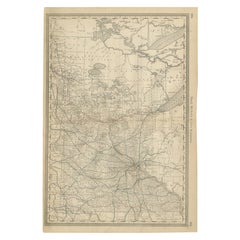
Large Original Antique City Plan of Minneapolis and St Paul, USA, circa 1900
$90
£68.53
€78.91
CA$127.54
A$137.19
CHF 73.32
MX$1,617.02
NOK 924.34
SEK 845.02
DKK 589.62
About the Item
Fabulous colorful map of Minneapolis and St Paul, Minnesota.
Original color
By Rand, McNally
Co.
Published, circa 1900
Unframed
Minor edge tears
Free shipping.
- Creator:Rand McNally Co. (Maker)
- Dimensions:Height: 27.5 in (69.85 cm)Width: 20.5 in (52.07 cm)Depth: 0.07 in (1.78 mm)
- Materials and Techniques:Paper,Other
- Place of Origin:
- Period:1900-1909
- Date of Manufacture:1900
- Condition:Wear consistent with age and use.
- Seller Location:St Annes, GB
- Reference Number:1stDibs: LU1836324413482
About the Seller
4.9
Gold Seller
Premium sellers maintaining a 4.3+ rating and 24-hour response times
1stDibs seller since 2016
3,281 sales on 1stDibs
Typical response time: 1 hour
Associations
International Confederation of Art and Antique Dealers
Associations
- ShippingRetrieving quote...Shipping from: St Annes, United Kingdom
- Return Policy
More From This Seller
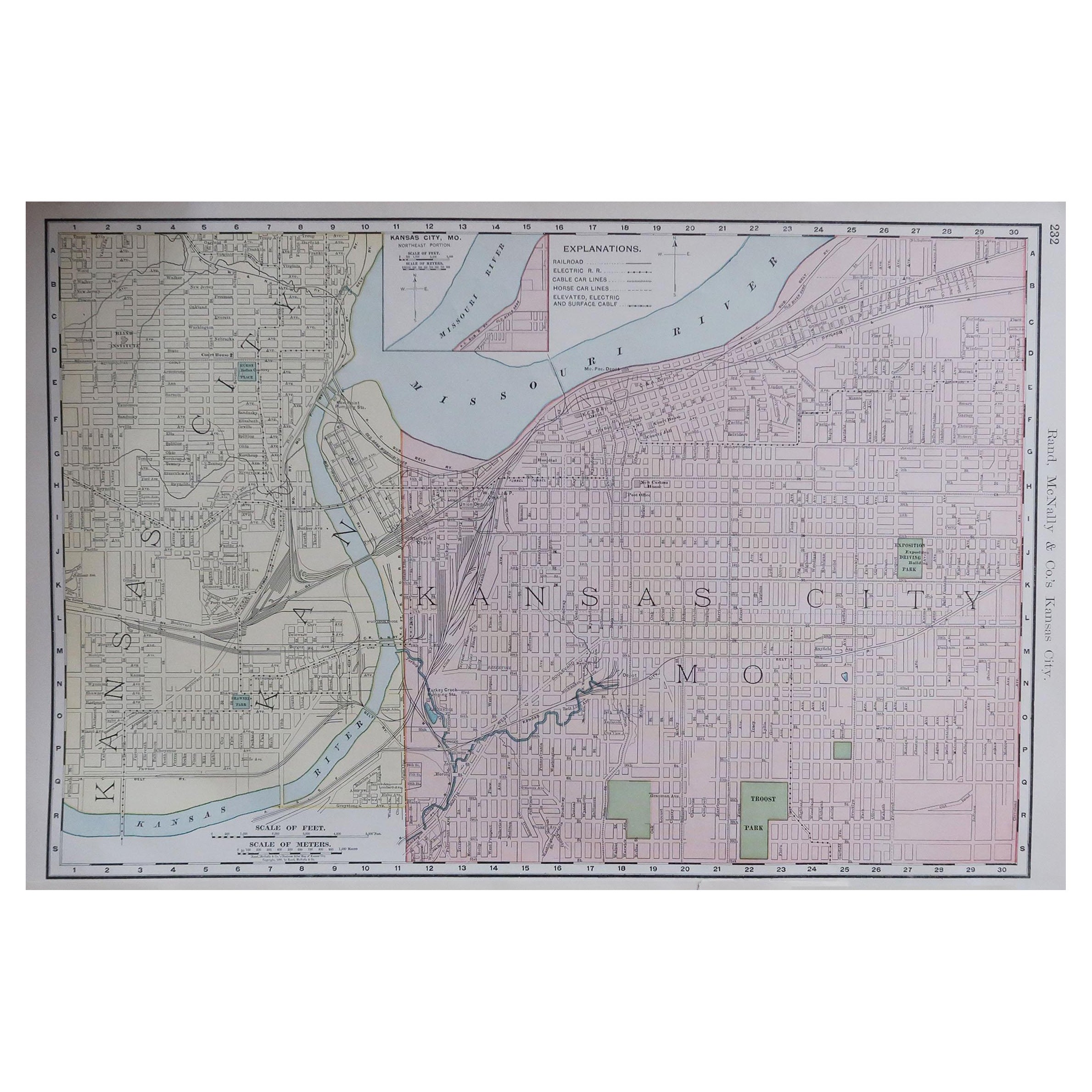
View AllOriginal Antique City Plan of Kansas City, USA. 1894
By Rand McNally
Co.
Located in St Annes, Lancashire
Fabulous colorful map of Kansas City
Original color
By Rand, McNally & Co.
Published, 1894
Unframed
Slightly reduced bottom margin.
Free shipping.
Category
Antique 1890s American Maps
Materials
Paper

Large Original Antique City Plan of Montreal, Canada, circa 1900
By Rand McNally
Co.
Located in St Annes, Lancashire
Fabulous colorful map of Montreal
Original color
By Rand, McNally & Co.
Published, circa 1900
Unframed
Minor edge tears
Free shipping.
Category
Antique Early 1900s American Maps
Materials
Paper

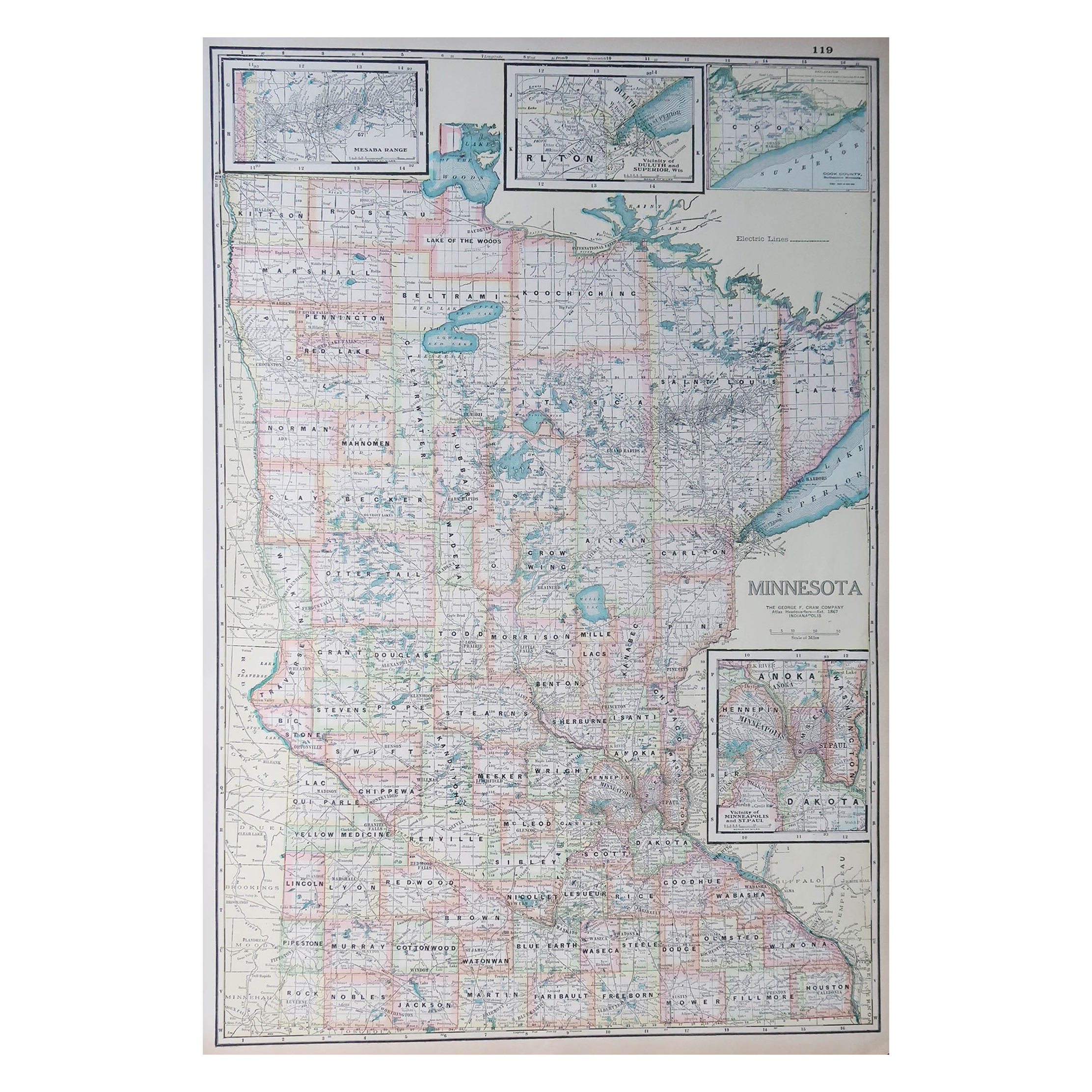
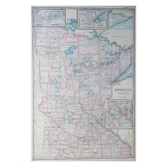
Large Original Antique Map of Minnesota, USA, C.1900
Located in St Annes, Lancashire
Fabulous map of Minnesota
Original color
Engraved and printed by the George F. Cram Company, Indianapolis.
Published, C.1900
Unframed
Repair to a small tear bottom left corner
...
Category
Antique 1890s American Maps
Materials
Paper
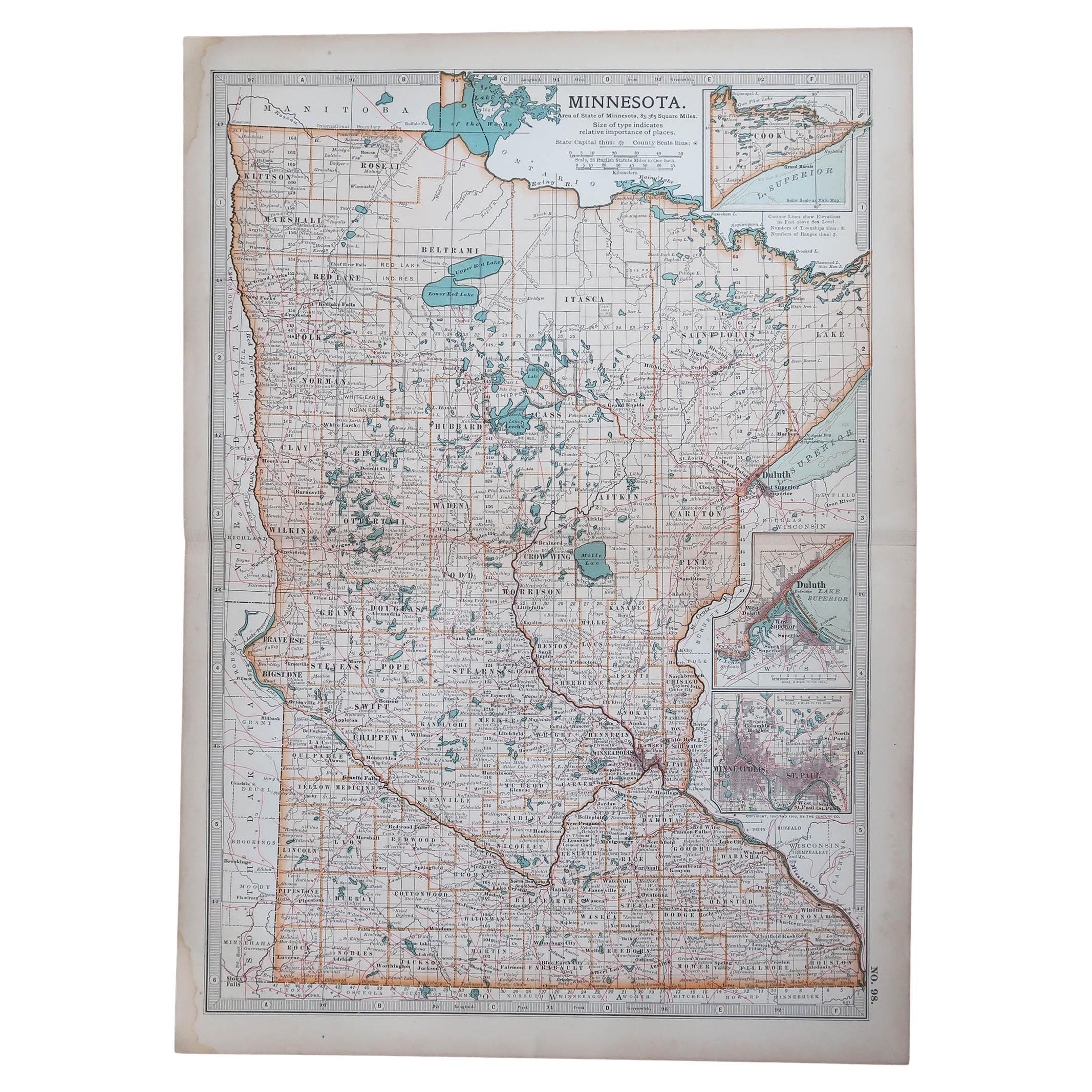
Original Antique Map of the American State of Minnesota, 1903
Located in St Annes, Lancashire
Antique map of Minnesota
Published By A & C Black. 1903
Original colour
Good condition
Unframed.
Free shipping
Category
Antique Early 1900s English Maps
Materials
Paper

Original Antique Map of South Dakota by Rand McNally, circa 1900
By Rand McNally
Co.
Located in St Annes, Lancashire
Fabulous monochrome map with red outline color
Original color
By Rand, McNally & Co.
Published, circa 1900
Unframed
Minor edge tears.
Category
Antique Early 1900s American Edwardian Maps
Materials
Paper

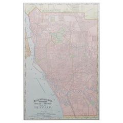
Original Antique City Plan of Buffalo, New York, USA, circa 1900
By Rand McNally
Co.
Located in St Annes, Lancashire
Fabulous colorful map of Buffalo
Original color
By Rand, McNally & Co.
Published, circa 1900
Unframed
Minor edge tears
Free shipping.
Category
Antique 1890s American Maps
Materials
Paper
You May Also Like
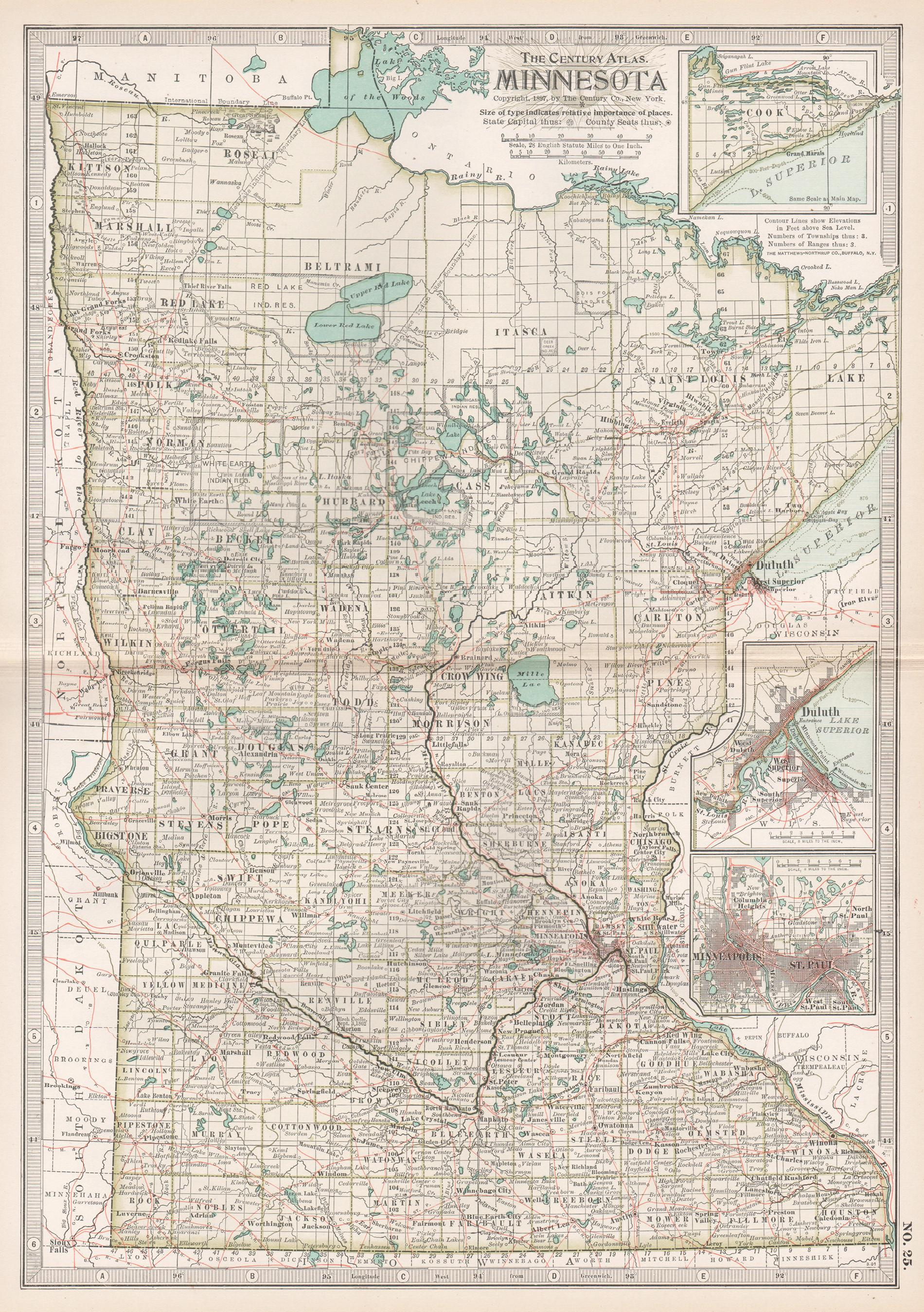
Minnesota. USA. Century Atlas state antique vintage map
Located in Melbourne, Victoria
'The Century Atlas. Minnesota.'
Original antique map, 1903.
Central fold as issued. Map name and number printed on the reverse corners.
Sheet 40cm by 29.5cm.
Category
Early 20th Century Victorian More Prints
Materials
Lithograph
Antique Minnesota Map Wall Art by Rand McNally, Color Lithograph, 1888
Located in Langweer, NL
Title: Antique Minnesota Map Wall Art – Railroads, Lakes
Cities, Rand McNally
Description:
This original antique atlas map depicts the state of Minnesota in rich geographic de...
Category
Antique Late 19th Century American Maps
Materials
Paper
Antique Map of St. Louis and Chicago
Located in Langweer, NL
Antique map titled 'The City of St. Louis Missouri - The City of Chicago Illinois'. Dual map on single page showing St. Louis and Chicago. Finely produ...
Category
Antique Mid-19th Century Maps
Materials
Paper

$142 Sale Price
20% Off
Antique Kansas City Map Wall Art – Missouri–Kansas Border, Rand McNally, ca.1888
Located in Langweer, NL
Title: Antique Kansas City Map Wall Art – Missouri–Kansas Border, Rand McNally
Description:
This original antique atlas map shows Kansas City in fine urban detail, depicting the str...
Category
Antique Late 19th Century American Maps
Materials
Paper
Antique Map of Missouri – The Show-Me State with St. Louis Inset, 1888
Located in Langweer, NL
Antique Map of Missouri – The Show-Me State with St. Louis Inset, 1888
This antique engraved map of Missouri, published in 1888 by Rand, McNally & Co. in Chicago for their Improved ...
Category
Antique Late 19th Century American Maps
Materials
Paper
Antique Map of the United States
North East
by Johnston
1909
Located in Langweer, NL
Antique map titled 'United States of North America'. Original antique map of United States of North America ( North East ). This map orig...
Category
Early 20th Century Maps
Materials
Paper

$237 Sale Price
20% Off