Items Similar to Large Original Antique City Plan of Montreal, Canada, circa 1900

Want more images or videos?
Request additional images or videos from the seller
1 of 5
Large Original Antique City Plan of Montreal, Canada, circa 1900
$90
£68.33
€78.77
CA$127.32
A$137.07
CHF 73.40
MX$1,651.63
NOK 926.14
SEK 847.57
DKK 588.59
About the Item
Fabulous colorful map of Montreal
Original color
By Rand, McNally
Co.
Published, circa 1900
Unframed
Minor edge tears
Free shipping.
- Creator:Rand McNally Co. (Maker)
- Dimensions:Height: 20.5 in (52.07 cm)Width: 27.5 in (69.85 cm)Depth: 0.07 in (1.78 mm)
- Materials and Techniques:Paper,Other
- Place of Origin:
- Period:1900-1909
- Date of Manufacture:1900
- Condition:Wear consistent with age and use.
- Seller Location:St Annes, GB
- Reference Number:1stDibs: LU1836324413492
About the Seller
4.9
Gold Seller
Premium sellers maintaining a 4.3+ rating and 24-hour response times
1stDibs seller since 2016
3,276 sales on 1stDibs
Typical response time: 1 hour
Associations
International Confederation of Art and Antique Dealers
Associations
- ShippingRetrieving quote...Shipping from: St Annes, United Kingdom
- Return Policy
More From This Seller
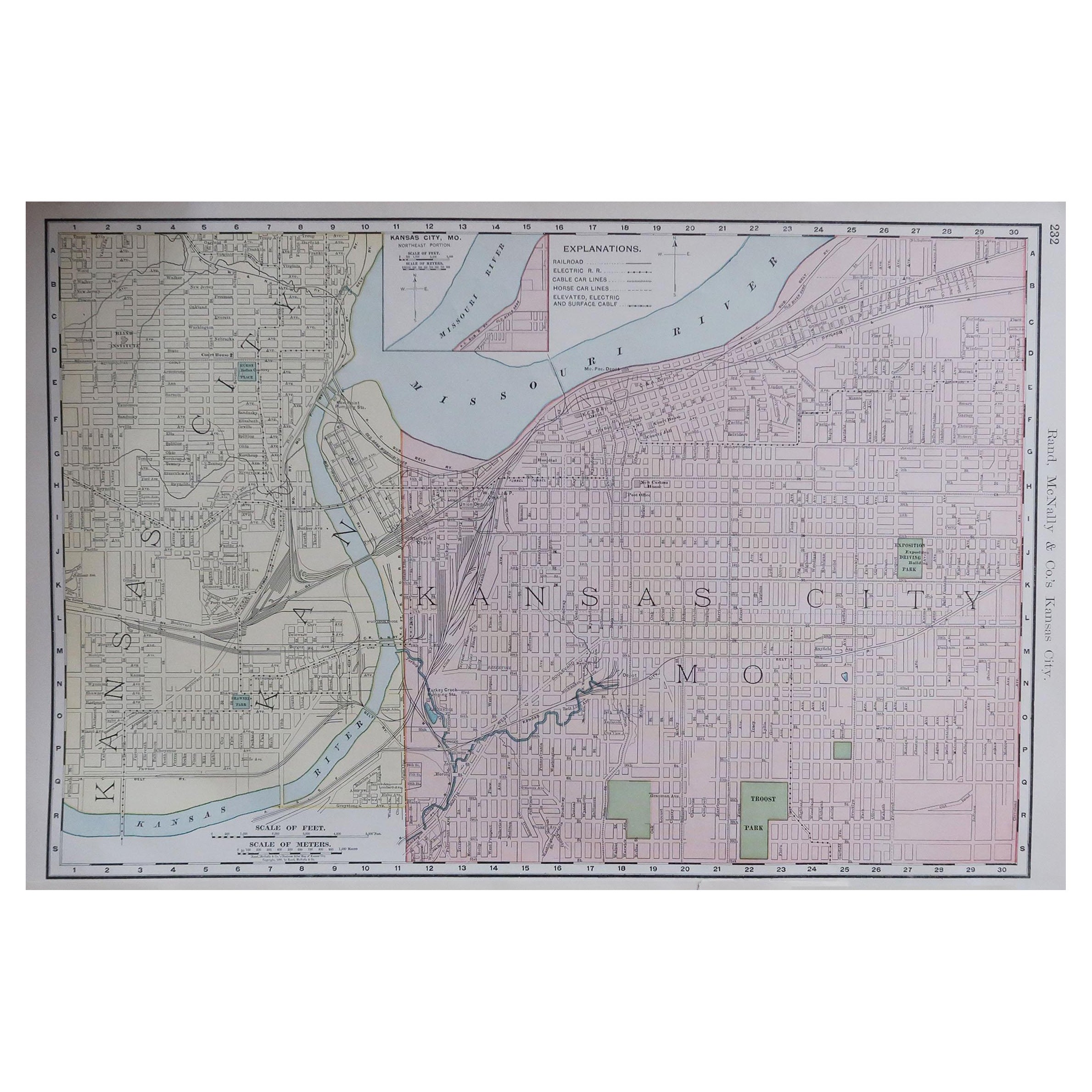
View AllOriginal Antique City Plan of Kansas City, USA. 1894
By Rand McNally
Co.
Located in St Annes, Lancashire
Fabulous colorful map of Kansas City
Original color
By Rand, McNally & Co.
Published, 1894
Unframed
Slightly reduced bottom margin.
Free shipping.
Category
Antique 1890s American Maps
Materials
Paper

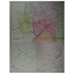
Large Original Antique City Plan of Minneapolis and St Paul, USA, circa 1900
By Rand McNally
Co.
Located in St Annes, Lancashire
Fabulous colorful map of Minneapolis and St Paul, Minnesota.
Original color
By Rand, McNally & Co.
Published, circa 1900
Unframed
Minor edge tears
Free shipping.
Category
Antique Early 1900s American Maps
Materials
Paper
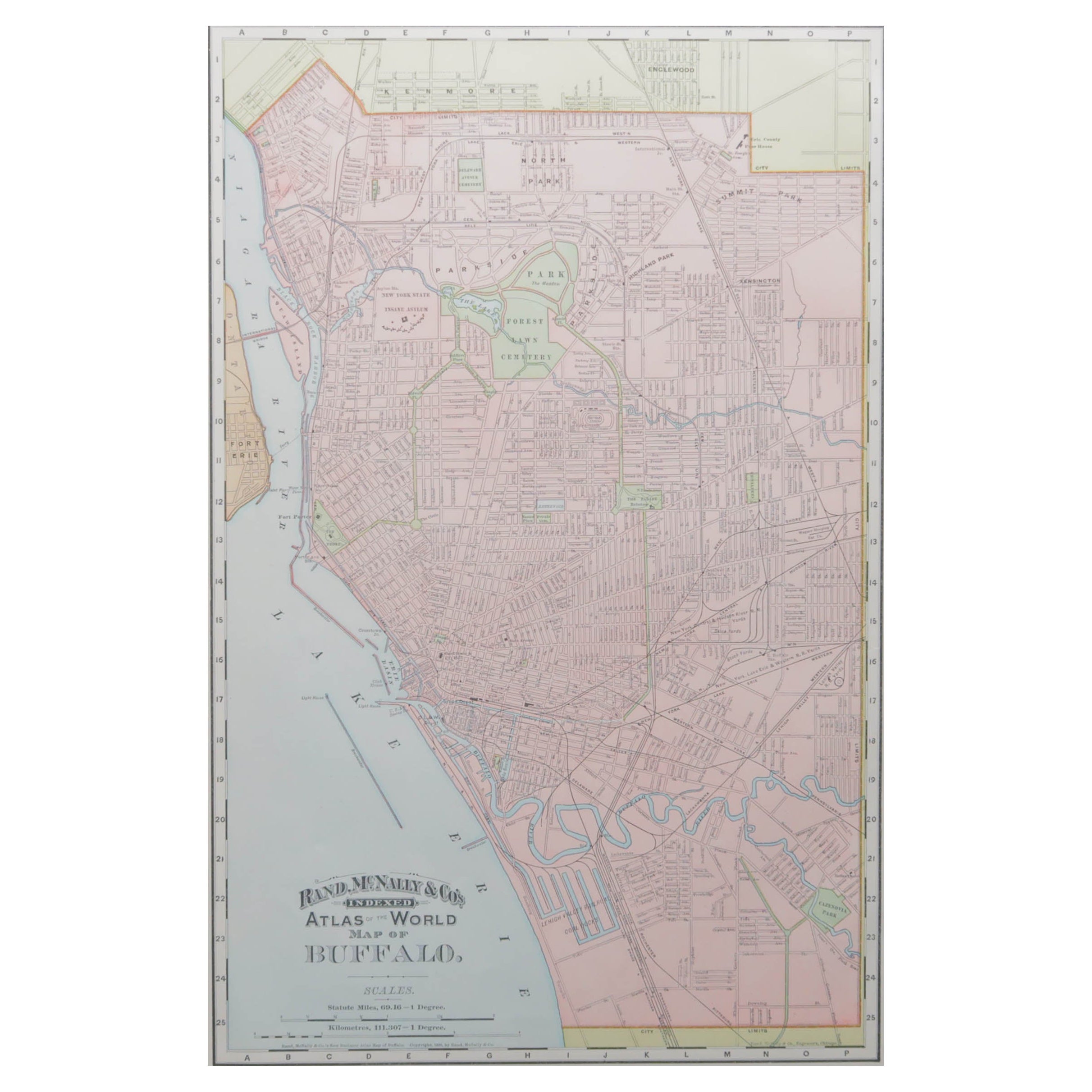
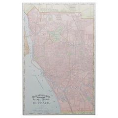
Original Antique City Plan of Buffalo, New York, USA, circa 1900
By Rand McNally
Co.
Located in St Annes, Lancashire
Fabulous colorful map of Buffalo
Original color
By Rand, McNally & Co.
Published, circa 1900
Unframed
Minor edge tears
Free shipping.
Category
Antique 1890s American Maps
Materials
Paper
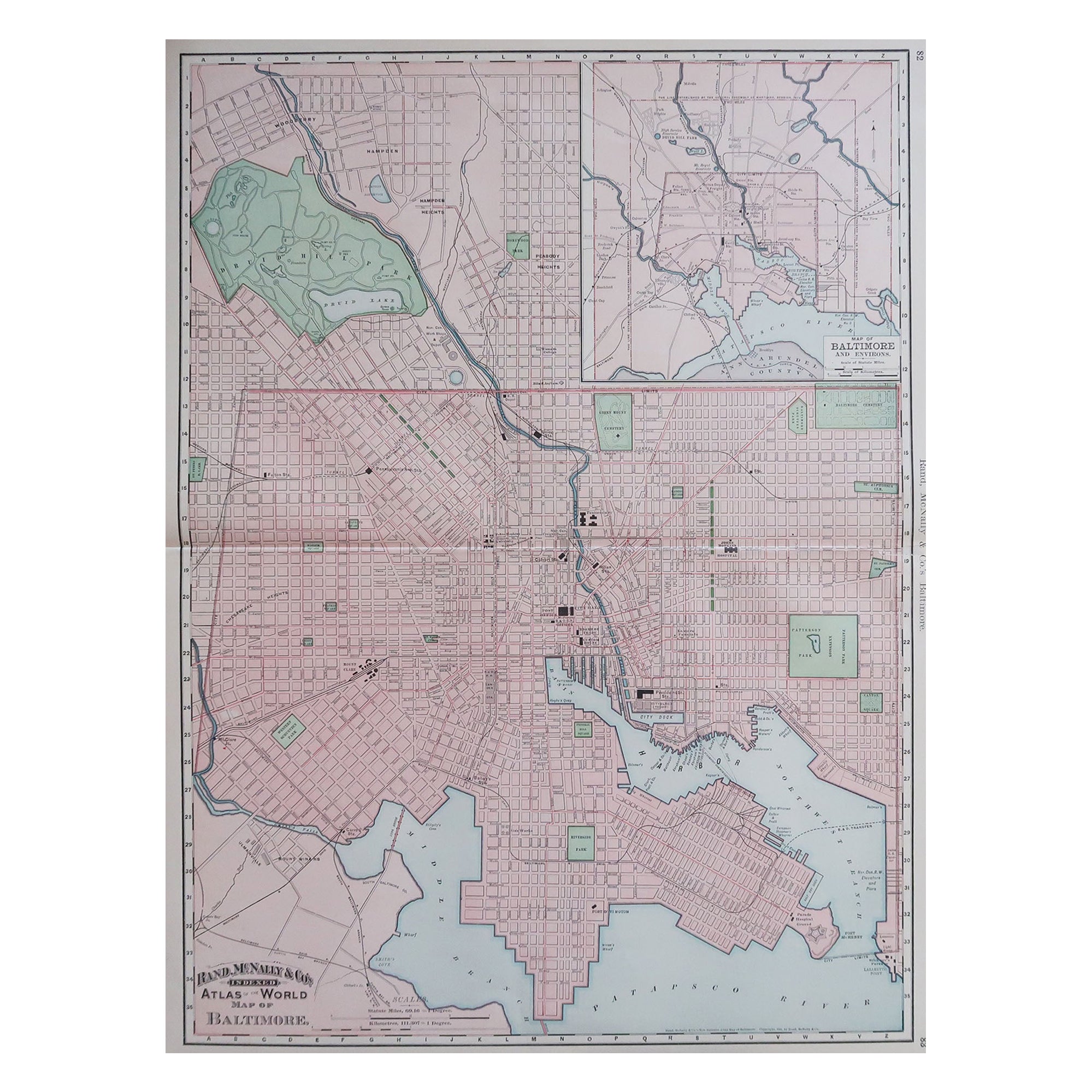
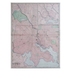
Large Original Antique City Plan of Baltimore, USA, 1894
By Rand McNally
Co.
Located in St Annes, Lancashire
Fabulous colorful map of Baltimore
Original color
By Rand, McNally & Co.
Published, 1894
Unframed
Free shipping.
Category
Antique 1890s American Maps
Materials
Paper
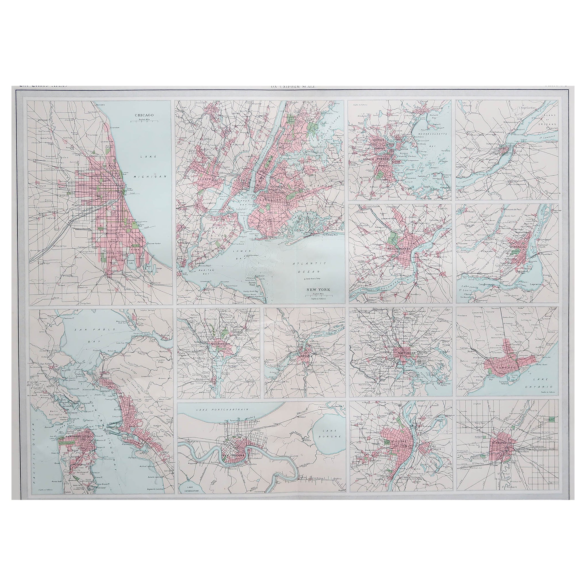
Antique Map of American Cities, Vignette of New York City, circa 1920
Located in St Annes, Lancashire
Great maps of American Cities
Unframed
Original color
By John Bartholomew and Co. Edinburgh Geographical Institute
Published, circa 1920
Category
Vintage 1920s British Maps
Materials
Paper

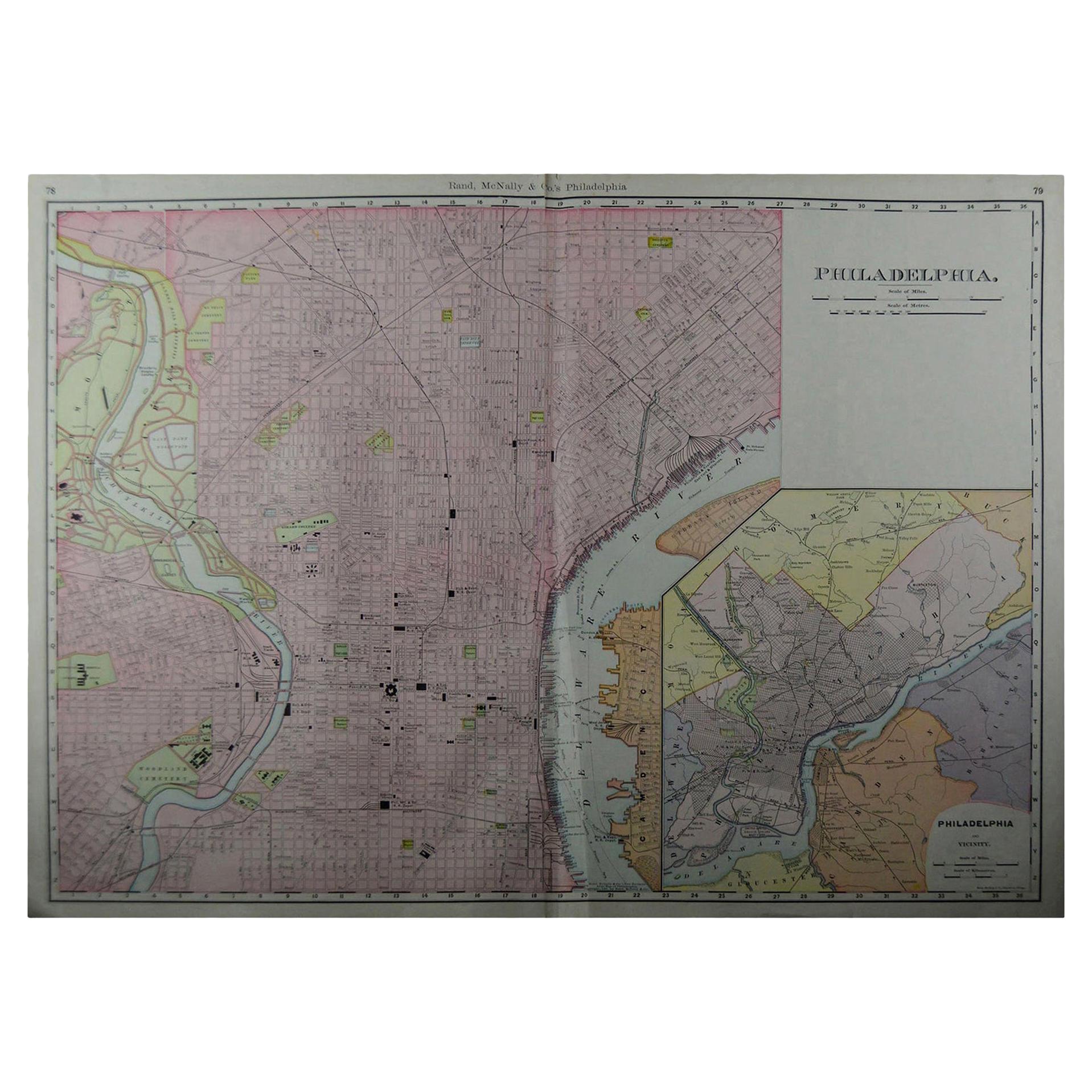
Large Original Antique City Plan of Philadelphia, USA, circa 1900
By Rand McNally
Co.
Located in St Annes, Lancashire
Fabulous colorful map of Philadelphia
Original color
By Rand, McNally & Co.
Published, circa 1900.
Unframed
Free shipping.
Category
Antique Early 1900s American Maps
Materials
Paper

You May Also Like
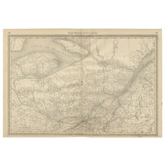
Quebec Antique Railroad Map c.1888 – La Belle Province, Cities
Towns
Located in Langweer, NL
Antique Map of Quebec, Canada – Rand McNally, circa 1888
This antique map of Quebec was published by Rand, McNally & Co. around 1888. Drawn from their late 19th-century atlas series...
Category
Antique Late 19th Century American Maps
Materials
Paper
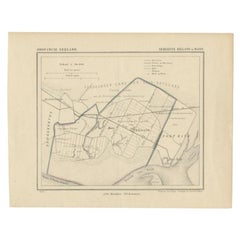
Antique Map of the Region of Rilland and Maire, Zeeland, the Netherlands, 1866
Located in Langweer, NL
Antique map titled 'Provincie Zeeland - Gemeente Rilland en Maire'. Original antique map of the region of Rilland en Maire, the Netherlands. This map originates from the 'Gemeente-At...
Category
Antique 19th Century Maps
Materials
Paper
Antique Map of Canada by Johnston
1909
Located in Langweer, NL
Antique map titled 'Dominion of Canada'. Original antique map of Canada. With inset maps of Niagara, Montreal, Quebec. This map originates from t...
Category
Early 20th Century Maps
Materials
Paper
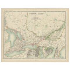
$237 Sale Price
20% Off
Antique Map of St. Louis and Chicago
Located in Langweer, NL
Antique map titled 'The City of St. Louis Missouri - The City of Chicago Illinois'. Dual map on single page showing St. Louis and Chicago. Finely produ...
Category
Antique Mid-19th Century Maps
Materials
Paper

$142 Sale Price
20% Off
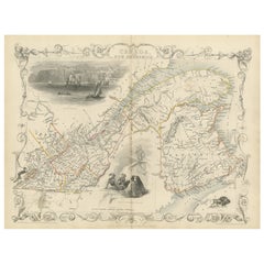
Decorative 1850s Map of Eastern Canada and New Brunswick with Historic Vignettes
Located in Langweer, NL
Decorative 1850s Map of Eastern Canada and New Brunswick with Historic Vignettes
This beautifully crafted 19th-century map of Eastern Canada and New Brunswick, drawn and engrave...
Category
Antique 1850s Maps
Materials
Paper
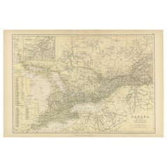
Antique Map of Canada, The Province of Ontario and Part of Quebec, 1882
Located in Langweer, NL
This is a historical map from the 1882 Blackie Atlas, this time detailing "The Province of Ontario, and Part of Quebec" in Canada. The map presents a detailed illustration of Ontario...
Category
Antique 1880s Maps
Materials
Paper
$237 Sale Price
20% Off
Free Shipping