Items Similar to Large Original Antique Map of Afghanistan. Edward Weller, 1861


Want more images or videos?
Request additional images or videos from the seller
1 of 5
Large Original Antique Map of Afghanistan. Edward Weller, 1861
$60
£45.47
€52.15
CA$83.83
A$91.46
CHF 48.51
MX$1,101.83
NOK 615.64
SEK 563.63
DKK 389.51
About the Item
Great map of Afghanistan
Lithograph engraving by Edward Weller
Original colour
Published, 1861
Unframed
Good condition
- Dimensions:Height: 19 in (48.26 cm)Width: 13 in (33.02 cm)Depth: 0.07 in (1.78 mm)
- Style:Victorian (Of the Period)
- Materials and Techniques:Paper,Other
- Place of Origin:
- Period:
- Date of Manufacture:1861
- Condition:Wear consistent with age and use.
- Seller Location:St Annes, GB
- Reference Number:1stDibs: LU1836341083502
About the Seller
4.9
Platinum Seller
Premium sellers with a 4.7+ rating and 24-hour response times
1stDibs seller since 2016
3,264 sales on 1stDibs
Typical response time: 1 hour
Associations
International Confederation of Art and Antique Dealers
Associations
- ShippingRetrieving quote...Shipping from: St Annes, United Kingdom
- Return Policy
More From This Seller
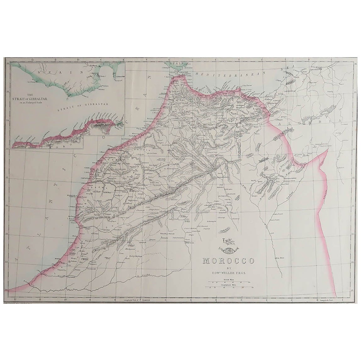
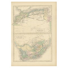
View AllLarge Original Antique Map of Morocco. Edward Weller, 1861
Located in St Annes, Lancashire
Great map of Morocco
Lithograph engraving by Edward Weller
Original colour
Published, 1861
Unframed
Good condition.
Category
Antique 1860s English Victorian Maps
Materials
Paper

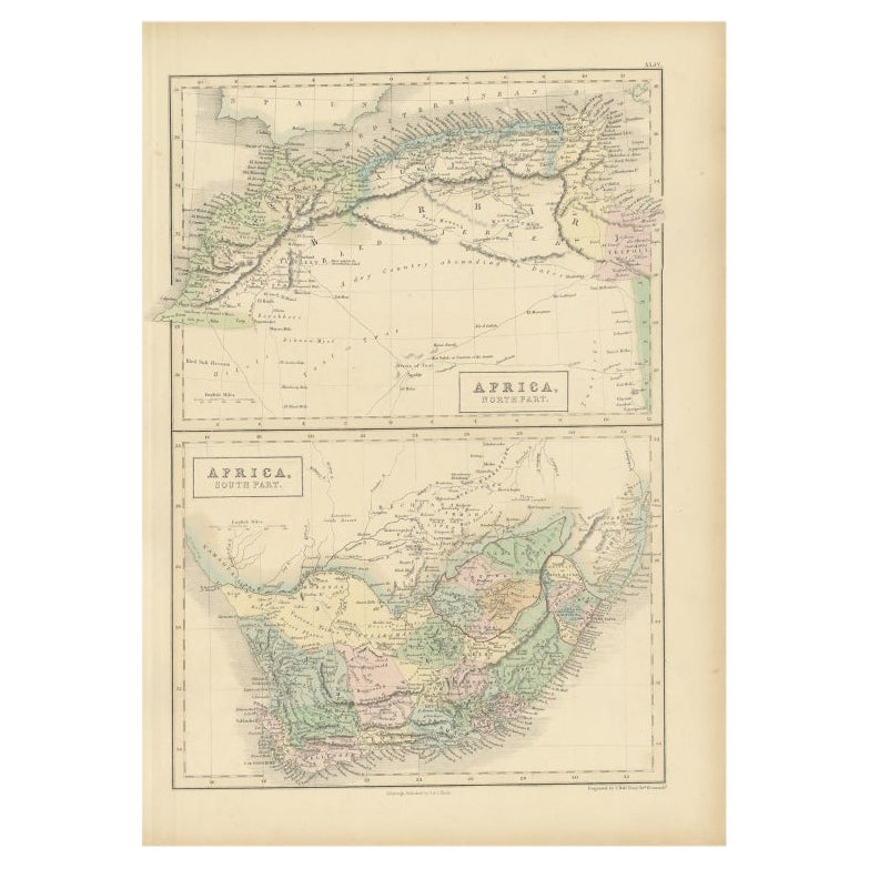
Original Antique Map of Africa by Dower, circa 1835
Located in St Annes, Lancashire
Nice map of Africa
Drawn and engraved by J.Dower
Published by Orr & Smith. C.1835
Unframed.
Free shipping
Category
Antique 1830s English Maps
Materials
Paper

Original Antique Map of India by Dower, circa 1835
Located in St Annes, Lancashire
Nice map of India
Drawn and engraved by J.Dower
Published by Orr & Smith. C.1835
Unframed.
Free shipping
Category
Antique 1830s English Maps
Materials
Paper

Large Original Antique Map of Africa. C.1900
Located in St Annes, Lancashire
Fabulous map of Africa
Original color.
Engraved and printed by the George F. Cram Company, Indianapolis.
Published, C.1900.
Unframed.
Free shipping.
Category
Antique 1890s American Maps
Materials
Paper

Large Original Antique Map of Cyprus. 1894
Located in St Annes, Lancashire
Superb Antique map of Cyprus
Published Edward Stanford, Charing Cross, London 1894
Original colour
Good condition
Unframed.
Free shipping
Category
Antique 1890s English Maps
Materials
Paper

Original Antique Map of China, Arrowsmith, 1820
Located in St Annes, Lancashire
Great map of China
Drawn under the direction of Arrowsmith
Copper-plate engraving
Published by Longman, Hurst, Rees, Orme and Brown, 1820
Unfr...
Category
Antique 1820s English Maps
Materials
Paper

You May Also Like
Antique Map of Afghanistan and Surroundings,
1845
Located in Langweer, NL
Antique map titled 'Map of Persia and Caubul'. Original antique map of Afghanistan and surroundings.
This map originates from 'An Atlas of the World, Comprehending Separate Maps of...
Category
Antique Mid-19th Century Maps
Materials
Paper

$191 Sale Price
20% Off
Antique Map of North Africa and South Africa by Black, 1854
Located in Langweer, NL
Antique map titled 'Africa north part - Africa south part'. Old map of Africa showing the region of Morocco, Algeria and South Africa. This map orginates from 'General Atlas Of The W...
Category
Antique 19th Century British Maps
Materials
Paper
Antique Map of Persia and Afghanistan by Johnston, 1882
Located in Langweer, NL
Antique map titled 'Persia and Afghanistan'.
Old map of Persia and Afghanistan. This map originates from 'The Royal Atlas of Modern Geography, Exhibiting, in a Series of Entirely O...
Category
Antique 19th Century Maps
Materials
Paper

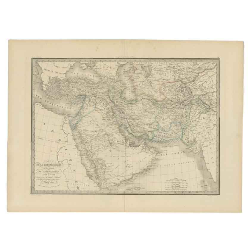
Antique Map by Pierre M. Lapie, Turkey, Persia, Afghanistan, 1842
By Pierre M. Lapie
Located in Langweer, NL
Antique map titled 'Carte de la Turquie d'Asia, de la Perse, de l'Afghanistan'. Map of Turkey, Persia and Afghanistan. This map originates from 'Atlas universel de géographie ancienn...
Category
Antique 19th Century French Maps
Materials
Paper

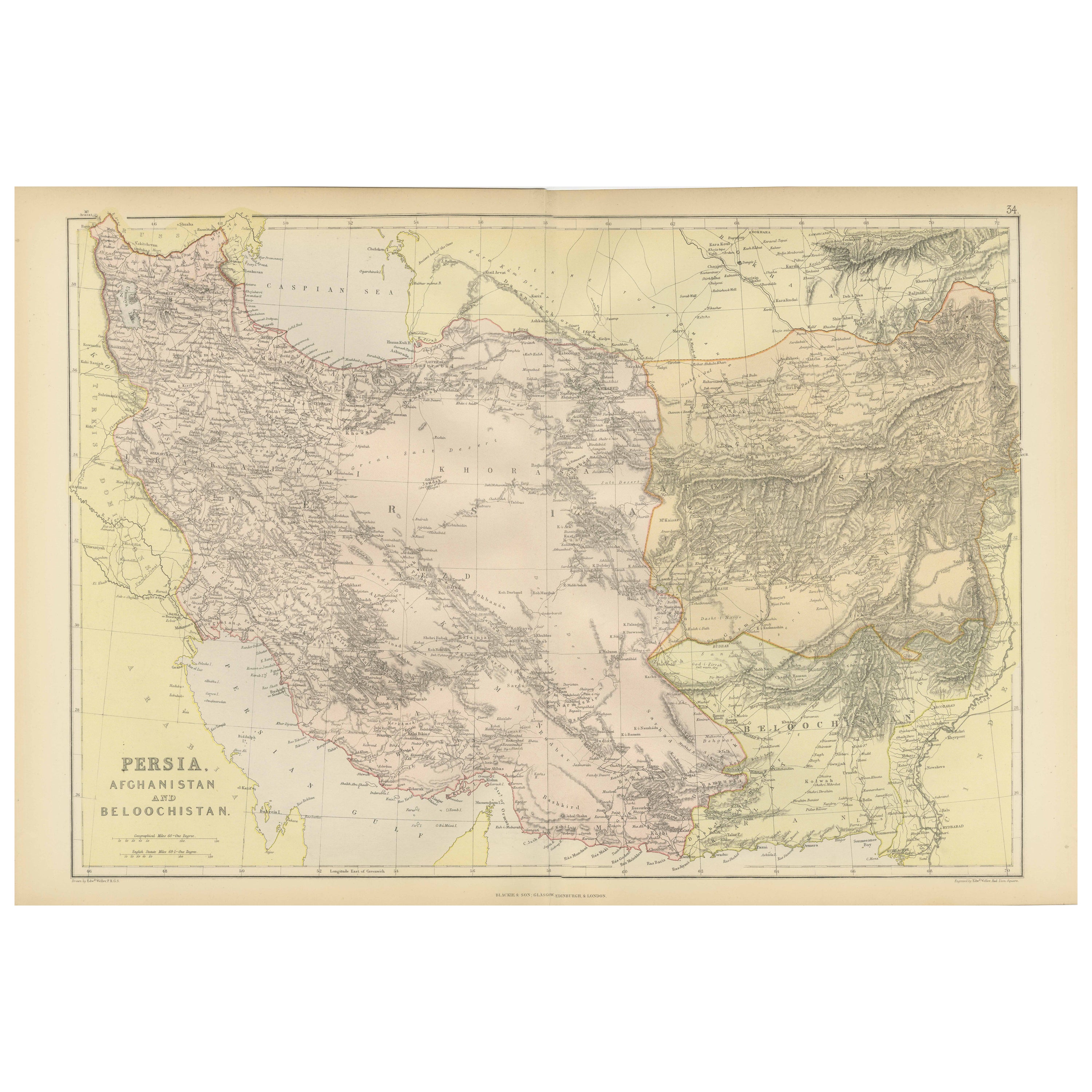
Oriental Realms: A Detailed Map of Persia, Afghanistan, and Beloochistan, 1882
Located in Langweer, NL
This historical map from the 1882 atlas published by Blackie & Son is a comprehensive depiction of Persia (modern-day Iran), Afghanistan, and Baluchistan (the region that includes pa...
Category
Antique 1880s English Maps
Materials
Paper

Persia Unveiled: Antique Map of Iran, Afghanistan, and Beyond, 1852
Located in Langweer, NL
The antique map titled 'Royaumes de Perse Herat & Kaboul' is an attractive map of Persia. Here are the key details and features of the map:
1. **Geographic Coverage**:
- The map ...
Category
Antique Mid-19th Century French Maps
Materials
Paper

$153 Sale Price
20% Off
More Ways To Browse
Goblets
Mid Century Modern Yellow Chair
Paulin Pierre
Used Pianos Pianos
18th Century Engravings
Antique Carved Wood Chair
Black Scandinavian Modern Dining Chairs
Dutch Mid Century Modern Table
Gold Modern Coffee Table
Iconic Modern Furniture
Japanese Metal
Midcentury Modern Gray Glass Vase
Round Glass Coffee Tables
Vintage Cave
18th Century Wood Side Tables
Antique Hand Carved Dining Room Sets
Mid Century Modern Pitcher
Vintage Italian Leather Dining Chair