Items Similar to Large Original Antique Map of the Dutchy of Holstein, Germany, ca.1840
Want more images or videos?
Request additional images or videos from the seller
1 of 5
Large Original Antique Map of the Dutchy of Holstein, Germany, ca.1840
$806.37
$1,007.9620% Off
£597.57
£746.9720% Off
€672
€84020% Off
CA$1,102.07
CA$1,377.5920% Off
A$1,199.70
A$1,499.6220% Off
CHF 636.80
CHF 79620% Off
MX$14,434.94
MX$18,043.6720% Off
NOK 8,069.12
NOK 10,086.4020% Off
SEK 7,393.59
SEK 9,241.9920% Off
DKK 5,118.82
DKK 6,398.5320% Off
About the Item
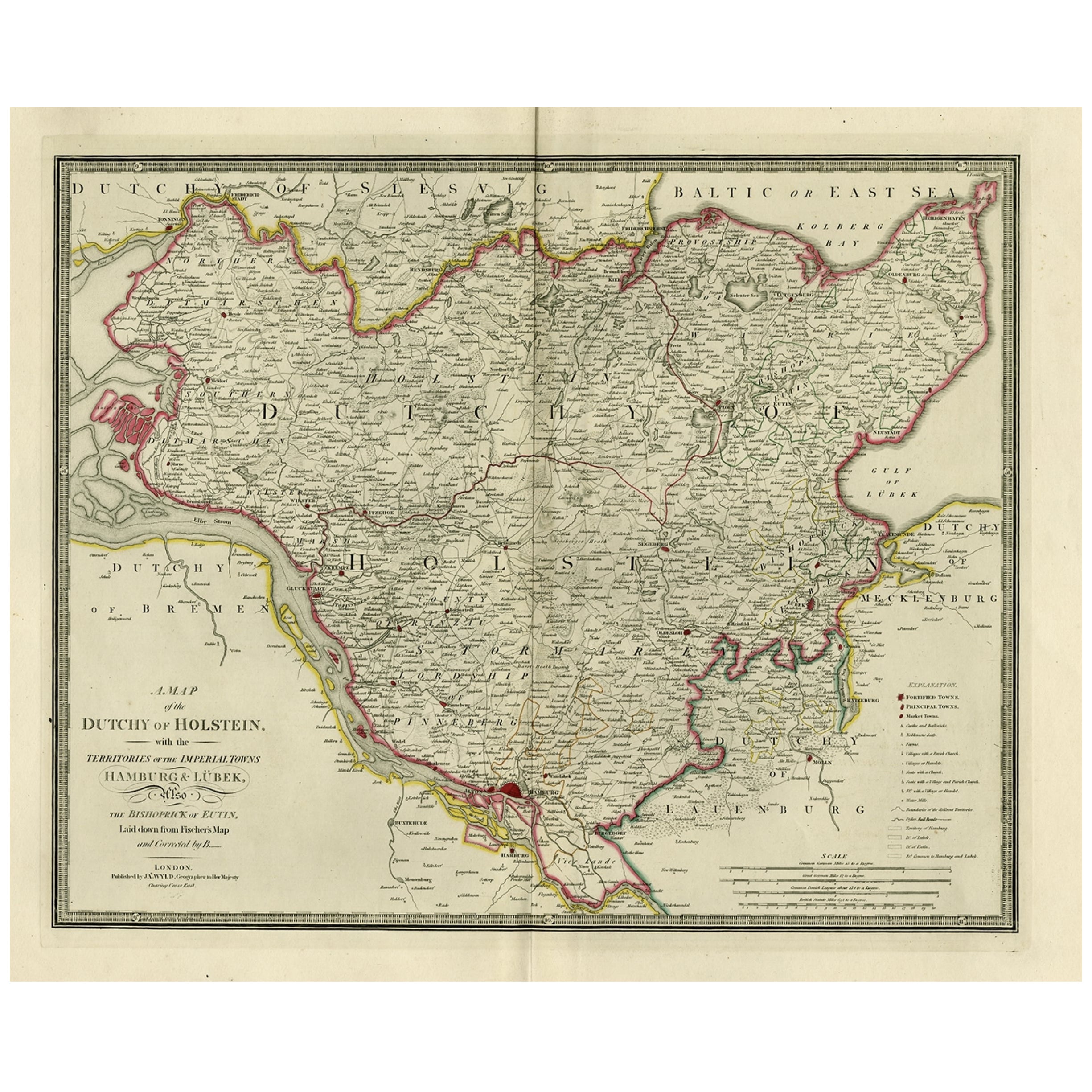
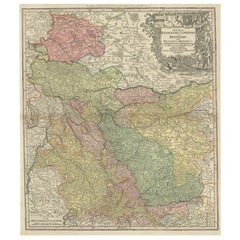
Antique map titled 'A Map of the Dutchy of Holstein, with the Territories of the Imperial Towns Hamburg
Lubek, Also The Bishoprick of Eutin, Laid down from Fischer's Map (..)'. Scarce regional map of Northern Germany, focused on the Duchy of Holstein and towns of Hamburg and Lubeck. Beautifully engraved to show fortified towns, principal towns, market towns, castles, noblemen's seats, farms, villages, windmills, dykes and topography. Source unknown, to be determined.
Artists and Engravers: James Wyld (1812–1887) was a British geographer and map-seller, best known for Wyld's Great Globe. He was successor to William Faden, one of the luminaries of late eighteenth century publishing in England. Wyld maintained the high standard of graphic and factual excellence that had been established by his predecessor and his maps are among the finest published in the early nineteenth century.
- Dimensions:Height: 23.04 in (58.5 cm)Width: 28.35 in (72 cm)Depth: 0 in (0.02 mm)
- Materials and Techniques:
- Period:
- Date of Manufacture:circa 1840
- Condition:Condition: Good, given age. Small tear bottom margin, not affecting image. A few minor unobtrusive spots. Original middle fold as issued. General age-related toning and/or occasional minor defects from handling. Please study scan carefully.
- Seller Location:Langweer, NL
- Reference Number:Seller: PC-58934 1stDibs: LU3054327384822
About the Seller
5.0
Recognized Seller
These prestigious sellers are industry leaders and represent the highest echelon for item quality and design.
Platinum Seller
Premium sellers with a 4.7+ rating and 24-hour response times
Established in 2009
1stDibs seller since 2017
2,816 sales on 1stDibs
Typical response time: 1 hour
- ShippingRetrieving quote...Shipping from: Langweer, Netherlands
- Return Policy
More From This Seller
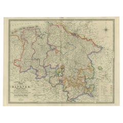
View AllOld Map of Holstein with the Imperial Towns Hamburg
Lubeck, Germany, 1854
Located in Langweer, NL
Antique map titled 'Map of the Duchy of Holstein with the territories of the Imperial Towns Hamburg & Lubeck (..)
Based on a map by Fischer.' Map of the Duchy of Holstein. From Jam...
Category
Antique 1850s Maps
Materials
Paper
Map of the Dutchy of Holstein and the Territories of Hamburg
Lübek, 1875
Located in Langweer, NL
Title: Map of the Dutchy of Holstein and the Territories of Hamburg & Lübek by James Wyld, ca. 1875
Description: This is an antique map titled "A Map of the Dutchy of Holstein, with...
Category
Antique 1870s Maps
Materials
Paper

$902 Sale Price
20% Off
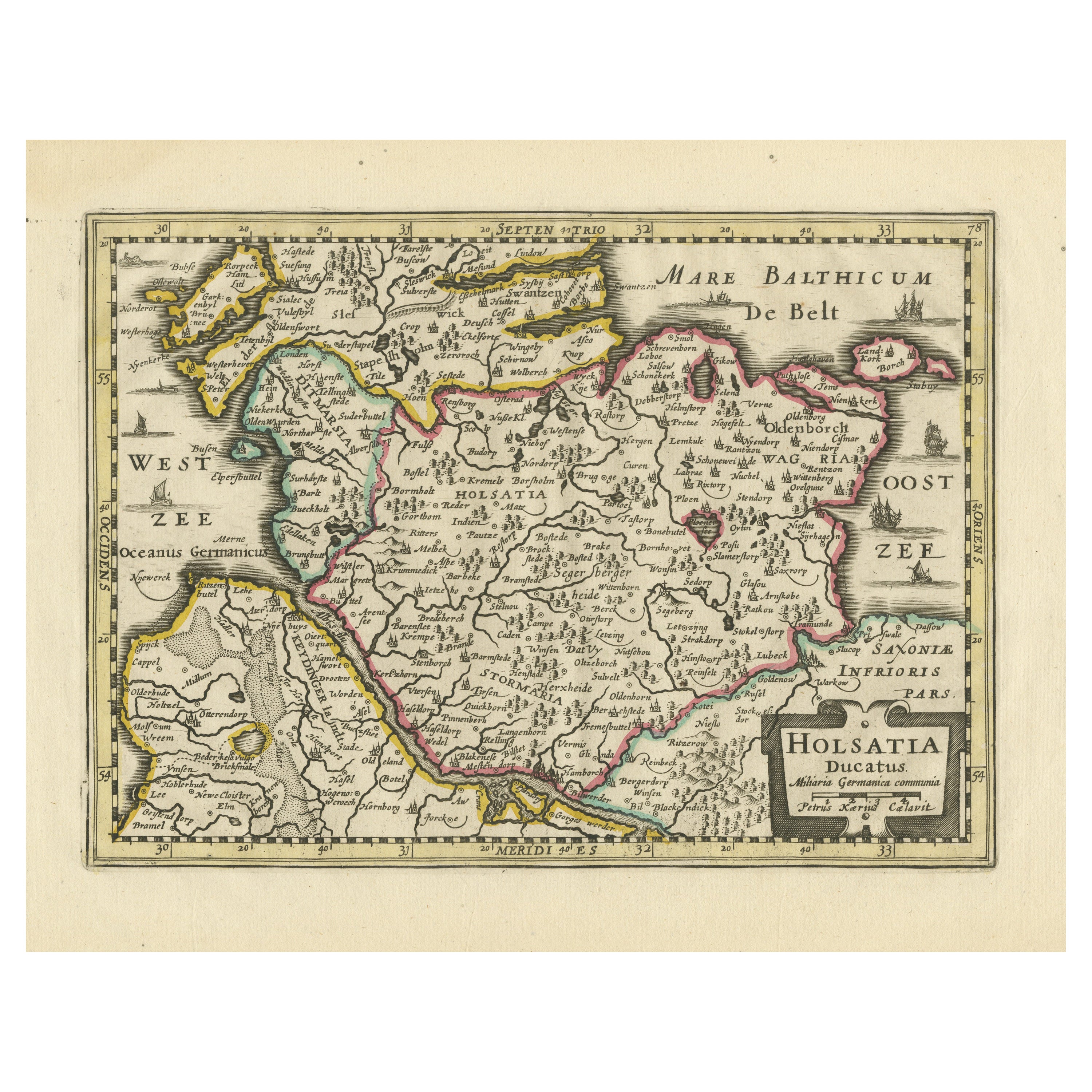
Antique Map of Holstein, Germany
Located in Langweer, NL
Antique map titled 'Holsatia Ducatus'. Original old map of Holstein, Germany. By Petrus Kaerius, published circa 1650. Pieter van den Keere (Latin: Petrus Kaerius 1571 – circa 1646) ...
Category
Antique Mid-17th Century Maps
Materials
Paper
$364 Sale Price
20% Off
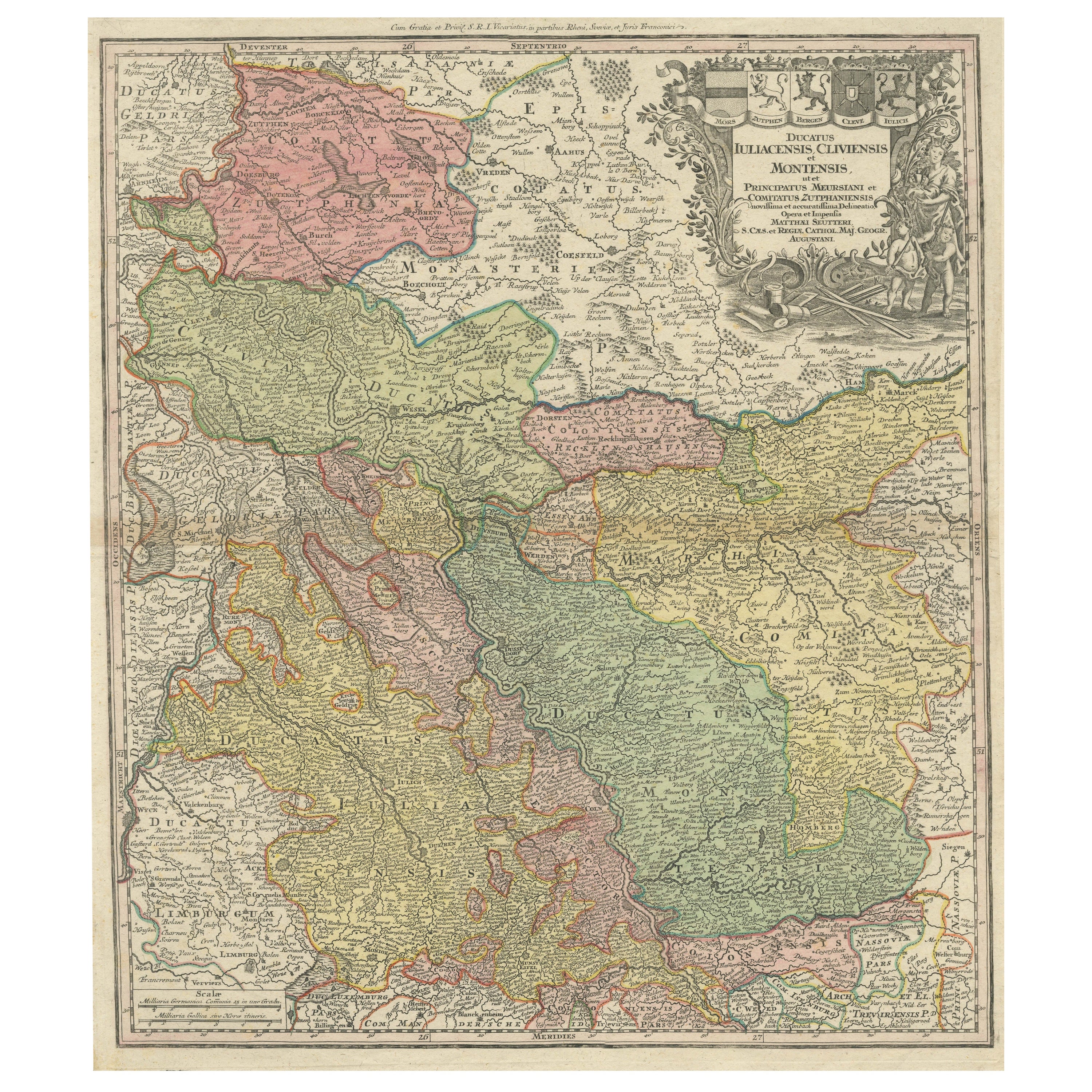
Antique Map of Western Germany with part of the Netherlands
Located in Langweer, NL
Antique map titled 'Ducatus Iuliacensis Cliviensis et Montensis (..)'. Original old map of Western Germany with part of the Netherlands. Published by M. Seutter, circa 1750.
George...
Category
Antique Mid-18th Century Maps
Materials
Paper
$431 Sale Price
20% Off
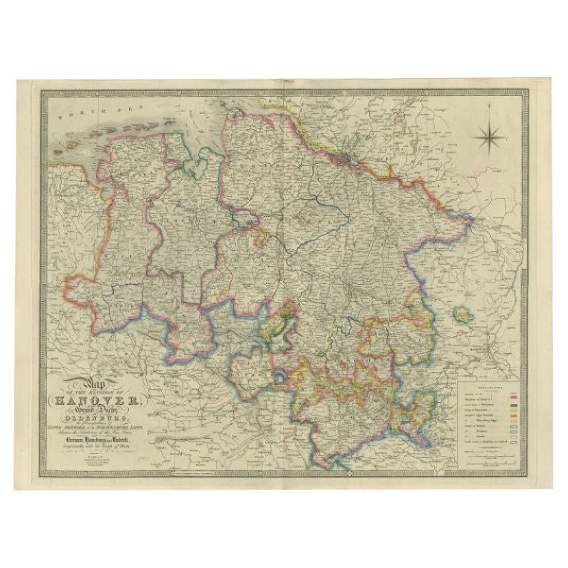
Antique Map of Northern Germany by Wyld, c.1840
Located in Langweer, NL
Antique map titled 'Map of the Kingdom of Hanover, with the Grand Duchy of Oldenburg, the Principalities of Lippe Detmold and Schauenburg Lippe, likewise the Territories of the Free ...
Category
Antique 19th Century Maps
Materials
Paper
$379 Sale Price
20% Off
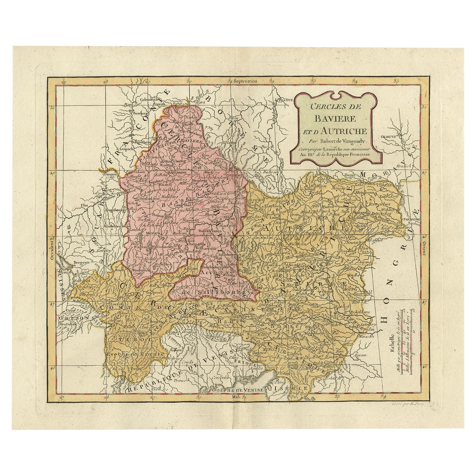
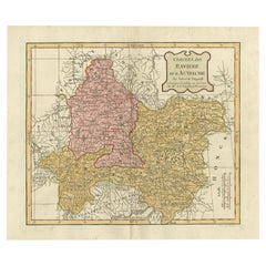
Antique Map of Bavaria in Southern Germany and Austria, 1806
Located in Langweer, NL
Antique map titled 'Cercles de Baviere et d'Autriche.' This map shows Bavaria in southern Germany and Austria. By Robert de Vaugondy, revised and published by Delamarche. Source unkn...
Category
Antique 19th Century Maps
Materials
Paper
You May Also Like
1849 Map of "Europaische Russland",
Meyer Map of European Russia
, Ric. R017
Located in Norton, MA
1849 Map of
"Europaische Russland"
( Meyer Map of European Russia)
Ric.r017
A lovely map of European Russia dating to 1849 by Joseph Meyer. It covers the European portions of...
Category
Antique 19th Century Unknown Maps
Materials
Paper

1839 Map of Karte Des "Russischen Reiches in Europa Und Asien" Ric.R0013
Located in Norton, MA
1839 map of Karte Des
"Russischen Reiches in Europa and Asien"
Ric.r013
Map of the European and Asian parts of Russian Empire. Karte der Russischen Reiches in Europa und Asien...
Category
Antique 19th Century Unknown Maps
Materials
Paper

Large Original Antique Map of Lombardy and Venice, Italy. John Dower, 1861
Located in St Annes, Lancashire
Great map of Lombardy and Venice
Lithograph engraving by John Dower
Original colour
Published, 1861
Unframed
Good condition / crease to bottom left corner
Free shipping
Category
Antique 1860s English Victorian Maps
Materials
Paper

Large Original Antique Map of The South of Italy. John Dower, 1861
Located in St Annes, Lancashire
Great map of the South of Italy
Lithograph engraving by John Dower
Original colour
Published, 1861
Unframed
Good condition
Free shipping
Category
Antique 1860s English Victorian Maps
Materials
Paper

1752 Vaugoundy Map of Flanders : Belgium, France, and the Netherlands, Ric.a002
Located in Norton, MA
Large Vaugoundy Map of Flanders:
Belgium, France, and the Netherlands
Colored -1752
Ric.a002
Description: This is a 1752 Didier Robert de Vaugondy map of Flanders. The map de...
Category
Antique 17th Century Unknown Maps
Materials
Paper

1853 Map of "Russia in Europe Including Poland" Ric.r016
Located in Norton, MA
Description
Russia in Europe incl. Poland by J Wyld c.1853
Hand coloured steel engraving
Dimension: Paper: 25 cm W x 33 cm H ; Sight: 22 cm W x 28 cm H
Condition: Good ...
Category
Antique 19th Century Unknown Maps
Materials
Paper

More Ways To Browse
Antique Farm Windmill
Antique Map Of Thailand
Louisiana Antique Furniture
Map Of Ancient Greece
Map Of Native American Tribes
Old Spice
Romania Map
Used Furniture Nova Scotia
18th Century Scottish Collectibles
Antique Furniture Northumberland
Antique Map Nova Scotia
Antique Map Palestine
California Island Map
Constantinople Map
Croatian Antiques
Jamaican Antique
Large Map Of Italy
Louisiana Antiques