Items Similar to Large Original Antique Map of Madeira. 1894
Want more images or videos?
Request additional images or videos from the seller
1 of 5
Large Original Antique Map of Madeira. 1894
$120
£90.71
€104.04
CA$167.28
A$182.10
CHF 96.66
MX$2,191.09
NOK 1,224.82
SEK 1,122.28
DKK 776.99
About the Item
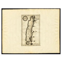
Superb Antique map of Madeira
Published Edward Stanford, Charing Cross, London 1894
Original colour
Good condition
Unframed.
Free shipping
- Dimensions:Height: 14.5 in (36.83 cm)Width: 22 in (55.88 cm)Depth: 0.07 in (1.78 mm)
- Materials and Techniques:Paper,Other
- Place of Origin:
- Period:
- Date of Manufacture:1894
- Condition:Wear consistent with age and use.
- Seller Location:St Annes, GB
- Reference Number:1stDibs: LU1836343794952
About the Seller
4.9
Platinum Seller
Premium sellers with a 4.7+ rating and 24-hour response times
1stDibs seller since 2016
3,260 sales on 1stDibs
Typical response time: 1 hour
Associations
International Confederation of Art and Antique Dealers
Associations
- ShippingRetrieving quote...Shipping from: St Annes, United Kingdom
- Return Policy
More From This Seller
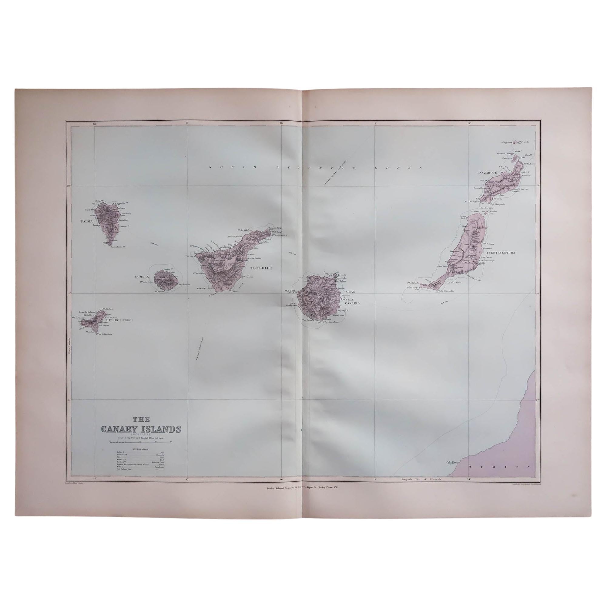
View AllLarge Original Antique Map of The Canary Islands. 1894
Located in St Annes, Lancashire
Superb Antique map of The Canary Islands
Published Edward Stanford, Charing Cross, London 1894
Original colour
Good condition
Unframed.
Free shipping
Category
Antique 1890s English Maps
Materials
Paper

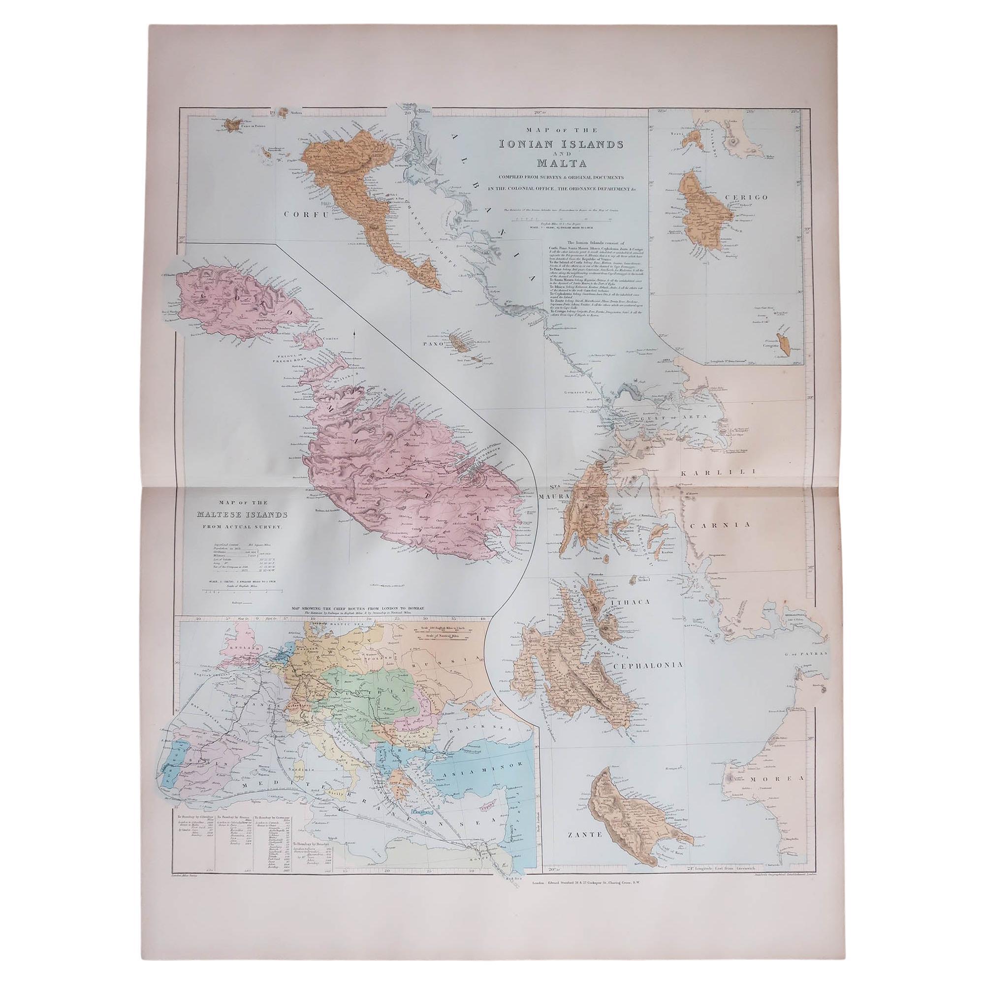
Large Original Antique Map of The Greek Islands. 1894
Located in St Annes, Lancashire
Superb Antique map of The Greek Islands
Published Edward Stanford, Charing Cross, London 1894
Original colour
Good condition
Unframed.
Free shipping
Category
Antique 1890s English Maps
Materials
Paper

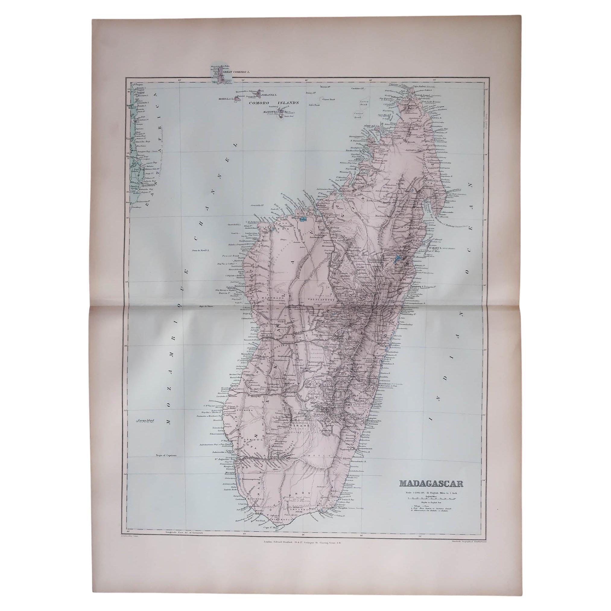
Large Original Antique Map of Madagascar. 1894
Located in St Annes, Lancashire
Superb Antique map of Madagascar
Published Edward Stanford, Charing Cross, London 1894
Original colour
Good condition
Unframed.
Free shipping
Category
Antique 1890s English Maps
Materials
Paper

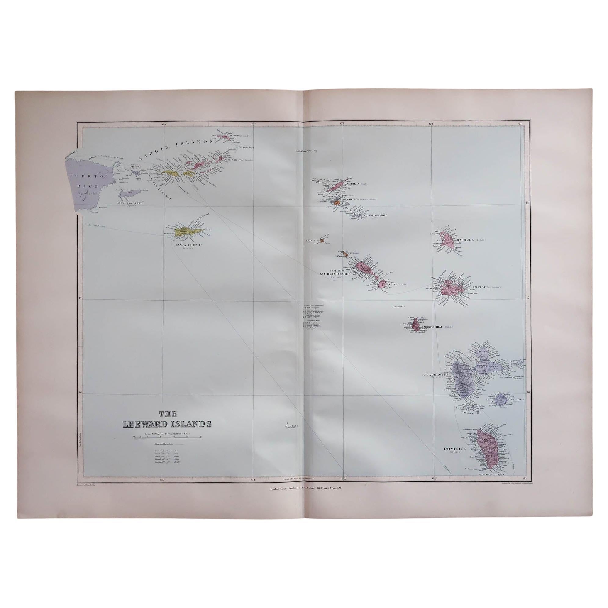
Large Original Antique Map of The Leeward Islands. 1894
Located in St Annes, Lancashire
Superb Antique map of The Leeward Islands
Published Edward Stanford, Charing Cross, London 1894
Original colour
Good condition
Unframed.
Free shipping
Category
Antique 1890s English Maps
Materials
Paper

Large Original Antique Map of Cyprus. 1894
Located in St Annes, Lancashire
Superb Antique map of Cyprus
Published Edward Stanford, Charing Cross, London 1894
Original colour
Good condition
Unframed.
Free shipping
Category
Antique 1890s English Maps
Materials
Paper

Large Original Antique Map of South Italy and Malta by Sidney Hall, 1847
Located in St Annes, Lancashire
Great map of South Italy and Malta
Drawn by Sidney Hall
Steel engraving by G.Aikman
Original color outline
Published by A & C Black. 1847
Un...
Category
Antique 1840s Scottish Maps
Materials
Paper

You May Also Like
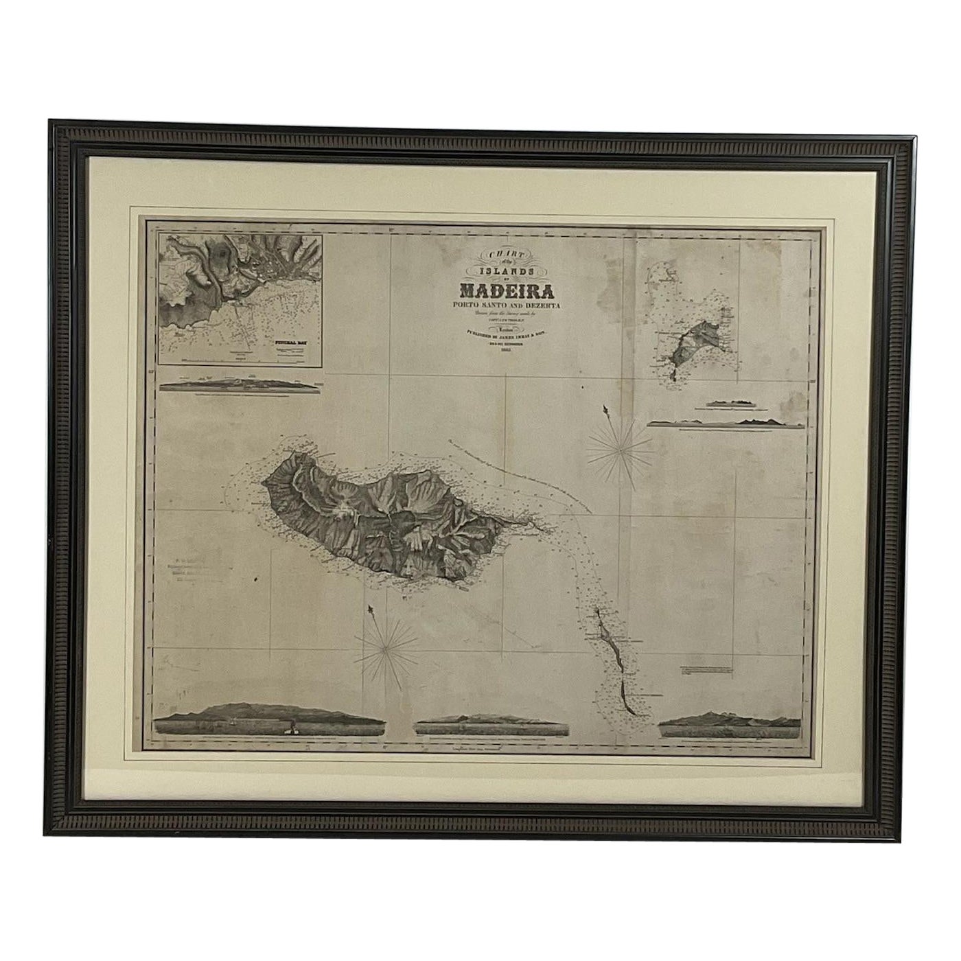
1865 Chart of the Islands of Madeira
Located in Norwell, MA
Rare James Imray chart from 1865 titled "Chart of the Islands of Madeira, Porto Santo and Dezerea" drawn from the survey made by Captain Ate Vidal Royal Navy, London. Published by Ja...
Category
Antique 1860s European Maps
Materials
Paper

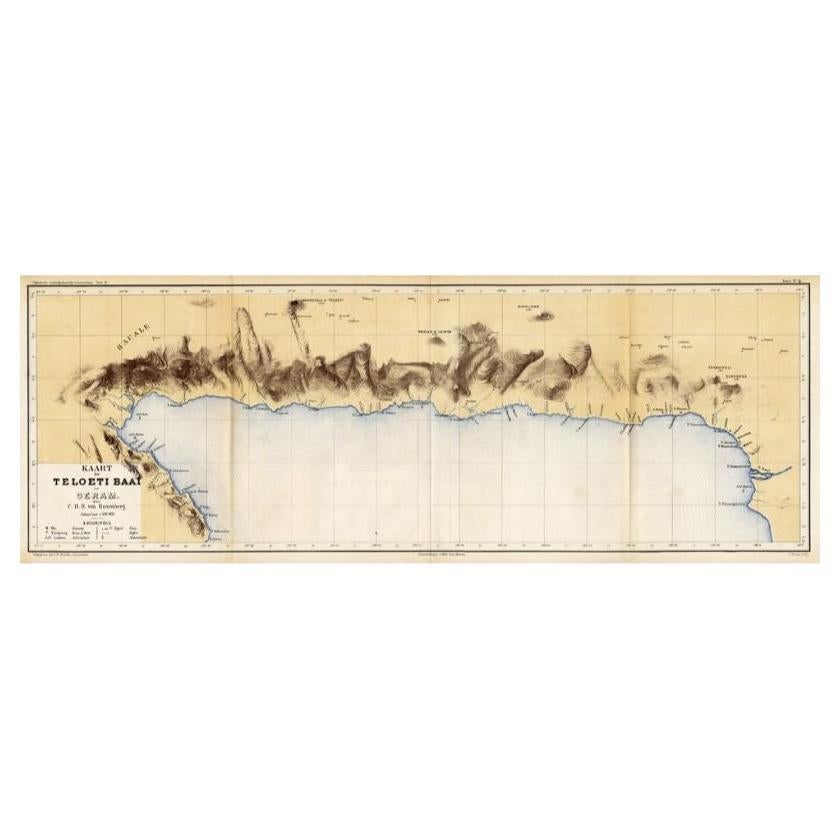
Antique Map of Taluti Bay by Stemler, C.1875
Located in Langweer, NL
Antique map titled 'Kaart der Teloeti Baai op Ceram.' This scarce map shows the Taluti Bay on the Moluccan island of Ceram. Originates from 'Tijdschrift Aardrijkskundig Genootschap',...
Category
Antique 19th Century Maps
Materials
Paper

$118 Sale Price
20% Off
Antique Map of the Region of Bengkulu in Indonesia, 1900
Located in Langweer, NL
Antique map of the region of Benkulu, Sumatra. Also depicting Enggano Island. This map originates from 'Atlas van Nederlandsch Oost- en West-Indië' by I. Dornseiffen.
Artists and E...
Category
20th Century Maps
Materials
Paper
Large Antique Map of Guadeloupe and Antigua with Adjacent Isles, 19th Century
Located in Langweer, NL
Title: "Antique Map of Guadeloupe and Antigua with Adjacent Isles, 19th Century"
Source: New General Atlas (circa 1817), published in Edinburgh
Description: This detailed antique m...
Category
Antique Early 19th Century British Maps
Materials
Paper
Antique Map of the Island of Java by Van Der Aa, 1725
By Pieter Van Der Aa
Located in Langweer, NL
Antique map titled 'Map: 'L'Ile de Java'. (The island of Java.) This map shows the Indonesian island of Java. With compass rose and scale. This plate originates from the very scarse:...
Category
Antique 18th Century Maps
Materials
Paper
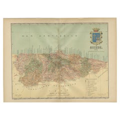
The Lay of the Land: A 1901 Topographic Map of Oviedo, Asturias
Located in Langweer, NL
The province depicted on the historical map on offer, Oviedo, corresponds to the modern-day autonomous community of Asturias in northwestern Spain. Here are some points about Asturia...
Category
Antique Early 1900s Maps
Materials
Paper
More Ways To Browse
Sterling Silver Flatware Service For 12
Antique Dining Tables With Leaves
Decorative Wall Panels
Frank Lloyd Wright For Cassina
Natural Curved
Spanish Wool Rug
Leather Pouf And Ottomans
Low Side Tables
Set Of Four Italian Dining Chairs
Silk Runner Carpet
18th Century Blue And White Porcelain
3x5 Rugs
Italian Lacquer Dining Room Sets
Round Brass Table
Round Table Base
Antique Imari Porcelain
Belgian Antiques
Cream Soup