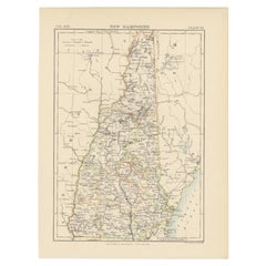
Items Similar to Large Original Antique Map of New Hampshire, USA, 1894

Want more images or videos?
Request additional images or videos from the seller
1 of 5
Large Original Antique Map of New Hampshire, USA, 1894
$90
£68.38
€78.58
CA$126.42
A$137.60
CHF 72.91
MX$1,654.86
NOK 927.03
SEK 849.52
DKK 586.99
About the Item
Fabulous map of New Hampshire
Original color
By Rand, McNally
Co.
Published, 1894
Unframed
Free shipping.
- Creator:Rand McNally Co. (Maker)
- Dimensions:Height: 20.5 in (52.07 cm)Width: 13.5 in (34.29 cm)Depth: 0.07 in (1.78 mm)
- Materials and Techniques:Paper,Other
- Place of Origin:
- Period:
- Date of Manufacture:1894
- Condition:Wear consistent with age and use.
- Seller Location:St Annes, GB
- Reference Number:1stDibs: LU1836329189352
About the Seller
4.9
Gold Seller
Premium sellers maintaining a 4.3+ rating and 24-hour response times
1stDibs seller since 2016
3,268 sales on 1stDibs
Typical response time: 1 hour
Associations
International Confederation of Art and Antique Dealers
Associations
- ShippingRetrieving quote...Shipping from: St Annes, United Kingdom
- Return Policy
More From This Seller
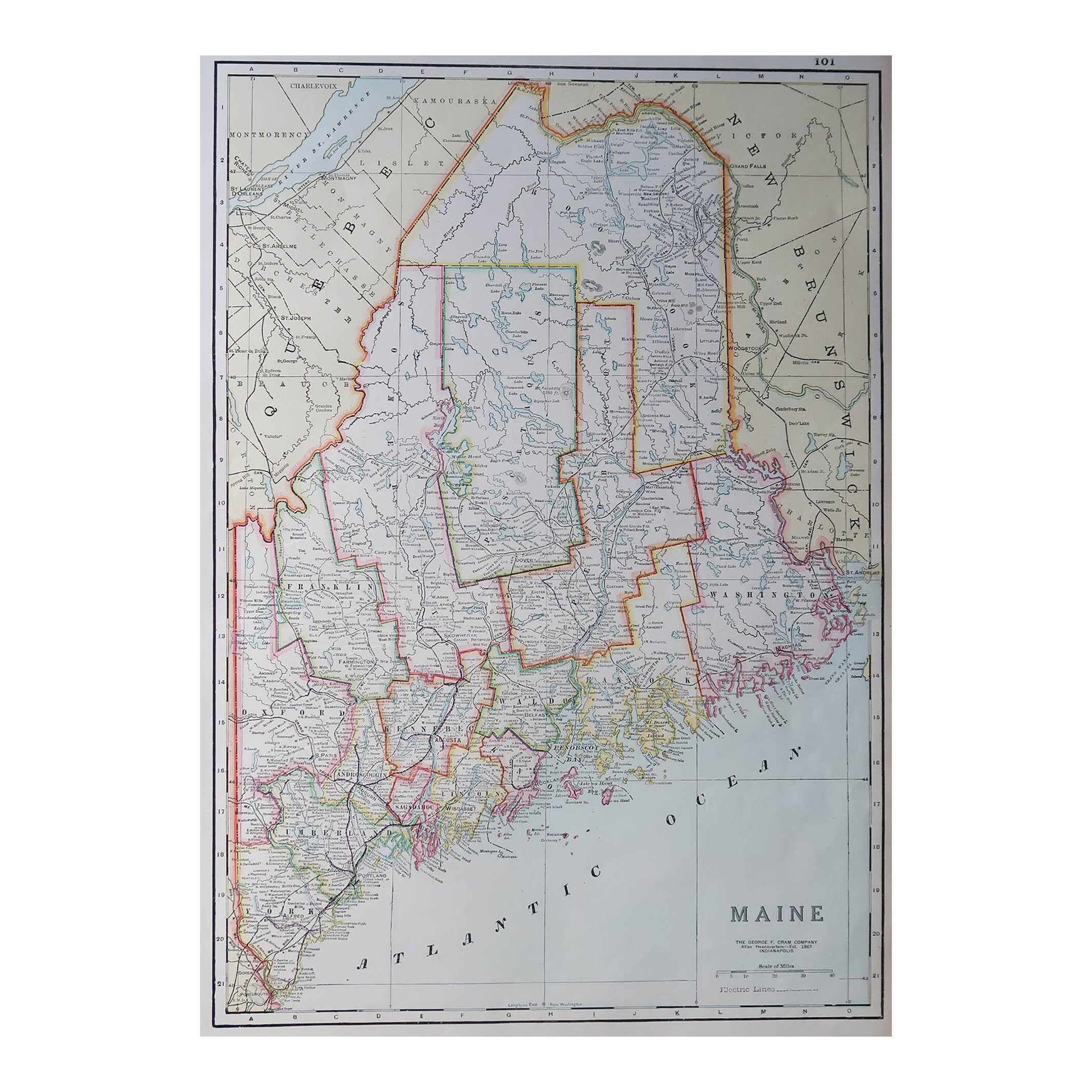
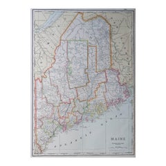
View AllLarge Original Antique Map of Maine, USA, C.1900
Located in St Annes, Lancashire
Fabulous map of Maine
Original color
Engraved and printed by the George F. Cram Company, Indianapolis.
Published, C.1900
Unframed
Free shipping.
Category
Antique 1890s American Maps
Materials
Paper
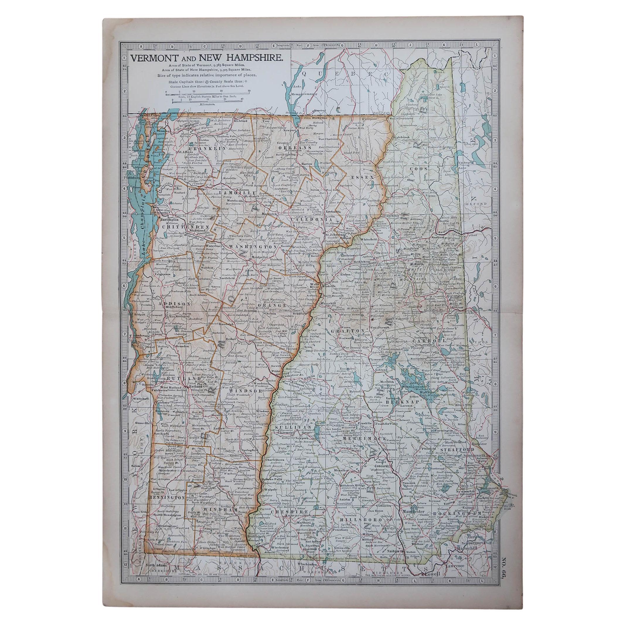
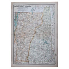
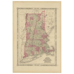
Original Antique Map of the American States of Vermont
New Hampshire, 1903
Located in St Annes, Lancashire
Antique map of Vermont and New Hampshire
Published By A & C Black. 1903
Original colour
Good condition
Unframed.
Free shipping
Category
Antique Early 1900s English Maps
Materials
Paper
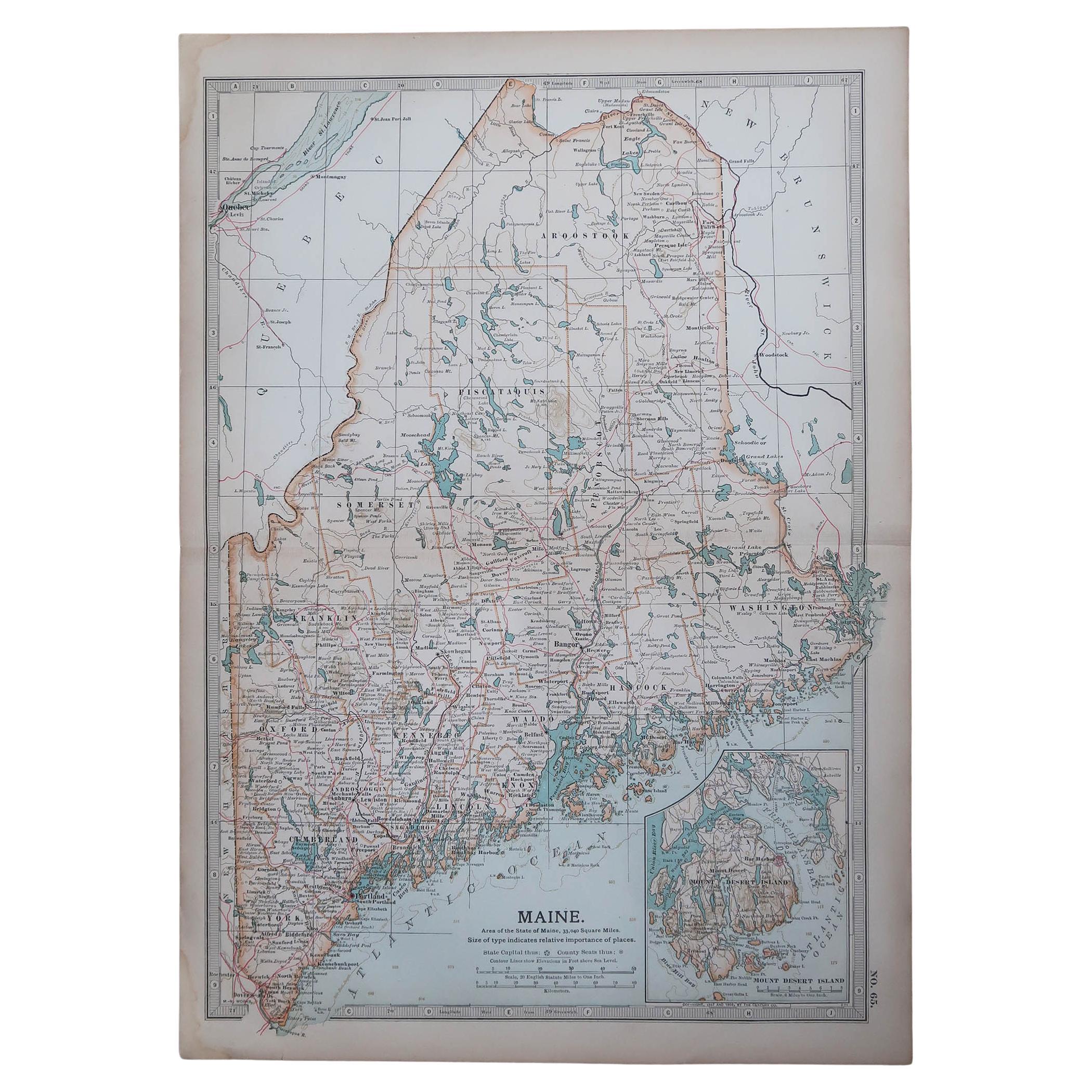
Original Antique Map of the American State of Maine, 1903
Located in St Annes, Lancashire
Antique map of Maine
Published By A & C Black. 1903
Original colour
Good condition
Unframed.
Free shipping
Category
Antique Early 1900s English Maps
Materials
Paper

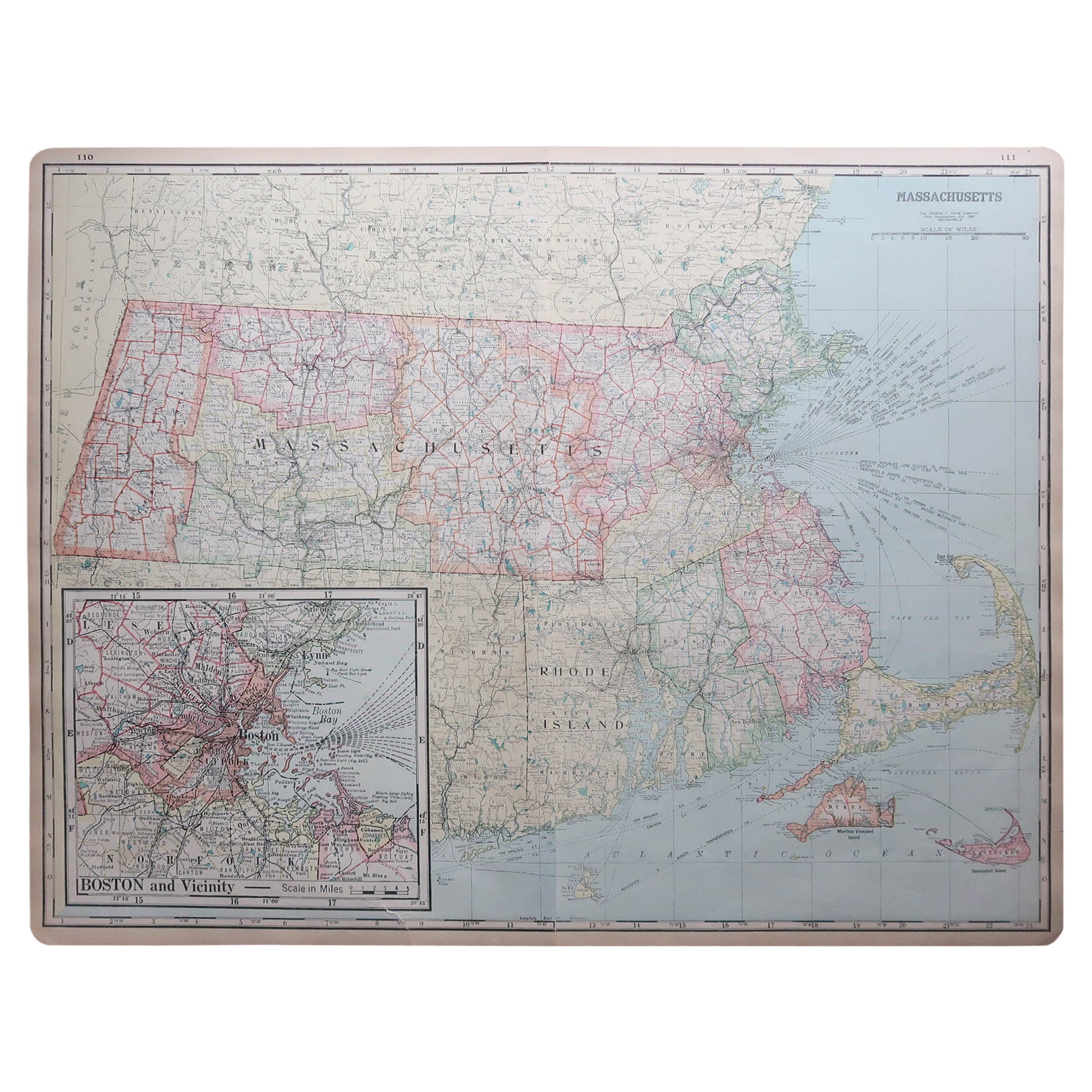
Large Original Antique Map of Massachusetts, USA, circa 1900
Located in St Annes, Lancashire
Fabulous map of Massachusetts
In 2 sheets. They can be joined but I have not done it
Original color
Engraved and printed by the George F. Cram ...
Category
Antique 1890s American Maps
Materials
Paper

Original Antique Map of the American State of Massachusetts, 1903
Located in St Annes, Lancashire
Antique map of Vermont and New Hampshire
Published By A & C Black. 1903
Original colour
Good condition
Unframed.
Free shipping
Category
Antique Early 1900s English Maps
Materials
Paper

Original Antique Map of the American State of Connecticut
Rhode Island, 1903
Located in St Annes, Lancashire
Antique map of Connecticut and Rhode Island
Published By A & C Black. 1903
Original colour
Good condition
Unframed.
Free shipping
Category
Antique Early 1900s English Maps
Materials
Paper

You May Also Like
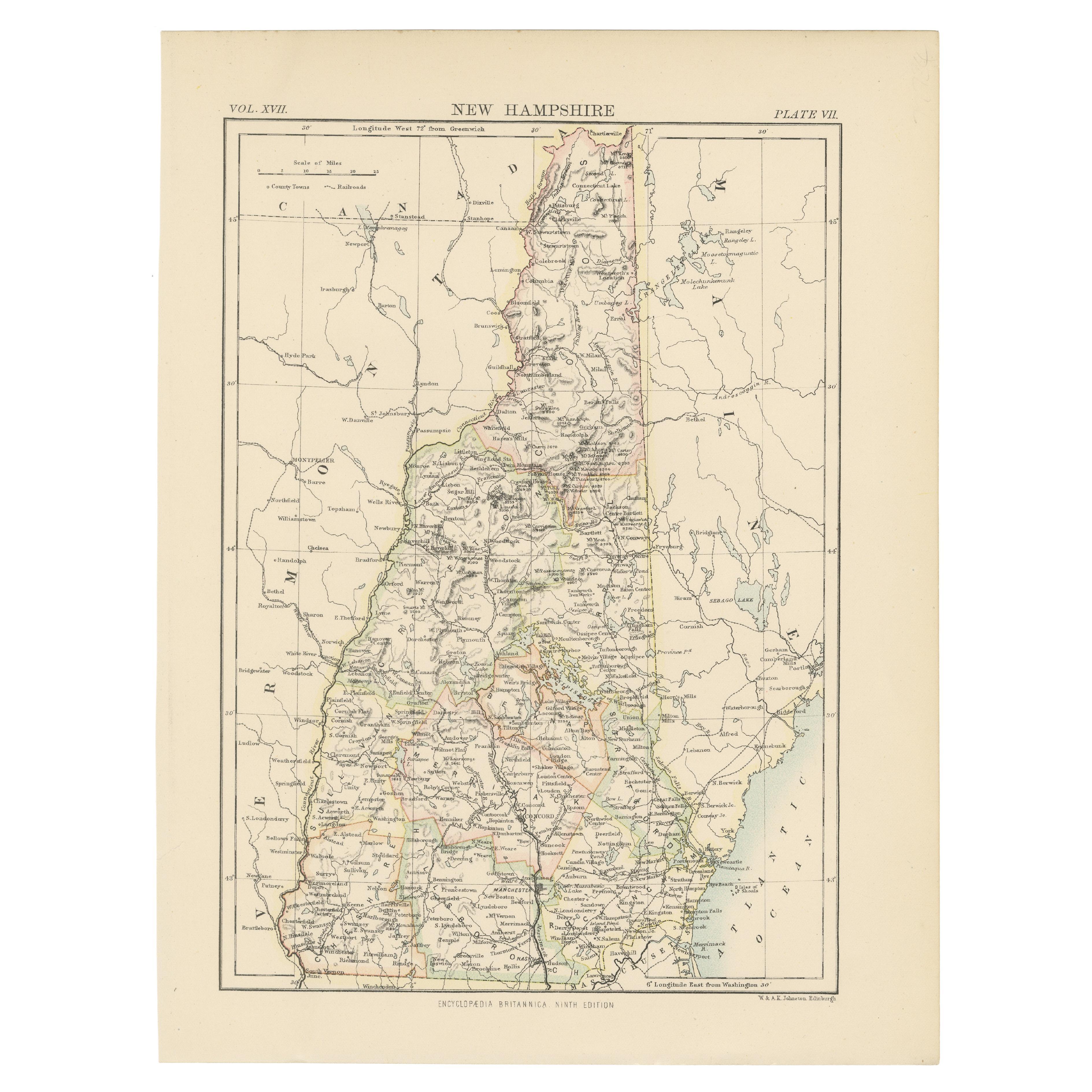
Antique Map of New Hampshire
Located in Langweer, NL
Antique map titled 'New Hampshire'. Original antique map of New Hampshire, United States. This print originates from 'Encyclopaedia Britan...
Category
Antique Late 19th Century Maps
Materials
Paper
$276 Sale Price
20% Off
Large Antique Map of New England with decorative Vignettes
Located in Langweer, NL
Antique map titled 'Johnson's New England'. Large map of New England, comprising the states Connecticut, Maine, Massachusetts, New Hampshire, Rhode ...
Category
Antique Mid-19th Century Maps
Materials
Paper
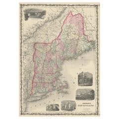
$371 Sale Price
20% Off
Rare 1864 Civil War Era Map of Vermont, New Hampshire, and Southern New England
Located in Langweer, NL
Title: Rare 1864 Civil War Era Map of Vermont, New Hampshire, and Southern New England
Description: This finely detailed antique map, titled "Johnson's Vermont, New Hampshire, Massa...
Category
Antique 1860s Maps
Materials
Paper
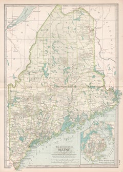
Maine. USA Century Atlas state antique vintage map
Located in Melbourne, Victoria
'The Century Atlas. Maine'
Original antique map, 1903.
Central fold as issued. Map name and number printed on the reverse corners.
Sheet 40cm by 29.5cm.
Category
Early 20th Century Victorian More Prints
Materials
Lithograph
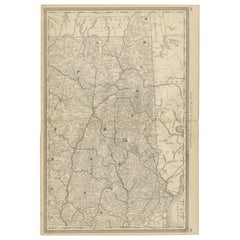
New Hampshire Antique Railroad Map c.1888 – Granite State Counties
Cities
Located in Langweer, NL
Antique Map of New Hampshire – Rand McNally, circa 1888
This antique map of New Hampshire was published by Rand, McNally & Co. around 1888. It provides a detailed late 19th-century ...
Category
Antique Late 19th Century American Maps
Materials
Paper
Antique Map of the United States
North East
by Johnston
1909
Located in Langweer, NL
Antique map titled 'United States of North America'. Original antique map of United States of North America ( North East ). This map orig...
Category
Early 20th Century Maps
Materials
Paper

$238 Sale Price
20% Off
More Ways To Browse
New Hampshire Used Furniture
Hampshire Antique Furniture
Antique Maps Of Long Island
Calcutta Map
Gibraltar Antique Map
Guyana Antique Map
Maps Of New Mexico
Saudi Arabia Map
16th Century Scotland
Antique Leather Map
Antique Map Of Argentina
Antique Map Of Colombia
Cornwall Map
Early Texas Furniture
Iraq Map
James Cook Map
Kentucky Antiques
Map Of Mexican California