Items Similar to Large Original Antique Map of the United States of America. 1891


Want more images or videos?
Request additional images or videos from the seller
1 of 5
Large Original Antique Map of the United States of America. 1891
$90
£68.17
€78.29
CA$126.12
A$137.12
CHF 72.70
MX$1,643.69
NOK 923.98
SEK 846.49
DKK 585.10
About the Item
Fabulous map of The United States
Original color
By Rand, McNally
Co.
Dated 1891
Unframed
Free shipping.
- Creator:Rand McNally Co. (Maker)
- Dimensions:Height: 20.5 in (52.07 cm)Width: 13.5 in (34.29 cm)Depth: 0.07 in (1.78 mm)
- Materials and Techniques:Paper,Other
- Place of Origin:
- Period:
- Date of Manufacture:1891
- Condition:Wear consistent with age and use.
- Seller Location:St Annes, GB
- Reference Number:1stDibs: LU1836329189632
About the Seller
4.9
Gold Seller
Premium sellers maintaining a 4.3+ rating and 24-hour response times
1stDibs seller since 2016
3,266 sales on 1stDibs
Typical response time: 1 hour
Associations
International Confederation of Art and Antique Dealers
Associations
- ShippingRetrieving quote...Shipping from: St Annes, United Kingdom
- Return Policy
More From This Seller
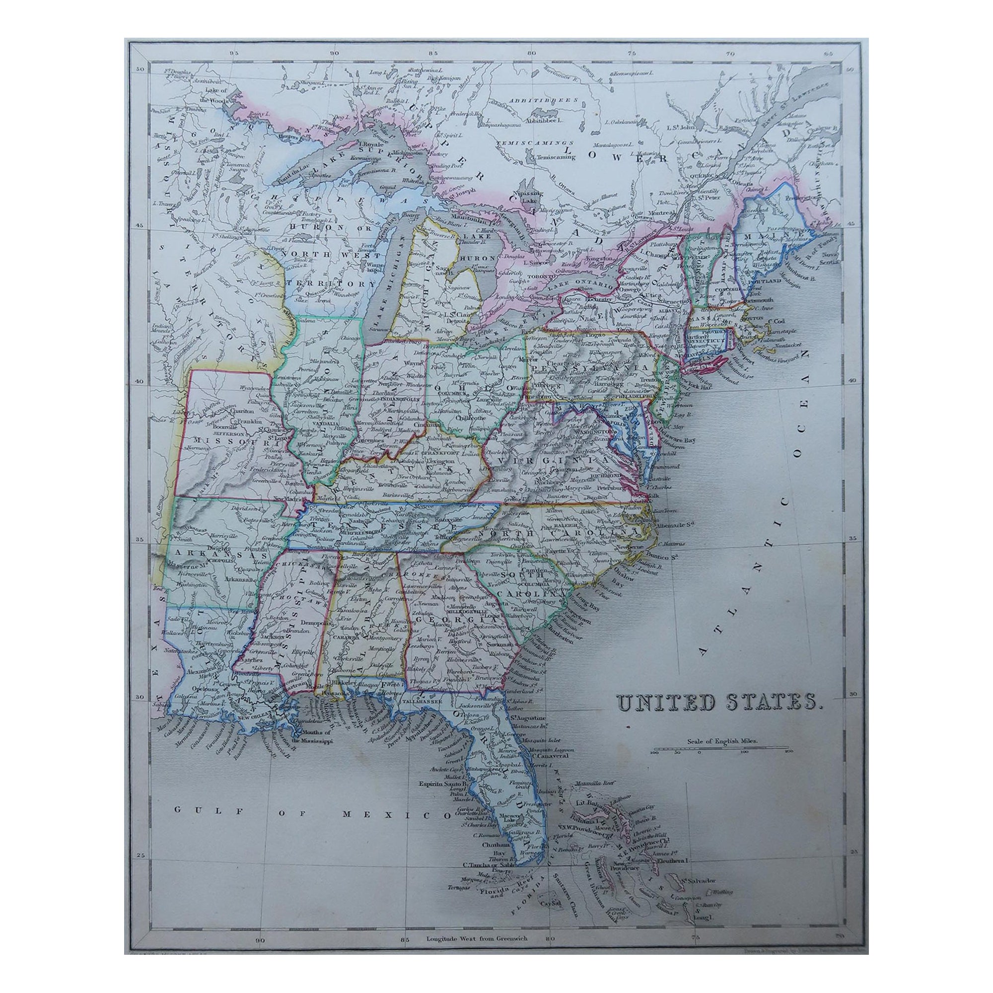
View AllOriginal Antique Map of United States, Grattan and Gilbert, 1843
Located in St Annes, Lancashire
Great map of United States
Drawn and engraved by Archer
Published by Grattan and Gilbert. 1843
Original colour
Unframed.
Category
Antique 1840s English Maps
Materials
Paper

Large Original Antique Map of New York, USA, 1894
By Rand McNally
Co.
Located in St Annes, Lancashire
Fabulous map of New York.
Original color.
By Rand, McNally & Co.
Published, 1894
Unframed
Free shipping.
Category
Antique 1890s American Maps
Materials
Paper
Large Vintage Maps of the United States, in 3 Sections, 1920
Located in St Annes, Lancashire
Great maps of the USA in 3 sections
Unframed
Original color
By John Bartholomew and Co. Edinburgh Geographical Institute
Published, circa 1920
The measurements given is for just...
Category
Vintage 1920s British Maps
Materials
Paper

Large Original Vintage Map of North America, circa 1920
Located in St Annes, Lancashire
Great map of North America
Original color. Good condition
Published by Alexander Gross
Unframed.
Category
Vintage 1920s English Edwardian Maps
Materials
Paper

Original Antique Map of The United States of America by Dower, circa 1835
Located in St Annes, Lancashire
Nice map of the USA
Drawn and engraved by J.Dower
Published by Orr & Smith. C.1835
Unframed.
Free shipping
Category
Antique 1830s English Maps
Materials
Paper

Large Original Vintage Map of the South Eastern States Inc. Florida, circa 1920
Located in St Annes, Lancashire
Great map of The South Eastern States
Original color. Good condition
Published by Alexander Gross
Unframed.
Category
Vintage 1920s English Maps
Materials
Paper
You May Also Like
Antique Railroad Map of the United States by Rand, McNally
Co, 1900
Located in Langweer, NL
Antique map titled 'Rand, McNally & Co's New Official Railroad map of the United States with portions of The Dominion of Canada, The Republic of Mexico and the West Indies'. Large railroad map of the United States, sectionalised and laid on linen. Map shows state boundaries for the United States, Mexico, the West Indies, and lower portion of Canada; major cities and towns, military posts, Native American reservations, and railroads; Oklahoma and "Indian Territory." Inset: "Map of Alaska...
Category
20th Century Maps
Materials
Linen, Paper

$2,242 Sale Price
25% Off
Free Shipping
Antique Map of the United States of North America, c.1882
Located in Langweer, NL
Antique map titled 'United States of North America'. Old map of the United States of North America. This map originates from 'The Royal Atlas of Modern Geography, Exhibiting, in a Se...
Category
Antique 1880s Maps
Materials
Paper

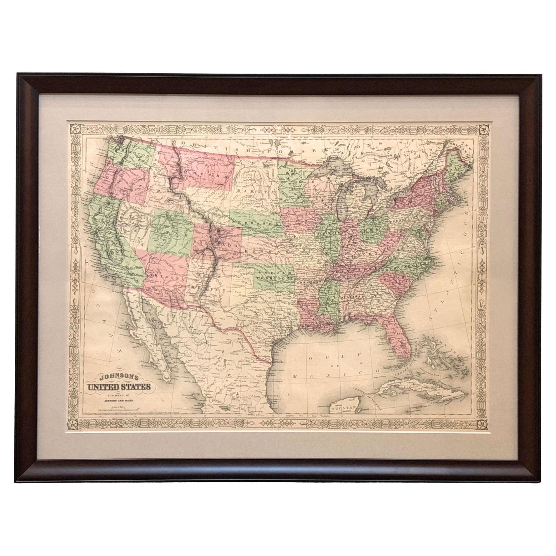
1866 "Johnson
s United States" Map, Published by Johnson and Ward
Located in Colorado Springs, CO
Presented is a detailed map of the United States by A. J. Johnson. Spanning the whole of the continental United States, as well as adjacent parts of Canada and Mexico, the map reflec...
Category
Antique 1860s American Victorian Maps
Materials
Paper

Antique Map of the United States by Titus
1871
Located in Langweer, NL
Antique map titled 'The United States of America'. Original antique map of the United States. This map originates from 'Atlas of Prebl...
Category
Antique Late 19th Century Maps
Materials
Paper

$765 Sale Price
20% Off
Antique Map of the United States
North East
by Johnston
1909
Located in Langweer, NL
Antique map titled 'United States of North America'. Original antique map of United States of North America ( North East ). This map orig...
Category
Early 20th Century Maps
Materials
Paper

$239 Sale Price
20% Off
Vintage Framed United States Map
Located in Queens, NY
Vintage aged paper map of the United States mounted on particle board and framed in a simple wooden frame.
Category
20th Century American Mid-Century Modern Maps
Materials
Wood, Paper

More Ways To Browse
Antique Maps Of Long Island
Calcutta Map
Gibraltar Antique Map
Guyana Antique Map
Maps Of New Mexico
Saudi Arabia Map
16th Century Scotland
Antique Leather Map
Antique Map Of Argentina
Antique Map Of Colombia
Cornwall Map
Early Texas Furniture
Iraq Map
James Cook Map
Kentucky Antiques
Map Of Mexican California
Montreal Map
Mughal Map