Items Similar to Large Original Antique Map of The World, Fullarton, C.1870


Want more images or videos?
Request additional images or videos from the seller
1 of 5
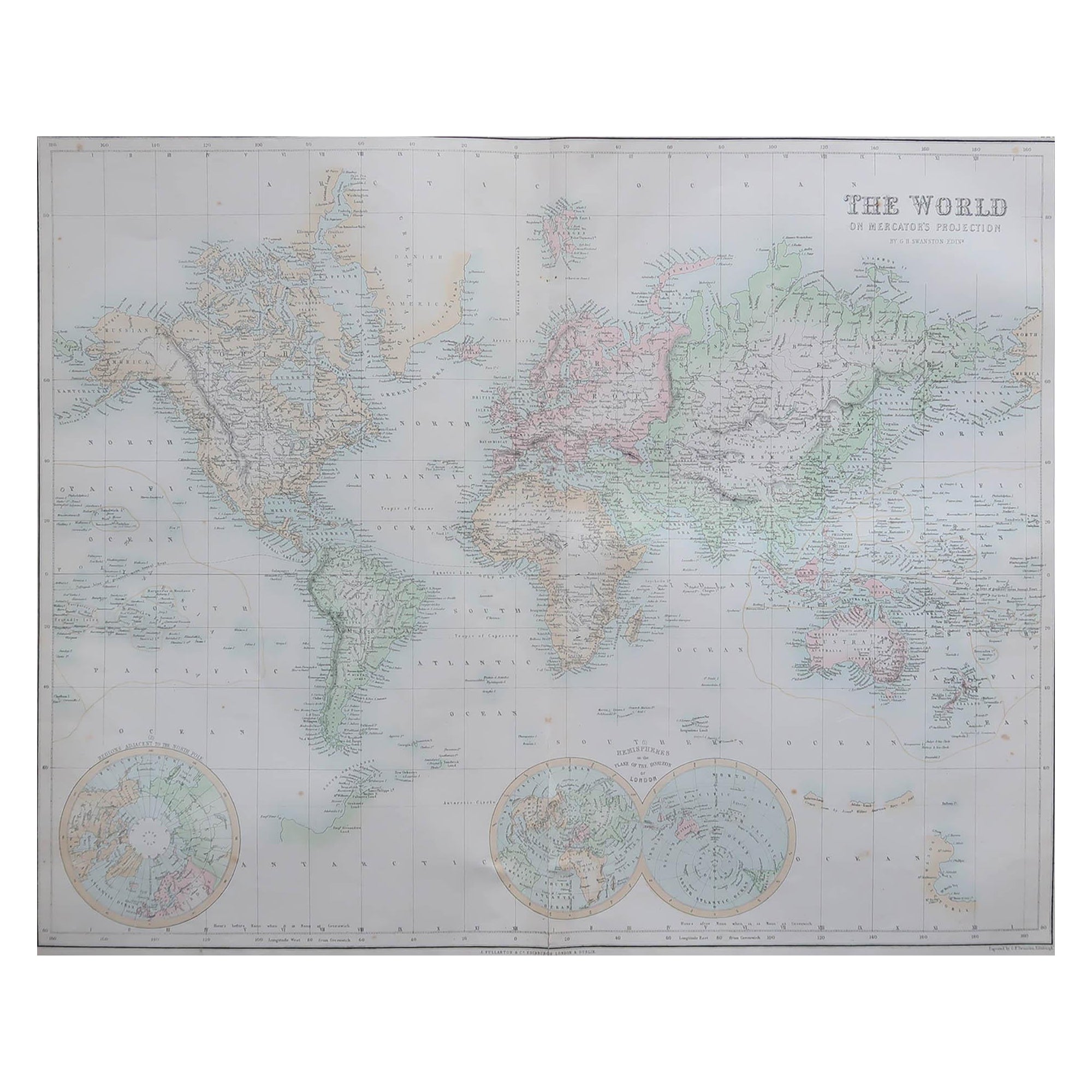
Large Original Antique Map of The World, Fullarton, C.1870
$140
£106.68
€123.03
CA$198.84
A$213.64
CHF 114.62
MX$2,516.98
About the Item
Great map of the World. Showing both hemispheres
From the celebrated Royal Illustrated Atlas
Lithograph. Original color.
Published by Fullarton, Edinburgh, C.1870
Unframed.
Repair to bottom part of the central fold. Seen in last image
- Dimensions:Height: 18.5 in (46.99 cm)Width: 22.5 in (57.15 cm)Depth: 0.07 in (1.78 mm)
- Materials and Techniques:Paper,Other
- Place of Origin:
- Period:
- Date of Manufacture:1870
- Condition:Wear consistent with age and use.
- Seller Location:St Annes, GB
- Reference Number:1stDibs: LU1836337008332
About the Seller
4.9
Gold Seller
Premium sellers maintaining a 4.3+ rating and 24-hour response times
1stDibs seller since 2016
3,281 sales on 1stDibs
Typical response time: 1 hour
Associations
International Confederation of Art and Antique Dealers
Associations
- ShippingRetrieving quote...Shipping from: St Annes, United Kingdom
- Return Policy
More From This Seller
View AllLarge Original Antique Map of the World, Fullarton, circa 1870
Located in St Annes, Lancashire
Great map of the World.
From the celebrated Royal Illustrated Atlas
Lithograph. Original color.
Published by Fullarton, Edinburgh, circa 1870.
Unframed.
Category
Antique 1870s Scottish Maps
Materials
Paper

Original Antique Map of The World by Dower, circa 1835
Located in St Annes, Lancashire
Nice map of the World
Drawn and engraved by J.Dower
Published by Orr & Smith. C.1835
Unframed.
Free shipping
Category
Antique 1830s English Maps
Materials
Paper

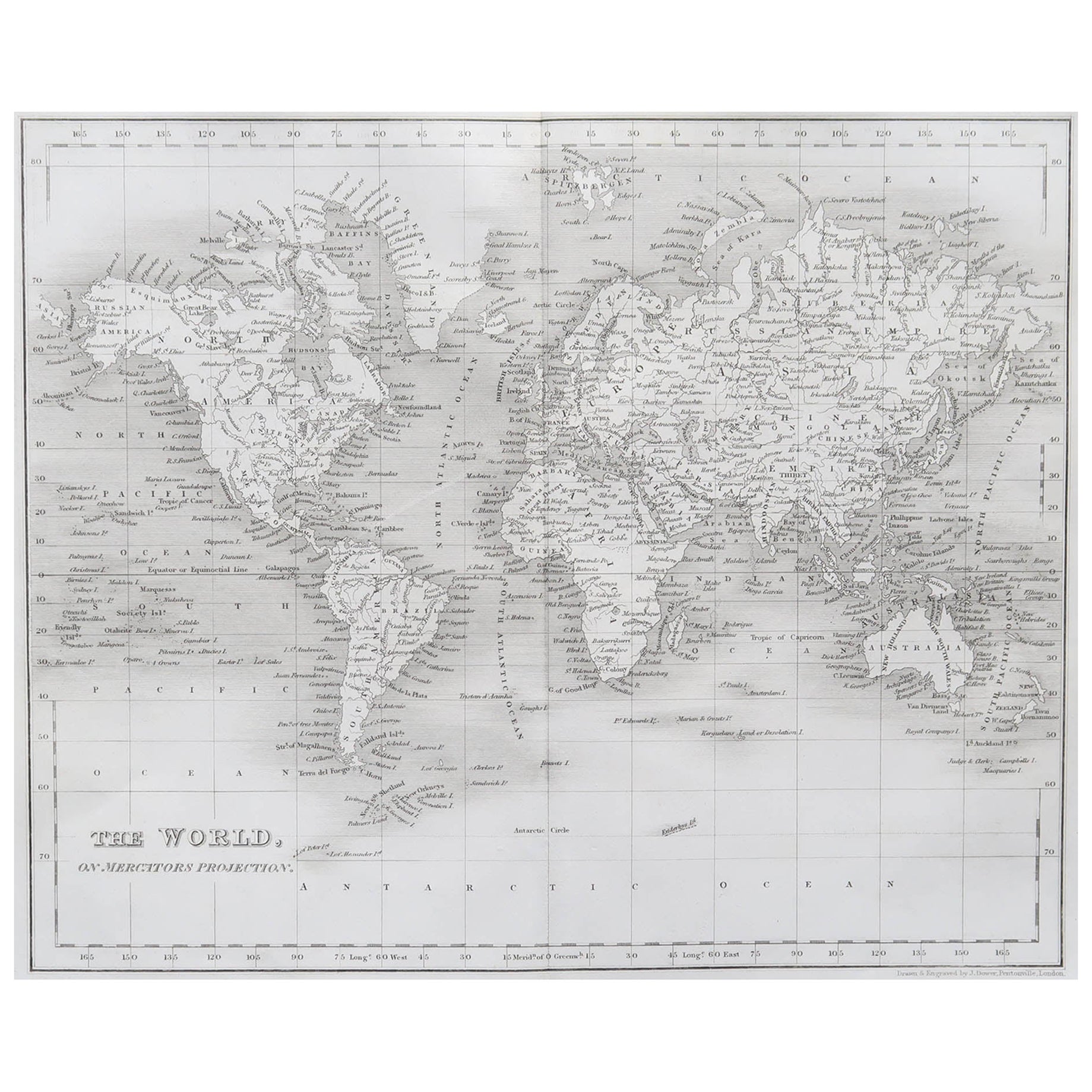
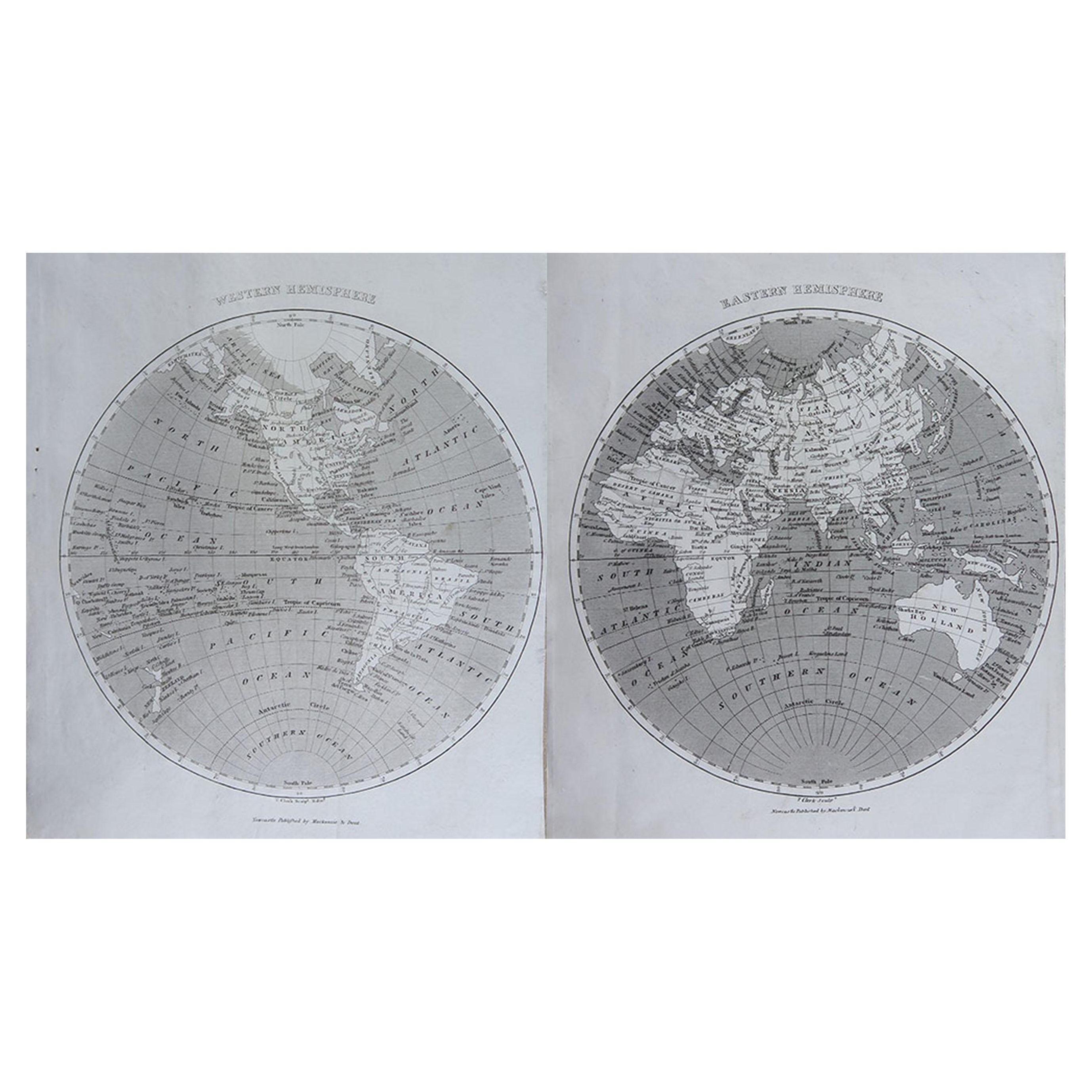
Original Antique Map of The World by Thomas Clerk, 1817
Located in St Annes, Lancashire
Great map of The Eastern and Western Hemispheres
On 2 sheets
Copper-plate engraving
Drawn and engraved by Thomas Clerk, Edinburgh.
Published by Mackenzie And Dent, 1817
...
Category
Antique 1810s English Maps
Materials
Paper

Original Antique Map of The Western Hemisphere by Dower, circa 1835
Located in St Annes, Lancashire
Nice map of the Western Hemisphere
Drawn and engraved by J.Dower
Published by Orr & Smith. C.1835
Unframed.
Free shipping
Category
Antique 1830s English Maps
Materials
Paper

Large Original Antique Map of Asia by Sidney Hall, 1847
Located in St Annes, Lancashire
Great map of Asia
Drawn and engraved by Sidney Hall
Steel engraving
Original colour outline
Published by A & C Black. 1847
Unframed
Free shipping
Category
Antique 1840s Scottish Maps
Materials
Paper

Large Original Antique Map of Europe by Sidney Hall, 1847
Located in St Annes, Lancashire
Great map of Europe
Drawn and engraved by Sidney Hall
Steel engraving
Original colour outline
Published by A & C Black. 1847
Unframed
Free shipping.
Category
Antique 1840s Scottish Maps
Materials
Paper

You May Also Like
Antique Map of the World by Johnson,
1872
Located in Langweer, NL
Antique map titled 'Johnson's World. Original world map. This map originates from 'Johnson's New Illustrated Family Atlas of the World' by A.J. John...
Category
Antique Late 19th Century Maps
Materials
Paper

$443 Sale Price
25% Off
Antique Map of the World in two sheets, 1852
Located in Langweer, NL
Antique map titled 'The World on Mercator's Projection'. Two individual sheets of the world. This map originates from 'Lowry's table Atlas constructed and engraved from the most rece...
Category
Antique Mid-19th Century Maps
Materials
Paper

$237 Sale Price / set
20% Off
Antique Map of the World, Mercator Projection, by Wyld,
1845
Located in Langweer, NL
Antique map titled 'The World'. Original antique world map, on Mercator's projection. This map originates from 'An Atlas of the World, Compr...
Category
Antique Mid-19th Century Maps
Materials
Paper

$331 Sale Price
20% Off
Antique Map of the World by D
Urville
1853
Located in Langweer, NL
Antique map titled 'Voyage Autour du Monde'. Original map of the world. This map originates from volume 1 of 'Voyage Autour du Monde' by Comte-Amiral Dumont D'Urville.
Category
Antique Mid-19th Century Maps
Materials
Paper

$284 Sale Price
20% Off
Antique Map of the Eastern Hemisphere by Wyld, 1842
Located in Langweer, NL
Antique map titled 'Eastern Hemisphere'. Large map depicting the continents Europe, Asia, Afrika and Australia.
Artists and Engravers: James Wyld (1812–1887) was a British geograph...
Category
Antique 19th Century Maps
Materials
Paper

Antique Map of The World in Hemispheres by W. G. Blackie, 1859
Located in Langweer, NL
Antique map titled 'The World in Hemispheres with other projections'. Original antique map of The World. This map originates from ‘The Imperial Atlas of Modern Geography’. Published ...
Category
Antique Mid-19th Century Maps
Materials
Paper

$290 Sale Price
30% Off
More Ways To Browse
World Map Copper
Mid Century Modern Wicker Chair
Mid-Century Modern Wicker Chairs
Curved Back Mid Century Dining Chairs
Glass Stopper
Stretcher Tables
M Table
Antique Sultanabad Carpets
China Chair
English Antique Desks
Used Beige Sofa
Antique Plate Germany
Hand Tufted Rugs
Rare China
Side Table Made In Denmark
Thonet Antique
Victorian Hall Tables
Vintage Computer