Items Similar to Large Scale Antique Scroll Map of Lincolnshire, England, Dated 1778
Want more images or videos?
Request additional images or videos from the seller
1 of 12
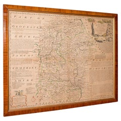
Large Scale Antique Scroll Map of Lincolnshire, England, Dated 1778
$950
£721.22
€831.45
CA$1,343.91
A$1,446.84
CHF 774.81
MX$17,433.87
NOK 9,775.95
SEK 8,946.57
DKK 6,212.94
About the Item
Wonderful scroll map of Lincolnshire
By Captain Armstrong, 1778
Copper plate engraving on paper laid on canvas
Original ebonized wood frame with lovely turned finials
The map can be rolled up for easy transport
Country house condition
Free shipping
- Dimensions:Height: 84 in (213.36 cm)Width: 60 in (152.4 cm)Depth: 1.5 in (3.81 cm)
- Style:Georgian (Of the Period)
- Materials and Techniques:
- Place of Origin:
- Period:1770-1779
- Date of Manufacture:1778
- Condition:Wear consistent with age and use.
- Seller Location:St Annes, GB
- Reference Number:Seller: 44831stDibs: LU1836324413782
About the Seller
4.9
Gold Seller
Premium sellers maintaining a 4.3+ rating and 24-hour response times
1stDibs seller since 2016
3,276 sales on 1stDibs
Typical response time: 1 hour
Associations
International Confederation of Art and Antique Dealers
Associations
- ShippingRetrieving quote...Shipping from: St Annes, United Kingdom
- Return Policy
More From This Seller
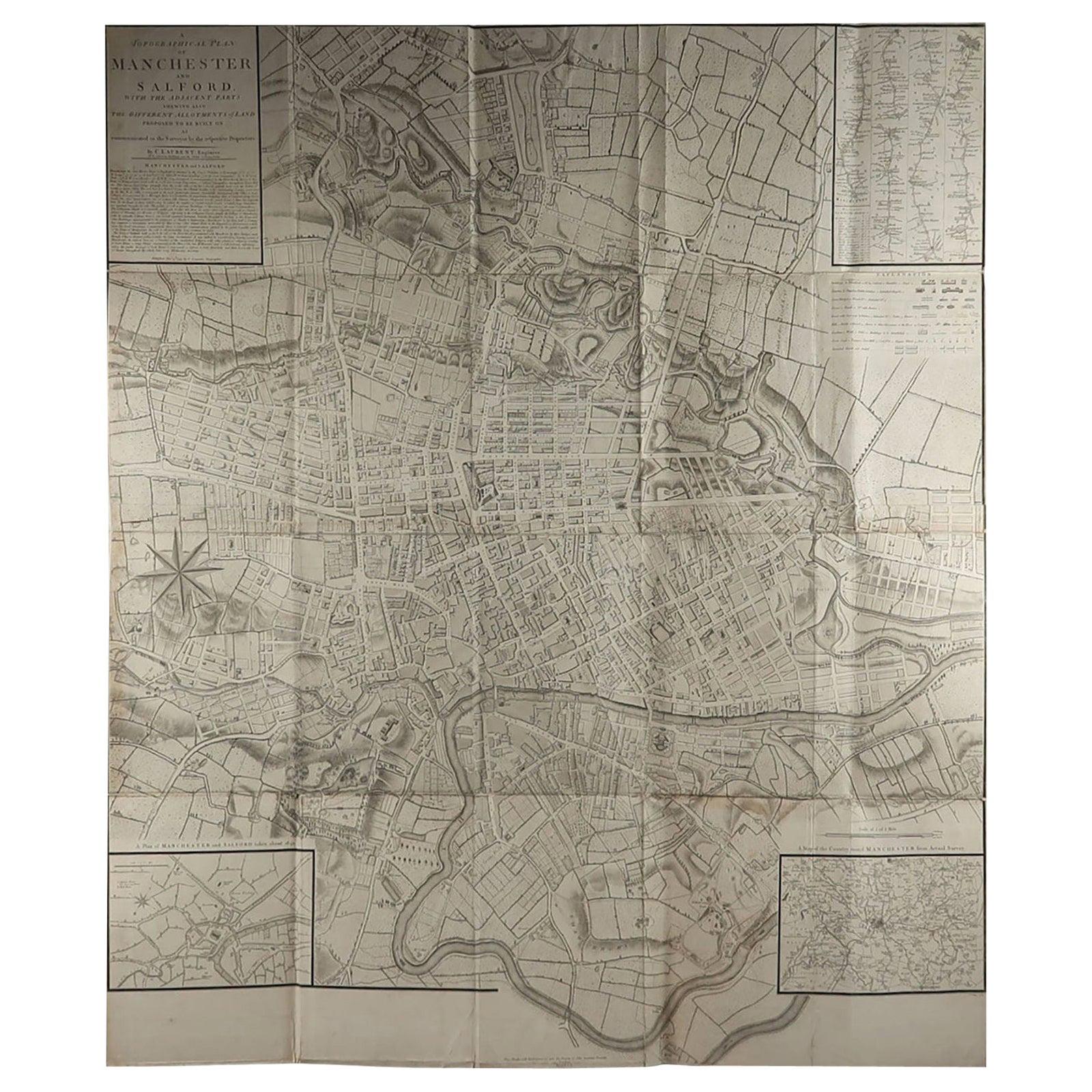
View AllLarge Original Antique Folding Map of Manchester, England, Dated 1793
Located in St Annes, Lancashire
Superb map of Manchester and Salford
Folding map. Printed on paper laid on to the original canvas
Unframed.
Published by C. Laurent, 1793.
Free shippi...
Category
Antique 1790s English Georgian Maps
Materials
Canvas, Paper

Original Antique Map of South America. C.1780
Located in St Annes, Lancashire
Great map of South America
Copper-plate engraving
Published C.1780
Two small worm holes to left side of map
Unframed.
Category
Antique Early 1800s English Georgian Maps
Materials
Paper

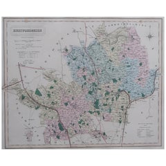
Original Antique English County Map, Hertfordshire. J
C Walker, 1851
Located in St Annes, Lancashire
Great map of Hertfordshire
Original colour
By J & C Walker
Published by Longman, Rees, Orme, Brown & Co. 1851
Unframed.
Category
Antique 1850s English Other Maps
Materials
Paper
Large Original Vintage Map of British Island Possessions, circa 1920
Located in St Annes, Lancashire
Great map of British Island Possessions
Original color. Good condition
Published by Alexander Gross
Unframed.
Category
Vintage 1920s English Maps
Materials
Paper

Original Antique Map of Hungary, Arrowsmith, 1820
Located in St Annes, Lancashire
Great map of Hungary
Drawn under the direction of Arrowsmith.
Copper-plate engraving.
Published by Longman, Hurst, Rees, Orme and Brown, 1820
Unframed.
Category
Antique 1820s English Maps
Materials
Paper

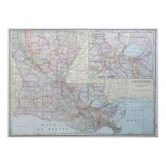
Large Original Antique Map of Louisiana, USA, C.1900
Located in St Annes, Lancashire
Fabulous map of Louisiana.
Original color.
Engraved and printed by the George F. Cram Company, Indianapolis.
Published, c.1900.
Unframed.
Repair ...
Category
Antique 1890s American Maps
Materials
Paper
You May Also Like
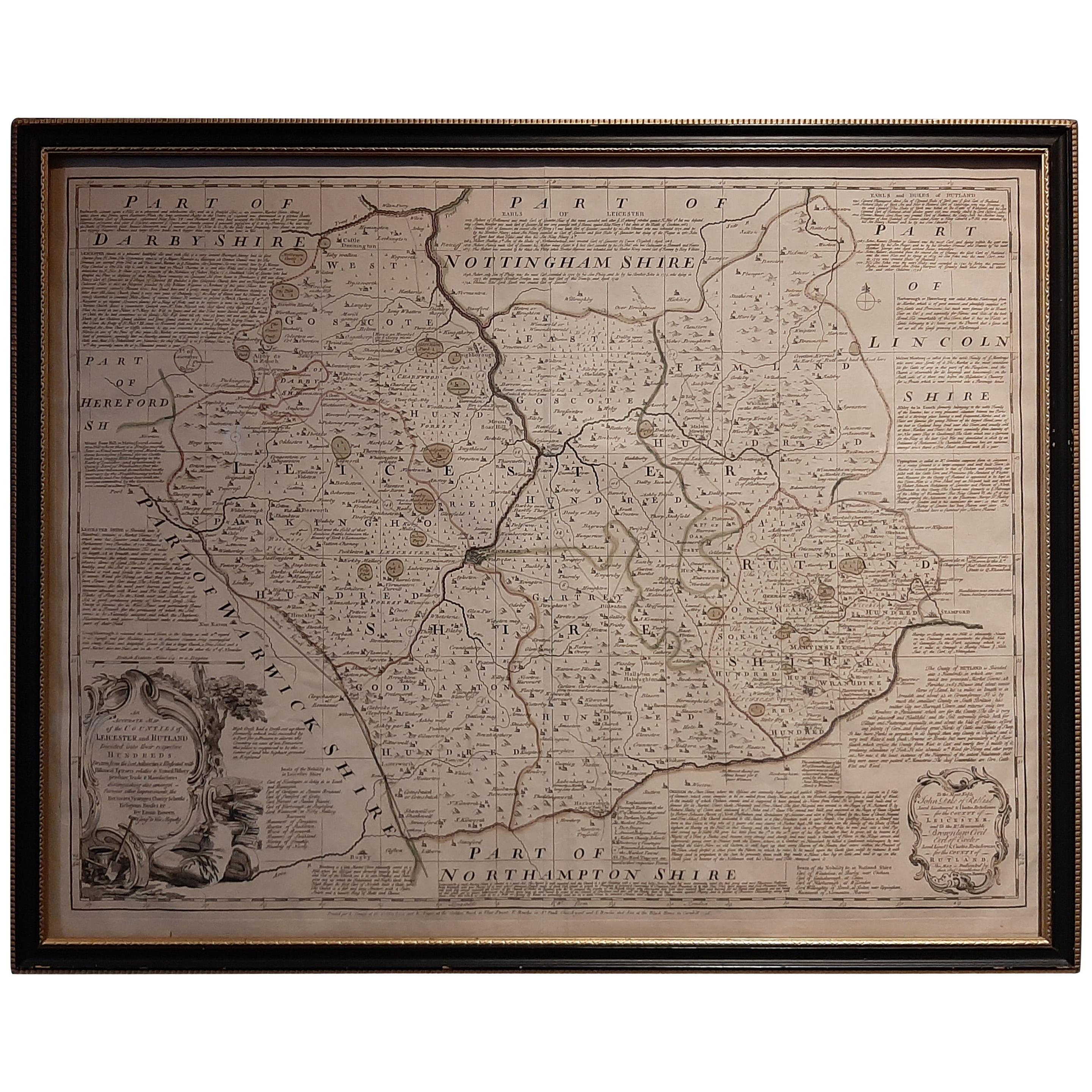
Antique Map of Leicester and Rutland by Tinney
Sayer,
circa 1756
Located in Langweer, NL
Antique map titled 'An Accurate Map of the Counties of Leicester and Rutland (..)'. Large map of Leicester and Rutland with dedications to the Most Noble John Duke of Rutland, and to...
Category
Antique Mid-18th Century Maps
Materials
Paper

$760 Sale Price
20% Off
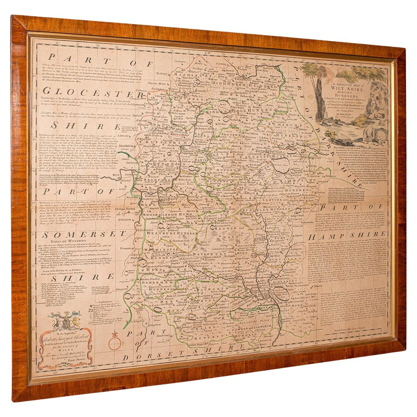
Large Antique Wiltshire Map, County Cartography, Framed, English, 18th Century
Located in Hele, Devon, GB
This is an antique county map of Wiltshire. An English, framed atlas engraving of cartographic interest By Emmanuel Bowen, dating to the mid 18th century and later.
Superb lithograp...
Category
Antique 1750s British Georgian Decorative Art
Materials
Glass, Paper
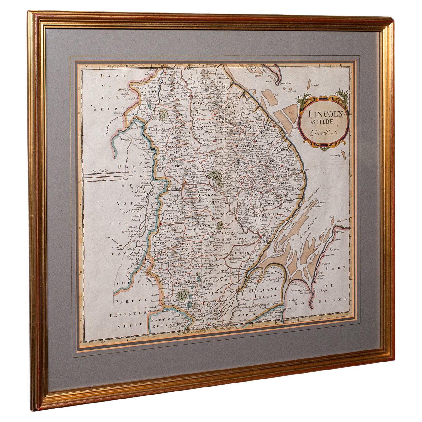
Antique Lincolnshire Map, English, County Cartography, Robert Morden, Victorian
Located in Hele, Devon, GB
This is a fine antique county map of Lincolnshire. An English, framed reproduction engraving, dating to the Victorian period and later, circa 1900.
A superb cartographic reproducti...
Category
Early 20th Century British Queen Anne Maps
Materials
Glass, Paper
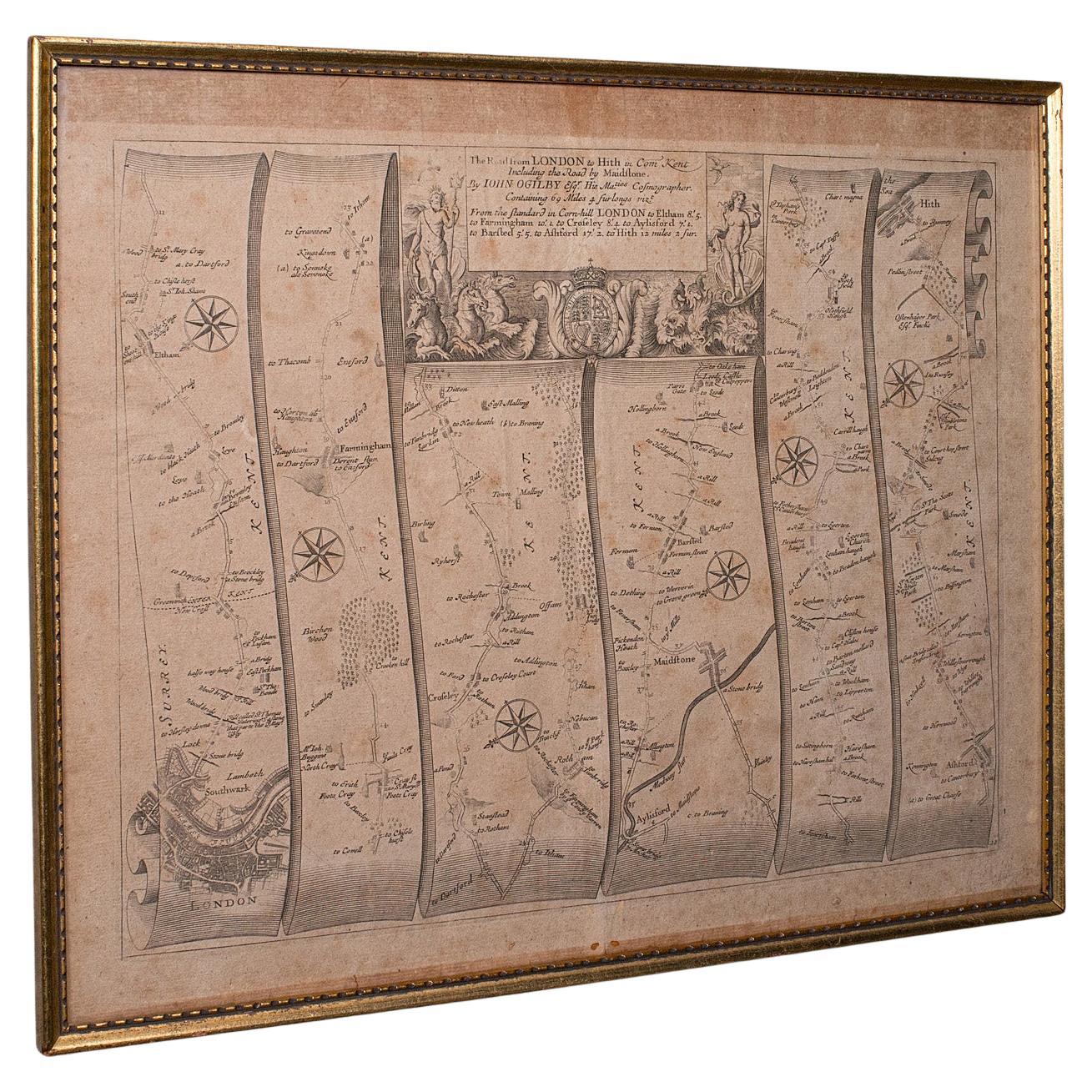
Antique Road Map, London to Hythe, Kent, English, Cartography, John Ogilby, 1675
Located in Hele, Devon, GB
This is an antique Road Map from London to Hythe, Kent. An English, cartographic atlas excerpt by John Ogilby, dating to the late 17th century with later frame, circa 1675
A superb ...
Category
Antique 17th Century British Queen Anne Maps
Materials
Glass, Paper
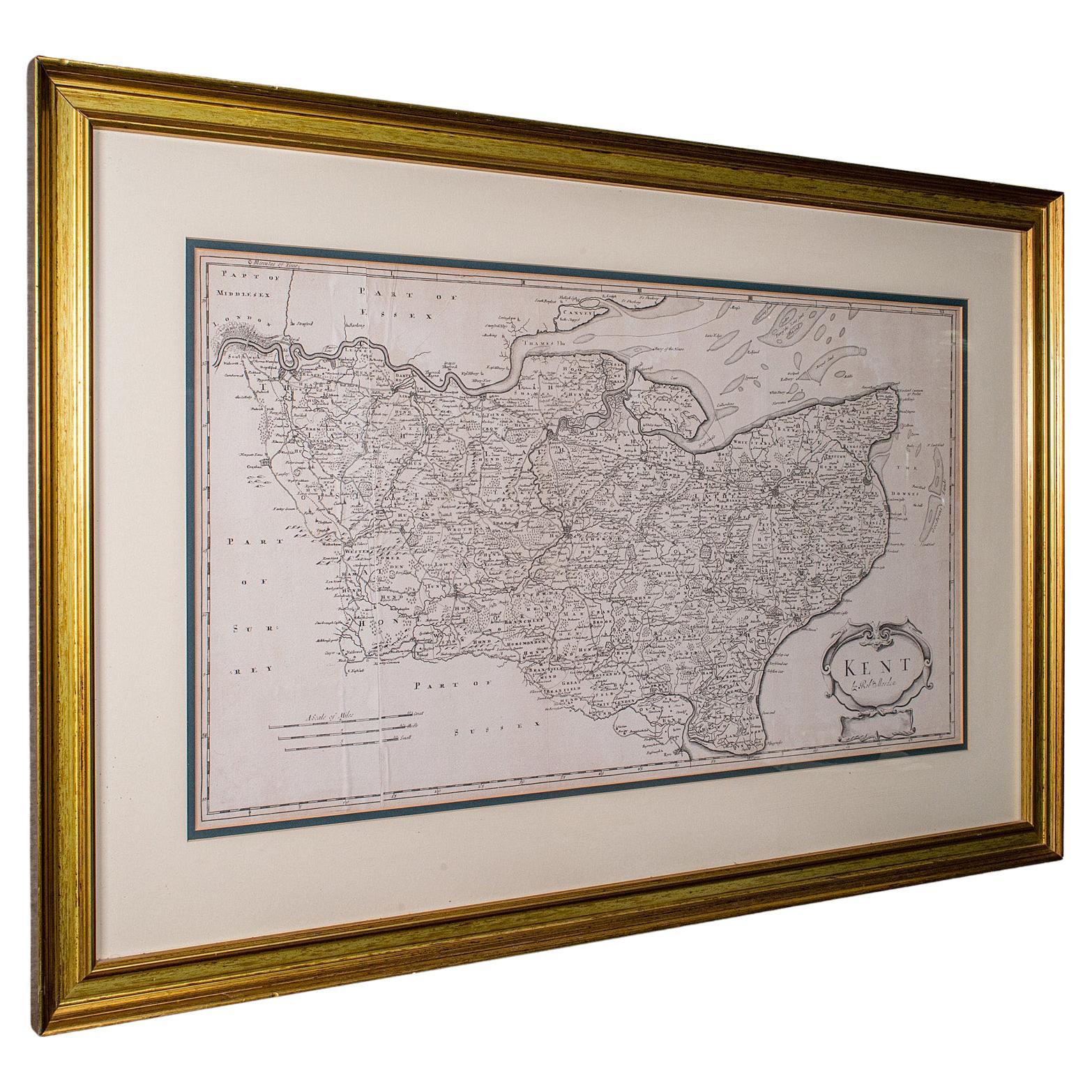
Large Antique Lithography Map of Kent, English, Cartography, Robert Morden, 1700
Located in Hele, Devon, GB
This is a large antique lithography map of Kent. An English, framed atlas engraving of cartographic interest by Robert Morden, dating to the early 18th century and later.
Superb li...
Category
Antique Early 18th Century British Queen Anne Maps
Materials
Glass, Wood, Paper

Map Lancashire 1793 John Cary engraver 37cm 14 1/2" high
Located in BUNGAY, SUFFOLK
Map of Lancashire by John Cary engraver
published 1st Jan 1793 by J Cary Engraver & Mapseller Strand
in original black and gold classic map frame
Category
Antique 18th Century English Georgian Maps
Materials
Paper
